


Cleuson/Siviez – Dam Trophy
Úroveň náročnosti: 4
Fotografie našich používateľov
From Aproz, first ride towards the village of Fey. At the village exit, you will face the first effort with a short but quite steep ascent towards the main road. On the main road, you pass through Basse-Nendaz,...
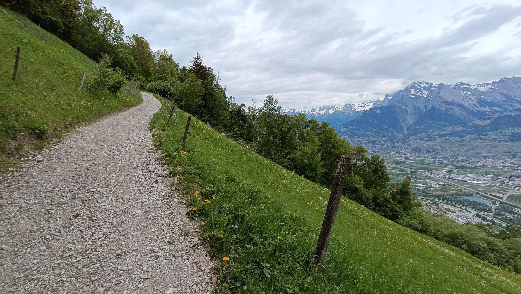
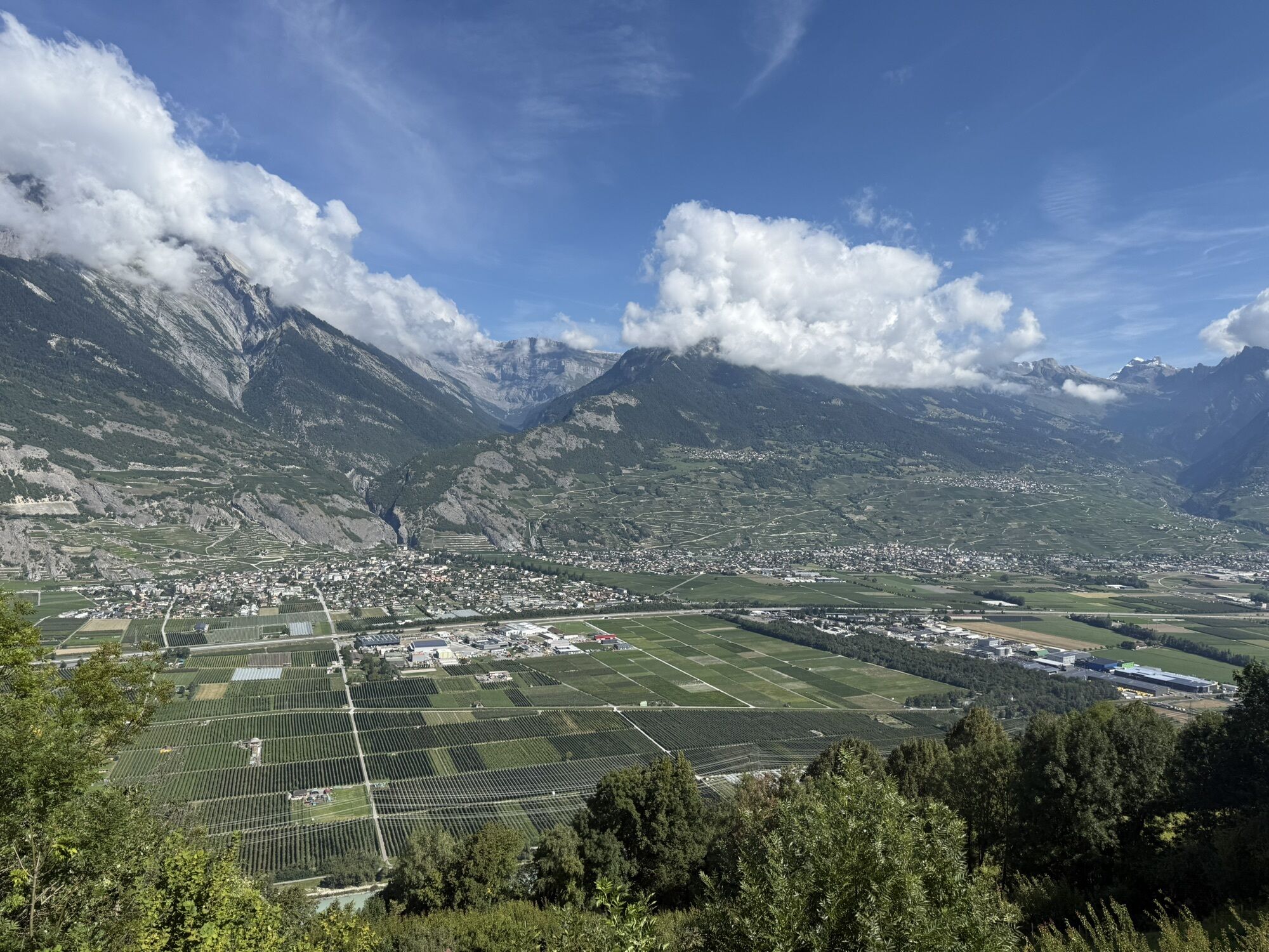
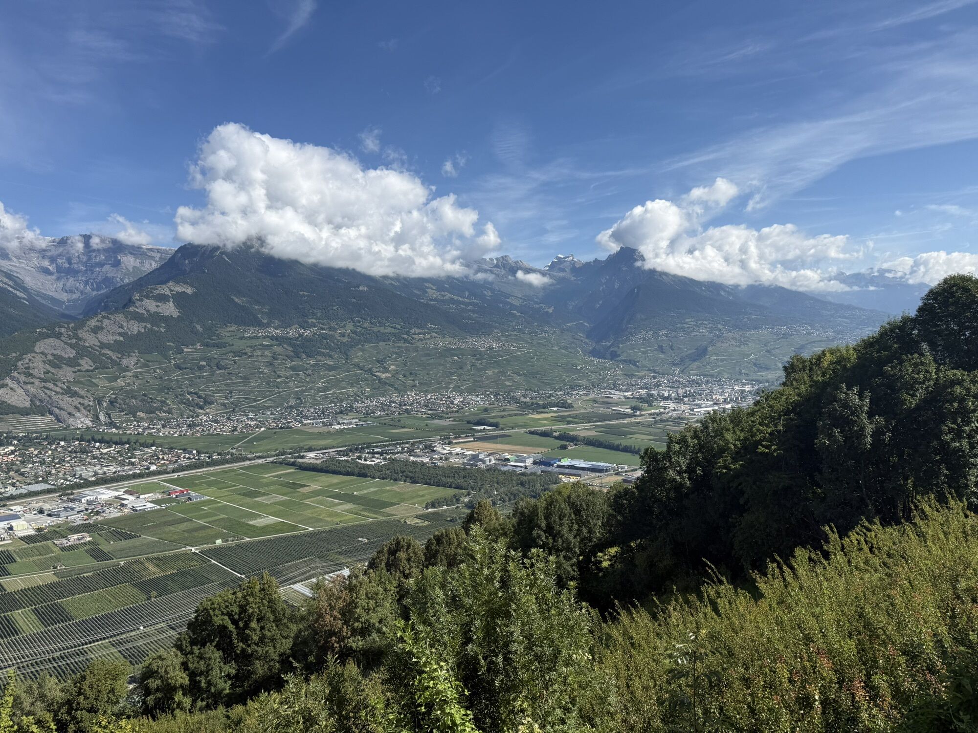
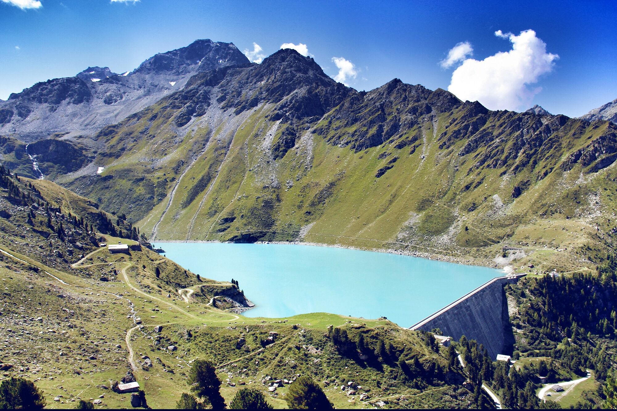
From Aproz, first ride towards the village of Fey. At the village exit, you will face the first effort with a short but quite steep ascent towards the main road. On the main road, you pass through Basse-Nendaz, where you turn onto the lightly trafficked road to Saclentse. Up to this point, the route follows the same path that also leads to the Col de la Croix de Cœur. Once you reach the height of Bleusy above Nendaz on the road to Siviez, you will enjoy a breathtaking view of Mont-Fort and Mont-Gelé at the end of the Val de Nendaz. The route continues steadily ascending towards Siviez. Gradually, the impressive Cleuson dam comes into view before you reach your destination near the facilities connecting the 4 Vallées.

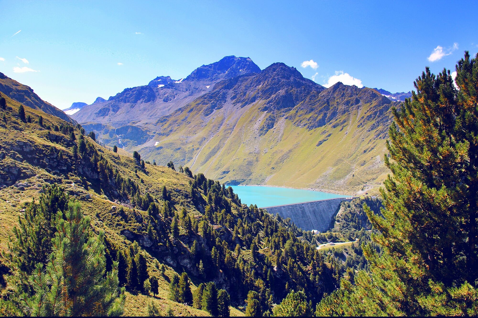
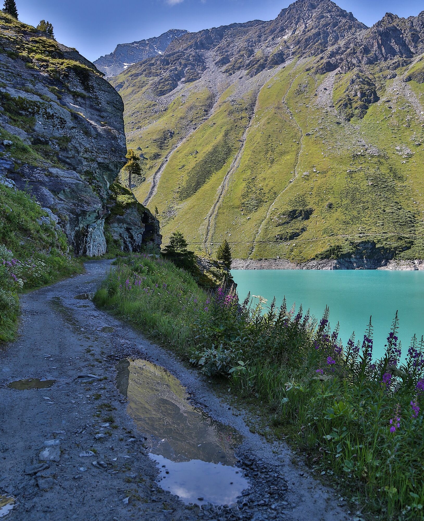
From Aproz, take the road towards the village of Fey and then continue to Basse-Nendaz. Here, the route turns right. Follow this path for 1.7 kilometers before turning left and continuing on a small, lightly trafficked road via Saclentse. Up to this point, the route is the same as the one leading to the Col de la Croix de Cœur. Take the left turn and follow the Route de Siviez for a little more than 5 kilometers to the valley station of the cable cars. Near the large parking lot, you can immortalize your ascent at the red arrival sign.
Áno
Our recommendation: Technically flawless bicycle, helmet, gloves and bell, weather-appropriate clothing (always carry rain protection), drink and nourishment.
Respect the rules of Swiss road traffic. Use of this route is at your own risk, any liability is excluded. Respect the flora and fauna in your surroundings. For your safety, we recommend wearing a bicycle helmet. Emergency numbers: 144 ambulance / 117 police / 1414 Rega. Assess your own skills and fitness carefully. Riding the various routes is fundamentally at your own responsibility.
Motorway A9 to exit 25 (Conthey), then cross the Rhone and continue to the village of Aproz.
Regular train connections from all over Switzerland to Sion, then post bus to Aproz.
Parking available in the village of Aproz. Follow the local parking guidance system in Aproz.
4
More information :
NendazThe fearless tackle the 3.5-kilometer-long gravel road to the dam crest! Follow the mountain bike signage.
Obľúbené výlety v okolí
-
5,0
From Saillon to the Farinet suspension bridge
strednáTuristika 7,86 km -
From Savoleyres to the mountain lake Lac des Vaux
strednáTuristika 14,0 km -
5,0
Sentier des bouquetins
strednáTuristika 8,73 km -
4,5
Cleuson Dam
strednáTuristika 11,5 km -
Tour du Grand Chavalard
strednáTuristika 14,9 km -
4,5
The Larches of Balavaux
svetloTuristika 11,0 km -
4,0
Tripon - Brac – Ancien Bisse du Torrent Neuf – St. Marguerite – Torrent Neuf – Prafirmin - St. Germain
svetloTuristika 12,9 km -
5,0
Tour de La Seya hike
strednáTuristika 8,09 km -
4,0
Belvédère via ferrata
strednáVia ferrata 1,81 km -
4,0
Sentier des Chamois
ťažkéTuristika 11,6 km
Turistika a stopovanie


Nenechajte si ujsť ponuky a inšpiráciu na ďalšiu dovolenku
Vaša e-mailová adresa bol pridaný do poštového zoznamu.