


Hannigalp Wannihorn Trail
Grächen is a snowshoe paradise with routes for every fitness level. The one for the Wannihorn Trail is high. The mountain itself rises to 2669 meters into the sky. Accordingly, the 2.3-kilometer route...
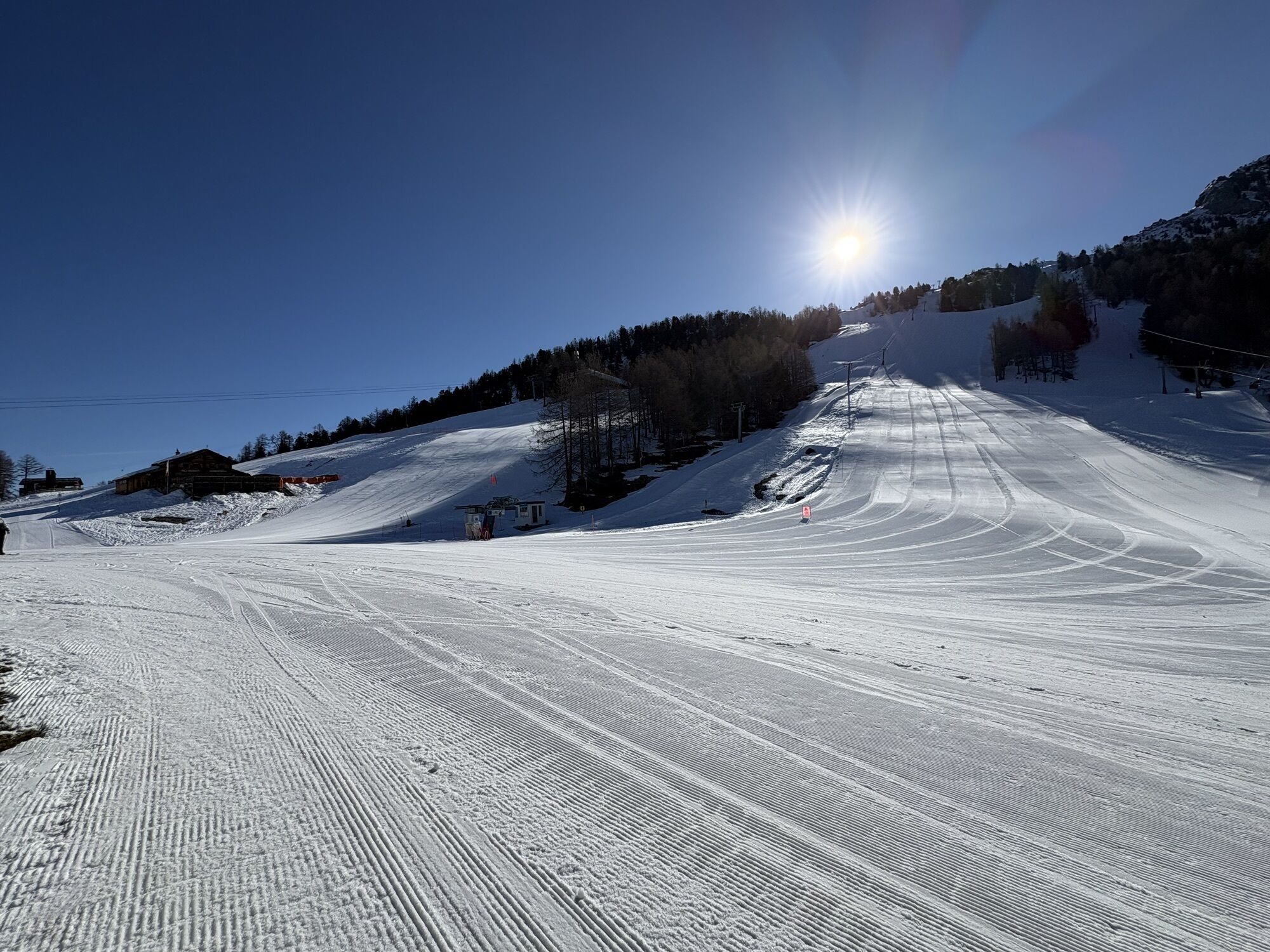
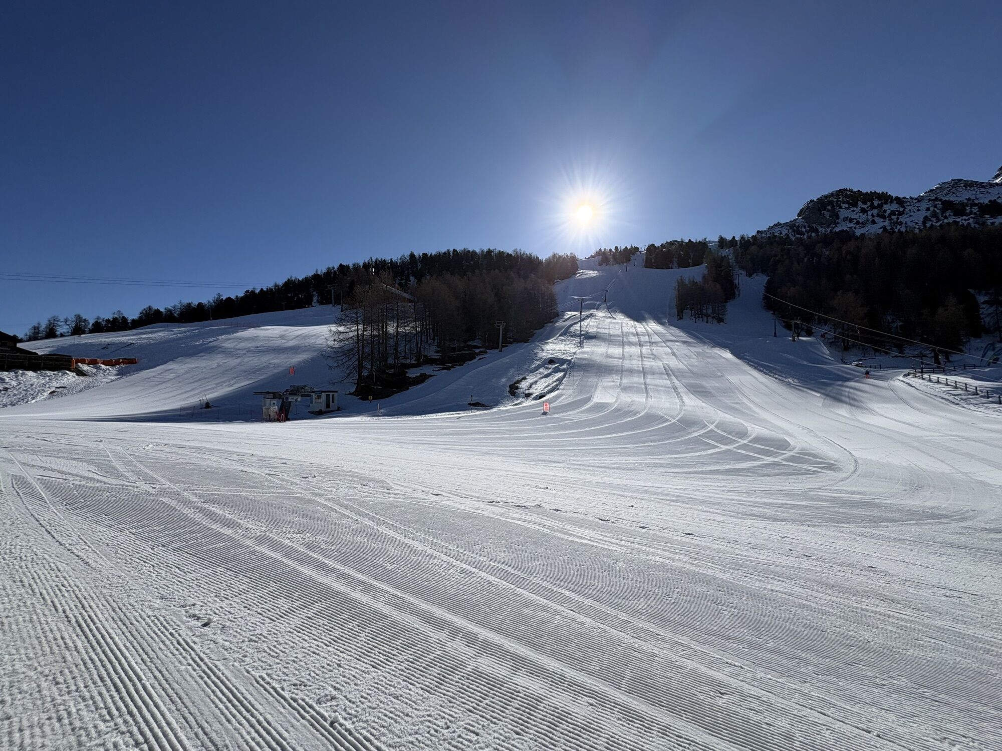
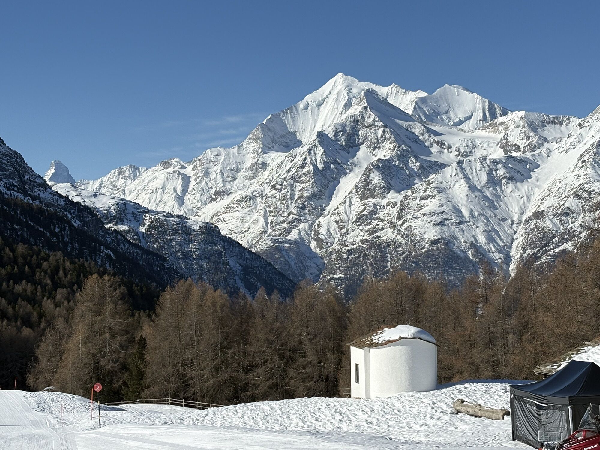
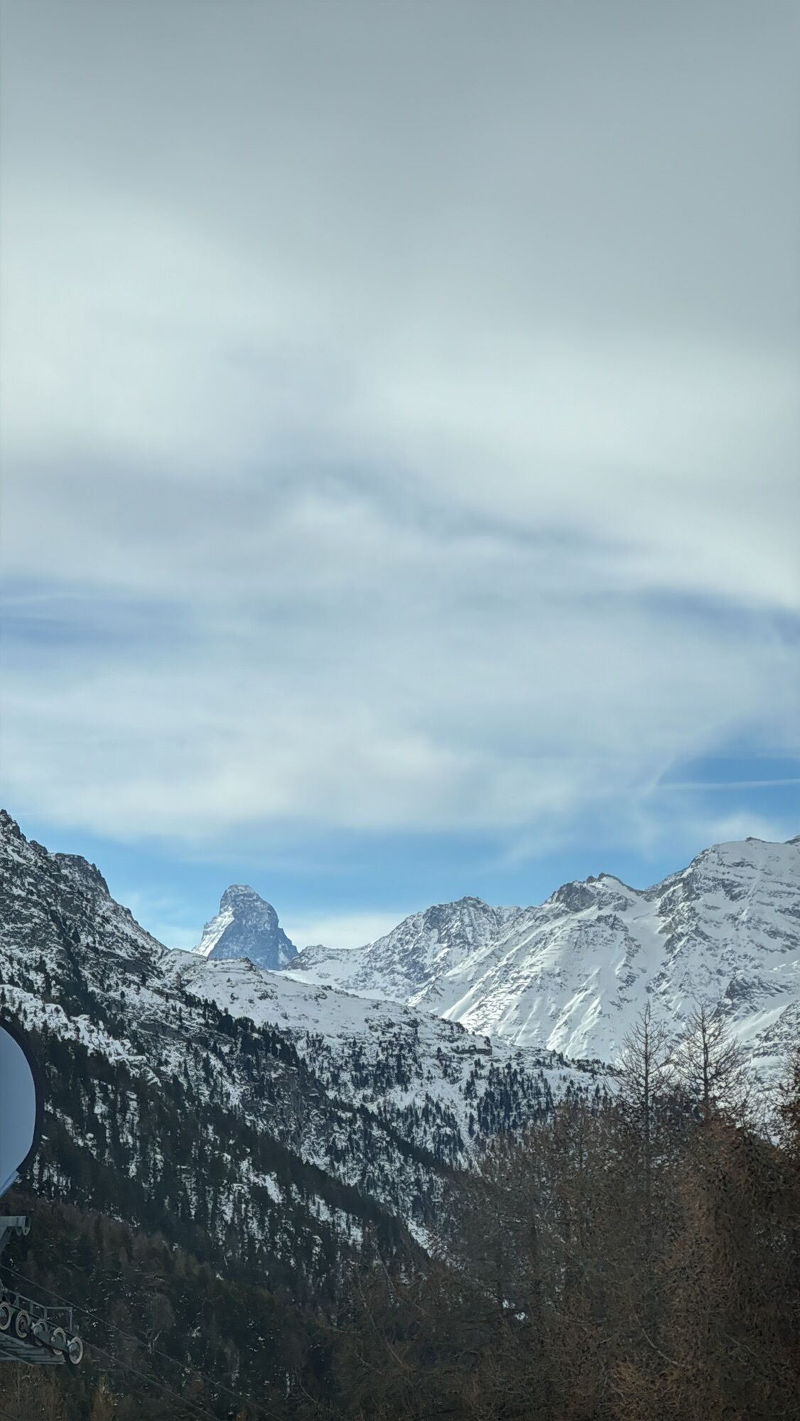
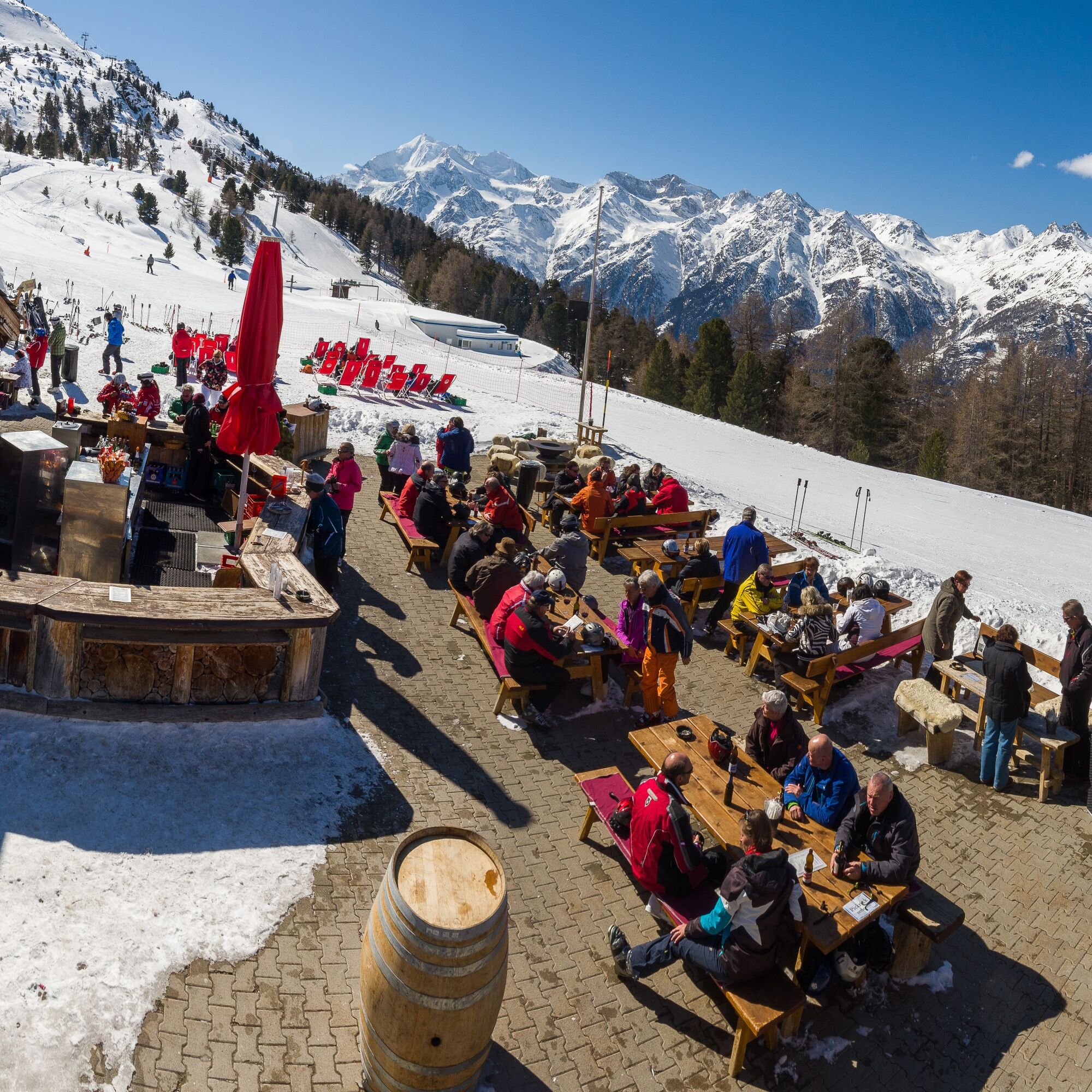
Grächen is a snowshoe paradise with routes for every fitness level. The one for the Wannihorn Trail is high. The mountain itself rises to 2669 meters into the sky. Accordingly, the 2.3-kilometer route demands a large portion of endurance. It is called the "king's route" for a reason. It is therefore for summit conquerors. The trail leads from Hannigalp over Stafel to Wannihorn, which also gave it its name. The really sporty ones start already in Grächen. The others take the Märchengondel to Hannigalp. There you put on your snowshoes, walk to Stafel, and have a last refreshment at the bar, surrounded by a wonderful mountain panorama. Then it goes steeply uphill through snowy forests to Wannihorn. And then, after about one and a half hours, the relieving exclamation: "Wow" – what a view. The Valais mountain world with views into the Saastal, to Bietschhorn, as well as Bis-, Brunegg-, and Weisshorn lies before you. Now all you have to do is take a deep breath, snap photos, and enjoy.

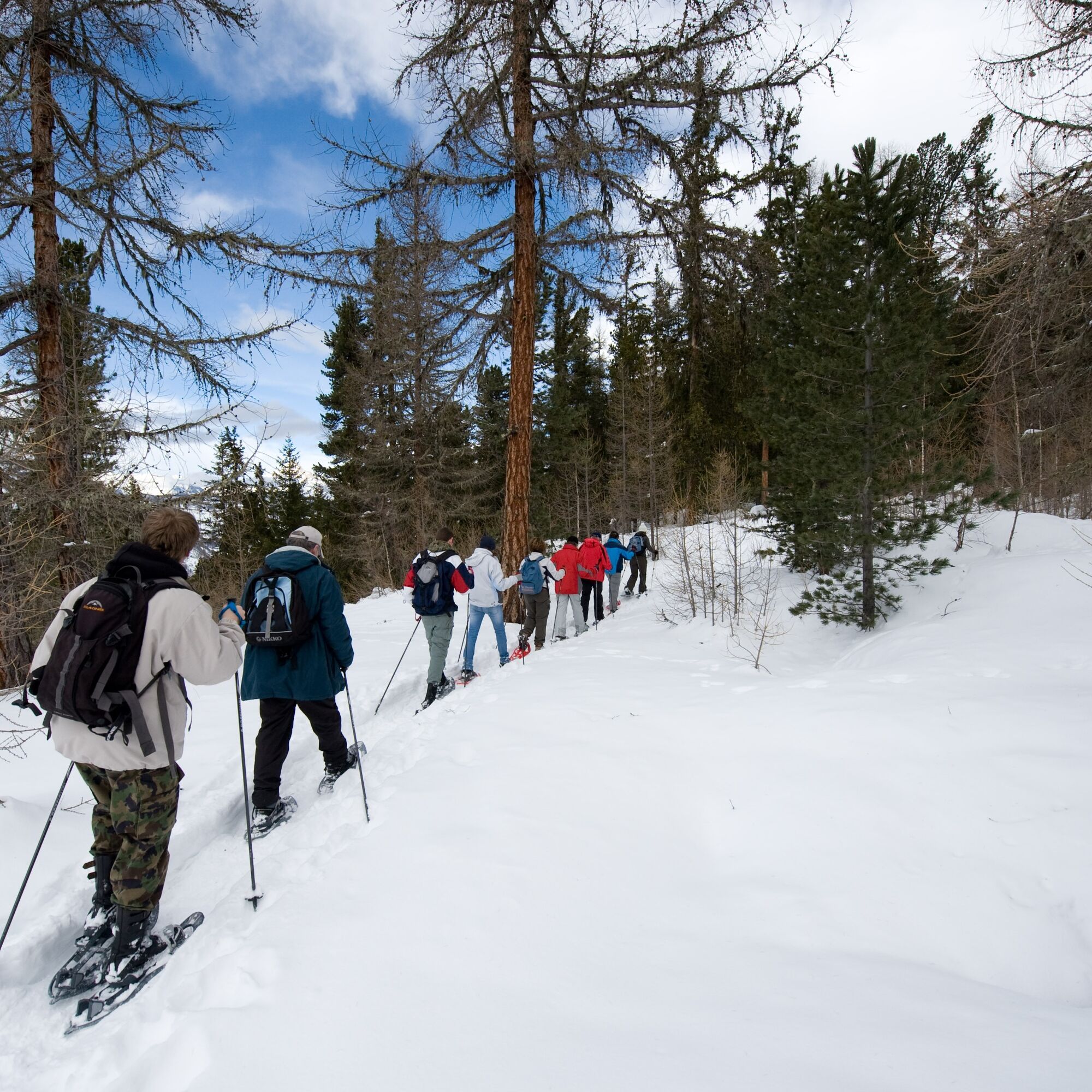
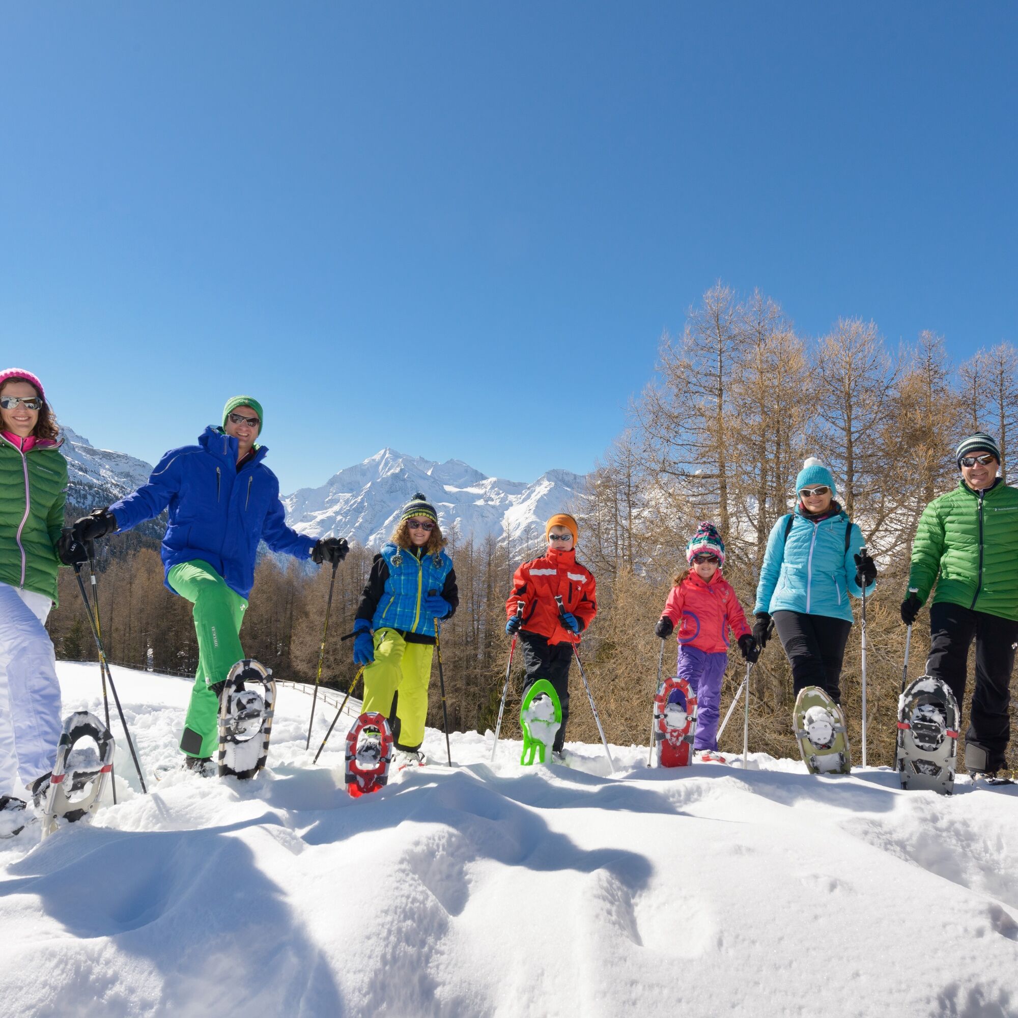
The challenging Wannihorn Trail leads from Hannigalp at 2121 meters initially on a relatively flat route to Stafel and from there on a steep path through the winter forest up to Wannihorn at 2669 meters. You will overcome 476 meters of altitude. The return route follows the same path.
Áno
Áno
We recommend:
Good and waterproof footwear Snowshoes Hiking poles Weather-dependent, waterproof and warm clothing Headwear Sunscreen Provisions Camera Printout of the hiking trail (click "Print" to download)Use of the snowshoe routes and information on this website is at your own risk. Conditions on site may cause changes to the route. Valais/Wallis Promotion assumes no responsibility for the accuracy and completeness of the information on this website.
Carry a map with you. Download the full description of the hiking trail with a large-scale map by clicking "Print" at the top right of the page. Use only marked trails and observe all signs and instructions – for your own safety, to protect grazing animals and out of respect for wildlife. Behave considerately towards other trail users and the landscape. Take your waste and that of others with you. Bring additional sun protection. UV rays at high altitudes can be especially strong in winter, even in cloudy weather. Plan your hike carefully. Consider the required fitness level of all participants as well as weather forecasts and seasonal conditions. Inform third parties about the route and if possible never go alone. Weather conditions can change very quickly and without warning in the mountains. Appropriate clothing and sufficient provisions and drinks are very important. In unstable weather, it is better to turn back early. Do not go on glaciers without a mountain guide. Observe warning signals indicating dangers, especially avalanche risk.Motorway A9 towards Visp. Cantonal road towards Saas-Fee / Zermatt until the Grächen turnoff.
Accessible by train and bus. From Visp or St. Niklaus station by bus to Grächen
Grächen is partially car-free. Two parking garages are available at the entrance to the village.
More information about the destination: Grächen
The route requires good stamina. Once you reach the top, however, the efforts are rewarded with a fantastic panoramic view. The Stafel bar is ideal for a small refreshment on the way. To finish, you can enjoy the view of the unique Matterhorn from the large sun terrace of the family mountain restaurant Hannigalp.
Webové kamery z prehliadky
Obľúbené výlety v okolí
-
3,3
Europaweg Grächen - Europahütte - Zermatt
ťažkéTuristika 39,9 km -
3,6
Höhenweg Kreuzboden - Almagelleralp - Saas-Almagell
Turistika 9,74 km -
3,5
Waldweg Saas-Fee - Saas-Almagell
Turistika 2,83 km -
5,0
Moosalp Panoramaweg
svetloTuristika 6,36 km -
3,8
Höhenweg Saas-Fee - Grächen
Turistika 12,0 km -
5,0
Weissmies Südgrat von Saas Almagell
strednáVysoké turné 20,5 km -
5,0
Marmot mountain path Spielboden
strednáTuristika 3,89 km -
5,0
Via ferrata Jägihorn
ťažkéVia ferrata 6,14 km -
3,5
Saas-Fee - Gemsweg - Hannig - Plattjen
Turistika 6,89 km -
5,0
Ibex path
strednáTuristika 9,02 km
Turistika a stopovanie


Nenechajte si ujsť ponuky a inšpiráciu na ďalšiu dovolenku
Vaša e-mailová adresa bol pridaný do poštového zoznamu.