


Suone Rittmal Saas-Balen
Úroveň náročnosti: T2
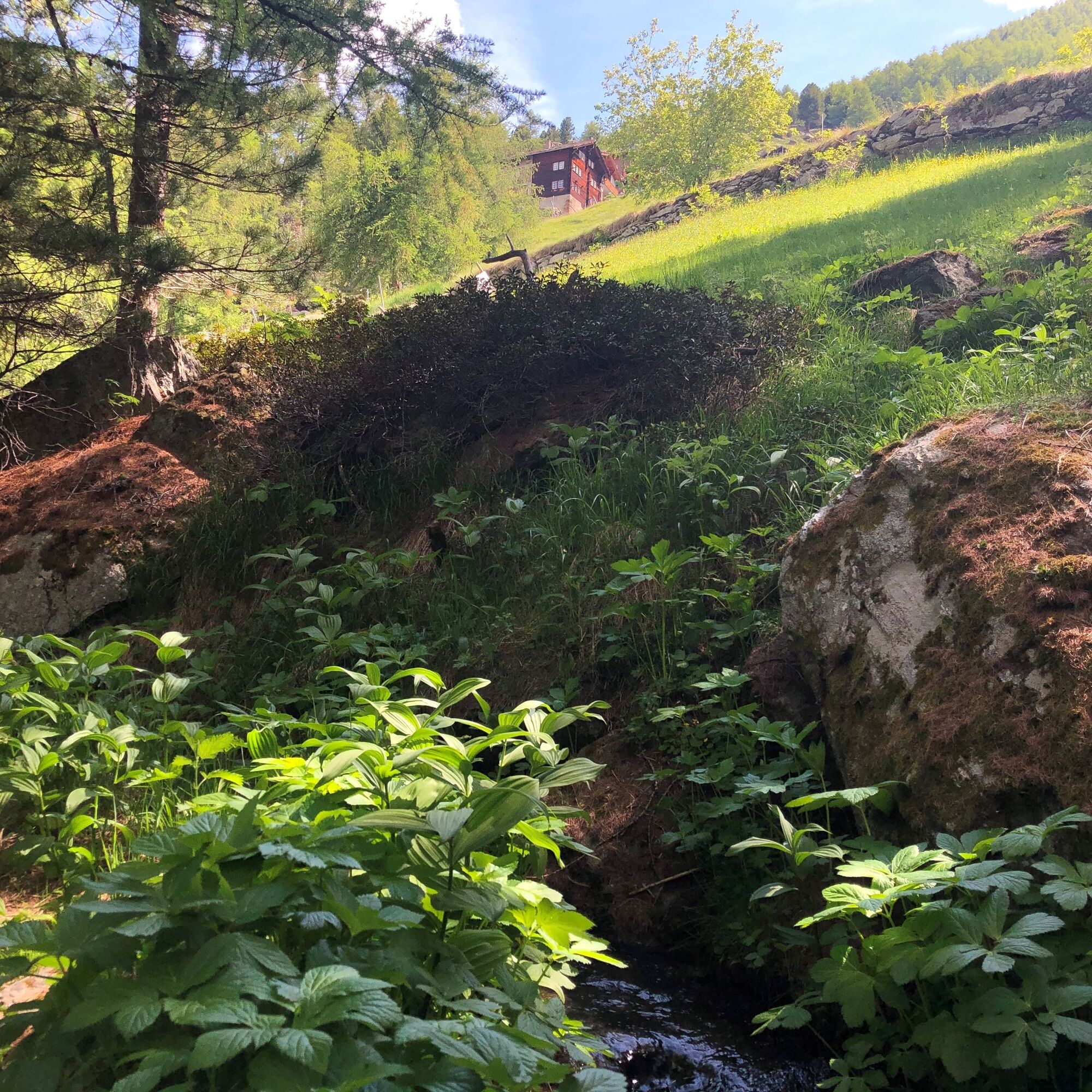
From Saas-Balen, ascend towards Rittmal/Tewaldji to the trail junction above the house in Rittmal. Here the path begins at the Rittmal "Wasserleitu" (= water channel/Suone). Along the babbling water, the...
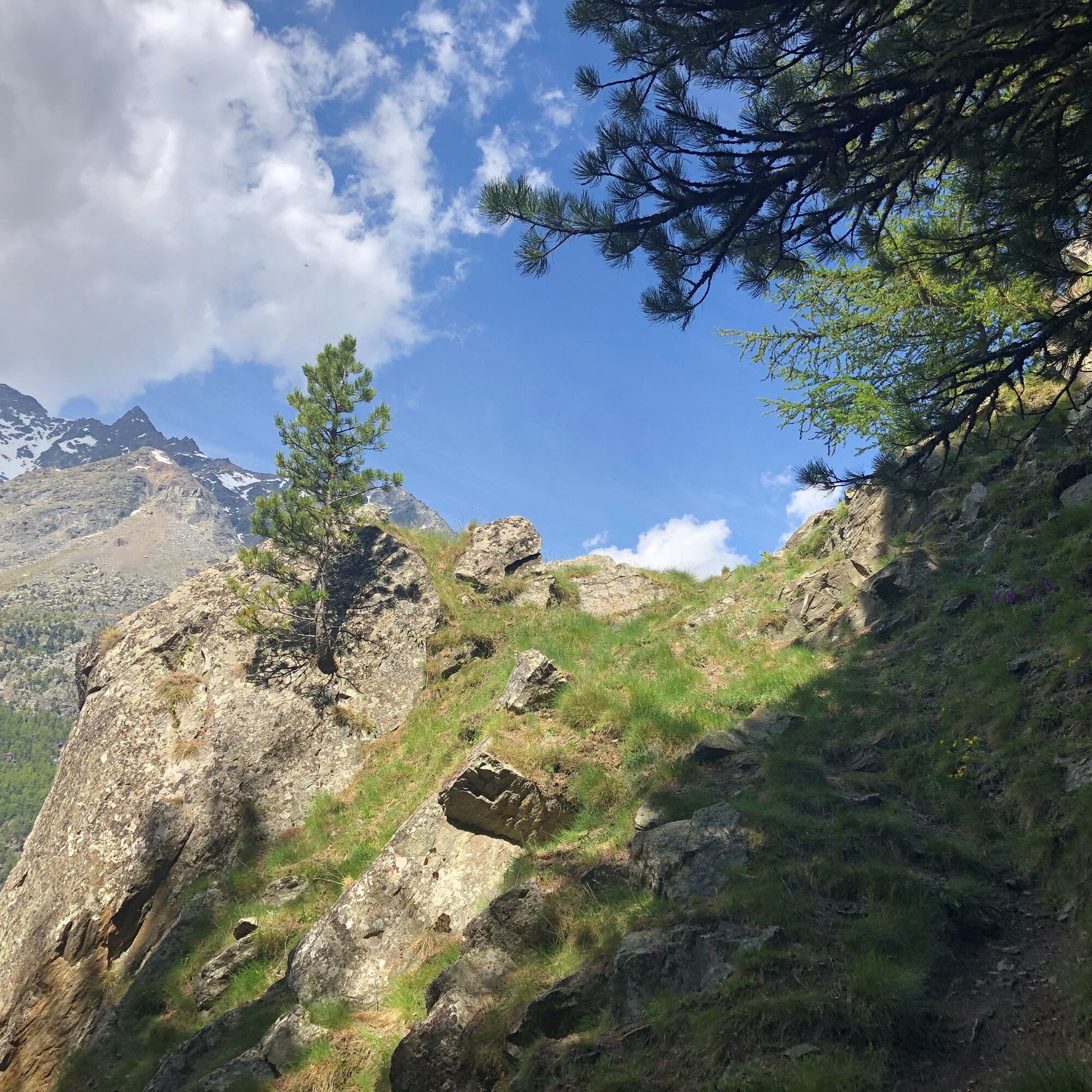
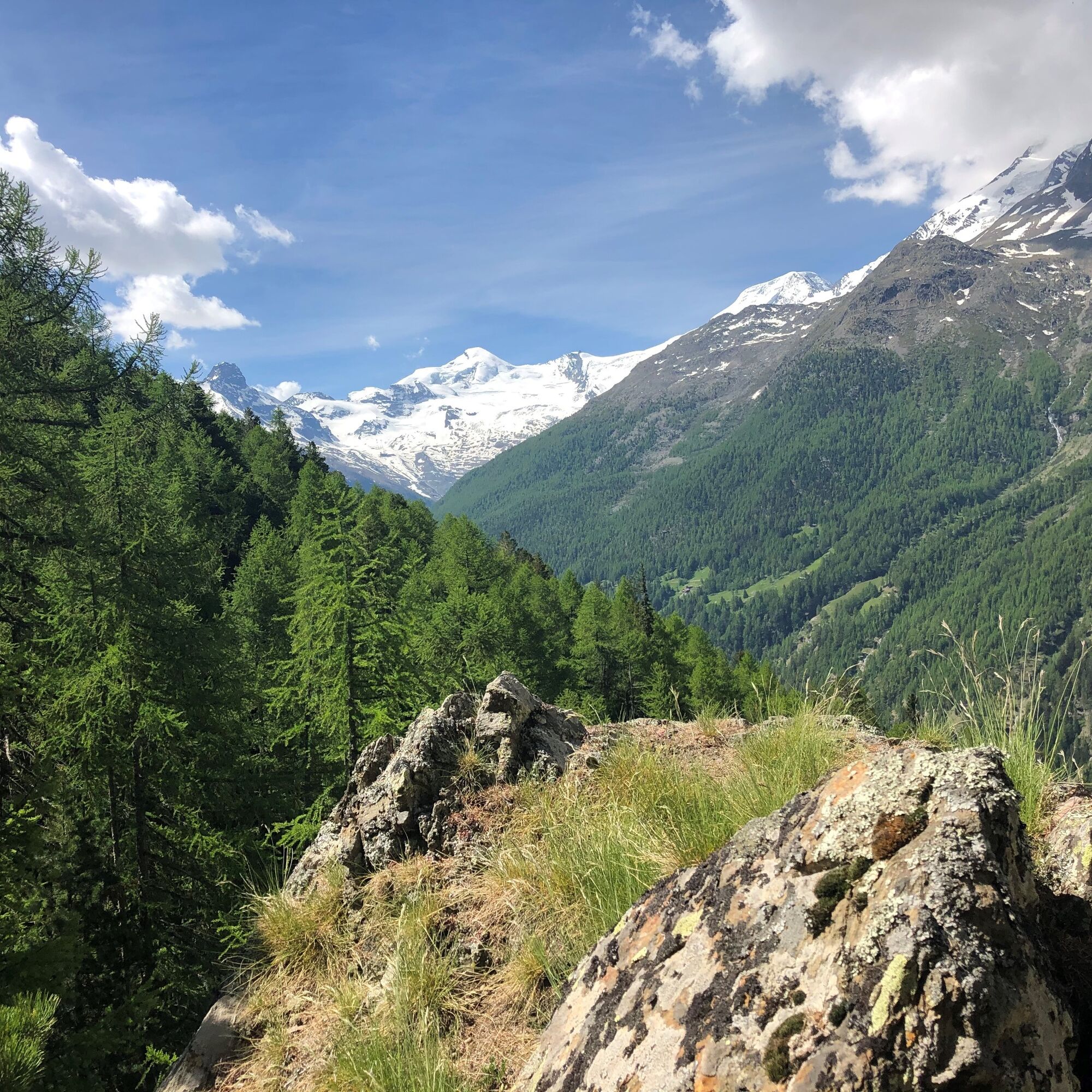
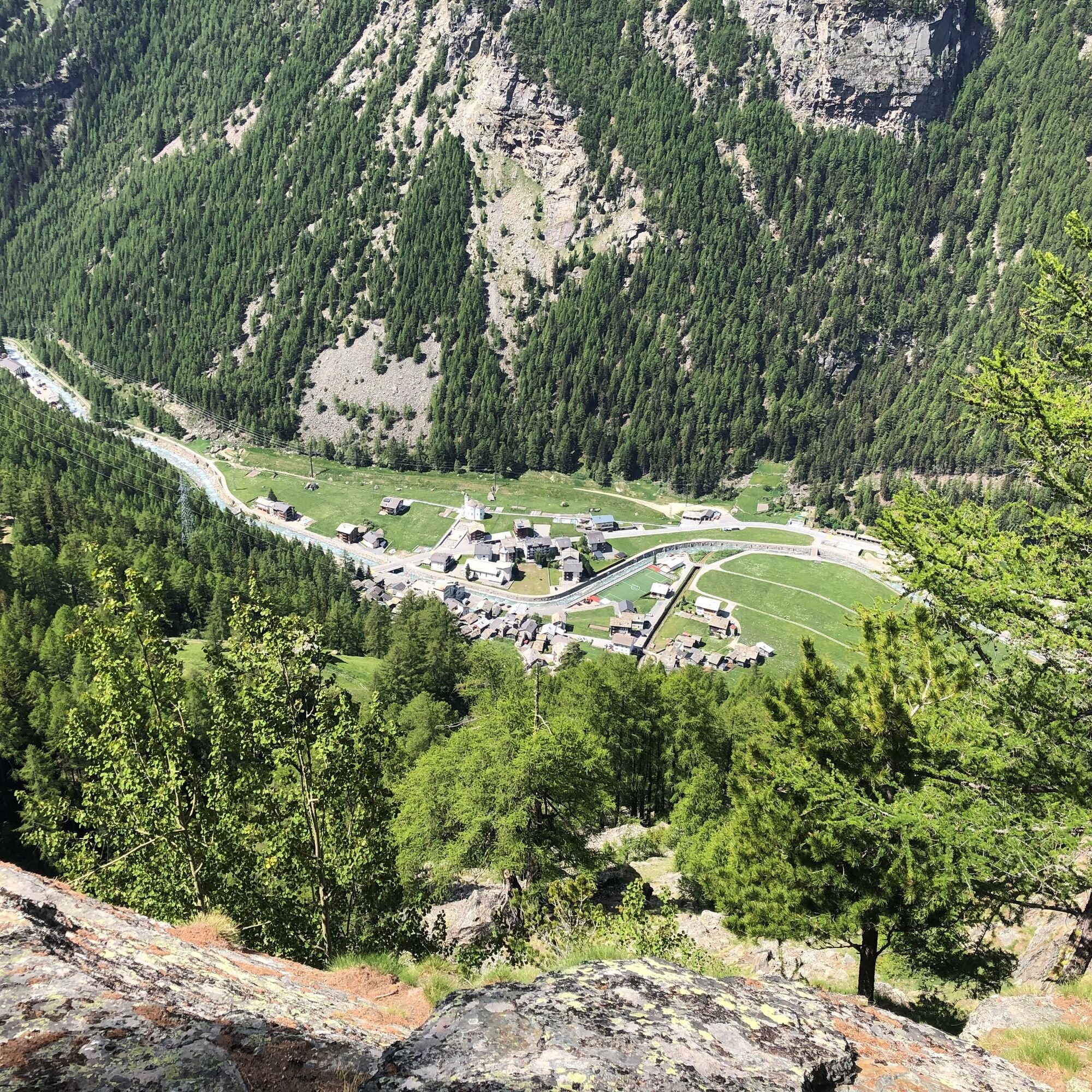
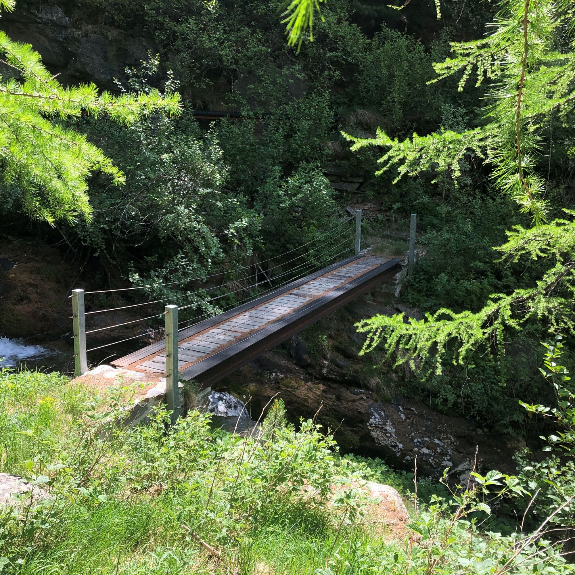
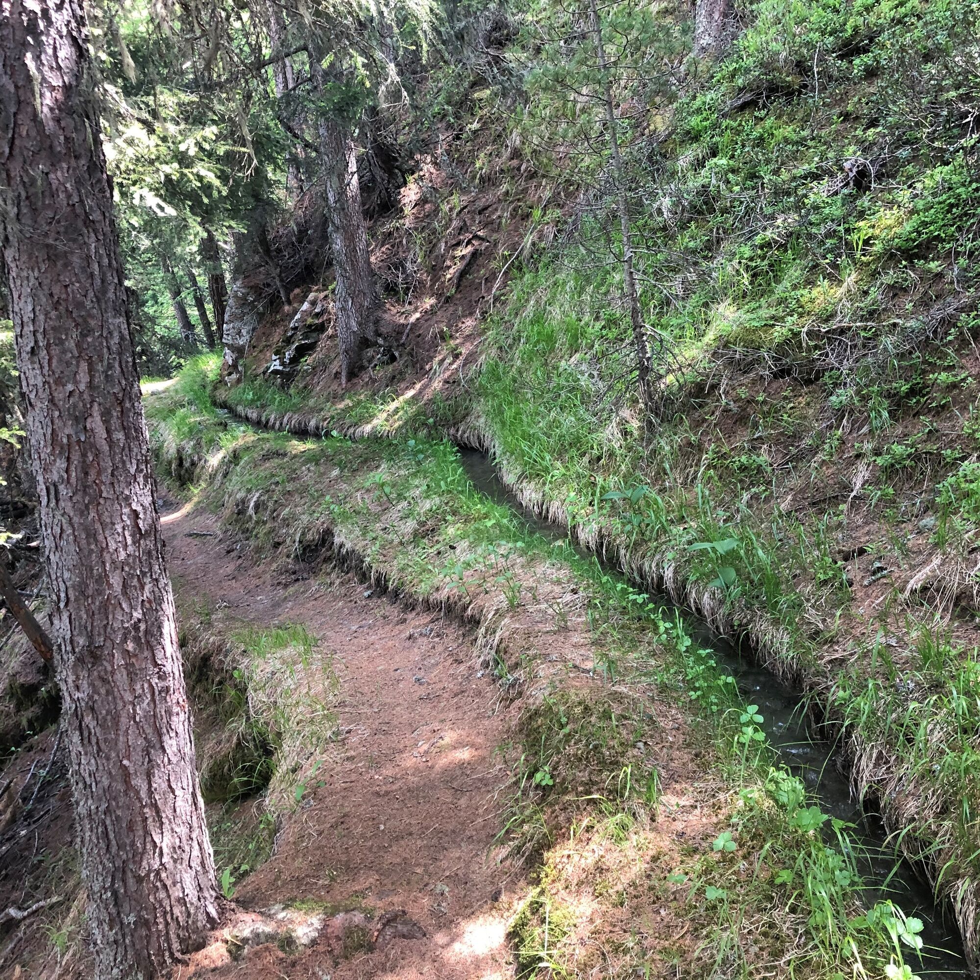
From Saas-Balen, ascend towards Rittmal/Tewaldji to the trail junction above the house in Rittmal. Here the path begins at the Rittmal "Wasserleitu" (= water channel/Suone). Along the babbling water, the path leads north through open forest. In a clearing, there is a rock outcrop with impressive views southwest to the Mittaghorn and Allalin. After a few minutes' walk, you see through the trees the meadows and houses of the alp "Unneri Brend." Shortly after crossing the Fellbach, the last ascent of the path follows. Here the view opens onto the village of Saas-Balen in the valley. From the "Lengflüe," the highest point of the hike, follow the road and path via Matt and Grundbiele towards Saas-Balen. At the end of the hike, a spectacular waterfall awaits as a highlight.
Suonen are the historical irrigation channels of Valais. They lead the urgently needed water via ditches and pipes to the pastures and gardens. These kilometer-long channels arose from water scarcity, which required inventiveness and diligence.

Saas-Balen - Rittmal - Lengflüe - Matt - Waterfall - Saas-Balen
Good footwear
Outdoor clothing: Always carry a waterproof jacket
Sun protection
Fluids and provisions
Trekking poles (optional)
Navigation tool
First aid kit
Using the hiking trails and information on this website is at your own risk. Local conditions may cause changes to the route.
Use only marked hiking trails and follow all signs and instructions – for your own safety, to protect farm animals, and without disturbing the peace of wildlife.
Be considerate towards other trail users and the landscape. Take your garbage and the garbage of others with you.
Carry sun protection. UV rays at high altitudes can be very strong, even in cloudy weather.
Plan your hike carefully: take into account the fitness level of all participants, weather forecasts, and seasonal dependencies.
Weather conditions in the mountains can change very quickly and without warning. Appropriate clothing and sufficient provisions (food and drink) are very important. In unsettled weather, turn back early.
Do not enter glaciers without a mountain guide.
Observe warning signs indicating danger.
Inform third parties about your route and, if possible, never go alone.
Pay attention to the opening hours of mountain lifts.
The Saastal is easily and conveniently accessible by car from all directions, whether from Switzerland or abroad. From the north, you reach us via Bern through the Lötschberg car shuttle. From the east, you come via the Furka Pass or the Furka car shuttle. From the south, we are reachable via the Simplon Pass or the Simplon car shuttle, and from the west, you drive via Lausanne along the Rhone Valley to Visp and from there towards Saas-Fee. From Visp, drive south towards Saas-Fee. At the "Killerhof" roundabout near Stalden, take the second exit to Saas-Fee and follow the main road to Saas-Balen.
Take the SBB to Visp and change there to the PostBus towards Saas-Fee (bus 511). Get off at the stop "Saas-Balen, Dorf".
After the bridge on the right is the public parking lot of Saas-Balen.
T2
Saastal Tourismus AG
Obere Dorfstrasse 2
3906 Saas-Fee
Tel.: +41 (0)27 958 18 58
E-Mail: info@saas-fee.ch
www.saas-fee.ch
Obľúbené výlety v okolí
-
4,9
Allalinhorn vom Mittelallalin über Normalweg
strednáVysoké turné 6,15 km -
3,3
Europaweg Grächen - Europahütte - Zermatt
ťažkéTuristika 39,9 km -
3,6
Höhenweg Kreuzboden - Almagelleralp - Saas-Almagell
Turistika 9,74 km -
3,5
Waldweg Saas-Fee - Saas-Almagell
Turistika 2,83 km -
3,8
Höhenweg Saas-Fee - Grächen
Turistika 12,0 km -
5,0
Moosalp Panoramaweg
svetloTuristika 6,36 km -
5,0
Weissmies Südgrat von Saas Almagell
strednáVysoké turné 20,5 km -
5,0
Via ferrata Jägihorn
ťažkéVia ferrata 6,14 km -
3,5
Saas-Fee - Gemsweg - Hannig - Plattjen
Turistika 6,89 km -
5,0
Winter Hike Mattmark
strednáZimná turistika 14,0 km
Turistika a stopovanie


Nenechajte si ujsť ponuky a inšpiráciu na ďalšiu dovolenku
Vaša e-mailová adresa bol pridaný do poštového zoznamu.