


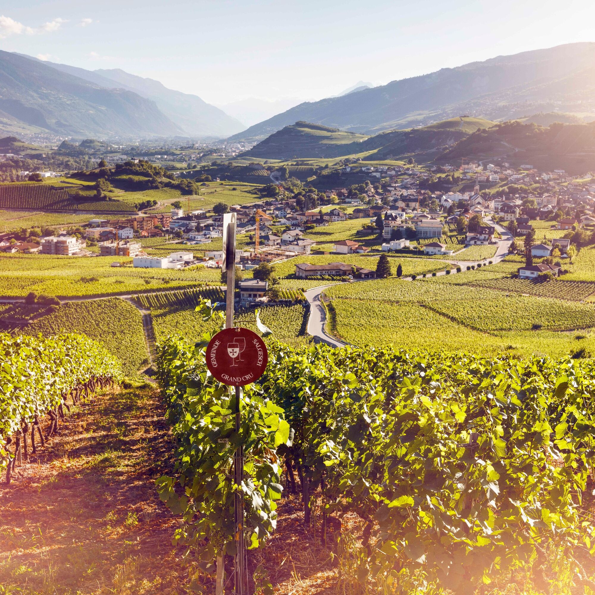
Wine route: Venthône – Leuk (Stage 4)

The wine route follows a scenic path along the sunny southern slopes and through charming wine-growing villages in the Valais wine region. The wine route can be explored in three ways – by car, bike, or...
The wine route follows a scenic path along the sunny southern slopes and through charming wine-growing villages in the Valais wine region. The wine route can be explored in three ways – by car, bike, or on foot. The hike covers 65 kilometers consisting of 4 stages, allowing you to not miss any of the numerous sights.
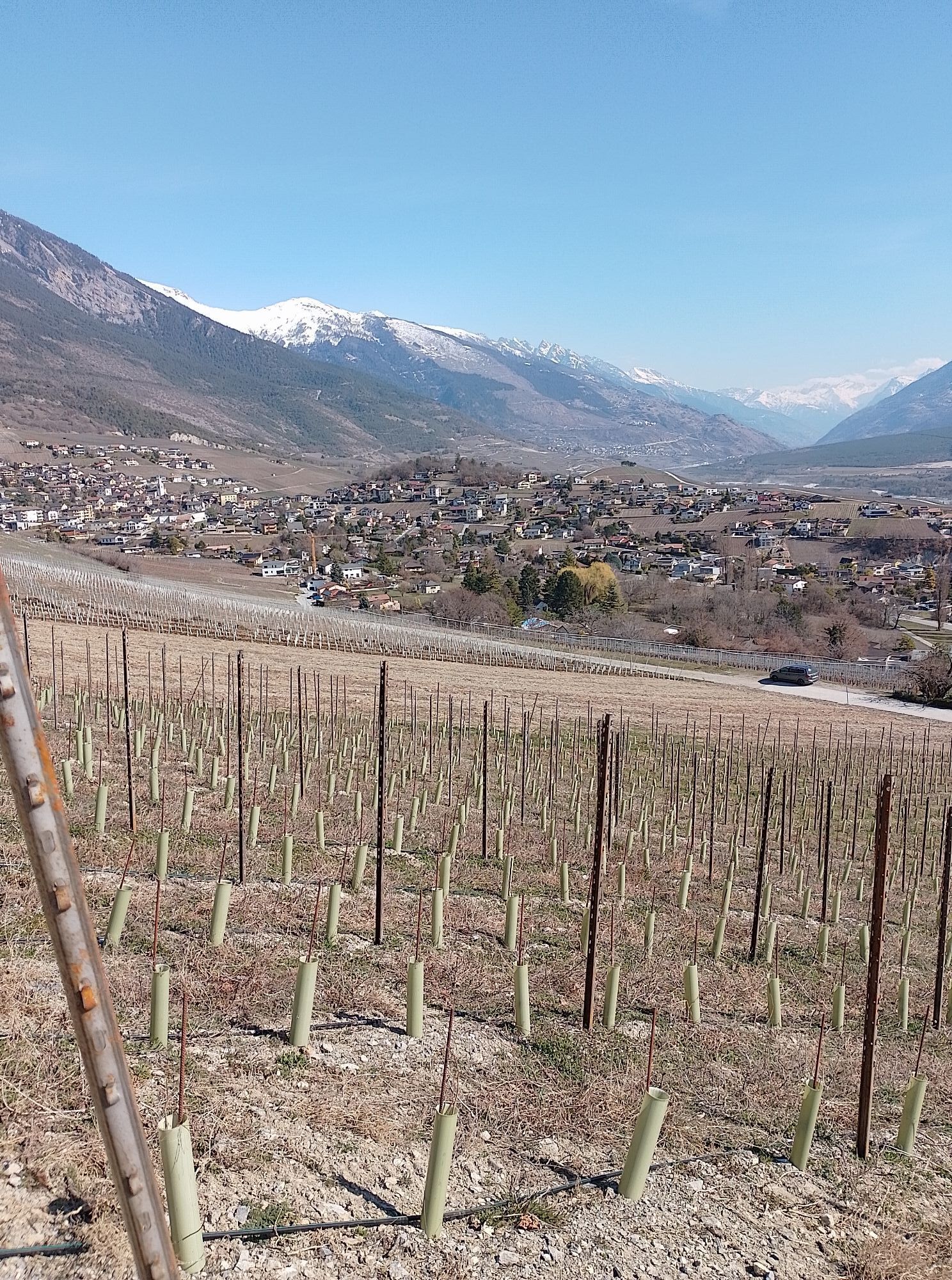
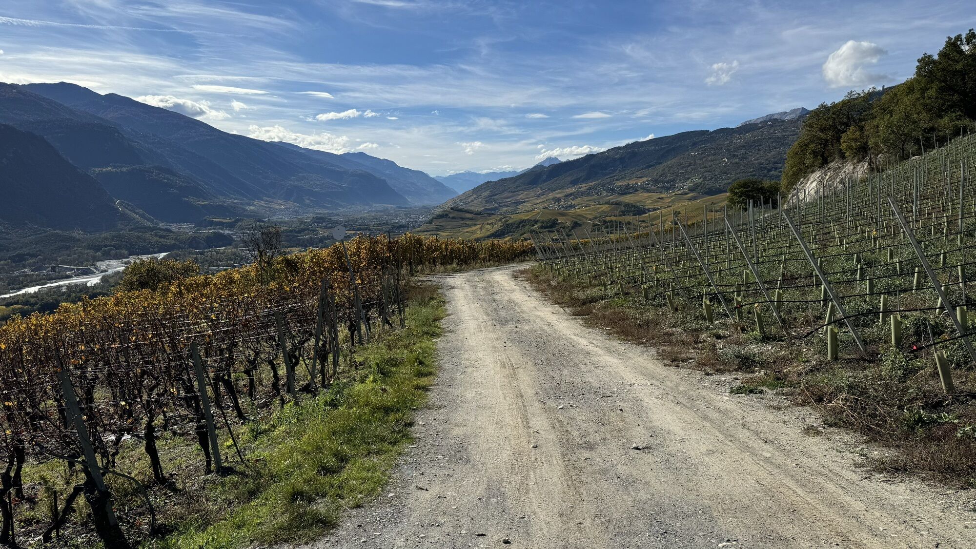
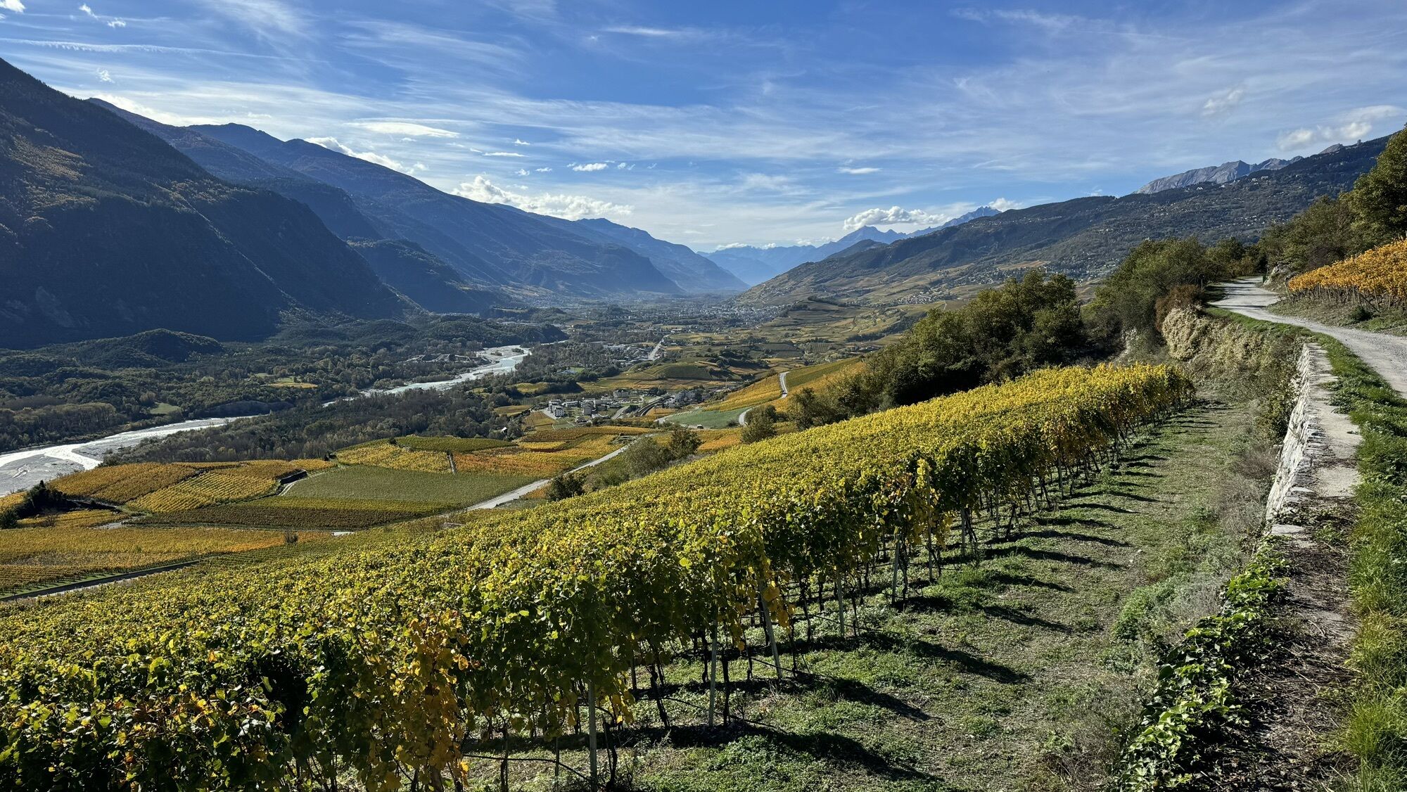
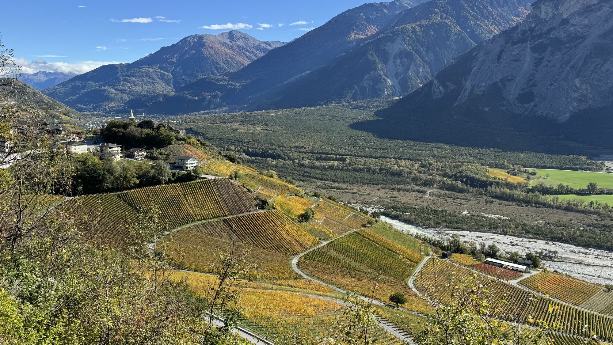
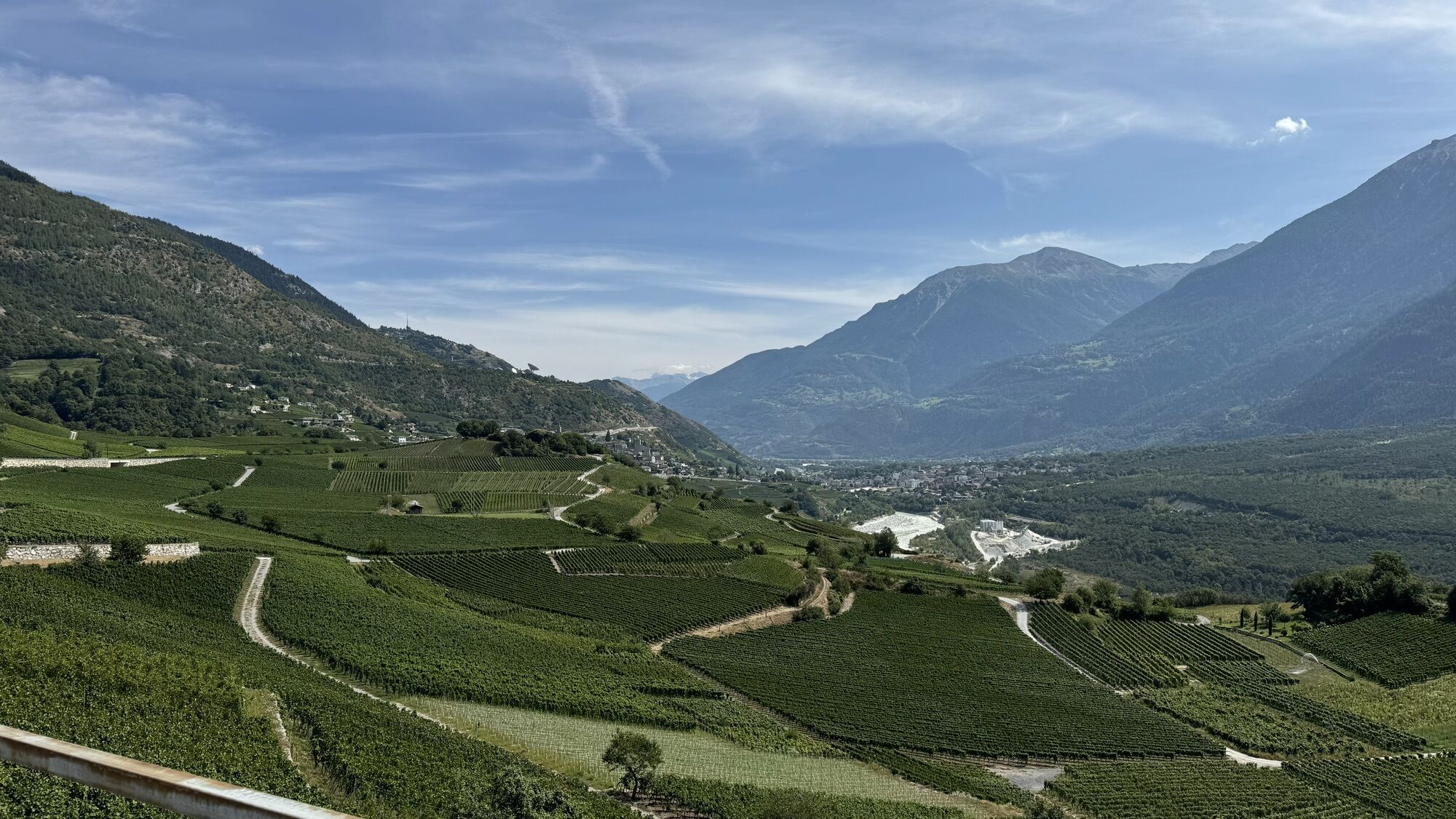
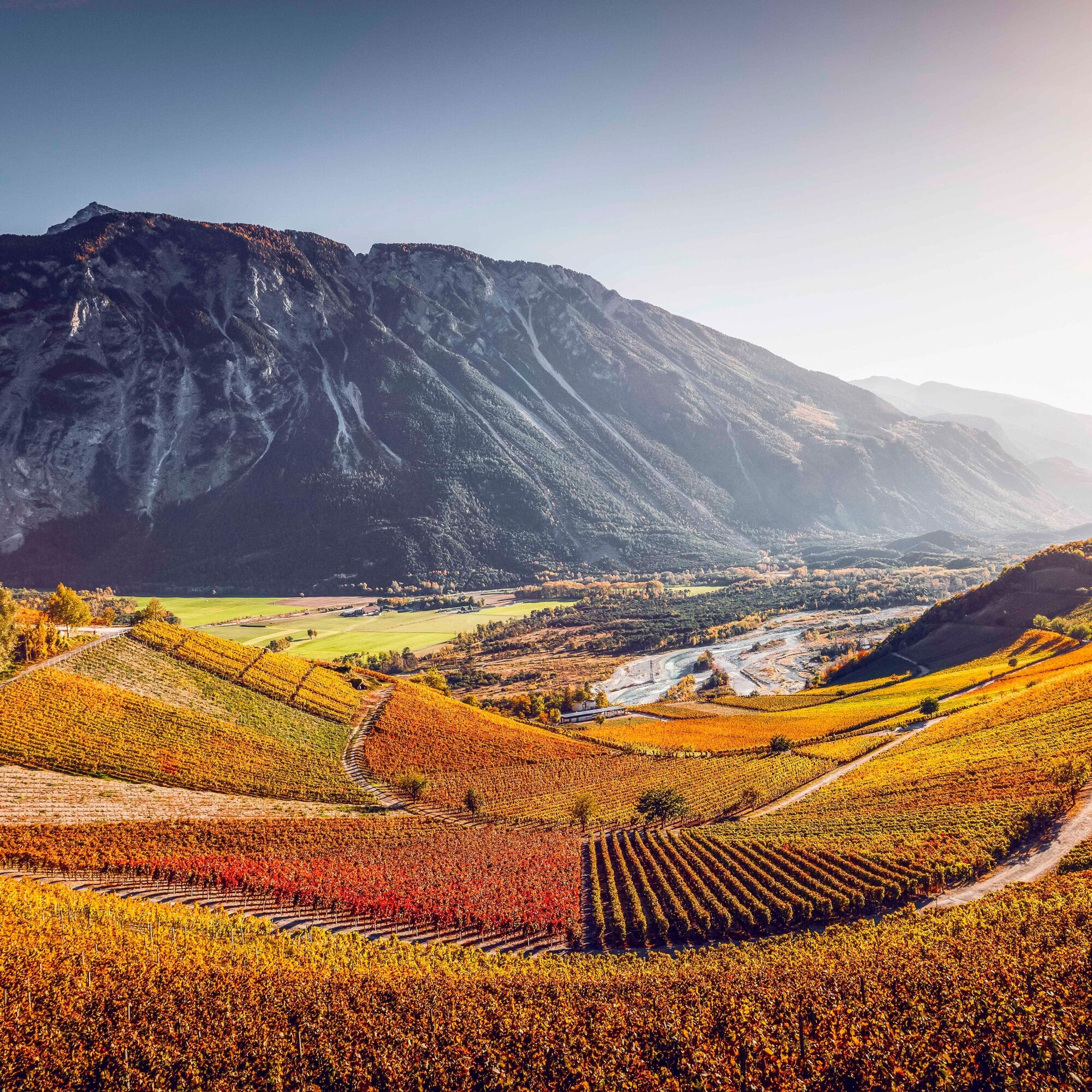
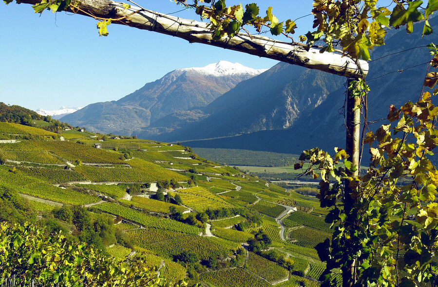
Because of the unstable geological situation, the Rhone in the region at the language border could never be tamed. It naturally flows with many branches – thus creating rocky islands. On the southern shore are the pine forests of the regional Pfyn-Finges Nature Park. This extensive nature park is one of the biodiversity hotspots in Switzerland and extends from the banks of the Rhone to mountain peaks and glaciers. In between are vineyards through which our hike leads.
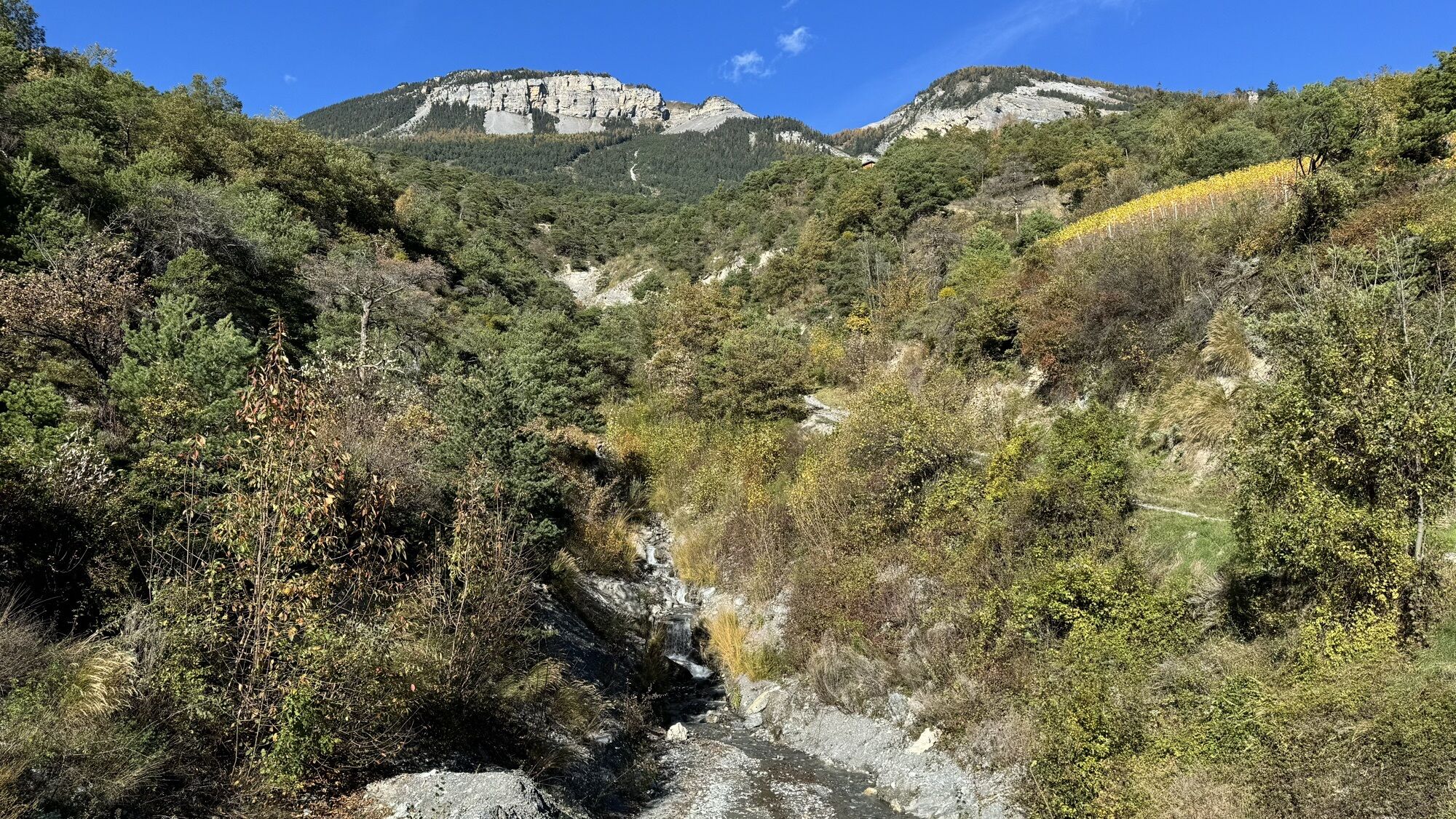
This stage of the wine route crosses the Raspille, which forms the language border between the German- and French-speaking Valais. Thus, the atmosphere in the French-speaking Venthône and Miège is quite different from that in Salgesch, Varen, and Leuk, also charming villages along the route.
A highlight along the path is the "Espace Terroirs" in Miège. This innovative visitor center shows an exhibition on the soil management of the vines and the influence of viticulture on the landscape. The center also offers a small café-restaurant and a tasting area with over 50 wines for tasting.
Besides the great view, you get to know the local history of the region. The highlight is the historic town of Leuk with its medieval buildings as well as the impressive castle, restored by Swiss star architect Mario Botta. Today, the castle is actively used for music events, theater, and exhibitions. Leuk is also home to the oldest wine in Switzerland: a Cornalin planted in 1798 in the heart of the town.
Highlights of the hike:
Great views of the wild Rhone and the extensive pine forests of the regional Pfyn-Finges Nature Park Espace Terroirs in Miège, the innovative visitor center on the topic of wine Hike crossing the language border with two different cultures Historic town Leuk with medieval castle restored by the star architect Mario Botta.
The hike begins just above Sierre in the small village of Venthône, which is reachable by a short bus ride (stop: Village). The hike is clearly marked.
In Miège, there is the "Espace Terroirs," a little off the path in the village center. This is also where the start of the "Sentier des Terroirs" is located, a themed trail about the geology and viticulture of the region. This circular hike lies between our route and the vineyard educational trail. The latter runs below the 4-day wine route from Sierre to Salgesch and connects the two locations of the Valais Wine Museum.
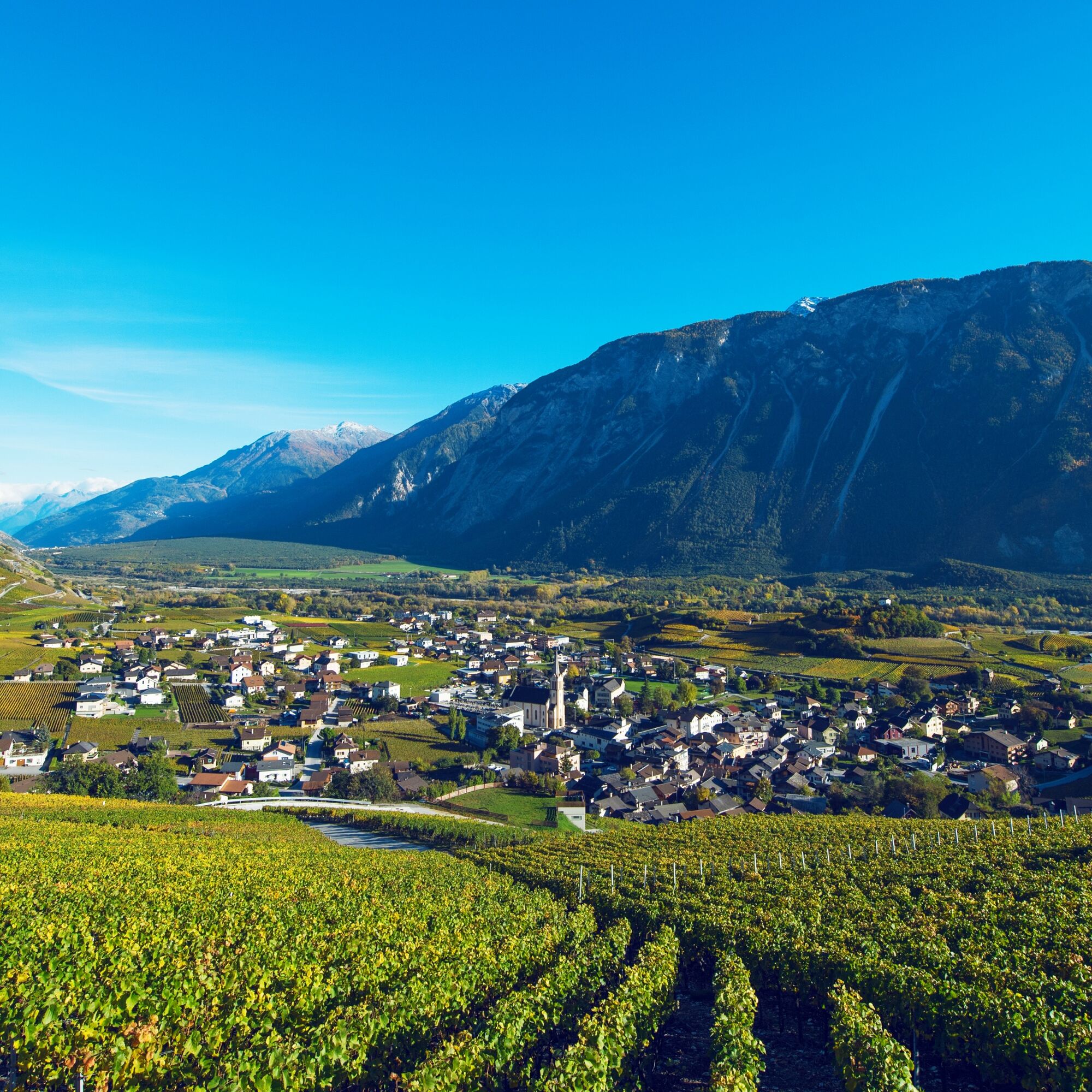
In Varen, a small detour of about 200m is worth it to reach the church on the hill – here you have a sensational view of the wild Rhone. Also in Varen, there is a charming trail on the subject of wine called the Pfyfoltru path (Pfyfoltru = butterfly).
Take your time in Leuk to admire the historic small town with its numerous medieval buildings. On the way to the station on the banks of the Rhone, you will pass the Ringacker Chapel – one of the most beautiful baroque churches in Valais.
Áno
Áno
We recommend:
Good footwear Weather-dependent clothing: always carry a waterproof vest Headgear Sunscreen Water bottle Picnic Camera Binoculars (optional) Trekking poles (optional) Printed copy of the hiking trail (click "Print" to download)For certain hikes:
SwimsuitThe mountains, a place of joy to share and respect. The mountain world is a place to meet and experience unforgettable moments together – whether by bike or on foot. So that all users can benefit, it is essential to share this space with respect for nature and agriculture. Respectful behavior allows everyone to pursue their leisure activities under the best conditions. Inform yourself about recommendations and rules. Assess your own skills and condition well. Traveling the different routes is always at your own risk.
For all hikes:
Carry a map with you. Download the complete description of the hiking trail with a large-scale map by clicking "Print" at the top right of the page. Use only marked hiking trails and observe all signposts and instructions – for your own safety, to protect grazing animals, and out of respect for wild animals. Close gates after passing through them. Behave considerately towards other trail users, plants, and animals.For mountain hikes:
Carry additional sun protection. UV rays can be very strong at high altitudes, even in cloudy weather. Plan your hike carefully: consider the required fitness level of all participants, weather forecasts, and seasonal conditions. Weather conditions in the mountains can change very quickly and without warning. Appropriate clothing and enough provisions (food and drink) are very important. In case of unstable weather, better turn back early.For high alpine hikes:
Inform your family about your hiking route. If possible, avoid hiking alone. Do not venture onto glaciers without a mountain guide. Pay attention to warning signs indicating dangers at riverbanks, along watercourses below dams and reservoirs: water levels can rise quickly and without warning.Motorway A9, exit 29 (Sierre-Est). On the main road towards Randogne and then through the village of Veyras to reach Venthône.
Regular train connections to Sierre, followed by a bus to Venthône (bus stop Village). At the end of the hike, the train from Leuk station will bring you back with regular connections. Detailed timetables for trains and postal buses can be found at sbb.ch.
Small parking lot northeast of the village center of Venthône. Large parking lot (paid) at the end of the hike at Leuk station.
Especially in autumn, numerous wine-related events take place in the region – for example, guided hikes and tastings in Varen and Salgesch on weekends in September.
Obľúbené výlety v okolí
-
5,0
Bisse du Ro
svetloTuristika 11,2 km -
5,0
Bella-Tola
strednáVysoké turné 6,72 km -
5,0
Restipass
Turistika 14,5 km -
5,0
Torrenthorn- Rigi der Walliser Alpen
Turistika 2,99 km -
4,7
Leukerbad - Gemmipass - Lämmerenhütte
strednáTuristika 9,49 km -
4,0
Grand Bisse de Lens
svetloTuristika 8,73 km -
4,0
Gemmipass - Lämmerenhütte - Rote Totz Lücke - Daubensee - Gemmipass
strednáTuristika 13,7 km -
Gratweg
Via ferrata 5,16 km -
Talabfahrt (Rinderhütte-Tunnel-Folljeret-Leukerbad)
Turistika 7,78 km -
4,0
Wolfstritt
Turistika 7,02 km
Turistika a stopovanie


Nenechajte si ujsť ponuky a inšpiráciu na ďalšiu dovolenku
Vaša e-mailová adresa bol pridaný do poštového zoznamu.