


Unnerriederi hike
Úroveň náročnosti: T2
The Unnerriederi hike offers a relaxed and scenically fascinating hike that connects the two communities of Staldenried and Eisten. The path follows a historic irrigation channel that formerly led water...
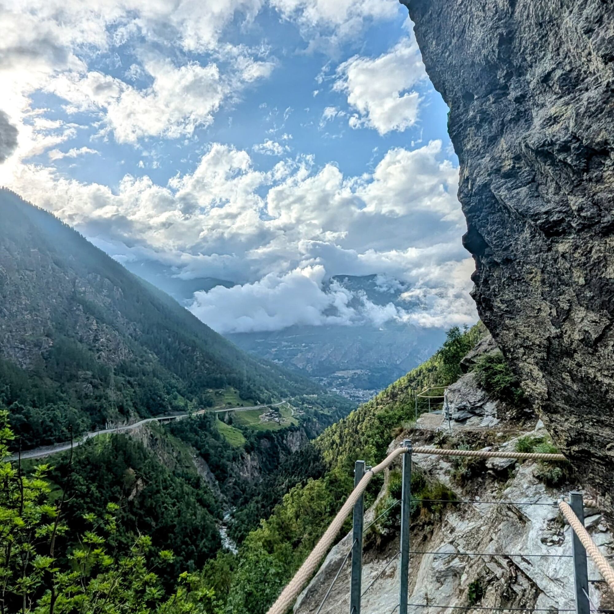
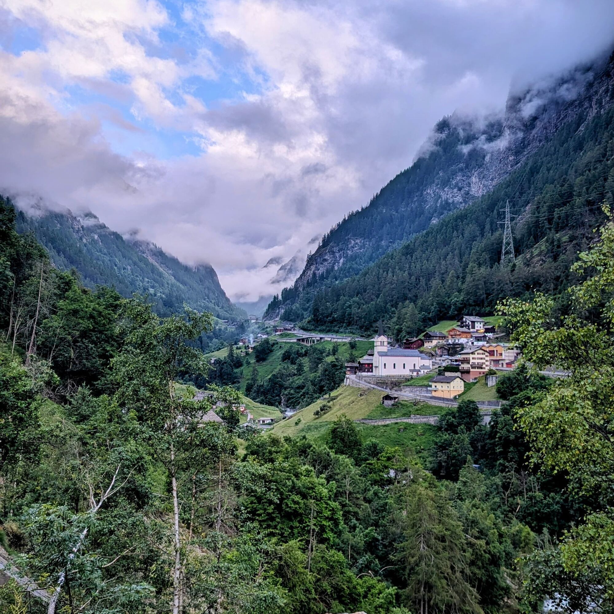
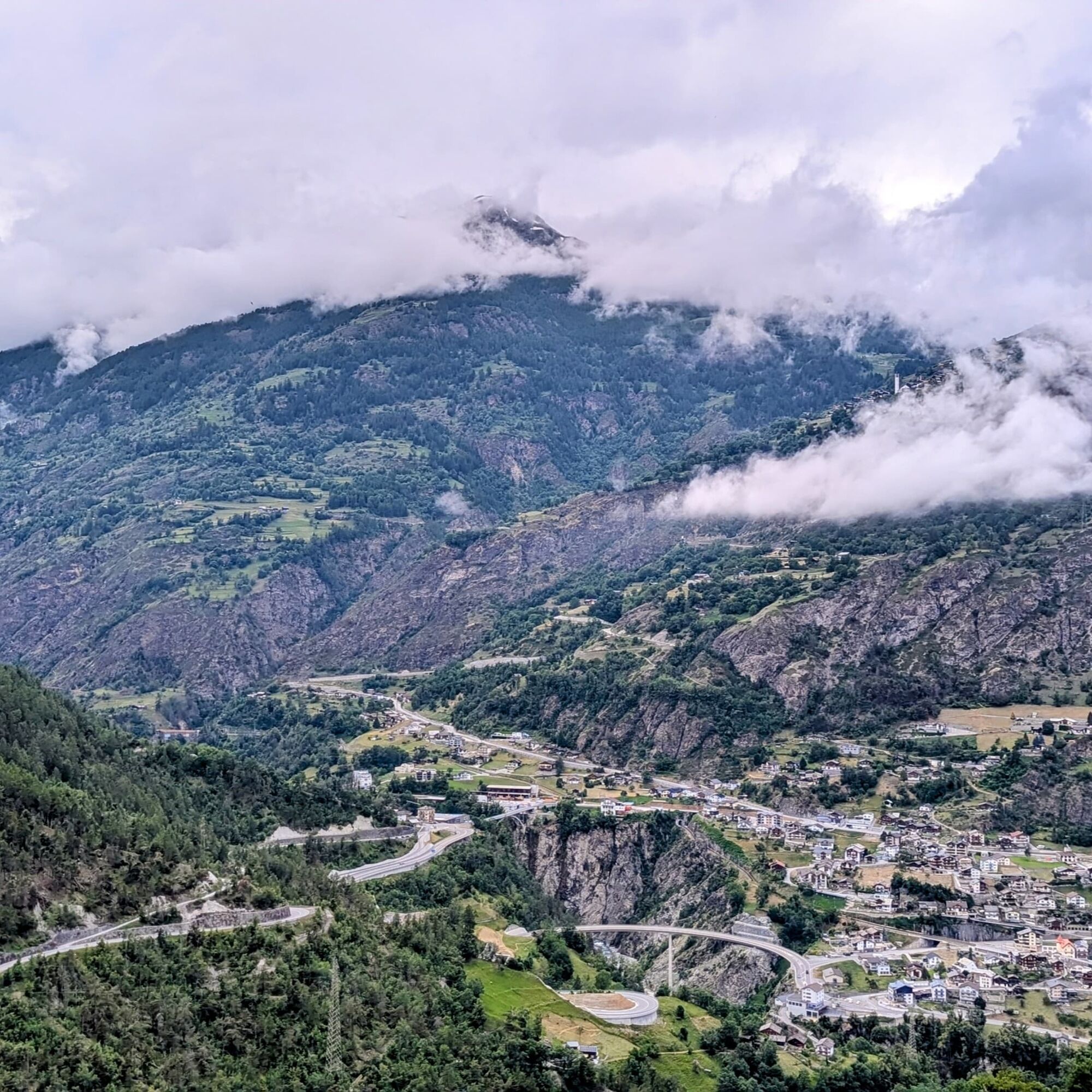
The Unnerriederi hike offers a relaxed and scenically fascinating hike that connects the two communities of Staldenried and Eisten. The path follows a historic irrigation channel that formerly led water from Eisten to Staldenried. Today, this old water channel is a wonderful trail that offers hikers not only insight into the history of the region but also impressive views of the Saastal and surrounding mountains.
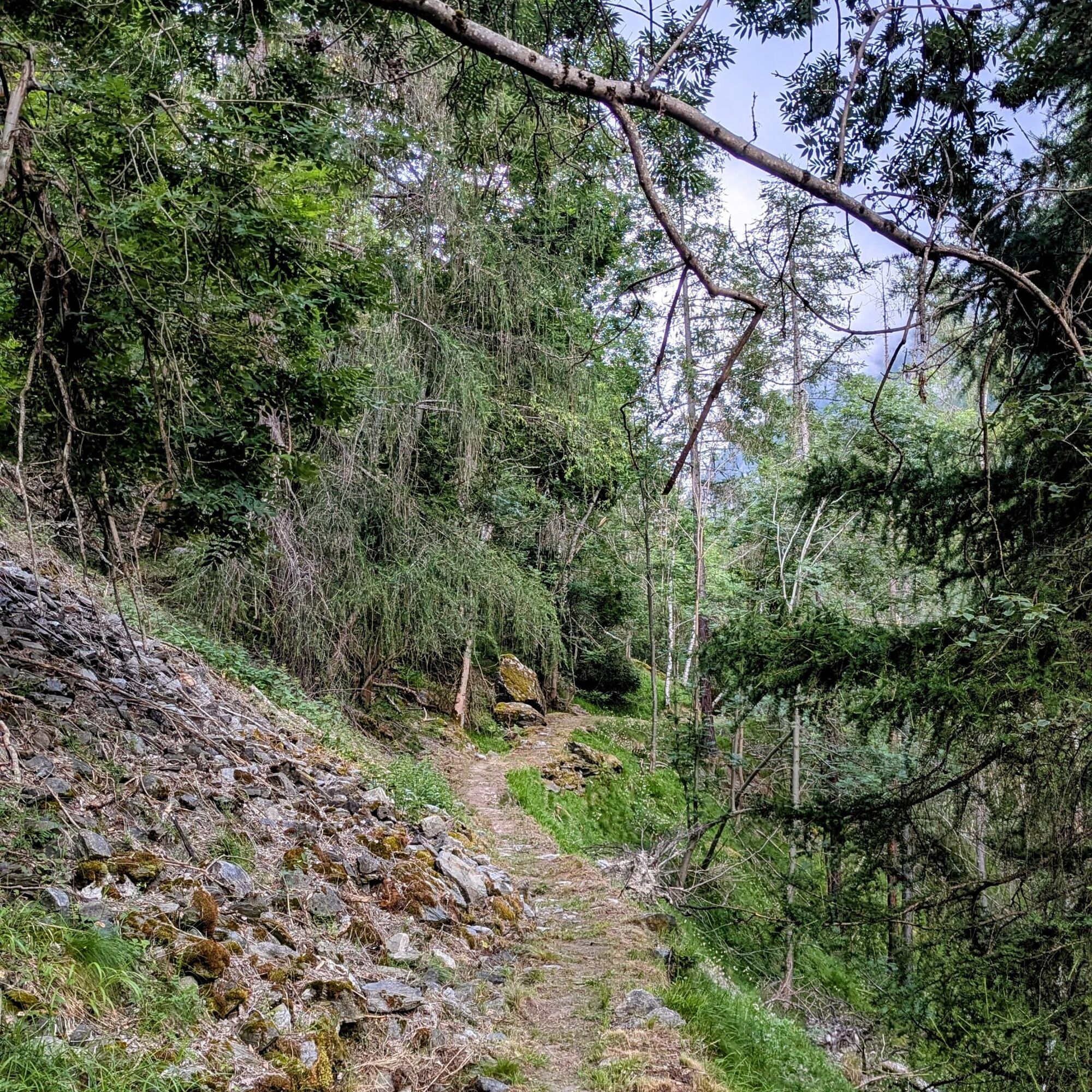
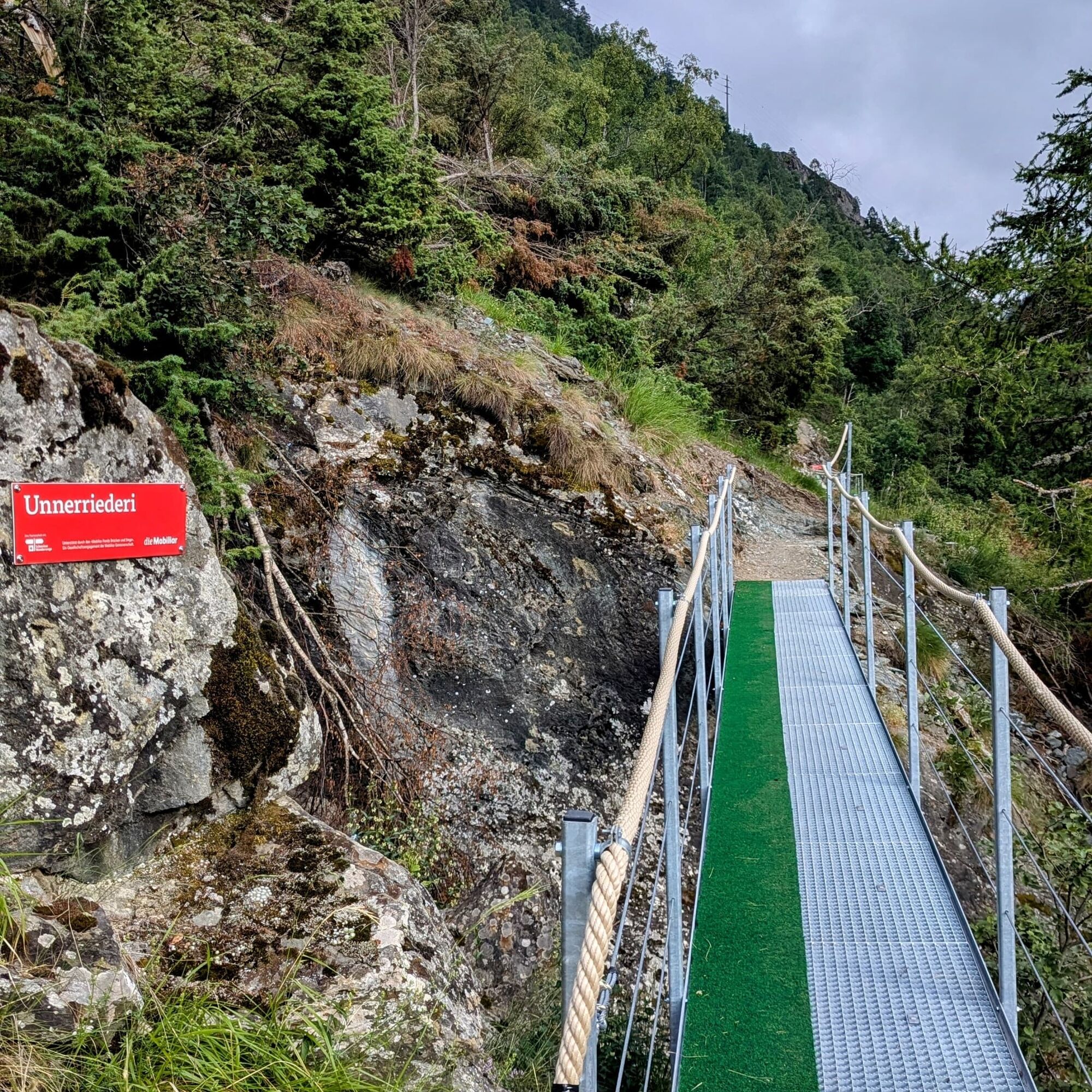
The hike is mostly easy but requires a certain lack of fear of heights at some points, as the path partially runs along steep slopes. Small bridges repeatedly provide charming crossings and enhance the idyllic character of the path. Especially impressive are the views, which invite pauses and bring hikers closer to the unspoiled beauty of the Saastal.
The Unnerriederi trail is a perfect link between the two villages and allows hikers to experience nature in all its variety. Thanks to the varied terrain, it is an ideal choice for a relaxed yet impressive hike in the Saastal.
Staldenried, Egga - Niw Matta - Fliebalmu - Werlischwald - Eisten, Werlischa
Good footwear
Outdoor clothing: always carry a waterproof jacket
Sun protection
Fluids and snacks
Hiking poles (optional)
Navigation tool
First aid kit
Use of the hiking trails and information on this website is at your own risk. Local conditions may possibly cause changes to the route.
Use only marked hiking trails and follow all signposts and instructions – for your own safety, to protect livestock, and without disturbing the peace of wildlife.
Be considerate towards other trail users and the landscape. Take your trash and the trash of others with you.
Carry sun protection. UV radiation at high altitudes can be very strong, even in cloudy weather.
Plan your hike carefully: take into account the required fitness of all participants, weather forecasts, and seasonal dependencies.
Weather conditions in the mountains can change very quickly and without warning. Appropriate clothing and sufficient provisions (food and drink) are very important. In unstable weather, better turn back early.
Observe warning signals that indicate dangers.
Inform third parties about your route and, if possible, never go alone.
Pay attention to the Postbus timetable.
Arrival by bus to stop: Staldenried Church, Cable car
Or by train/bus to stop: Stalden-Saas and then by the Stalden - Staldenried cable car to Staldenried
Bus according to timetable or by cable car.
Parking spaces both in Staldenried and at Stalden station.
Stalden station is recommended since the return trip from Eisten does not go via Staldenried.
T2
Saastal Tourismus AG
Obere Dorfstrasse 2
3906 Saas-Fee
Tel.: +41 (0)27 958 18 58
E-mail: info@saas-fee.ch
Children's playground in Staldenried
Combine with valley path (the path runs on the opposite side of the valley, allowing for a varied hike between Stalden-Eisten-Staldenried)
Obľúbené výlety v okolí
-
3,3
Europaweg Grächen - Europahütte - Zermatt
ťažkéTuristika 39,9 km -
3,6
Höhenweg Kreuzboden - Almagelleralp - Saas-Almagell
Turistika 9,74 km -
3,4
Waldweg Saas-Fee - Saas-Almagell
Turistika 2,83 km -
3,8
Höhenweg Saas-Fee - Grächen
Turistika 12,0 km -
5,0
Weissmies Südgrat von Saas Almagell
strednáVysoké turné 20,5 km -
5,0
Moosalp Panoramaweg
svetloTuristika 6,36 km -
5,0
Via ferrata Jägihorn
ťažkéVia ferrata 6,14 km -
3,5
Saas-Fee - Gemsweg - Hannig - Plattjen
Turistika 6,89 km -
4,0
NATICHERBERG CIRCULAR TRAIL
strednáTuristika 12,1 km -
4,5
Saas Fee - Bärenfalle - Melchboden - Hannigalp
strednáTuristika 8,38 km

Turistika a stopovanie


Nenechajte si ujsť ponuky a inšpiráciu na ďalšiu dovolenku
Vaša e-mailová adresa bol pridaný do poštového zoznamu.