







Galerie Défago
Take a natural path hewn into the heart of the rock, where the word “GALERIE” (“GALLERY”) can be seen in block capitals above you. Located on the large cliff face opposite the village of Champéry, on the...
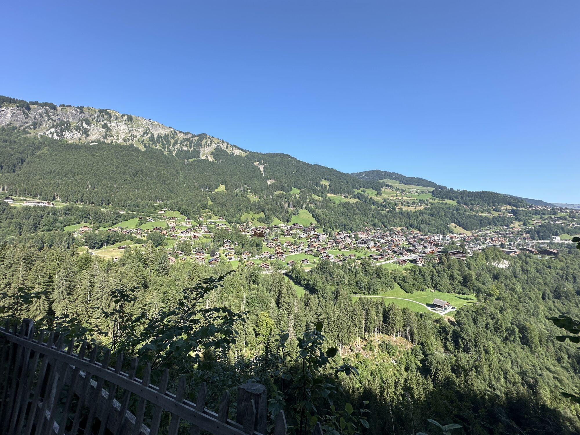
Take a natural path hewn into the heart of the rock, where the word “GALERIE” (“GALLERY”) can be seen in block capitals above you. Located on the large cliff face opposite the village of Champéry, on the other side of the Vièze river, this inscription marks the start of one of the most beautiful walks in the area. Spanning over 600 metres, this path follows a natural ledge, home to a wide variety of plants. The views open up more and more the further along the path you go. At the end of the path, you’ll be rewarded by a magnificent panorama of the village of Champéry. Take the time to admire the valley in its entirety and spot the bell tower of Illiez and the village of Troistorrents.

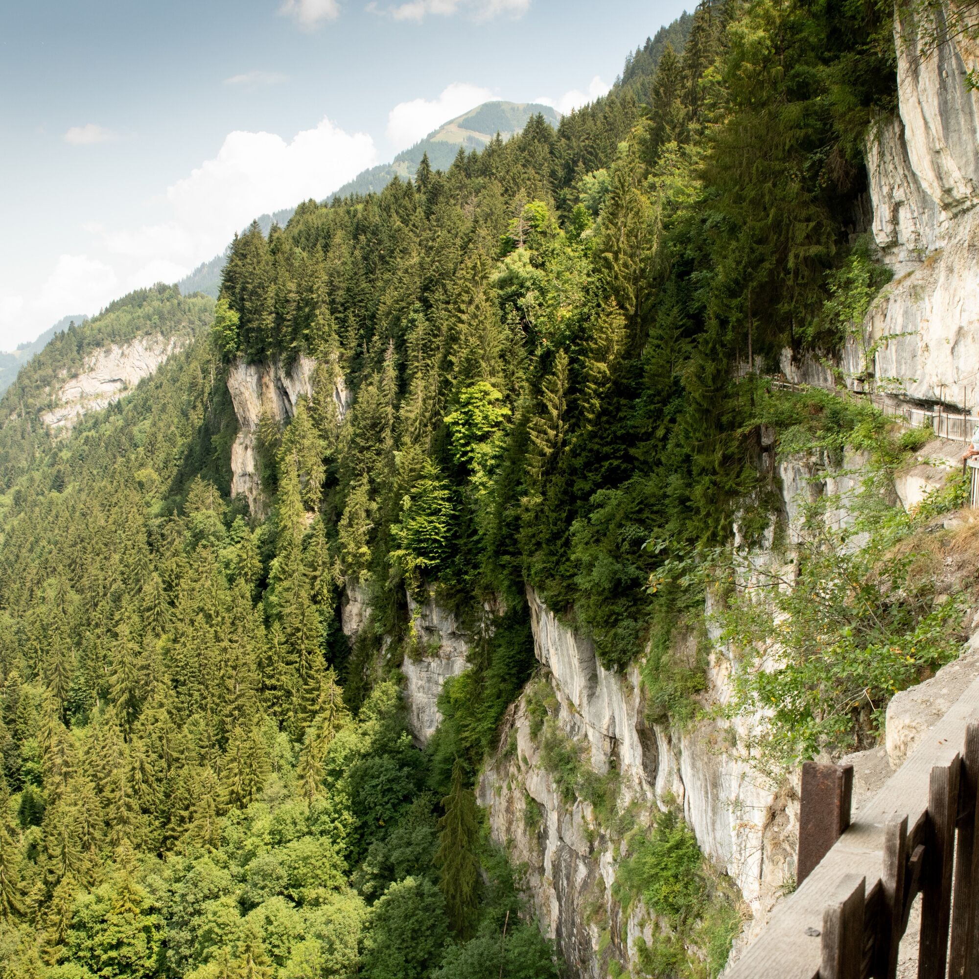
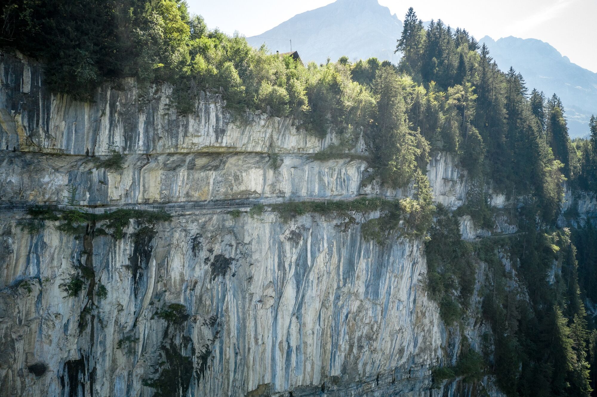
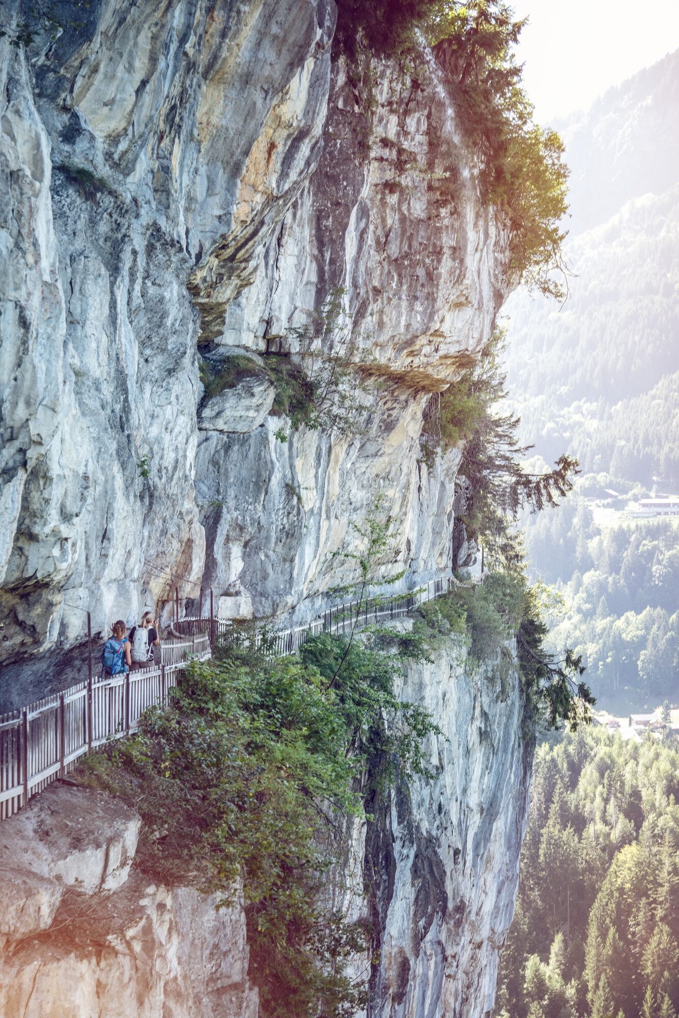

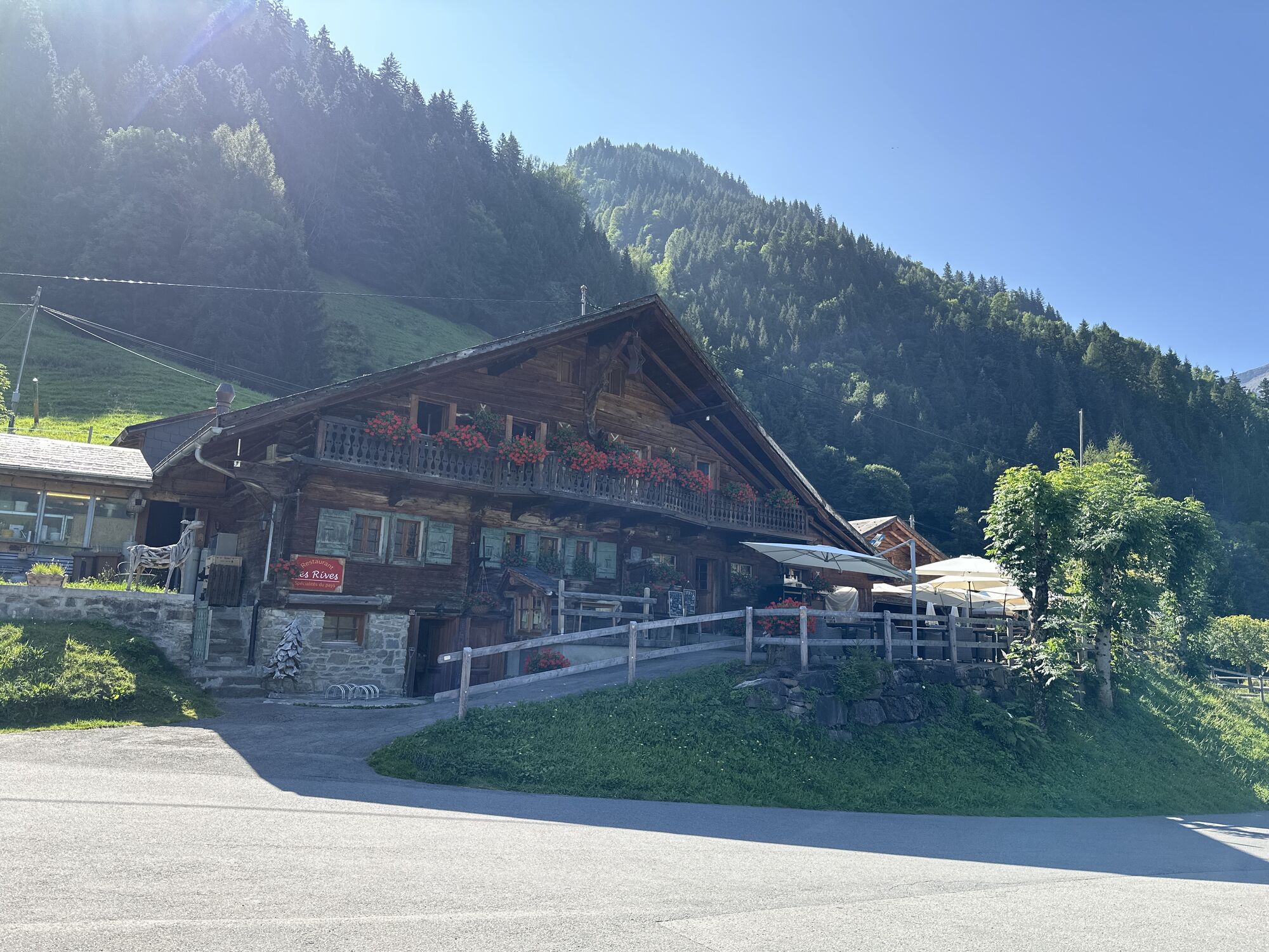
The hike starts at Champéry station. From here, the path crosses the Vièze river and climbs to one of the region’s most significant attractions – a path hewn into the cliff faces above the village. Emmanuel Défago, a local businessman, opened this gallery in 1864. The path mainly follows a natural ledge along the cliff face. At certain spots, the workers had to dig into the rock to create a continuous path. One century later, this passage has been extended to 600 metres in length, opening up spectacular views over Champéry and the valley below. At the end of the gallery, the route continues towards Val-d’Illiez, passing through Les Rives. At Les Esserts, you will start your descent to the bottom of the valley, before climbing back up to the village of Val-d’Illiez, passing by the former sawmill.
Áno
We recommend:
good footwear clothing suitable for the weather: always carry a waterproof jacket hat or cap sunscreen bottle for water picnic camera binoculars (optional) hiking poles (optional) printout of this hike (click “Print” icon, to download)
For certain walks:
SwimwearUse of the trails and the information on this website is at hikers’ own risk. Local conditions may entail changes to routes. Valais/Wallis Promotion accepts no liability for the accuracy and completeness of information on this website. When planning, take into account participants’ fitness level and ability. All riding is at one’s own risk.
For all hikes:
Bring a map. Download full description of this route including large-scale map by clicking on “Print” icon, top right of this page. Use marked trails only, and observe all signposting – for your own safety, to safeguard grazing animals and to avoid disturbing wildlife. Close gates after passing through. Please be considerate to other trail users, and to the plants and animals. Do not leave any waste in nature.
For mountain hikes:
Take extra care protecting yourself from the sun at altitude. UV radiation can be exceptionally strong, even in cloudy weather. Plan hike carefully: take into consideration fitness level of each participant, weather forecast and season. Weather conditions can change quickly in the mountains, without warning. Appropriate clothing is therefore essential, along with adequate supplies of food and water. In uncertain weather, turn back in good time.
For high-altitude hikes:
Inform others of the route you plan to take. Whenever possible, avoid going alone. Do not venture onto glaciers without a mountain guide. Take note of the warning signs that point out the constant danger in river beds and along watercourses below dams and reservoirs: water levels may rise rapidly without warning.Motorway A9 exit 18 (St-Triphon), then follow the direction of the Portes du Soleil via Collombey, Troistorrents, Val-d'Illiez and finally Champéry.
From Geneva or Brig, take the Simplon line to Aigle. Change for the regional train (AOMC) to Champéry.
Large car park at the Champéry train station.
Further information:
ChampéryConquer a series of eight zip wires, one of which is 180 metres in length, in the treetop adventure park Accrobranche du Dahu.
 Získajte prehľad
Vždy naživo na mieste s viac ako 9 500 webovými kamerami. bergfex Ako používateľ Pro si teraz môžete pozrieť príslušné webové kamery pre mnohé zájazdy v aplikácii zájazdy z. Môžete si tak priamo prezerať aktuálne podmienky.
Získajte prehľad
Vždy naživo na mieste s viac ako 9 500 webovými kamerami. bergfex Ako používateľ Pro si teraz môžete pozrieť príslušné webové kamery pre mnohé zájazdy v aplikácii zájazdy z. Môžete si tak priamo prezerať aktuálne podmienky.
Obľúbené výlety v okolí
-
5,0
Sentier de Salanfe
strednáTuristika 12,8 km -
5,0
Circular hike Roc Coupé – Bonavau – Champéry
strednáTuristika 12,1 km -
3,5
Lac d'Emosson - Gorge de la Veudale - Col de la Terrasse - Lac du Vieux Emosson zurück nach Lac d'Emosson
strednáTuristika 14,3 km -
5,0
Morgins - Col des Portes du Soleil
svetloSkitour 15,2 km -
5,0
Champéry - Sous Scex
Turistika 2,41 km -
Champéry - Seen von Antème
Turistika 14,8 km -
3,0
Sentier des alpages de Vionnaz
svetloTuristika 13,6 km -
4,0
Circular hike to the Lacs d’Antème
ťažkéTuristika 16,3 km -
3,0
Hiking trail along the Vièze gorges
svetloTuristika 6,18 km -
Mont-Blanc Balcony Trail
strednáTuristika 8,36 km
Turistika a stopovanie


Nenechajte si ujsť ponuky a inšpiráciu na ďalšiu dovolenku
Vaša e-mailová adresa bol pridaný do poštového zoznamu.





