Monts du Lyonnais - The Argentière circuit - Loop 2.4
svetlo
Získajte túto prehliadku v mobilnom telefóne
Monts du Lyonnais - The Argentière circuit - Loop 2.4
svetlo
Cyklistika
35,33
km
Naskenujte kód QR a spustite navigáciu v aplikácii bergfex


Turistika a stopovanie





Monts du Lyonnais - The Argentière circuit - Loop 2.4
svetlo
Vzdialenosť
35,33
km
Trvanie
02:30
h
Ascent
466
hm
Hladina mora
425 -
670
m
Stiahnutie skladby
Monts du Lyonnais - The Argentière circuit - Loop 2.4
svetlo
Cyklistika
35,33
km
Sporty side
Although having characteristics similar to loop 2.3, this route presents an atypical profile: from the start of Sainte-Foy-l’Argentière a 5% climb over 5 km is proposed. We recover over 18 km...
Opis
Sporty side
Although having characteristics similar to loop 2.3, this route presents an atypical profile: from the start of Sainte-Foy-l’Argentière a 5% climb over 5 km is proposed. We recover over 18 km of flat and gentle descents. The 7% of the 3 km climb to Grézieu requires certain effort management. The last kilometres of descents are welcome.
The most seasoned cyclists can combine this loop with the 2.3 and thus have a route of 70 km for 1,000 m of elevation.
Tourism side
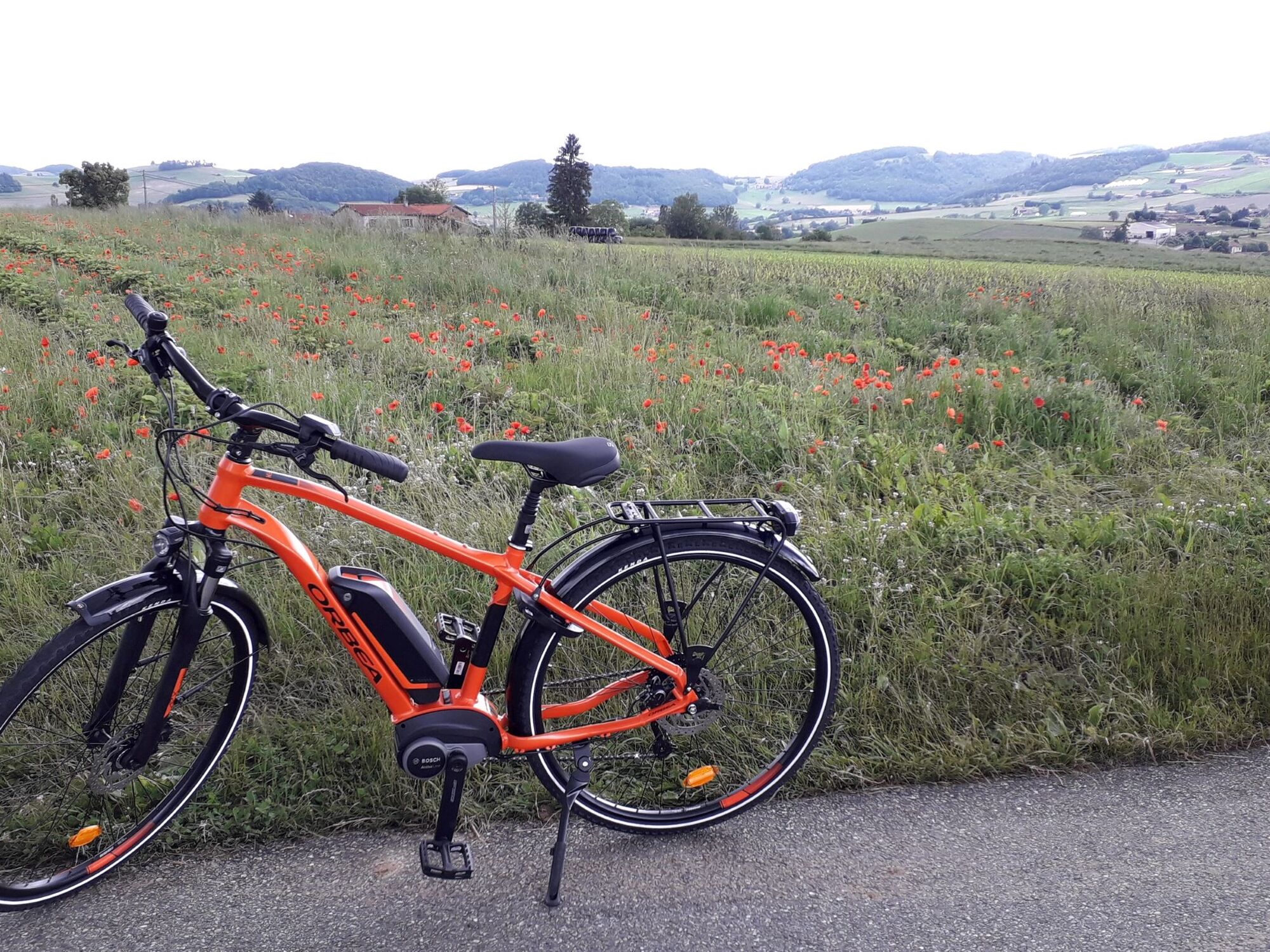
A circuit that connects beautiful viewpoints and small quiet country roads: panorama opposite the Château de Chamousset, valley of the Torranche after Haute-Rivoire...
Thanks to its low level of difficulty, it offers cycling in “ride” mode to take the time to linger in the villages and tourist sites.
Although having characteristics similar to loop 2.3, this route presents an atypical profile: from the start of Sainte-Foy-l’Argentière a 5% climb over 5 km is proposed. We recover over 18 km of flat and gentle descents. The 7% of the 3 km climb to Grézieu requires certain effort management. The last kilometres of descents are welcome.
The most seasoned cyclists can combine this loop with the 2.3 and thus have a route of 70 km for 1,000 m of elevation.
Tourism side
A circuit that connects beautiful viewpoints and small quiet country roads: panorama opposite the Château de Chamousset, valley of the Torranche after Haute-Rivoire...
Thanks to its low level of difficulty, it offers cycling in “ride” mode to take the time to linger in the villages and tourist sites.
Trasa
Église Sainte-Foy
(430 m)
Miesto uctievania
0,3 km
La Salvatière
(605 m)
Susedstvo
4,0 km
Saint-Clément-les-Places
(627 m)
Dedina
9,3 km
Église Sainte-Marguerite
(601 m)
Miesto uctievania
15,0 km
Église Saint-Pierre
(560 m)
Miesto uctievania
21,2 km
Côte Roman
(502 m)
Zúčtovanie
24,0 km
Les Esparcieux
(581 m)
Zúčtovanie
30,5 km
Trasa
Monts du Lyonnais - The Argentière circuit - Loop 2.4
svetlo
Cyklistika
35,33
km
Sainte-Foy-l'Argentière
(430 m)
Dedina
0,2 km
Église Sainte-Foy
(430 m)
Miesto uctievania
0,3 km
Il était une Foy
(426 m)
Reštaurácia
0,6 km
Camard
(431 m)
Zúčtovanie
0,7 km
Les Vignes
(494 m)
Susedstvo
0,9 km
Bridemont
(491 m)
Zúčtovanie
1,2 km
Chenevatière
(464 m)
Zúčtovanie
1,5 km
La Salvatière
(605 m)
Susedstvo
4,0 km
Restaurant Jean François Bar
(634 m)
Reštaurácia
5,0 km
Saint-Laurent-de-Chamousset
(635 m)
Dedina
5,0 km
Les Roches
(648 m)
Susedstvo
5,3 km
Croix Sopha
(655 m)
Susedstvo
5,4 km
Bellevé
(656 m)
Zúčtovanie
6,0 km
Laprat
(644 m)
Zúčtovanie
8,4 km
Saint-Clément-les-Places
(627 m)
Dedina
9,3 km
Auberge de St Clément
(629 m)
Reštaurácia
9,5 km
Pinquoi
(645 m)
Zúčtovanie
10,6 km
Hauteville
(631 m)
Zúčtovanie
12,2 km
La Bourrie
(599 m)
Zúčtovanie
14,5 km
La Taverne de l'Ermite
(600 m)
Reštaurácia
15,0 km
Haute-Rivoire
(599 m)
Dedina
15,0 km
Église Sainte-Marguerite
(601 m)
Miesto uctievania
15,0 km
La Brosse
(612 m)
Susedstvo
15,6 km
Le Bancel
(580 m)
Zúčtovanie
16,7 km
Le Bravarel
(594 m)
Zúčtovanie
17,2 km
Le Perret
(599 m)
Zúčtovanie
18,3 km
Le Cheval Mort
(584 m)
Zúčtovanie
19,1 km
Le Haut
(607 m)
Susedstvo
20,5 km
La Garde
(597 m)
Susedstvo
20,6 km
Église Saint-Pierre
(560 m)
Miesto uctievania
21,2 km
Meys
(565 m)
Dedina
21,2 km
La Buissonne
(533 m)
Zúčtovanie
21,8 km
La Gagère
(491 m)
Zúčtovanie
22,3 km
Côte Roman
(502 m)
Zúčtovanie
24,0 km
Restaurant O'BAR B'ELLES
(666 m)
Reštaurácia
26,1 km
Grézieu-le-Marché
(665 m)
Dedina
26,3 km
Les Eymains
(653 m)
Zúčtovanie
26,7 km
Les Brosses
(619 m)
Zúčtovanie
28,0 km
Le Reynard
(574 m)
Zúčtovanie
30,0 km
Les Esparcieux
(581 m)
Zúčtovanie
30,5 km
La Feuillée
(468 m)
Zúčtovanie
33,0 km
Les Ormes
(446 m)
Zúčtovanie
33,8 km
Cité de la Tuilerie
(438 m)
Susedstvo
34,3 km
Lotissement Les Souches
(443 m)
Susedstvo
34,5 km
Sainte-Foy-l'Argentière
(430 m)
Dedina
34,7 km
Autor
Poskytuje Monts du Lyonnais
Prehliadku Monts du Lyonnais - The Argentière circuit - Loop 2.4 zabezpečuje outdooractive.com.


Ďalšie informácie a tipy
Ďalšie informácie
APIDAE Tourism data updated on 06/02/2023 by "Rhône Tourisme".
An error on this file? Write to the owner by mentioning these references:
File name: Monts du Lyonnais - The Argentière circuit - Loop 2.4 | File ID: 5012061 | URL (link) of this Outdooractive page.
An error on this file? Write to the owner by mentioning these references:
File name: Monts du Lyonnais - The Argentière circuit - Loop 2.4 | File ID: 5012061 | URL (link) of this Outdooractive page.
Zatiaľ žiadne recenzie
Obľúbené výlety v okolí
-
5,0
The Gimond dam - Monts du Lyonnais - Grézieu-le-Marché
svetloTuristika 11,2 km -
Coise Riverbank Trail
svetloTuristika 14,6 km -
Trail of the landscapes of the Monts du Lyonnais
strednáTuristika 12,0 km -
The Signal - Monts du Lyonnais - Saint-André-la Côte
svetloTuristika 14,5 km -
The Tacot, ephemeral journey
svetloTematická trasa 1,91 km -
Regina, Duroni, Sweetheart - Monts du Lyonnais - Bessenay
svetloTuristika 13,6 km -
Sentier découverte de l'aqueduc romain de la Brévenne
svetloTuristika 5,42 km -
Chemin de Saint Jacques de Compostelle - Etape 3 - Saint-Martin-en-Haut / Saint Galmier
svetloTuristika 26,5 km -
Malá túra na crêt d'Arjoux - Monts du Lyonnais - Saint-Julien-sur-Bibost
svetloTuristika 4,93 km -
Courz'y Trail Park - Circuit No. 1: La Découverte
svetloTrailrunning 7,27 km
Turistika a stopovanie

Viac ako 550.000 návrhov výletov, podrobné mapy a intuitívny plánovač trás robia z aplikácie povinnú výbavu pre všetkých nadšencov prírody.

Nenechajte si ujsť ponuky a inšpiráciu na ďalšiu dovolenku
Prihlásiť sa k odberu noviniek
Chyba
Vyskytla sa chyba. Prosím, skúste to znova.
Ďakujeme za vašu registráciu
Vaša e-mailová adresa bol pridaný do poštového zoznamu.
Zájazdy po celej Európe
Rakúsko
Švajčiarsko
Nemecko
Taliansko
Slovinsko
Francúzsko
Holandsko
Belgicko
Poľsko
Lichtenštajnsko
Česko
Slovensko
španielsko
Hrvaška
Bosna a Hercegovina
Luxembursko
Andorra
Portugalsko
Island
Spojené kráľovstvo
Írsko
Grécko
Albánsko
Severné Macedónsko
Malta
Nórsko
Čierna Hora
Moldavsko
Kosovo
Maďarsko
San Maríno
Rumunsko
Estónsko
Lotyšsko
Bielorusko
Cyprus
Litva
Srbsko
Bulharsko
Monako
Dánsko
Švédsko
Fínsko





