


Immersive trail in the Orgère valley
You'll love the start, through quaint little villages on the left and right banks fo the Arc river. The village of Amodon marks the end of your warm-up. Walking through silver firs and mountain pines,...
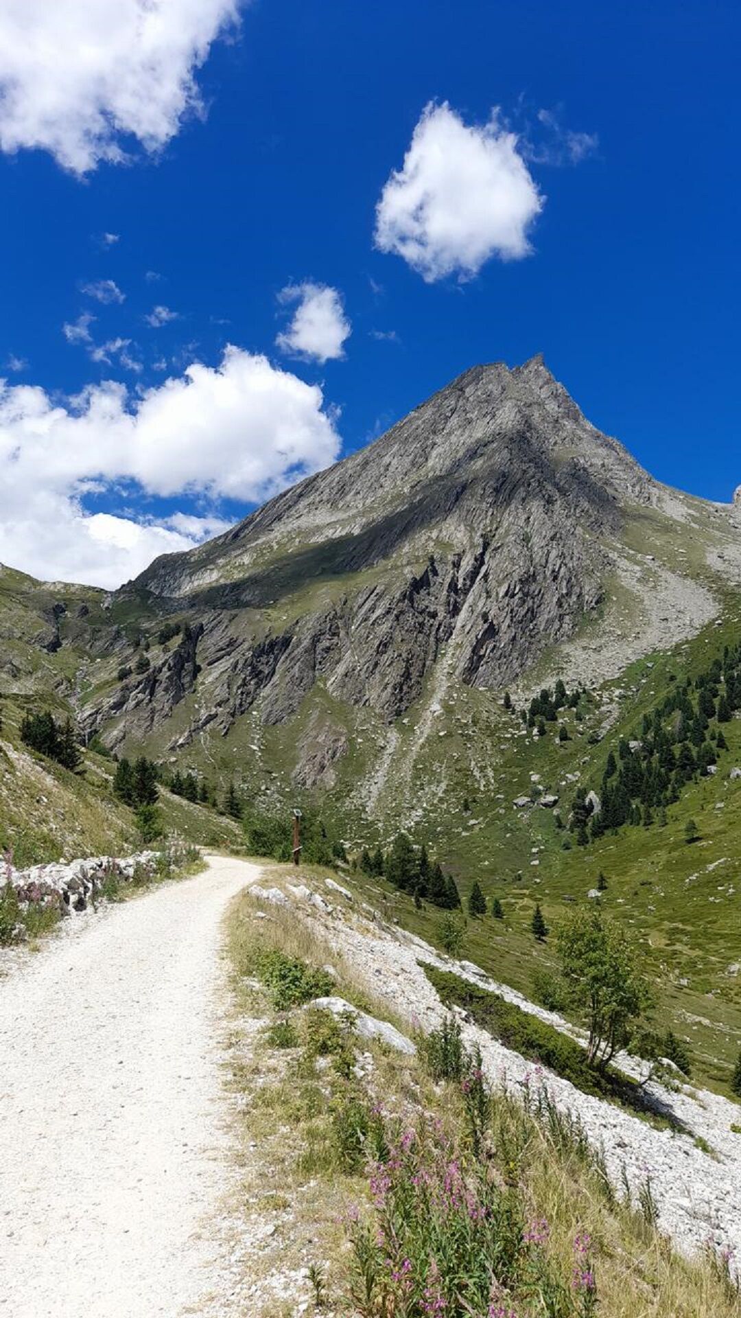
You'll love the start, through quaint little villages on the left and right banks fo the Arc river. The village of Amodon marks the end of your warm-up. Walking through silver firs and mountain pines, you'll reach a secluded clearing, the ideal place to take a break and cool off. Don't miss out on visiting the former Aiguille Doran refuge, a top attraction in Vanoise National Park. Can you hear the distant whistles of the marmots echoing around the cliffs of Aiguille Doran and Râteau d'Aussois? Rising to over 3,000 m of altitude, these two summits seem to watch over you. Stop off for a meal at Orgère refuge to to get even more into the mountain spirit. Who knows, maybe it'll also unleash your desire to spend a night in the refuge or bivouacking? In the height of summer, you'll be thankful for the shade that accompanies you on your way down from Pont des Chèvres. When you return, walk through the alleys of Villarodin and Le Bourget to hunt out some heritage secrets.

To guide you in the field, consult the "step-by-step" directional diagram provided in pdf.
2/ Using GPX tracks As hazards may occur at any time on the routes, the GPX tracks provided are not contractual. They are given for information only. Riders use them at their own risk, depending on their level of technological proficiency and their understanding of the terrain.
Obľúbené výlety v okolí
-
5,0
BARDONECCHIA Colle Sommeiller
strednáMountainbike 25,4 km -
4,5
BARDONECCHIA Walter Bonatti Path - Grange della Rho
strednáTuristika 6,06 km -
5,0
BARDONECCHIA Decauville
strednáTuristika 7,29 km -
4,0
BARDONECCHIA Sentiero dei Cosetti by Luciano Ferraris
svetloTuristika 3,24 km -
BARDONECCHIA Rochemolles Dam - Scarfiotti Refuge
strednáTuristika 7,77 km -
BARDONECCHIA Frejusia Basins - Decauville - Rochemolles Dam
svetloMountainbike 7,54 km -
5,0
BARDONECCHIA Caserma L - Pian dei Morti
ťažkéTuristika 7,04 km -
5,0
BARDONECCHIA Decauville
svetloSnežnice 4,11 km -
5,0
Goldtoni - Alpenbogen A070 Refuge du Mont Thabor-Vallee Etroite
strednádiaľková pešia trasa 21,5 km -
Refuge du Fond d'Aussois - a wild valley in the Vanoise - 2-day hike
svetloTuristika 9,22 km
Turistika a stopovanie


Nenechajte si ujsť ponuky a inšpiráciu na ďalšiu dovolenku
Vaša e-mailová adresa bol pridaný do poštového zoznamu.