The Roman aqueduct in Brévenne discovery trail
svetlo
Získajte túto prehliadku v mobilnom telefóne
The Roman aqueduct in Brévenne discovery trail
svetlo
Turistika
2,47
km
Naskenujte kód QR a spustite navigáciu v aplikácii bergfex


Turistika a stopovanie





The Roman aqueduct in Brévenne discovery trail
svetlo
Vzdialenosť
2,47
km
Trvanie
01:30
h
Ascent
98
hm
Hladina mora
519 -
616
m
Stiahnutie skladby
The Roman aqueduct in Brévenne discovery trail
svetlo
Turistika
2,47
km
The Roman Aqueduct of the Brévenne was fed above Sainte-Foy-l'Argentière, in Aveize. Its channel, rectangular in section, vaulted in a semicircle, has a gentle and regular slope. Apart from some sudden...
Opis
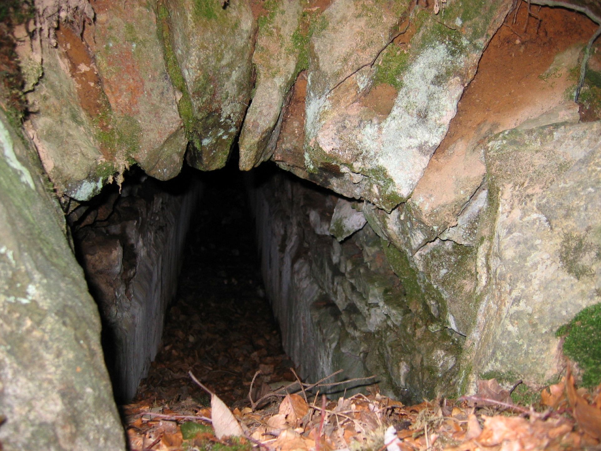
The Roman Aqueduct of the Brévenne was fed above Sainte-Foy-l'Argentière, in Aveize. Its channel, rectangular in section, vaulted in a semicircle, has a gentle and regular slope. Apart from some sudden drops in altitude, the water flowed smoothly. Along its 70 km length, it has been identified in over 160 sites.
To better understand the construction principle of this aqueduct, visit in Montromant the small exhibition building at the start of the route, and observe the identical reconstruction of a section made with expert advice from the association "l'Araire."
To better understand the construction principle of this aqueduct, visit in Montromant the small exhibition building at the start of the route, and observe the identical reconstruction of a section made with expert advice from the association "l'Araire."
Trasa
Trasa
The Roman aqueduct in Brévenne discovery trail
svetlo
Turistika
2,47
km
Autor
Poskytuje Monts du Lyonnais
Prehliadku The Roman aqueduct in Brévenne discovery trail zabezpečuje outdooractive.com.


Informácie o trase
Trasa
At the starting point, follow the small signs with the aqueduct drawing.
Zariadenie
Plan for good walking shoes and something to quench your thirst.
Bezpečnostné pokyny
Please stay on the paths.
Informácie o príchode
Parkovanie
Free parking in the village center, Rue du Verger towards the Town Hall.
Ďalšie informácie a tipy
Ďalšie informácie
Données APIDAE Tourisme updated on 10/24/2022 by "OTI des Monts du Lyonnais."
An error on this sheet? Write to the owner referencing these details:
Sheet name: Discovery Trail of the Roman Aqueduct of the Brévenne | Sheet ID: 152370 | URL of this Outdooractive page.
An error on this sheet? Write to the owner referencing these details:
Sheet name: Discovery Trail of the Roman Aqueduct of the Brévenne | Sheet ID: 152370 | URL of this Outdooractive page.
Tipy
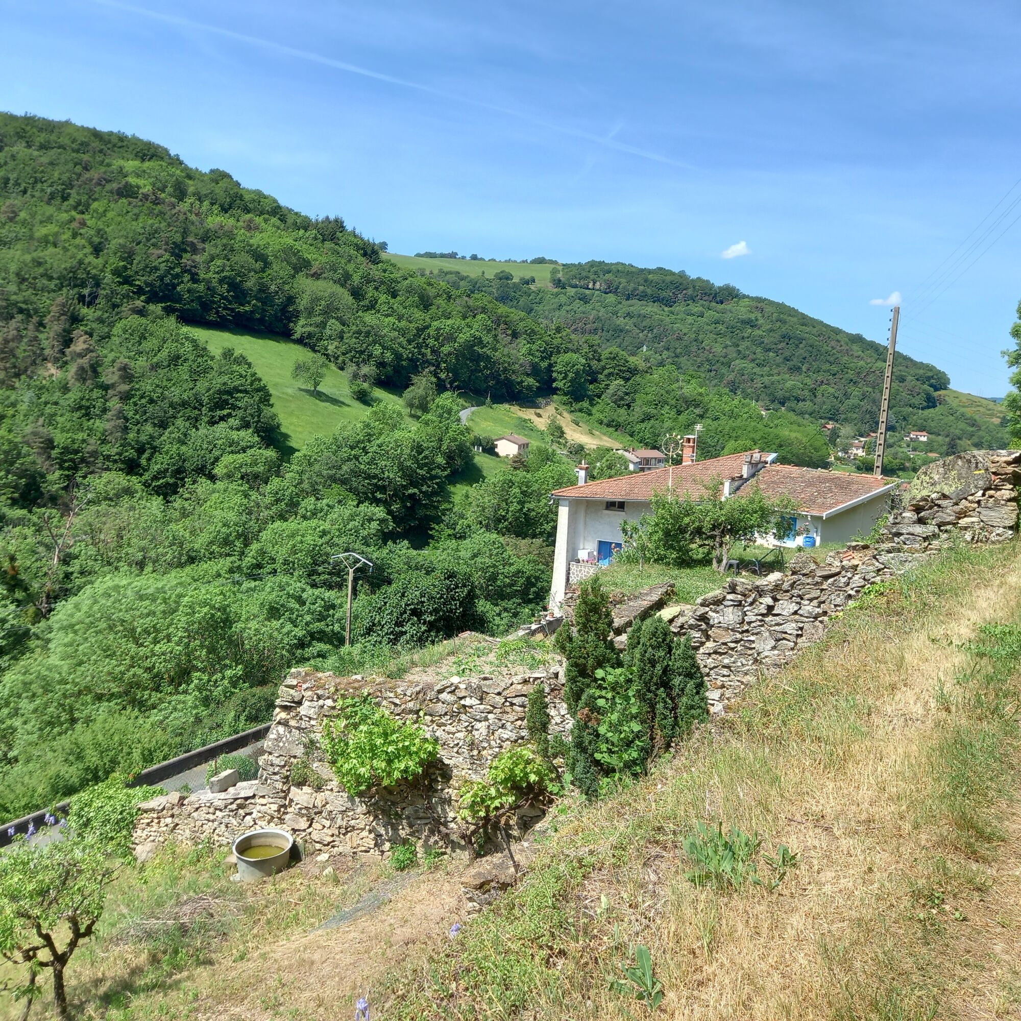
Despite a good elevation gain at the start of the route, the passages under the woods are very pleasant, especially in summer.
Zatiaľ žiadne recenzie
Získajte prehľad
Vždy naživo na mieste s viac ako 9 500 webovými kamerami. bergfex Ako používateľ Pro si teraz môžete pozrieť príslušné webové kamery pre mnohé zájazdy v aplikácii zájazdy z. Môžete si tak priamo prezerať aktuálne podmienky.
Obľúbené výlety v okolí
-
5,0
The Gimond dam - Monts du Lyonnais - Grézieu-le-Marché
svetloTuristika 11,2 km -
Coise Riverbank Trail
svetloTuristika 14,6 km -
Trail of the landscapes of the Monts du Lyonnais
strednáTuristika 12,0 km -
The Signal - Monts du Lyonnais - Saint-André-la Côte
svetloTuristika 14,5 km -
The Tacot, ephemeral journey
svetloTematická trasa 1,91 km -
Regina, Duroni, Sweetheart - Monts du Lyonnais - Bessenay
svetloTuristika 13,6 km -
Health-sport hike: the Croix Forest bridge
svetloTuristika 9,78 km -
Sentier découverte de l'aqueduc romain de la Brévenne
svetloTuristika 5,42 km -
Let's walk in the woods - Monts du Lyonnais - Pollionnay
svetloTuristika 12,6 km -
Chemin de Saint Jacques de Compostelle - Etape 3 - Saint-Martin-en-Haut / Saint Galmier
svetloTuristika 26,5 km
Turistika a stopovanie

Viac ako 550.000 návrhov výletov, podrobné mapy a intuitívny plánovač trás robia z aplikácie povinnú výbavu pre všetkých nadšencov prírody.

Nenechajte si ujsť ponuky a inšpiráciu na ďalšiu dovolenku
Prihlásiť sa k odberu noviniek
Chyba
Vyskytla sa chyba. Prosím, skúste to znova.
Ďakujeme za vašu registráciu
Vaša e-mailová adresa bol pridaný do poštového zoznamu.
Zájazdy po celej Európe
Rakúsko
Švajčiarsko
Nemecko
Taliansko
Slovinsko
Francúzsko
Holandsko
Belgicko
Poľsko
Lichtenštajnsko
Česko
Slovensko
španielsko
Hrvaška
Bosna a Hercegovina
Luxembursko
Andorra
Portugalsko
Island
Spojené kráľovstvo
Írsko
Grécko
Albánsko
Severné Macedónsko
Malta
Nórsko
Čierna Hora
Moldavsko
Kosovo
Maďarsko
San Maríno
Rumunsko
Estónsko
Lotyšsko
Bielorusko
Cyprus
Litva
Srbsko
Bulharsko
Monako
Dánsko
Švédsko
Fínsko





