Waldgaststätte Sportheim - Leonberg - Eltinger Kopf - Franziskuskirche mit Gemeindehaus
stredná
Získajte túto prehliadku v mobilnom telefóne
Waldgaststätte Sportheim - Leonberg - Eltinger Kopf - Franziskuskirche mit Gemeindehaus
stredná
Turistika
16,87
km
Naskenujte kód QR a spustite navigáciu v aplikácii bergfex

Turistika a stopovanie


Waldgaststätte Sportheim - Leonberg - Eltinger Kopf - Franziskuskirche mit Gemeindehaus
stredná
Vzdialenosť
16,87
km
Trvanie
04:32
h
Ascent
509
hm
Hladina mora
376 -
519
m
Stiahnutie skladby
Waldgaststätte Sportheim - Leonberg - Eltinger Kopf - Franziskuskirche mit Gemeindehaus
stredná
Turistika
16,87
km
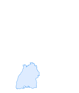
Trasa
Waldgaststätte Sportheim
(455 m)
Reštaurácia
0,0 km
Leonberg
(386 m)
Mesto
5,2 km
Eltinger Kopf
(519 m)
Summit
9,0 km
Franziskuskirche mit Gemeindehaus
(418 m)
Miesto uctievania
14,9 km
Warmbronn
(417 m)
Dedina
14,9 km
Neubruch
(437 m)
Susedstvo
15,9 km
Leonberg
(386 m)
Mesto
16,0 km
Trasa
Waldgaststätte Sportheim - Leonberg - Eltinger Kopf - Franziskuskirche mit Gemeindehaus
stredná
Turistika
16,87
km
Waldgaststätte Sportheim
(455 m)
Reštaurácia
0,0 km
Leonberg
(386 m)
Mesto
5,2 km
Eltinger Kopf
(519 m)
Summit
9,0 km
Franziskuskirche mit Gemeindehaus
(418 m)
Miesto uctievania
14,9 km
Warmbronn
(417 m)
Dedina
14,9 km
Neubruch
(437 m)
Susedstvo
15,9 km
Leonberg
(386 m)
Mesto
16,0 km
Waldgaststätte Sportheim
(455 m)
Reštaurácia
16,8 km
Zatiaľ žiadne recenzie
Obľúbené výlety v okolí
-
4,0
Stuttgarter Rössleweg (im Uhrzeigersinn)
strednáTuristika 58,5 km -
5,0
AugenBlick-Runde Tiefenbronn-Mühlhausen
Turistika 7,35 km -
5,0
Killesberg - Feuerbacher Heide - Bismarckturm - Rote Wand Stuttgart, Deutschland
svetloTuristika 5,83 km -
Sillenbuch: Über Waldspielplatz und Haus des Waldes ins Ramsbachtal
svetloTuristika 8,49 km -
5,0
Stuttgart Ultra sehr Zentral
strednáTuristika 53,0 km -
5,0
Mammutmarsch Stuttgart 2024 30KM neu
ťažkéTuristika 30,0 km -
3,0
Feuerbacher Runde
strednáTuristika 17,8 km -
Neckar valley/Black Forest | German Timber-Frame Road: Circular route Neckar valley/Black Forest
ťažkéDiaľková cyklotrasa 367,8 km -
Sport spirit meets culture and scenic beauty: circular bike route from Althengstett to the Wendelinus Chapel
svetloCyklistika 37,8 km -
Ausblicke im Strohgäu und Stille im Wald
svetloTuristika 10,0 km

Turistika a stopovanie

Viac ako 550.000 návrhov výletov, podrobné mapy a intuitívny plánovač trás robia z aplikácie povinnú výbavu pre všetkých nadšencov prírody.

Nenechajte si ujsť ponuky a inšpiráciu na ďalšiu dovolenku
Prihlásiť sa k odberu noviniek
Chyba
Vyskytla sa chyba. Prosím, skúste to znova.
Ďakujeme za vašu registráciu
Vaša e-mailová adresa bol pridaný do poštového zoznamu.
Zájazdy po celej Európe
Rakúsko
Švajčiarsko
Nemecko
Taliansko
Slovinsko
Francúzsko
Holandsko
Belgicko
Poľsko
Lichtenštajnsko
Česko
Slovensko
španielsko
Hrvaška
Bosna a Hercegovina
Luxembursko
Andorra
Portugalsko
Island
Spojené kráľovstvo
Írsko
Grécko
Albánsko
Severné Macedónsko
Malta
Nórsko
Čierna Hora
Moldavsko
Kosovo
Maďarsko
San Maríno
Rumunsko
Estónsko
Lotyšsko
Bielorusko
Cyprus
Litva
Srbsko
Bulharsko
Monako
Dánsko
Švédsko
Fínsko