


Mountain hike Marienbrückenweg
Fotografie našich používateľov
-
 © Olaf ScheinVytvorené dňa 13.07.2024
 -
 © Daniel SchulzeVytvorené dňa 28.09.2023
 -
 © Daniel SchulzeVytvorené dňa 28.09.2023
 -
 © Ralf TheuneVytvorené dňa 09.05.2026
 -
 © Ralf TheuneVytvorené dňa 09.05.2026
 -
 © ami_noa_mucVytvorené dňa 26.04.2026
 -
 © ami_noa_mucVytvorené dňa 26.04.2026
 -
 © ami_noa_mucVytvorené dňa 26.04.2026
 -
 © FelixVytvorené dňa 27.12.2025
 -
 © Marly WoutersVytvorené dňa 07.11.2025
 -
 © Marly WoutersVytvorené dňa 07.11.2025
 -
 © Marly WoutersVytvorené dňa 07.11.2025
 -

 © Michael HohlfeldVytvorené dňa 29.10.2025
 -
 © Michael HohlfeldVytvorené dňa 29.10.2025
 -
 © Michael HohlfeldVytvorené dňa 29.10.2025
 -
 © Michael HohlfeldVytvorené dňa 29.10.2025
 -
 © Michael HohlfeldVytvorené dňa 29.10.2025
 -
 © Michael HohlfeldVytvorené dňa 29.10.2025
 -
 © JuliaVytvorené dňa 28.09.2025
 -
 © Rainer KieningVytvorené dňa 04.09.2025
 -
 © Kristijan DržajVytvorené dňa 21.04.2025
 -
 © Kristijan DržajVytvorené dňa 21.04.2025
 -
 © Kristijan DržajVytvorené dňa 21.04.2025
 -
 © Kristijan DržajVytvorené dňa 21.04.2025
 -
 © Kristijan DržajVytvorené dňa 21.04.2025
 -

 © Florian GrundVytvorené dňa 01.12.2024
 -
 © Florian GrundVytvorené dňa 01.12.2024
 -

 © Daniel HerzVytvorené dňa 19.09.2024
 -
 © Daniel HerzVytvorené dňa 19.09.2024
 -
 © MattiVytvorené dňa 18.10.2023
 -
 © Edit SzoboszlayVytvorené dňa 09.08.2021
 -

 © PerryBVytvorené dňa 06.07.2021
 -
 © PerryBVytvorené dňa 06.07.2021
 -
 © Olaf ScheinVytvorené dňa 13.07.2024
 -
 © Olaf ScheinVytvorené dňa 13.07.2024
 -
 © Les aventures de GhislainVytvorené dňa 31.12.2023
 -
 © Daniel SchulzeVytvorené dňa 28.09.2023
 -
 © Daniel SchulzeVytvorené dňa 28.09.2023
 -
 © Daniel SchulzeVytvorené dňa 28.09.2023
 -
 © Daniel SchulzeVytvorené dňa 28.09.2023
 -
 © Daniel SchulzeVytvorené dňa 28.09.2023
 -
 © Daniel SchulzeVytvorené dňa 28.09.2023
 -
 © Daniel SchulzeVytvorené dňa 28.09.2023
 -
 © Daniel SchulzeVytvorené dňa 28.09.2023
 -

 © SussyVytvorené dňa 28.09.2023
 -
 © SussyVytvorené dňa 28.09.2023
 -
 © SussyVytvorené dňa 28.09.2023
 -
 © SussyVytvorené dňa 28.09.2023


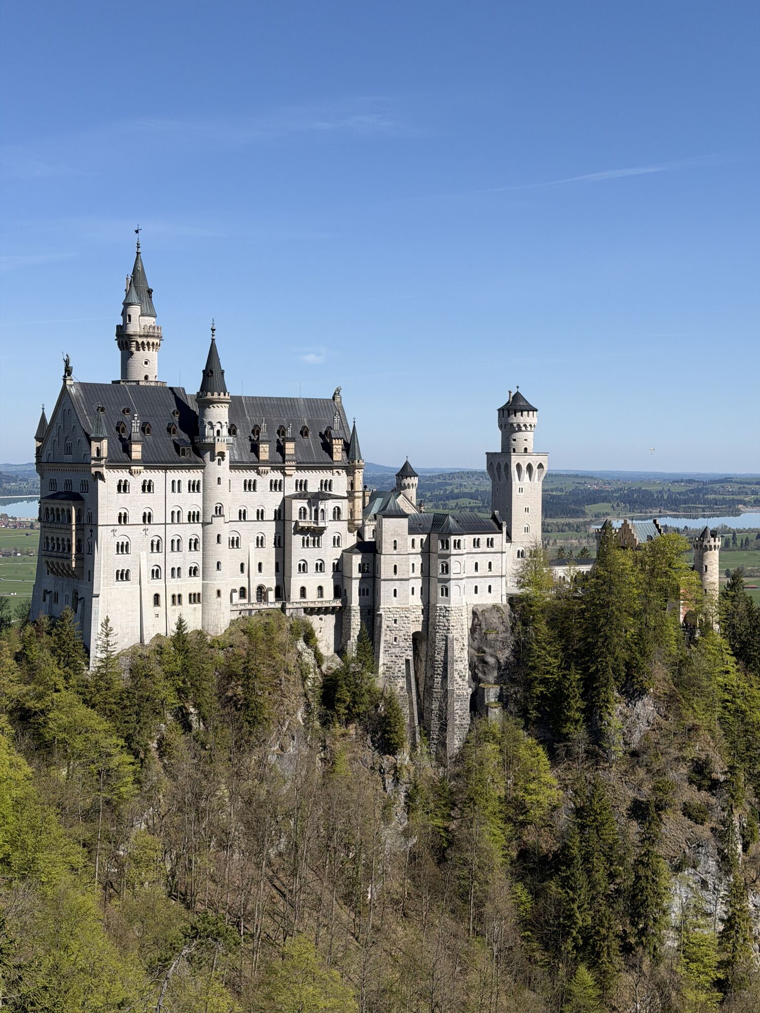

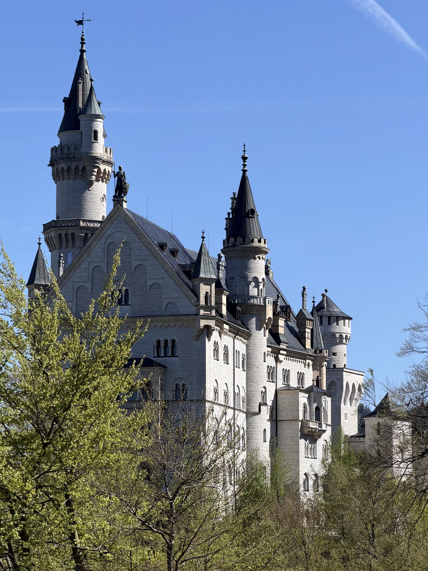
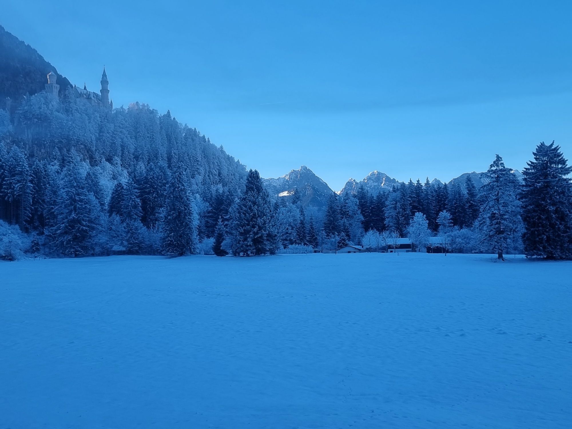
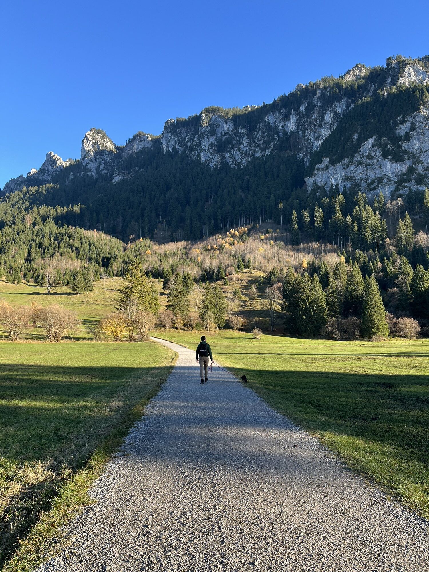
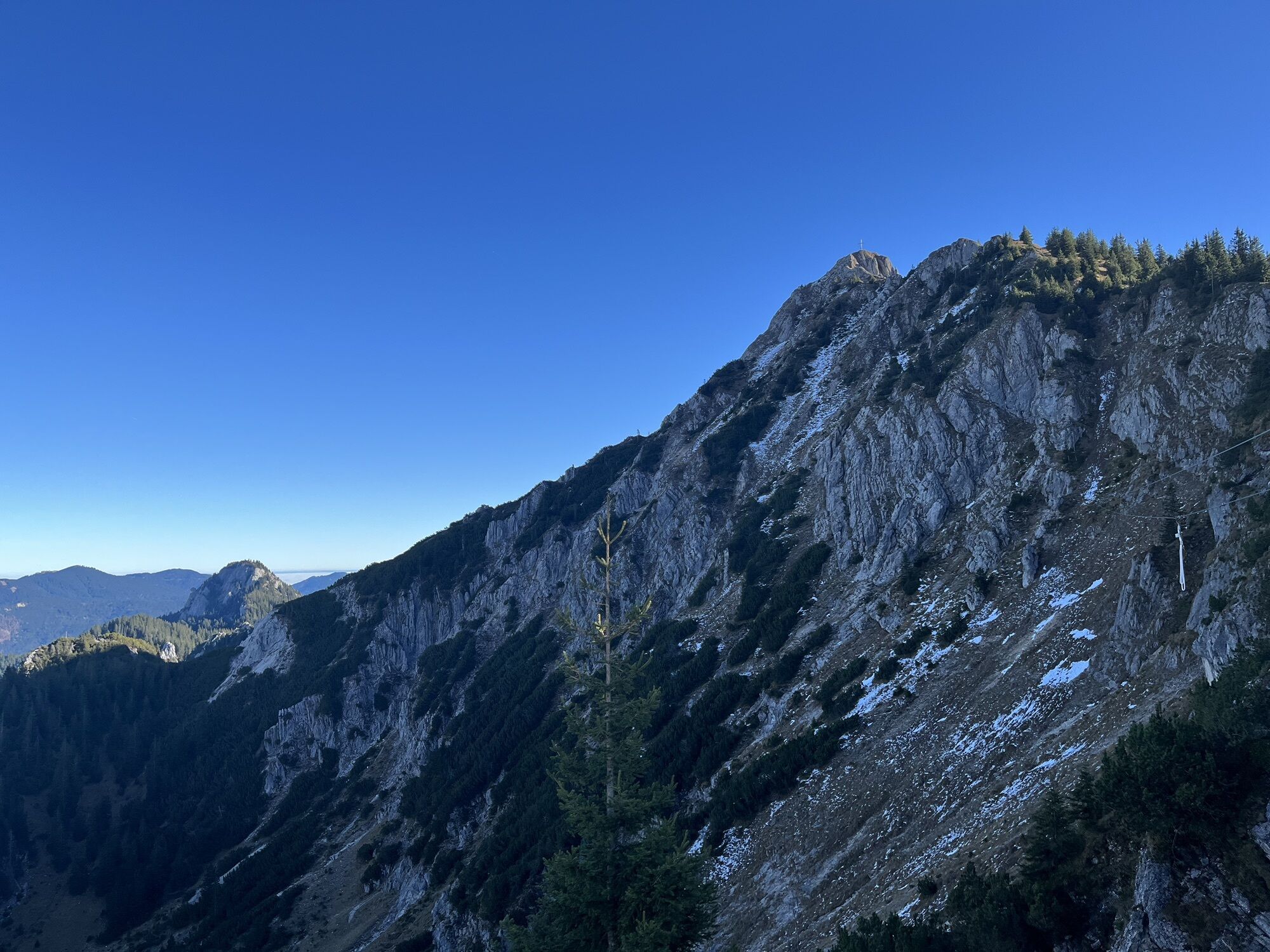
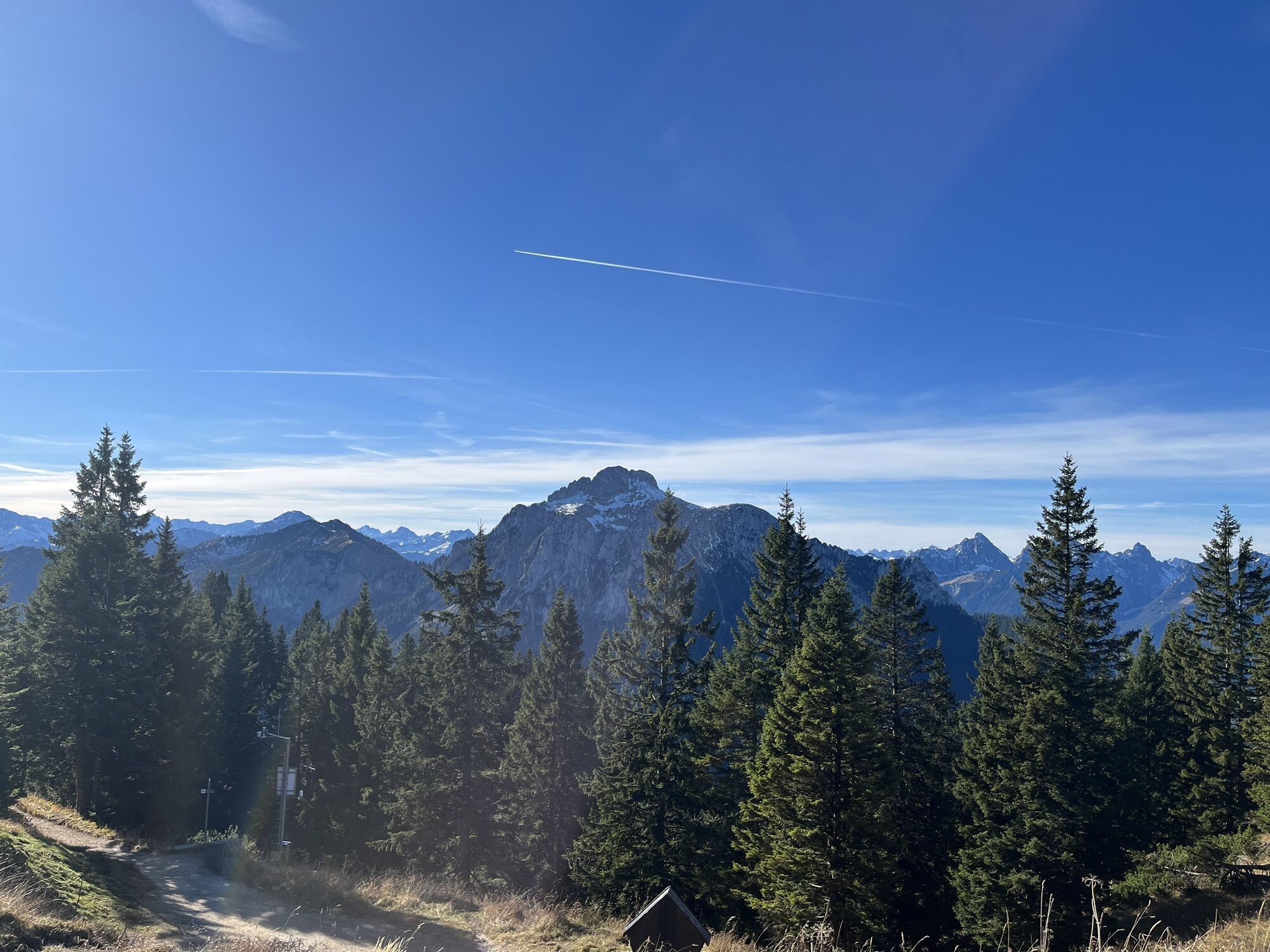


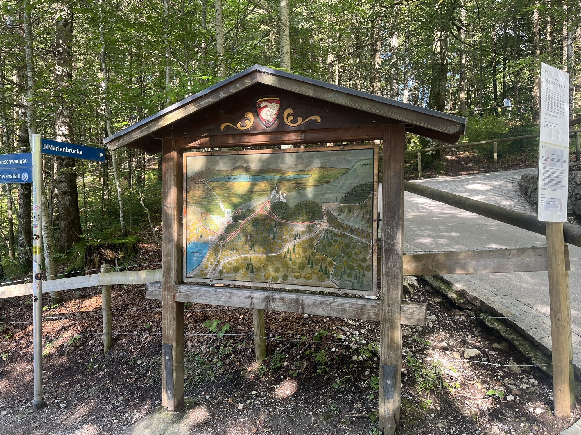

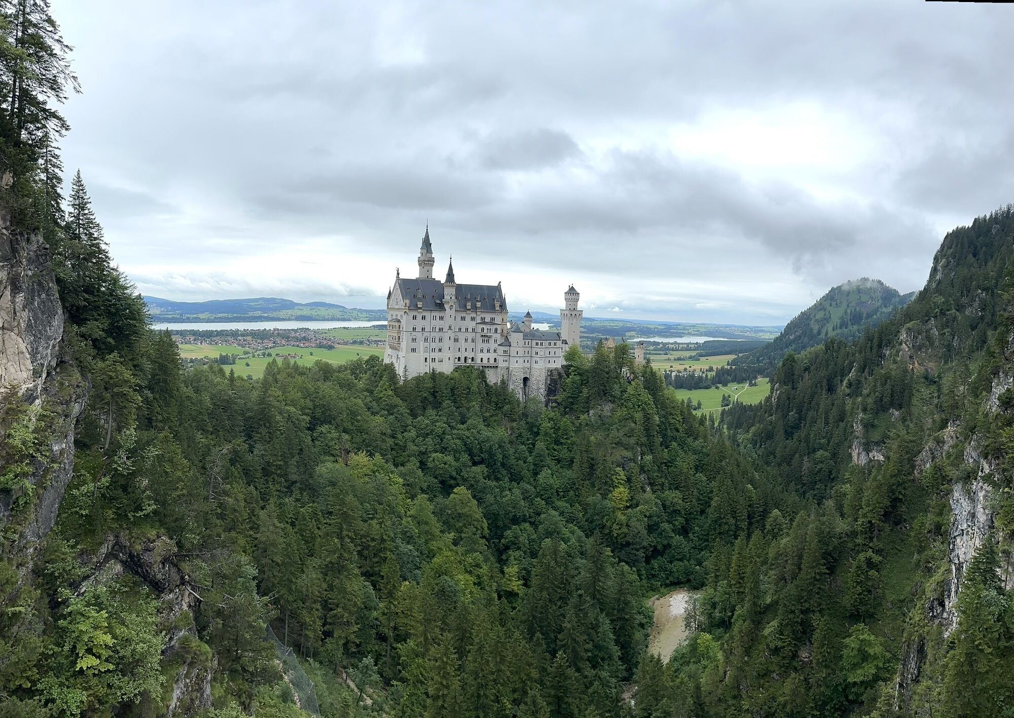


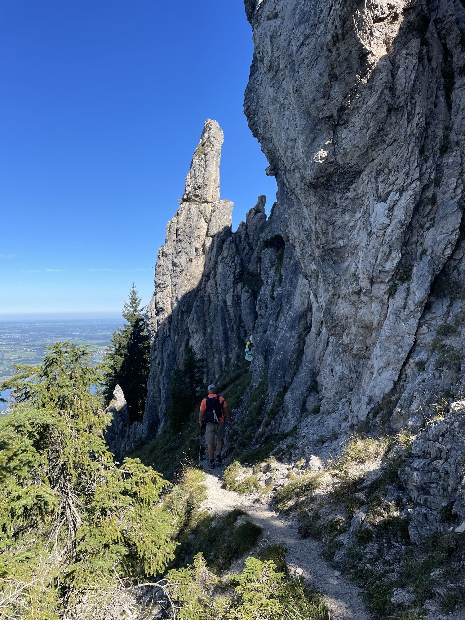

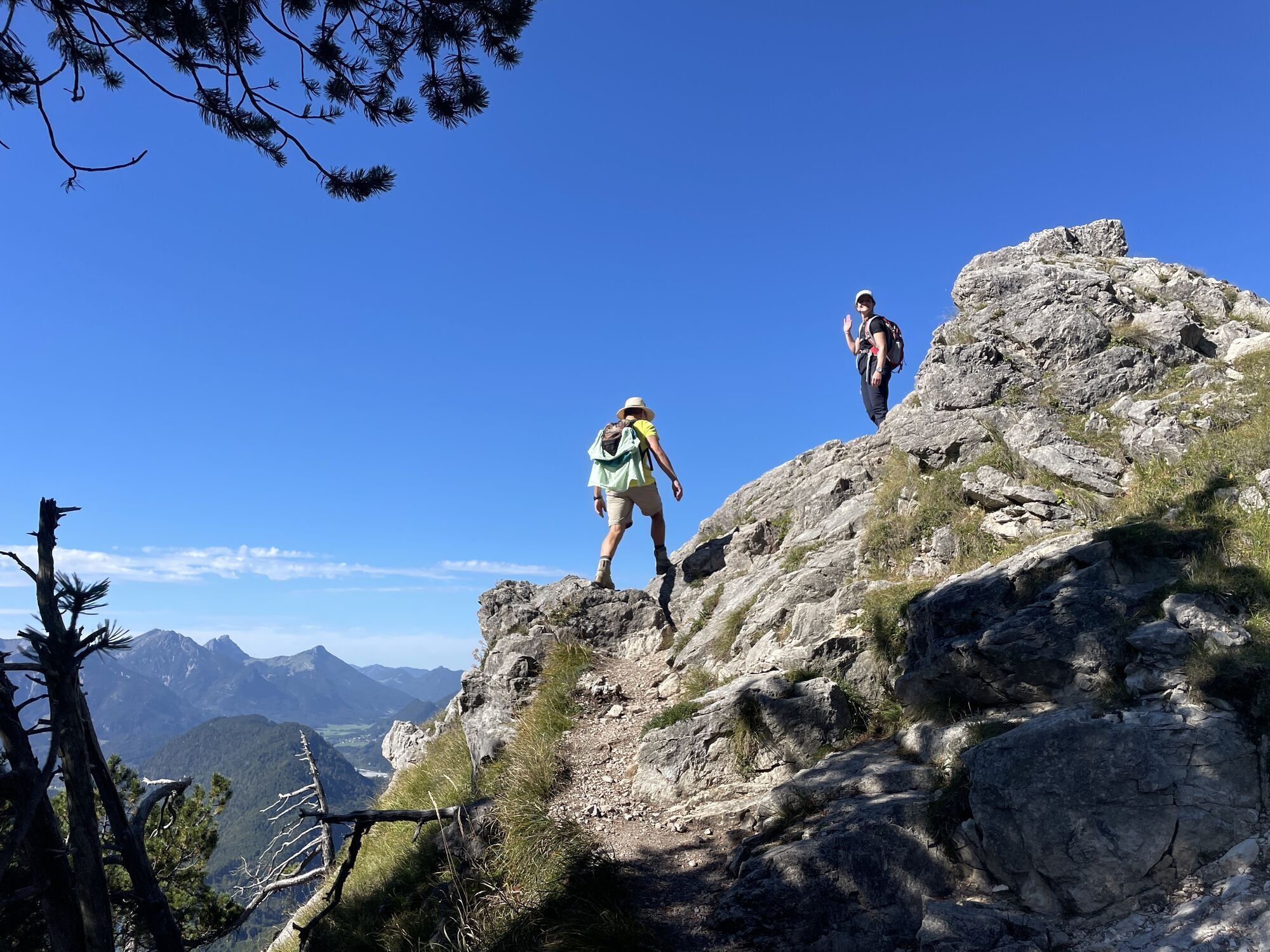
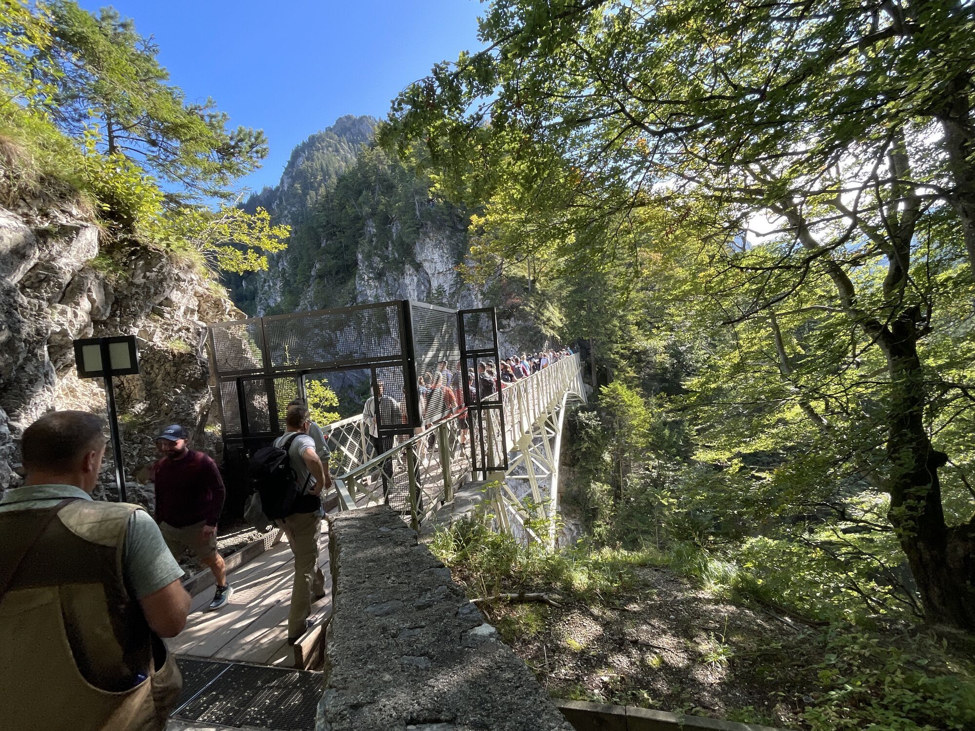


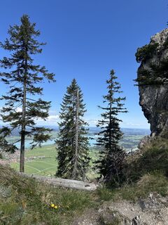
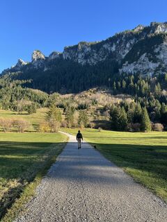
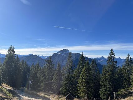
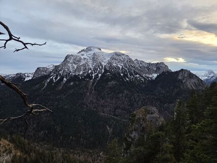
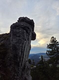
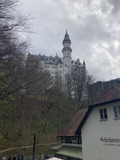
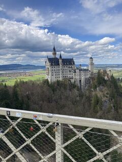
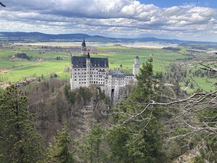
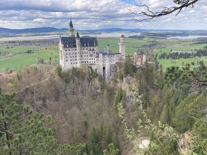
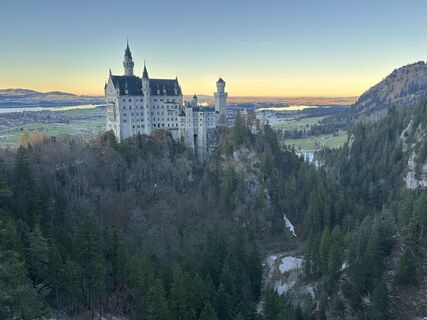
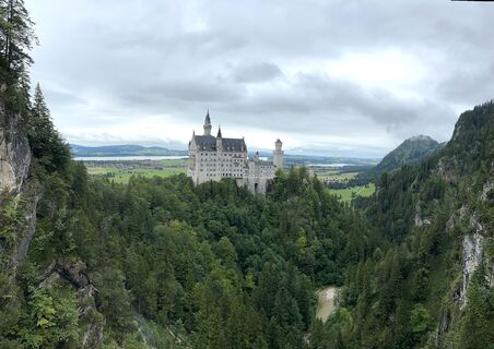
Alpine premium route from the Tegelberg valley station to the panoramic viewpoint Marienbrücke and along the ridge up to Tegelberg. Afterwards, take the Tegelbergbahn back down to the starting point. A...
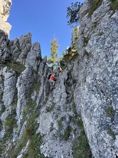
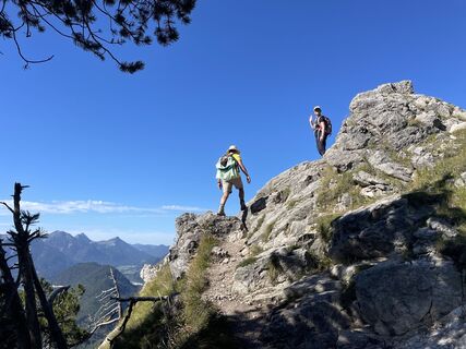
Alpine premium route from the Tegelberg valley station to the panoramic viewpoint Marienbrücke and along the ridge up to Tegelberg. Afterwards, take the Tegelbergbahn back down to the starting point. A classic with breathtaking views that can be shortened by taking the cable car.

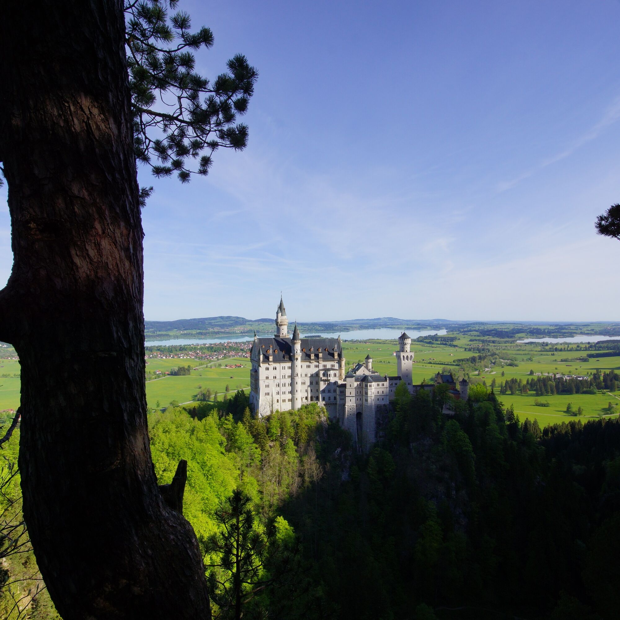
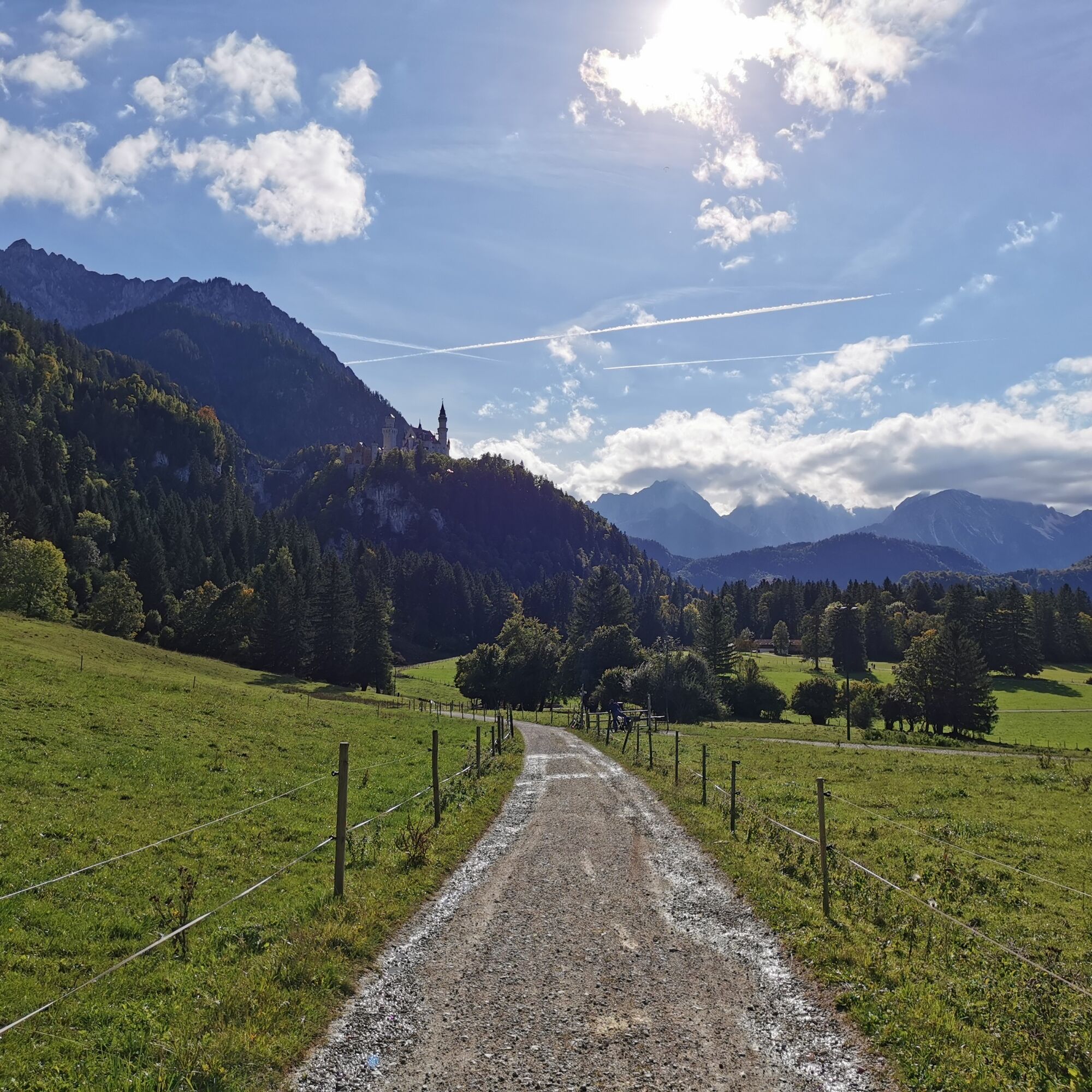
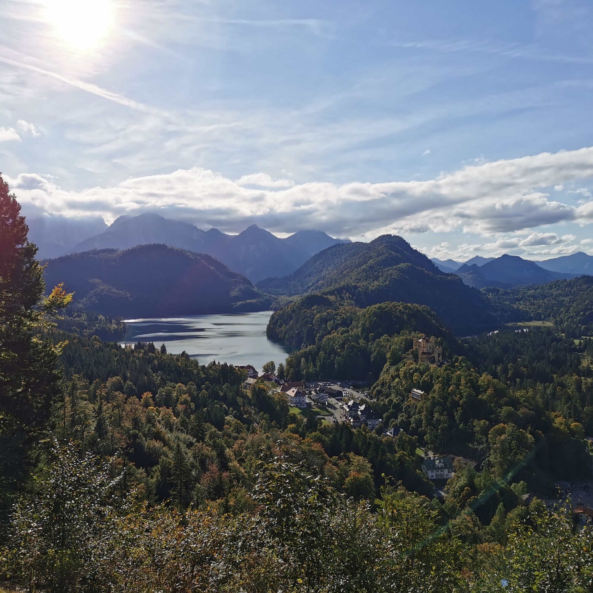
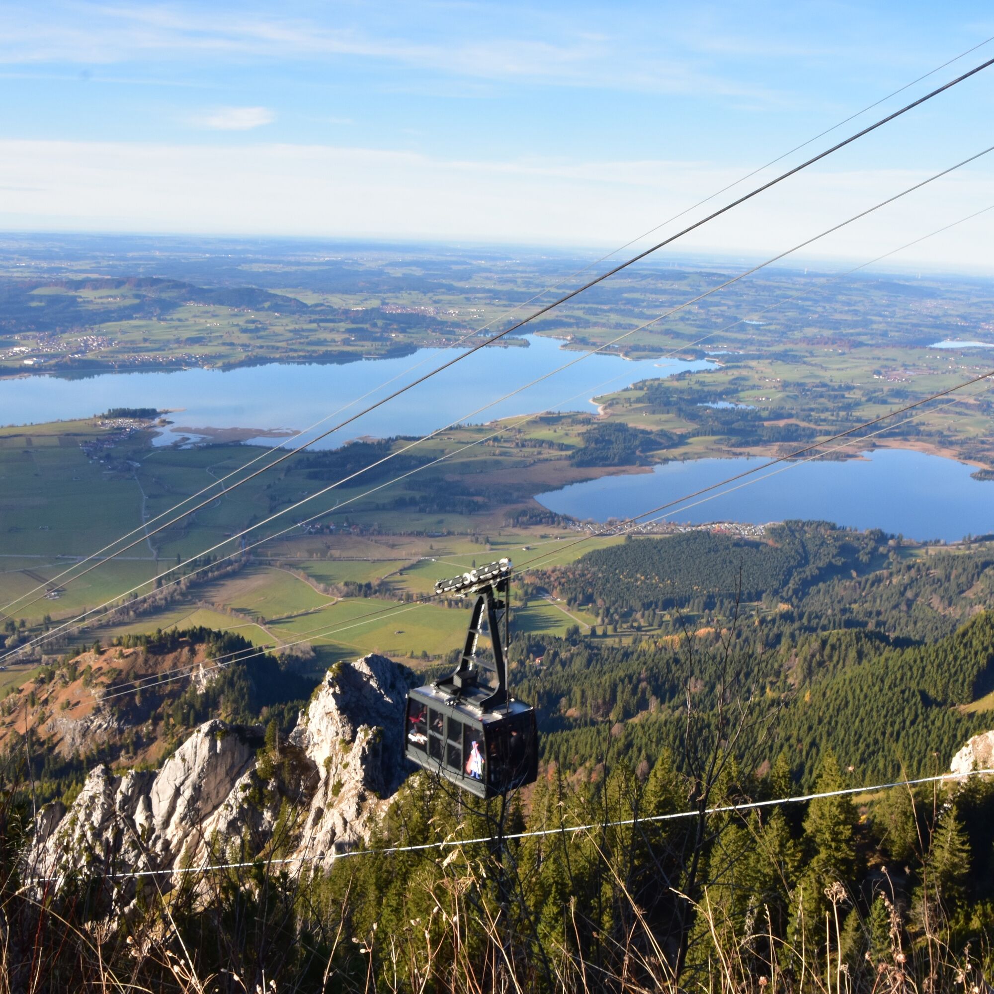
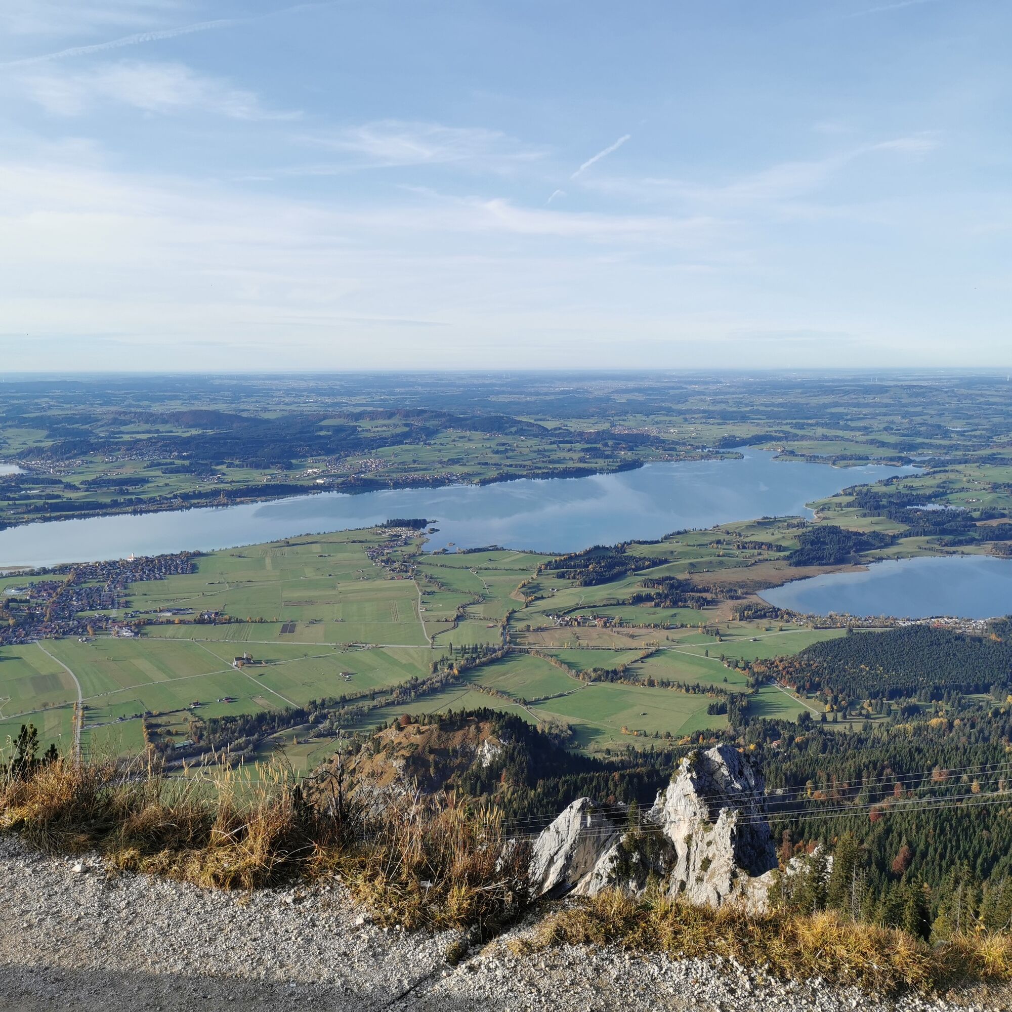
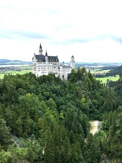
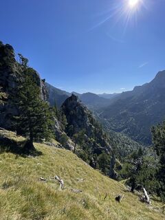
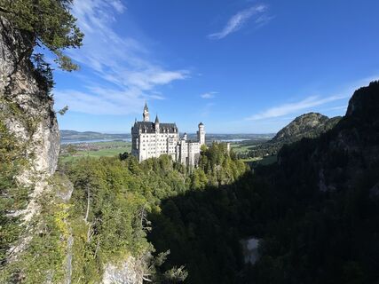
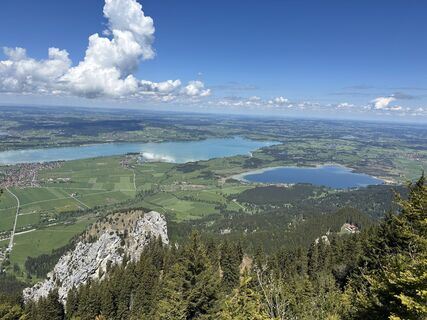
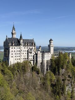
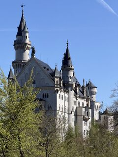
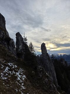
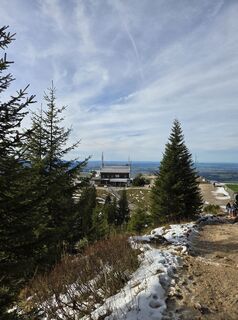
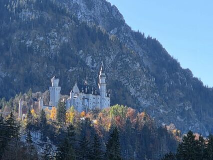
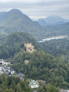
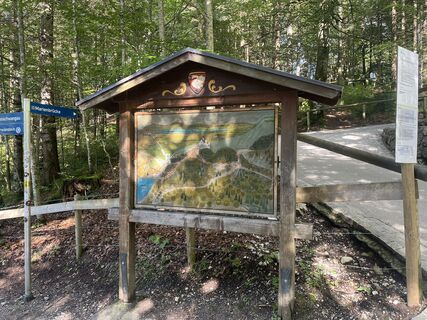
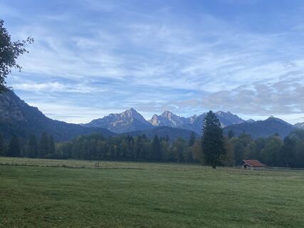
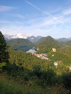
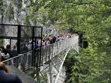
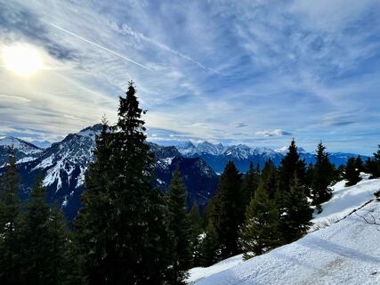
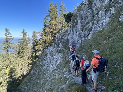
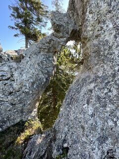
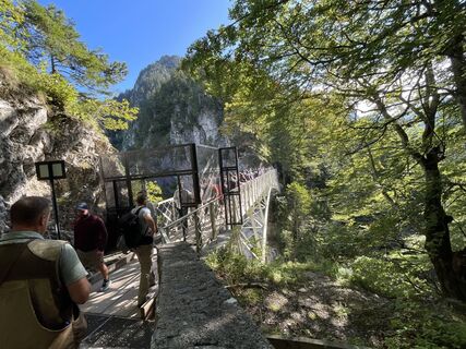
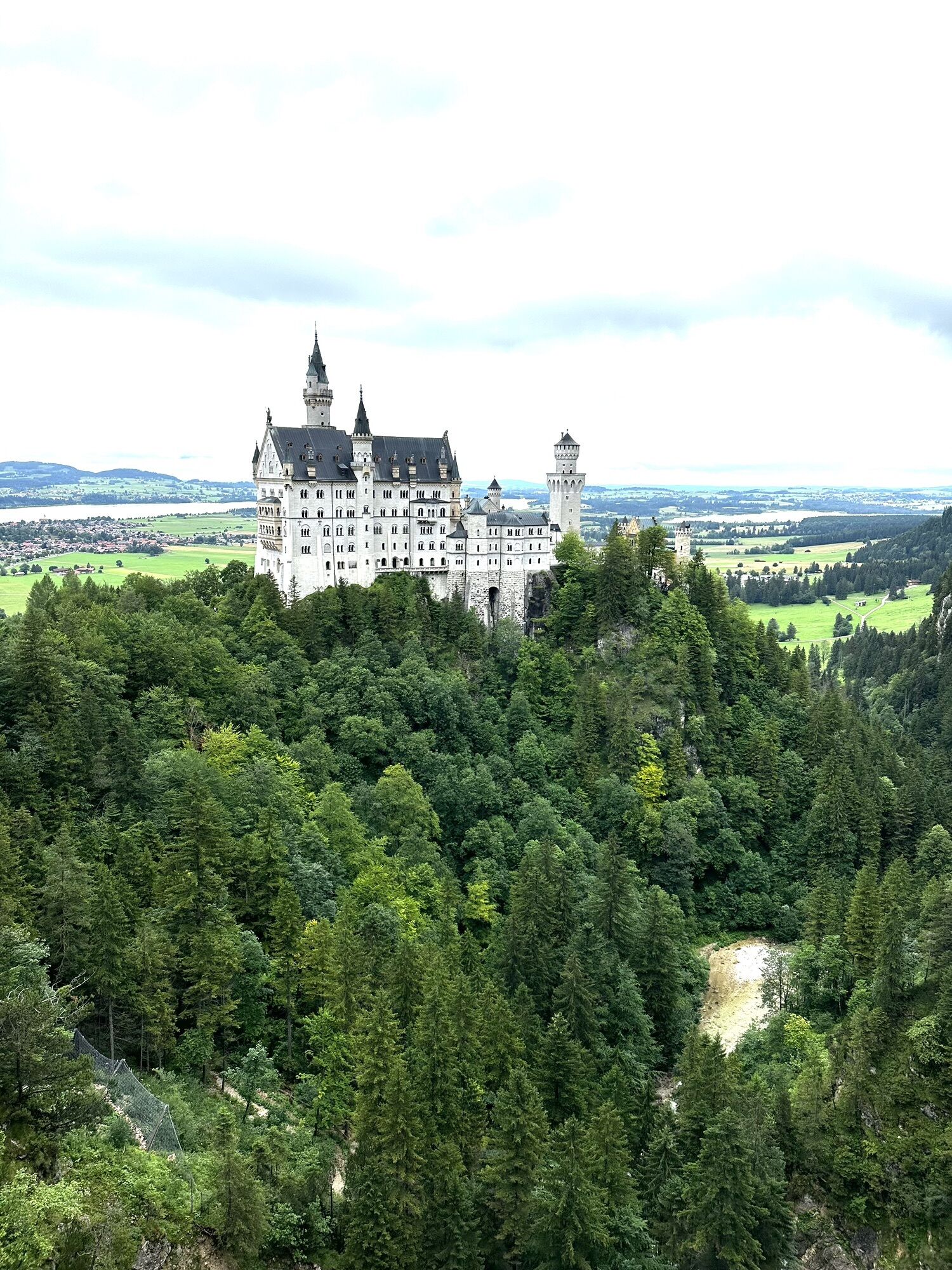
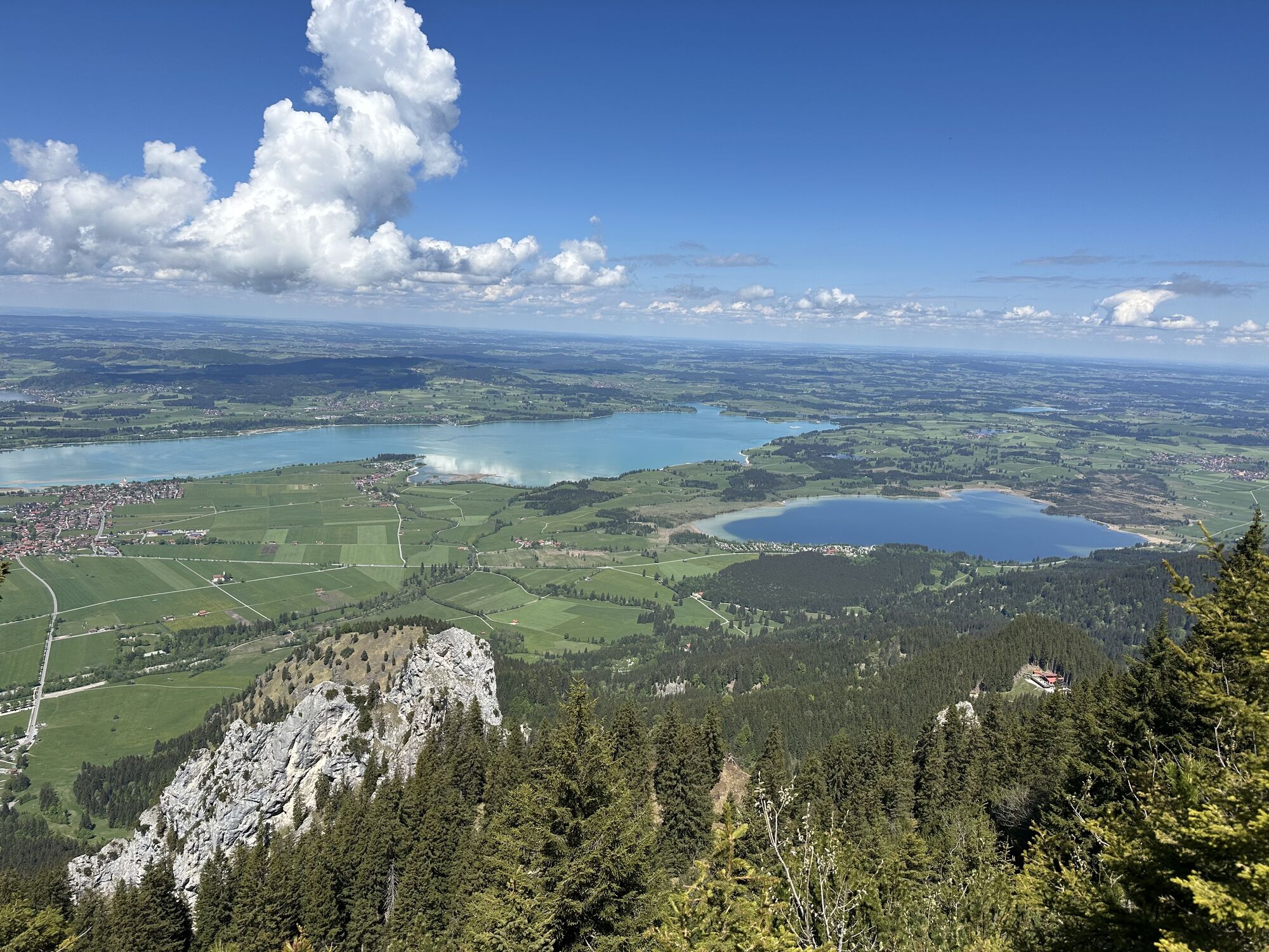
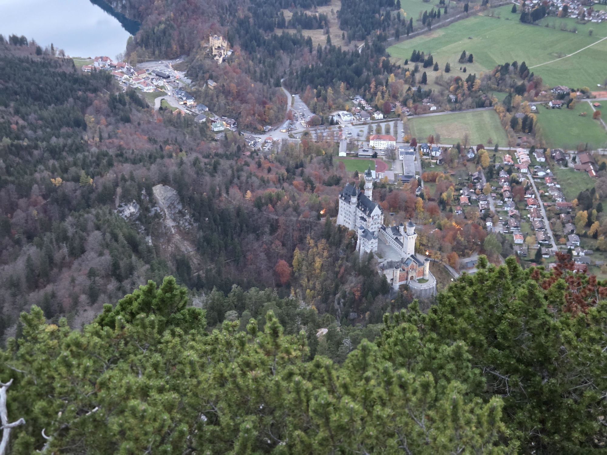
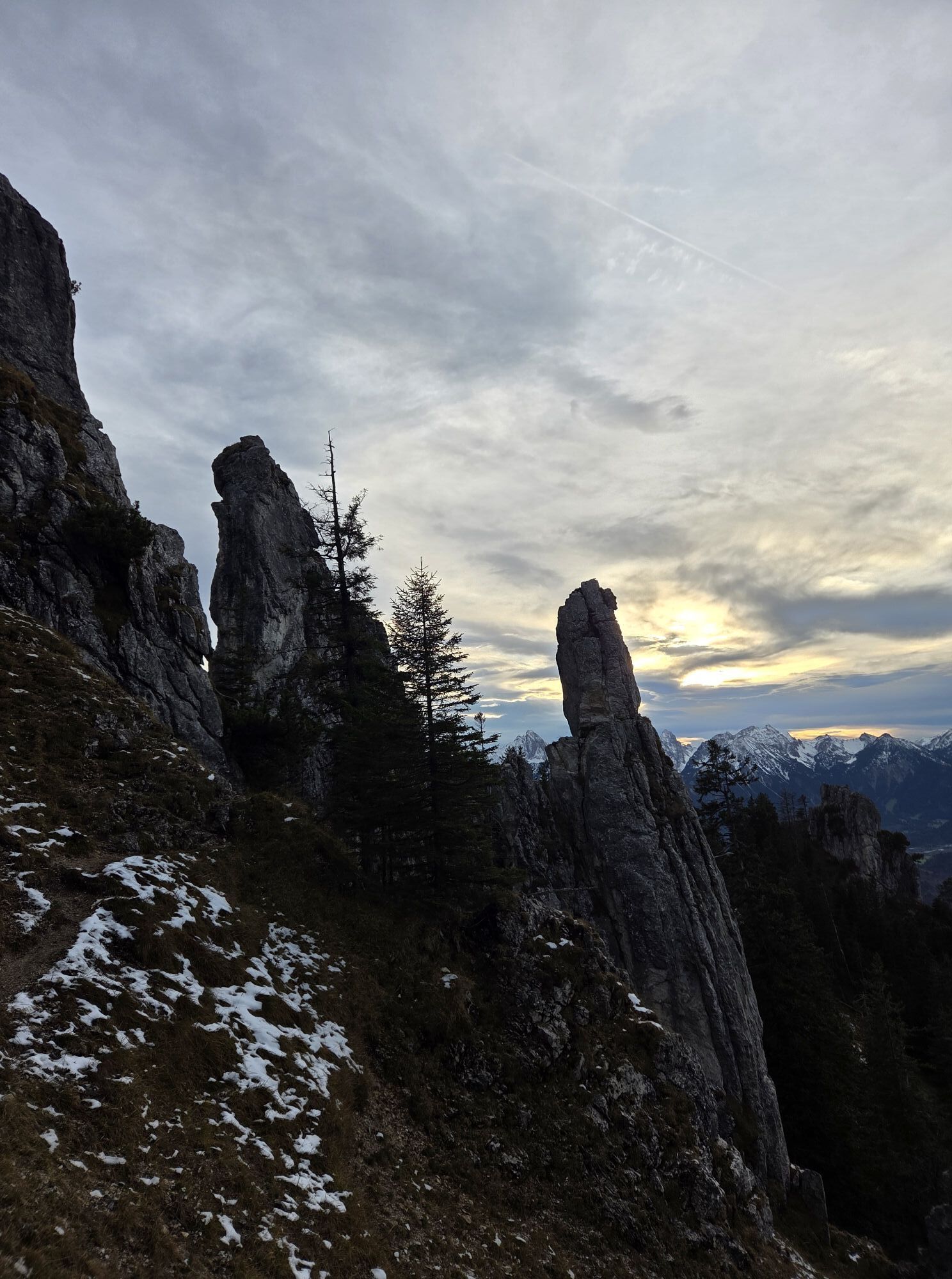
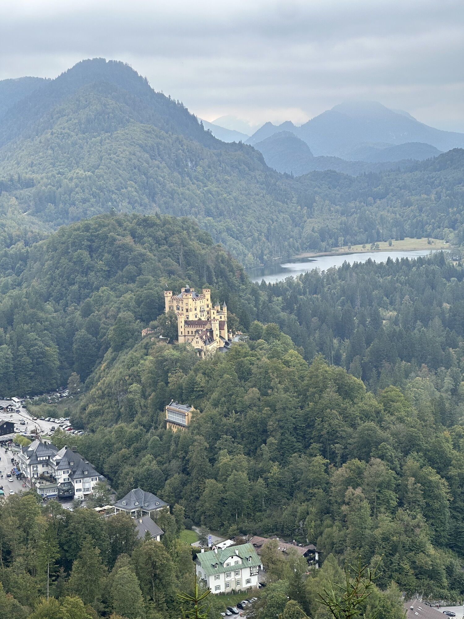
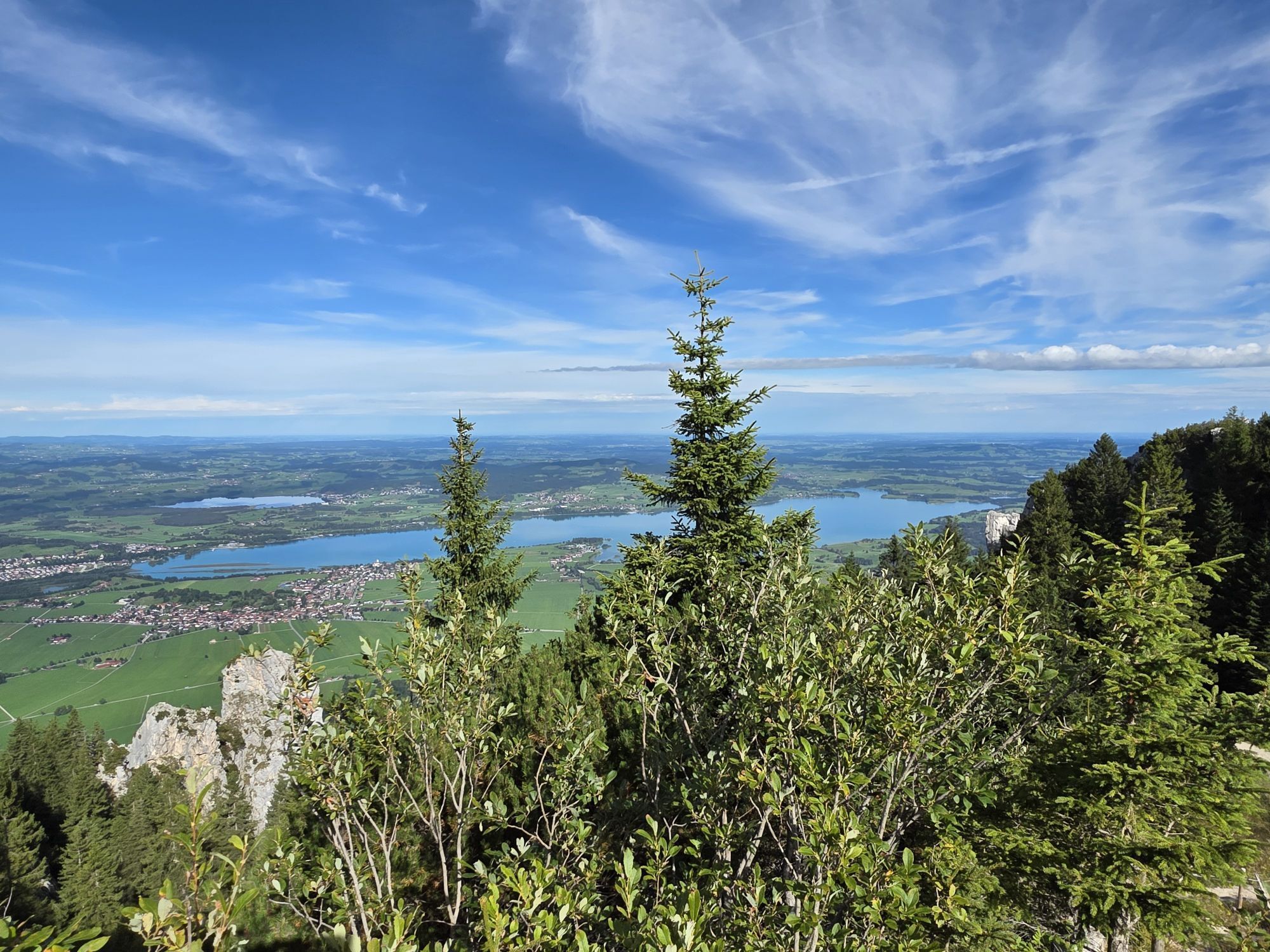
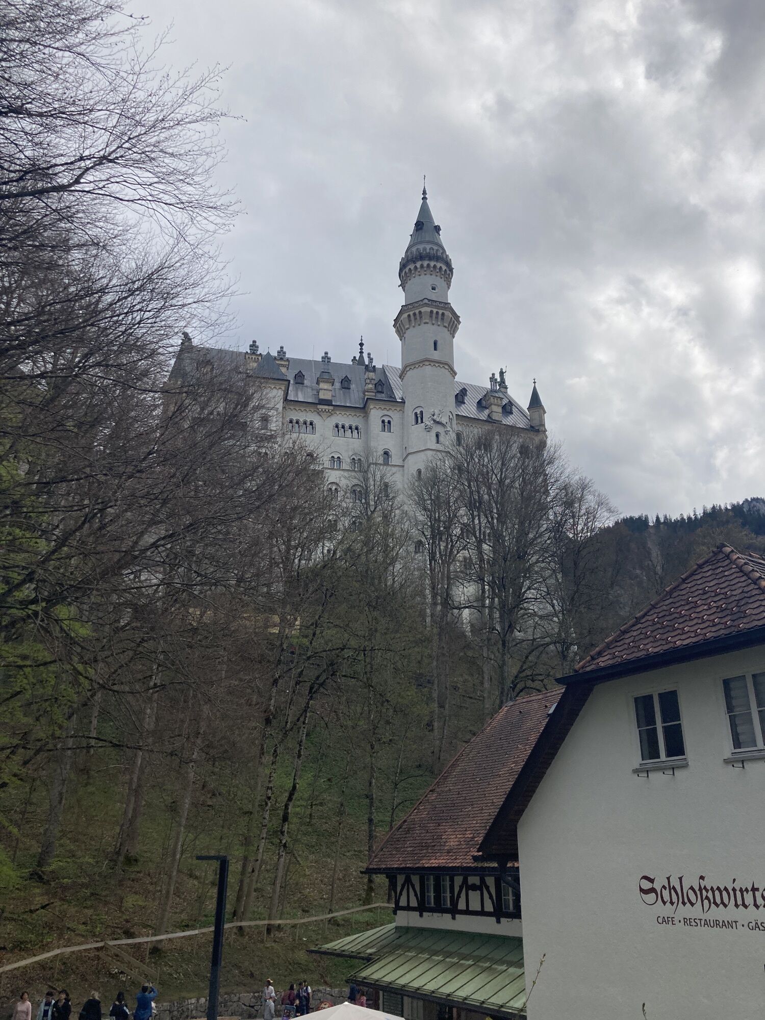
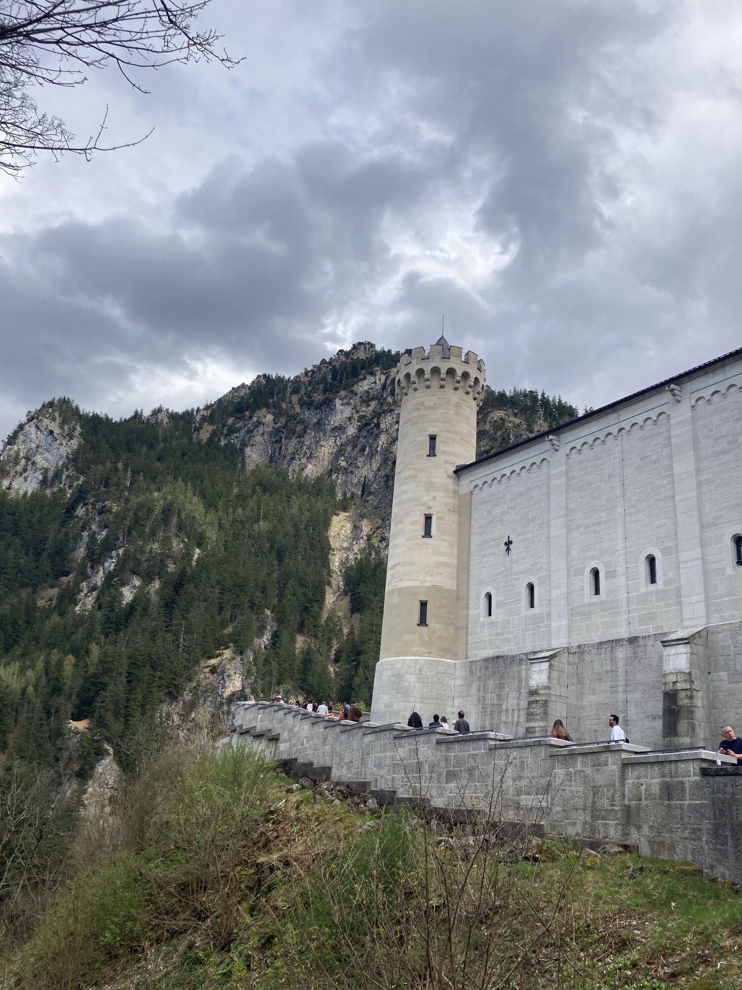
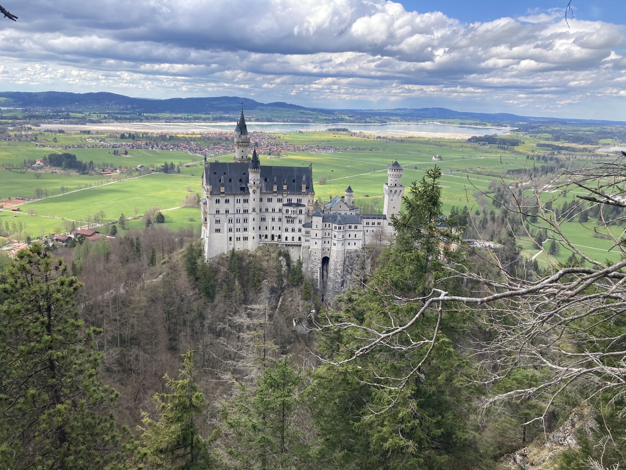
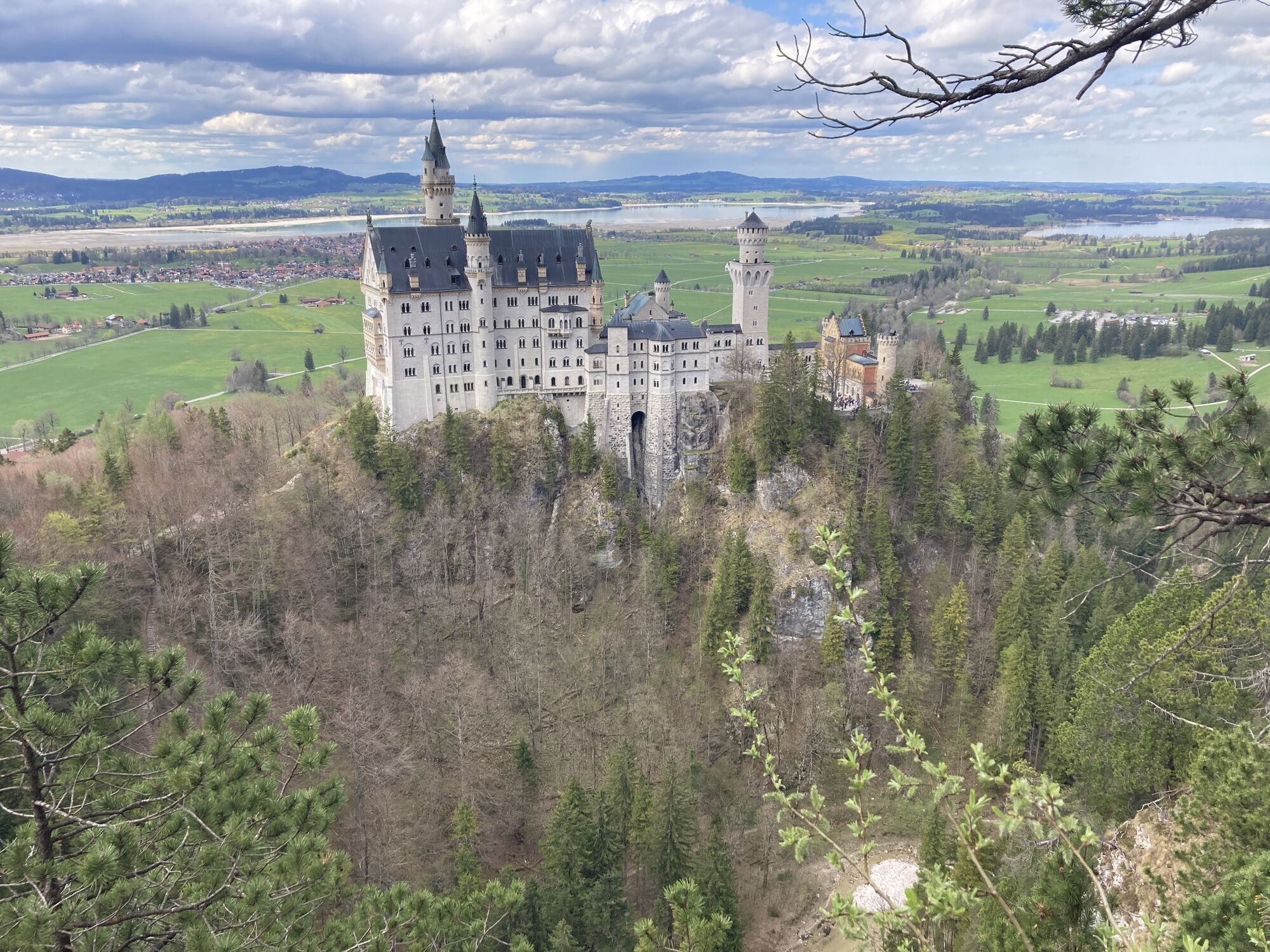
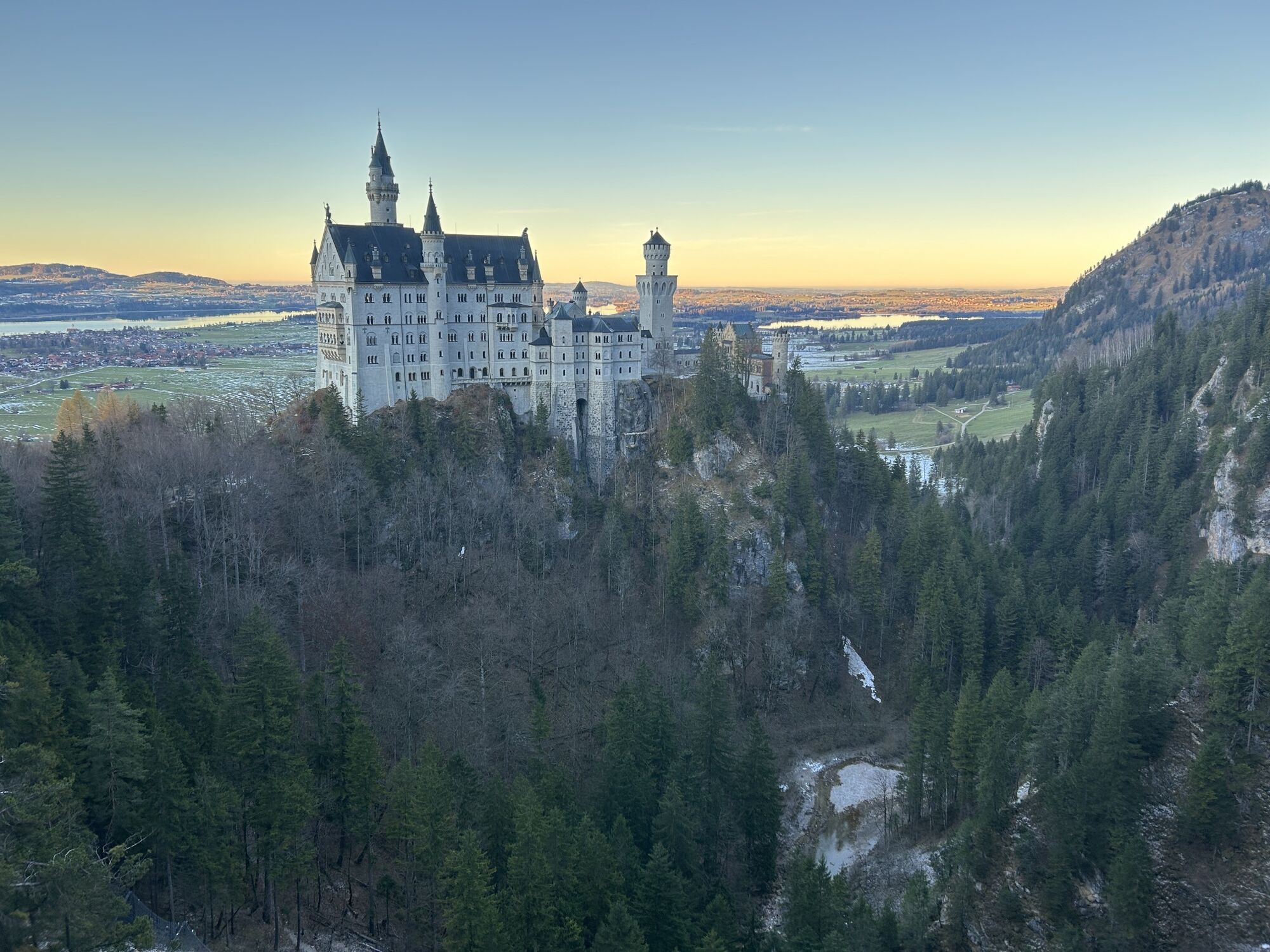
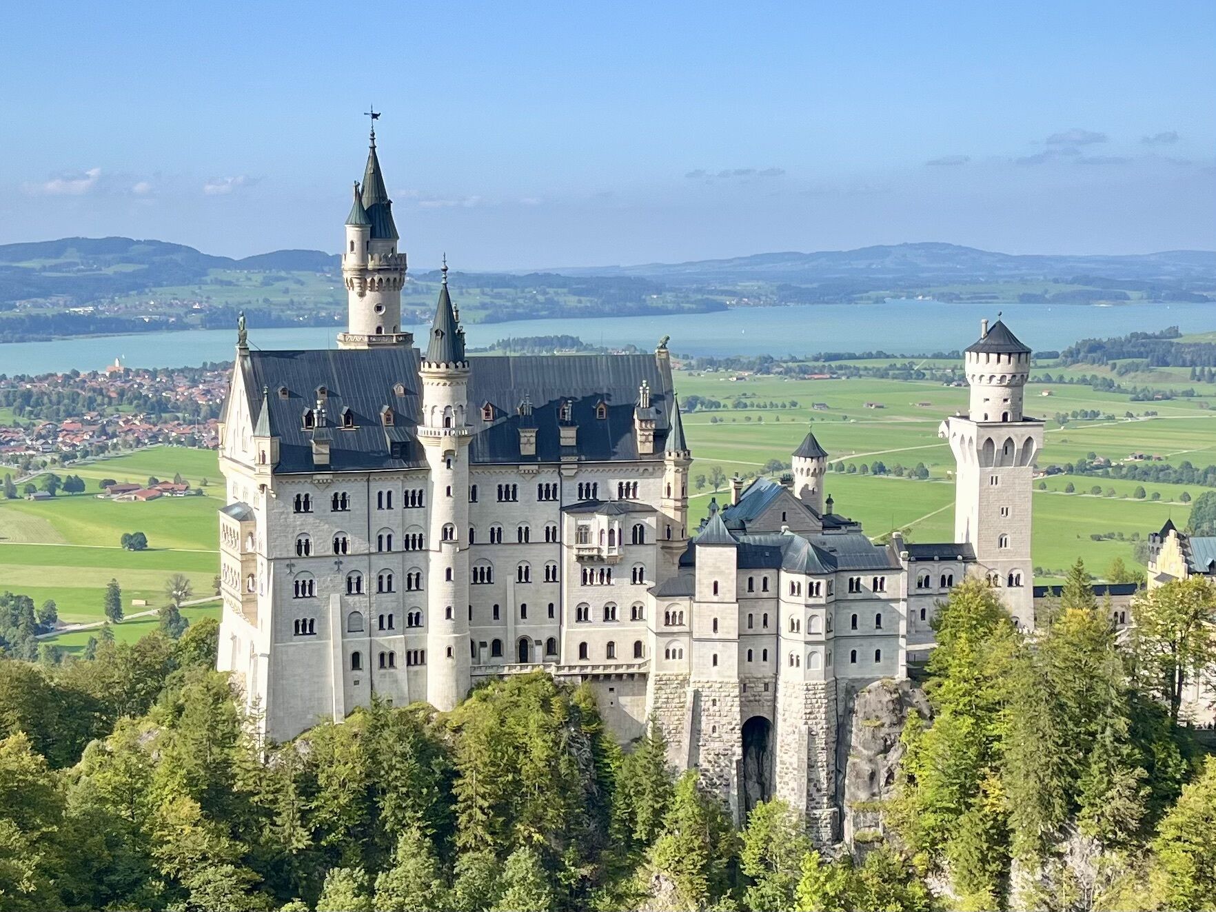
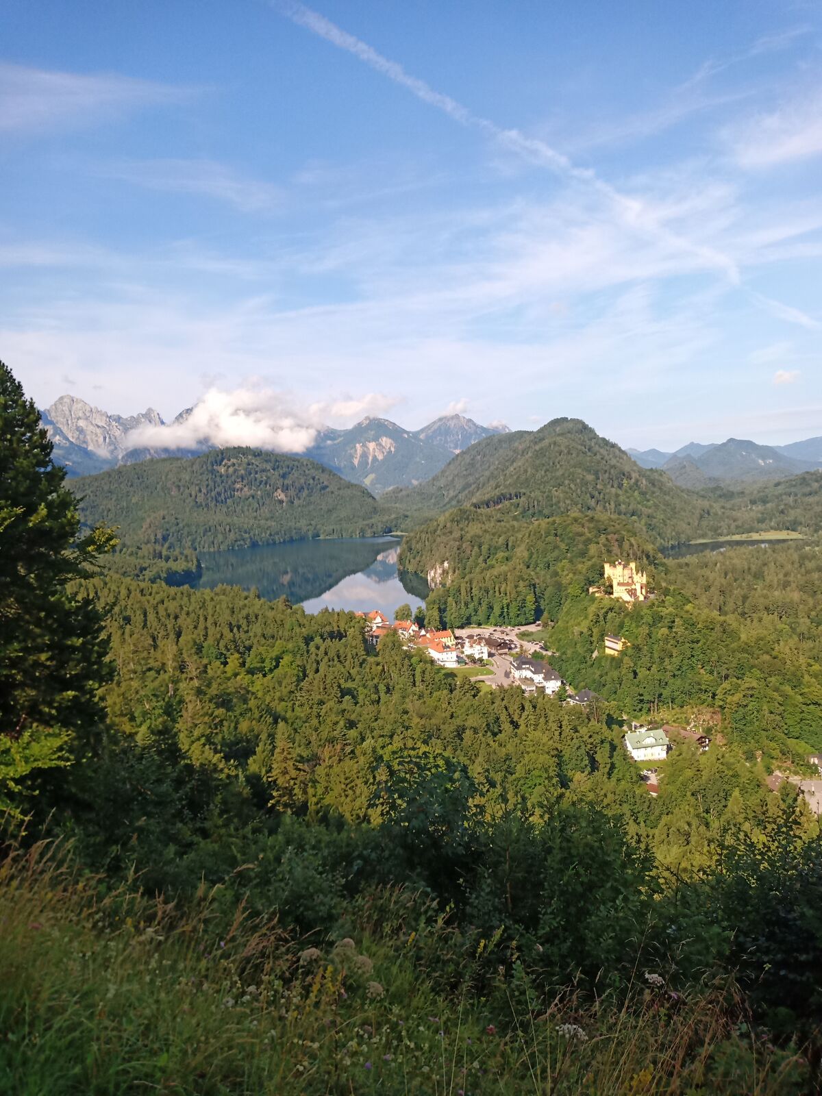
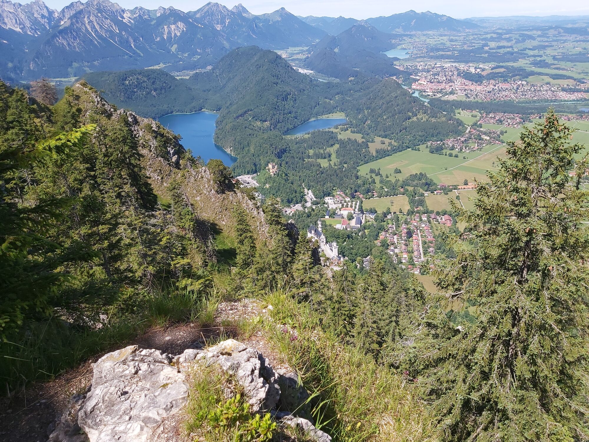
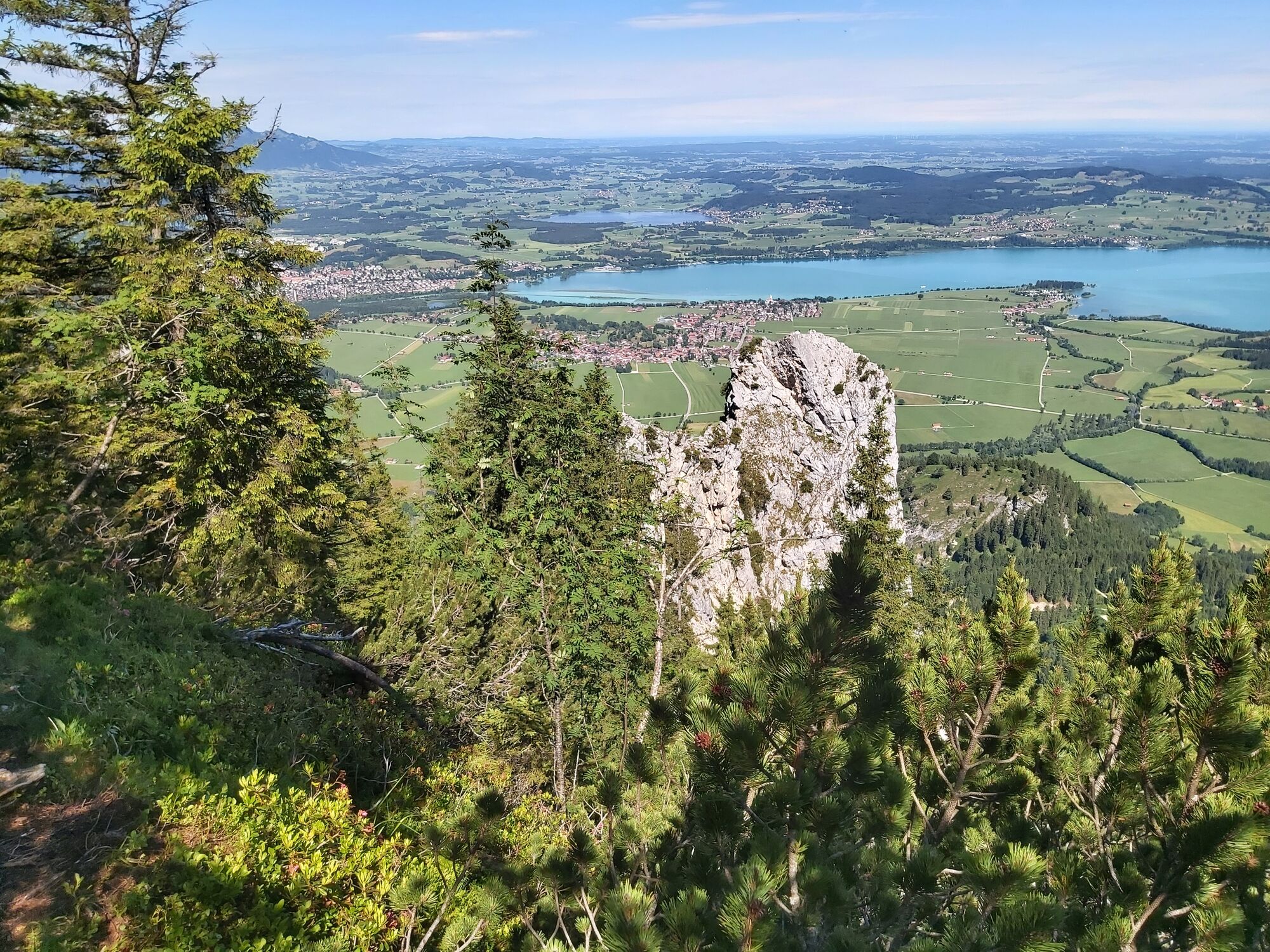
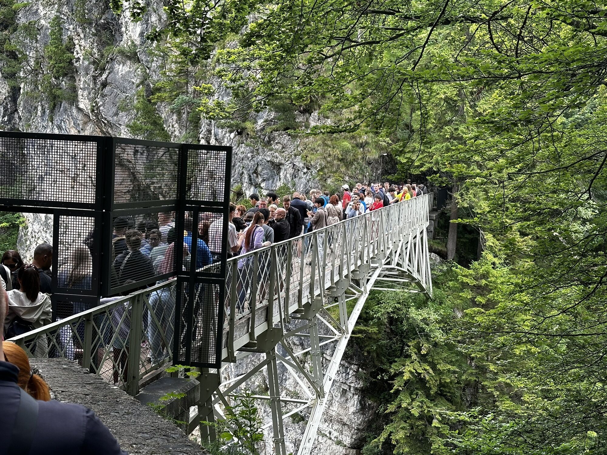
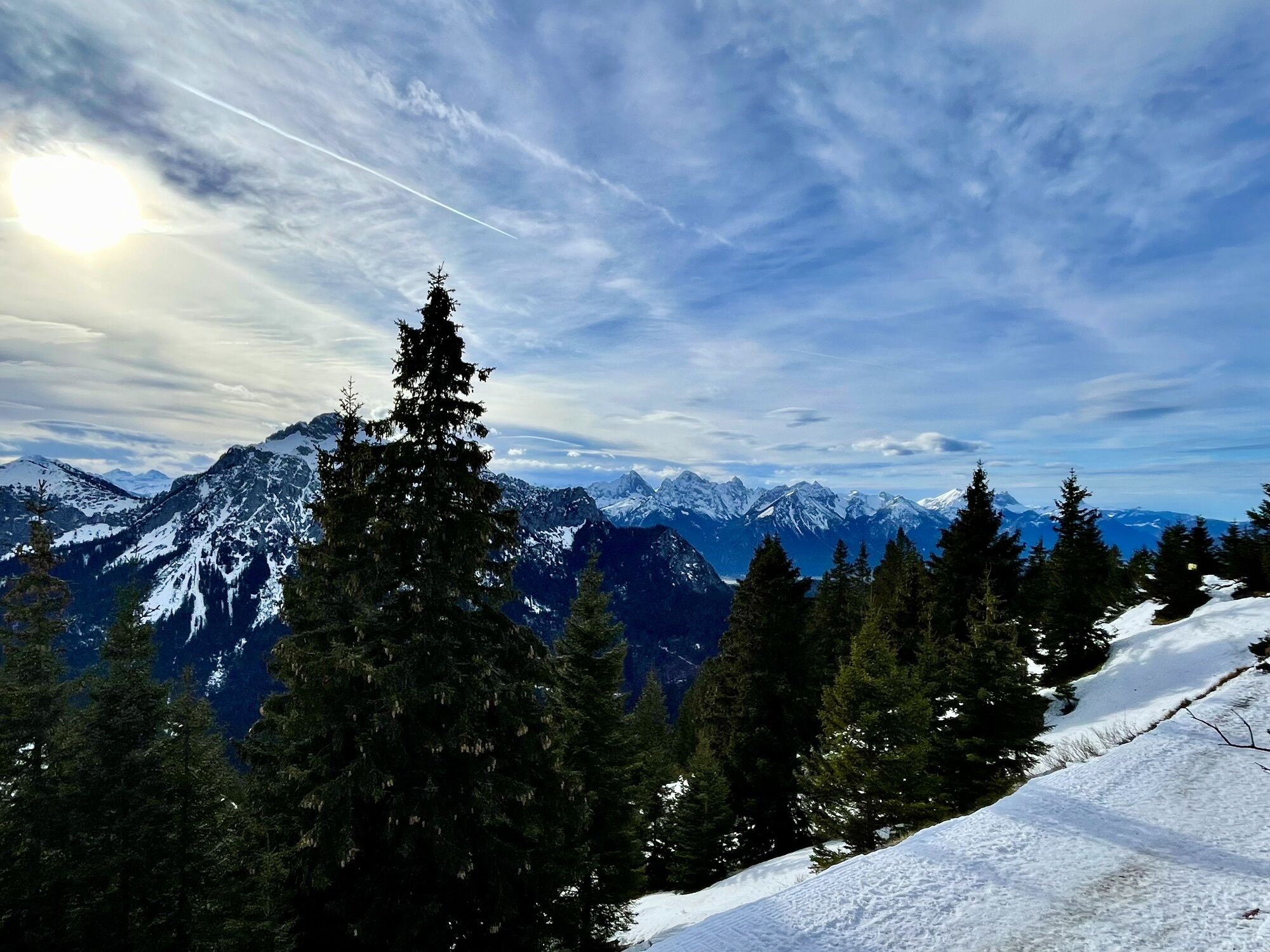
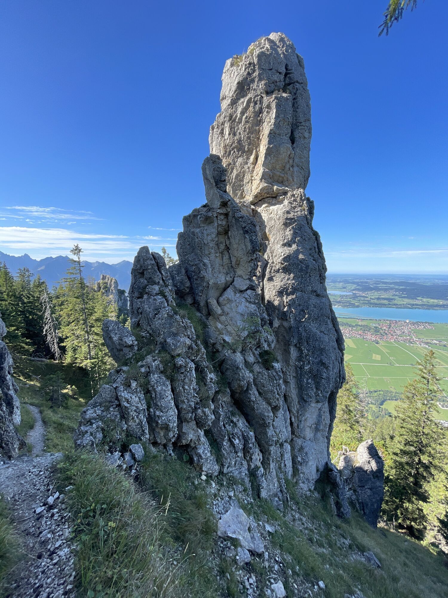
By bus or car, you reach the Tegelbergbahn valley station – the starting point of the beautiful mountain hike. Then you walk along the Pöllat, over the old Gipsmühle to Hohenschwangau. Once there, follow the signs toward "Neuschwanstein Castle" and "Marienbrücke". Here, you can also take the shuttle bus, which operates there, to Marienbrücke. Now you cross the world-famous Marienbrücke. There, you are offered a spectacular view of Neuschwanstein Castle and the Pöllat. “This spot is one of the most beautiful to be found, sacred and unreachable,” once raved King Ludwig II of the approximately 400-meter-long Pöllat gorge, which impressively shows the power of nature. Next, follow the signs for "Tegelberg". The hike now becomes demanding and steep, surefootedness is required. But the route repeatedly rewards with particularly beautiful views of the surrounding mountains and lakes. If you are lucky, you may see a chamois or two. Just under two hours (about 5 km) after crossing the Marienbrücke, you reach the summit of Tegelberg. Here, you can enjoy the breathtaking view of the town of Schwangau, the Forggensee, and the foothills of the Allgäu Alps and refresh yourself at the panoramic restaurant or the Tegelberghaus after the hike. Afterwards, you can take the Tegelbergbahn back down to the starting point. Of course, you can also hike down the Tegelberg (4.1 km descent).
Áno
We recommend: weather-appropriate clothing, hiking boots, poles, drinks, snacks, and a first aid kit.
Surefootedness
Avoid during thunderstorms
Marienbrücke is closed in winter
Coming from the B17 or Schwangau in the direction of "Tegelbergbahn" (Tegelbergstraße).
By train: to Füssen station (from there continue by bus)
By bus: bus stop Schwangau Tegelbergbahn (lines 73, 78, 9606, 9651)
Paid parking lot at the Tegelberg valley station.
Numerous dining options at Tegelberg and in Hohenschwangau can be found here.
The route can also be hiked in reverse: first take the cable car up to Tegelberg and then descend via the Marienbrückenweg down to Marienbrücke and Hohenschwangau. From here, you can also take the public bus back to the parking lot at Tegelbergbahn.
Webové kamery z prehliadky
-
Talstation
-
Tegelbergbahn Bergstation
-
Tegelberghaus
-
Füssen - Wellness Hotel Sommer
-
Segelclub Füssen
-
Talstation
-
Tegelbergbahn Bergstation
-
Tegelbergbahn Bergstation
-
Tegelbergbahn Bergstation
-
Tegelbergbahn Bergstation
-
Tegelbergbahn Bergstation
-
Schloss Hohenschwangau
-
Schloss Hohenschwangau
-
Schloss Hohenschwangau
-
Schloss Hohenschwangau
-
Schloss Hohenschwangau
-
Schloss Hohenschwangau
-
Schloss Hohenschwangau
-
Schloss Hohenschwangau
-
Ludwigs Festspielhaus Füssen
-
Ludwigs Festspielhaus Füssen
-
Ludwigs Festspielhaus Füssen
-
Ludwigs Festspielhaus Füssen
-
Ludwigs Festspielhaus Füssen
-
Ludwigs Festspielhaus Füssen
-
Ludwigs Festspielhaus Füssen
-
Forggensee
-
Tegelbergbahn Bergstation
-
Schwangau - Blick auf den Tegelberg
-
Hotel Hirsch
-
Hotel Hirsch
-
Hotel Hirsch
-
Hotel Hirsch
-
Hotel Hirsch
-
Hotel Hirsch
-
Hotel Hirsch
-
Hotel Hirsch
-
Schwangau - Schlossbrauhaus
-
Tegelberg Landeplatz
Obľúbené výlety v okolí
-
4,8
Around Weißensee
svetloTuristika 6,12 km -
5,0
Hiking tour to Breitenberg
ťažkéTuristika 15,6 km -
4,1
Drehhütte
svetloTuristika 3,34 km -
4,7
Yellow Wall Trail, Tegelberg (A)
strednáVia ferrata 3,65 km -
4,5
Circular hike Dreh- and Rohrkopfhütte
svetloTuristika 8,76 km -
5,0
Gemeinde Grän, Tirol/Österreich Aggenstein Rundtour über Höhenweg
strednáTuristika 9,84 km -
4,2
Cultural trail Schutzengelweg
strednáTuristika 5,13 km -
3,6
Rundwanderung Plansee
strednáTuristika 9,80 km -
4,9
Tegelberg | Branderschrofen | Neuschwanstein
strednáTuristika 14,8 km -
4,5
Schönjöchl am Plansee
strednáTuristika 7,21 km

Turistika a stopovanie


Nenechajte si ujsť ponuky a inšpiráciu na ďalšiu dovolenku
Vaša e-mailová adresa bol pridaný do poštového zoznamu.