


Valais Panorama Bike 1. Grimsel-Reckingen
Úroveň náročnosti: S2


Valais Panorama Bike (VPB) - stage 1
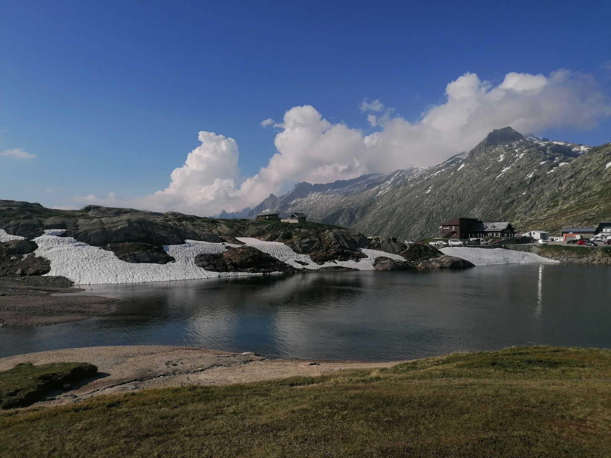
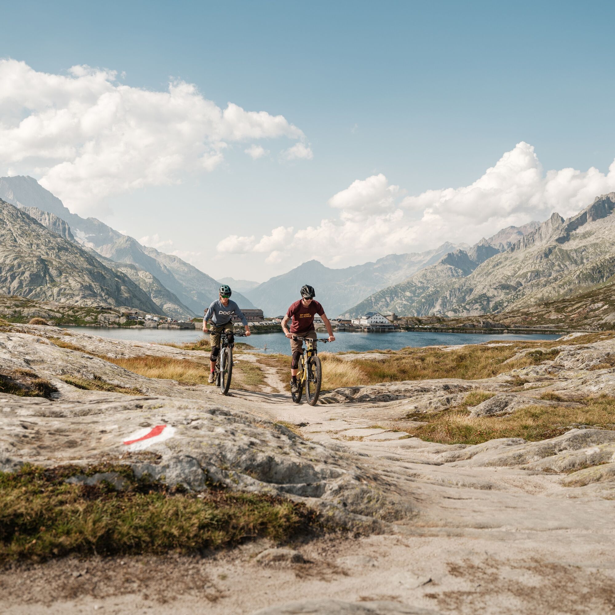
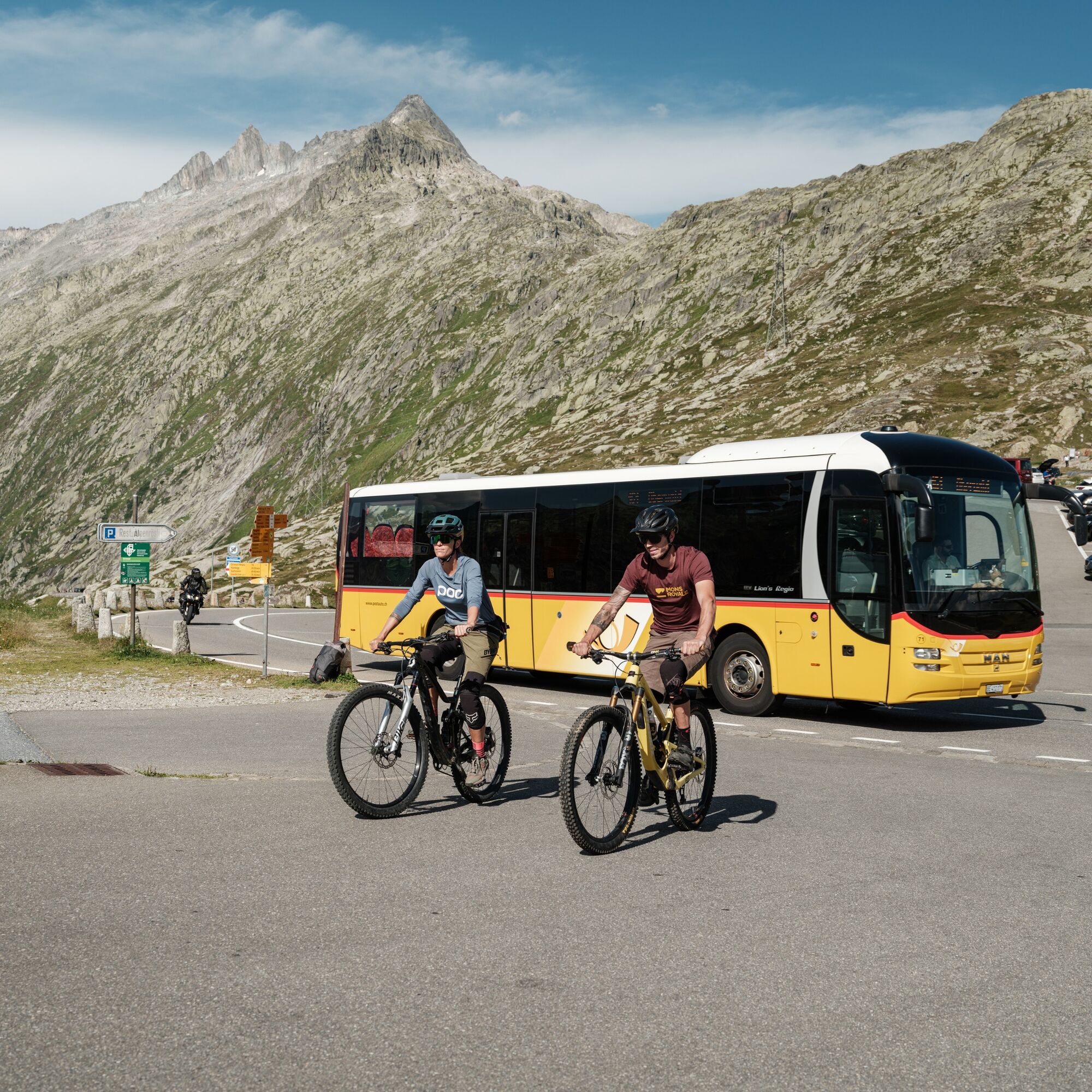
Depart from Oberwald by postbus and travel in comfort to the starting point at the Grimsel Pass. First pass the Totesee lake, then head west along the historic mule...
Depart from Oberwald by postbus and travel in comfort to the starting point at the Grimsel Pass. First pass the Totesee lake, then head west along the historic mule track. Worn stone slabs bear witness to the countless hoofbeats of these pack animals. A high mountain path with short ascents and descents takes you to the Üerlichergale mountain pasture, where you’ll follow a forest track to Ulrichen. In the near future, this descent can also be made on a magnificent singletrack. After a short break to regain your energy, it's time for the real challenge of the day: the ascent via Chietal to Moosmatte. Those wishing to shorten the climb can take the postbus to Kittbrigg or Ladstafel. Once at the top, a newly-developed singletrack takes you over the mountains to Flesche, from where you’ll descend quickly on a forest trail to the valley, before covering the last few kilometres along the “young Rhône” to Reckingen, your destination for the day.

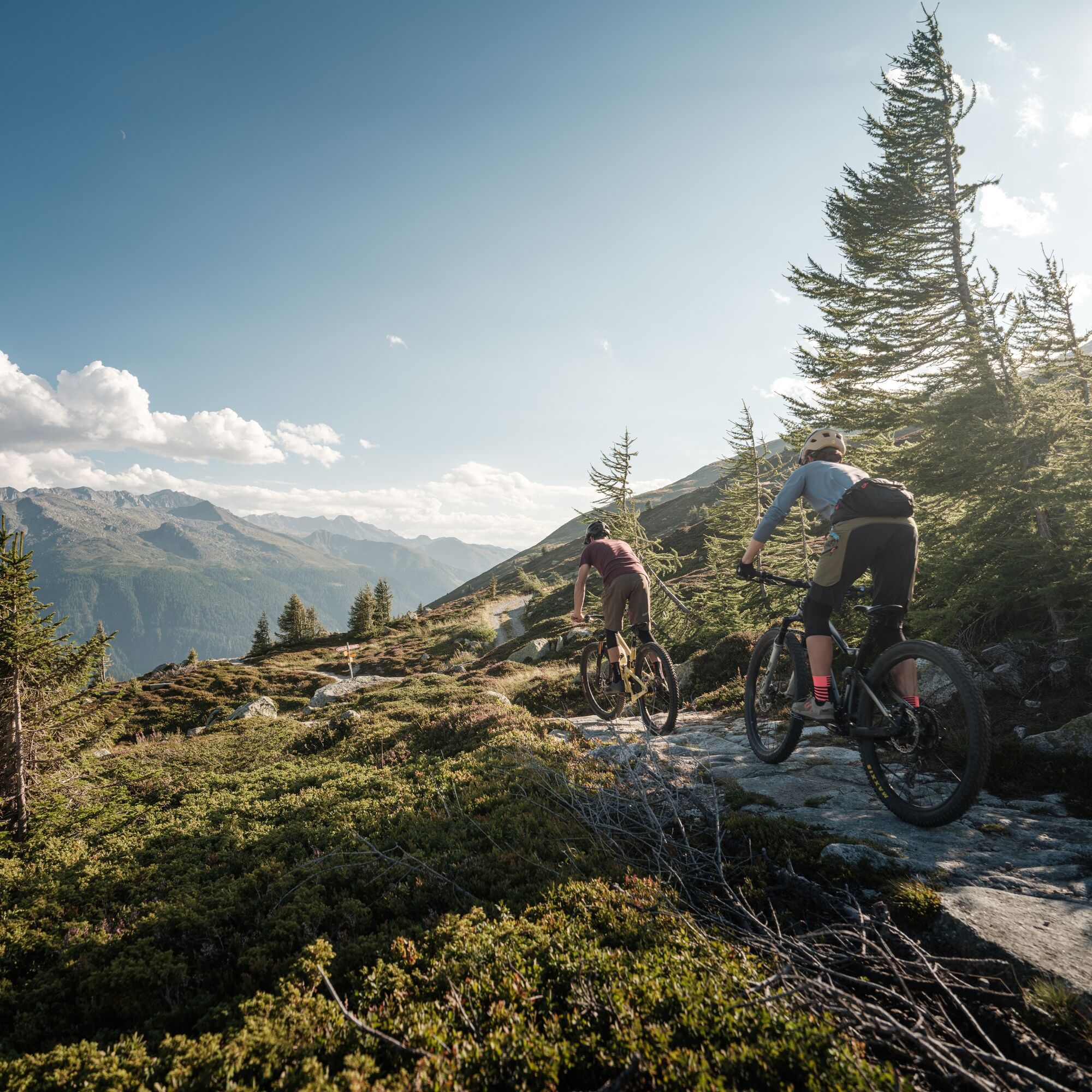
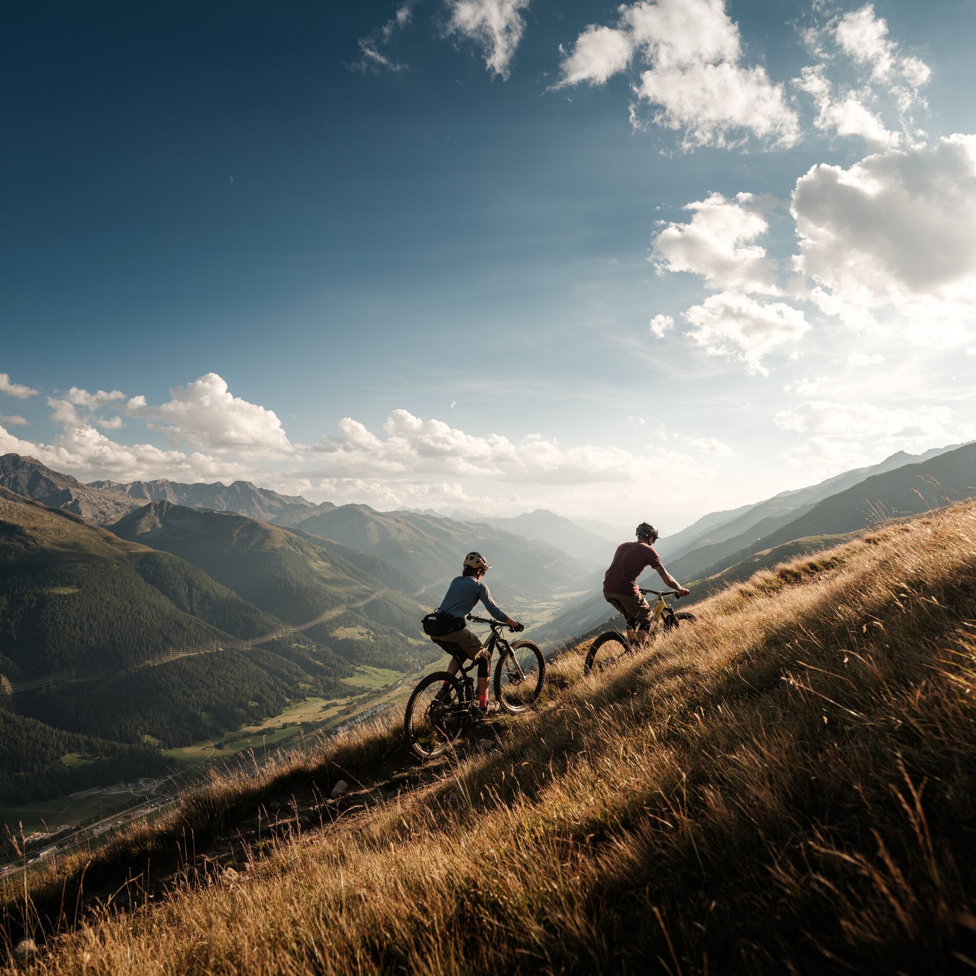
At Nassbode, descend to the junction using an alpine track, turn right and follow this upwards via Unnerbodme and then Gämschfax to Üerlichergale. This road then descends gently into the valley to Ulrichen. On the other side, the historic pass road will take you up the Ägene valley in places, from Zum Loch to just above Kittbrigg. Approximately 60 metres before the suspension bridge, turn right and cross the new pass road onto the forest track to Moosmatte. From here, 175 metres of ascent await you as far as Chietal. The final descent via Flesche and Breite Wald takes you through larch forests on briefly steeper sections, before returning to the end of the valley, where you can have a relaxed ride on Cycle Route 1, alternating left and right of the Rhône, as far as Reckingen.
Áno
Áno
Áno
Preparing for mountain bike outings
Use marked bike trails and routes only, making sure you observe all signposting.
The mountains are a place of pleasure to be shared and respected, offering space in which to meet up and share unforgettable moments, whether by bike or on foot. For all outdoor enthusiasts to enjoy them properly, it is essential that mountains are shared in a way that respects both Nature and agriculture. Respectful behaviour enables everyone to enjoy their hobby in the best possible conditions. Find out about the recommendations and rules in place.
When planning, take into account participants’ fitness level and ability. All riding is at one’s own risk.
From Zurich: take the A1 motorway to Bern, then the A6 to Spiez and continue towards Kandersteg; use the Kandersteg-Goppenstein car train and continue towards Wiler.
From Geneva: take the A1 motorway to Lausanne, then continue on the A9 towards Brig as far as Gampel; continue towards Goppenstein, then Wiler.
From Milan: take the A8/A26 motorway towards Simplon; use the Iselle-Brig car train and continue towards Visp (Visp), then Gampel; continue towards Goppenstein, then Wiler.
Follow the directions for parking in Oberwald. For this leg of the Valais Panorama Bike (VPB), we recommend that you park your vehicle in Reckingen and get to Grimsel pass using public transport (regional train and post bus). Remember to reserve a place for your bike on the sbb.ch platform for the Oberwald-Grimsel pass bus line.
S2
More information about the destination:
See full itinerary:
Experienced sportsmen and women can take the Postbus to the Nufenen Pass, at an altitude of 2,478 metres, and follow a technically demanding trail back to the original route.
Webové kamery z prehliadky
-
Hungerberg - Restaurant Gommerblick
-
Obergesteln
-
Ulrichen VS / Hotel Astoria
-
Blitzingen
-
Berghaus Oberaar
-
Obergoms/Oberwald
-
Nordisches Zentrum Goms
-
Münster Landhaus Goms
-
Reckingen Hotel Glocke
-
Blitzingen Bodmen
-
Blitzingen - Hotel Castle
-
Hotel Grimselpass
-
Grimselsee - Grimsel Hospiz
-
Obergesteln - Source du Rhône
-
Goms - Obergesteln
Obľúbené výlety v okolí
-
5,0
Circular hike from Grimsel Pass - Sidelhorn via Jostsee
strednáTuristika 8,47 km -
5,0
9 lake-trail
ťažkéTuristika 17,3 km -
Furka Pass – Rhone Glacier
svetloTuristika 3,59 km -
4,8
Ciaspolata al Rifugio Maria Luisa
strednáSnežnice 11,2 km -
5,0
Gelmersee-Tour
svetloTuristika 9,03 km -
4,0
Capanna Piansecco
svetloSnežnice 7,26 km -
5,0
Um den Gelmersee zur Gelmerhütte
strednáTuristika 9,30 km -
von Albert-Heim-Hütte via Nepali Highway und Sidelenhütte nach Furkapass
ťažkédiaľková pešia trasa 8,40 km -
5,0
Toce Waterfall - Riale - San Giacomo Pass road
strednáTuristika 10,9 km -
4,5
Hike to the Glacier View in Bellwald
strednáTuristika 8,86 km
Turistika a stopovanie


Nenechajte si ujsť ponuky a inšpiráciu na ďalšiu dovolenku
Vaša e-mailová adresa bol pridaný do poštového zoznamu.