






Hike to the Glacier View in Bellwald

The Fiescher Glacier, at almost 15 kilometers in length, is the second longest glacier in the Alps. It is one of the jewels of the UNESCO World Heritage Swiss Alps Jungfrau-Aletsch, which protects the...
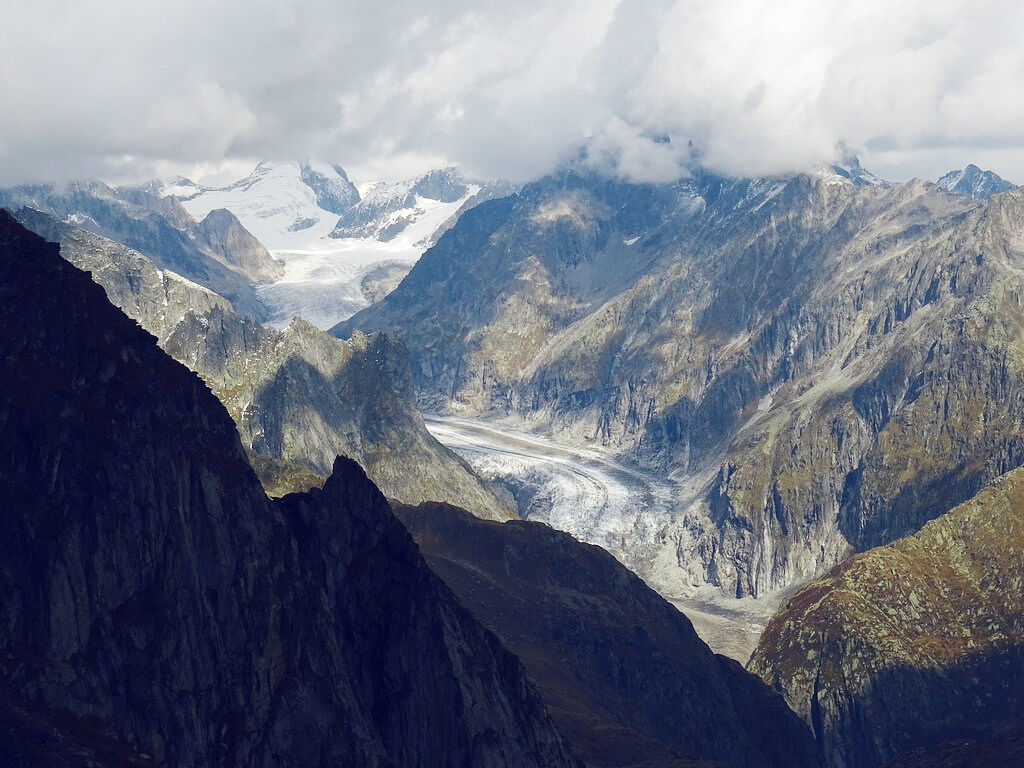
The Fiescher Glacier, at almost 15 kilometers in length, is the second longest glacier in the Alps. It is one of the jewels of the UNESCO World Heritage Swiss Alps Jungfrau-Aletsch, which protects the mightiest glacier in the Alps and its surroundings. The area also includes nine four-thousanders – including the Finsteraarhorn (4,273 m), which towers above the Fiescher Glacier.
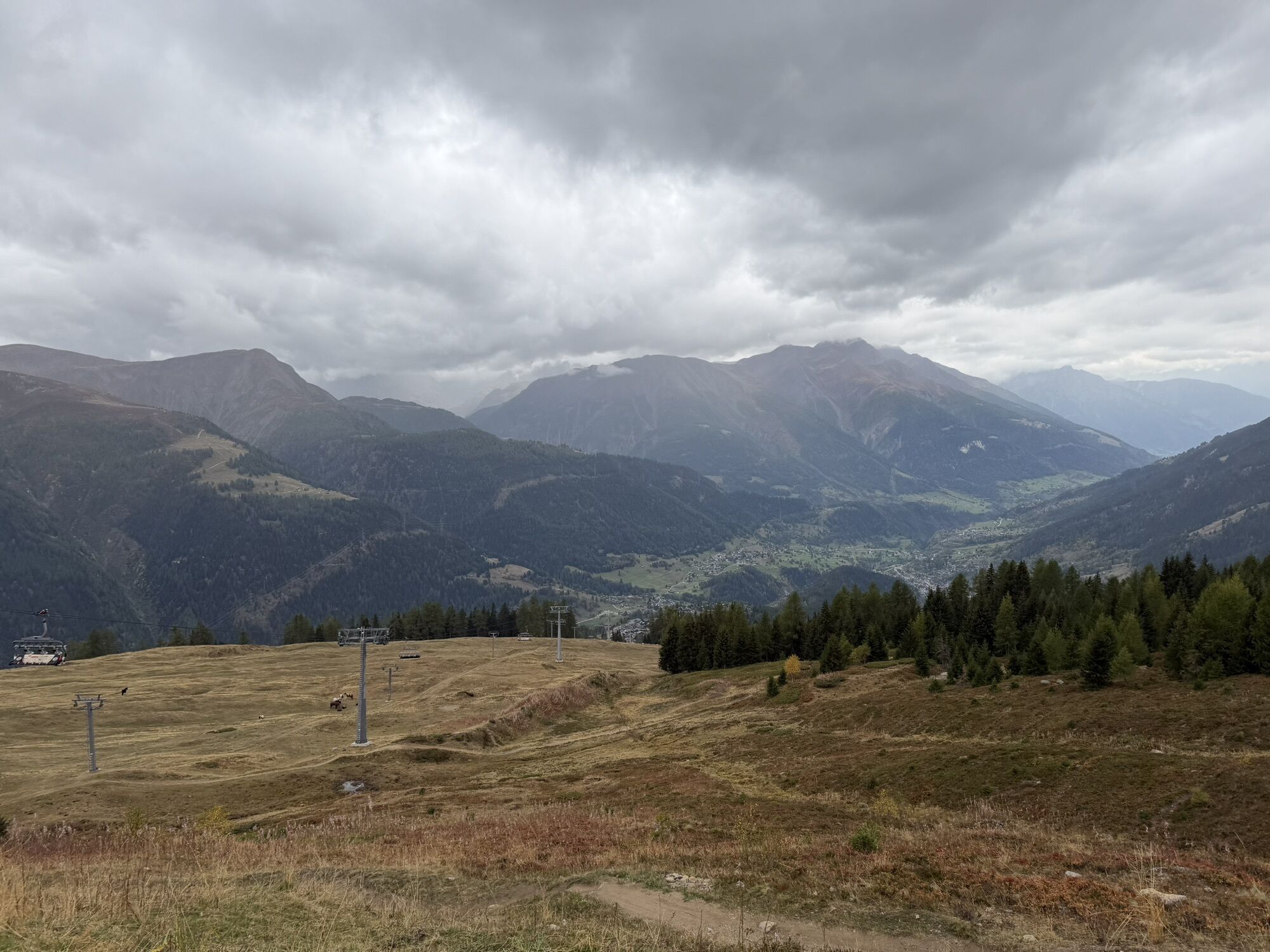
This invigorating hike climbs the slopes above Bellwald and leads to a viewpoint offering the best views of the Fiescher Glacier. From here, the route returns to the starting point via a different path. Before the descent begins, the trail runs a bit higher and allows views of the Goms.
The chairlift takes hikers at the start of the route from Bellwald to Richenen, the starting point of the hike. With its mountain lake, restaurant with sun terrace, and adventure course for children, Richenen is an ideal place for families to linger. The course includes a play boat, forest house, slide, musical instruments, and a research station where the little ones can let off steam and simultaneously get to know the local flora and fauna.
The village of Bellwald itself should not be overlooked; it is one of the oldest and best-preserved villages in Valais and lies on one of the sunniest spots in the canton. Life here still seems somewhat more relaxed, though the cable car, opened in 1956, improved access to the village. The car-free village center with its sunburned houses and barns, as well as the baroque church, is full of historic charm.
Highlights of the hike:
Sunny alpine hike with great views of the Goms. View of the Fiescher Glacier, the second longest glacier in the Alps, part of the UNESCO World Heritage Swiss Alps Jungfrau-Aletsch. Scenic chairlift ride to the starting point of the hike, where a restaurant and adventure playground for children invite you to linger.
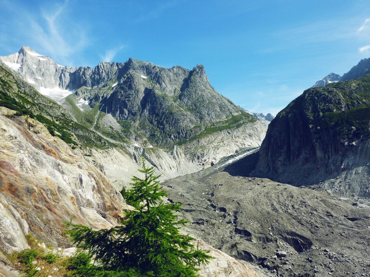
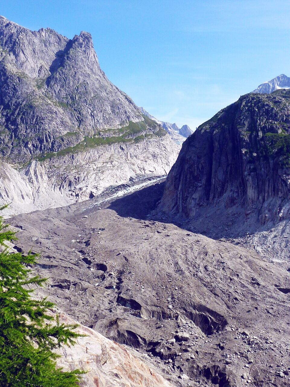
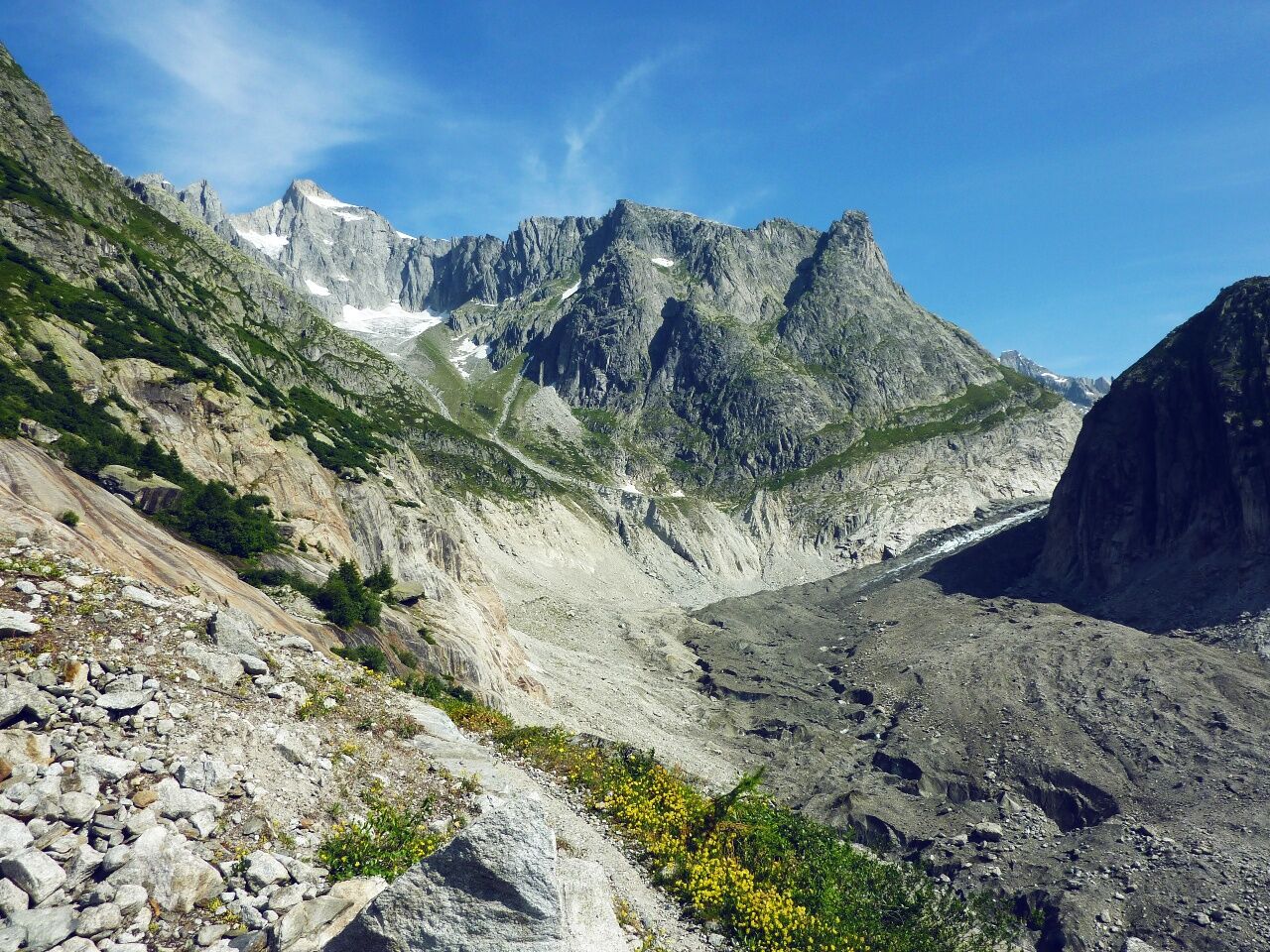

The hike starts at the mountain station of the Richenen chairlift. From here, the path steadily climbs northwest along the flank of the Fiescher valley to the viewpoint "Glacier View". The return route first briefly follows the same path before turning left and following a higher path back to Richenen.
The route can easily be extended, for example by walking the return path to Bellwald instead of taking the chairlift.
Several other hikes lead to the two spectacular suspension bridges in the region. The Aspi-Titter, built in 2016 and 160 m long, spans the gorge below the Fiescher Glacier at a height of 120 m. The Goms Bridge crosses the Rhone near the valley station of the Fürgangen-Bellwald cable car at 280 m.
Áno
Áno
We recommend:
Good footwear Weather-dependent clothing: always carry a waterproof vest Headwear Sunscreen Water bottle Picnic Camera Binoculars (optional) Hiking poles (optional) Printout of the hiking trail (click "Print" to download)For certain hikes:
Swimming suitUse of the hiking trails and information on this website is at your own risk. Local conditions may cause changes to the route. Valais/Wallis Promotion assumes no responsibility for the accuracy and completeness of the information on this website. Assess your own abilities and fitness well. Using the different routes is fundamentally at your own responsibility.
For all hikes:
Carry a map with you. Download the complete description of the hiking trail with a large-scale map by clicking "Print" at the top right of the page. Use only marked hiking trails and observe all signs and instructions – for your own safety, to protect grazing animals, and out of respect for wildlife. Close gates after passing through. Be considerate of other trail users, plants, and animals.For mountain hikes:
Carry additional sun protection. UV rays at high altitudes can be very strong, even in cloudy weather. Plan your hike carefully: consider the required fitness level of all participants, weather forecasts, and seasonal dependencies. Weather conditions in the mountains can change very quickly and without warning. Appropriate clothing and sufficient provisions (food and drink) are very important. In unstable weather, it is better to turn back early.For high alpine hikes:
Inform your family about your hiking route. If possible, avoid being alone. Do not venture onto glaciers without a mountain guide. Observe warning signs indicating dangers at riverbanks, along waterways below dams and reservoirs: water levels can rise quickly and without warning.Motorway A9 to Brig. From Brig, take cantonal road 19 (Furka road) and follow it to Fürgangen. In Fürgangen at the roundabout, turn left towards Bellwald.
Regular train connections from all over Switzerland to Brig. From there, regional trains of the Matterhorn Gotthard Bahn to Fürgangen, then by cable car to Bellwald. The chairlift can be reached with a 10-minute walk through Bellwald. Train and postbus timetables can be found at sbb.ch.
Large parking lots near the Bellwald-Richenen chairlift.
More information about the destination:
BellwaldThe chairlift ride is included in the summer guest card.

Webové kamery z prehliadky

Aktivity počas prehliadky

Obľúbené výlety v okolí
-
5,0
BELALP - SPARRHORN
ťažkéTuristika 11,2 km -
4,9
SUSPENSION BRIDGE RIEDERALP - BELALP
strednáTuristika 11,5 km -
5,0
9 lake-trail
ťažkéTuristika 17,3 km -
4,5
Panoramaweg über den Aletschgletscher
strednáTuristika 17,7 km -
UNESCO Höhenweg
Turistika 3,70 km -
5,0
Pfingstegg - Bäregg - Schreckhornhütte SAC
ťažkéHorská turistika 16,5 km -
4,0
Eggishorn via ferrata
strednáVia ferrata 1,39 km -
5,0
Aletsch Sightseeing
strednáZimná turistika 15,5 km -
5,0
VIA FERRATA "ALETSCH"
strednáVia ferrata 3,40 km -
3,0
Lötschenlücke
strednáSkitour 26,2 km
Turistika a stopovanie


Nenechajte si ujsť ponuky a inšpiráciu na ďalšiu dovolenku
Vaša e-mailová adresa bol pridaný do poštového zoznamu.





