


Malga Coot loop - Costantini bivouac - Mount Guarda
Úroveň náročnosti: T3
Fotografie našich používateľov
-
 © Gabi KlammerVytvorené dňa 28.12.2025
 -
 © Fabrizio PlesnizerVytvorené dňa 21.12.2025
 -
 © Brigitte HainVytvorené dňa 31.08.2025
 -
 © Brigitte HainVytvorené dňa 31.08.2025
 -
 © Gianni VaruttiVytvorené dňa 12.06.2025
 -
 © Gianni VaruttiVytvorené dňa 12.06.2025
 -
 © Gianni VaruttiVytvorené dňa 12.06.2025
 -
 © Gianni VaruttiVytvorené dňa 12.06.2025
 -
 © Gianni VaruttiVytvorené dňa 12.06.2025
 -
 © Gianni VaruttiVytvorené dňa 12.06.2025
 -
 © Gianni VaruttiVytvorené dňa 12.06.2025
 -
 © Gianni VaruttiVytvorené dňa 12.06.2025
 -
 © Gianni VaruttiVytvorené dňa 12.06.2025
 -
 © NicoVytvorené dňa 04.08.2025
 -
 © NicoVytvorené dňa 04.08.2025


The proposed loop is one of the most rewarding itineraries for hikers with some experience. The difficulties are never high, but a surefooted step on rocky and gravelly terrain and no fear of heights for...
The proposed loop is one of the most rewarding itineraries for hikers with some experience. The difficulties are never high, but a surefooted step on rocky and gravelly terrain and no fear of heights for some short ridge passages are required.
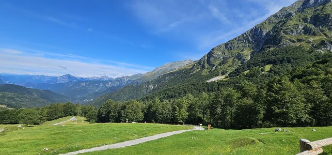
The starting point is at the parking lot below Malga Coot, one of the oldest alpine pasture structures in the whole Resia valley, now an agritourism ready to offer delicious zero-kilometer dishes and where you can refresh at the end of the itinerary.
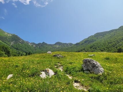
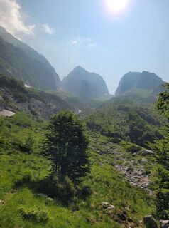
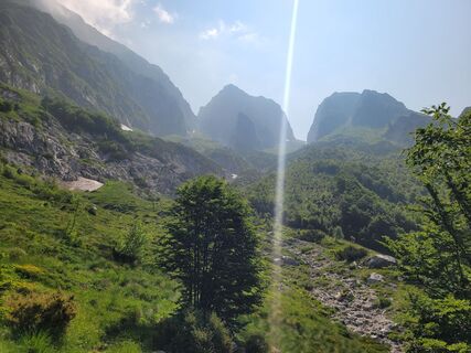
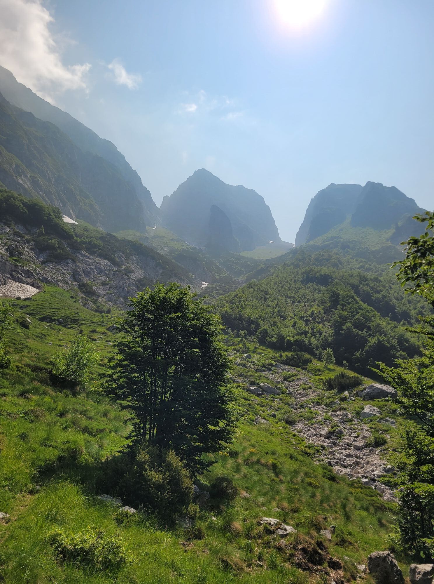
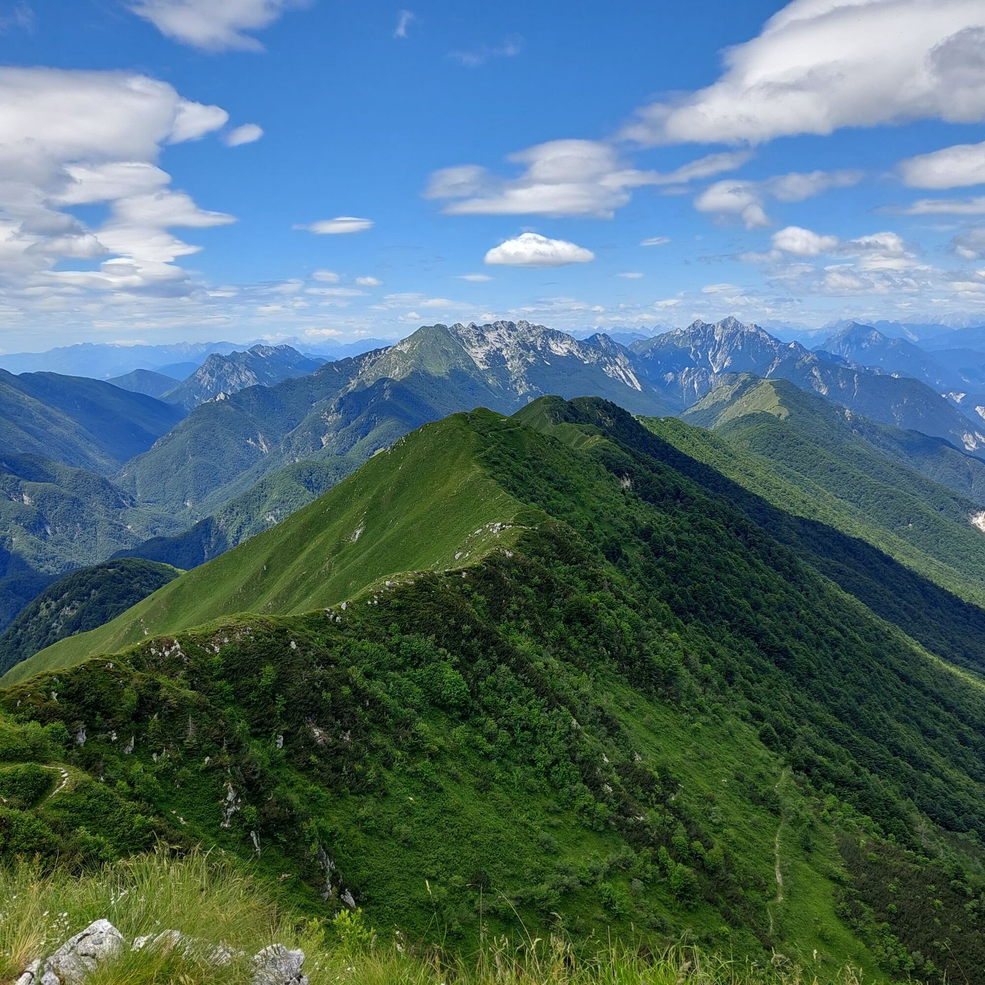
The trail develops in Upper Resia Valley crossing many different environments: beech and conifer forests, high altitude meadows and pastures with beautiful blooms, and gravelly and rocky environments under the walls of Mount Baba Grande and Baba Piccola. Along the route, it is also common to spot many animal species such as deer, chamois, ibex, and in the sky griffons and eagles.
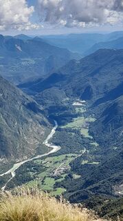
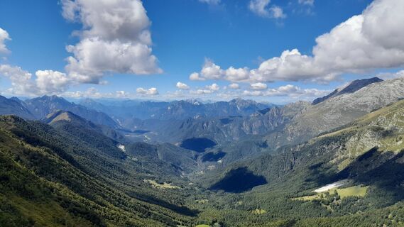
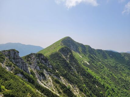
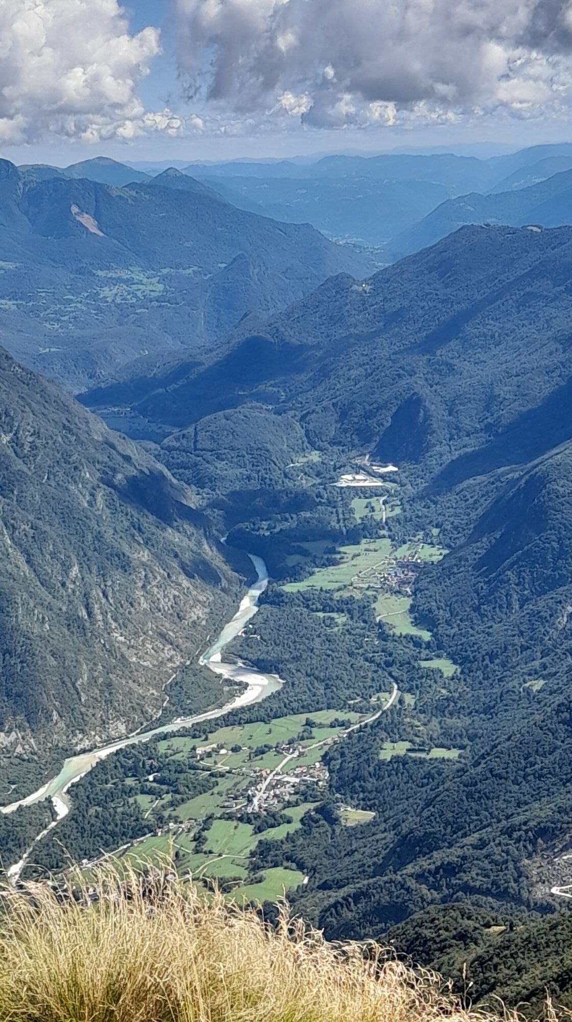
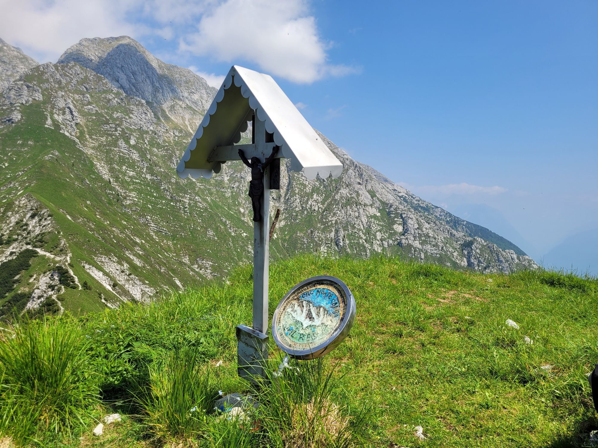
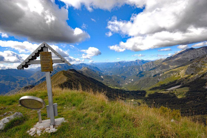
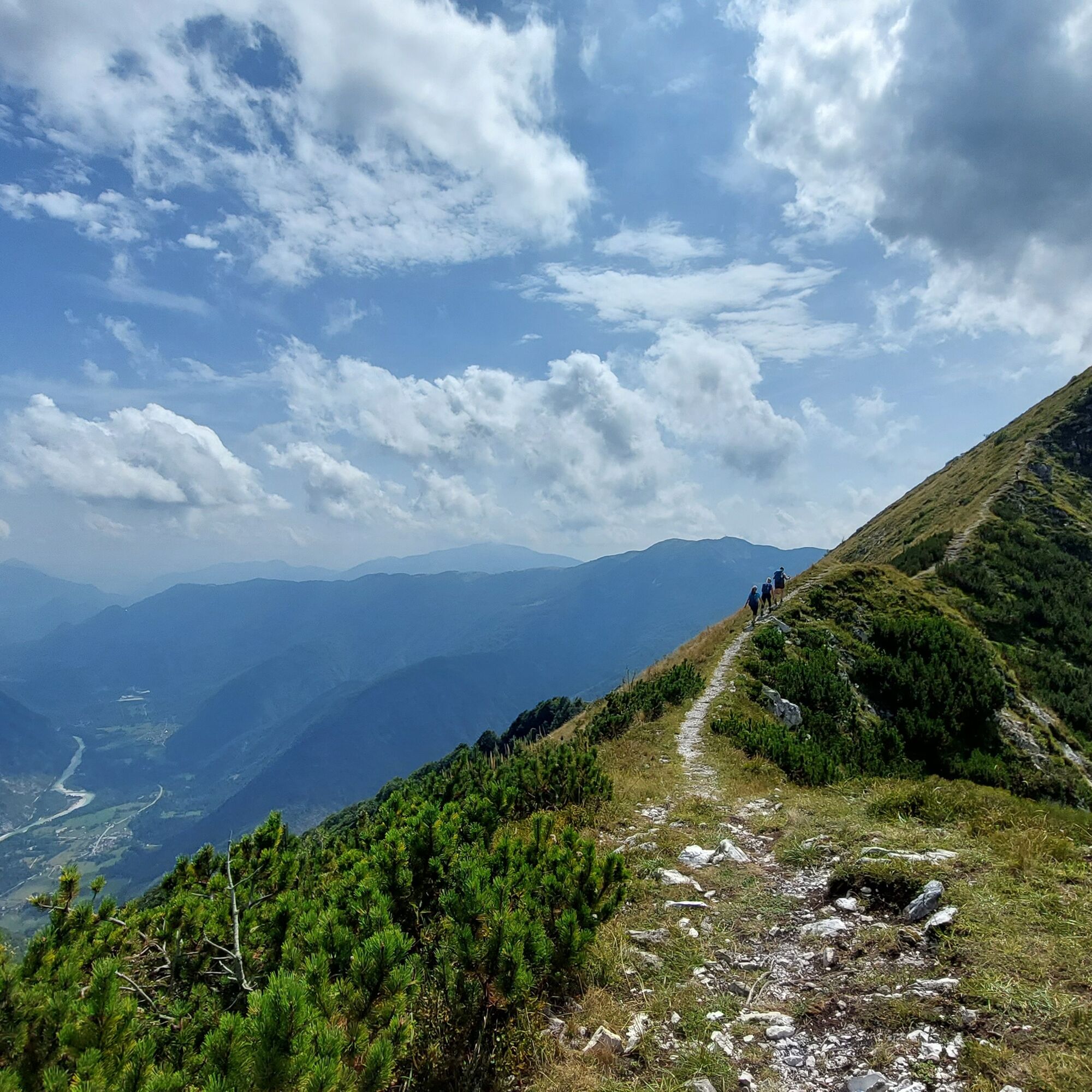
The summit of Mount Guarda, straddling Slovenia and Italy, is the point from which to enjoy splendid views towards the Isonzo Valley to the east and the Friulian Alps to the west.

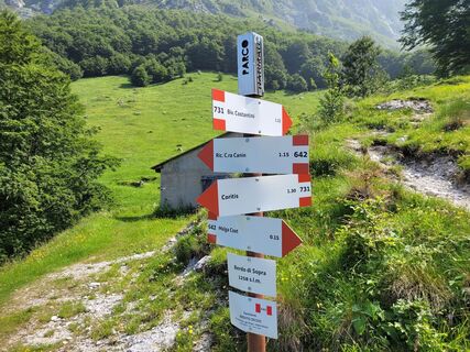
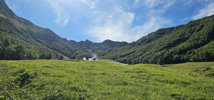
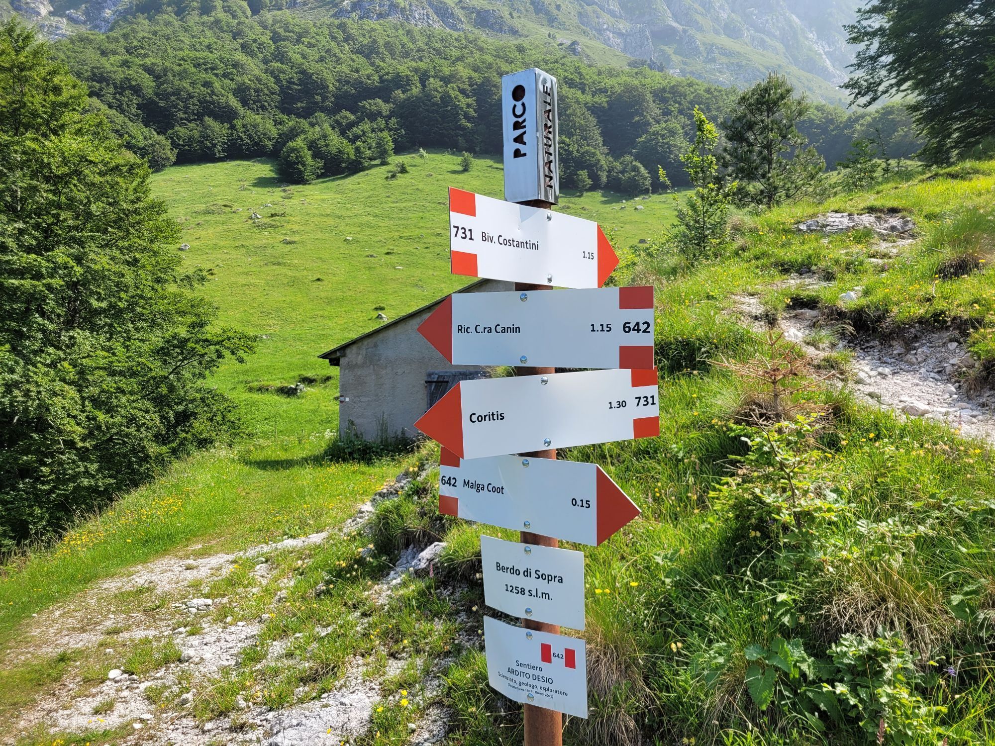
Leaving the car at the Malga Coot parking lot, walk a few meters towards the malga and then immediately turn left along a dirt road. This road starts gently in a beautiful beech forest and then climbs steeply on a gravel surface until reaching the junction with trail CAI no. 642. Turning left, you take the trail which, after crossing a dry stream, leads to the Berdo di Sopra mountain huts. From this beautiful pasture, where animals are still brought to graze today, you can enjoy a first view of the Resia Valley.
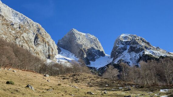
Near the huts, turn right (signs present), along a path that crosses the dry stream again and climbs about 400m of positive elevation gain. This stretch offers magnificent views of the southern walls of the Canin massif, where chamois and ibex are often seen grazing on meadows suspended above the cliffs.
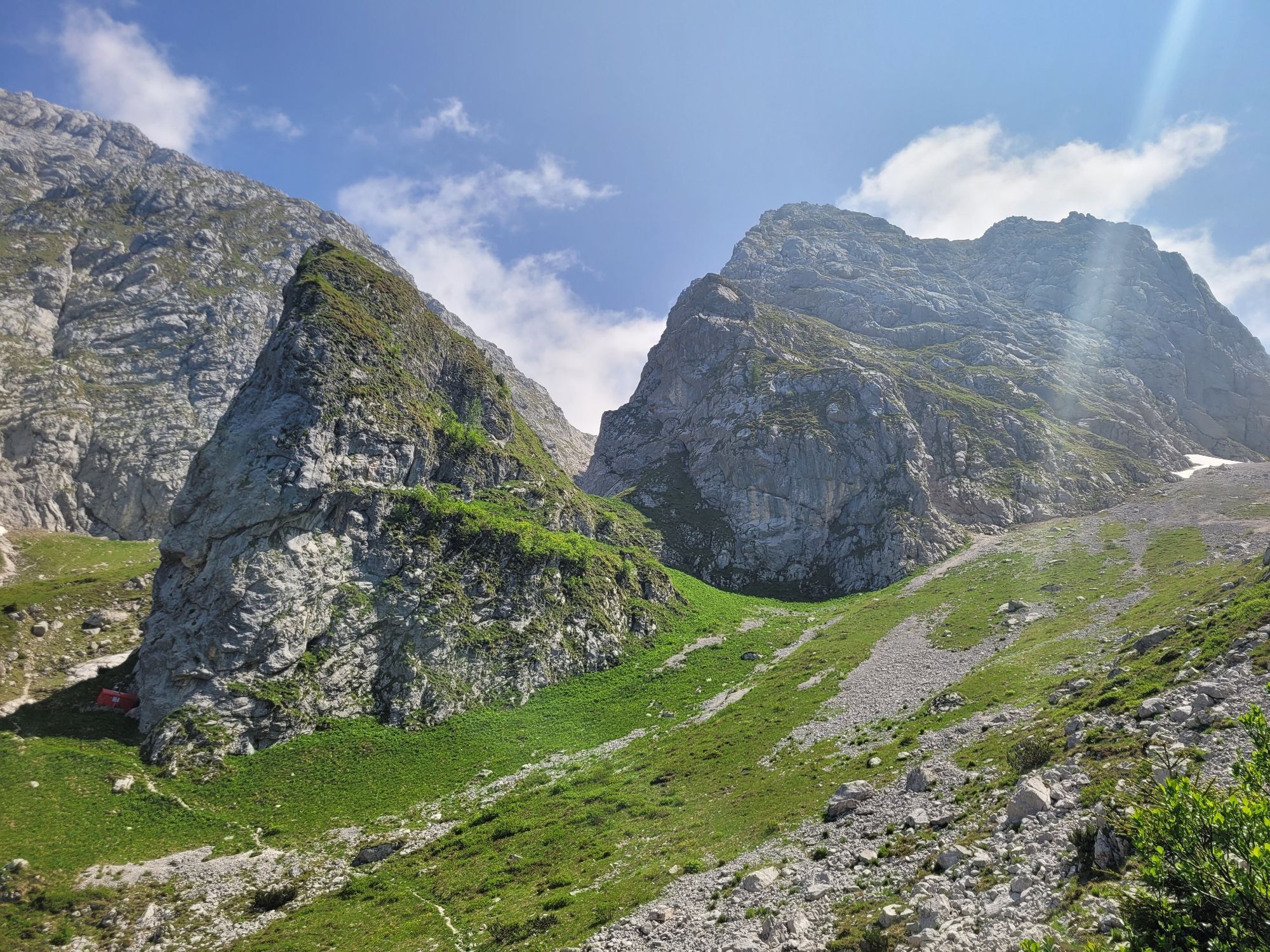
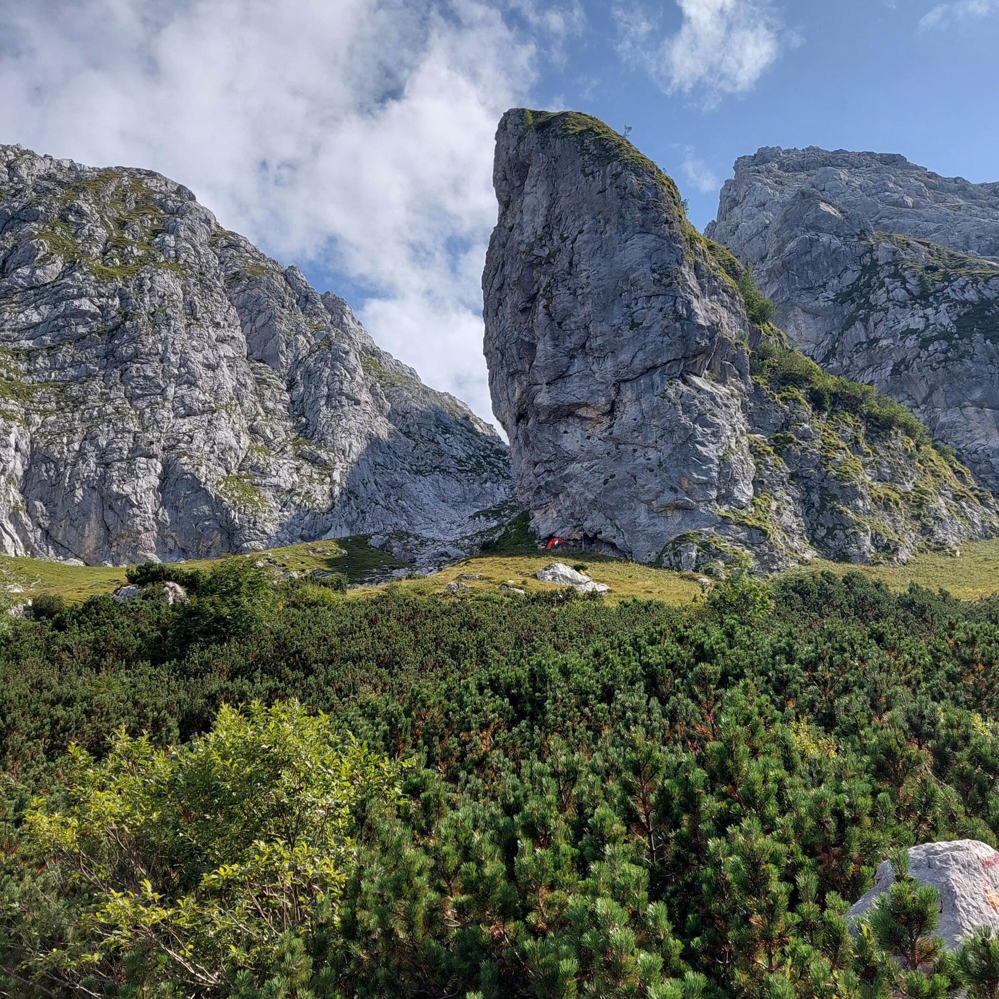
At an altitude of 1660m, you reach another junction. Turning left, in a few minutes you arrive at the F. Costantini bivouac, a rest point for those who want to follow the Alta Via Resiana. The bivouac, located under the large walls of Mulaz, offers a splendid view of the surrounding territories and a place to rest after the recently completed climb.
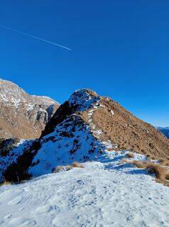
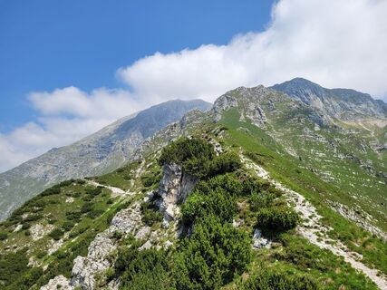
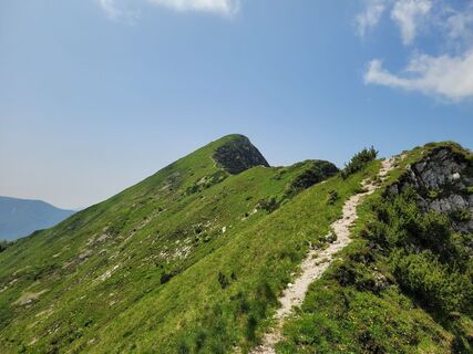
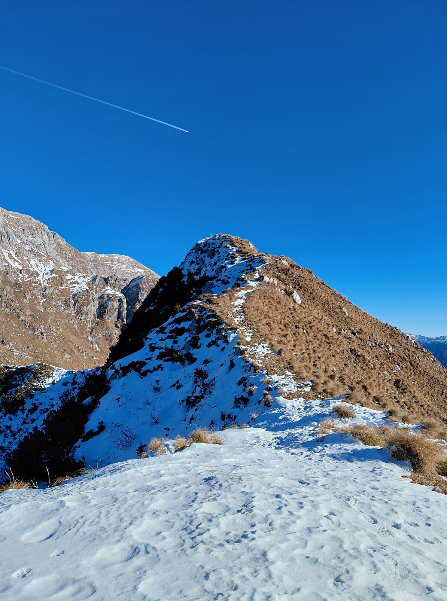
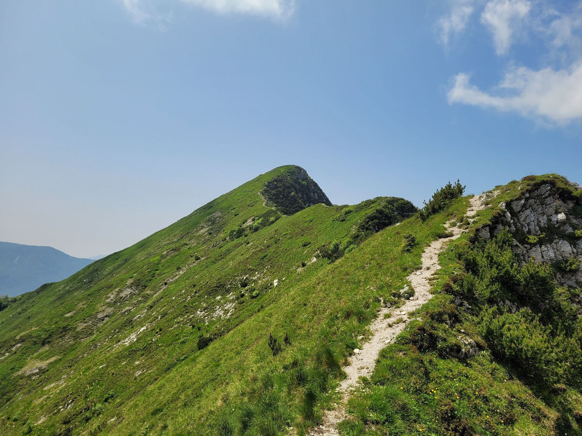
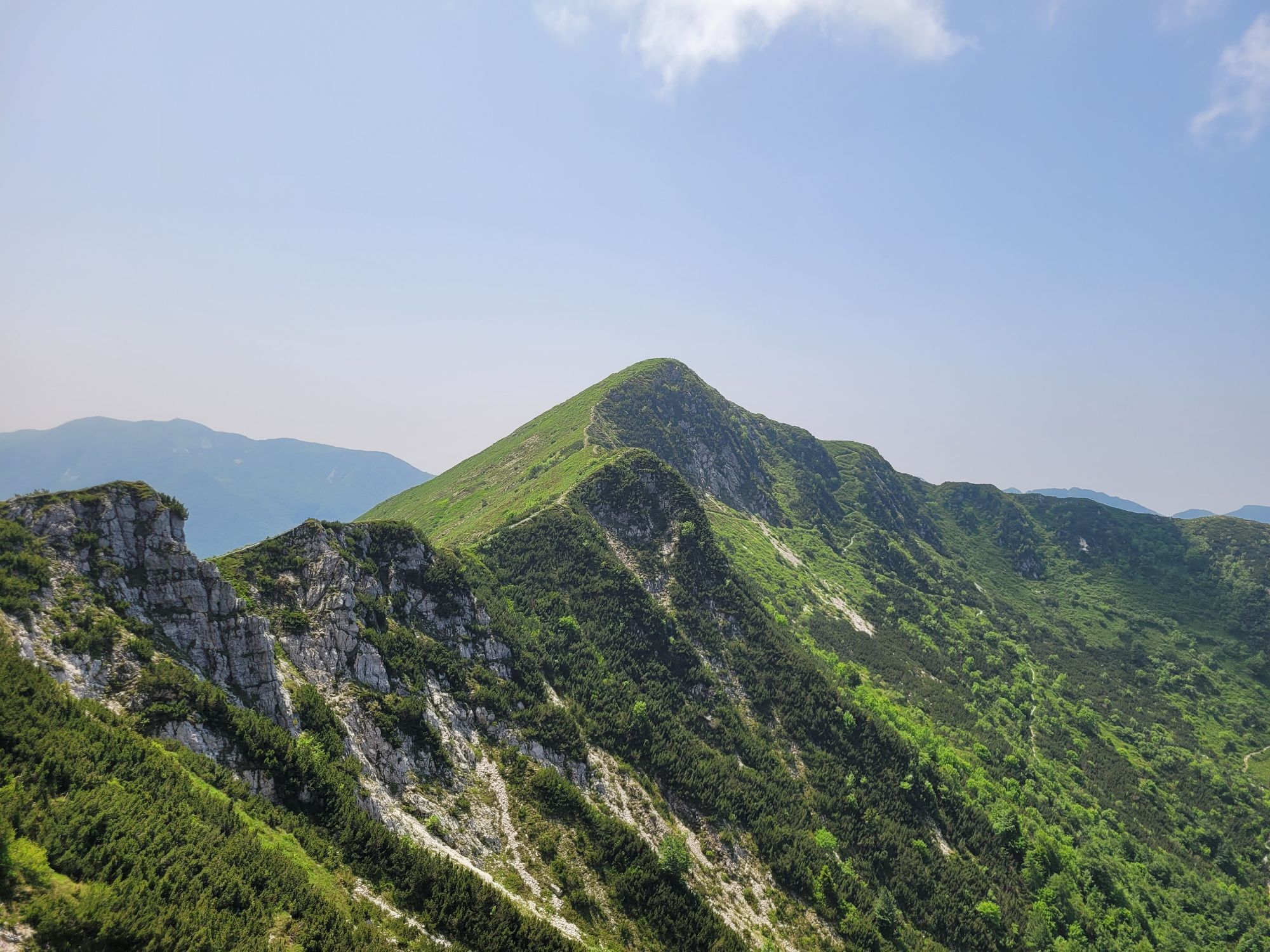
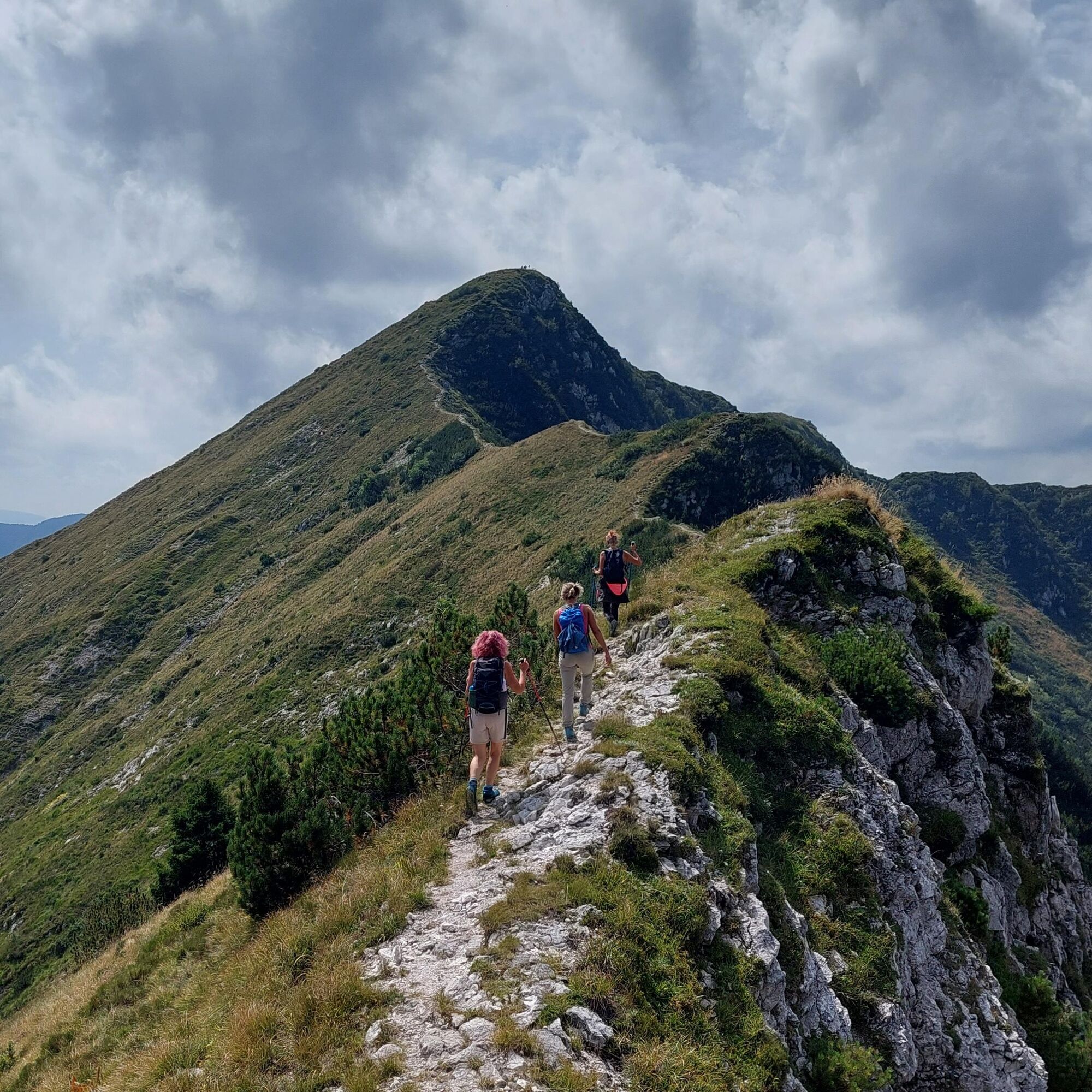
To reach the summit of Mount Guarda, go back to the junction at 1660m, from where you continue straight along trail CAI no. 731 which crosses the southwestern slopes of Mount Baba Piccola (be careful of some slippery sections). After almost 1 km, the most spectacular part of the route begins: the trail runs along a simple ridge, straddling Slovenia and Italy, with breathtaking views of the surrounding valleys and reaches the summit of Mount Guarda, after covering about one hundred meters of positive elevation gain.
A break at the summit is essential to admire the Isonzo valley to the east and the Resia valley to the west, being able to embrace with one glance almost the entire Julian Prealps Nature Park.
To complete the route, descend from the summit southwards until you reach a junction that allows you to take trail CAI no. 741, which leads to Malga Coot after about 2 km and 400m of descent. After refreshing at the malga, follow the service road for a few hundred meters and reach the parking lot again, thereby concluding the itinerary.
Áno
Áno
A suitable equipment for outdoor activities is recommended:
Rain jacket; Long pants; T-Shirt; Sweatshirt; Hiking shoes or boots; Hat; Water and snacks; First aid kit and sunscreen;In case of injuries, the number to call is 112 NUE
Ticks are present throughout the Friuli Venezia Giulia territory; therefore, it is recommended to inform yourself about prevention and protection techniques: Tick information Friuli Venezia Giulia region
The trail is not recommended after and during adverse weather conditions and is not recommended during the hottest hours of the summer.
The Malga Coot agritourism is conveniently reachable via SP42. From SS13-Pontebbana, heading towards Tarvisio, turn right at Resiutta and follow the signs to Stolvizza and then Malga Coot.
Malga Coot agritourism can also be reached from Tarcento, following SR646 towards Uccea. In Uccea, turn left following the signs to Sella Carnizza and then continue along the same road until passing the Lischiazze hamlet and reaching the junction with SP42. From here, turn right and continue to Stolvizza and then Malga Coot. PLEASE NOTE: the Uccea-Sella Carnizza road is often subject to safety works. Before following these directions, check if the road is open.
Bus
In the Resia Valley there are some local public transport bus lines. To know timetables and stops, view the pdf file at this link: click here or visit the website of TPL FVG.
Train
The nearest useful station is Carnia Station, more than 30km from the starting point of the itinerary.
There are no public transport lines that reach the starting point of the itinerary.
Large free parking available a 10-minute walk from the malga. GPS point
T3
Given the karst nature of the territory, it is recommended to bring enough water as none is available along the route.
It is recommended to carry out all waste and preserve the places crossed as best as possible.
Remember that collecting plant species or their parts is prohibited inside the Natural Park and can be subject to restrictions according to regional law L.R. 7/2009 in external areas. The list of protected species can be consulted at this link.
Remember that inside protected areas dogs must be kept on a leash.
A stop is recommended at the Malga Coot agritourism, where you can enjoy excellent dishes and buy local products.
Webové kamery z prehliadky
Obľúbené výlety v okolí
-
4,4
Kozjak Wasserfall und Soča
svetloTuristika 5,18 km -
4,3
Cima di Terra Rossa
Turistika 4,90 km -
4,8
Jof di Somdogna
strednáTuristika 15,8 km -
4,0
Boka Wasserfall
strednáTuristika 1,94 km -
5,0
Prestreljenik Window (2390 m) – dramatic view of the Western Julian Alps
strednáSkitour 14,5 km -
4,5
Entlang der Soca
svetloTuristika 8,09 km -
4,8
Tarvisio - Gorizia: z hôr do viníc (CX01)
strednáDiaľková cyklotrasa 155,8 km -
3,6
Sella Robon
Turistika 12,2 km -
3,2
Slap Kozjak (Wasserfall)
svetloTuristika 3,40 km -
5,0
Cima di Terrarossa
strednáVysoké turné 9,35 km

Turistika a stopovanie


Nenechajte si ujsť ponuky a inšpiráciu na ďalšiu dovolenku
Vaša e-mailová adresa bol pridaný do poštového zoznamu.