


TRAIL OF THE LOOKOUTS OF THE CAMPANILE DI VAL MONTANAIA
Úroveň náročnosti: T1
Fotografie našich používateľov

The path starts from the highest area of the Rifugio Pordenone parking lot. In the first section, it runs on the right side of the Val Montanaia watercourse, at the base of a rock face located at the edge...
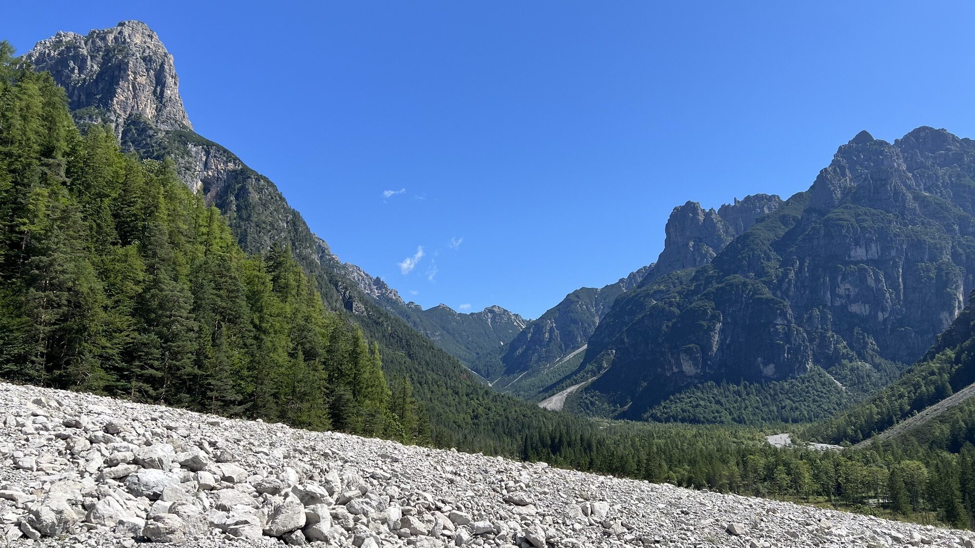
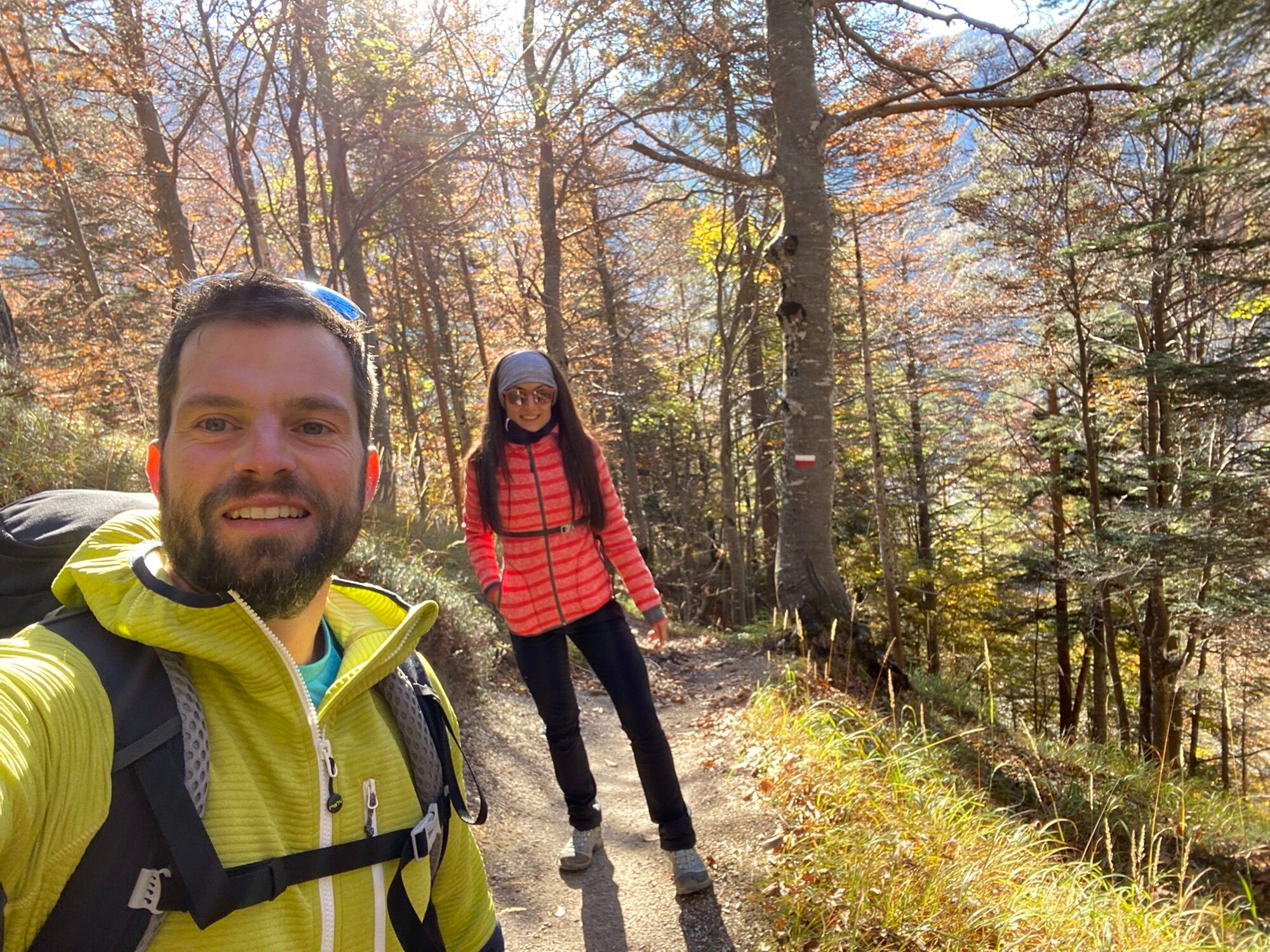
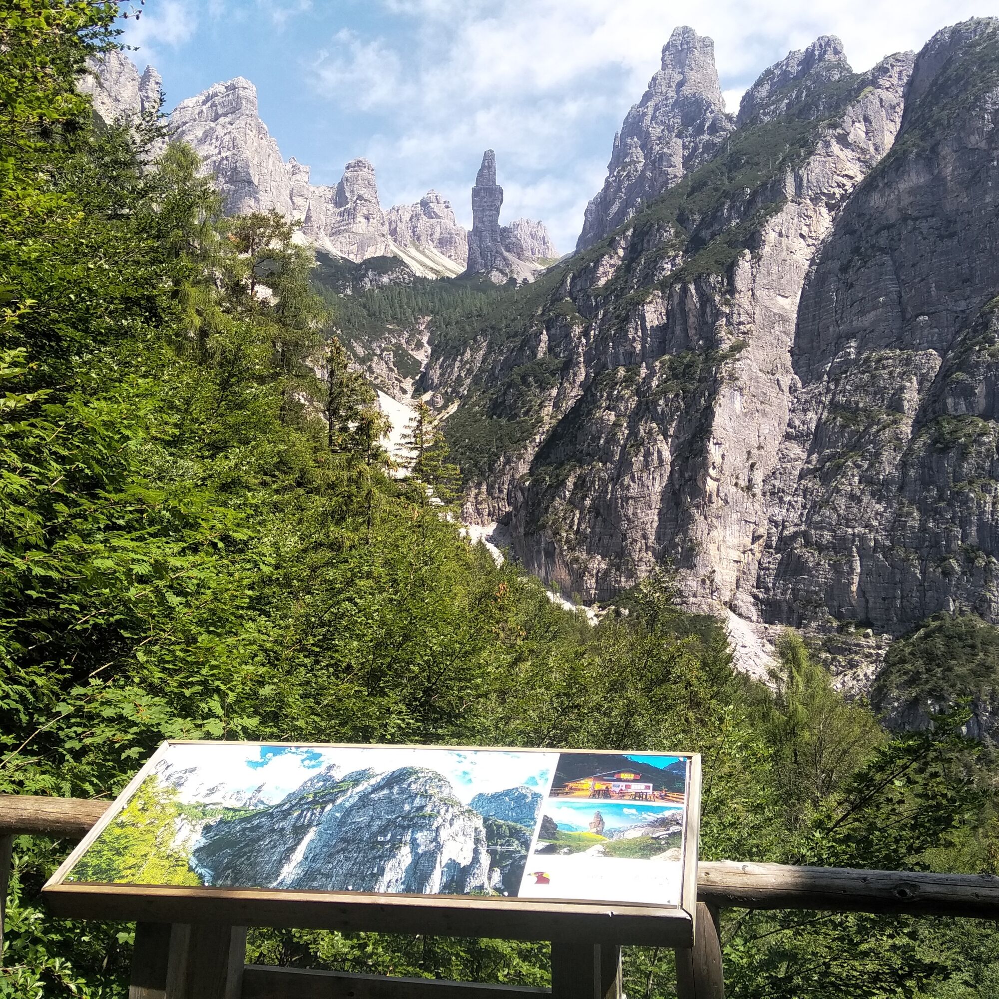
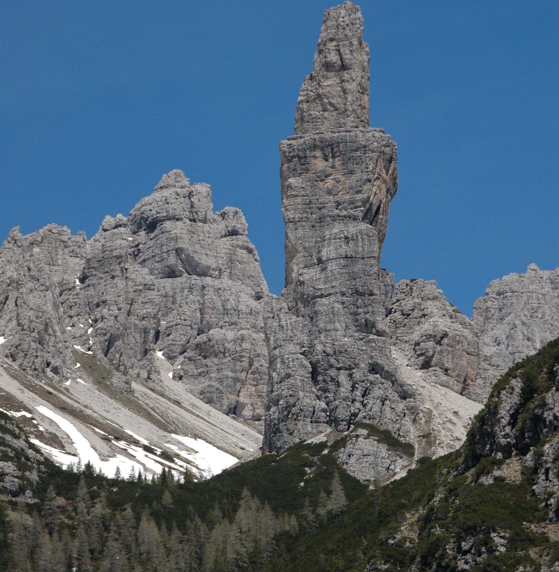
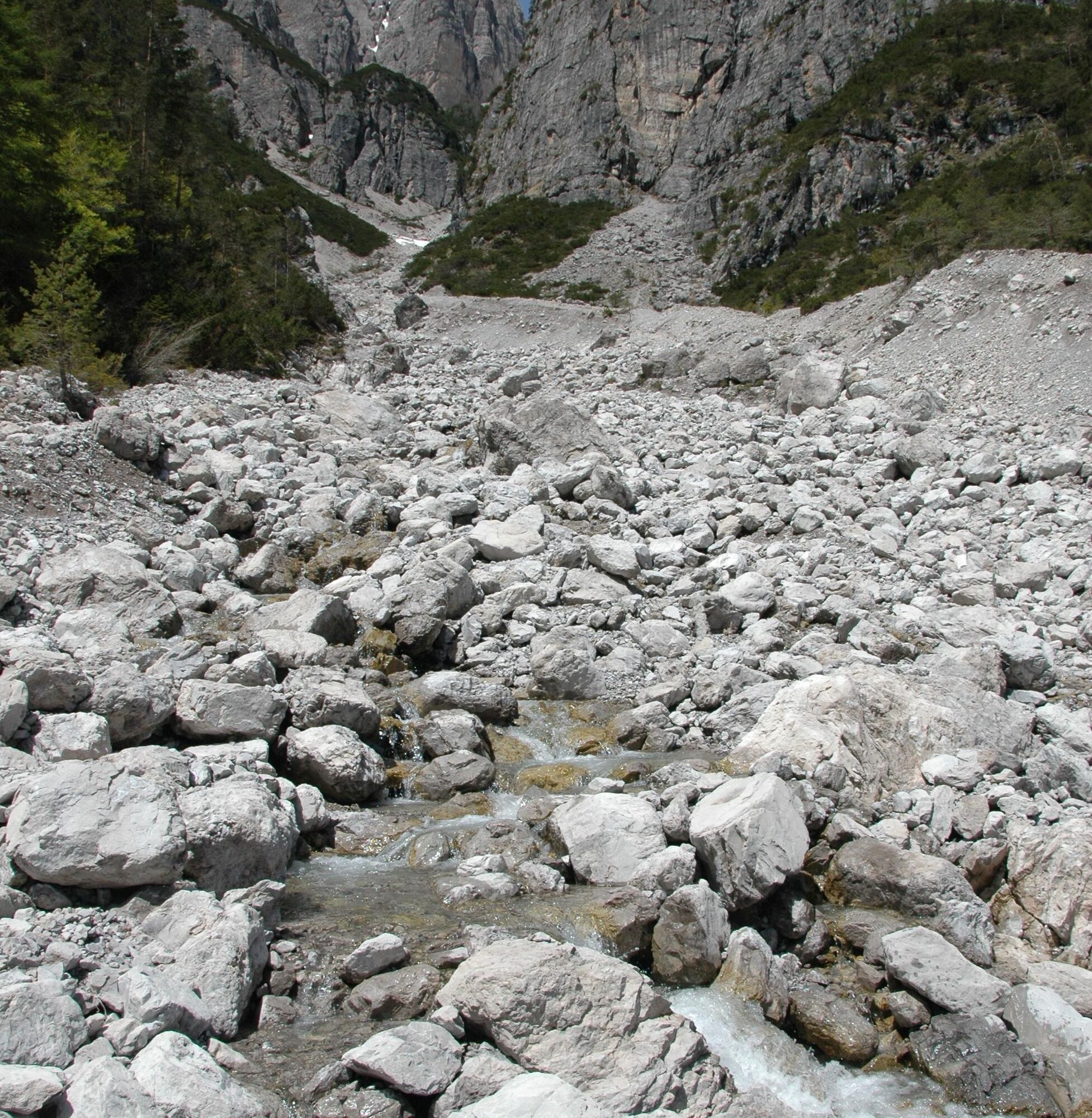
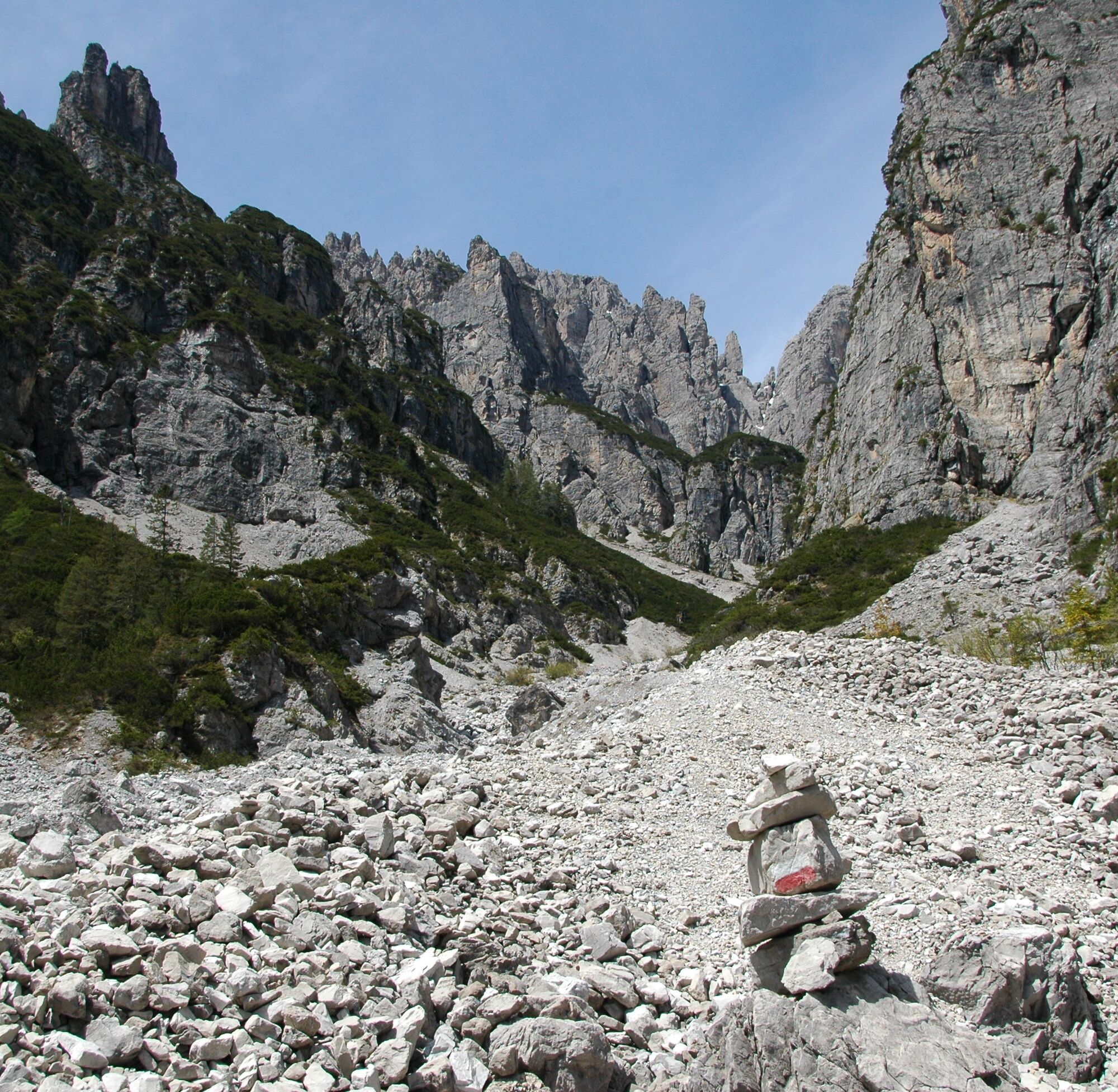
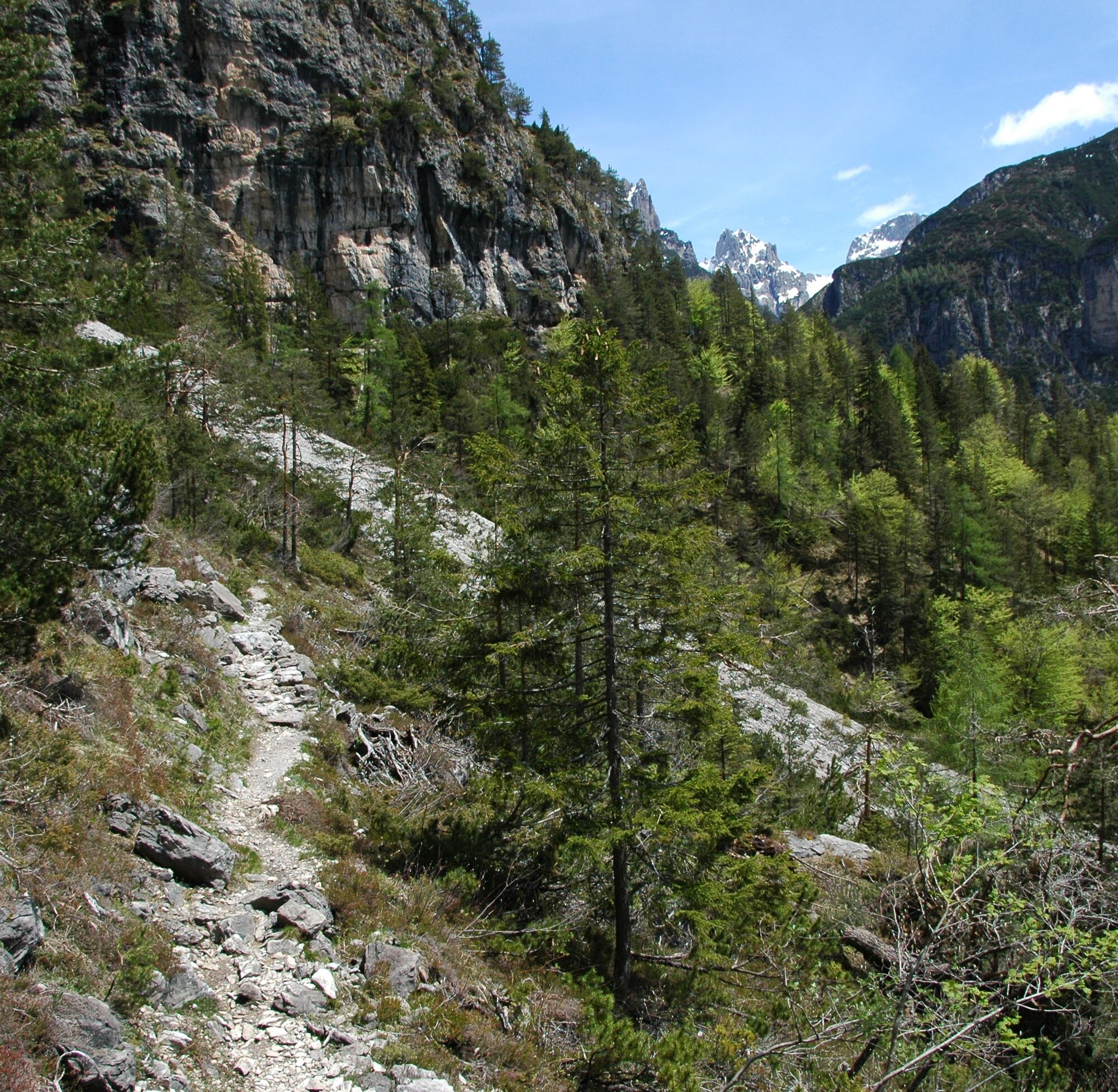
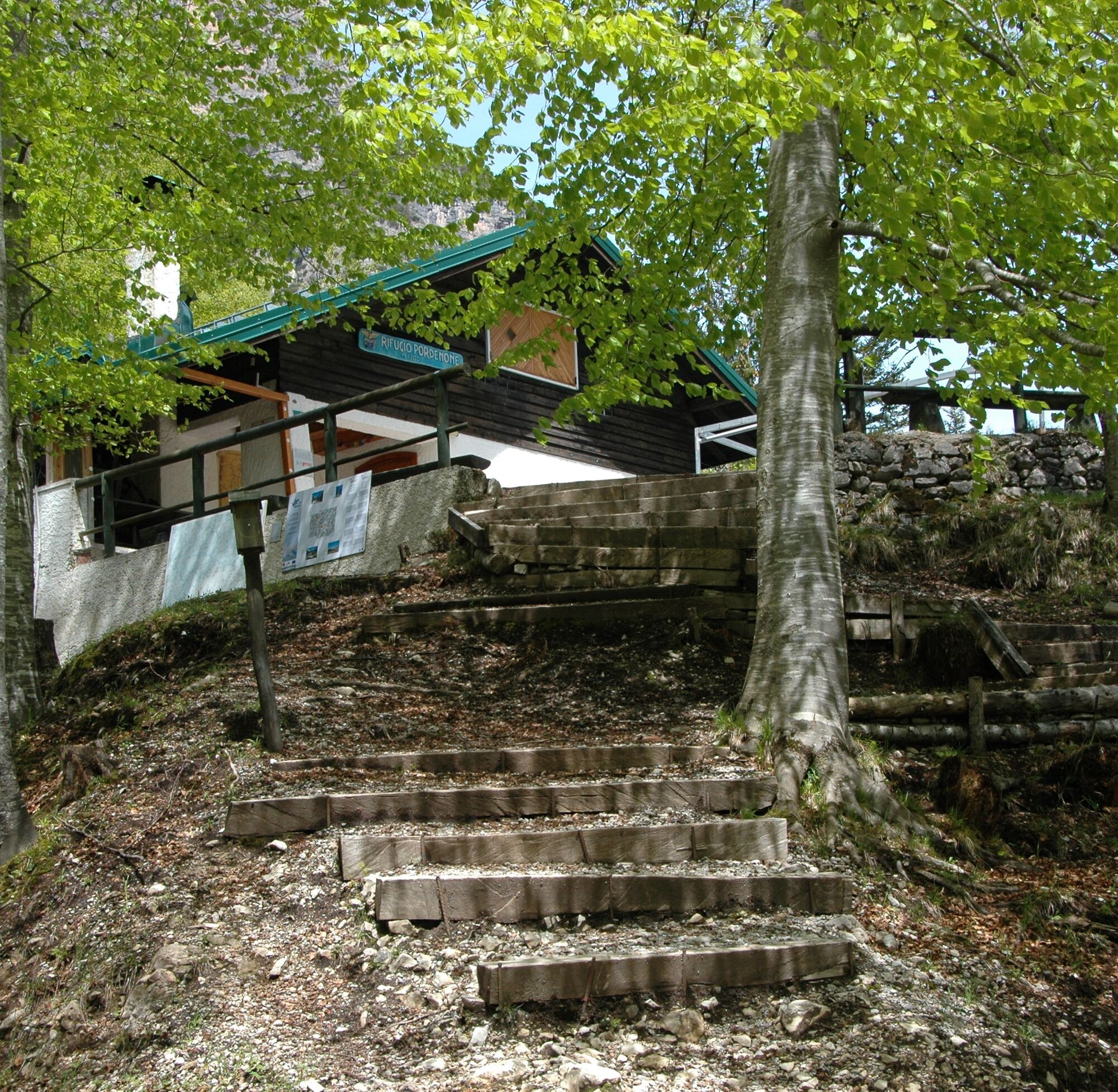
The path starts from the highest area of the Rifugio Pordenone parking lot. In the first section, it runs on the right side of the Val Montanaia watercourse, at the base of a rock face located at the edge of the large scree that fills the valley. After a few hundred meters, you reach a junction where you must turn left. The trail begins to climb along the slope with a series of switchbacks. It crosses a forest mainly composed of beech trees, also including firs and larches, where chamois are often spotted. After a relatively steep initial stretch, the slope eases, and the first viewpoint is reached. Continuing for another 5 minutes, you arrive at the second, larger viewpoint. These two lookouts allow observation of the Campanile della Val Montanaia: one of the rare examples of spire present in Friuli Venezia Giulia. About 300 meters high, it represents a “Dolomitic” morphology linked to erosive phenomena, especially those connected with glaciers that covered these valleys until about 10,000 years ago, shaping the current forms. You then descend on the trail climbed back to the junction; here, turn left to resume ascending Val Montanaia. After about a hundred meters, the trail reaches the scree and crosses it diagonally (marked by cairns), continuing upward. Upon reaching the opposite side, a directional arrow indicates the fork leading to Rifugio Pordenone. The path descends on the left side of the watercourse, moving away from the scree (which remains on the right) and enters the forest after about two hundred meters. The descent continues in the forest, steeper and with some switchbacks, until the refuge. From the refuge, the trail descends again toward the scree and, after crossing it, leads to the starting parking lot.

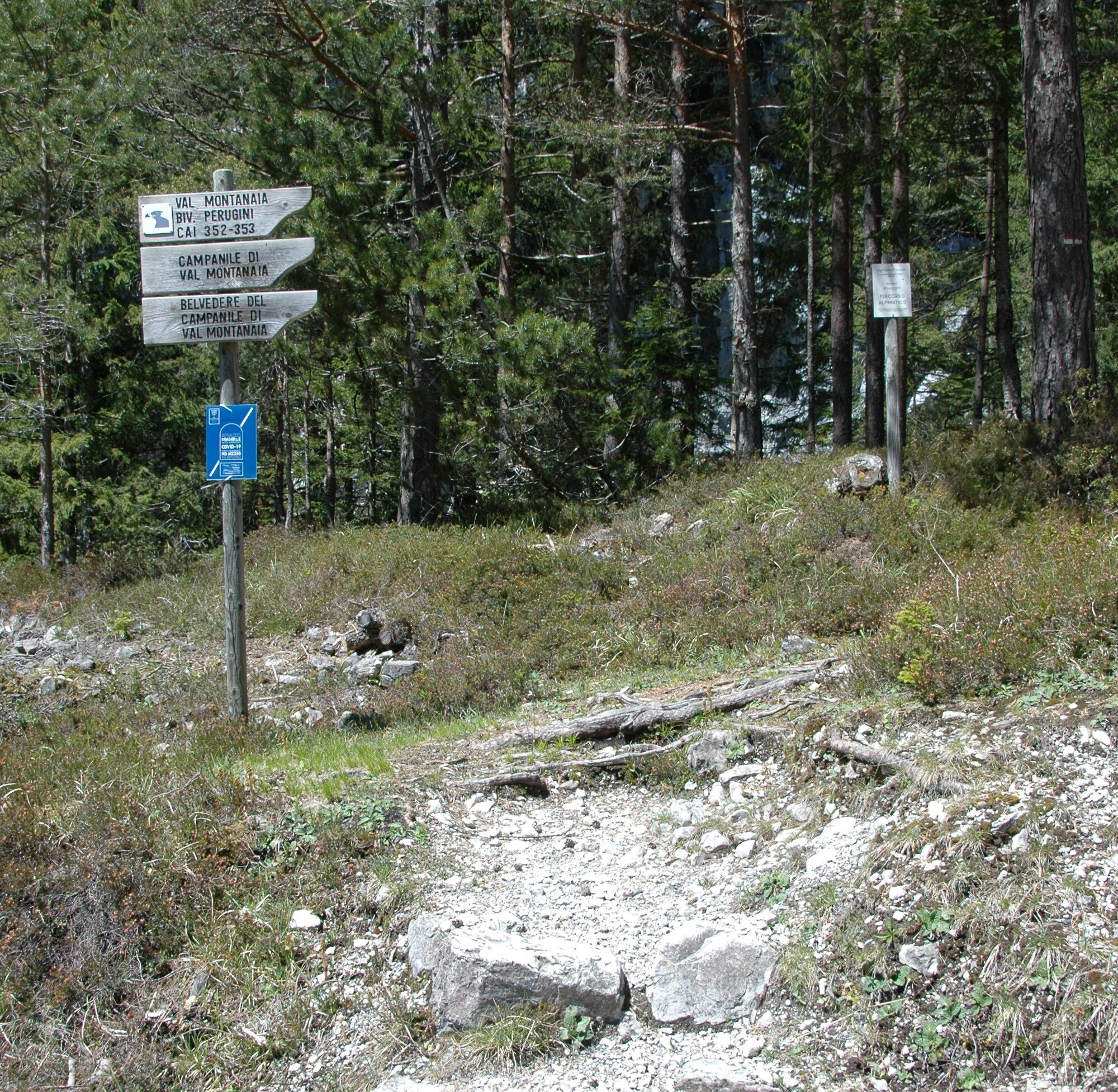

CAI trail markers 352 and 353
Áno
Áno
Hiking
T1
https://app.parcodolomitifriulane.it/itinerari/semplici-per-tutti/belvederi-del-campanile-di-val-montanaia/
Obľúbené výlety v okolí
-
5,0
Campanile di Val Montanaia a Bivacco Perugini
strednáTuristika 2,76 km -
4,0
Monte Resettum
ťažkéTuristika 15,0 km -
Mounts Bivera and Clap Savon from Casera Razzo, alpine ride
ťažkéTuristika 20,5 km -
4,5
GALVANA TRAIL
ťažkéTuristika 12,2 km -
Loop of the Friulian Dolomites from Forni di Sopra
strednádiaľková pešia trasa 34,7 km -
The multicolored campanili of Mount Zauf
strednáTuristika 14,2 km -
Anello delle Dolomiti Friulane 3 Rifugio Pordenone - Rifugio Padova
strednáTuristika 7,04 km -
Urtisiel and Canpuros, Dolomitic wonders
strednáTuristika 13,5 km -
Col dei Piais, San Gualberto Crest Path and new Truoi de Thep
strednáTuristika 12,4 km -
BIVACCO MARCHI-GRANZOTTO DA FORNI DI SOPRA
ťažkéTuristika 10,3 km
Turistika a stopovanie


Nenechajte si ujsť ponuky a inšpiráciu na ďalšiu dovolenku
Vaša e-mailová adresa bol pridaný do poštového zoznamu.