


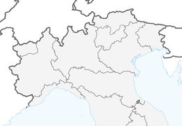


20 PIANI DEL CRISTO from borgata Puiche - Sappada
This proposal is little known and consequently little frequented. Instead, it is especially valid from a naturalistic point of view, since the route (which has changed a lot in the last stretch after the...
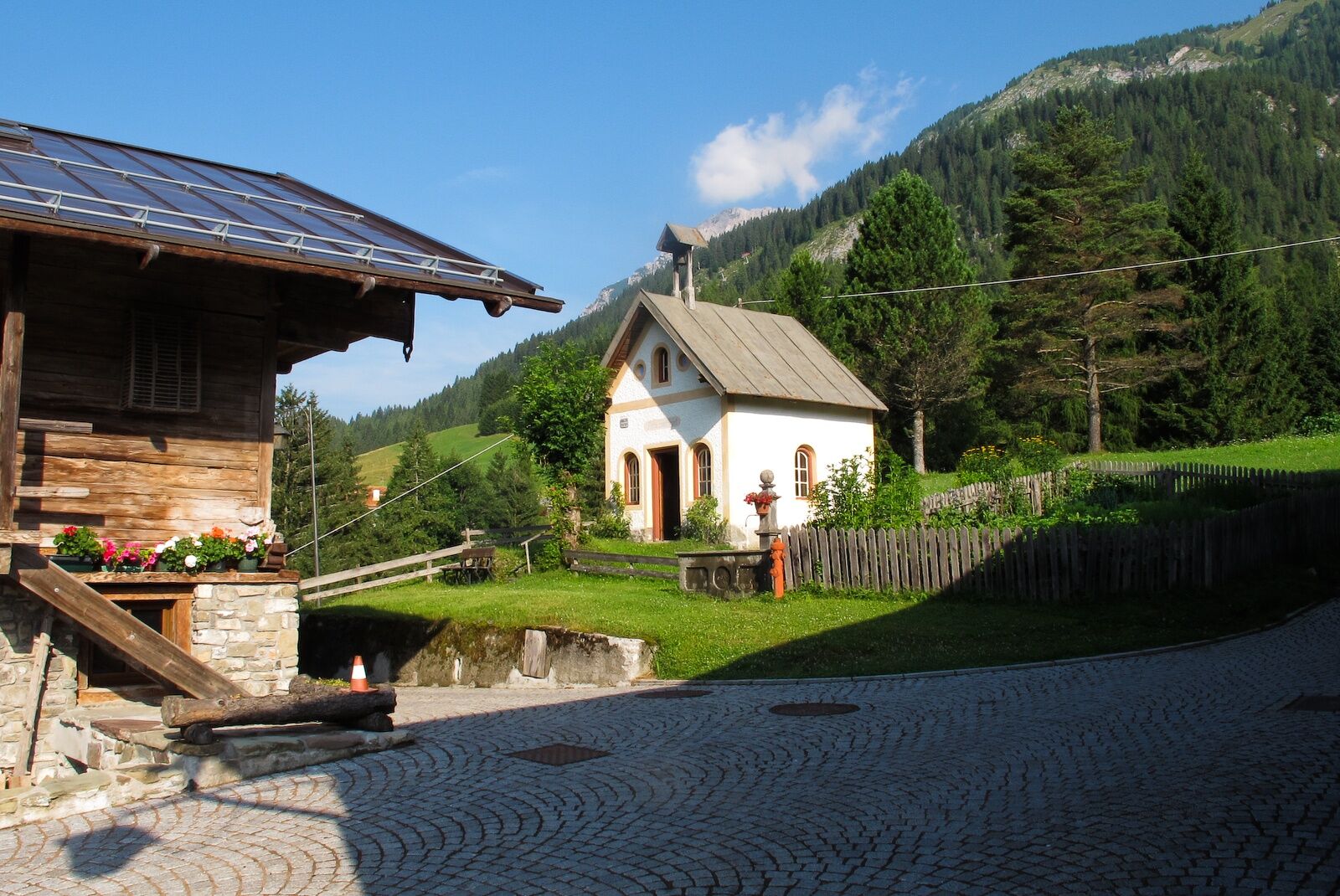
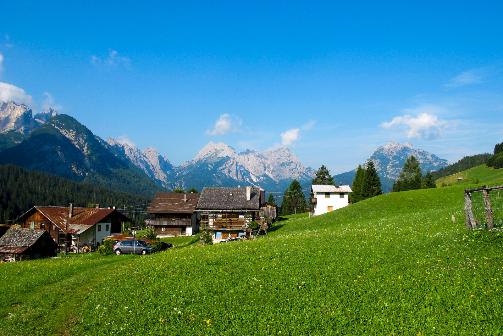
This proposal is little known and consequently little frequented. Instead, it is especially valid from a naturalistic point of view, since the route (which has changed a lot in the last stretch after the construction of a wide forest track) runs through a considerable variety of environments: vast meadows dotted here and there with huts, babbling streams, cool woods. Another peculiarity you will surely appreciate is the silence that will accompany you for almost the entire path, very sunny in the first part, a bit shaded in the second when the rapid descent to the Piani del Cristo begins.
Author: © Giovanni Borella
C.A.I. Sappada/Plodn
Interreg V Italy-Austria - CLLD Dolomiti Live.Project “Safe Mountain – Mountain Adventure” ITAT 4019 CUP B43J16000270004

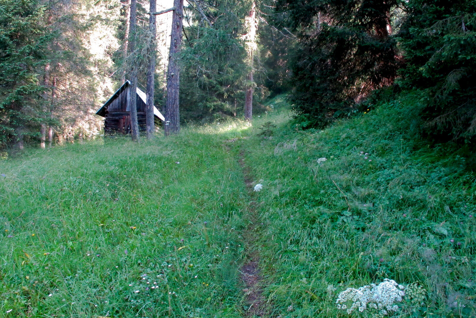

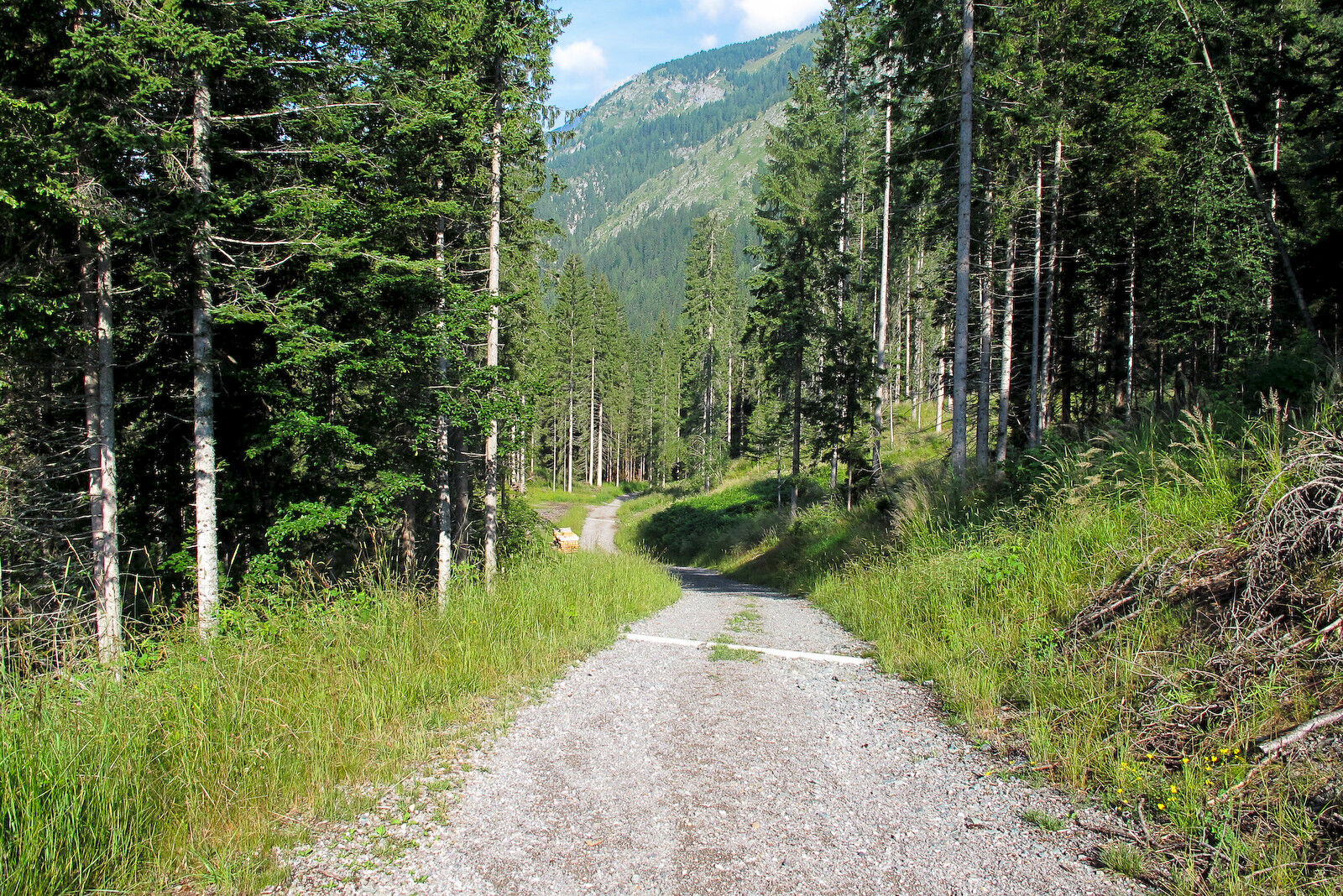
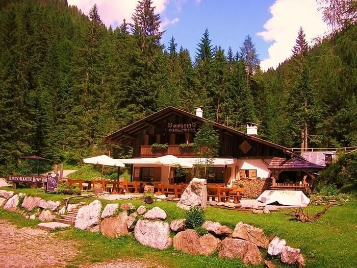

From the last house of the lovely, isolated borgata Puiche, a dirt road pushes northeast among the meadows, crosses the Fauner stream and, becoming a mule track, gently climbs towards a wooded hill, then reaching a vast plateau called Prati di Cretta above the homonymous borgata. The path further on leads to a large clearing with a hut. Here, ignoring a dirt road that descends to the right (south), you continue straight on the path which, after crossing the meadows, enters a forest, first dense, then gradually sparser up to the top of a ridge where a wide forest road begins. Forward on this with a slight ascent, then with some ups and downs, until emerging exactly where the first series of hairpins on provincial road no. 22 of the Sesis Valley ends, a short distance from the destination.
The descent is either by the same route or, alternatively, you can descend to Cima Sappada via route 19.
Author: © Giovanni Borella
Even if the hike is simple (for example, a route in search of mushrooms) always use suitable footwear with non-slip treaded soles. Also always carry supplementary clothing with you for any weather changes.
Difficulty: T
Hours: ascent 1:00-1:15 descent 0:30-0:45 total 1:30-2:00
MARKING: 139
DIFFICULTY SCALE
In the technical sheet of each route, the acronyms commonly used in mountain guides (T- E - EE- EEA - A) are present. Some routes may have a double acronym (e.g. T/E or E/EE) as they present characteristics of both categories
T (tourist) indicates routes almost always short and easy that run on forest roads and/or well-marked or clearly visible paths, which do not require particular training
E (hiking) indicates routes, sometimes rather long, that wind along mule tracks and/or paths often above 2000 meters, visible but not always with trail markers. They do not have significant difficulties, but occasionally may present some slightly exposed or awkward stretches or single passages. Suitable equipment, a minimum of experience and training are required
EE (for experienced hikers) indicates routes generally above 2000 meters altitude, which may run on treacherous terrain and/or in rugged areas, often characterized by exposed and/or equipped passages or stretches, sometimes on rocks with difficulties of grade 1. Experience, surefootedness, sense of direction, good equipment, and physical and psychological preparation are required.
EEA (for experienced hikers with equipment) indicates routes equipped with metal cables, brackets, ladders. Exposure is almost always constant. Experience, training and appropriate equipment including a helmet and via ferrata set are mandatory. Gloves are useful.
A (for alpinists) indicates rock routes leading to peaks with low alpine difficulties (1st/2nd grade). Technical skills, good experience, physical preparation, and suitable equipment (helmet, some slings, and always useful a 20-30 meter rope) are required
WARNINGS
The information below cannot replace the presence of a professional alpine guide The mountain is a wonderful environment but not free of risks, so it must always be approached with the utmost caution In the Warnings of the Guides of the Mountains of Italy C.A.I./T.C.I. it is stated that difficulty classifications “remain essentially indicative and should be considered as such”, being a subjective element. This also applies to the routes proposed on the site The classification of difficulties and the traversal times refer to a hiker/alpinist of average level regarding training, experience, ability, and conditioning When undertaking a route, carefully evaluate the difficulties, your abilities, and your level of training Before starting a route (which is not a short walk) it is good practice: 1) to consult the Dolomiti Meteo of Arpav, connecting to the website http://www.arpa.veneto.it or calling 049 8239399 (Option 2). The bulletin, unlike national weather bulletins, offers a rather reliable local forecast. 2) to get information from the Tourist Office, the local C.A.I. section, the alpine guides, the refuge operators. Indeed, the passability status of a route and its difficulty level may undergo significant changes even in a very short time due to natural events (landslides, bad weather) and/or contingent situations (deterioration of trail signs, fixed equipment, presence of residual snowfields, etc.) The mobile phone can give a false sense of security, because it should be noted that there are areas without phone coverage In the unfortunate event of an accident, illness, inability to continue, contact only and exclusively SUEM 118Obľúbené výlety v okolí
-
4,5
Karnischer Höhenweg – Etappe 4: Hochweißsteinhaus – Wolayersee Hütte
ťažkédiaľková pešia trasa 15,9 km -
4,7
Obergail - Obergailer Alm - Obergailer Lake - Enderberg hut - Source for Health & Peace - Madonna circular hiking route - Obergail
strednáTuristika 11,4 km -
4,9
Karnischer Hauptkamm - Hohe Warte 2.780m - Hike and Bike
ťažkéHorská turistika 19,5 km -
5,0
Porzehütte (1.942 m)
svetloTuristika 9,01 km -
4,3
Mountainbiketour von der Hubertuskapelle zum Wolayersee
ťažkéMountainbike 9,06 km -
5,0
Carnic altitude trail. Stage 4: Porzehütte – Hochweißsteinhaus
ťažkéTuristika 17,5 km -
3,8
Karnischer Höhenweg KHW 403 - "Weg des Friedens"
strednáTuristika 46,7 km -
3,8
Circular hike Obergail - Gamskofel - Obergail Alm - Obergail
strednáTuristika 13 km -
2,0
Porzehütte/Tilliacher Joch am Karnischen Kamm
strednáMountainbike 8,99 km -
5,0
Valentin-Wolayersee-Runde
strednáTuristika 12,4 km

Turistika a stopovanie


Nenechajte si ujsť ponuky a inšpiráciu na ďalšiu dovolenku
Vaša e-mailová adresa bol pridaný do poštového zoznamu.