


JULIANA TRAIL: stage 13 Kobarid – Bovec
Úroveň náročnosti: T1
Fotografie našich používateľov
-
 © TakuhiroVytvorené dňa 01.05.2026
 -
 © TakuhiroVytvorené dňa 01.05.2026
 -

 © Marusa TopolovecVytvorené dňa 25.04.2026
 -
 © Sándor ZsilkaVytvorené dňa 08.06.2025
 -
 © André ZänkerVytvorené dňa 03.07.2024
 -
 © André ZänkerVytvorené dňa 03.07.2024
 -
 © André ZänkerVytvorené dňa 03.07.2024
 -
 © Bogdan LapajneVytvorené dňa 02.05.2026
 -
 © Gianberto ZilliVytvorené dňa 08.10.2025
 -

 © ajkuehnVytvorené dňa 20.09.2025
 -
 © WeingartnerhVytvorené dňa 14.08.2025
 -
 © WeingartnerhVytvorené dňa 14.08.2025
 -
 © WeingartnerhVytvorené dňa 14.08.2025
 -
 © NicoVytvorené dňa 20.07.2025
 -
 © NicoVytvorené dňa 20.07.2025
 -
 © NicoVytvorené dňa 20.07.2025
 -
 © NicoVytvorené dňa 29.06.2025
 -
 © Mario WetzlVytvorené dňa 25.06.2025
 -
 © Mario WetzlVytvorené dňa 25.06.2025
 -
 © Mario WetzlVytvorené dňa 25.06.2025
 -
 © Mario WetzlVytvorené dňa 25.06.2025
 -

 © Ulli RVytvorené dňa 14.07.2024
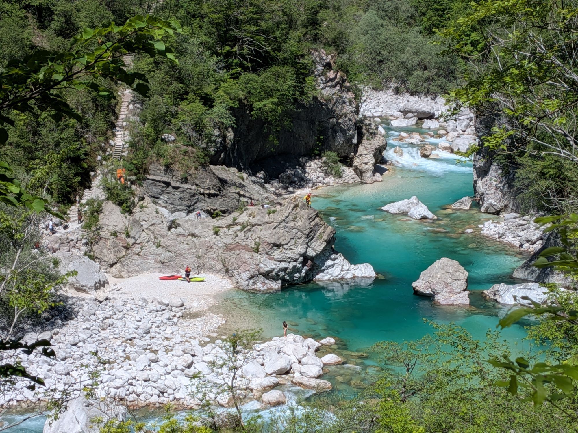

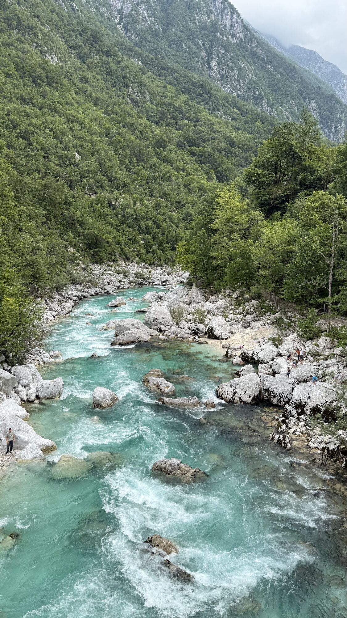


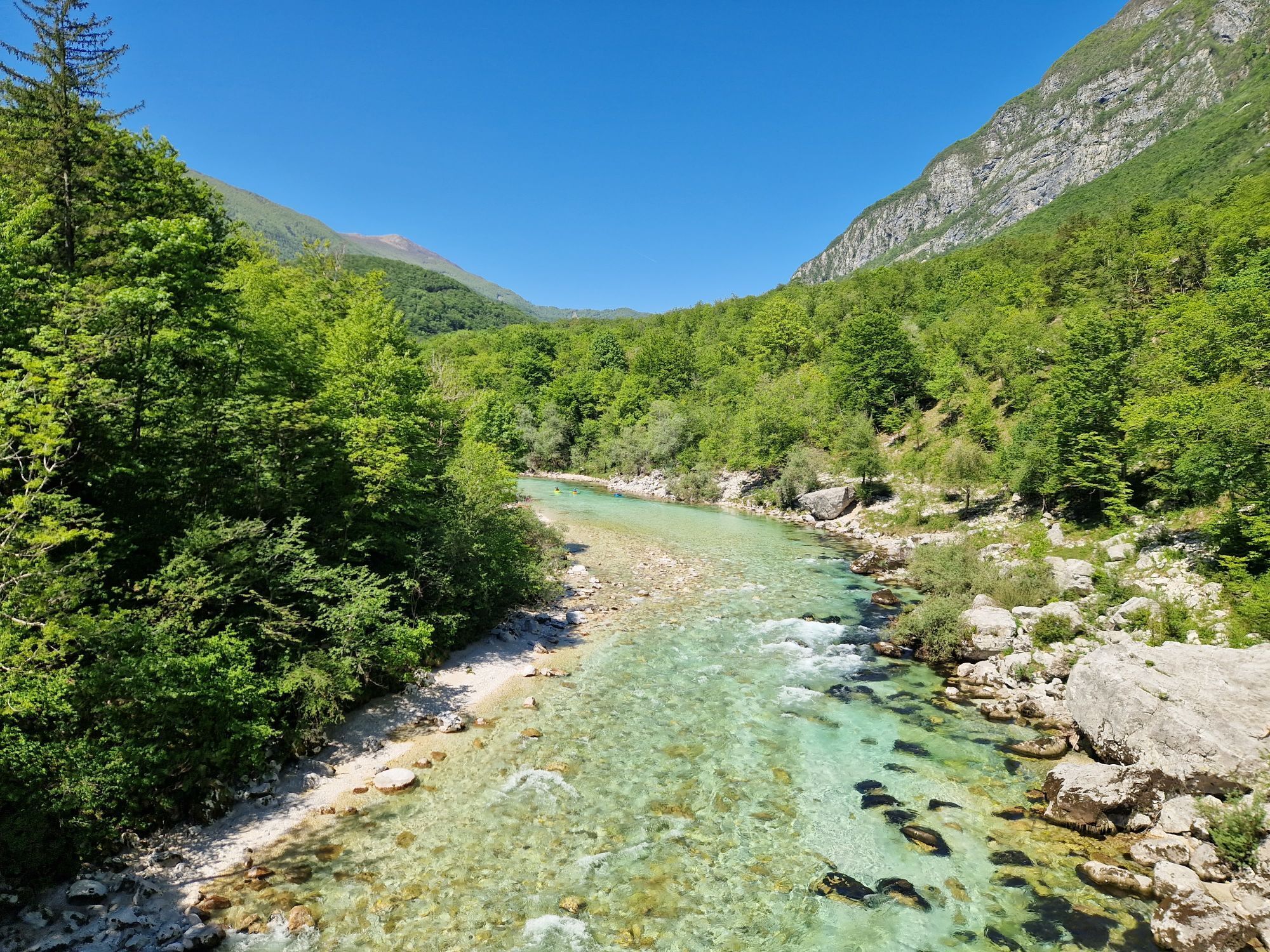

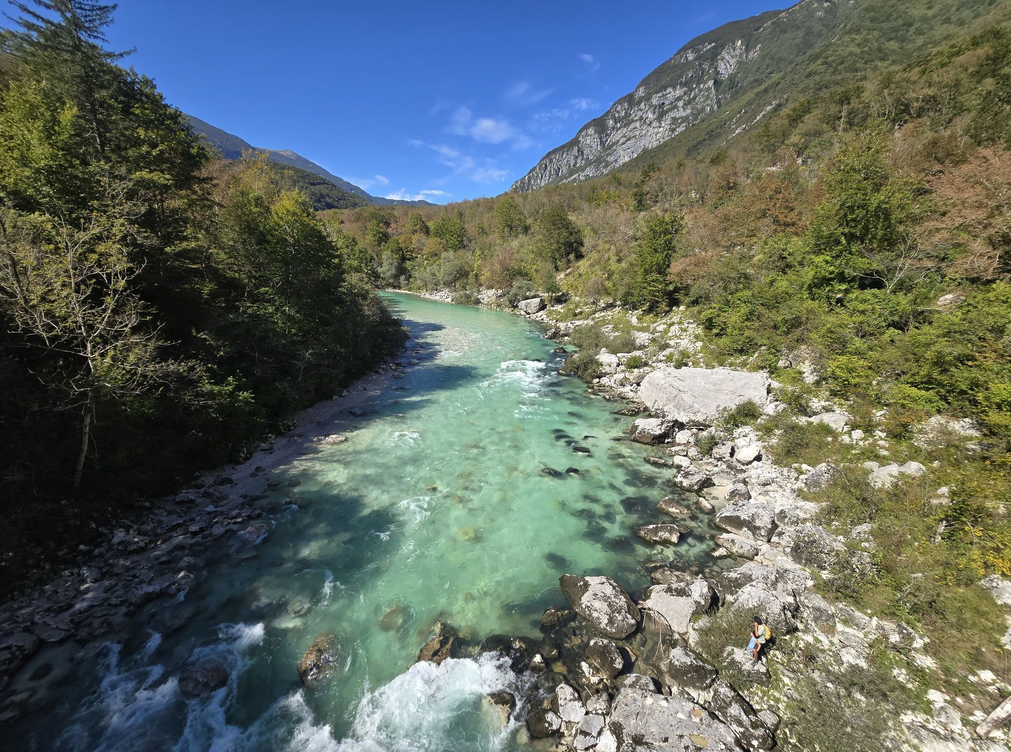

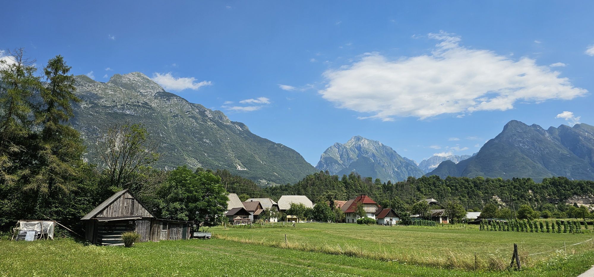


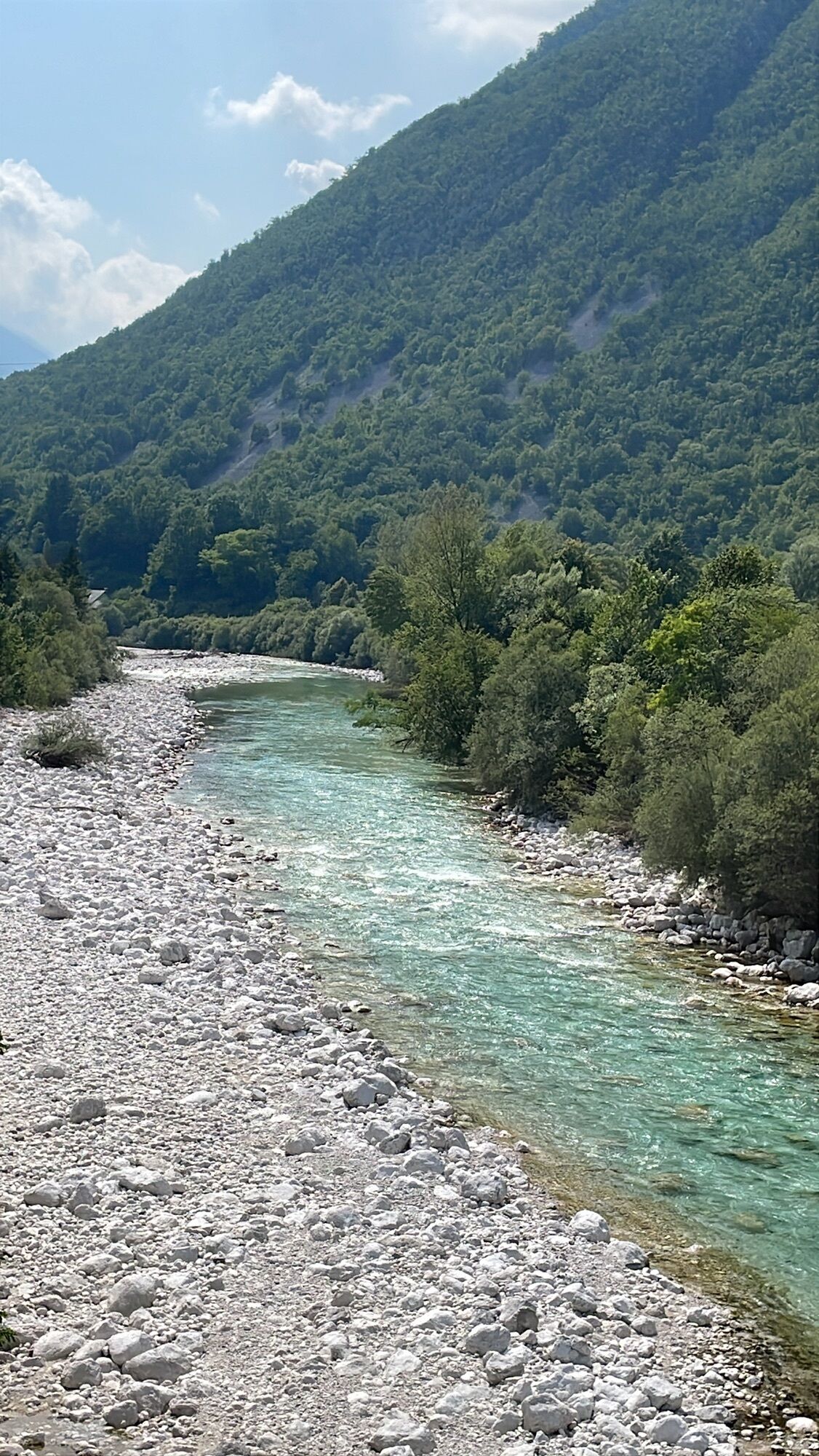
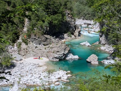
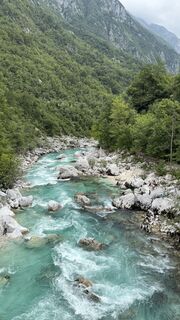
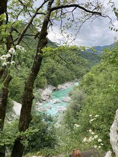
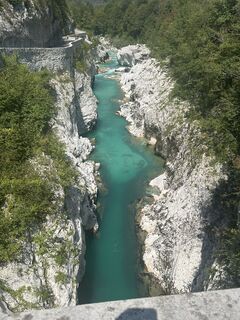
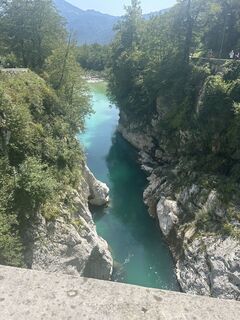
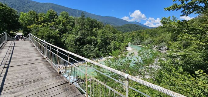
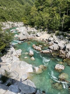
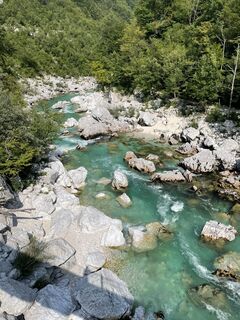
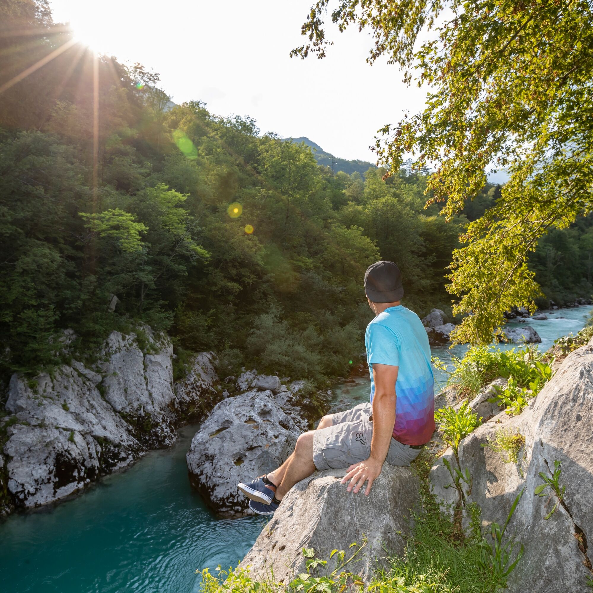
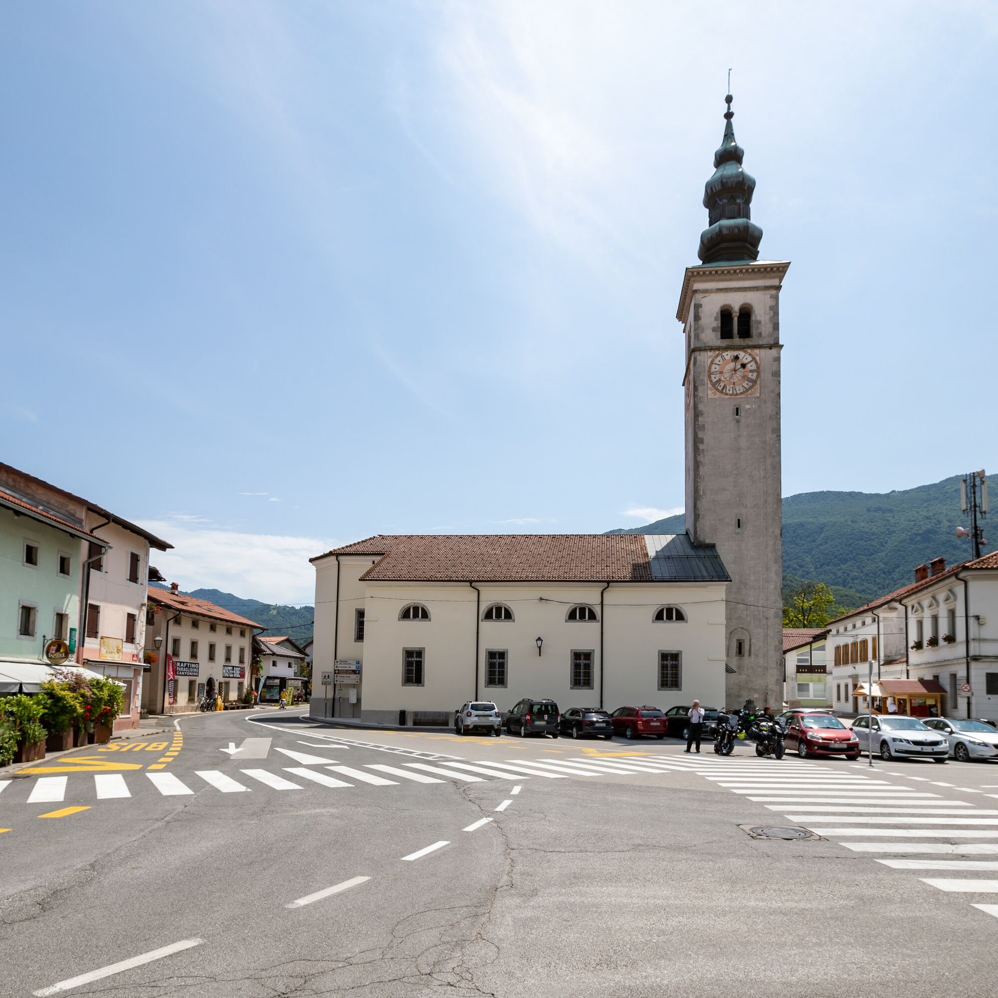
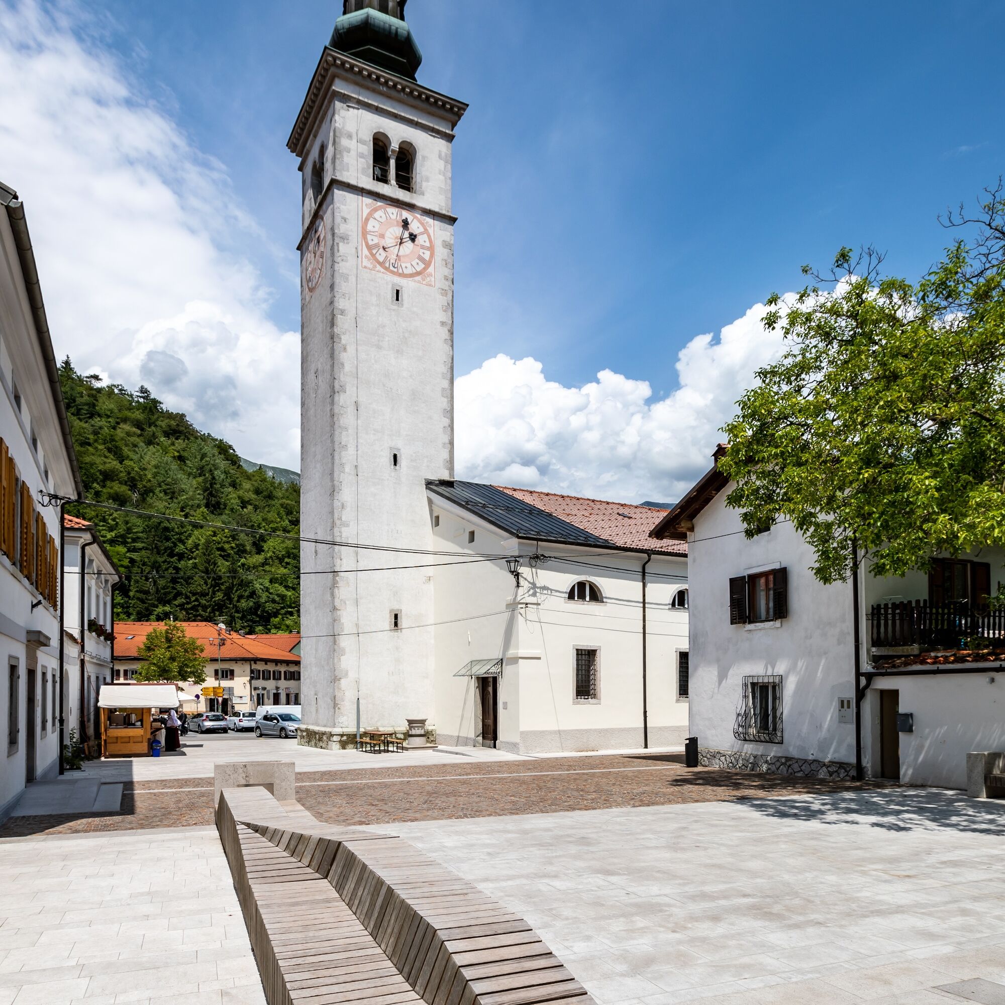
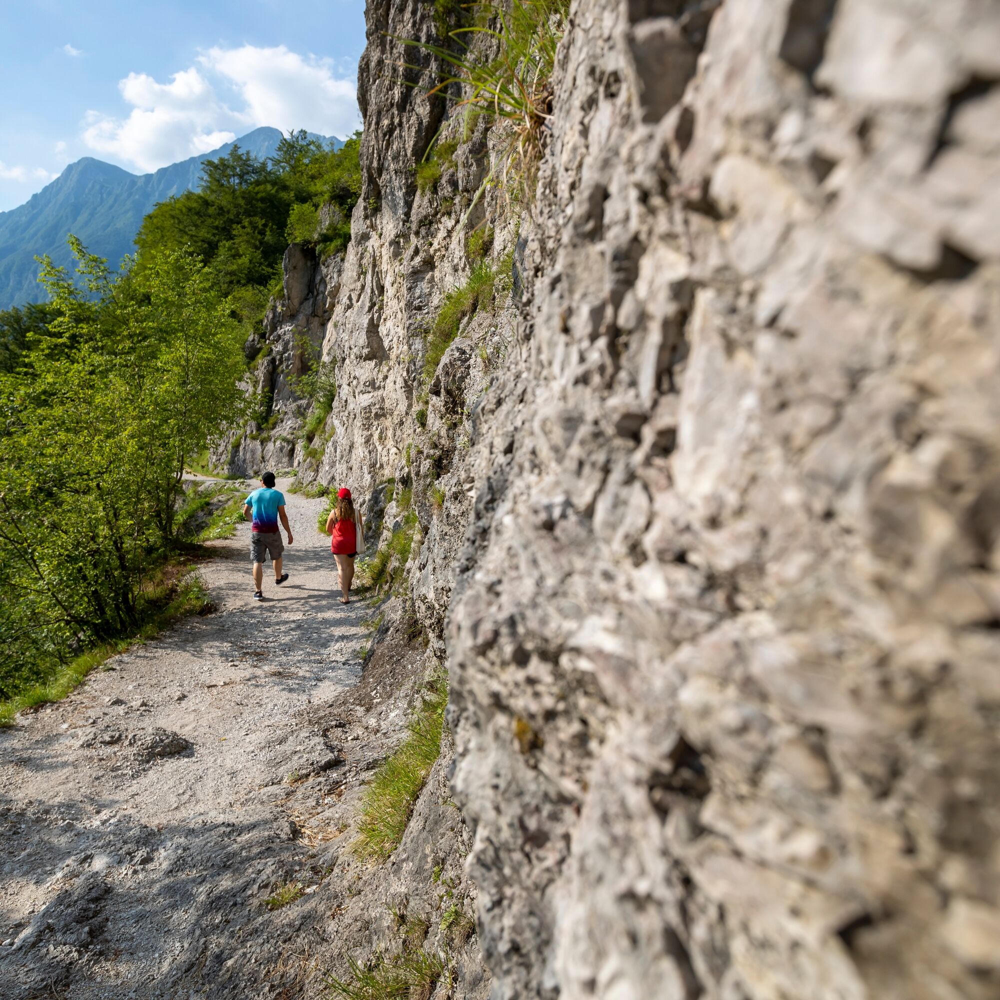
The stage between Kobarid and Bovec takes you from the soft region of Primorska back into the sharply incised mountain world. Just after Kobarid the valley changes dramatically; the formerly wide riverbed...
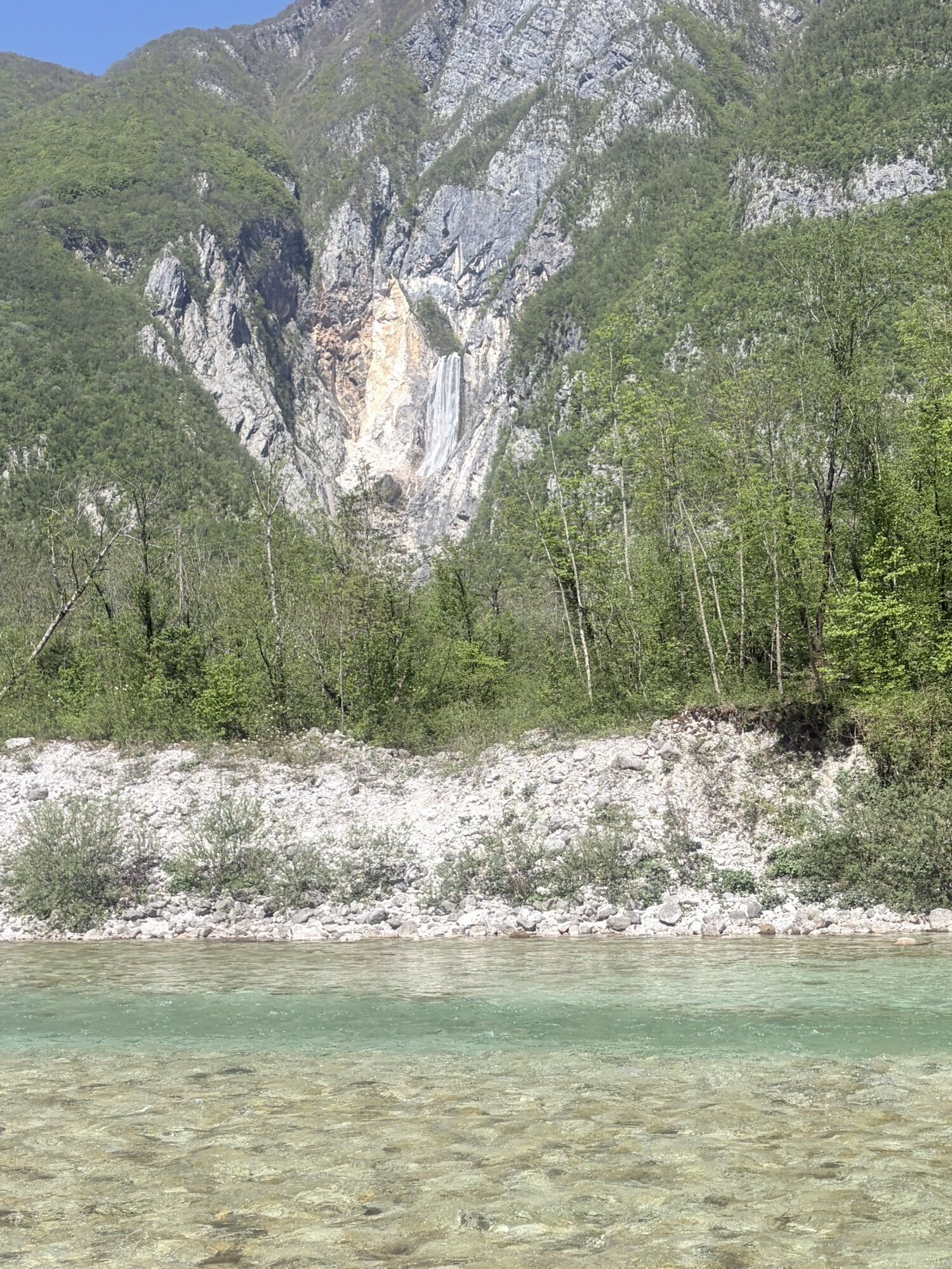
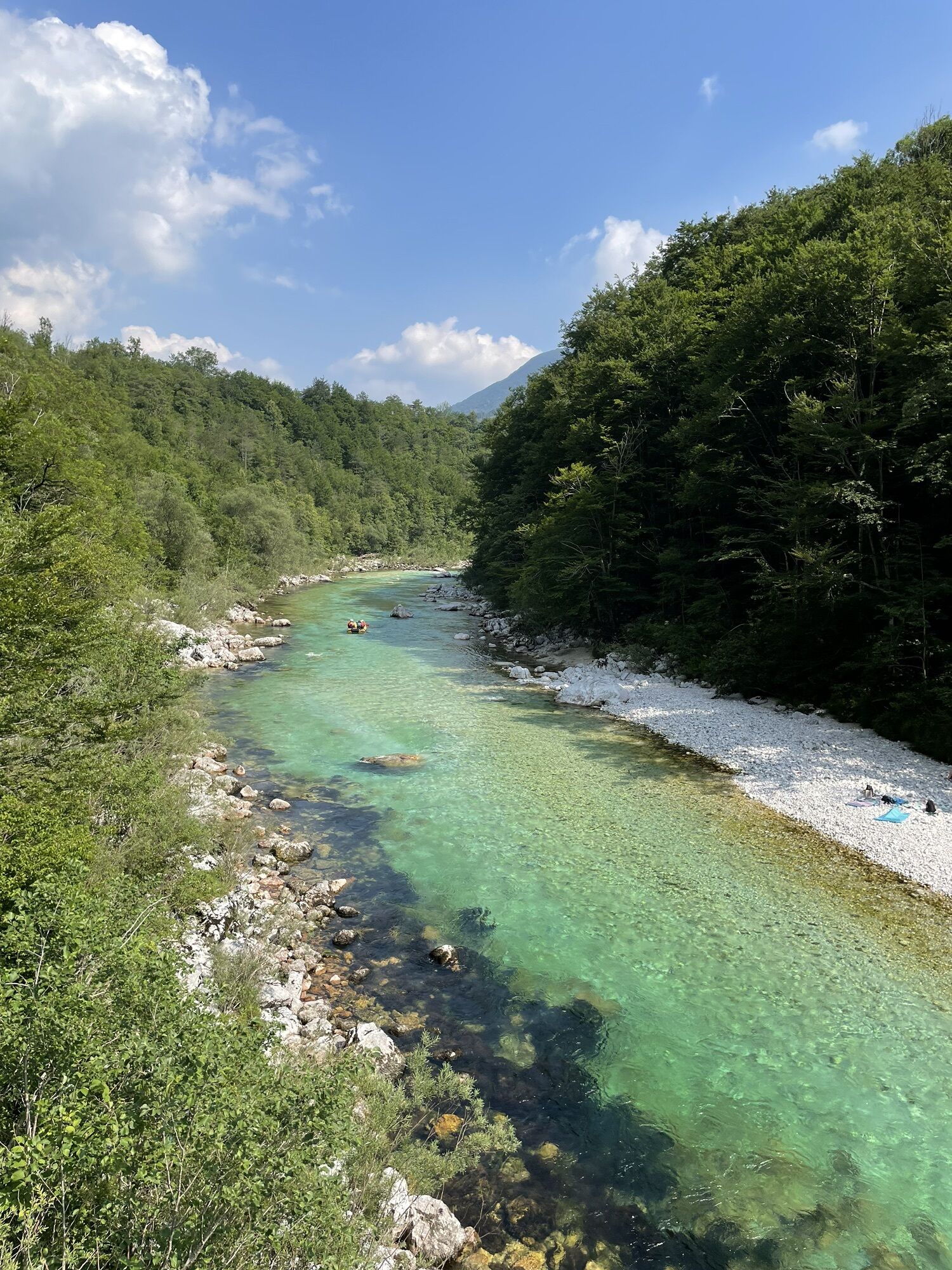
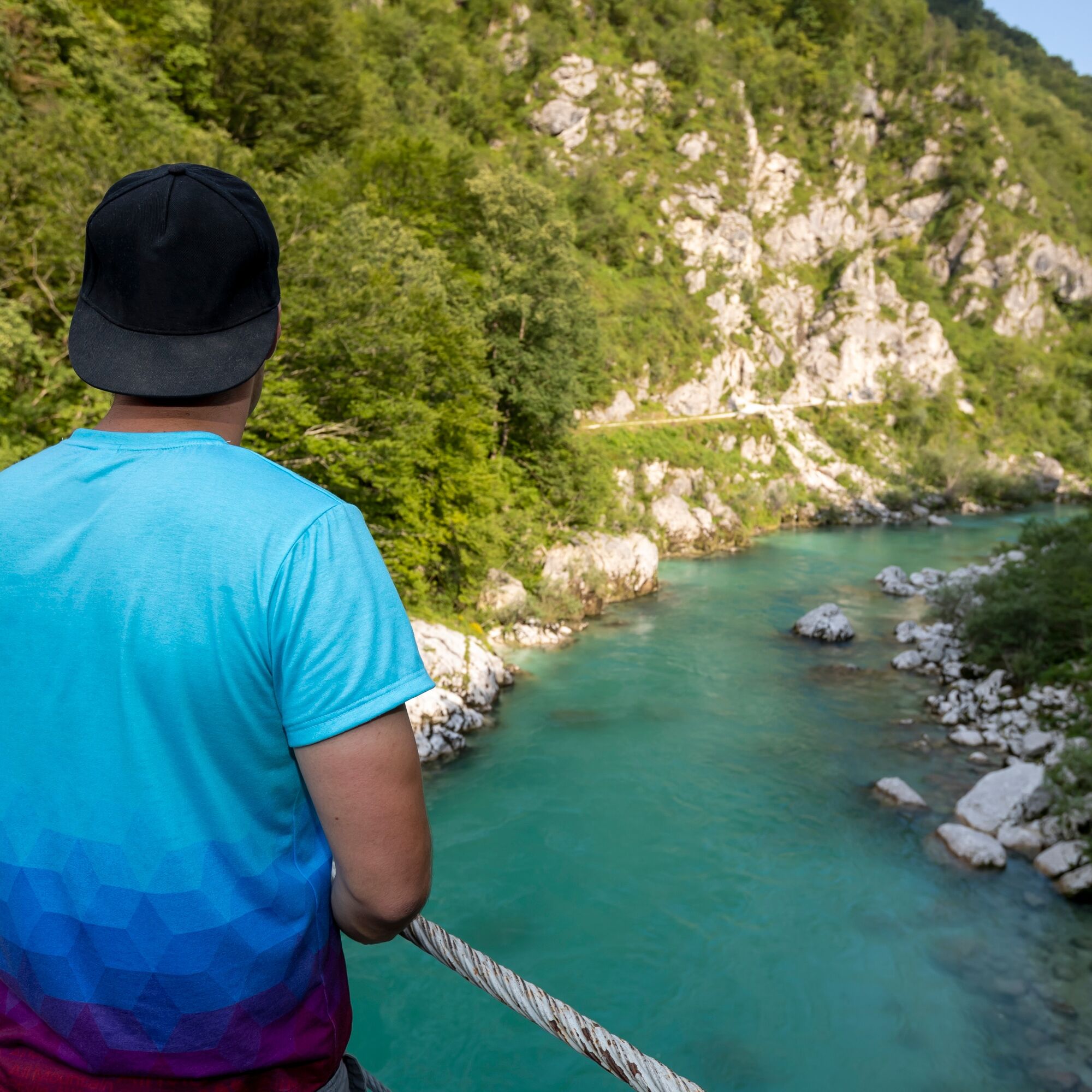
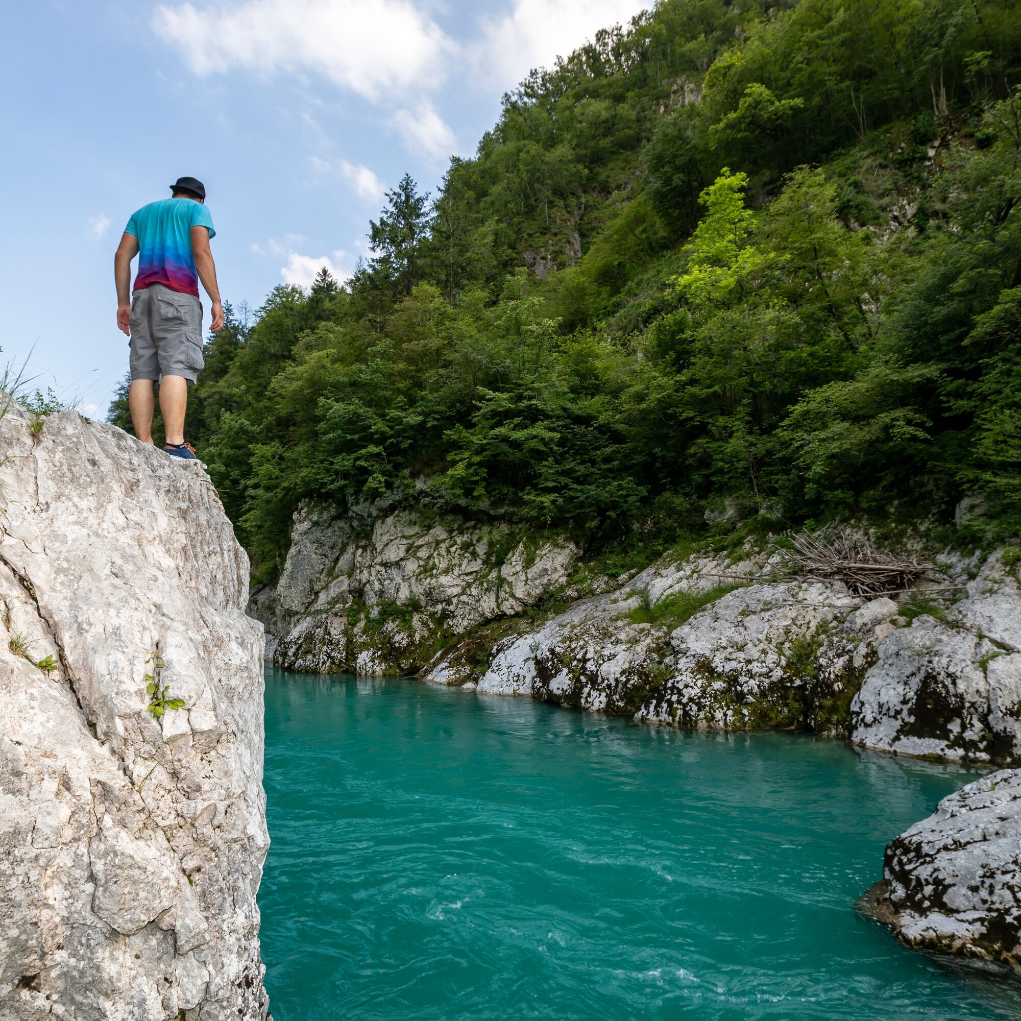
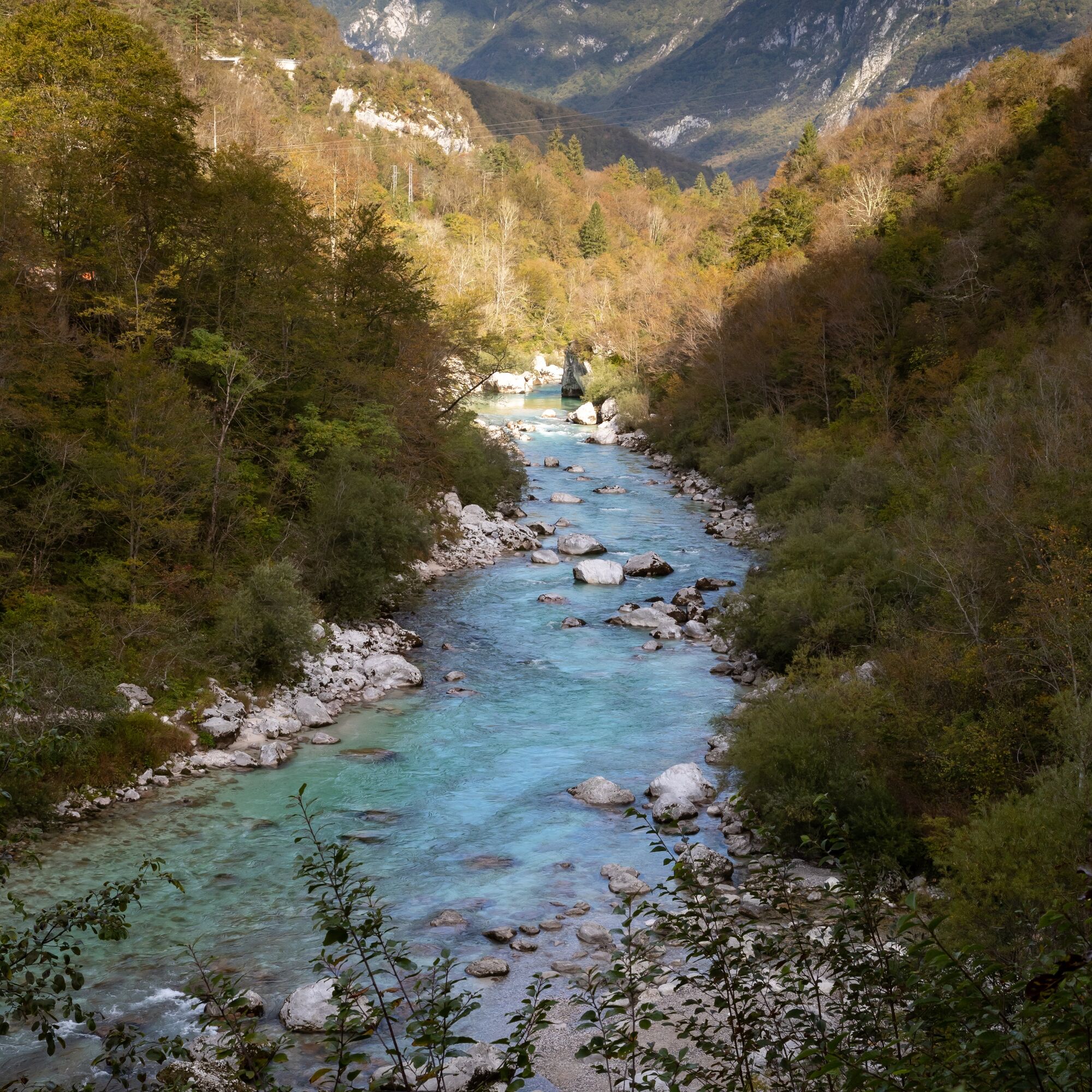
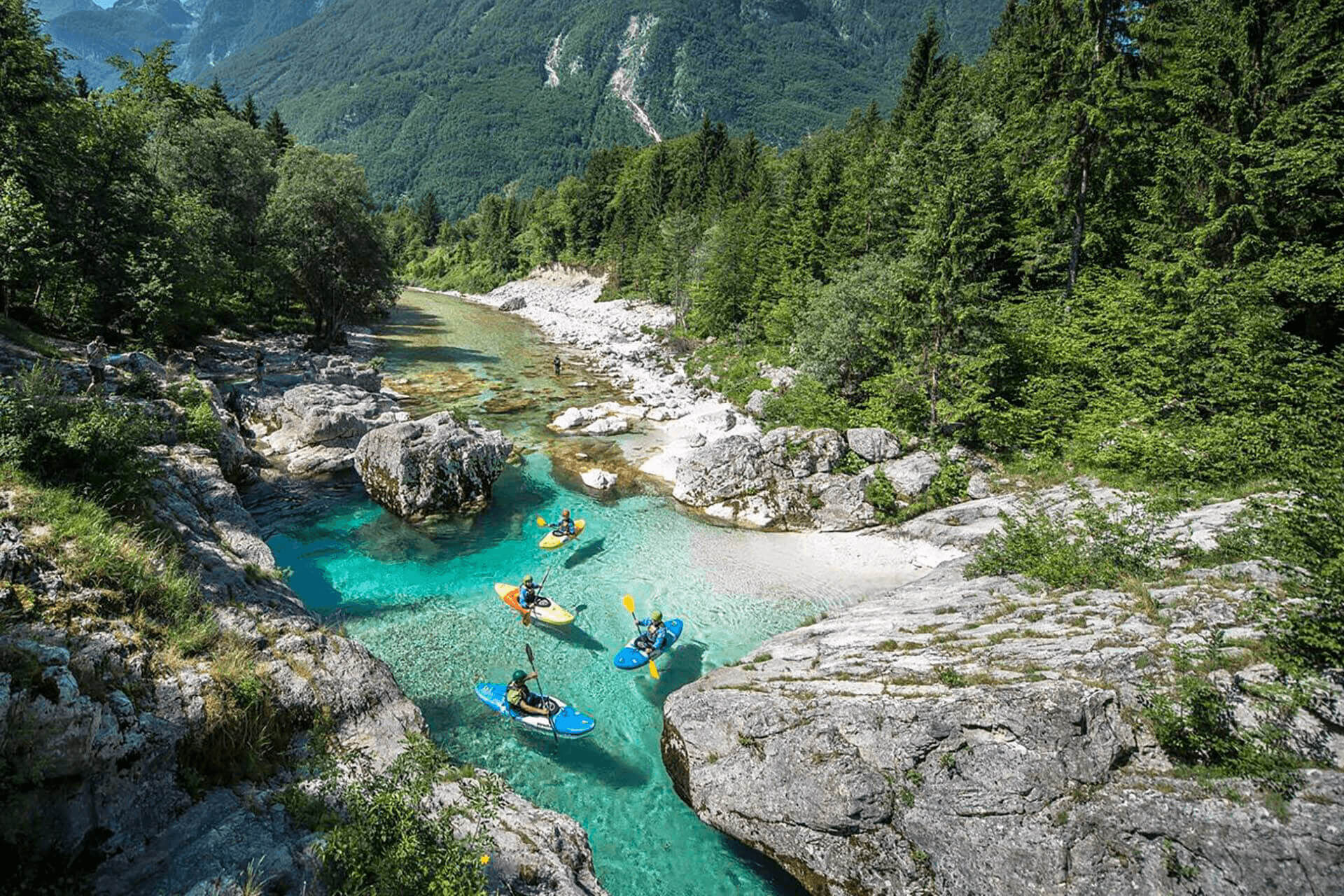
The stage between Kobarid and Bovec takes you from the soft region of Primorska back into the sharply incised mountain world. Just after Kobarid the valley changes dramatically; the formerly wide riverbed and flat banks are squeezed here between the steep slopes of Polovnik on one side and Kobariški Stol on the other. The SoÄa, which flows gently over the gravel in the lower part, bubbles here in wild rapids and deep pools. You follow its wildest stream all day and go through areas that have given the river its name and reputation among wild water enthusiasts. The section between Kobarid and Trnovo is reserved only for kayakers, whom you will always encounter in season. World-class championships sometimes take place in the area of Trnovo. In the upper part, between Trnovo and the Boka waterfall, rafting is also possible with agencies that bring even those who are not experienced rowers on wild water closer to the river.
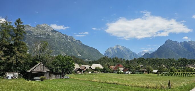
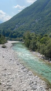
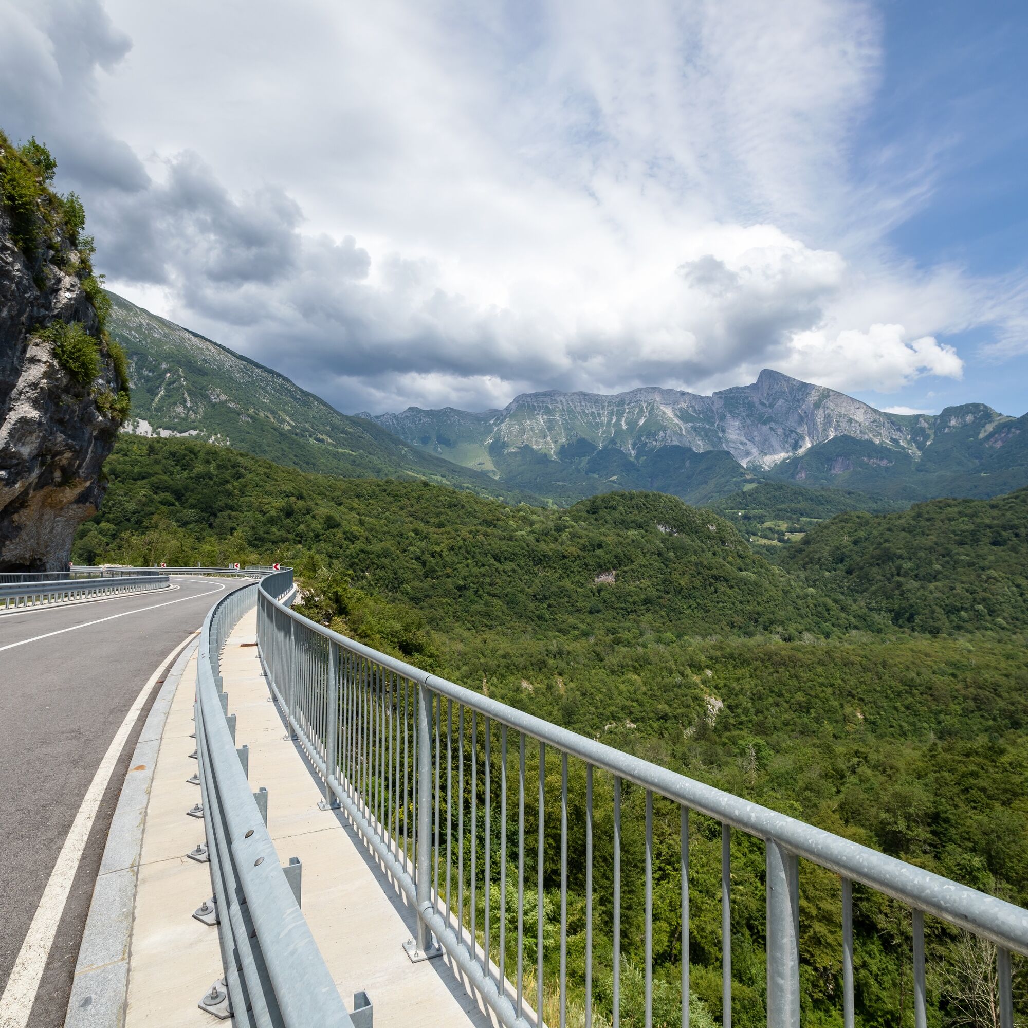
Beyond Boka, the valley widens again and opens up into the Bovec basin with views of mighty peaks: Kanin, Rombon, Loške stene, Svinjak, and at the end of the valley also Triglav. The side road takes you through the long village of ÄezsoÄa towards Bovec. Bovec is the tourist center of the valley and the largest hub for all kinds of outdoor activities in nature.

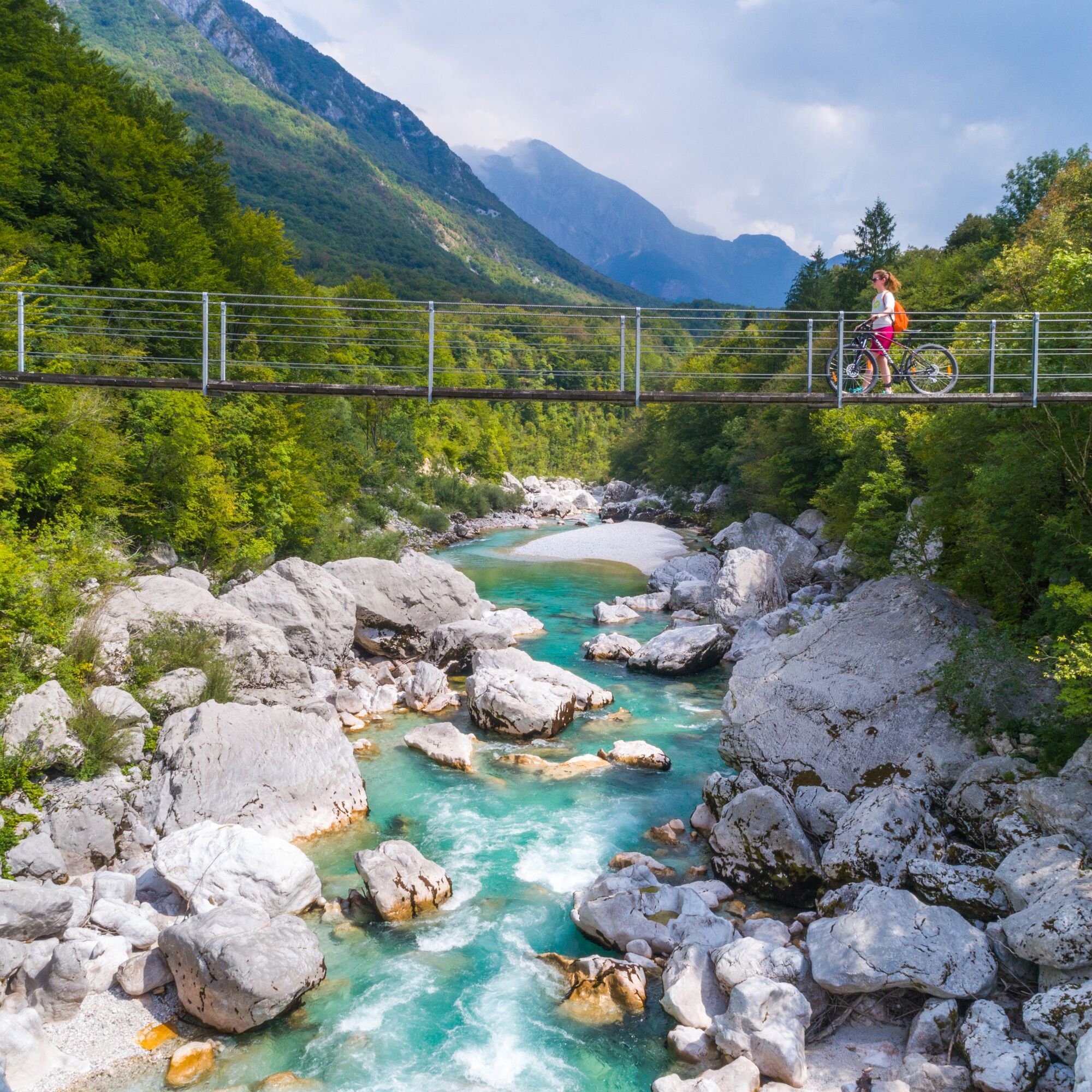
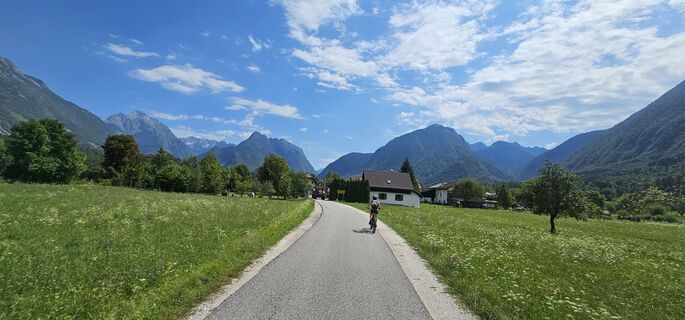
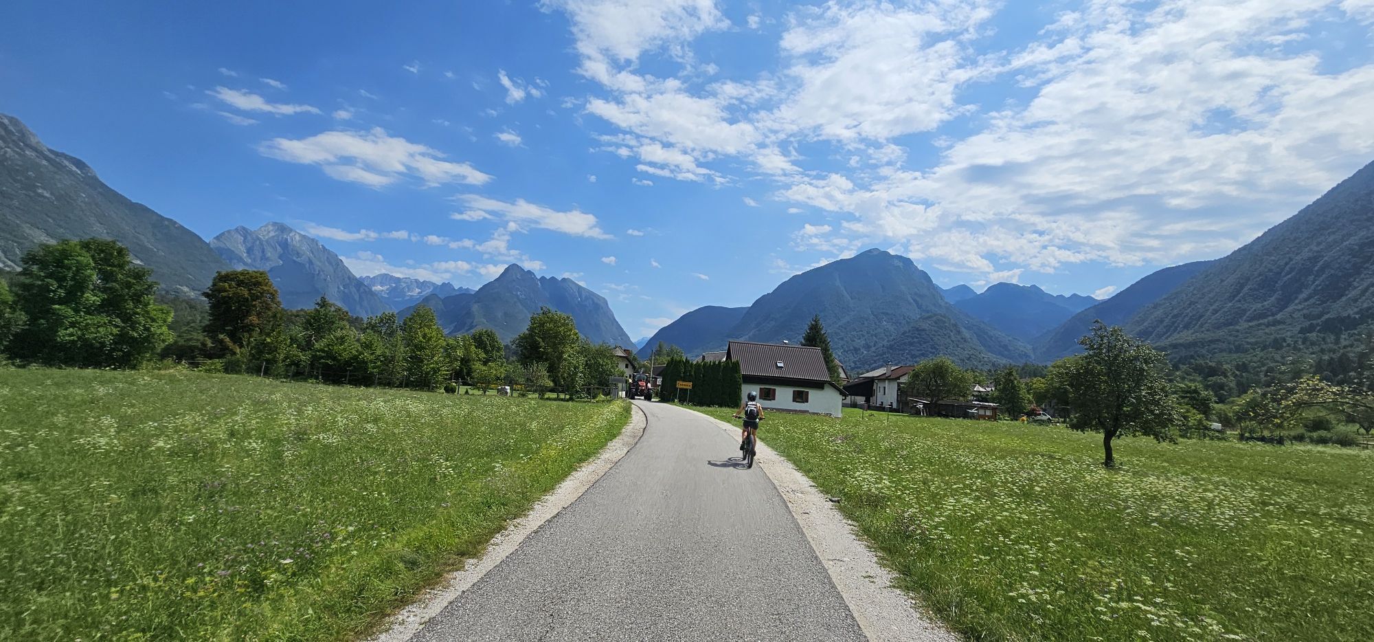
You always walk on the left bank of the SoÄa; up to the village of Trnovo on the new path over the SoÄa, which widens into a forest road near Trnovo, which you follow to Log Äezsoški and then further along the cozy side road through ÄezsoÄa and to Bovec.
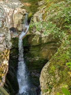
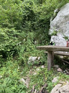
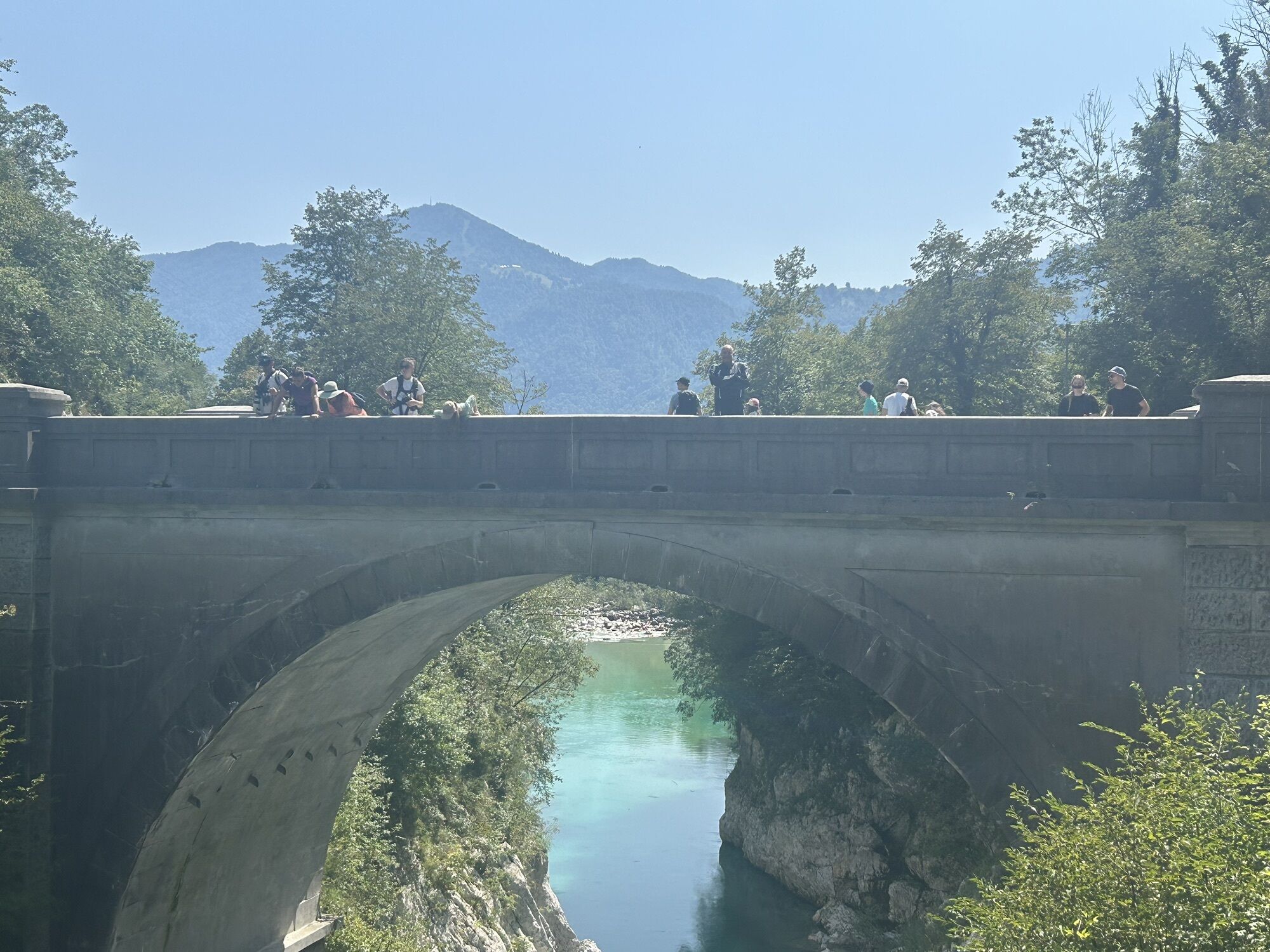
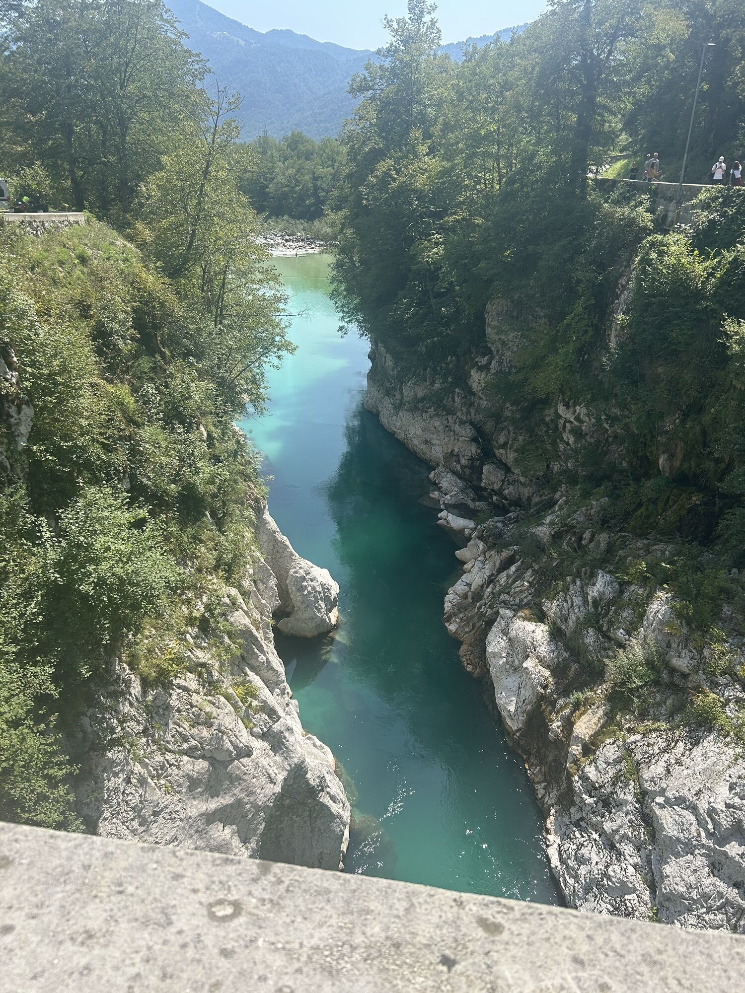
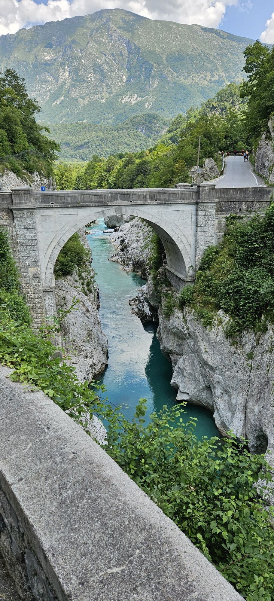
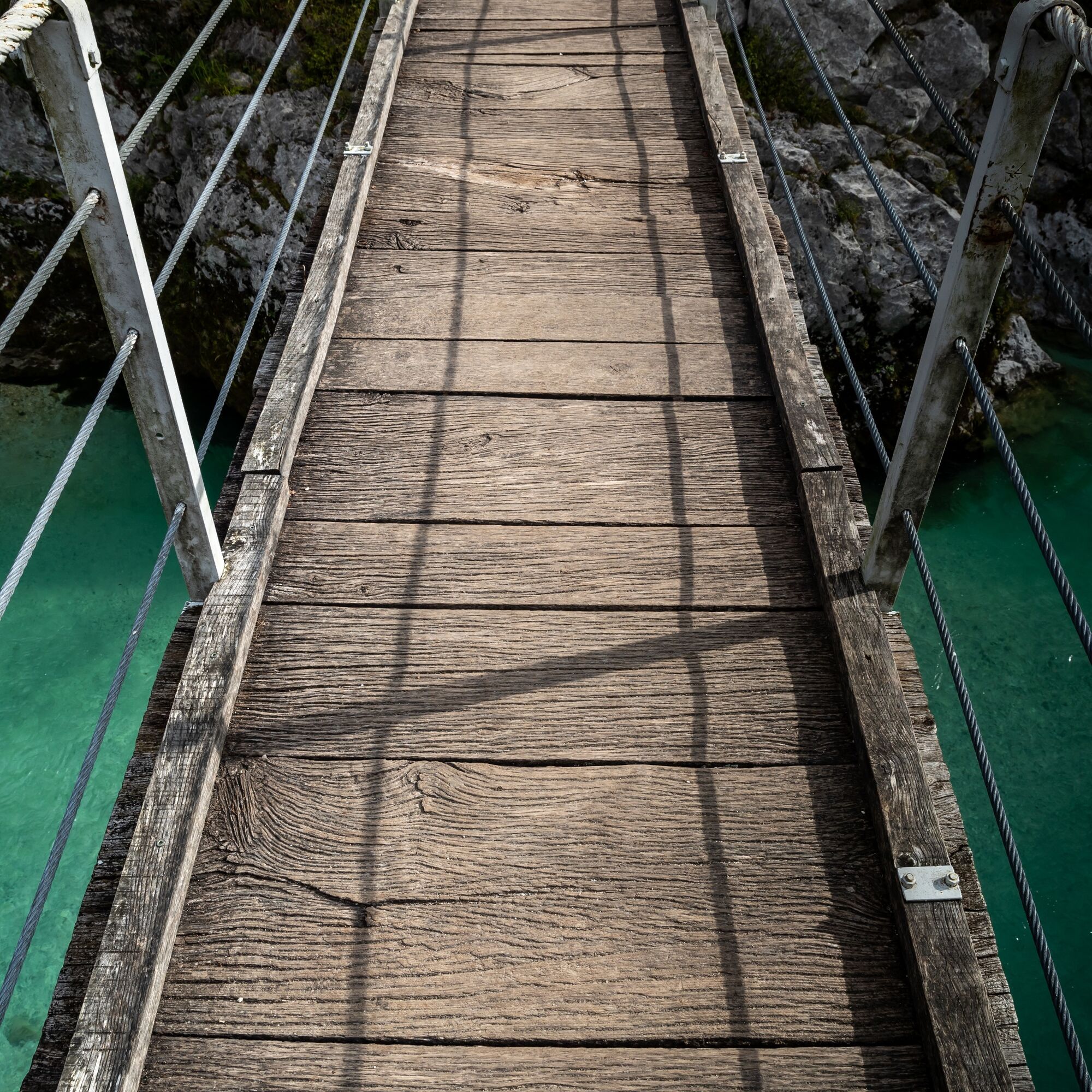
From Kobarid you walk downhill to the SoÄa and cross it via the Napoleon Bridge or the next suspension bridge behind the Lazar campsite. You follow the signs for the Kozjak waterfall and soon reach the Kozjak creek and the gorge on the other side, which leads right to the waterfall (10 minutes, worth a visit). You walk downhill to the mouth of the creek into the SoÄa and look on the other side for the only path that leads you over natural crossings sometimes closer to the river and sometimes higher uphill.
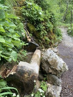
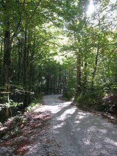
Soon after the only rope-secured spot (also a trough and a water source), the path joins a forest road for a while. You follow this to the left to the end where you find the path again, which takes you higher above the SoÄa, along the terrace edge to a large open meadow. Here you have two options:
The more beautiful, but about half an hour longer path: on the other side of the meadow at the lower edge is a path that takes you downhill to the Prosja suspension bridge; there you continue to the other side and further through the village of Trnovo. On the other side of the village you will find a road that leads to the exit point for rafting and kayaking and to the upper bridge that takes you back to the left bank of the SoÄa; The more boring, but faster way: on the other side of the meadow at the upper edge you will find a forest road that takes you through the forest to the upper bridge in Trnovo.From the upper bridge in Trnovo, you continue along the forest road, over meadows and through the forest, always above the SoÄa, under the steep slopes of Polovnik, to the village of Log Äezsoški. From the village, a road leads on the left bank, first past the bridge over the starting point for the SoÄa – behind which opens a wonderful view of the mighty Boka waterfall, high above in the steep slopes of Kanin on the other side – and further forward across the open plain into the village of ÄezsoÄa and finally to Bovec.
Áno
Áno
Typical seasonal hiking equipment.
Individual sections in the first part are quite exposed, so caution is advised there.
If there is no snow in the valley, the path is also passable in winter; special care is only needed because of icy spots.
Regional road:
Travisio (Italy) – Bovec – Kobarid
Kranjska Gora – VršiÄ – Bovec – Kobarid
Nova Gorica – Tolmin – Kobarid – Bovec
Ljubljana – Idrija – Tolmin – Bovec
Bus:
Nova Gorica – Kobarid – Bovec
Ljubljana – Kranjska Gora – VršiÄ – Bovec – Kobarid
Ljubljana – Idrija – Tolmin – Kobarid – Bovec
Parking in Kobarid.
Parking in Bovec.
T1
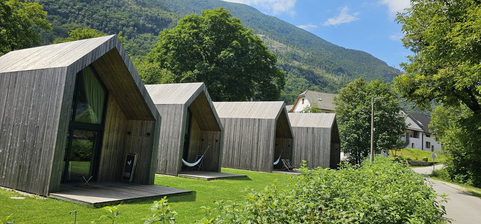
This is one of the longest stages on the route, so you should allow yourself enough time for the path and the stops to make your experience as enjoyable as possible. If you want to shorten the stage, you can stay overnight at Hotel Boka at the waterfall of the same name.

Obľúbené výlety v okolí
-
4,4
Kozjak Wasserfall und Soča
svetloTuristika 5,18 km -
4,0
Boka Wasserfall
strednáTuristika 1,94 km -
4,7
Soca Trail
svetloTuristika 23,0 km -
3,3
Auf den Krn
strednáTuristika 5,90 km -
5,0
Prestreljenik Window (2390 m) – dramatic view of the Western Julian Alps
strednáSkitour 14,5 km -
4,5
Entlang der Soca
svetloTuristika 8,09 km -
3,6
Sella Robon
Turistika 12,2 km -
3,2
Slap Kozjak (Wasserfall)
svetloTuristika 3,40 km -
5,0
Teil - Etappe 23 Alpe Adria Trail
strednáTuristika 15,5 km -
4,0
Matajur
strednáMountainbike 24,8 km

Turistika a stopovanie


Nenechajte si ujsť ponuky a inšpiráciu na ďalšiu dovolenku
Vaša e-mailová adresa bol pridaný do poštového zoznamu.