


Piz Tomül in the Safien valley
Úroveň náročnosti: PD+
Turrahuus is an ideal place to stay overnight and a starting point. At the beginning, the route steeply climbs along the old pass path. Then the route leads along the wide northeast shoulder to Rotflua....
Turrahuus is an ideal place to stay overnight and a starting point. At the beginning, the route steeply climbs along the old pass path. Then the route leads along the wide northeast shoulder to Rotflua. At P.2561, the following southeast ridge becomes narrower and partly rocky. Often it is windblown and requires some attention. The ridge can be a challenge, especially on the descent.
The reward comes at the summit. The view into the Bündner mountain world and far beyond is simply magnificent. The descent is also magnificent. Once you leave the mentioned ridge, perfect ski slopes await you that you will not forget quickly. Under safe conditions, you can also descend shortly after the summit via the steep eastern slopes.

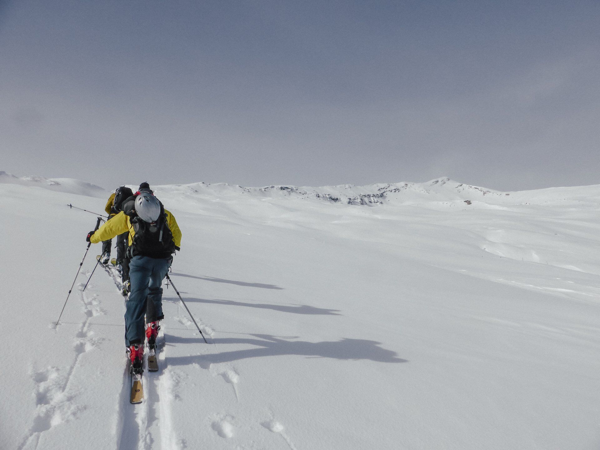
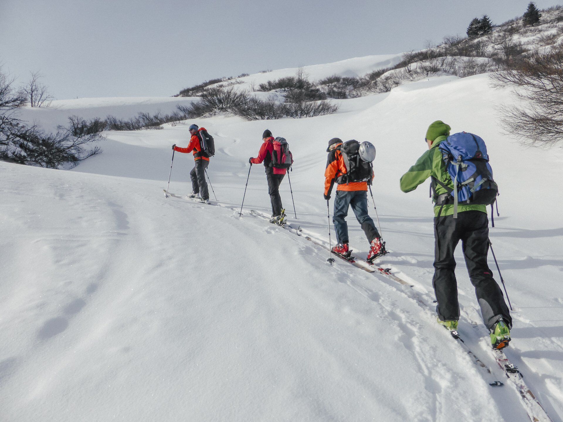
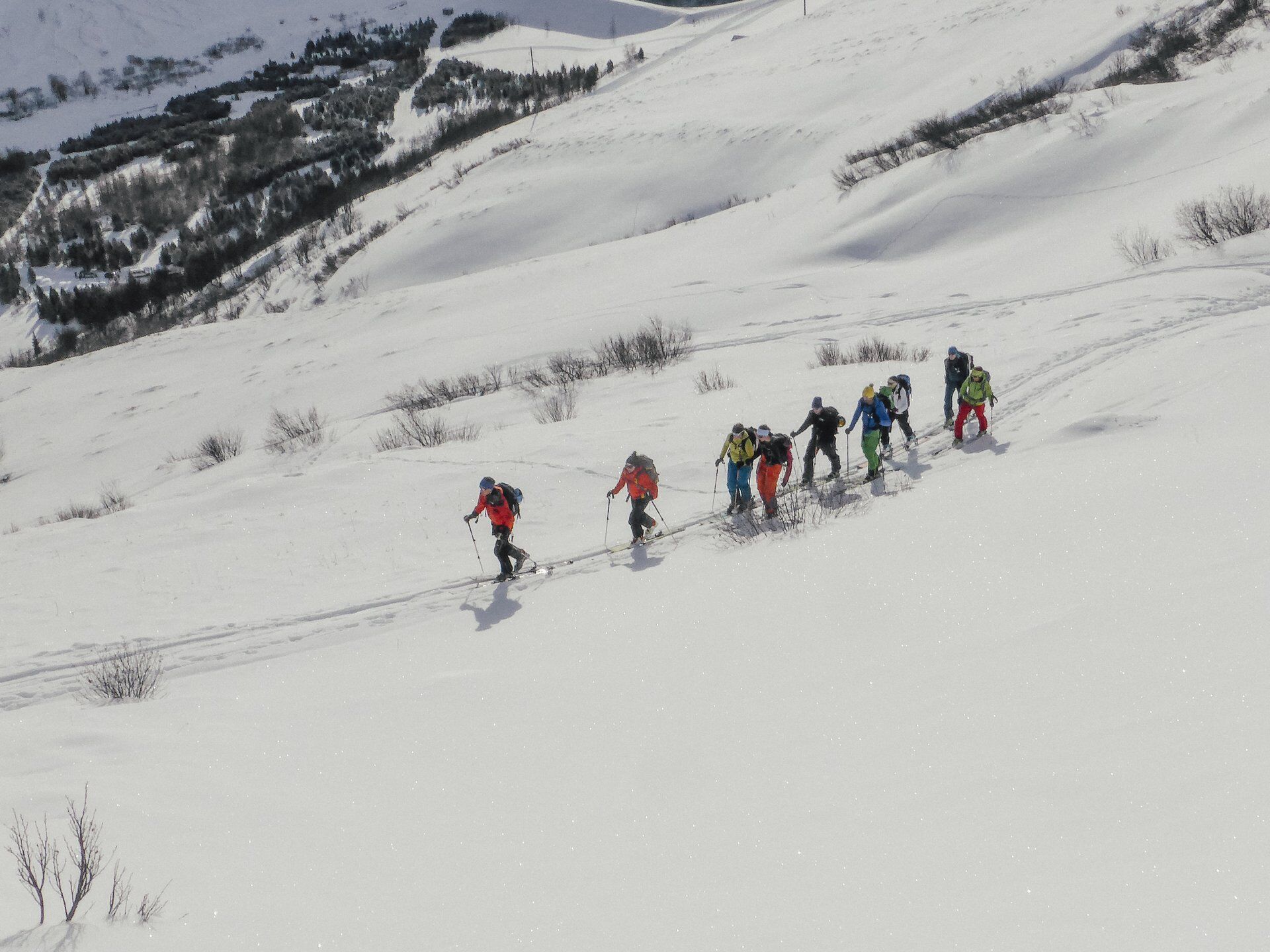
Turrahus - Rotflua - Piz Tomül - descent via the ascent route or, under safe conditions, via the steep eastern slopes.
Áno
Áno
See safety instructions
Ski and snowshoe tours in unsecured terrain require good knowledge in avalanche risk assessment and route planning. Additionally, a complete safety equipment must always be carried - regardless of the current avalanche danger.
We recommend the APP and website of WhiteRisk for preparation and planning of the tour.
For a carefree experience, we recommend our mountain guides and snowshoe hiking leaders of Surselva.
Drive from Chur or Ilanz to Versam. Then turn into the Safien valley and drive almost to the very end of the valley to Turrahus.
Winter equipment required.
By train to RhB station Versam-Safien. Then by post bus to the final stop Thalkirch, Turrahus
There are some parking spaces to the right of Turrahus.
PD+
Stopover and overnight stay nearby at Turrahus or at Gasslihof
Obľúbené výlety v okolí
-
Piz Fess 2880m, der Stolze
ťažkéTuristika 12,8 km -
5,0
Panorama route
svetloTuristika 5,39 km -
5,0
Hiking route Suspension Bridge Val da Tersnaus
strednáTuristika 3,24 km -
3,3
3-lake hike
strednáTuristika 12,8 km -
5,0
Winter hike Gadastatt - Frunt - Zerfreila (Panorama trail)
svetloZimná turistika 5,36 km -
5,0
Southeast Switzerland Hiking Day Vals 2017
svetloTuristika 11,8 km -
5,0
Hike Vrin - Uors over the suspension bridge Val da Silgin
strednáTuristika 12,3 km -
3,5
Places of Magic - Lumbrein
strednáTuristika 8,74 km -
Fanellhorn 3124 m
ťažkéVysoké turné 6,86 km -
4,0
Senda culturala Lumnezia / Kulturweg Lumnezia
svetloTematická trasa 7,54 km

Turistika a stopovanie


Nenechajte si ujsť ponuky a inšpiráciu na ďalšiu dovolenku
Vaša e-mailová adresa bol pridaný do poštového zoznamu.