


Piz Sesvenna from S-charl
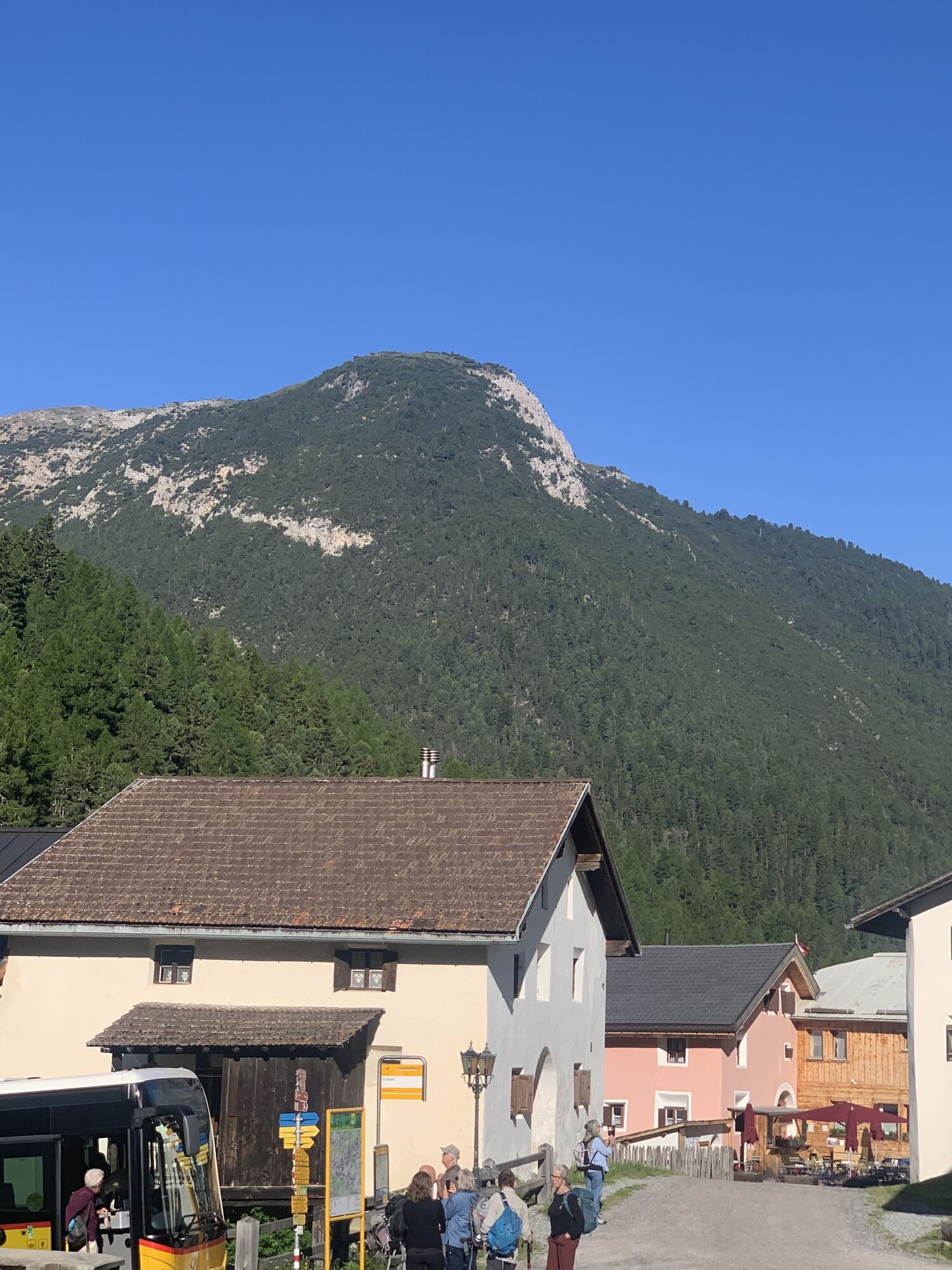
The starting point of the first stage is the small Engadine village of S-charl. This location can only be reached in winter by horse-drawn carriage, which runs daily between Scuol and S-charl. From S-charl...
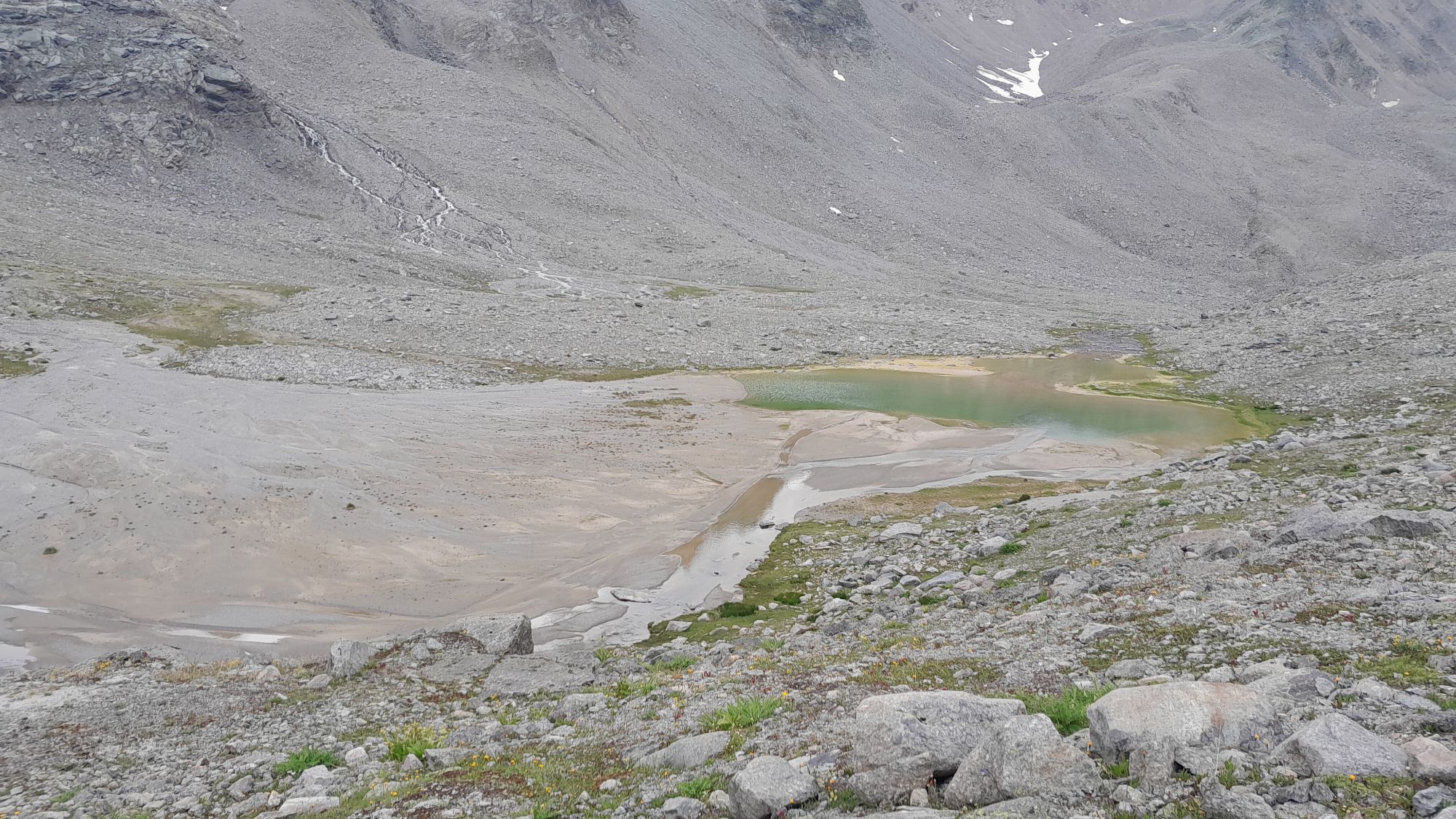
The starting point of the first stage is the small Engadine village of S-charl. This location can only be reached in winter by horse-drawn carriage, which runs daily between Scuol and S-charl. From S-charl (1808 m) northeastwards on the alpine trail to Alp Sesvenna (2098 m), then eastwards along the summer trail through the entire Val Sesvenna. In large bends via Lai da Sesvenna to Vadret da Sesvenna. Southwards over the glacier to the rocks immediately west of the notch at point 3079. Ski deposit.
Depending on conditions, with crampons and ice axe over the block ridge to the summit.
Descent: Along the ascent route, to the Sesvenna hut, or through Avigna valley / Val d’Avigna to Müstair. If conditions are safe, it is also possible to descend more directly northwest from the ski deposit into Val Sesvenna.
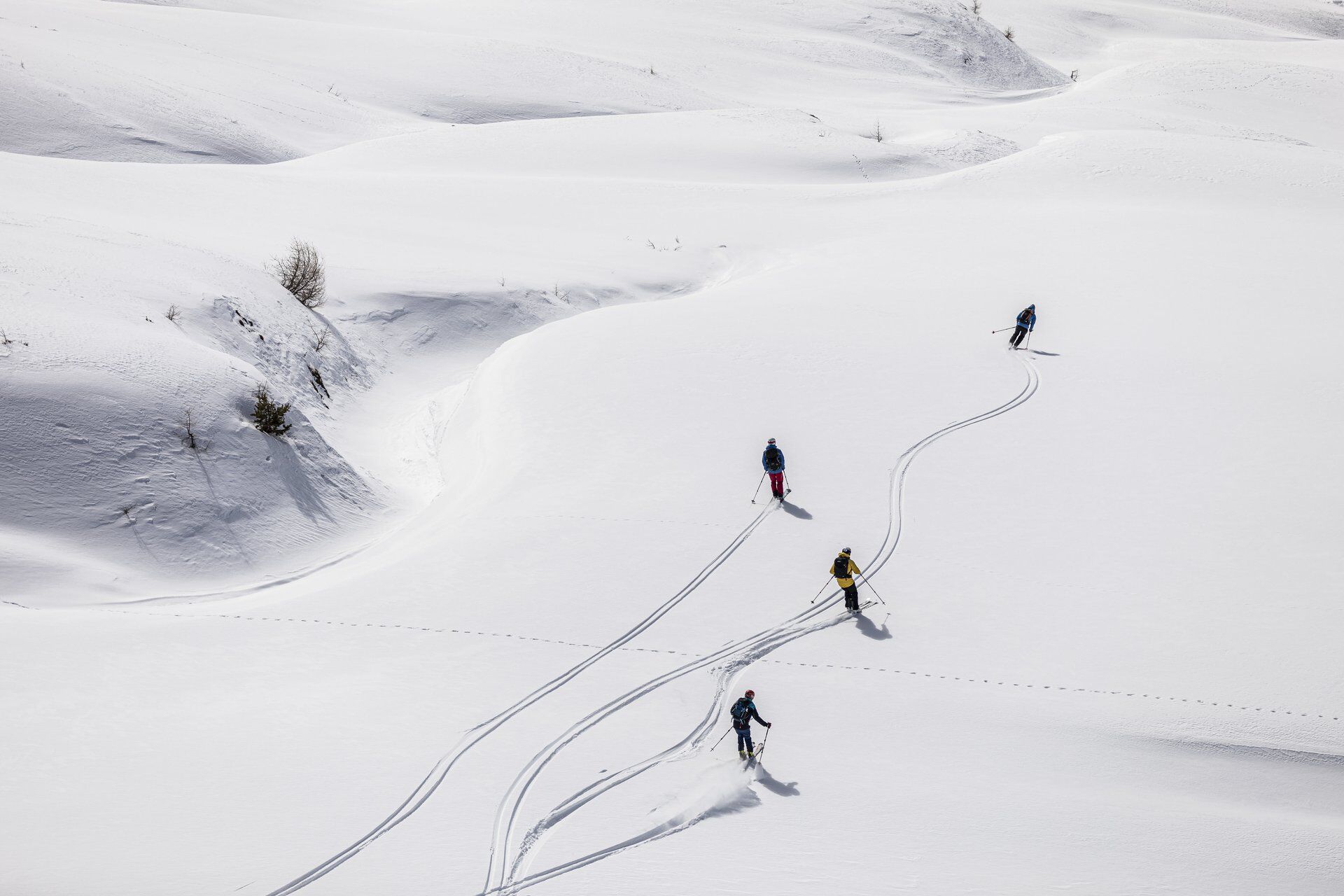
Start of the ski tour: S-charl Summit of the ski tour: Piz Sesvenna Descent of the ski tour: Along the ascent route or through Avigna valley End of the ski tour: S-charl or Sesvenna hut Dangers: There are several wildlife protection areas that must be strictly observed. Depending on conditions, ice axe and crampons are needed for the block ridge.
The starting point is S-charl, it is recommended to park the car in Scuol
Áno
Áno
Ski touring equipment, safety equipment (avalanche transceiver, probe, shovel), first aid kit, provisions, optionally ice axe and crampons
Your safety comes first!
Winter mountain tours carry risks. Off secured pistes and trails you are responsible for yourself. This requires thorough training and appropriate equipment including avalanche emergency gear. Check the weather and avalanche danger before each tour.
The route was rated under favorable weather conditions; the current conditions and weather forecasts must be observed before starting the tour.
Emergency numbers:
144 emergency, first aid I 1414 mountain rescue REGA I 112 international emergency
Traversing routes in alpine terrain requires good fitness, serious preparation, and technical skills in mountaineering. All routes are undertaken at your own risk. For safe mountaineering, training under expert guidance is recommended. All content is compiled with the greatest possible care. Tourism Engadin Samnaun Val Müstair AG (TESSVM) and the authors accept no liability for the timeliness, correctness, or completeness of the provided information. Liability claims of any kind against TESSVM or the authors are excluded. It is also advisable to always check the daily current avalanche bulletin: slf.ch
From the north: via Landquart – Klosters by car train through the Vereina Tunnel (Selfranga - Sagliains) or over the Flüela Pass into the Lower Engadine on H27
From the east: via Landeck / Austria towards St. Moritz on H27
From the south: via Reschen Pass (Nauders-Martina) or Ofen Pass (Val Müstair-Zernez) on H27
Scuol is located directly on the Engadine road H27
By the Rhaetian Railway from Chur, Landquart/Prättigau to Scuol-Tarasp. From the station, continue with a shuttle to the departure point of the horse-drawn sleighs, which then take you to S-charl or to Gasthaus Mayor. The shuttle or horse-drawn sleigh must be booked in advance.
In Scuol at the Gurlaina ice rink, free parking spaces are available. From the parking lot, a shuttle runs to the departure point of the horse-drawn sleighs, which then take you to S-charl or to Gasthaus Mayor. The shuttle or horse-drawn sleigh must be booked in advance.
To reservation
To reservation
Obľúbené výlety v okolí
-
4,1
Panoramaweg Schöneben Haider Alm
svetloTuristika 5,78 km -
5,0
Mountain restaurant Plantaptasch (without Lift)
strednáTuristika 3,42 km -
4,2
Reschensee
svetloTuristika 15,6 km -
3,6
Easy hiking rout to the top of the Watles Moutain (2.550 m)
strednáTuristika 2,35 km -
4,1
Haidersee - Graun - Trentino-Alto Adige/Südtirol/Italia
svetloTuristika 4,99 km -
4,5
Rundwanderweg Wattles und Sesvenna
svetloTuristika 16,4 km -
4,0
National Park: Margunet
svetloTuristika 7,76 km -
4,5
Tarasp Fontana – Sparsels – Lai Nair (circular route)
svetloTuristika 7,67 km -
4,0
Wanderung über dem Haidersee
strednáTuristika 15,1 km -
4,7
Bergwanderung Schlinig -Seswenahütte
strednáTuristika 13,6 km

Turistika a stopovanie


Nenechajte si ujsť ponuky a inšpiráciu na ďalšiu dovolenku
Vaša e-mailová adresa bol pridaný do poštového zoznamu.