


Senda Sagogn
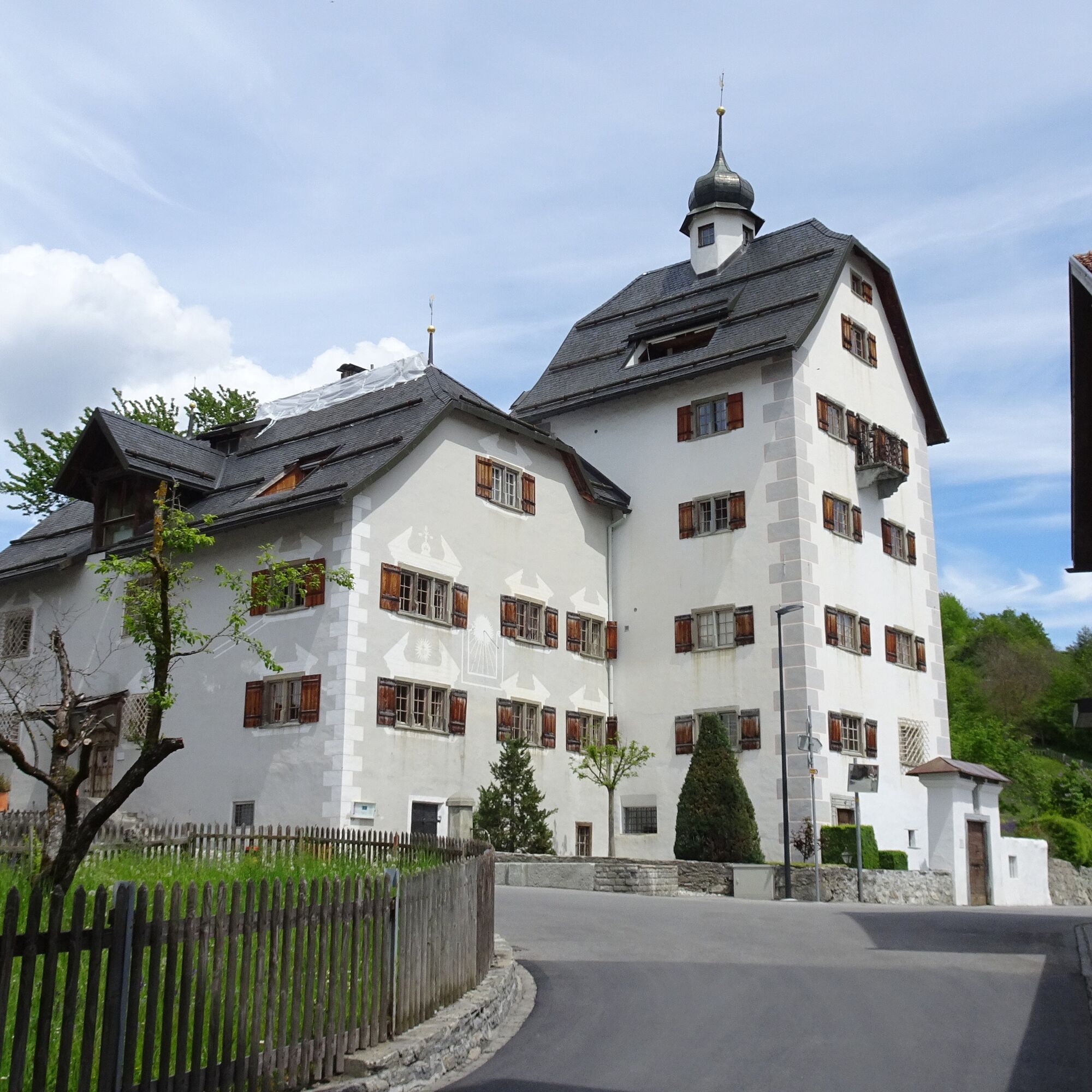
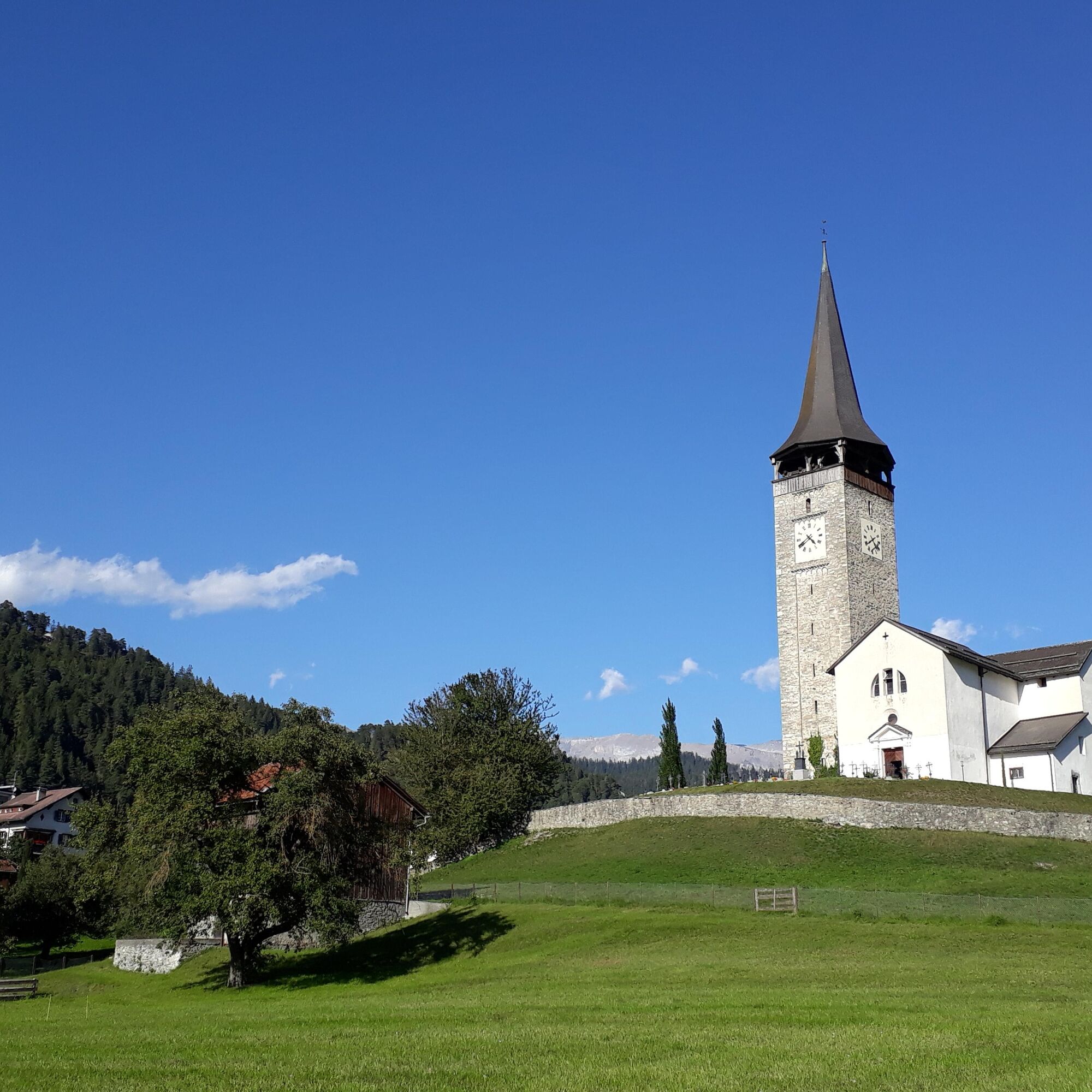
Sagogn was already settled in the Bronze Age and was the religious center of the region in the Middle Ages. Witnesses from this time are the Casti Aspermont from the 13th century, as well as the Catholic...
Sagogn was already settled in the Bronze Age and was the religious center of the region in the Middle Ages. Witnesses from this time are the Casti Aspermont from the 13th century, as well as the Catholic Church from the 5th century. We invite you to get to know our village during a walk on the SENDA SAGOGN. On nine information boards, you will learn a lot of interesting facts about the village.
What does the word Sagogn mean? What is a “Pistrin”? Which large family stays in the Reformed Church during summer? Why does the “Via Cochetta” (coquettish street) have this name? You will find answers to such questions and much more.
From the Senda Sagogn, detours can be made to the Schiedberg ruins, the ruins of the former industrial area Mulin in the Val Mulin, or the Crap Signina viewing platform. You will also find information boards with interesting details there.

After a short stretch through the village, it goes up to Bregl, the elevated plain on the eastern edge of Sagogn. Here are two reclined benches where you can rest and enjoy nature and the beautiful view of the surroundings. Afterwards, it goes back over Runs into the village to the next sights.
Áno
Áno
Áno
Áno
Comfortable shoes and weather-appropriate clothing.
From Laax or Schluein, you can reach Sagogn in just 5 minutes. The schoolhouse is located on the edge of the large plain next to the playground.
From Chur towards Laax and then the line from Laax to Ilanz.
Get off at the stop: Sagogn, Vitg Dado.
There are plenty of parking spaces next to the schoolhouse and the playground.
Guest information Flims Laax Falera
Via Nova 62
CH-7017 Flims
Tel. +41 (0)81 920 92 00
E-Mail: info@flimslaax.com
Web: www.flimslaax.com
Stop at Stiva Grischuna and enjoy a Grison specialty.

Obľúbené výlety v okolí
-
4,5
4-lake hike: Caumasee - Crestasee - Felsbach Gorge
strednáTuristika 12,8 km -
4,8
Rheinschlucht: From Ilanz to Versam into the heart of the Rheinschlucht
strednáTuristika 11,4 km -
4,7
Rhine Gorge Hike: Senda Ruinaulta (659)
svetloTuristika 9,39 km -
4,7
The Water Trail: Trutg dil Flem 764
ťažkéTematická trasa 8,56 km -
5,0
Caumasee tour: Flims - Caumasee - Conn - Flims
svetloTuristika 7,94 km -
4,7
Mountain hike to the Strudeltöpfe on Alp Mora: Bargis-Trin
ťažkéTuristika 18 km -
5,0
Lower Segnesboden: Nagens Sura - Lower Segnesboden - Segnes hut - Alp Nagens
strednáTuristika 6,66 km -
4,3
Circular hike: Falera-Curnius-Alp Dadens-Falera
strednáTuristika 11,4 km -
3,0
Tour zum Martinsloch
ťažkéTuristika 3,82 km -
5,0
Circular route: Lake Cauma - Rhine Gorge "Swiss Grand Canyon"
strednáTuristika 19,8 km
Turistika a stopovanie


Nenechajte si ujsť ponuky a inšpiráciu na ďalšiu dovolenku
Vaša e-mailová adresa bol pridaný do poštového zoznamu.