


National Park: Fuorcla Trupchun
Úroveň náročnosti: T3
This hike leads to the pass between Piz Trupchun and Piz Saliente, at the back of Val Trupchun on the border with Italy. Sure-footedness is required in the upper part of the steep route. In dull weather,...
This hike leads to the pass between Piz Trupchun and Piz Saliente, at the back of Val Trupchun on the border with Italy. Sure-footedness is required in the upper part of the steep route. In dull weather, ibex can already be observed in the valley floor. In warm summer weather, rather on the rocky ridges around the Fuorcla. On the one hand, the hike invites you to extend the simple hike to Alp Trupchun, on the other hand, it also offers the opportunity of a pass hike from S-chanf to Livigno (continuing hiking trail on the Italian side through the steep Valle del Saliente, hiking time: 2:30h). From Livigno, there is a bus connection with Silvestri Bus (Swiss tickets valid) to Zernez and Pontresina.
Note: Bringing dogs is not allowed in the Swiss National Park, not even on a leash. More information and all protection regulations can be found at nationalpark.ch/schutzbestimmungen.

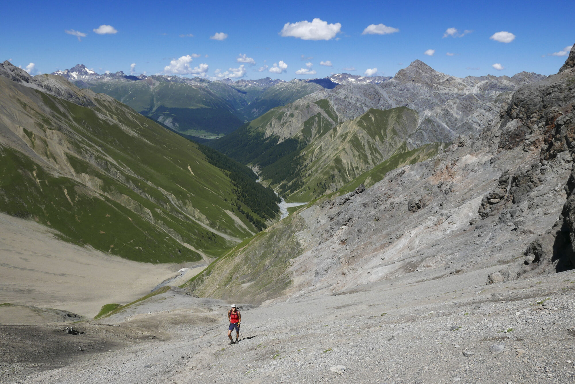
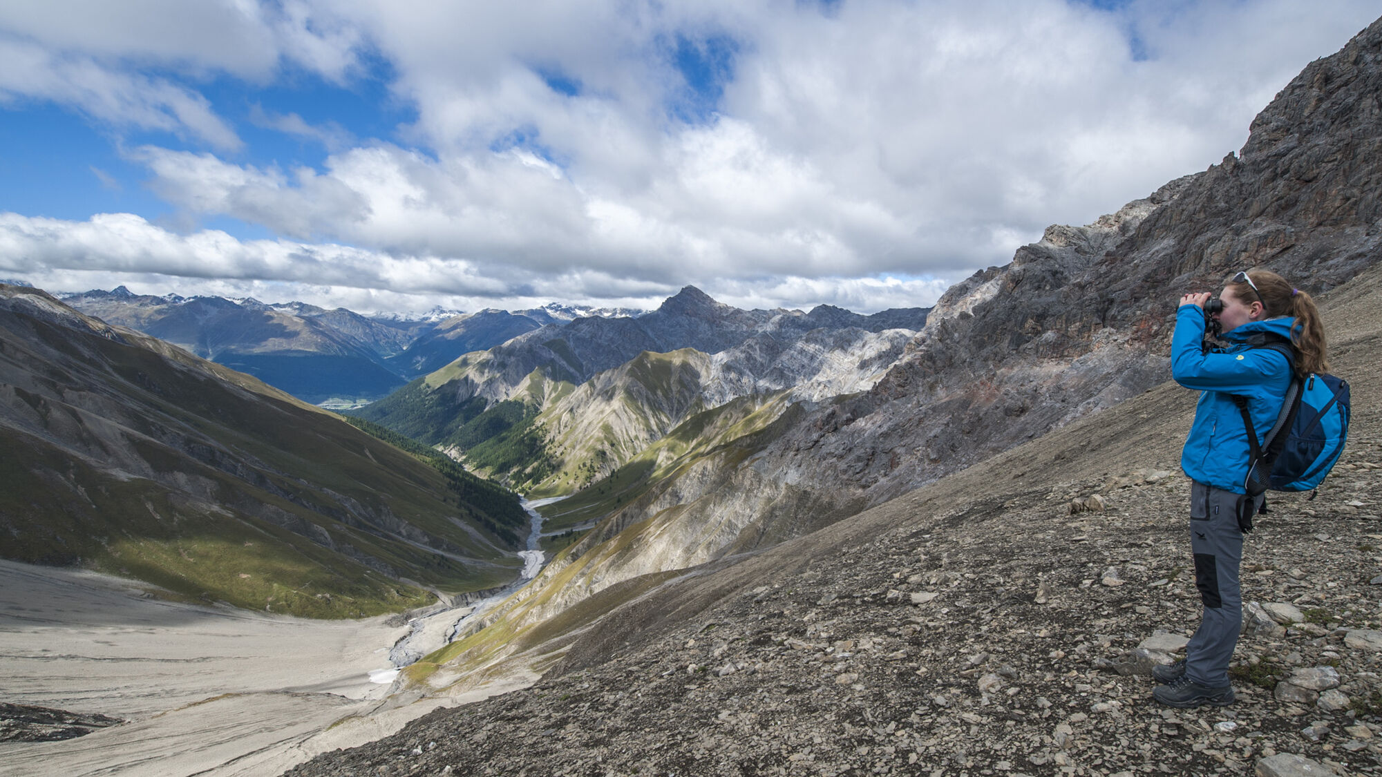
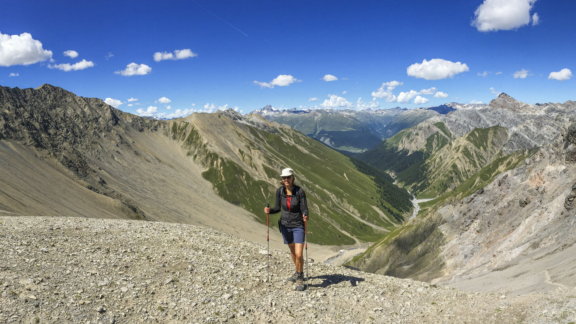
From S-chanf or Prasüras, hike via the high or valley trail to Alp Trupchun (2040 m a.s.l.) (see route "Val Trupchun"). From Alp Trupchun, follow a narrow but well-maintained path through several scree fields. The last approximately 300 vertical meters are across slippery scree to the pass summit at Fuorcla Trupchun (2782 m a.s.l.) on the border with Italy. Return on the same path back to Alp Trupchun or continue on the Italian side on a steep and marked path through Valle del Saliente to Livigno.
Áno
Áno
Sturdy hiking boots or mountain boots, warm clothing, sun and rain protection, trekking poles if needed, binoculars recommended.
Steep and strenuous, slippery scree in the upper part, sure-footedness required.
Emergency call:
144 Emergency, first aid
1414 Mountain rescue REGA
112 International emergency call
S-chanf is located on the Engadin road H27. Follow the "Parc Naziunel" signage from the village.
Paid parking spaces in the Prasüras area at the entrance to Val Trupchun.
T3
The Swiss National Park (SNP) offers a guided day hike to Val Trupchun every Thursday (during the red deer rut in autumn also Fridays). Details at www.nationalpark.ch

Obľúbené výlety v okolí
-
4,8
Circular hike Val Trupchun in the Swiss National Park
strednáTuristika 13,8 km -
5,0
Muottas Muragl - Segantini hut - Pontresina
strednáTuristika 6,46 km -
5,0
Lej Muragl
strednáTuristika 7,39 km -
4,8
National Park: Grimmels (circular hike)
svetloTuristika 6 km -
4,7
Alp Languard - Segantini Hut - Muottas Muragl
strednáTrailrunning 6,45 km -
5,0
Crap da la Pare' with Joëlette
svetloTuristika 4,58 km -
4,5
Muottas Muragl - Fuorcla Muragl - Val Chamuera
strednáTuristika 17,6 km -
Kesch Trek Tour (4 stages)
strednádiaľková pešia trasa 47,6 km -
National Park: Chamanna Cluozza
strednáTuristika 8,37 km -
5,0
National Park: Murtaröl
ťažkéTuristika 15,6 km
Turistika a stopovanie


Nenechajte si ujsť ponuky a inšpiráciu na ďalšiu dovolenku
Vaša e-mailová adresa bol pridaný do poštového zoznamu.