Lamotte Circuit
svetlo
Získajte túto prehliadku v mobilnom telefóne
Lamotte Circuit
svetlo
Turistika
11,43
km
Naskenujte kód QR a spustite navigáciu v aplikácii bergfex

Turistika a stopovanie


Lamotte Circuit
svetlo
Vzdialenosť
11,43
km
Trvanie
02:57
h
Ascent
117
hm
Hladina mora
18 -
111
m
Stiahnutie skladby
Lamotte Circuit
svetlo
Turistika
11,43
km
Nestled between land and sea, the Lamotte circuit starting from Ault, a charming coastal resort in the Somme, offers hikers a route combining coastal landscapes, rural heritage, and preserved nature.This...
Opis
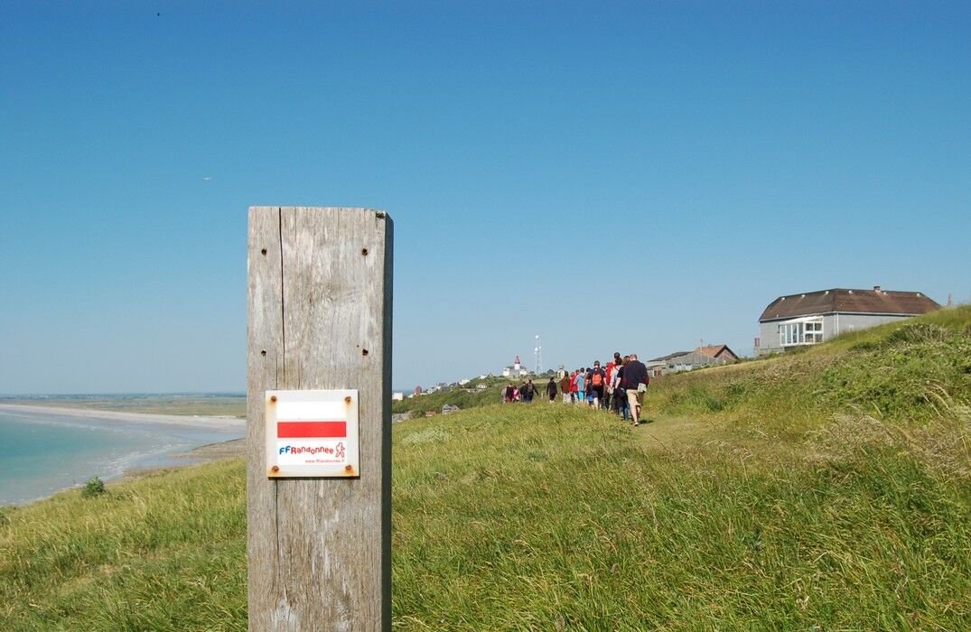
Nestled between land and sea, the Lamotte circuit starting from Ault, a charming coastal resort in the Somme, offers hikers a route combining coastal landscapes, rural heritage, and preserved nature. This marked trail of about 12 km invites you to explore the heights of the chalk cliffs and the hinterland which offers views over the endless horizon of the English Channel.
The start is from the center of Ault, a typical maritime village, next to the Saint-Pierre church. After crossing the town heading towards the sea, the trail gradually climbs south towards the Bois de Cise, offering magnificent views of the white cliffs and the sea as far as the eye can see.
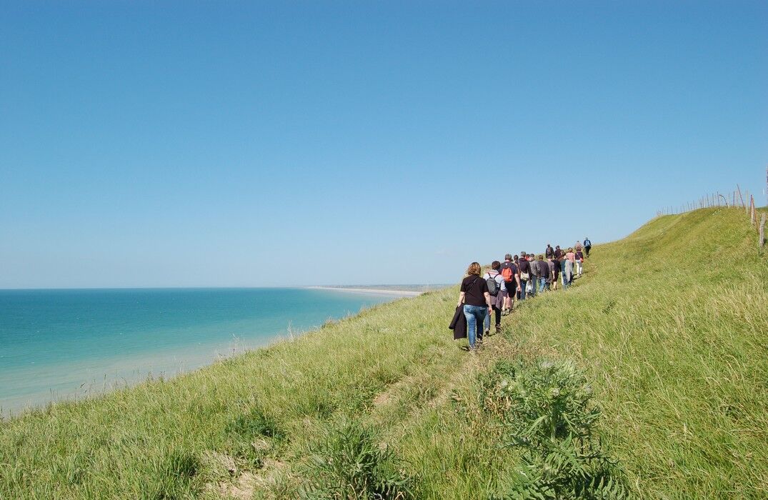
The rest of the route winds between hollow paths bordered by hedges, pastures, and groves, revealing the Bois de Cise then the municipality of Saint-Quentin-Lamotte-Croix-au-Bailly (the longest commune name in France!).
Accessible to walkers of all levels, this well-marked circuit can be completed in about 2.5 to 3 hours.
The start is from the center of Ault, a typical maritime village, next to the Saint-Pierre church. After crossing the town heading towards the sea, the trail gradually climbs south towards the Bois de Cise, offering magnificent views of the white cliffs and the sea as far as the eye can see.
The rest of the route winds between hollow paths bordered by hedges, pastures, and groves, revealing the Bois de Cise then the municipality of Saint-Quentin-Lamotte-Croix-au-Bailly (the longest commune name in France!).
Accessible to walkers of all levels, this well-marked circuit can be completed in about 2.5 to 3 hours.
Trasa
Église Saint-Pierre
(28 m)
Miesto uctievania
0,0 km
Ault
(22 m)
Dedina
0,1 km
Bois de Cise
(53 m)
Susedstvo
2,3 km
Saint-Quentin-la-Motte-Croix-au-Bailly
(104 m)
Dedina
6,7 km
Église Saint-Quentin
(104 m)
Miesto uctievania
6,8 km
Église Saint-Pierre
(28 m)
Miesto uctievania
11,2 km
Trasa
Lamotte Circuit
svetlo
Turistika
11,43
km
Église Saint-Pierre
(28 m)
Miesto uctievania
0,0 km
Ault
(22 m)
Dedina
0,1 km
Calvaire
(56 m)
Uhol pohľadu
0,5 km
Bois de Cise
(53 m)
Susedstvo
2,3 km
Saint-Quentin-la-Motte-Croix-au-Bailly
(104 m)
Dedina
6,7 km
Église Saint-Quentin
(104 m)
Miesto uctievania
6,8 km
Église Saint-Pierre
(28 m)
Miesto uctievania
11,2 km
Ault
(22 m)
Dedina
11,3 km


Naposledy sledované
Pred 2 týždňami
Bezpečnostné pokyny
In case of emergency, dial 112
Informácie o príchode
Príchod
Consider carpooling
Parkovanie
Parking close to the starting point
Ďalšie informácie a tipy
Ďalšie informácie
Zatiaľ žiadne recenzie
Obľúbené výlety v okolí
-
Greenway "Path between Glass & Sea"
svetloTuristika 35,8 km -
Circuit vélo – Gravelot
strednáCyklistika 36,8 km -
The Baie de Somme coastal path
svetloTuristika 52,7 km -
The Hâble d'Ault Bird Reserve
svetloTuristika 6,05 km -
Circuit of the Isle
svetloTuristika 11,4 km -
The Vélomaritime® - EuroVelo4 - Le Tréport -> Cayeux-sur-Mer
svetloMountainbike 22,5 km -
Mésange Circuit
svetloCestný bicykel 38,4 km -
The Seagull circuit
svetloCestný bicykel 29,0 km -
Circuit du Vanneau
svetloMountainbike 30,5 km -
The Tufa Crosses: Franleu - Cayeux-sur-Mer
svetloCestný bicykel 52,0 km

Turistika a stopovanie

Viac ako 550.000 návrhov výletov, podrobné mapy a intuitívny plánovač trás robia z aplikácie povinnú výbavu pre všetkých nadšencov prírody.

Nenechajte si ujsť ponuky a inšpiráciu na ďalšiu dovolenku
Prihlásiť sa k odberu noviniek
Chyba
Vyskytla sa chyba. Prosím, skúste to znova.
Ďakujeme za vašu registráciu
Vaša e-mailová adresa bol pridaný do poštového zoznamu.
Zájazdy po celej Európe
Rakúsko
Švajčiarsko
Nemecko
Taliansko
Slovinsko
Francúzsko
Holandsko
Belgicko
Poľsko
Lichtenštajnsko
Česko
Slovensko
španielsko
Hrvaška
Bosna a Hercegovina
Luxembursko
Andorra
Portugalsko
Island
Spojené kráľovstvo
Írsko
Grécko
Albánsko
Severné Macedónsko
Malta
Nórsko
Čierna Hora
Moldavsko
Kosovo
Maďarsko
San Maríno
Rumunsko
Estónsko
Lotyšsko
Bielorusko
Cyprus
Litva
Srbsko
Bulharsko
Monako
Dánsko
Švédsko
Fínsko