


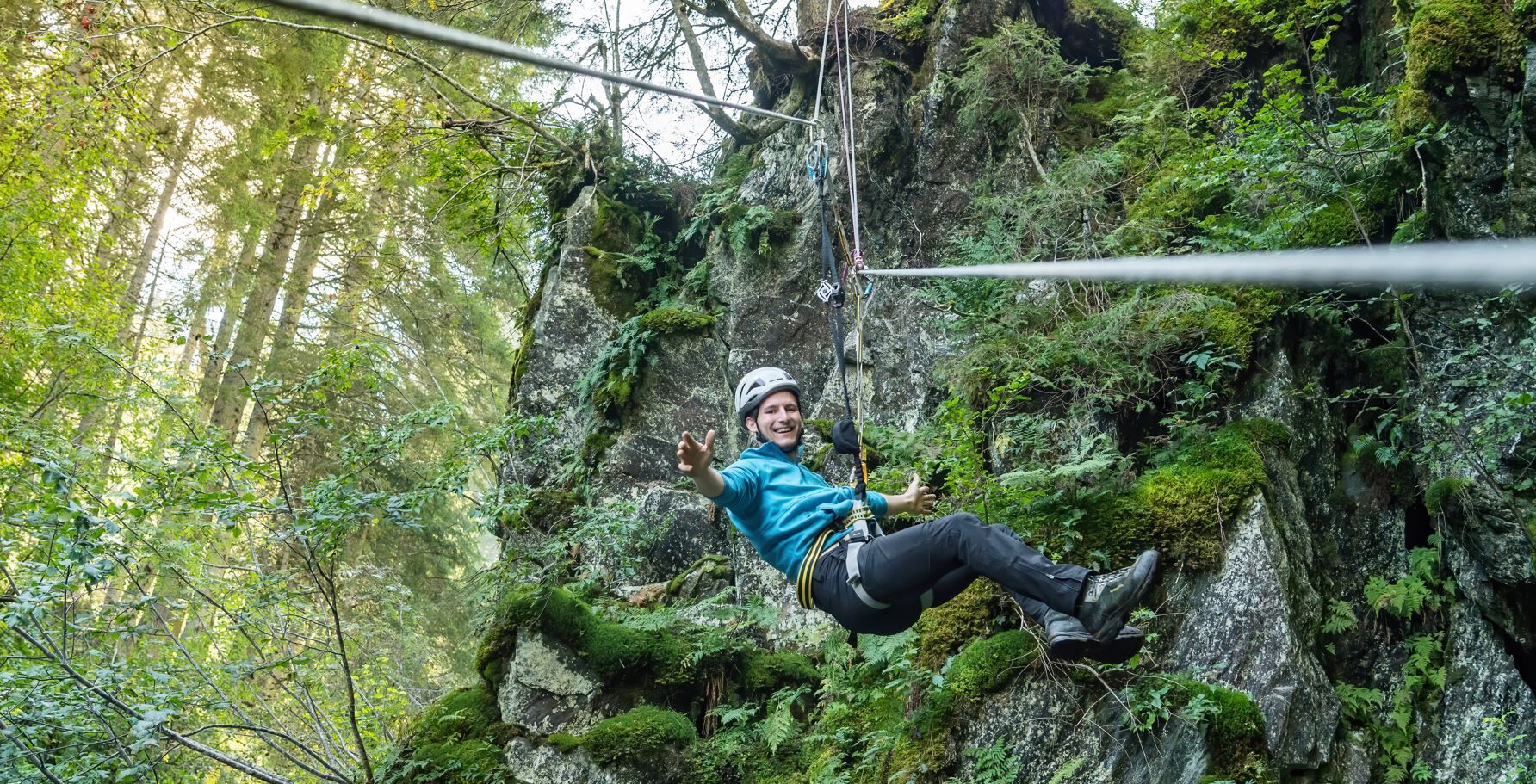
Heilkraft Waterfall Via Ferrata
Úroveň náročnosti: B
Please check before the route for the current accessibility (open / closed) as well as the current weather situation!
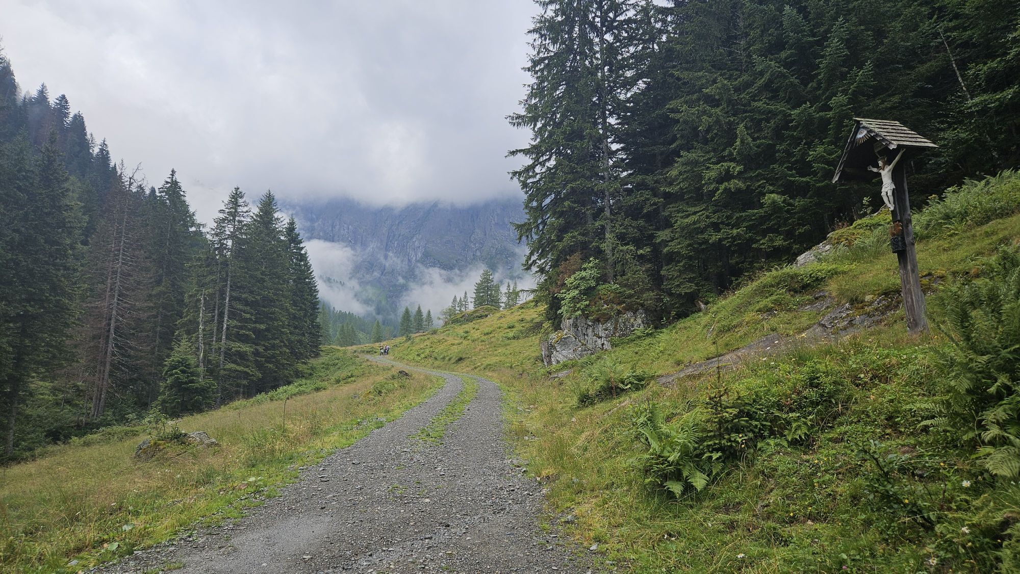
From the parking lot, walk inland on the gravel path by the "Bienentankstelle". At...
Please check before the route for the current accessibility (open / closed) as well as the current weather situation!
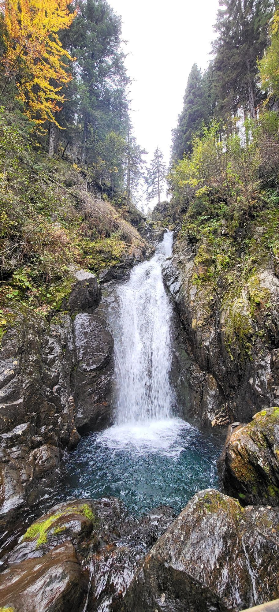
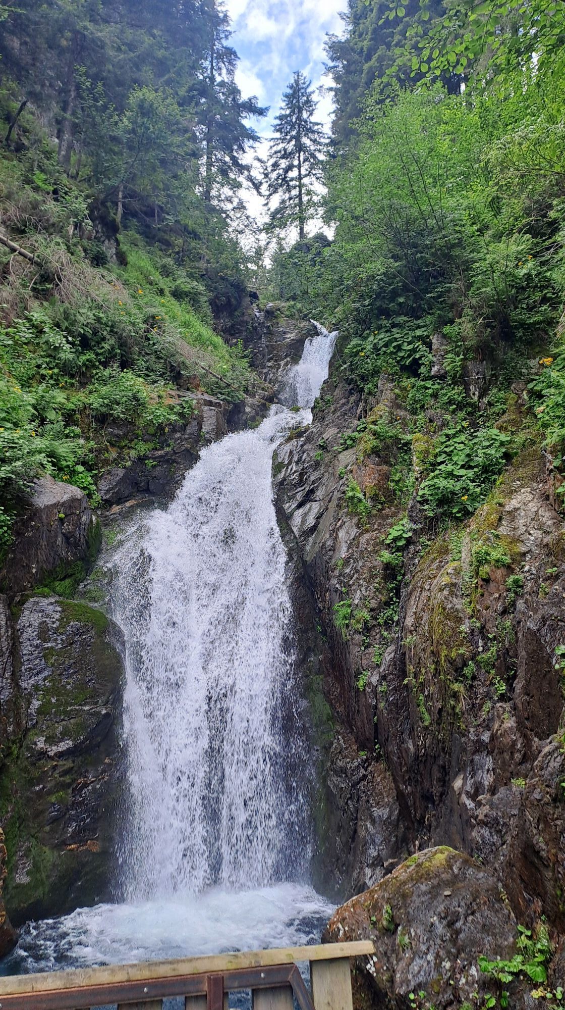
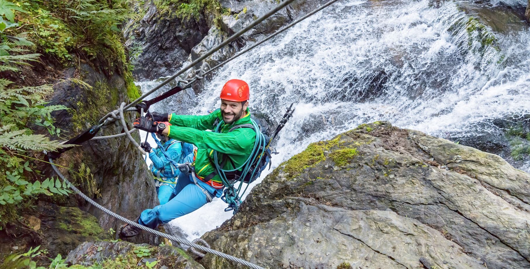
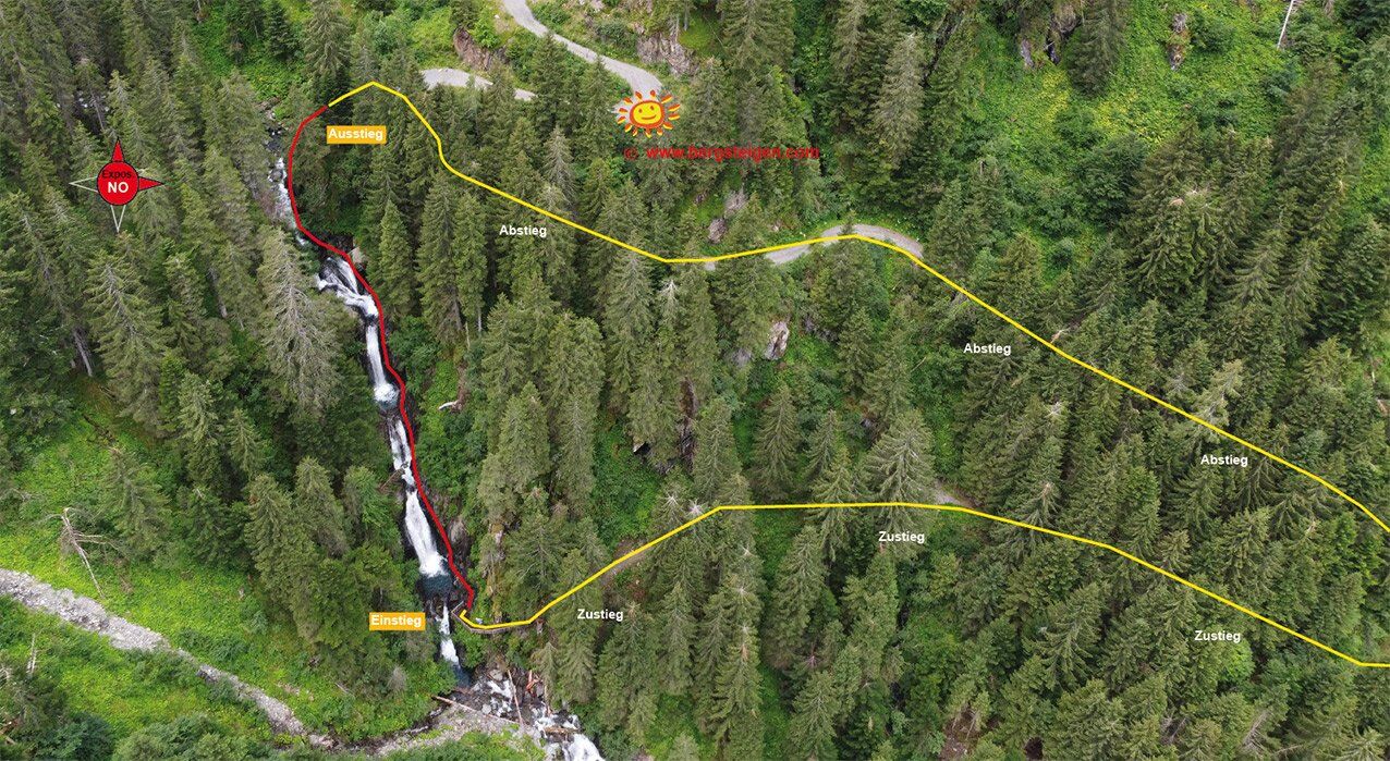
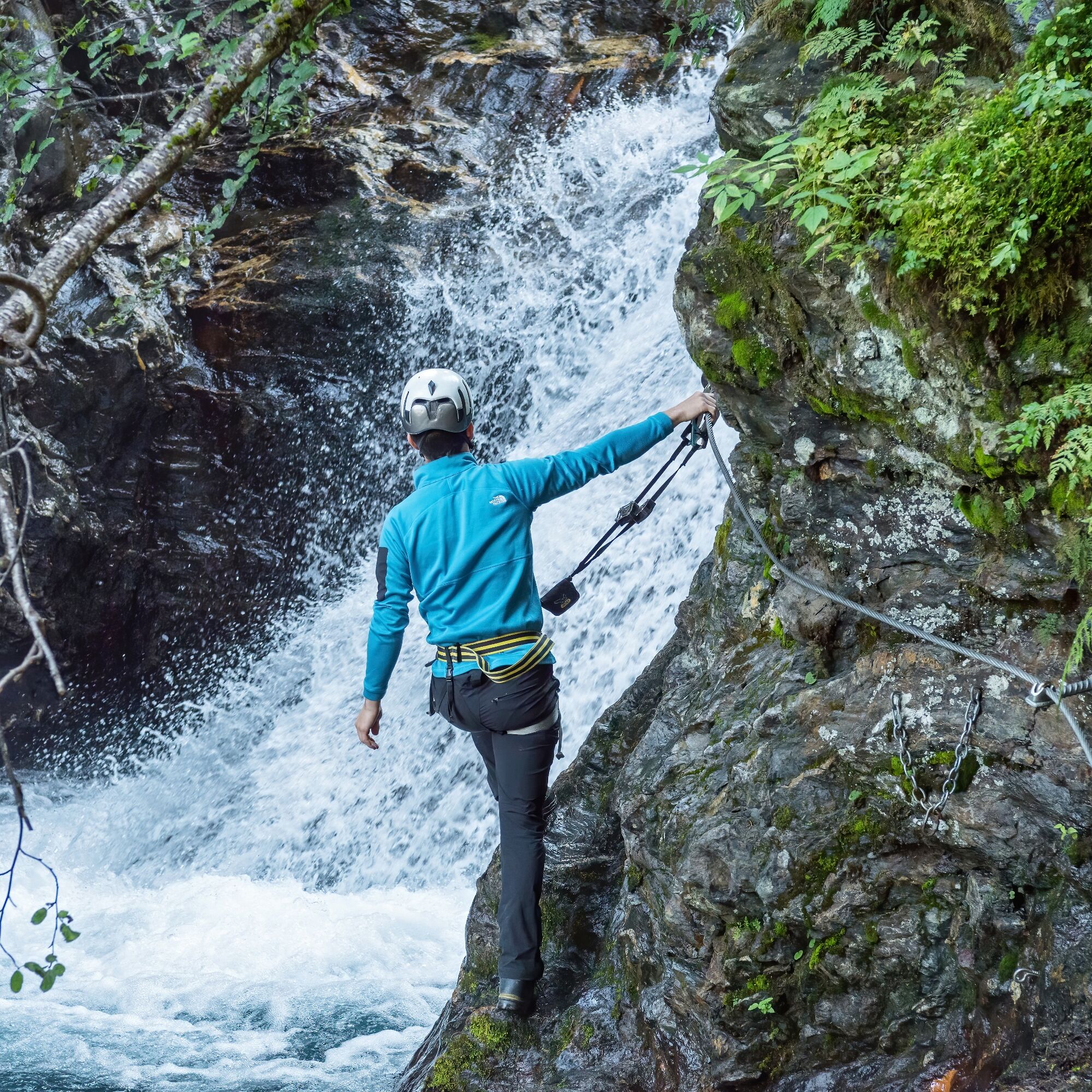
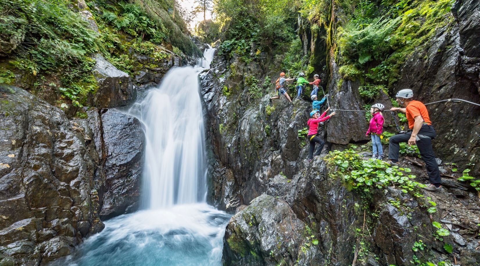
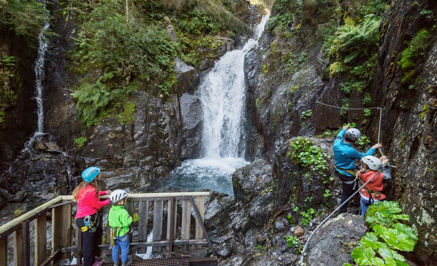
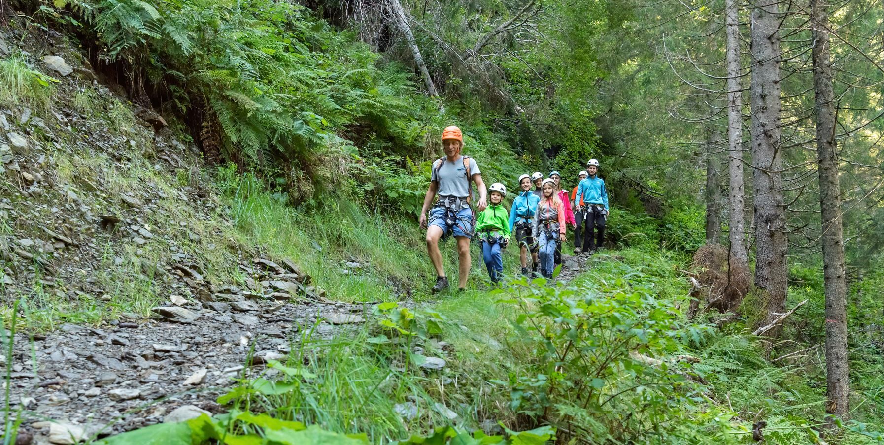
From the parking lot, walk inland on the gravel path by the "Bienentankstelle". At a fork, turn right towards the waterfall/Goldcamp. At Goldcamp, leave the gravel road and continue straight on the path, then turn left uphill towards the waterfall. You will reach a platform directly at the water, where the via ferrata begins. The via ferrata is mostly A/B, with some sections slightly more difficult B/C.
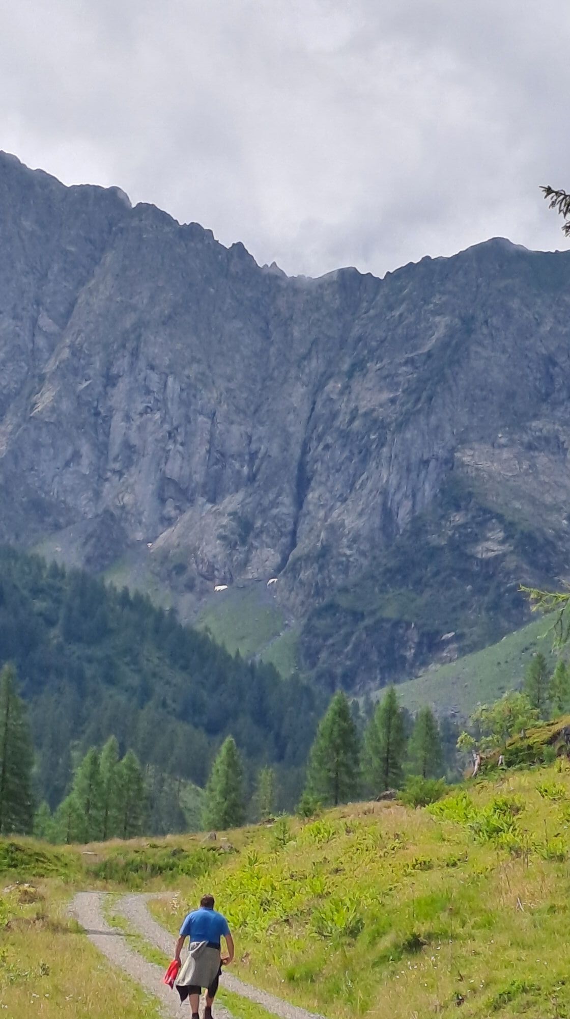
After the via ferrata, there is also the option to continue hiking to the Gamskogel.
Descent:
From the exit, return on the gravel path to the starting point.

Please check before the route for the current accessibility (open / closed) as well as the current weather situation!
From the parking lot, walk inland on the gravel path by the "Bienentankstelle". At a fork, turn right towards the waterfall/Goldcamp. At Goldcamp, leave the gravel road and continue straight on the path, then turn left uphill towards the waterfall. You will reach a platform directly at the water, where the via ferrata begins. The via ferrata is mostly A/B, with some sections slightly more difficult B/C.
After the via ferrata, there is also the option to continue hiking to the Gamskogel.
Descent:
From the exit, return on the gravel path to the starting point.
Áno
Áno
Emergency numbers:
Mountain rescue: 140 European emergency number: 112Note:
The difficulty rating applies only to the via ferrata, excluding approach and descent.
Drive from Hermagor to Kötschach and stay on the road for about 30 kilometers. Then turn left onto B110 and after a few hundred meters turn right onto Gailtalstraße B111. Stay on the road for 14 kilometers and turn left onto Obergail. Follow the road to the parking lot.
It is possible to reach Liesing by public transport.
Information about schedules at: www.nassfeld.at/mobilitaet
Parking is possible at the "Bienentankstelle" parking lot
B
Mountain guides for the route:
Of course, there are also experienced contacts in the region who will be happy to accompany you on this route! For safety, we recommend a mountain guide if you lack basic knowledge.
More information can be found at www.nassfeld.at
Obľúbené výlety v okolí
-
4,7
Karlsbader Hütte über Rudl-Eller-Weg
ťažkéTuristika 5,10 km -
4,5
Karnischer Höhenweg – Etappe 4: Hochweißsteinhaus – Wolayersee Hütte
ťažkédiaľková pešia trasa 15,9 km -
4,8
Pirknerklamm (C)
strednáVia ferrata 2 km -
4,8
Lienzer Dolomiten-Lasertörl
strednáTuristika 13,2 km -
4,7
Obergail - Obergailer Alm - Obergailer Lake - Enderberg hut - Source for Health & Peace - Madonna circular hiking route - Obergail
strednáTuristika 11,4 km -
3,9
Karlsbader Hütte - Lienzer Dolomiten
Turistika 8 km -
4,9
Karnischer Hauptkamm - Hohe Warte 2.780m - Hike and Bike
ťažkéHorská turistika 19,5 km -
4,3
Mountain bike route from the Hubertus Chapel to the Wolayersee
ťažkéMountainbike 9,06 km -
3,9
Summit hike to the Hochstadel
strednáTuristika 7,83 km -
5,0
Carnic altitude trail. Stage 4: Porzehütte – Hochweißsteinhaus
ťažkéTuristika 17,5 km
Turistika a stopovanie


Nenechajte si ujsť ponuky a inšpiráciu na ďalšiu dovolenku
Vaša e-mailová adresa bol pridaný do poštového zoznamu.