


TOUR DU LAC DU SALAGOU HIKE - GR® DE PAYS ENTRE 2 LACS AVÈNE - SALAGOU
In the heart of the Grand Site Salagou - Cirque de Mourèze, 2 or 3 days hiking around the most famous lake in the Hérault...Discover Clermont l'Hérault, the Salagou dam and all the banks of the lake, Celles,...
The Tour du lac du Salagou is one of the components of the GR® de Pays Entre Deux Lacs Avène - Salagou: two lake tours over 2 or 3 days, and a Sentier des 2 lacs that can be completed in 3, 4 or 5 days. Wonderful slow-motion journeys through the nature and geology of the Hérault region, in the heart of the Terres d'Hérault Geopark.

1
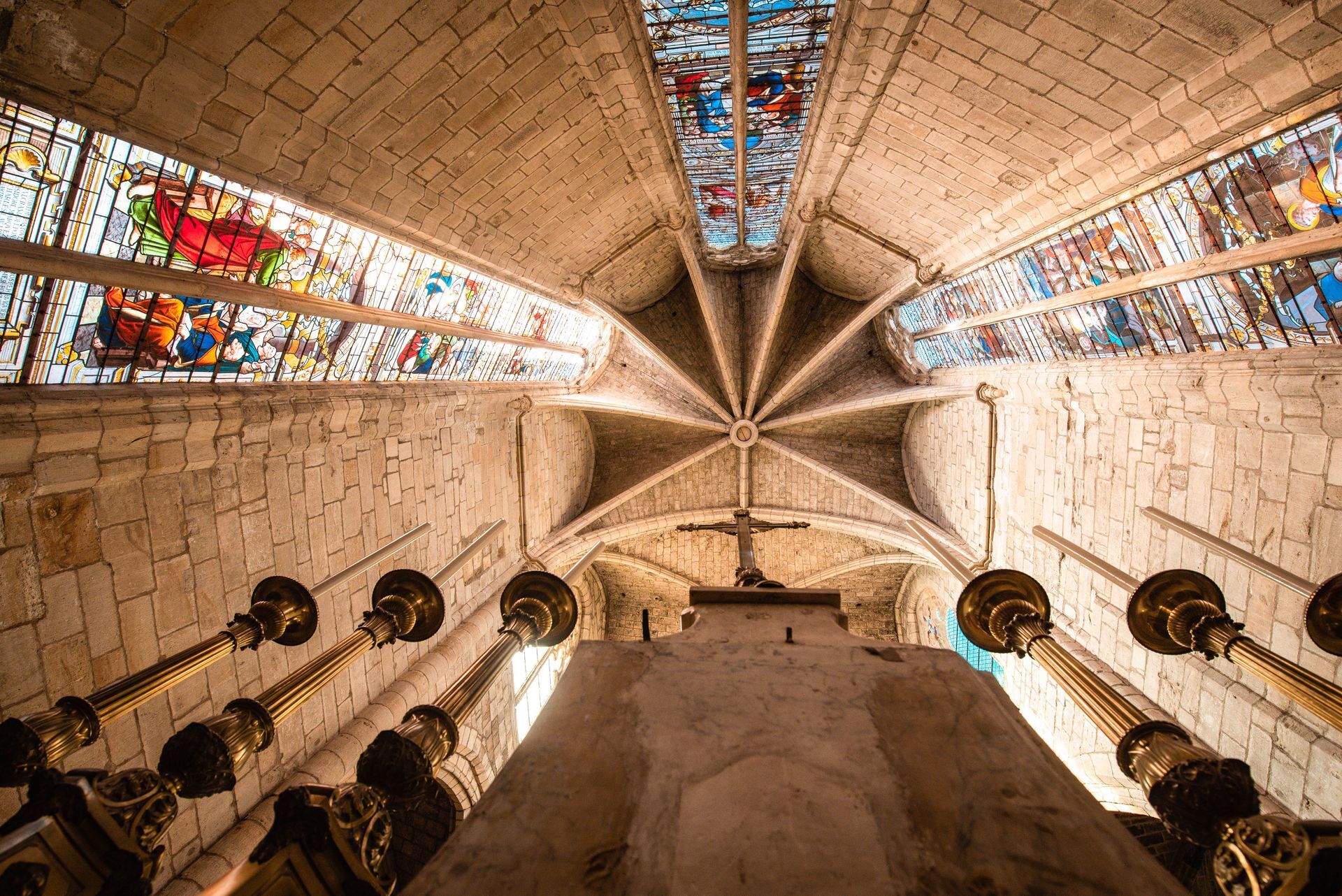
Clermont l'Hérault From the Esplanade de la Gare, it's a short walk to the imposing Church of St. Paul, a remarkable example of Southern Gothic architecture. Embedded in the city walls, this 13th-century edifice was part of a defensive system. The interior is incredibly light and airy... On Wednesday mornings, a wonderful market is held around the Saint-Paul church... After wandering through the narrow streets of medieval Clermont, you're soon on your way out of town. A visit to the Miellerie du Salagou is highly recommended! A pretty "voie verte" leads to a pass with a magnificent view of the Lac du Salagou, a quiet track leads down to the lake between vineyards and olive groves, then along the road, enjoying the view, to the dam.
2
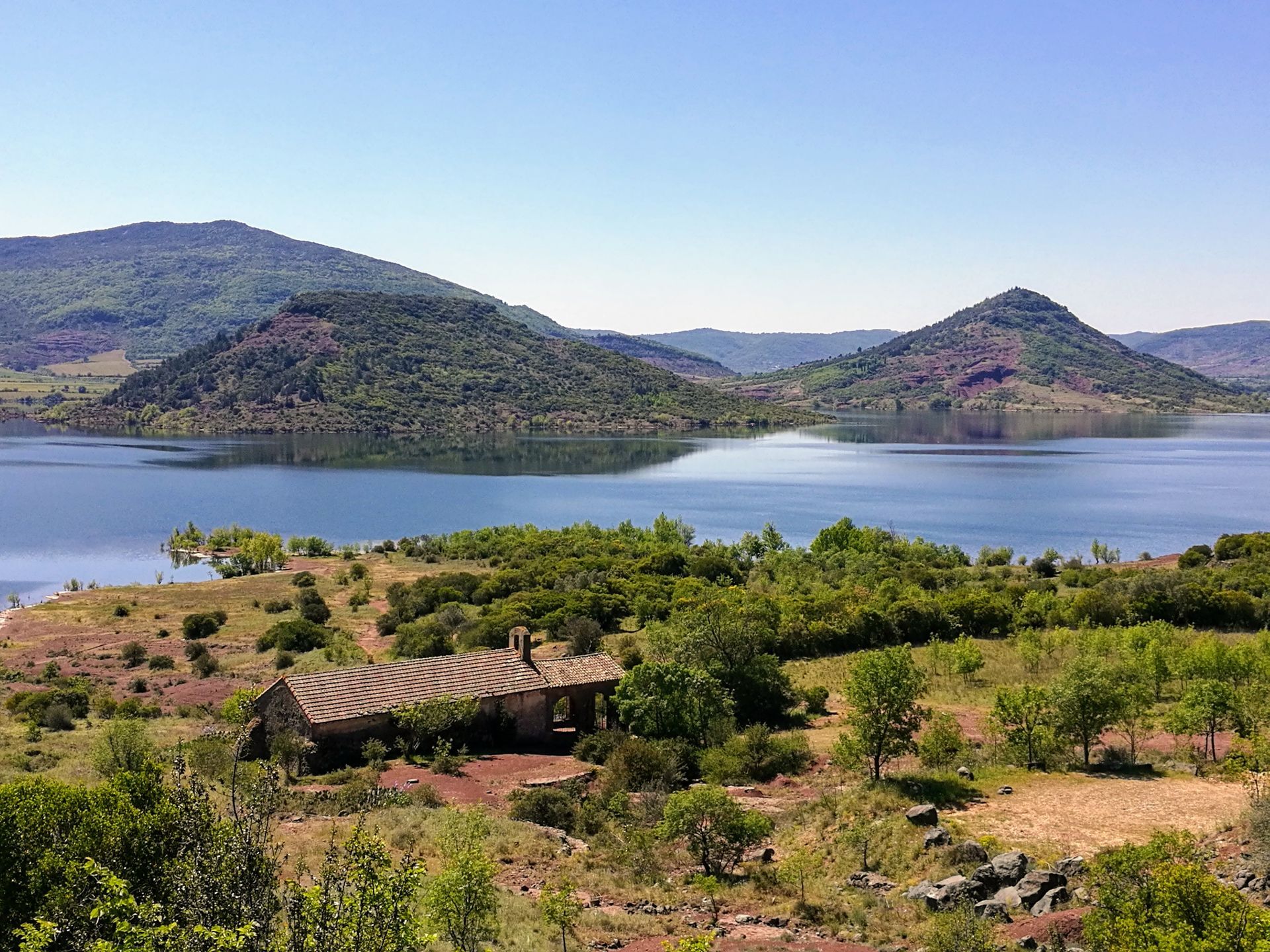
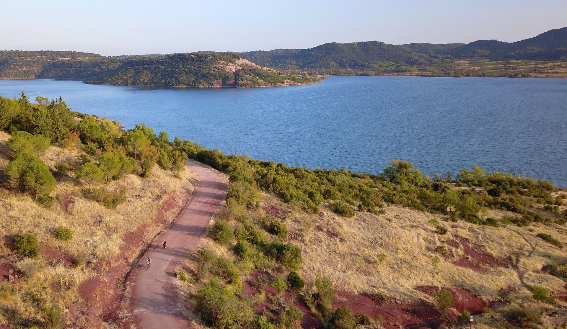
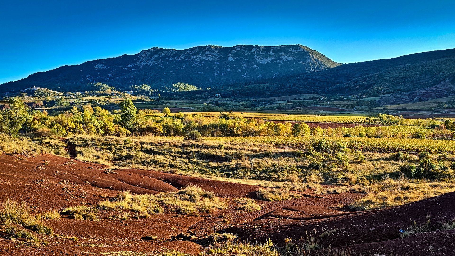
Salagou dam The height and massiveness of the dam are impressive: it's got to be to contain the 103 million cubic metres and 700 hectares of lake! The rockfill of this imposing structure is made of basalt, a rock of volcanic origin quarried locally. Dating back to the 1960s, the dam was built to irrigate the land and regulate flooding. After a good climb, we reach the comfortable track on the northern shores of the lake: a magnificent view of the lake and the ideal spot for a picnic. After this break, the trail skirts a canyon and then plunges down a steep path to the lake shore. This is followed by a long walk along a wonderful path just above the lake. Swimming breaks in fine weather, and photo breaks all year round!
3
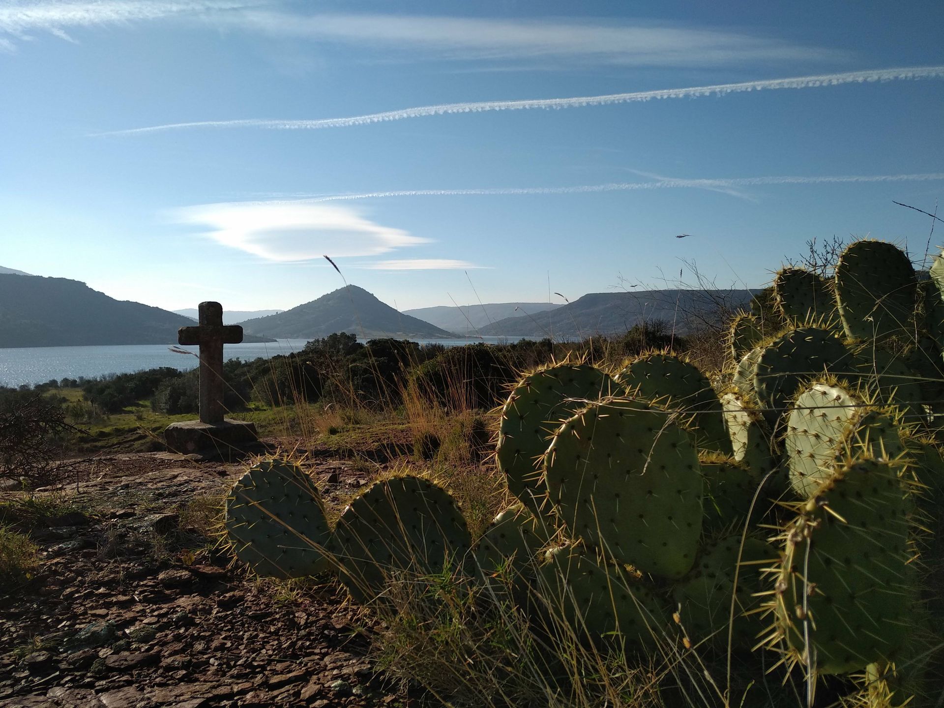
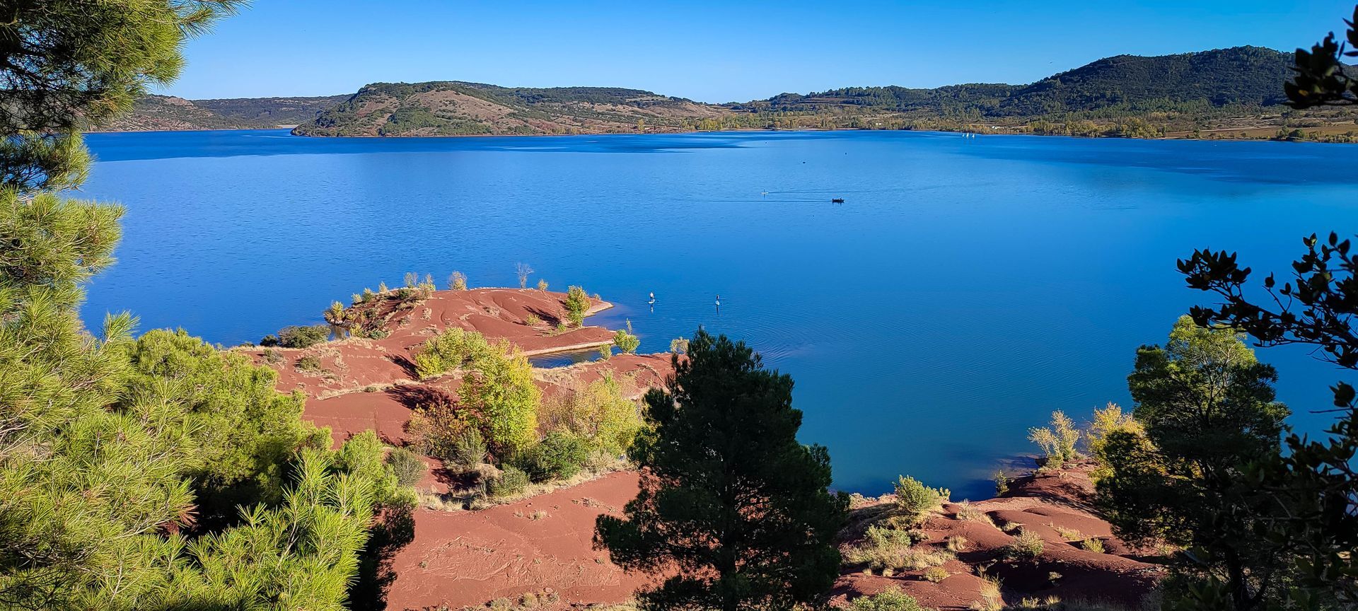
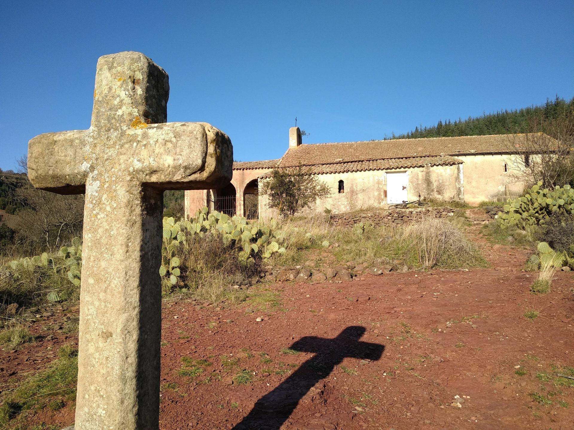
Notre-Dame des Clans A detour to the Notre-Dame des Clans chapel is a must (just follow the mountain bike signs). Built in the 14th and 15th centuries of local stone, this edifice overlooking the lake is dedicated to the Virgin Mary. Today, the chapel is a place of pilgrimage on August 15. The site is magnificent: beautiful views of the lake, Mont Liausson and the peninsulas on the south shore. And an Arizona atmosphere: watch out for the cacti! Back on the shores of the lake, the path continues under the hamlet of Les Vailhès, still between banks and ruffes. From here on, you're sure to come across many mountain bikers: you're on the legendary route of the Tour du Lac du Salagou mountain bike tour! Respectful sharing of paths and water is part of the spirit of the Grand Site Salagou - Cirque de Mourèze: to avoid multiplying paths and damaging a unique ecosystem...
4
The Baie des Vailhès The Baie des Vailhès is the Salagou beach most easily accessible from Montpellier or Lodève. In summer (and not only), it's a lively and busy place, with wonderful swimming and fishing spots, a campsite, a refreshment bar, a nautical base... and a breathtaking view to the south towards the Rouens peninsula and Mount Liausson. It's rootsy, but the setting is true to the spirit of the lake and the Lodévois - Larzac region: natural, friendly and welcoming! After a break at the Baie des Vailhès, the trail climbs a little steeply through an astonishing landscape of red canyons, before descending along a stony path to Celles.
5
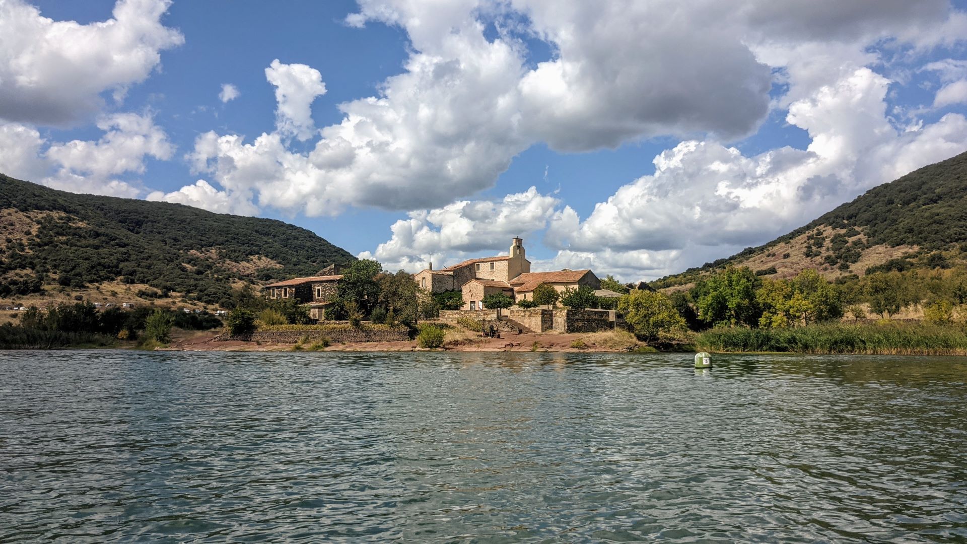
Celles The story of a death foretold, and a rebirth. The village of Celles survived the impoundment of the Lac du Salagou: half a century ago, by a miracle, the water from the dam stopped at the gates of the emptied village. Celles is the icon of the lake: a strange, ghostly place... It has played host to numerous film shoots, and touches all those who visit it. Today, a second life is about to begin: at Celles, all real estate speculation will be banned, as the town council will retain ownership of the land, to preserve the beauty of the site and the spirit of the place. Just beyond Celles, the trail crosses the Mas de Riri, a wonderful campsite/hotel/restaurant and a wonderful family story. When the lake was born in 1969, no one but Riri thought it would interest anyone... Joelle, daughter of Riri and Marcelle, became mayor of Celles, and her tenacity is behind the village's renaissance. And her son Youri is now continuing the Mas de Riri adventure. Just a few hundred meters on a pretty path, still shared with mountain bikes, to reach the banks of Octon.
6
Rives d'Octon In Octon, there are two banks! The first is the one with the pretty fishing pontoon set up for the enjoyment of disabled anglers opposite the Neck de la Roque. There's also a funny boat launch: this is the old road that crossed the Salagou valley before the dam was built. If you look closely at the lake, you'll be able to make out its course (there are still some trees sticking out in front of the Mas de Riri). Between the 2 shores, don't hesitate to make a detour to the village of Octon: charm, accommodation, restaurants and a nice grocery store... Everything for the hiker's pleasure!
7
Les Arcades The second shore of Octon is the official end of the Sentier des 2 lacs, at the Arcades campsite. A remarkable viewpoint: reed beds, Neck de la Roque... In summer, the Relais Nautique guinguette offers swimming, pedal-boating or stand-up paddle; and a lovely table! The Relais Nautique team: passionate, a little crazy... like the Salagou landscape. We continue towards the southern shores of the lake, crossing the ford over the Salagou River, which gives the lake its name (beware, it gets wet after heavy rain!). Then it's an uninterrupted series of pretty red paths, vineyards and crumbling ruffes, with breathtaking views of the lake, the Sure hill, the Rouens peninsula and the Liausson mountain. With a few bathing spots thrown in for good measure in summer: it gets hot on the ruffes...
8
Banks of Liausson From the banks of Liausson, it's highly recommended to make a detour via Mont Liausson on the yellow PR trail. This is an 8km route with just under 500m of ascent, with a pleasant climb from the Col des Portes to the summit. The Grand Site Salagou - Cirque de Mourèze seen from above... An exceptional panoramic view, full of color: the blue of the lake, the red ruffles, the yellow of the broom and the mosaic of the vines. On the other side, your gaze stops on the ghostly shapes of the cirque de Mourèze. This trail is connected to the cirque de Mourèze PR. Salagoumaniac tip: get out your maps and consider adding a stopover in Mourèze to your tour. You won't be disappointed... If you don't have the time or the courage to make the detour via Mont Liausson and Mourèze, at least go up to Liausson: a charming village with magical views over the vineyards and lake!
9
Rives de Clermont In summer, stop off at Olivier's on the beach at Wind34. Another lake lover, and a great place to enjoy a local beer! Enjoy the beach and watch the kite-surfers and other wing-foilers who have made this mythical spot their home. Off-season, don't look for the guinguette: Olivier dismantles it for the winter, to restore the wild character of the area. On the banks of Clermont, the view of the lake at the end of the day from the pontoon is a delight for lovers of beautiful landscapes and perfect shots! You can eat, drink, camp or simply enjoy the shady beach. Make a detour to the Base de Plein Air du Salagou to rent a pedalo, paddle or other sailing craft! Only 6 km to go to the end of the tour, following the route taken on the outward journey....
10
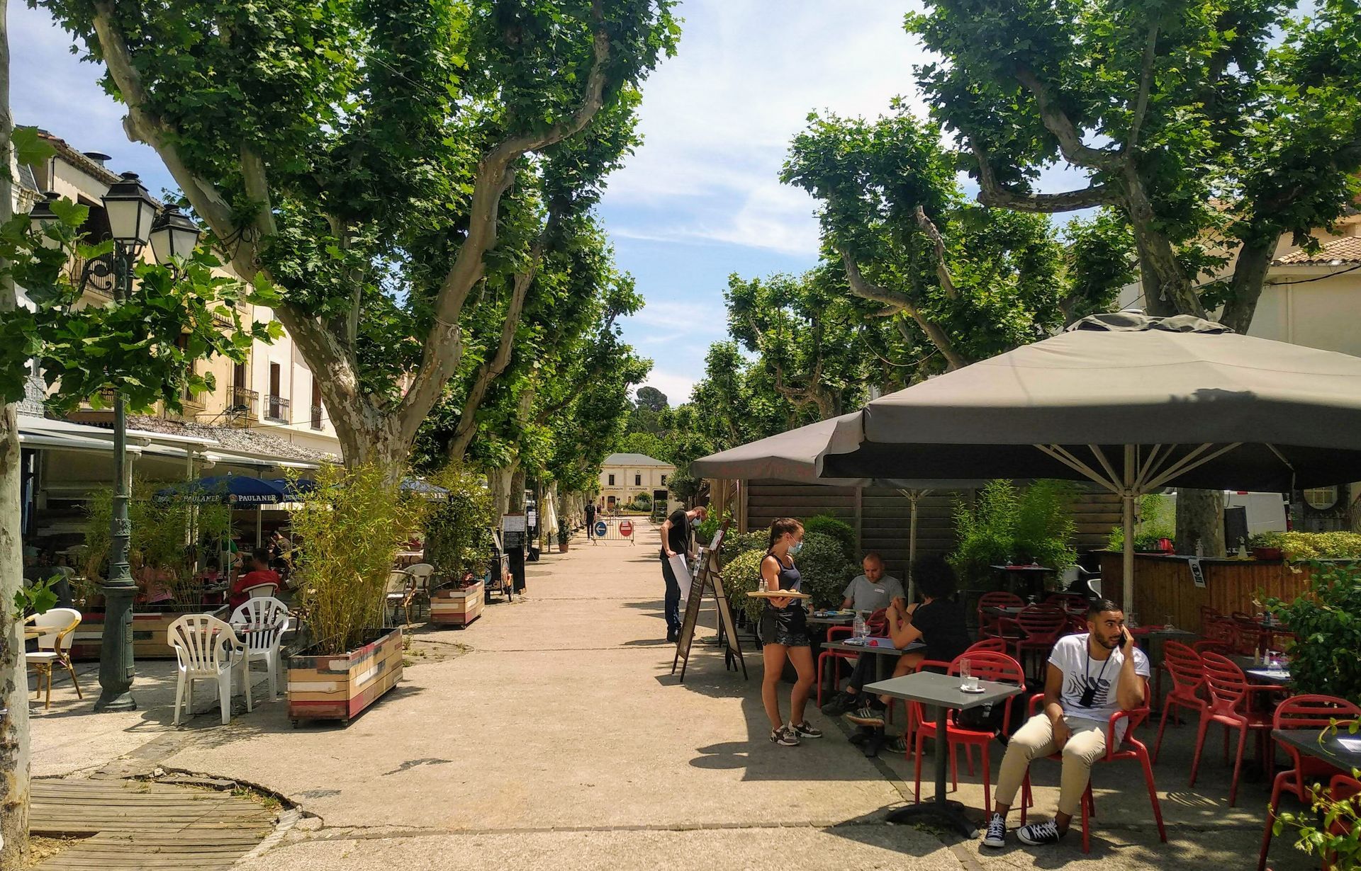
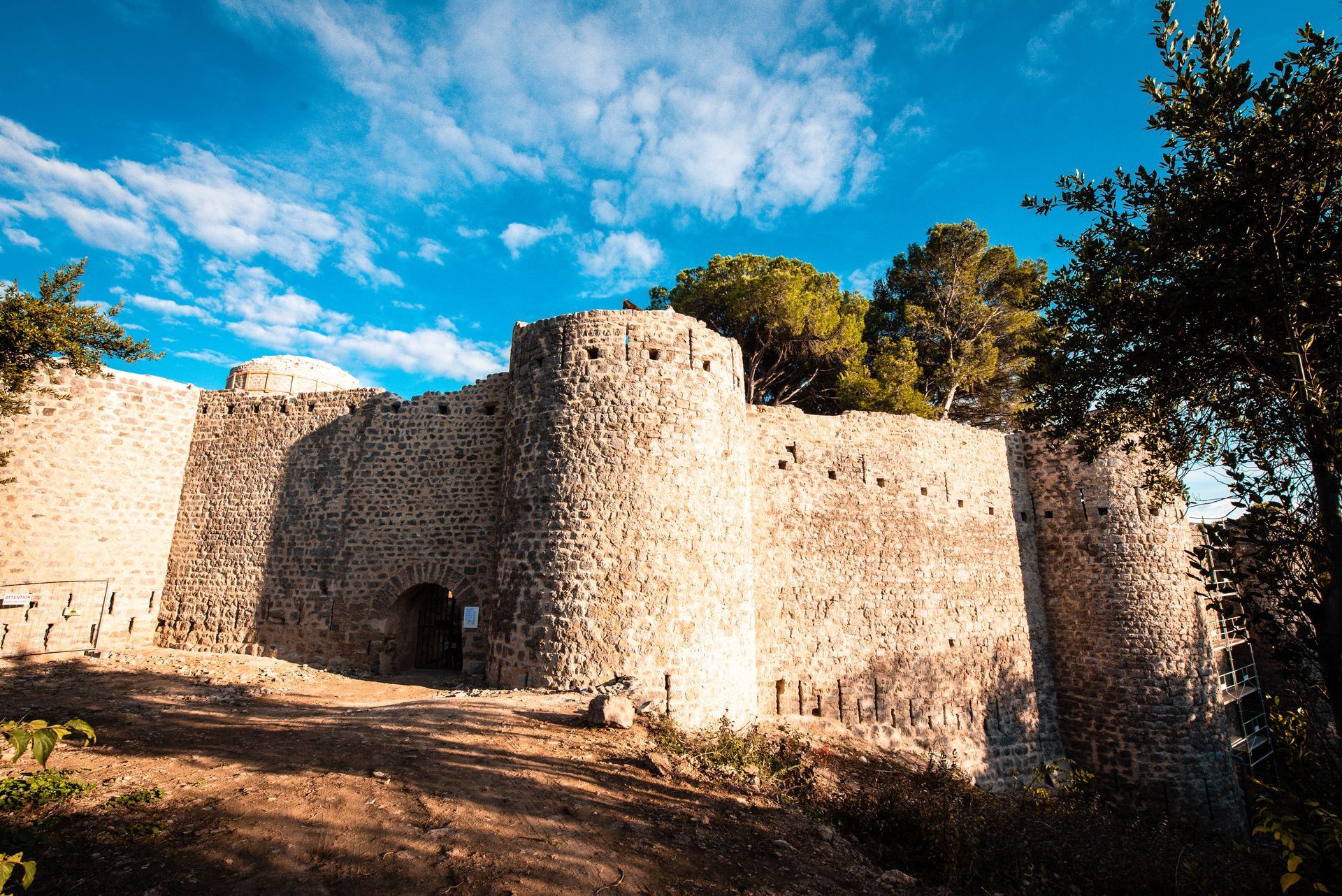
Château des Guilhem and Allées Salengro From the Miellerie du Salagou, you'll pass through a number of housing estates before returning to the panoramic path that leads to the Château des Guilhem. Built on the site of Puech Castel overlooking the town, the edifice dates back to the 12th century. Despite its eventful history, it has preserved its typical circular towers and several ramparts. An exceptional and rare testimony to a bygone era, it was recently restored by the commune. Tip: when the castle site is open, walk through it to follow the signposts on the trail to the heights of old Clermont. You'll be impressed by the magnificent views over the town and the plain from the castle walls. All that's left to do is let yourself be guided through the town, admiring the Saint-Paul church again as you go, and window-shopping in the rue du Doyen René Gosse. The adventure ends on a terrace, on the Allées Salengro: the lively heart of the town, and a wonderful Languedoc atmosphere, with plane trees and wine...
The Salagou - Mourèze tour in 3 days: Best done in spring or autumn, as it gets hot between Mourèze and Mont Liausson in summer. - Day 1: Clermont l'Hérault to Octon - Day 2: Octon to Mourèze via the banks of Liausson and the PR of Mont Liausson and Cirque de Mourèze - 3rd day: from Mourèze to Clermont, passing the summit of Mont Liausson
The Salagou tour in trail mode: - 1 day, 26 kilometers, starting from the banks of Clermont. - The most motivated will climb Mont Liausson on the way.... + 8 km and + 464m ascent, by the PR du Mont Liausson from the banks of Liausson
GR® and GR® de Pays are registered trademarks of the FFRandonnée, designating routes identified as "GR®", marked with white-red markings; and as "GR® de Pays", marked with yellow-red markings. These routes are the creations of FFRandonnée. Their unauthorized reproduction, as well as the GR® and GR® de Pays trademarks, constitutes an infringement liable to prosecution. Find all GR® routes on mongr.fr
Yellow and red GR country
https://www.destination-salagou.fr/
Office de Tourisme du Clermontais
GRP - FFR
Obľúbené výlety v okolí
-
5,0
CIRQUE DE MOUREZE HIKE
strednáTuristika 6,86 km -
5,0
LES VAILHÉS HIKING TRAIL
strednáTuristika 9,28 km -
5,0
MONT LIAUSSON HIKE
strednáTuristika 7,36 km -
5,0
CIRCUIT N°1 LE LAC DU SALAGOU - ESPACE VTT-FFC DU SALAGOU
strednáMountainbike 26,9 km -
4,0
HIKE OF THE GRÉZAC PLATEAU
strednáTuristika 14,0 km -
LAVAL DE NIZE HIKE
svetloTuristika 6,07 km -
TRAIL OF THE TOUR OF LAKE SALAGOU (SHORES OF CLERMONT) - GR® OF THE REGION BETWEEN 2 LAKES Avène – Salagou
strednáTrailrunning 25,6 km -
COURTINALS TRAIL HIKE
svetloTuristika 2,36 km -
BEALS TRAIL HIKE
strednáTuristika 4,51 km -
OENORANDO® OF THE VINEYARDS AND VOLCANOES OF FONTES
strednáTuristika 11,2 km
Turistika a stopovanie


Nenechajte si ujsť ponuky a inšpiráciu na ďalšiu dovolenku
Vaša e-mailová adresa bol pridaný do poštového zoznamu.