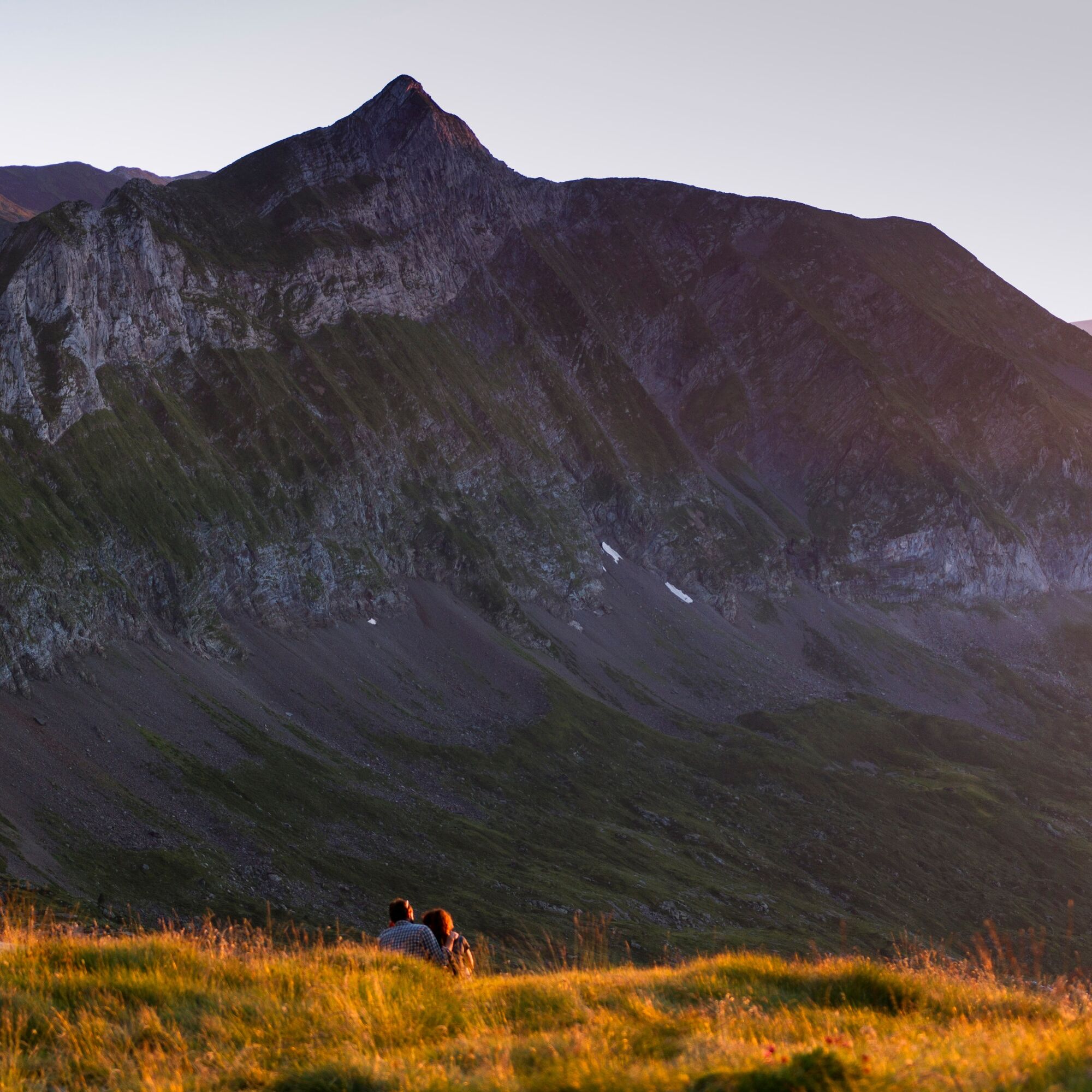
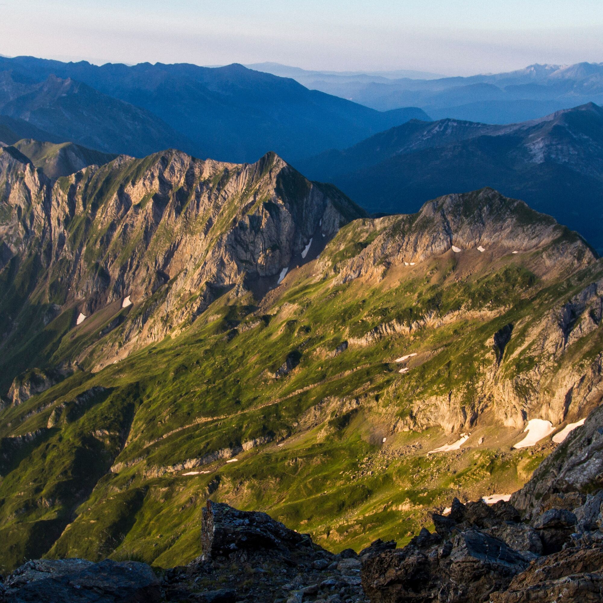
Mont Valier par l'étang de Milouga
ťažké
Navigácia na stránke
Navigácia na stránke
Získajte túto prehliadku v mobilnom telefóne
Mont Valier par l'étang de Milouga
ťažké
Turistika
21,21
km
Naskenujte kód QR a spustite navigáciu v aplikácii bergfex

Turistika a stopovanie


Mont Valier par l'étang de Milouga
ťažké
Vzdialenosť
21,21
km
Trvanie
11:30
h
Ascent
2 040
hm
Hladina mora
940 -
2 811
m
Stiahnutie skladby
Mont Valier par l'étang de Milouga
ťažké
Turistika
21,21
km
Trasa
Réserve domaniale du Mont Vallier
(942 m)
Uhol pohľadu
0,0 km
La Maison du Valier
(943 m)
Reštaurácia
0,2 km
Cascade de Nérech
(1 410 m)
Vodopád
3,6 km
Refuge «Les Estagnous»
(2 248 m)
Úkryt
7,0 km
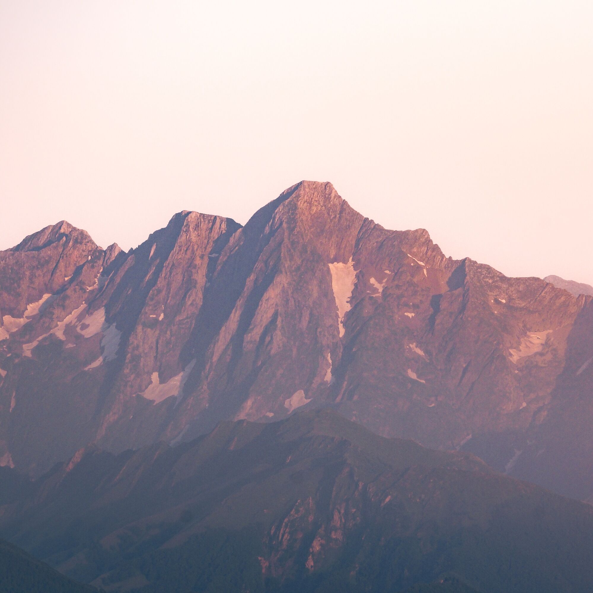
Mont Valier
(2 838 m)
Summit
8,9 km
Cabane du Taus
(1 893 m)
Útočisko (nespravované)
14,9 km
Fontaine d'Aouen
(1 691 m)
Zdroj
16,6 km
Trasa
Mont Valier par l'étang de Milouga
ťažké
Turistika
21,21
km
Réserve domaniale du Mont Vallier
(942 m)
Uhol pohľadu
0,0 km
La Maison du Valier
(943 m)
Reštaurácia
0,2 km
Cascade de Nérech
(1 410 m)
Vodopád
3,6 km
Cascade de la Lauze
(1 593 m)
Vodopád
4,5 km
Cabane de Caussis
(1 836 m)
Útočisko (nespravované)
5,5 km
Refuge «Les Estagnous»
(2 248 m)
Úkryt
7,0 km
Mont Valier
(2 838 m)
Summit
8,9 km
Refuge «Les Estagnous»
(2 248 m)
Úkryt
10,7 km
Cabane du Taus
(1 893 m)
Útočisko (nespravované)
14,9 km
Fontaine d'Aouen
(1 691 m)
Zdroj
16,6 km
La Maison du Valier
(943 m)
Reštaurácia
20,9 km
Autor
Poskytuje Ariège Pyrénées Tourisme
Prehliadku Mont Valier par l'étang de Milouga zabezpečuje outdooractive.com.


Informácie o trase
Trasa
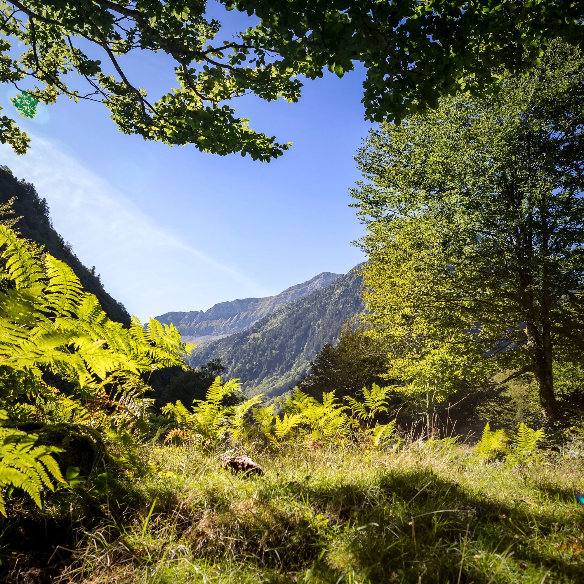
1/Departure from the Pla de la Lau car park 0h - 935 m Follow the GR10 down to the stream and to the right (signposted), leaving it quickly (do not cross the footbridge) to go straight ahead on the Port de la Girelle GRT (cross-border), signposted in red and white. A little further on, leave the Barlonguère route on the right and cross two footbridges on the left. Go up the right bank of the stream along the well-marked path that continues through the forest and ends near a rock shelter (la tutte de l'ours). The path splits and a footbridge allows you to follow the route on the other bank to reach the
2/Cascade de Nérech 1h40 - 1350 m Cross the footbridge and climb the switchbacks carved into the rock. Further on you come out into the meadow and continue as far as
3/La cabane de Caussis 3h - 1859 m At the fork in the path, take the path up on the left, still signposted in red and white (the path on the right takes 30 minutes to the Etang Rond). The climb is less steep and it won't be long before you reach the
4/Refuge des Estagnous 4h - 2246 m Leave the red and white markings and follow the well-marked yellow path (heading east-south-east). It quickly rises to a rocky spur that can be bypassed on the right. The climb is steep (snow-covered at the start of the season) towards the Col de Faustin. The route then becomes easy, deviates slightly from the ridge and quickly leads to the
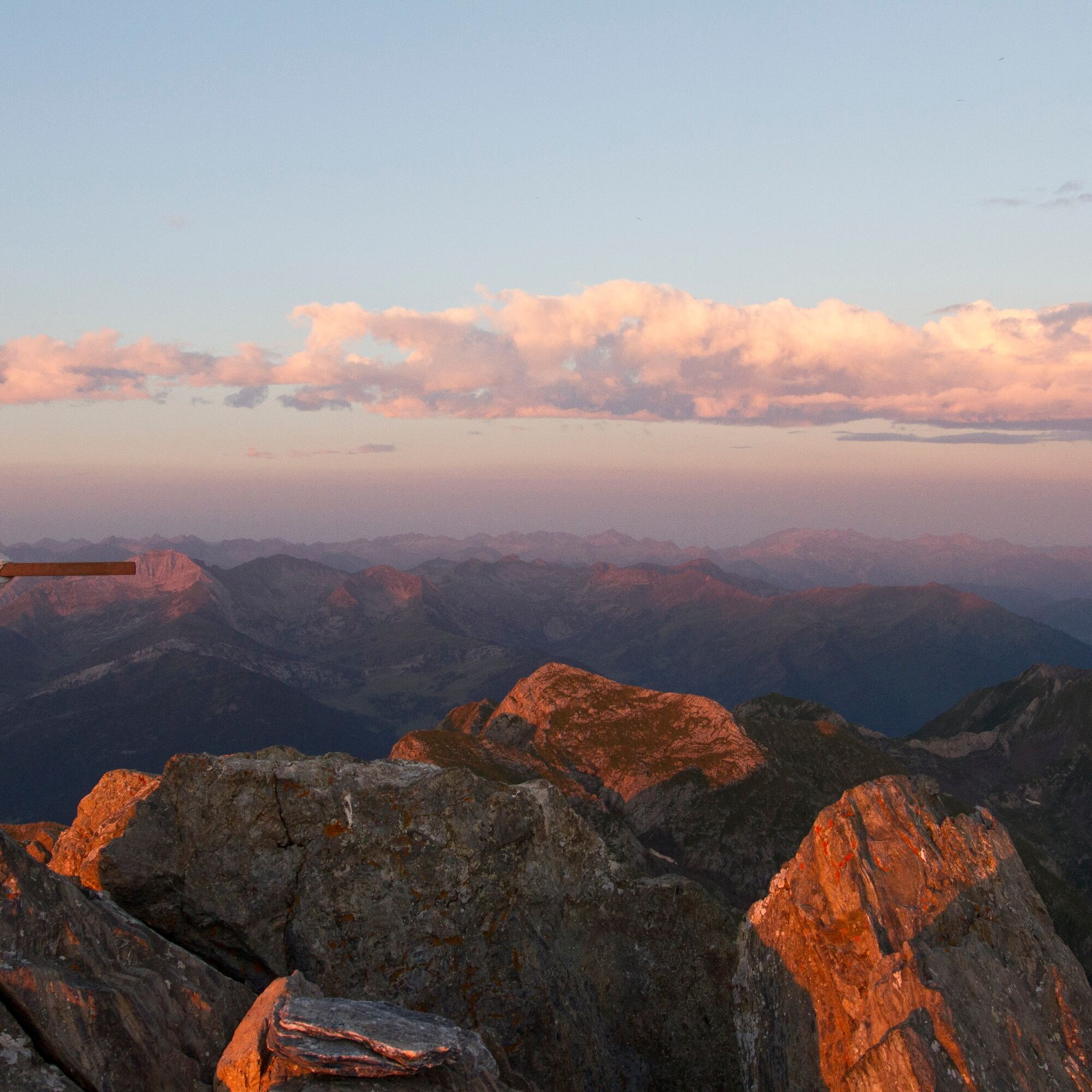
5/Summit of Mont-Valier 5h30 - 2838 m The return journey takes the same route in the opposite direction to the refuge, behind which the yellow signposted trail climbs to the Col de Pécouch (2462 m) and descends through the Lauzés (a large granite plain that is best crossed without fog) to arrive at
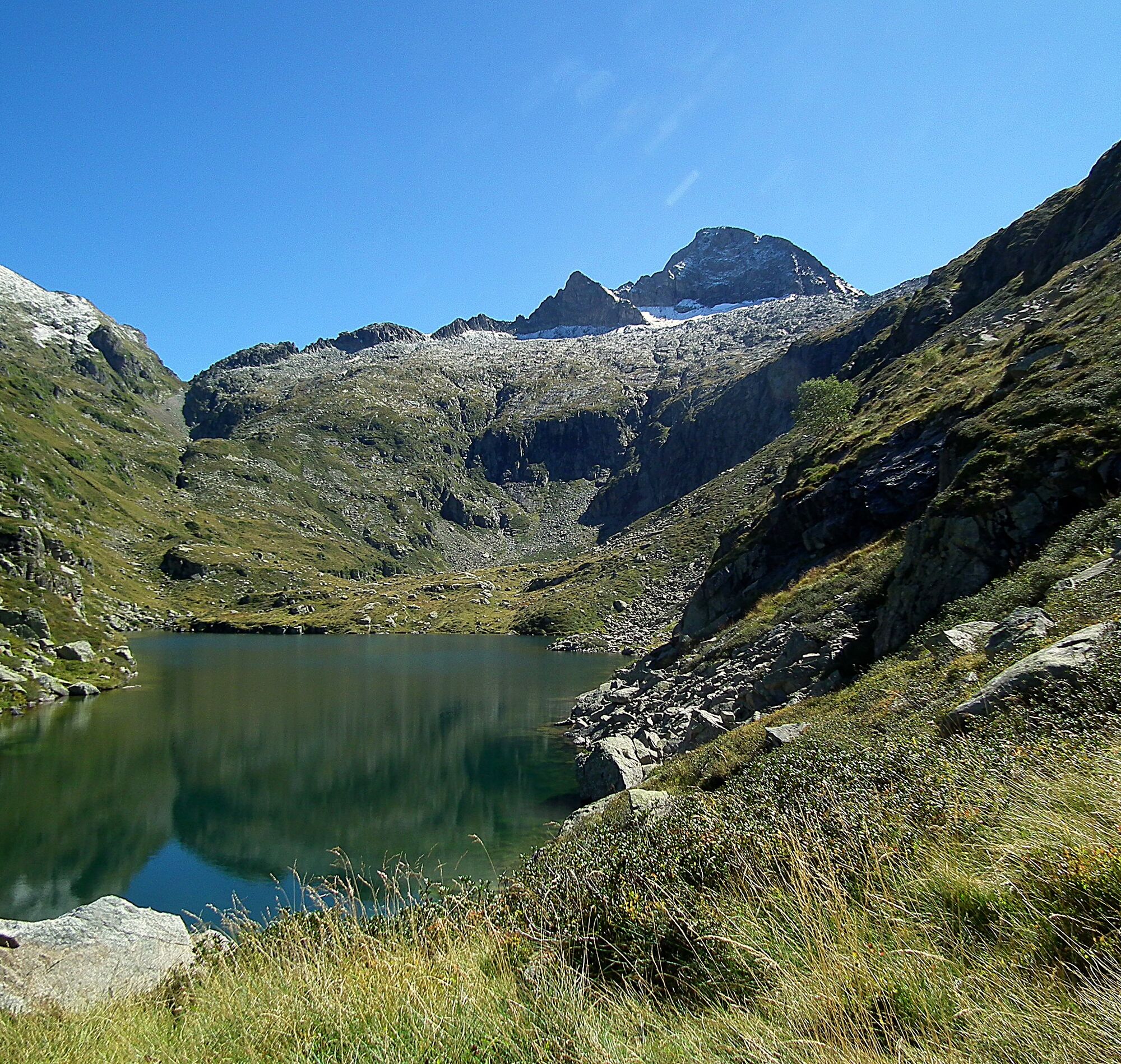
6/Milouga pond (1959 m). An almost flat crossing (always marked in yellow) takes you back to the
7/Taus hut (1890 m). From here a gentle climb joins the GR10 (red and white), which takes you to the Aouen hut and then a long descent to the Pla la Lau car park.
8/Parking du Pla de la Lau 11h30 935 m
2/Cascade de Nérech 1h40 - 1350 m Cross the footbridge and climb the switchbacks carved into the rock. Further on you come out into the meadow and continue as far as
3/La cabane de Caussis 3h - 1859 m At the fork in the path, take the path up on the left, still signposted in red and white (the path on the right takes 30 minutes to the Etang Rond). The climb is less steep and it won't be long before you reach the
4/Refuge des Estagnous 4h - 2246 m Leave the red and white markings and follow the well-marked yellow path (heading east-south-east). It quickly rises to a rocky spur that can be bypassed on the right. The climb is steep (snow-covered at the start of the season) towards the Col de Faustin. The route then becomes easy, deviates slightly from the ridge and quickly leads to the
5/Summit of Mont-Valier 5h30 - 2838 m The return journey takes the same route in the opposite direction to the refuge, behind which the yellow signposted trail climbs to the Col de Pécouch (2462 m) and descends through the Lauzés (a large granite plain that is best crossed without fog) to arrive at
6/Milouga pond (1959 m). An almost flat crossing (always marked in yellow) takes you back to the
7/Taus hut (1890 m). From here a gentle climb joins the GR10 (red and white), which takes you to the Aouen hut and then a long descent to the Pla la Lau car park.
8/Parking du Pla de la Lau 11h30 935 m
Ďalšie informácie a tipy
Ďalšie informácie
Vous êtes au cœur du Parc Naturel des Pyrénées Ariégeoises.
Nous vous encourageons à adopter un comportement responsable dans ce milieu fragile et partagé.
- Rester sur les sentiers et emporter ses déchets.
- Observer la flore sans la cueillir.
- Rester discret, pour les animaux sauvages.
- Dans les zones d’estive, penser à refermer les clôtures et barrières. Ne pas approcher ni nourrir les animaux. Si un Patou (chien de protection des troupeaux) s’approche de vous, écartez-vous lentement et calmement. Pas de grands gestes ni de cris, même s’il aboie, car il vous considérerait comme une menace. S’il vous suit, ignorez-le.
-La baignade dans les lacs de la commune de Bethmale est interdite. Elle concerne les lacs de Bethmale, Ayes, Eychelle, Milouga, Arouech et Cruzous. (Arrêté AR-2024-004 le 05/12/2024)
- Le bivouac est autorisé, mais seulement entre 19h et 9h, et à plus d’une heure de marche d’un parking.
- En période de sécheresse tout feu est interdit. Dans les autres cas, les feux sont autorisés seulement à plus de 200m d’une forêt. Préférer les réchauds aux foyers naturels.
- En cas de rencontre, très peu probable, avec un ours (qui cherche à tout prix à nous éviter) : manifestez-vous calmement, éloignez-vous progressivement, et ne courrez pas.
Zatiaľ žiadne recenzie
Aktivity počas prehliadky

Obľúbené výlety v okolí
-
Rundweg Mail des Morères
strednáTuristika 8,15 km -
Tour du Biros
ťažkéTuristika 50,4 km -
GR10 Pyrenäenweg Etappe 30
svetlodiaľková pešia trasa 7,90 km -
Estanys
strednáTuristika 8,40 km -
Mont Valier
ťažkéTuristika 17,6 km -
Pic du Crabère
ťažkéTuristika 23,4 km -
Tour du Mail Blanc
svetloTuristika 10,8 km -
Tour of Mont Valier
ťažkéTuristika 77,6 km -
GR 10 Couserans Pyrénées - Castillon
ťažkéTuristika 37,2 km -
Étang d'Ayes
svetloTuristika 7,32 km

Turistika a stopovanie

Viac ako 550.000 návrhov výletov, podrobné mapy a intuitívny plánovač trás robia z aplikácie povinnú výbavu pre všetkých nadšencov prírody.

Nenechajte si ujsť ponuky a inšpiráciu na ďalšiu dovolenku
Prihlásiť sa k odberu noviniek
Chyba
Vyskytla sa chyba. Prosím, skúste to znova.
Ďakujeme za vašu registráciu
Vaša e-mailová adresa bol pridaný do poštového zoznamu.
Zájazdy po celej Európe
Rakúsko
Švajčiarsko
Nemecko
Taliansko
Slovinsko
Francúzsko
Holandsko
Belgicko
Poľsko
Lichtenštajnsko
Česko
Slovensko
španielsko
Hrvaška
Bosna a Hercegovina
Luxembursko
Andorra
Portugalsko
Island
Spojené kráľovstvo
Írsko
Grécko
Albánsko
Severné Macedónsko
Malta
Nórsko
Čierna Hora
Moldavsko
Kosovo
Maďarsko
San Maríno
Rumunsko
Estónsko
Lotyšsko
Bielorusko
Cyprus
Litva
Srbsko
Bulharsko
Monako
Dánsko
Švédsko
Fínsko