



Navigácia na stránke
Získajte túto prehliadku v mobilnom telefóne
Mapa
Road bike tour Nesslau - Hemberg - Wattwil - Nesslau
stredná
Cestný bicykel
34,71 km
Naskenujte kód QR a spustite navigáciu v aplikácii bergfex
QR Code
Turistika a stopovanie

Road bike tour Nesslau - Hemberg - Wattwil - Nesslau

Vzdialenosť
34,7 km
Trvanie
01:50 h
Ascent
507 hm
Hladina mora
611 - 1 108 m

Úroveň náročnosti: 3

Stiahnutie skladby
Mapa
Road bike tour Nesslau - Hemberg - Wattwil - Nesslau
stredná
Cestný bicykel
34,71 km

From Nesslau the route steadily rises and leads over wide, panoramic sections to Hemberg. After a short, often fast descent, the transition to Wattwil follows before the route returns to Nesslau on the...

Opis

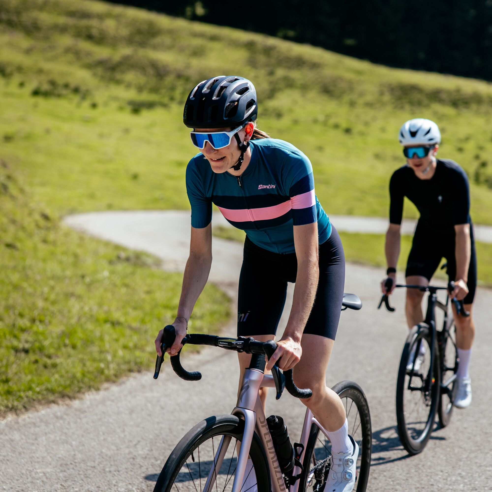
From Nesslau the route steadily rises and leads over wide, panoramic sections to Hemberg. After a short, often fast descent, the transition to Wattwil follows before the route returns to Nesslau on the valley road. The tour is suitable for experienced road cyclists and offers a good mix of elevation, fast sections, and impressive scenery. Particularly appealing is the view of Säntis and the Churfirsten during the ascent.

Trasa
Trasa
Mapa
Road bike tour Nesslau - Hemberg - Wattwil - Nesslau
stredná
Cestný bicykel
34,71 km
Wiese
(762 m)
Susedstvo
0,0 km
Nesslau-Neu St. Johann
(759 m)
Železničná stanica
0,0 km
Neu St. Johann
(765 m)
Dedina
0,6 km
Rutzenbach
(755 m)
Koridor/terén
0,8 km
Gäuer
(750 m)
Koridor/terén
0,9 km
Unterstein
(904 m)
Zúčtovanie
3,1 km
Sibold
(967 m)
Zúčtovanie
3,2 km
Hof-Aemelsberg
(978 m)
Zúčtovanie
3,9 km
Dreibrunnen
(975 m)
Koridor/terén
3,9 km
Brüssel
(977 m)
Koridor/terén
4,0 km
Guggenloch
(981 m)
Koridor/terén
5,2 km
Platten-Guggenloch
(1 008 m)
Koridor/terén
5,4 km
Sternen
(1 020 m)
Reštaurácia
5,9 km
Bendel
(1 013 m)
Zúčtovanie
5,9 km
Kellen-Bendel
(1 087 m)
Koridor/terén
7,1 km
Eggli
(1 018 m)
Susedstvo
9,6 km
Oberdorf
(962 m)
Susedstvo
9,9 km
Katholische Kirche St. Johannes der Täufer
(968 m)
Miesto uctievania
10,3 km
Hemberg
(946 m)
Horské sedlo
10,5 km
Evangelische Kirche
(945 m)
Miesto uctievania
10,5 km
Gasthaus Löwen
(946 m)
Reštaurácia
10,6 km
Anker
(889 m)
Reštaurácia
14,5 km
Heiterswil
(883 m)
Zúčtovanie
14,6 km
Eggberg
(869 m)
Reštaurácia
16,7 km
Eggberg
(823 m)
Zúčtovanie
16,9 km
Dicken
(770 m)
Zúčtovanie
17,6 km
Tüetlisberg
(737 m)
Zúčtovanie
18,3 km
Evangelische Kirche
(619 m)
Miesto uctievania
19,4 km
Wattwil
(611 m)
Dedina
19,9 km
Ennetbrugg
(611 m)
Koridor/terén
20,0 km
Türkisch-Islamisches Zentrum
(613 m)
Miesto uctievania
20,0 km
Fladehüsli
(639 m)
Reštaurácia
23,0 km
Scheftenau
(636 m)
Zúčtovanie
23,3 km
Kappel
(632 m)
Dedina
24,5 km
Ebnat-Kappel
(632 m)
Dedina
25,1 km
Ebnat
(638 m)
Dedina
25,6 km
Gasthaus Sternen
(634 m)
Reštaurácia
25,9 km
Die Fabrik
(637 m)
Reštaurácia
26,2 km
Blume
(687 m)
Reštaurácia
27,8 km
Blomberg
(729 m)
Zúčtovanie
29,4 km
Türler
(705 m)
Koridor/terén
30,1 km
Türli
(735 m)
Koridor/terén
30,2 km
Krummenau
(713 m)
Dedina
30,4 km
Brunnen
(723 m)
Zúčtovanie
30,6 km
Krümmenswil
(732 m)
Stanica gondoly
31,1 km
Kammern
(744 m)
Koridor/terén
31,8 km
Thurrain
(758 m)
Koridor/terén
32,3 km
Vor dem Bach-Bühl
(758 m)
Koridor/terén
32,9 km
Bühl
(759 m)
Koridor/terén
33,0 km
Bühlerbrugg
(742 m)
Koridor/terén
33,3 km
Rutzenbach
(755 m)
Koridor/terén
33,5 km
Neu St. Johann
(765 m)
Dedina
34,0 km
Nesslau-Neu St. Johann
(759 m)
Železničná stanica
34,6 km
Wiese
(762 m)
Susedstvo
34,7 km
Informácie o prehliadke

Varied road bike loop from Nesslau over the scenic Hemberg to Wattwil and along the Thur valley back. Ideal for sporty riders.

Technológia
3 / 6
Stav
4 / 6
Krajina
5 / 6
Skúsenosti
3 / 6
Najlepšie ročné obdobie
Jan
Feb
Mar
Apr
Máj
Jún
Júl
Aug
Sep
Okt
Nov
Dec
Zdieľať prehliadku
Mapa
Road bike tour Nesslau - Hemberg - Wattwil - Nesslau
stredná
Cestný bicykel
34,71 km
Chyba
Vyskytla sa chyba. Prosím, skúste to znova.
Zariadenie

Road-safe racing bike with good tires, bike helmet, weather-appropriate bike clothing in a multi-layer principle, lightweight wind jacket, grippy bike shoes, shatterproof cycling glasses, fingerless gloves, mobile phone and possibly phone holder, GPS device or map material, power bank, water bottle and holder, sufficient drinking water and provisions, small first aid kit, multitool, spare tube or tubeless repair kit, mini pump, chain lock as well as sun and rain protection.

Bezpečnostné pokyny

Traffic can be heavier depending on the time of day when climbing to Hemberg.
Caution in shaded areas: wet spots are common in spring and autumn.
The descent to Wattwil includes some tight curves.

Informácie o príchode
Príchod
- From the Zurich metropolitan area and central Switzerland: On the A3 at Reichenburg towards Rapperswil and then over the Ricken Pass to Wattwil. Then up the Toggenburg to Nesslau.

- From Eastern Switzerland: From St. Gallen to Herisau and further over the Wasserfluh to Lichtensteig. Or from St. Gallen to Wil, take the Toggenburg exit. Follow the main road to Nesslau.

- From southern Germany: Via Bregenz and St. Margrethen on the A13 to Haag and take the exit towards Toggenburg/Wildhaus. Or via Konstanz to Wil, then take the Toggenburg exit and follow the main road to Nesslau.

Verejná doprava

Take the train to Nesslau-Neu St. Johann.

Parkovanie

Parking spaces are available at Nesslau station. 

Ďalšie informácie a tipy
Úroveň náročnosti

3

Ďalšie informácie
Toggenburg Tourism

Main Street 104

CH-9658 Wildhaus

Tel: +41 (0)71 999 99 11

Email: info@toggenburg.swiss

Internet: www.toggenburg.swiss

Tipy

A short stop in Hemberg is worthwhile – the view into the Neckertal and towards Alpstein is particularly impressive in clear weather.

Zatiaľ žiadne recenzie
Napíšte recenziu

Recenzie pomáhajú ostatným používateľom vybrať si ďalšie dobrodružstvo. Prosím, hodnoťte len prehliadku, nie počasie alebo občerstvenie.

Vyberte jednu z hviezdičiek a ohodnoťte prehliadku
Zlé turné
Slabé turné
Priemerné turné
Dobrá prehliadka
Vynikajúca prehliadka
bergfex logo Získajte prehľad Vždy naživo na mieste s viac ako 9 500 webovými kamerami. bergfex Ako používateľ Pro si teraz môžete pozrieť príslušné webové kamery pre mnohé zájazdy v aplikácii zájazdy z. Môžete si tak priamo prezerať aktuálne podmienky.
Turistika a stopovanie

Turistika a stopovanie

Turistika a stopovanie
Viac ako 550.000 návrhov výletov, podrobné mapy a intuitívny plánovač trás robia z aplikácie povinnú výbavu pre všetkých nadšencov prírody.
bergfex


