







Winter hike Ahorn loop
Úroveň náročnosti: 1
The easy hike starts at Restaurant Weidhof above Oberhelfenschwil. From there, the path leads along the edge of the forest to a maple tree over 350 years old. With a diameter of over 5.5 meters, it is...
The easy hike starts at Restaurant Weidhof above Oberhelfenschwil. From there, the path leads along the edge of the forest to a maple tree over 350 years old. With a diameter of over 5.5 meters, it is one of the largest in the region. A bench under the maple invites you to enjoy the view. Then it gently goes downhill towards Berlig, and the path continues along the road into the village of Oberhelfenschwil. Between the bakery and retirement home, the hiking trail leads back up to the starting point at Weidhof.

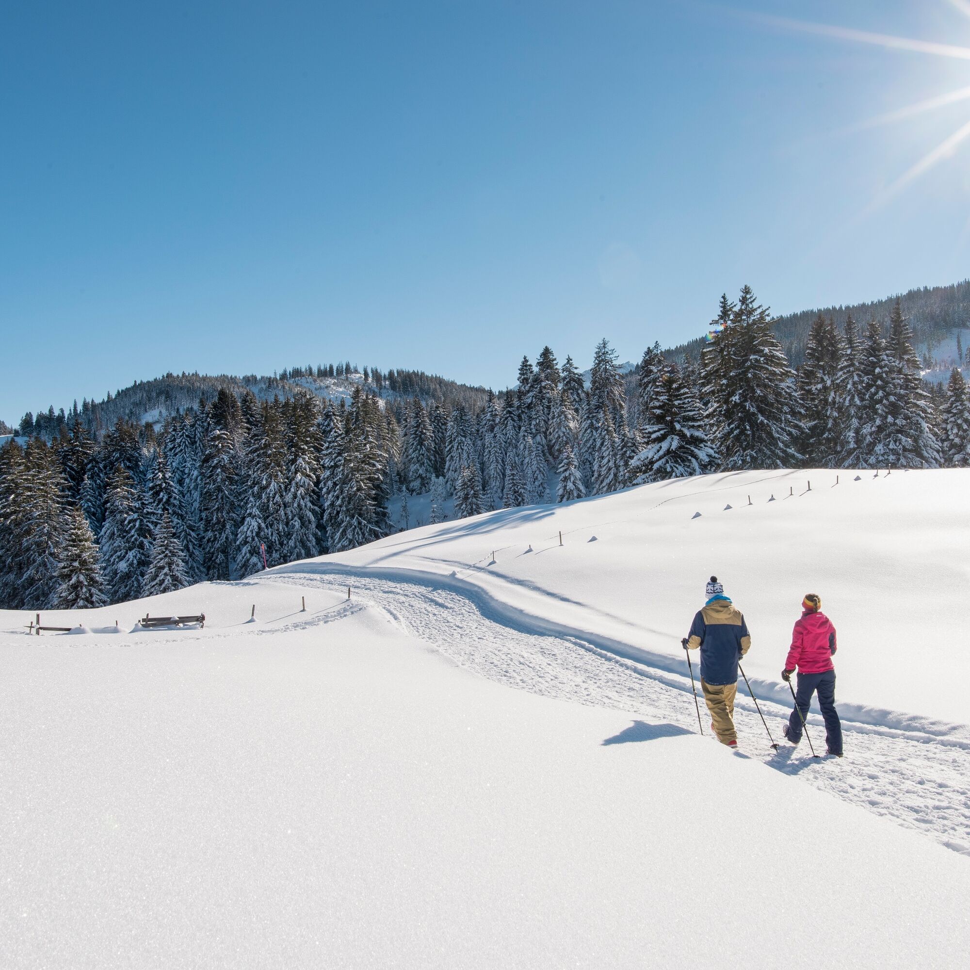

The path starts at Restaurant Weid-Hof in Oberhelfenschwil. It leads to the first viewpoint above the farm and then follows to the approximately 350-year-old maple tree. The path continues towards Berlig, which runs left after the forest clearing. Then the road leads to Usserdorf. On the right side, the ski lift can soon be seen. Upon reaching the village center, the path follows the road along Altegg back to the starting point at Weid-Hof Oberhelfenschwil.
Day hiking backpack (approx. 20 liters) with rain cover, comfortable and waterproof winter shoes or sturdy hiking boots, possibly crampons and gaiters, warm and weatherproof clothing in layers, hat/headband, scarf, gloves, sun and rain protection, snacks and drinking water, thermos with hot drink, first aid kit, pocket knife, mobile phone, possibly headlamp, maps, possibly telescopic poles
From Wil, drive via Lichtensteig and Brunnadern. Continue to the village of Necker, where you take the left turn towards Oberhelfenschwil in the center.
From St.Gallen, take the route via Herisau, Schönengrund, and St.Peterzell to Brunnadern. Continue to the village of Necker, where you take the left turn towards Oberhelfenschwil in the center. In the village center, take the turn by the Solebad towards Weid-Hof - follow the signposts and drive along the road to Restaurant Weid-Hof.
You take the train connection via St.Gallen or Wil to Brunnadern station. From there, an hourly postbus runs to Oberhelfenschwil. At the Dorf stop, start the circular route from the village center instead of from Restaurant Weid-Hof.
Parking spaces are available in the village center or at Restaurant Weid-Hof.
1
Toggenburg Tourism
Hauptstrasse 104
CH-9658 Wildhaus
Tel: +41 (0)71 999 99 11
Email: info@toggenburg.swiss
Internet: www.toggenburg.swiss
Visit the Restaurant Weid-Hof. Open from Friday, 2:00 pm to Sunday, 6:00 pm.
 Získajte prehľad
Vždy naživo na mieste s viac ako 9 500 webovými kamerami. bergfex Ako používateľ Pro si teraz môžete pozrieť príslušné webové kamery pre mnohé zájazdy v aplikácii zájazdy z. Môžete si tak priamo prezerať aktuálne podmienky.
Získajte prehľad
Vždy naživo na mieste s viac ako 9 500 webovými kamerami. bergfex Ako používateľ Pro si teraz môžete pozrieť príslušné webové kamery pre mnohé zájazdy v aplikácii zájazdy z. Môžete si tak priamo prezerať aktuálne podmienky.
Obľúbené výlety v okolí
-
4,3
Schnebelhorn Rundwanderung
strednáTuristika 11,9 km -
3,2
Winter hike at the Hulftegg
svetloZimná turistika 7,39 km -
4,5
Hulftenegg - Hörndli
svetloZimná turistika 6,98 km -
Hike from Hemberg to the Ofenloch
strednáTuristika 10,9 km -
4,5
Hike from Ebnat-Kappel to Tanzboden
strednáTuristika 14,5 km -
4,3
Steg-Schnebelhorn
strednáTuristika 17,9 km -
4,7
Hike at Hulftegg
svetloTuristika 7,42 km -
4,5
Bauma - Chlihörnli - Hörnli - Steg
strednáTuristika 10,3 km -
4,0
Schönengrund - Hochhamm - Schönengrund
strednáTuristika 9,51 km -
4,5
Hike from Ganterschwil to Bruedertöbeli
svetloTuristika 7,15 km
Turistika a stopovanie


Nenechajte si ujsť ponuky a inšpiráciu na ďalšiu dovolenku
Vaša e-mailová adresa bol pridaný do poštového zoznamu.





