


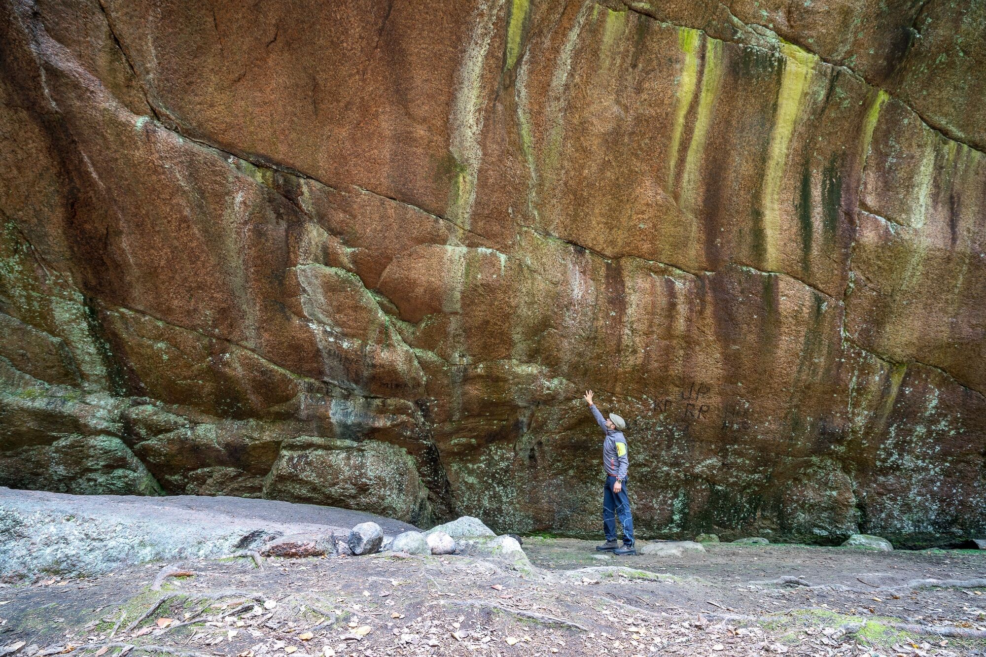
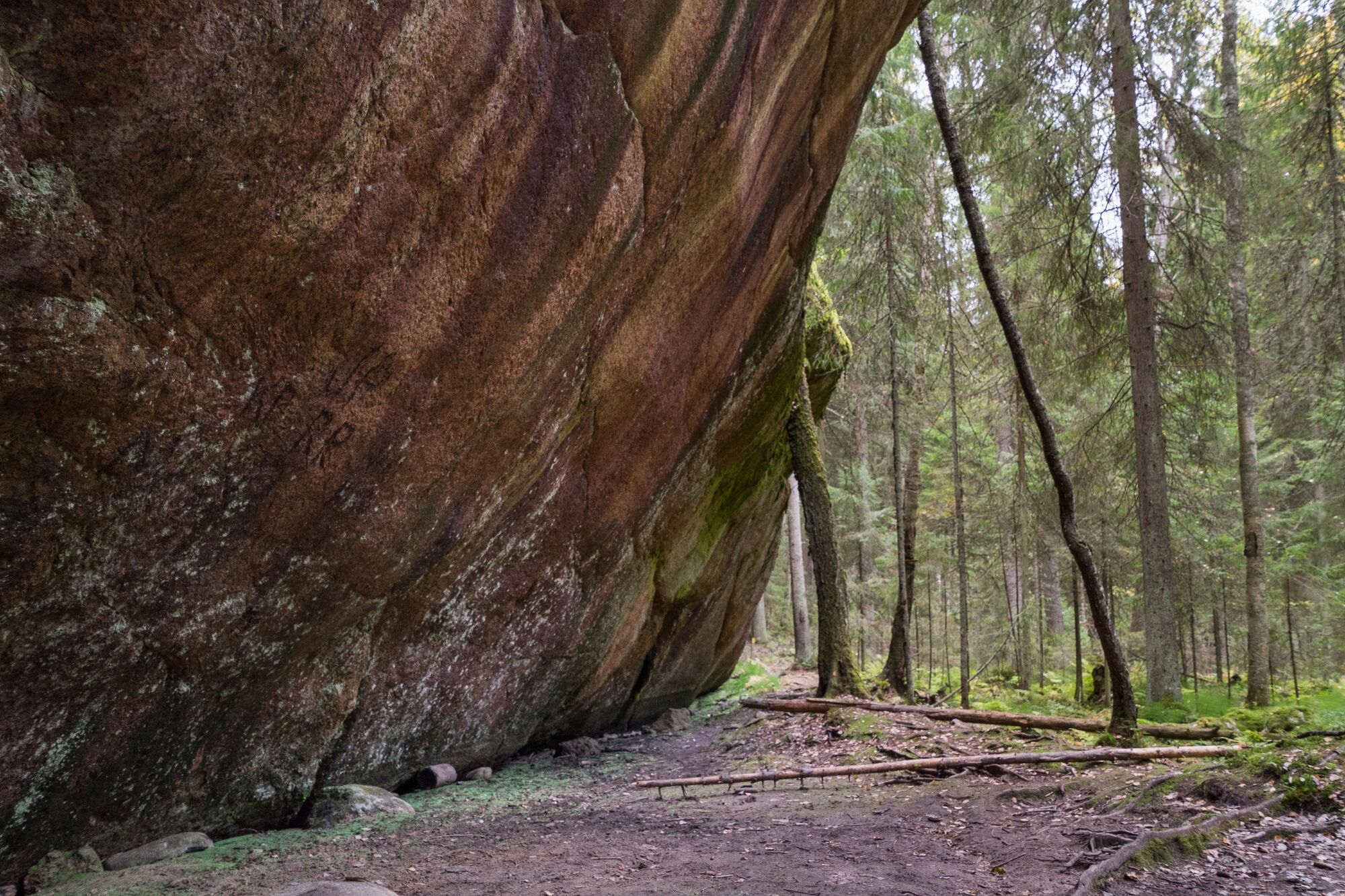
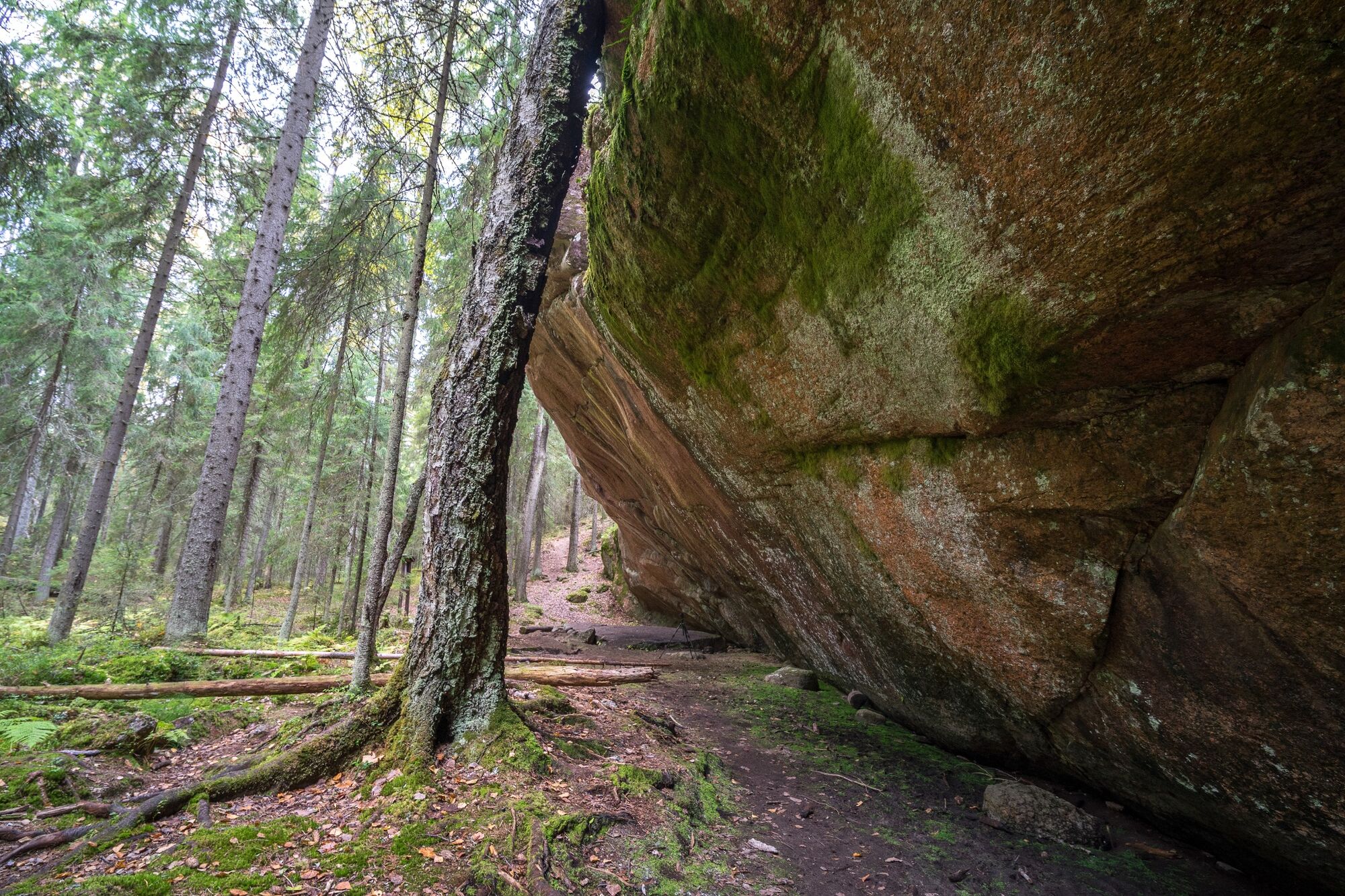
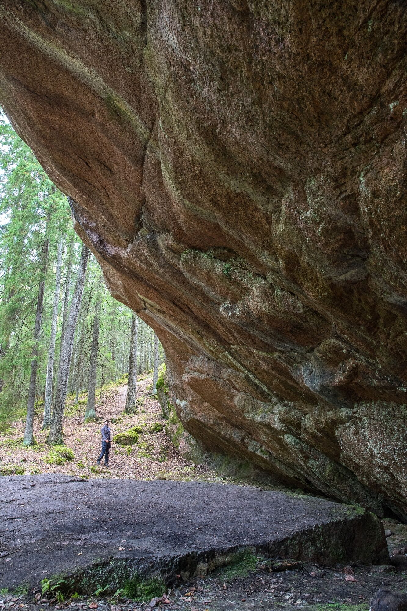
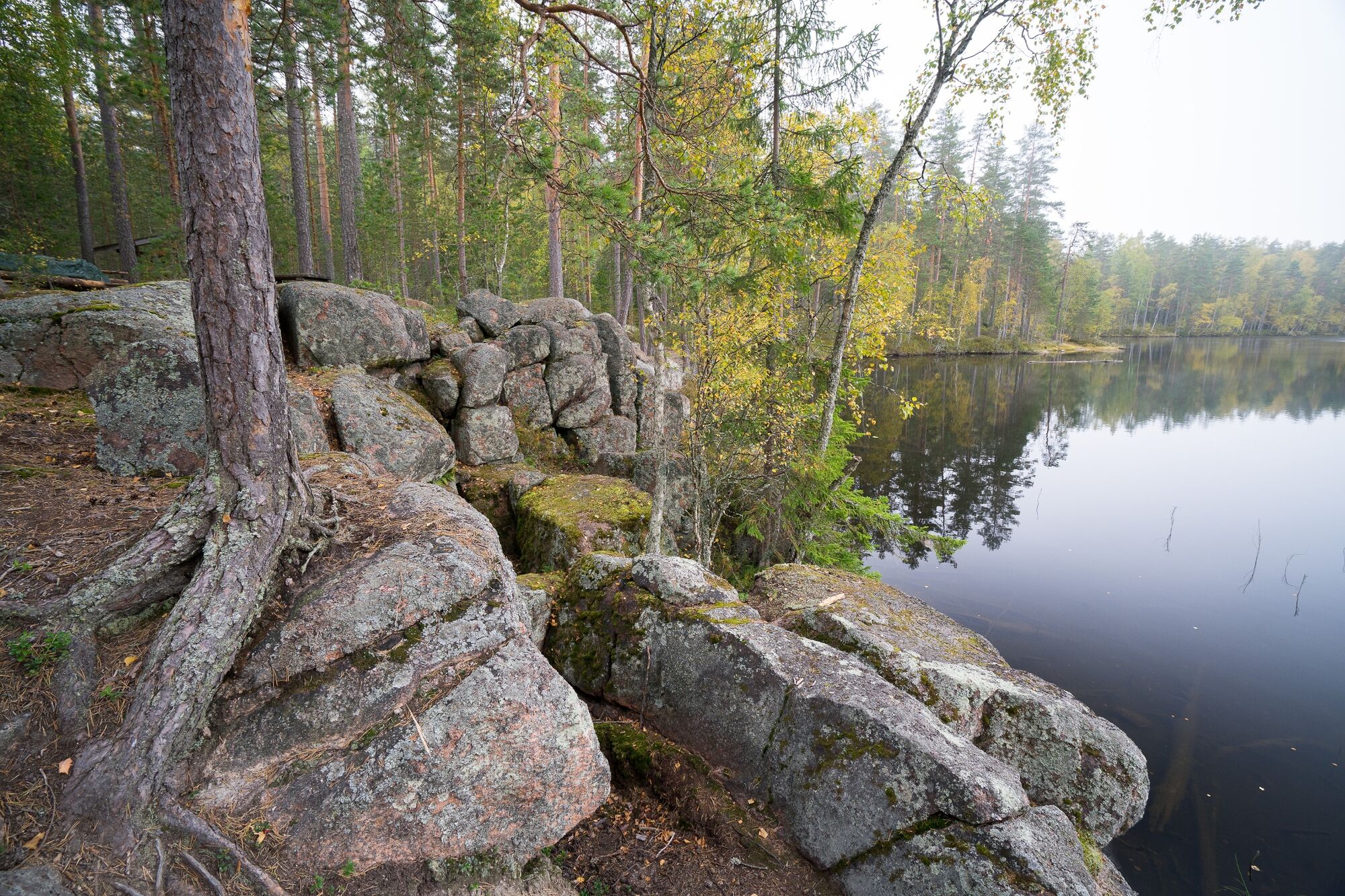
Pirunkirkko Cave, Paistjärvi Area
The cave formed along a fracture zone at the foot of a cliff consisting of about 1,600 million-year-old rapakivi granite. The continental ice sheet has transported the loose rock material away, sculptured...
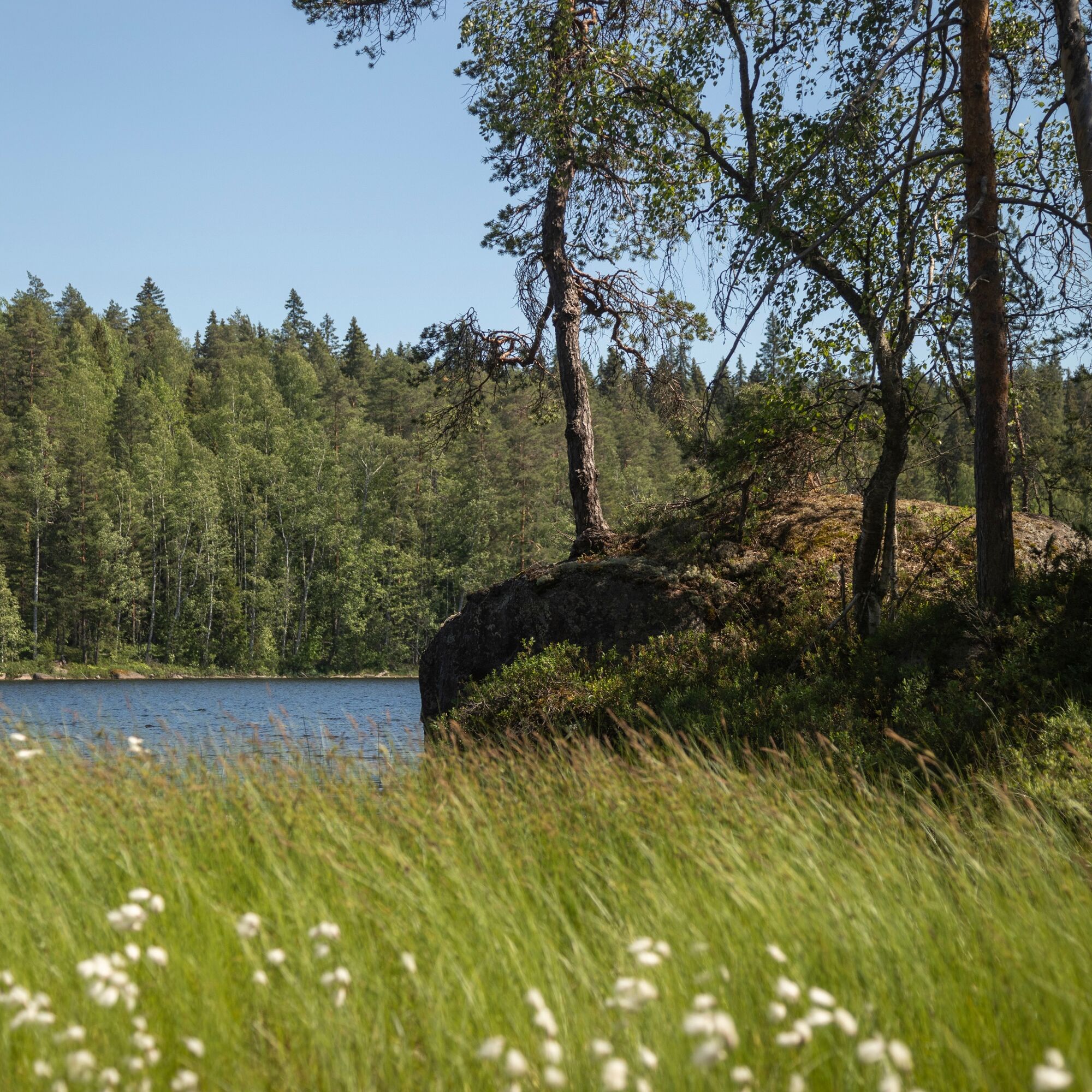
Pirunkirkko is one of the most important rock formations of the Salpausselkä UNESCO Global Geopark.
The Paistjärvi area is managed by Metsähallitus Nature Services. The maintenance of the trails and service structures is the responsibility of the City of Heinola.

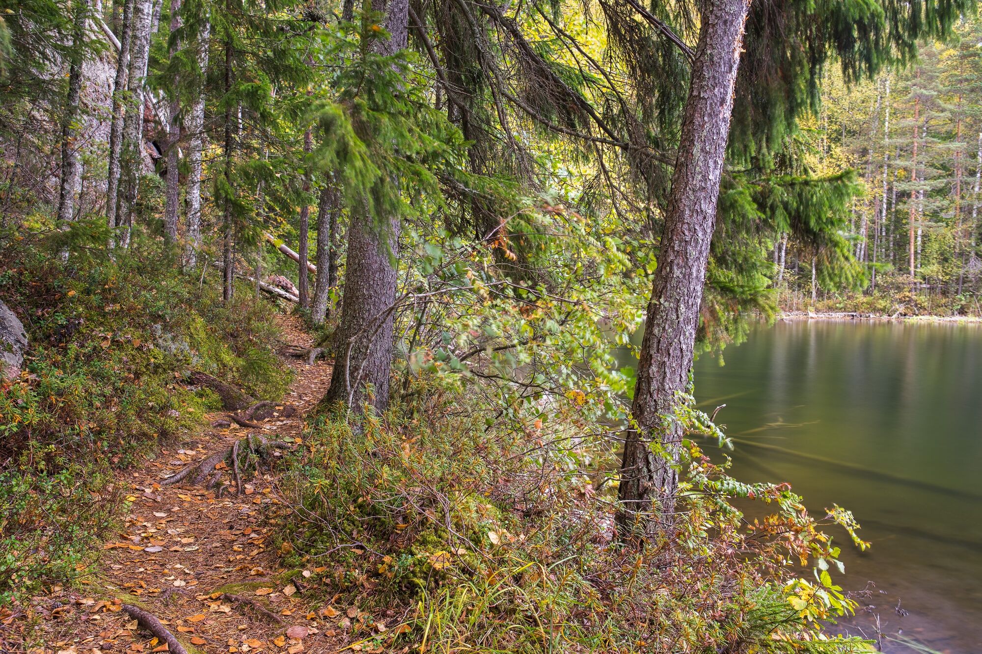
Der Weg zu Pirunkirkko beginnt am Parkplatz Niinilampi und führt zunächst über einen Waldweg, von dem der Pfad abzweigt. Der Pfad verläuft ca. 300 m durch hügeligen Wald bis zum See Iso-Vuorttunen. Hier führt der Pfad über 300 m am Ufer entlang, bis er dann wieder in den Wald eintaucht, wo es noch 200 m bis Pirunkirkko sind.
Am Fuße der Felswand kann man eine Rast einlegen und den eindrucksvollen Anblick genießen. Hier gibt es eine Bank und eine Trockentoilette, jedoch keine Feuerstelle. Von Pirunkirkko kann man denselben Weg zurück nehmen oder auf dem Rundweg weiter bis zum Parkplatz Simonlampi laufen.
Von Pirunkirkko geht es 300 m in Richtung Iso-Vuorttunen-See. Der Weg führt zunächst durch hügeliges, flechtenbedecktes Gelände. Der schwierigste Anstieg kommt gleich zu Beginn, wenn man Pirunkirkko verlässt. Nach der wilden Uferlandschaft zweigt der Pfad vom oberen Ende des Sees zum Wald ab. Nach 600 m erreichen Sie den Parkplatz von Simonlampi. Der Abschnitt zwischen See und Parkplatz verläuft über einen leichteren und ebeneren Pfad. Im Norden des Pfades liegt der kleine Teich Simonlampi, der von Sumpf umgeben ist. Vom Parkplatz Simonlampi geht es 2,2 km über einen Forstweg zurück zum Parkplatz Niinilampi.
Áno
Sturdy shoes are recommended
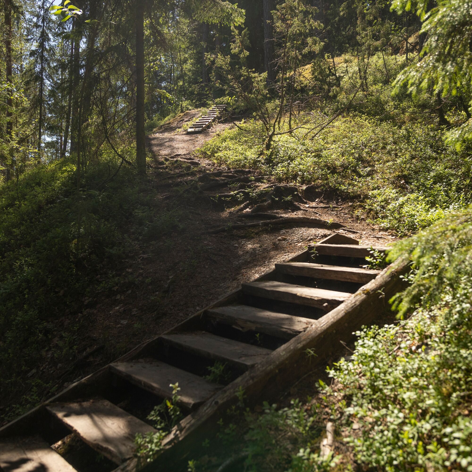
Die Route verläuft durch hügeliges und abwechslungsreiches Gelände. Die Treppen und Stege der Route wurden 2016 erneuert, was das Passieren der schwierigeren Abschnitte erleichtert. Am anspruchsvollsten ist der Pfad im Westen des Sees Iso-Vuorttunen. Die sonstigen Abschnitte verlaufen über ebenere Pfade bzw. einen Forstweg. Die Route ist im Gelände mit gelben Markierungen gekennzeichnet.
Das Ausflugsgebiet Paistjärvi befindet sich östlich der Staatsstraße 5. Vom Ortszentrum Heinola sind es 30 km nach Paistjärvi und von Lahti etwa 65 km.
Anfahrt zum Parkplatz Niinilampi: Biegen Sie von der E75 auf die Straße Nr. 46 in Richtung Kouvula (5 km) ab, biegen Sie auf die Straße Nr. 4143 (19 km) ab, am Ufer des Sees Sonnanen biegen Sie nach links auf die Straße Kesiöntie (1,6 km) ab, biegen Sie nach rechts zu Pirunkirkko (0,5 km) ab.
Es gibt keine öffentlichen Verkehrsverbindungen in das Gebiet von Paistjärvi
Kostenloses Parken auf den Parkplätzen Niinilampi und Simonlampi
Neben dem Parkplatz am Teich Niinilampi gibt es Feuerstelle und Toilette.
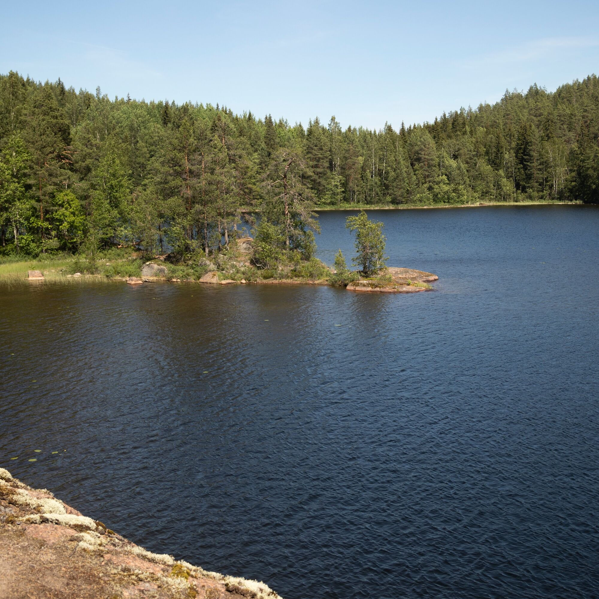
Im Gebiet befindet sich auch der See Sonnanen, der für sein kristallklares Wasser bekannt ist und vor allem bei Tauchern ausgesprochen beliebt ist. Im Ausflugsgebiet Paistjärvi gibt es auch andere Wanderwege und Feuerstellen. Vom Parkplatz Sonnanen gelangt man zu den Wanderwege nach Ketturiutta und zur Landenge Kuijärven kannas.
On the shore of Niinilampi there is a charming resting place with a campfire site.
In addition to Pirunkirkko, the most interesting hiking destinations in the Paistjärvi area are the beautiful Kuijärvenharju and Ketturiutta with its sandy beaches and campfire sites.
Obľúbené výlety v okolí
-
Kannaksen route, Paistjärvi recreation area, Heinola
Turistika 8,40 km -
Sonnanen-Harjulampi-Ketturiutta, Paistjärvi recreational area
svetloTuristika 4,52 km -
Kouvola - Pitkäniemi - Heisanharjun varauskota
svetloTuristika 2,78 km -
Nurmaa - Vanhakorpi - Pökölä - Paljakka
ťažkéMountainbike 68,3 km -
Mäntyharju - Nurmaa - Jäniskylä - Alho
strednáMountainbike 57,8 km -
Kouvola - Heisanharju - Heisanharjun varauskota - Pitkäniemi
svetloTuristika 4,38 km
Turistika a stopovanie


Nenechajte si ujsť ponuky a inšpiráciu na ďalšiu dovolenku
Vaša e-mailová adresa bol pridaný do poštového zoznamu.