



SAUZE DI CESANA Valle Argentera

Úroveň náročnosti: S2
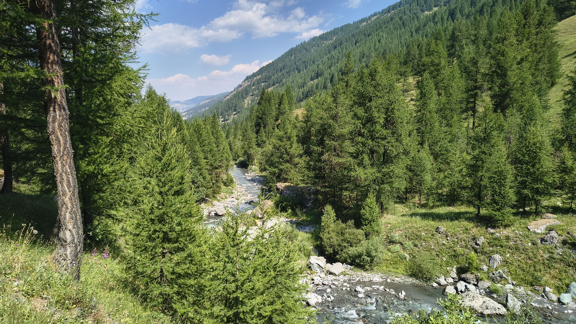
Whether you want to ride it in the summer kaleidoscope or when the larches turn golden, the itinerary, if done on MTB, requires good training and endurance; if done on E-bike, it is accessible to everyone...
Whether you want to ride it in the summer kaleidoscope or when the larches turn golden, the itinerary, if done on MTB, requires good training and endurance; if done on E-bike, it is accessible to everyone including families with children.
Easy route suitable for families: in the first part of the route the road has a compact dirt surface and presents a slight positive slope in some sections inside the forest. It continues along a very easy plateau up to the bottom of the valley, following the Ripa river, where there are several picnic areas, farms, and shepherds selling local products.
An alternative of medium difficulty thus for the more trained and technically skilled: to make a circular route first climbing towards Alpe Plane and then along a series of hairpin bends up to Alpe Gran Mioul. On the descent, rejoin the easy route along the valley floor.
Support and technical description by the cycle touring guides of the Moon Mountain Company excursion centre



The route follows the municipal road of Valle Argentera up to Alpe Plane and then continues climbing to Alpe Gran Mioul, passing refuges and alpine pastures, allowing you to savor the different facets of this incredible area.
Starting from the town centre of Sauze di Cesana, at the locality Ponte delle Albere, the route begins with a gentle climb on a path with an unpaved surface up to the locality Ponte terribile. It continues with a slight incline for about 2 km on an asphalt road until reaching the large plateau of Valle Argentera, at Brusà del Plan locality. The first alpine pasture on the left offers typical products for purchase. Continuing along the main road, the landscape opens into a typical alluvial valley: ideal in summer for nature lovers, trekking, and outdoor sports; in autumn it enchants with the larches turning golden in a warm and enveloping light.
At the twelfth kilometre, one direction leads towards the Valle Lunga which leads to the Alpe Plane refuge and the other towards the Valle del Gran Miol, which ends with arrival at the Grand Queyron mountain.
Áno
Áno
Route suitable for MTB and E-BIKE, the choice depends on the level of training and personal physical endurance
Road open to motorized traffic and also frequented by hikers on foot - regulate speed and pay attention.
Valle Argentera is reachable by car via SP 215 from Sauze di Cesana, from Cesana or from Sestriere.
The start of the route is reachable by public transport.
Train from Torino P.N to Bardonecchia (stops at Oulx-Cesana-Claviere-Sestriere) + Arriva bus line 285 from Oulx to Sestriere, stop Sauze di Cesana
Near the parking area Ristornate Il Cardo / Quad excursions
S2
- Arriving at the Pian della Milizia plateau: possibility to continue to Alpe Gran Mioul or alternatively return early by following the downhill track along the dirt road that goes into the forest on the right.
- The route follows an old dirt road, part of the Historic Mountain Routes network
- Difficulty: MTB S5 and E-bike S4
Long but not difficult route for those who are not very trained and want to enjoy a relaxing but dynamic day; the use of E-bikes is recommended, as the electric battery assistance allows you to complete the route without too much effort.
Webové kamery z prehliadky

Aktivity počas prehliadky

Obľúbené výlety v okolí
-
GR®58 Tour du Queyras
strednáTuristika 114,0 km -
5,0
BOBBIO PELLICE Upslowtour - Ring 2 of the refuges
ťažkéCyklistika 37,6 km -
5,0
SESTRIERE Monte Rognosa
ťažkéTuristika 6,42 km -
5,0
SESTRIERE Brugnetti-Sidoti trail rhododendron loop
svetloTuristika 5,93 km -
5,0
Invincibles valley - Alpe Caugis
Turistika 15,3 km -
5,0
CESANA T.SE Thures - Cima Bosco
ťažkéSnežnice 3,94 km -
CESANA T.SE Val Thuras
strednáTuristika 7,58 km -
5,0
BOBBIO PELLICE: Hike to the Barbara Lowrie Mountain Hut
ťažkéCestný bicykel 9,19 km -
CESANA T.SE Bousson - Lago Nero
strednáSnežnice 4,68 km -
CESANA T.SE Monti della Luna
strednáMountainbike 28,1 km
Turistika a stopovanie


Nenechajte si ujsť ponuky a inšpiráciu na ďalšiu dovolenku
Vaša e-mailová adresa bol pridaný do poštového zoznamu.


