


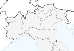


The Roads of the Forts - Stage 1 from Villafranca Piemonte to Pinerolo
From the Po River, with the Ochette path running along it, we move through fields and orchards to Cavour, with its Rocca.
From Cavour we move on to Pinerolo, continuing on a lowland route that touches...
From Cavour we move on to Pinerolo, continuing on a lowland route that touches several fortified castles and charming churches.
This stage presents a mostly flat route that allows you to enjoy the alpine panorama and prepare for the next stages, which are gradually more challenging. Mileage is limited to allow for visits to places of interest. The route is partly on paved roads, partly on dirt roads generally with a good surface, which may deteriorate when riding in spring or immediately after periods of rain.
The crossing of several settlements favors the presence of water, which can be taken from water fountains or distributors (little houses). The various settlements also provide opportunities to obtain food.

Áno
Appropriate clothing and footwear for the environment and season are recommended.
Getting to Villafranca Piemonte is easy via A55 and SP139.
Bus www.cavourese.it
There are public parking lots in the center of Villafranca Piemonte.
Obľúbené výlety v okolí
-
BRICHERASIO The Via della Pietra
svetloDiaľková cyklotrasa 11,5 km -
PRAROSTINO From Piani to Sonagliette and back - SLOWLY TOGETHER
svetloTuristika 6,60 km -
PRAROSTINO Circuit of the hamlets
strednáMountainbike 18,1 km -
PRAROSTINO Faro della Libertà Walk
svetloTuristika 3,60 km -
SAN SECONDO Upslowtour - Loop 14 Memory and partisan routes
strednáCyklistika 33,8 km -
Chisone ring on the trail of herons
strednáMountainbike 22,4 km -
CAVOUR Ancient trees
svetloDiaľková cyklotrasa 29,6 km -
Manfre Path
Turistika 11,8 km -
BIBIANA Upslowtour - Valley Floor Ring 12
svetloCyklistika 55,2 km -
PINEROLO Scopricollina
svetloTuristika 10,3 km
Turistika a stopovanie


Nenechajte si ujsť ponuky a inšpiráciu na ďalšiu dovolenku
Vaša e-mailová adresa bol pridaný do poštového zoznamu.