


LEMIE Alpe d'Ovarda
Úroveň náročnosti: S1
Start: Lemie (840 m) or Chiandusseglio (1030 m).
Finish: Alpe di Ovarda (1886 m).
Total elevation gain: about 1,050 m (starting from Lemie) or 850 m (from Chiandusseglio).
Distance: ~11 km (one way from Lemie).
Difficulty...
Start: Lemie (840 m) or Chiandusseglio (1030 m).
Finish: Alpe di Ovarda (1886 m).
Total elevation gain: about 1,050 m (starting from Lemie) or 850 m (from Chiandusseglio).
Distance: ~11 km (one way from Lemie).
Difficulty (MTB): MC/BC (for medium-skilled cycle tourists). The climb is technically simple (dirt road) but requires excellent physical effort due to the slopes.
Rideability: 100% up to the alpine pasture.
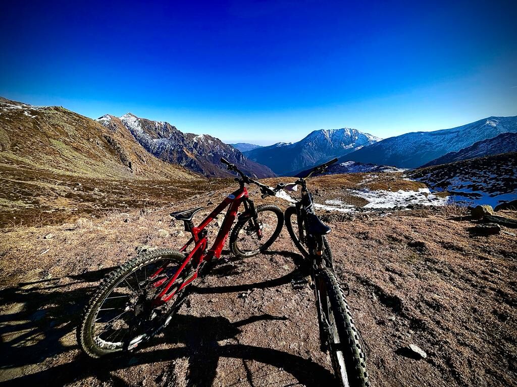
EXPERTS ONLY - Beyond the Alpe, the trail towards the Ovarda Lakes is only partially rideable and requires portage (carrying the bike).
Route Description
The route is divided into three distinct phases:
Warm-up (Lemie - Chiandusseglio): If you start from Lemie, you have about 2.5 km of asphalt along the provincial road to reach the Chiandusseglio junction. It is a good way to warm up your legs before tackling the tougher slopes.
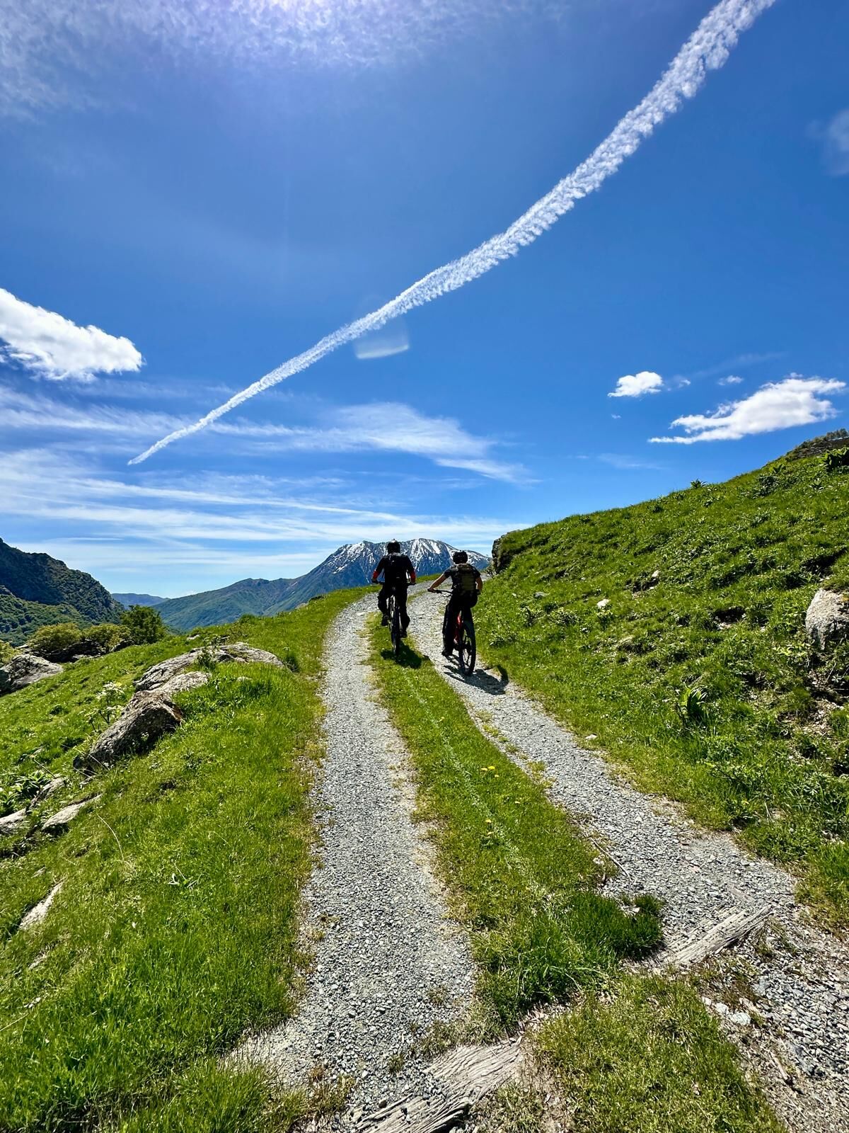
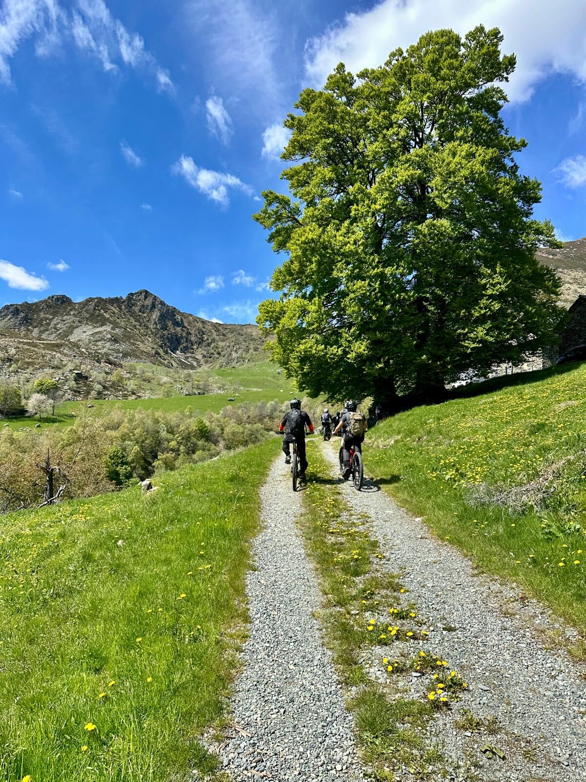
The initial ramp (Steep asphalt): From the Chiandusseglio junction, a very narrow and steep asphalt road begins. You will pass the hamlets of Molar, Fontana, and Inversigni. This is the hardest part for the heart, with slopes often reaching 10-12%.
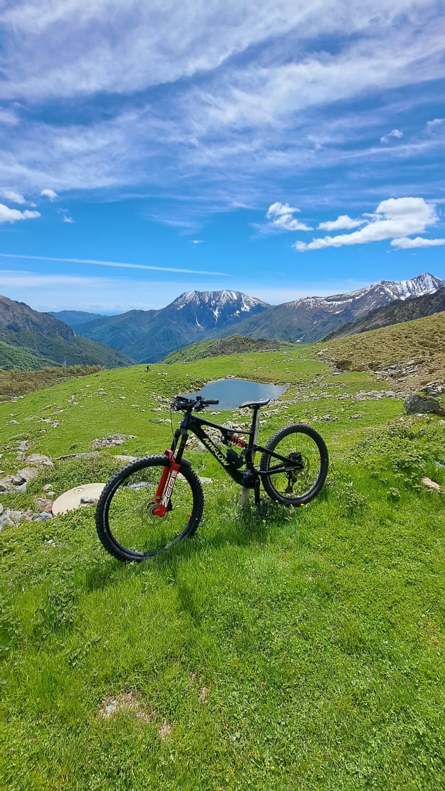
Ovarda Valley (Dirt road): Just after Inversigni (around 1240 m), the asphalt ends and the dirt road begins. The surface is generally good and compact. You will encounter the suggestive Chapel of San Bartolomeo (great rest spot), cross the Ovarda stream, and climb with wide switchbacks among high-altitude pastures and erratic boulders up to the huts of Alpe di Ovarda.
Départ : Lemie (840 m) ou Chiandusseglio (1030 m).
Difficulté (VTT) : MC/BC (pour cyclotouristes de capacité moyenne). L'ascension est techniquement simple (chemin blanc) mais exige un excellent effort physique à cause des pentes.
Cyclabilité : 100 % jusqu'à l'alpage.
RÉSERVÉ AUX EXPERTS - Au-delà de l'Alpe, le sentier vers les Lacs d'Ovarda est cyclable seulement par endroits et nécessite du portage (vélo à l'épaule).
Áno
The Bicycle: A Mountain Bike (MTB) is a must. A Front Tail (front suspension only) is sufficient given the regularity of the dirt road, but a Full Suspended will give you much more comfort on the descent. If you use an E-Bike, make sure you have plenty of battery left.
Repair Kit: Don't be caught unprepared. Bring with you:
Spare inner tube and tire levers (even if you use tubeless tires).
Mini pump or $CO_2$ cartridges.
Multitool with chain breaker (essential on steep slopes if the chain breaks).
Since this area has intensive pastures, you may encounter guard dogs (Maremmani) protecting the flocks. If it happens: slow down, get off your bike and put it between you and the dog, speaking calmly until you have moved away.
For a more immersive experience, we always recommend relying on one of our MTB guides.
S1
Water is abundant thanks to the many streams flowing down the slopes. However, it is always good to refill at the fountains in Chiandusseglio.
Features and Curiosities
The Barma Frè boulder: Along the climb, you will notice huge erratic boulders. One of these, Barma Frè, is linked to local legends and offers an impressive sight, almost like a natural fortress.
The Ovarda Tower: Throughout the second part of the climb, you will be overshadowed by the Ovarda Tower (3075 m). Its pyramidal and slender shape is one of the most iconic in the Lanzo Valleys.
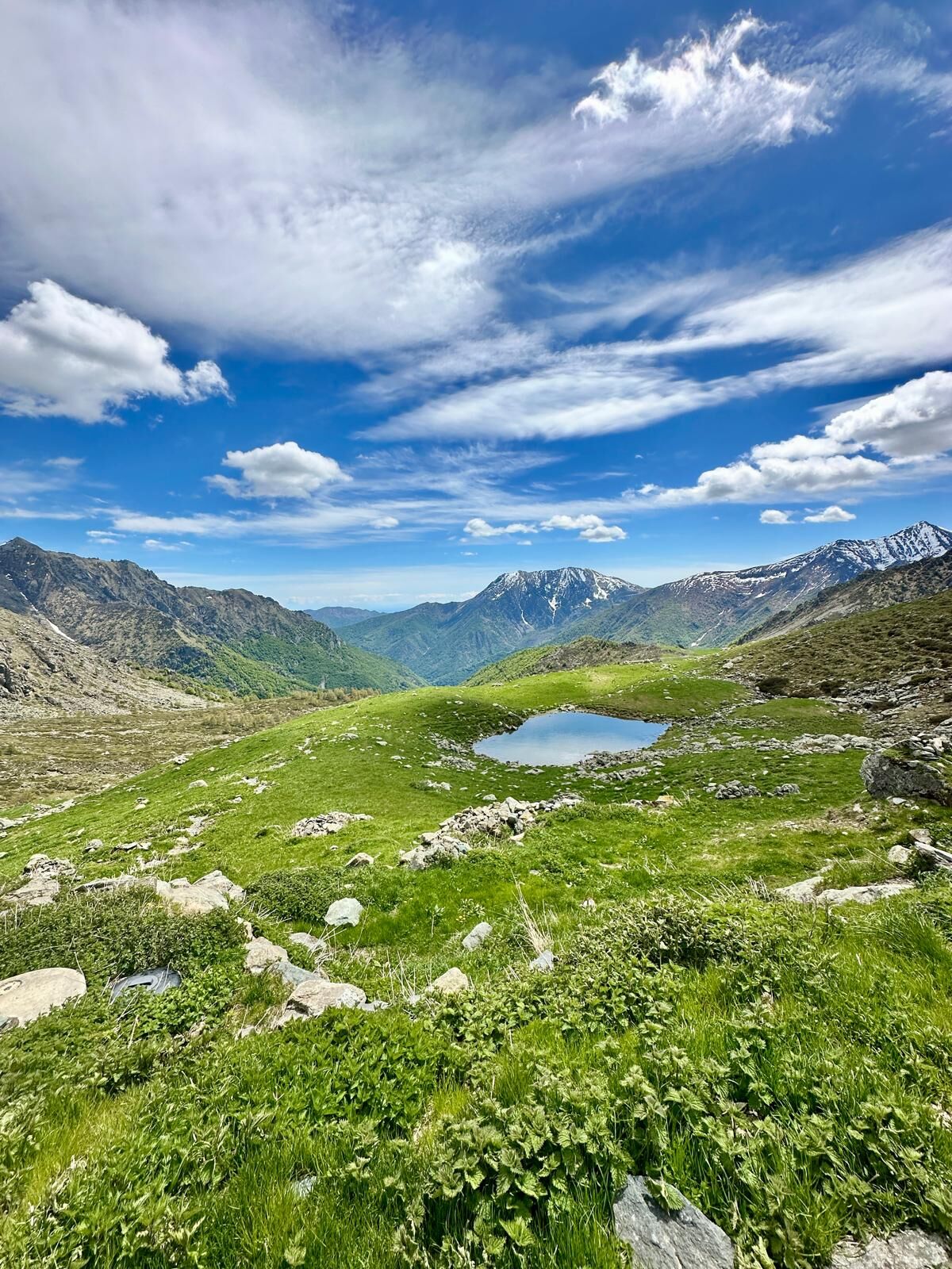
Pian del Gioco: Just beyond the Alpe is the “Pian del Gieugh,” a grassy plateau dotted with rocks where, according to tradition, shepherds gathered for games and challenges. It is a magical and quiet place.
The paved switchbacks: In some sections of the upper dirt road, you will notice switchbacks reinforced with dry stone (paved), a testament to the ancient mountain construction wisdom designed to withstand the weather.
Obľúbené výlety v okolí
-
CERES Santa Cristina Loop
strednáTuristika 7,84 km -
5,0
BALME Green Lakes and Lago Paschiet
strednáTuristika 7,51 km -
5,0
BALME Arnas Ring - Pian della Mussa
ťažkéTuristika 13,6 km -
5,0
LEMIE Ovarda Lakes loop
ťažkéTuristika 15,9 km -
COLLE DEL LYS Partisan Trail
strednáTuristika 11,6 km -
4,7
High Way of the Lanzo Valleys | Stage 6 Tazzetti Refuge - Lake of Malciaussia
strednáTuristika 5,49 km -
5,0
Alta Via delle Valli di Lanzo | Stage 4 Rifugio Citt di Ciri - Rifugio Cibrario
ťažkéTuristika 12,0 km -
USSEGLIO Lake Nero from Lake Malciaussia
svetloTuristika 4,79 km -
USSEGLIO Lake behind the Tower and of the Rossa
ťažkéTuristika 17,1 km -
VIU' Lake Viana from Alpe Bianca
strednáTuristika 5,56 km
Turistika a stopovanie


Nenechajte si ujsť ponuky a inšpiráciu na ďalšiu dovolenku
Vaša e-mailová adresa bol pridaný do poštového zoznamu.