Navigácia na stránke
Získajte túto prehliadku v mobilnom telefóne
Mapa
TURIN - From the city center to the vineyards of the hillside, to the Monferrato of Turin.
stredná
Cestný bicykel
72,13 km
Naskenujte kód QR a spustite navigáciu v aplikácii bergfex
QR Code
Turistika a stopovanie

TURIN - From the city center to the vineyards of the hillside, to the Monferrato of Turin.

Vzdialenosť
72,1 km
Trvanie
04:30 h
Ascent
1 063 hm
Hladina mora
205 - 562 m

Úroveň náročnosti: 1

Stiahnutie skladby
Mapa
TURIN - From the city center to the vineyards of the hillside, to the Monferrato of Turin.
stredná
Cestný bicykel
72,13 km

The bicycle tourist will appreciate places and history by taking the whole day and tackling it at a slow pace. The sportsman will enjoy the constant ups and downs of roads with little traffic. The route...

Opis

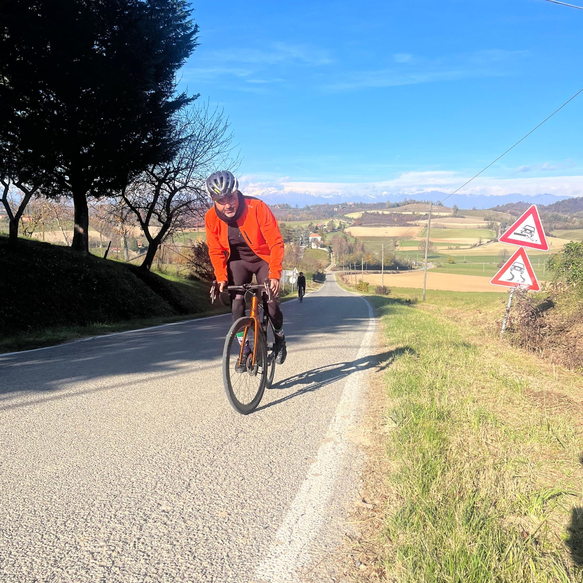
The bicycle tourist will appreciate places and history by taking the whole day and tackling it at a slow pace. The sportsman will enjoy the constant ups and downs of roads with little traffic. The route bypasses the hills of Turin and enters the Chierese area, riding along sections of the Piedmont Blue Way. It passes through Pecetto, famous for its cherries, and continues on to Chieri, a town with a long tradition in textiles, and Pessione di Chieri, the historic headquarters of Martini & Rossi (which can be visited by appointment). Passing by imposing castles such as the Rocca di Arignano, it travels along winding stretches with challenging ups and downs amid vineyards and fields. At Cinzano and Sciolze the last climbs before the return to the Po and the city.

Trasa
Turin
(239 m)
Mesto
0,0 km
Chiesa di Sant'Antonio
(285 m)
Miesto uctievania
20,3 km
Cappella di San Sebastiano
(311 m)
Miesto uctievania
30,4 km
Sant'Antonio Abate
(488 m)
Miesto uctievania
41,0 km
Chiesa di Santa Lucia del Fagnour
(477 m)
Miesto uctievania
51,7 km
San Rocco
(207 m)
Miesto uctievania
64,3 km
Cappella di Sant'Anna
(212 m)
Miesto uctievania
65,2 km
Trasa
Mapa
TURIN - From the city center to the vineyards of the hillside, to the Monferrato of Turin.
stredná
Cestný bicykel
72,13 km
Turin
(239 m)
Mesto
0,0 km
Murazzi
(229 m)
Prístavisko trajektu
1,2 km
Borgo Medioevale del Valentino
(225 m)
Koridor/terén
3,1 km
Borgo Medioevale
(224 m)
Prístavisko trajektu
3,1 km
Pilonetto
(226 m)
Susedstvo
4,6 km
Chiesa del Pilonetto
(229 m)
Miesto uctievania
4,7 km
Cavoretto
(342 m)
Dedina
6,5 km
Moncalieri
(250 m)
Mesto
6,6 km
La Boccio
(347 m)
Reštaurácia
6,7 km
Il Bastian Contrario
(560 m)
Reštaurácia
9,4 km
Revigliasco
(392 m)
Dedina
11,8 km
San Sebastiano
(371 m)
Miesto uctievania
13,4 km
Pecetto Torinese
(402 m)
Dedina
14,0 km
Vigne - Lavatoio
(374 m)
Susedstvo
14,2 km
San Felice
(339 m)
Zúčtovanie
16,5 km
Chiesa delle Orfanelle
(283 m)
Miesto uctievania
19,9 km
Santa Teresa
(283 m)
Miesto uctievania
20,0 km
Chiesa di Sant'Antonio
(285 m)
Miesto uctievania
20,3 km
Chieri
(285 m)
Mesto
20,7 km
Sant'Anna
(286 m)
Susedstvo
25,5 km
Emporio Enogastronomico
(278 m)
Reštaurácia
26,9 km
Dai Braji
(278 m)
Reštaurácia
27,0 km
Andezeno
(283 m)
Dedina
27,1 km
L'Òsto dël Tòrcc
(279 m)
Reštaurácia
27,8 km
Arignano
(298 m)
Dedina
30,2 km
Cappella di San Sebastiano
(311 m)
Miesto uctievania
30,4 km
Chiesa parrocchiale dell'Assunzione di Maria Vergine e di San Remigio
(321 m)
Miesto uctievania
30,5 km
Tetti Chiaffredo
(338 m)
Zúčtovanie
32,7 km
Cascina Roasine
(323 m)
Zúčtovanie
33,0 km
Barbaso
(373 m)
Zúčtovanie
34,4 km
Cappella di San Bernardino da Siena
(375 m)
Miesto uctievania
36,8 km
Moncucco Torinese
(400 m)
Dedina
37,2 km
Osteria Mangé Bin
(398 m)
Reštaurácia
37,3 km
San Paolo
(420 m)
Miesto uctievania
37,8 km
Sant'Antonio Abate
(488 m)
Miesto uctievania
41,0 km
Cinzano
(486 m)
Dedina
41,0 km
Regione Sant'Antonio
(452 m)
Zúčtovanie
41,7 km
Caseppa
(286 m)
Zúčtovanie
46,0 km
Cascina Celeste
(266 m)
Zúčtovanie
47,0 km
Regione Fasella
(378 m)
Zúčtovanie
49,3 km
Sciolze
(410 m)
Dedina
50,7 km
Ristorante del Pino
(413 m)
Reštaurácia
50,7 km
Chiesa di San Rocco
(410 m)
Miesto uctievania
50,7 km
Chiesa di Santa Lucia del Fagnour
(477 m)
Miesto uctievania
51,7 km
Regione Bavento
(422 m)
Zúčtovanie
52,3 km
Regione Curlando
(453 m)
Zúčtovanie
52,5 km
Tetti Grosso
(436 m)
Zúčtovanie
53,0 km
Aprà
(228 m)
Reštaurácia
58,1 km
Castiglione Torinese
(217 m)
Dedina
59,2 km
Enso Sushi
(204 m)
Reštaurácia
60,8 km
Settimo Torinese
(202 m)
Mesto
61,8 km
Sambuy
(224 m)
Susedstvo
62,3 km
Il quadrifoglio
(209 m)
Reštaurácia
63,1 km
San Mauro Torinese
(204 m)
Mesto
64,0 km
La Casarola
(210 m)
Reštaurácia
64,2 km
Centro
(212 m)
Susedstvo
64,3 km
San Rocco
(207 m)
Miesto uctievania
64,3 km
Cappella di Sant'Anna
(212 m)
Miesto uctievania
65,2 km
Sant'Anna
(208 m)
Susedstvo
65,6 km
I Sapori Della Pizza
(211 m)
Reštaurácia
66,0 km
La Luna e I Falò
(211 m)
Reštaurácia
66,0 km
Borgata Rosa
(213 m)
Susedstvo
67,0 km
Sassi
(223 m)
Dedina
68,5 km
Madonna del Pilone
(220 m)
Susedstvo
70,0 km
Vanchiglietta
(219 m)
Susedstvo
70,1 km
Turin
(239 m)
Mesto
71,8 km
Informácie o prehliadke

Cherries, vermouth, vineyards and castles. A tour through history and nature.

Technológia
1 / 6
Stav
3 / 6
Krajina
5 / 6
Skúsenosti
5 / 6
Prístupné po celý rok
Jan
Feb
Mar
Apr
Máj
Jún
Júl
Aug
Sep
Okt
Nov
Dec
Zdieľať prehliadku
Mapa
TURIN - From the city center to the vineyards of the hillside, to the Monferrato of Turin.
stredná
Cestný bicykel
72,13 km
Chyba
Vyskytla sa chyba. Prosím, skúste to znova.
Informácie o trase
Trasa

From the center of Turin you reach the bank of the Po and continue southward within the Valentino Park to the Balbis Bridge, over which you cross the river. After a short stretch on Corso Moncalieri, turn uphill on Via Sabaudia, following the signs for Cavoretto. After passing Cavoretto, continue on Strada della Viola in the direction of Revigliasco. (The highest point of this first ascent is a junction from which a deviation from the trail allows you to reach the Victory Lighthouse on Colle della Maddalena.) The subsequent descent leads first to Revigliasco, then to Pecetto Torinese. With an almost flat section, you pass Chieri and Andezeno, until you reach Arignano, from which, through the center and the Rocca di Arignano, you begin a hilly section with some short but steep climbs that lead to Moncucco , Cinzano and Sciolze (from Cinzano to Sciolze it is possible to stay at altitude with a variation to the proposed track, reducing the overall elevation gain). After Sciolze begins the descent that leads through the town of Bardassano to Castiglione Torinese. From Castiglione, along Via Casale, you reach San Mauro and, back on the bank of the Po, return toward the center of Turin.

Geologické zaujímavosti

Áno

Zariadenie

Bico road, bicycle touring or gravel.

Bezpečnostné pokyny

Beware of some stretches with asphalt not in the best condition.

Ďalšie informácie a tipy
Úroveň náročnosti

1

Ďalšie informácie

Itinerary passable 12 months a year, but beware of weather in winter and high temperatures in summer (leave very early in the morning) .

Tipy

Itinerary that requires some athletic preparation if you have little time, but can be tackled calmly and without special training to enjoy the beautiful views offered by the Piedmont Blue Way.

Turistika a stopovanie

Turistika a stopovanie

Turistika a stopovanie
Viac ako 550.000 návrhov výletov, podrobné mapy a intuitívny plánovač trás robia z aplikácie povinnú výbavu pre všetkých nadšencov prírody.
bergfex