







FFC bike route No. 25: Discovering Bairols
Úroveň náročnosti: 4
The village of Bairols was built at 832 m altitude, on a rocky ridge which allows you to progress along a steep slope throughout the ascent, overlooking the valley and offering a wide panorama of the surrounding...
The village of Bairols was built at 832 m altitude, on a rocky ridge which allows you to progress along a steep slope throughout the ascent, overlooking the valley and offering a wide panorama of the surrounding mountains. Once you reach the highest point village, you will greatly enjoy wandering the freshly paved alleys, one of which encircles the village, discovering the old stone facades, vaulted and medieval covered passages with their vertiginous stairs.

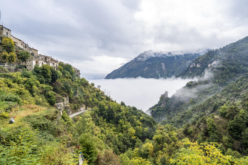

From the start at the roundabout, take the RM 2205 towards Nice. At the exit of the place name, turn right onto RM 26 and the bridge that crosses the Tinée river towards Bairols. As soon as you leave the bridge, stay right on the RM 56. From this intersection begins the climb towards Bairols. Once you reach the village and after a well-deserved rest or a visit through the alleys, all that remains is to retrace your steps back to the starting point, being very careful on the descent, which is winding and little frequented by motorists.
Áno
- Wear an approved helmet
- Check the condition of your tires
- Carry a repair kit in case of puncture
- Prefer at least a flashing LED light to fix on the seat post to be seen by motorists
- Do not overestimate your abilities
- Check the mountain weather before you leave
- Remember to carry an ID and a number to call in case of danger
- Respect the environment and other road users
- Be cautious on the narrow and winding descent
Located 55 km from Nice, this starting point allows you to easily and safely take routes that would not always be easy to do from Nice, otherwise having to cover many kilometers on a busy road.
Nice is served by the A8 highway "La Provençale", coming from Aix-en-Provence to the West and from the border to the East.
To reach the start located 55 km from Nice:
Take Exit No. 52: Saint-Isidore
Direction Digne via RM 6202
Then take the Route de la Tinée (RM 2205)
Find bus lines at: https://www.lignesdazur.com
A parking lot is available at the starting roundabout
4
Route intended for recreational use - FFC Color: Blue (difficult)
Bairols is a very secluded mountain village, between sky and earth, it nevertheless has an inn located in an old mill hence its name Auberge du Moulin. A stop is highly recommended to simply have a drink or to taste delicious dishes with a breathtaking view. Do not hesitate to call to make a reservation as the owners make their own bread and only use fresh ingredients.
All outdoor activities of the Métropole Nice Côte d'Azur are on https://outdoor.nicecotedazur.org
Obľúbené výlety v okolí
-
The Salt Roads: The Pagarine Route
strednádiaľková pešia trasa 159,7 km -
5,0
FFC cycling circuit No. 32: The loop of the 2 valleys from St. Sauveur/Tinée
ťažkéCestný bicykel 117,8 km -
FFC cycling circuit no. 30: the loop of the Col de la Couillole
ťažkéCestný bicykel 70,8 km -
Utelle - Roquebillière / Pagarine route (stage 4)
strednáTuristika 20,0 km -
Mountain bike circuit FFC no. 21a: Les granges de la Brasque
ťažkéMountainbike 41,2 km -
Auron - Nice gravel route
ťažkéDiaľková cyklotrasa 364,4 km -
Mountain bike FFC circuit no. 53: The Madeleine Pass - La Colmiane
ťažkéMountainbike 18,8 km -
FFC mountain bike route no. 11: The pointe de la Penna
strednáMountainbike 11,1 km -
Itinerary n°1 - 2 days - Stage 1 Nice - Isola Village
ťažkéCestný bicykel 109,8 km -
5,0
Goldtoni - Alpenbogen A080 Saint Sauveur Sur Tinée-Utelle
strednádiaľková pešia trasa 40,7 km
Turistika a stopovanie


Nenechajte si ujsť ponuky a inšpiráciu na ďalšiu dovolenku
Vaša e-mailová adresa bol pridaný do poštového zoznamu.





