Göllheim: On the Way of St. James to Eiswoog
stredná
Získajte túto prehliadku v mobilnom telefóne
Göllheim: On the Way of St. James to Eiswoog
stredná
Pútnická trasa
14,15
km
Naskenujte kód QR a spustite navigáciu v aplikácii bergfex

Turistika a stopovanie


Göllheim: On the Way of St. James to Eiswoog
stredná
Vzdialenosť
14,15
km
Trvanie
03:32
h
Ascent
171
hm
Hladina mora
210 -
349
m
Stiahnutie skladby
Göllheim: On the Way of St. James to Eiswoog
stredná
Pútnická trasa
14,15
km
Trasa
Protestantische Kirche Göllheim
(247 m)
Miesto uctievania
0,0 km
Kühberg
(366 m)
Summit
7,4 km
Schloßberg
(327 m)
Summit
8,0 km
Pfarrkirche Mariä Himmelfahrt
(233 m)
Miesto uctievania
10,3 km
Hotel Landgasthaus zum Hirsch
(219 m)
Reštaurácia
10,4 km
Eiswoog Stumpfwaldbahn
(254 m)
Železničná stanica
13,8 km
seehaus forelle
(255 m)
Reštaurácia
14,1 km
Trasa
Göllheim: On the Way of St. James to Eiswoog
stredná
Pútnická trasa
14,15
km
Protestantische Kirche Göllheim
(247 m)
Miesto uctievania
0,0 km
Göllheim
(247 m)
Dedina
0,0 km
Kriegsberg-Hütte
(334 m)
Reštaurácia
3,2 km
Kühberg
(366 m)
Summit
7,4 km
Stauf
(319 m)
Susedstvo
7,7 km
Schloßberg
(327 m)
Summit
8,0 km
Pfarrkirche Mariä Himmelfahrt
(233 m)
Miesto uctievania
10,3 km
Ramsen
(214 m)
Dedina
10,4 km
Hotel Landgasthaus zum Hirsch
(219 m)
Reštaurácia
10,4 km
Eiswoog Stumpfwaldbahn
(254 m)
Železničná stanica
13,8 km
seehaus forelle
(255 m)
Reštaurácia
14,1 km
Autor
Poskytuje Zum Wohl die Pfalz
Prehliadku Göllheim: On the Way of St. James to Eiswoog zabezpečuje outdooractive.com.


Informácie o trase
Trasa
From the center of Göllheim via Kerzweiler and Rosenthalerhof, to Stauf, then continuing via Ramsen to Eiswoog.
Zariadenie
Suitable hiking map, sturdy footwear, weather-appropriate clothing, sun and rain protection,
and sufficient supply of food and drinks, as there are not always dining or shopping options
available or open.
and sufficient supply of food and drinks, as there are not always dining or shopping options
available or open.
Bezpečnostné pokyny
Especially in autumn, it should be noted that fallen leaves can cover unevenness, roots, stones or holes in the path. You should expect such path impairments when going on a hike. If you believe certain sections of the path are impassable for you, you should avoid them. Particularly in adverse weather conditions, natural trails can have muddy and slippery sections.
Informácie o príchode
Príchod
Via the A 63: Coming from Mainz or Kaiserslautern, take the Göllheim exit. Follow the signs to Göllheim, town center.
Verejná doprava
Timetable information at www.vrn.de
Parkovanie
in Göllheim, town center
Ďalšie informácie a tipy
Ďalšie informácie
Donnersberg Tourism Association (Tel. 06352 / 1712)
www.jakobusgesellschaft.eu
http://www.jakobsweg-pfalz.de/
www.jakobusgesellschaft.eu
http://www.jakobsweg-pfalz.de/
Tipy
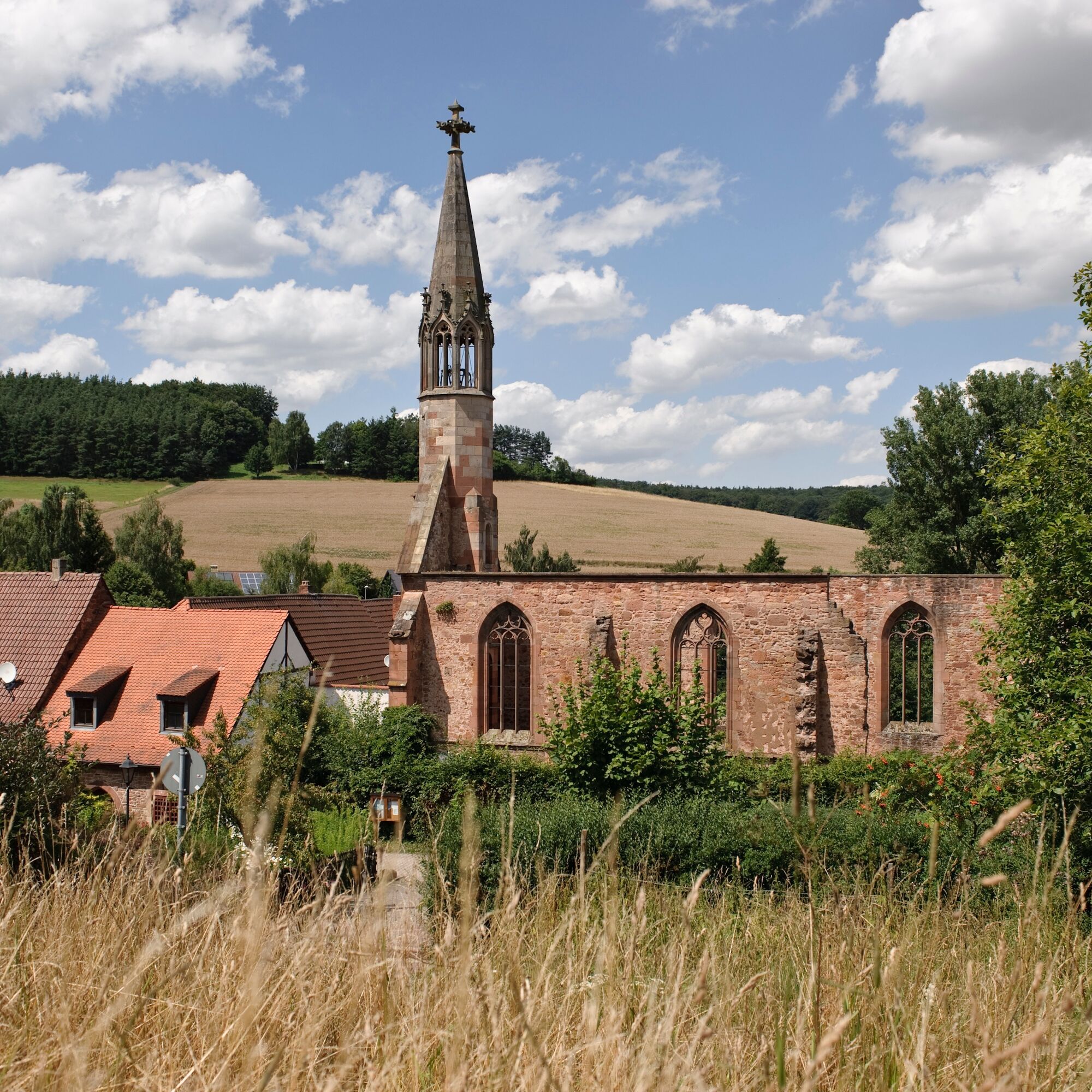
Rosenthal Monastery Ruins
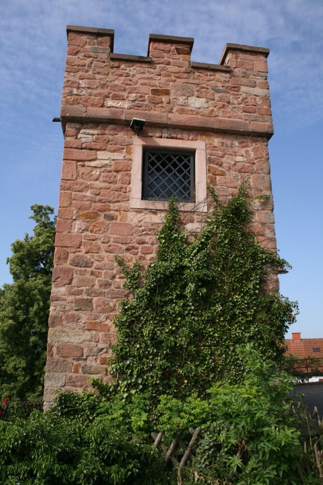
Stauf Castle
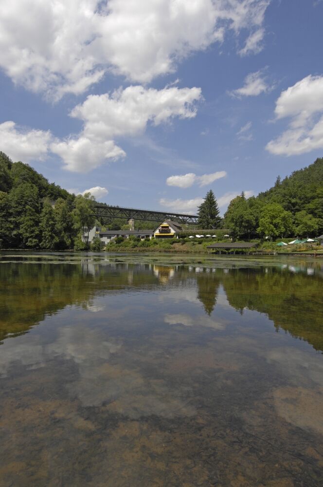
Eiswoog
Stauf Castle
Eiswoog
Zatiaľ žiadne recenzie
Obľúbené výlety v okolí
-
4,0
Ganerbenweg - Premium circular hiking route in the Freinsheim holiday region
strednáTuristika 10,5 km -
5,0
Circular route through forest and vineyard: Weisenheim am Berg - "Wine, Forest, Ungeheuer"
strednáTuristika 12,5 km -
5,0
Leininger Castle Trail - Premium hiking trail with audio and video stations
ťažkéTuristika 22,3 km -
3,5
Leininger Monastery Trail - Premium hiking trail with audio and video stations
strednáTuristika 15,3 km -
4,3
Zwei-Burgen Tour Battenberg
strednáTuristika 5,43 km -
5,0
Palatinate Wine Trail Stage 01 Bockenheim - Neuleiningen
strednádiaľková pešia trasa 16,9 km -
5,0
Palatinate Wine Trail Stage 02 Neuleiningen - Bad Dürkheim
strednádiaľková pešia trasa 17,6 km -
Wine hike: Kallstadt - Rieslingweg
svetloTuristika 6,57 km -
4,0
Wine hike: Weisenheim am Berg - Herxheim am Berg - Dackenheim
svetloTuristika 7,95 km -
5,0
Circular route through vineyards and forest: Weisenheim am Berg - Bobenheim am Berg - Leiningerland - Dackenheim
ťažkéTuristika 17,0 km

Turistika a stopovanie

Viac ako 550.000 návrhov výletov, podrobné mapy a intuitívny plánovač trás robia z aplikácie povinnú výbavu pre všetkých nadšencov prírody.

Nenechajte si ujsť ponuky a inšpiráciu na ďalšiu dovolenku
Prihlásiť sa k odberu noviniek
Chyba
Vyskytla sa chyba. Prosím, skúste to znova.
Ďakujeme za vašu registráciu
Vaša e-mailová adresa bol pridaný do poštového zoznamu.
Zájazdy po celej Európe
Rakúsko
Švajčiarsko
Nemecko
Taliansko
Slovinsko
Francúzsko
Holandsko
Belgicko
Poľsko
Lichtenštajnsko
Česko
Slovensko
španielsko
Hrvaška
Bosna a Hercegovina
Luxembursko
Andorra
Portugalsko
Island
Spojené kráľovstvo
Írsko
Grécko
Albánsko
Severné Macedónsko
Malta
Nórsko
Čierna Hora
Moldavsko
Kosovo
Maďarsko
San Maríno
Rumunsko
Estónsko
Lotyšsko
Bielorusko
Cyprus
Litva
Srbsko
Bulharsko
Monako
Dánsko
Švédsko
Fínsko