


Circular route through vineyards and forest: Freinsheim - Berntal - Leistadt - Lindemannsruhe - Bismarck Tower - Weilach - Kallstadt


Fotografie našich používateľov
Challenging, very varied landscape route with some ascents in the forest area from Leistadt.
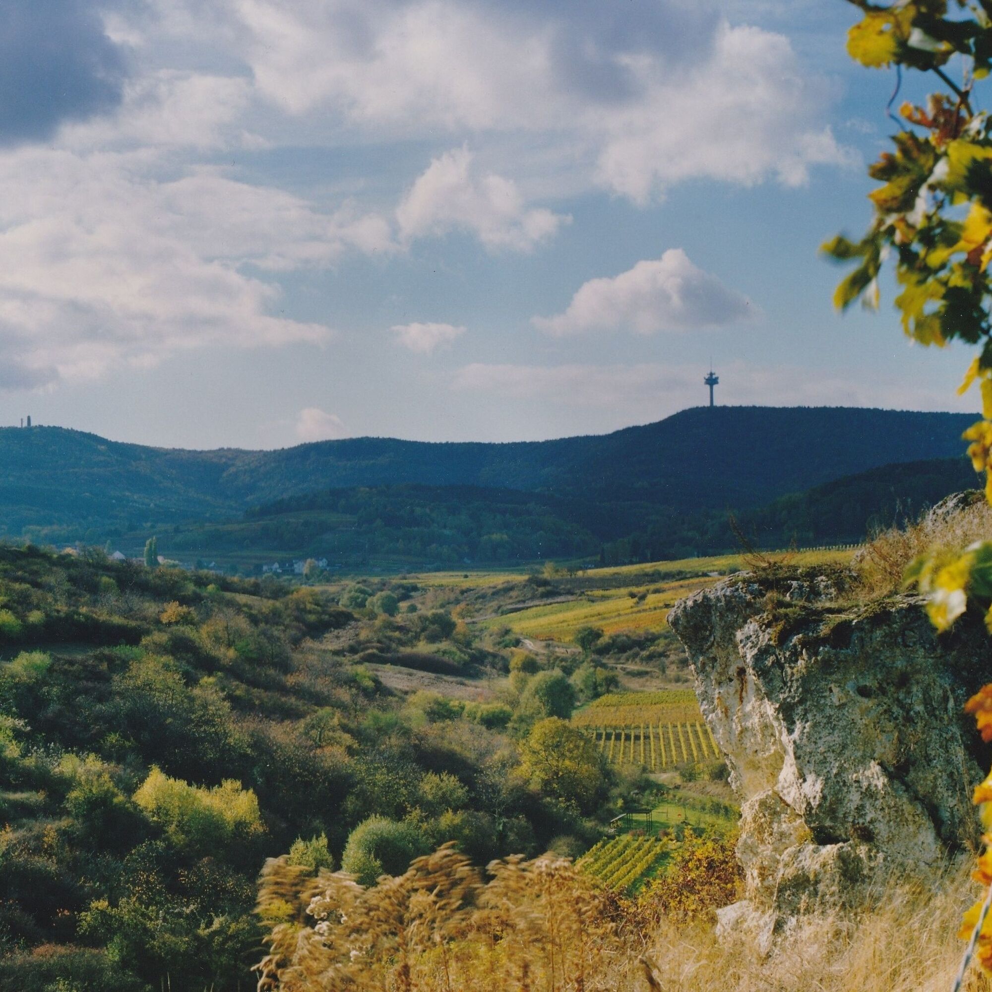
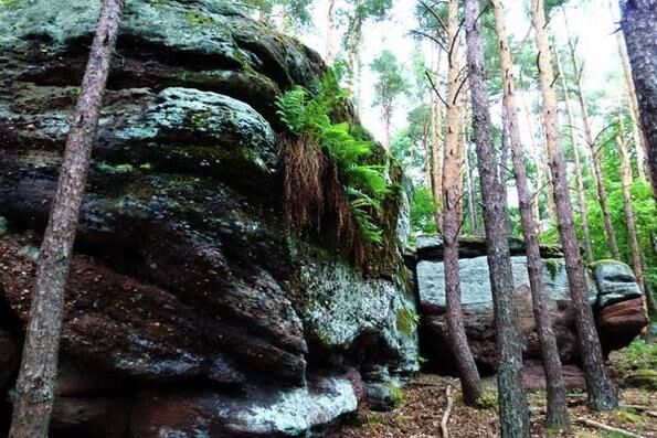
The route leads over the Oschelskopf vineyard and then past the impressive rock face in the Berntal nature reserve....
Challenging, very varied landscape route with some ascents in the forest area from Leistadt.
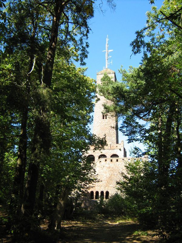
The route leads over the Oschelskopf vineyard and then past the impressive rock face in the Berntal nature reserve. In the forest, it passes various natural monuments such as the old quarry Krummholzer Stuhl, the Soup Bowl, the Leininger boundary stone, the Kanapee, the Devil's Bench, and the Devil's Wall to Lindemannsruhe and the Bismarck Tower. The return route continues through the forest to Leistadt and over the Roman winery at Weilberg to Kallstadt. On the way back to Freinsheim, you pass Hahnenplatz with old chestnut trees.
The tour is not separately signposted.


The hike begins at the Tourist Information i-Point Freinsheim at the historic town hall in Freinsheim. You walk along the main street over Bahnhofstraße and Herxheimer Straße, straight ahead into Holzweg. You cross the railway embankment and after about 300m turn right at the large meadow. You pass the Oschelskopf sculpture and follow the paved path downhill. At the bench group by the meadow, keep right. After about 400m, go right over the small bridge and then cross the wine road (attention: no crossing assistance).
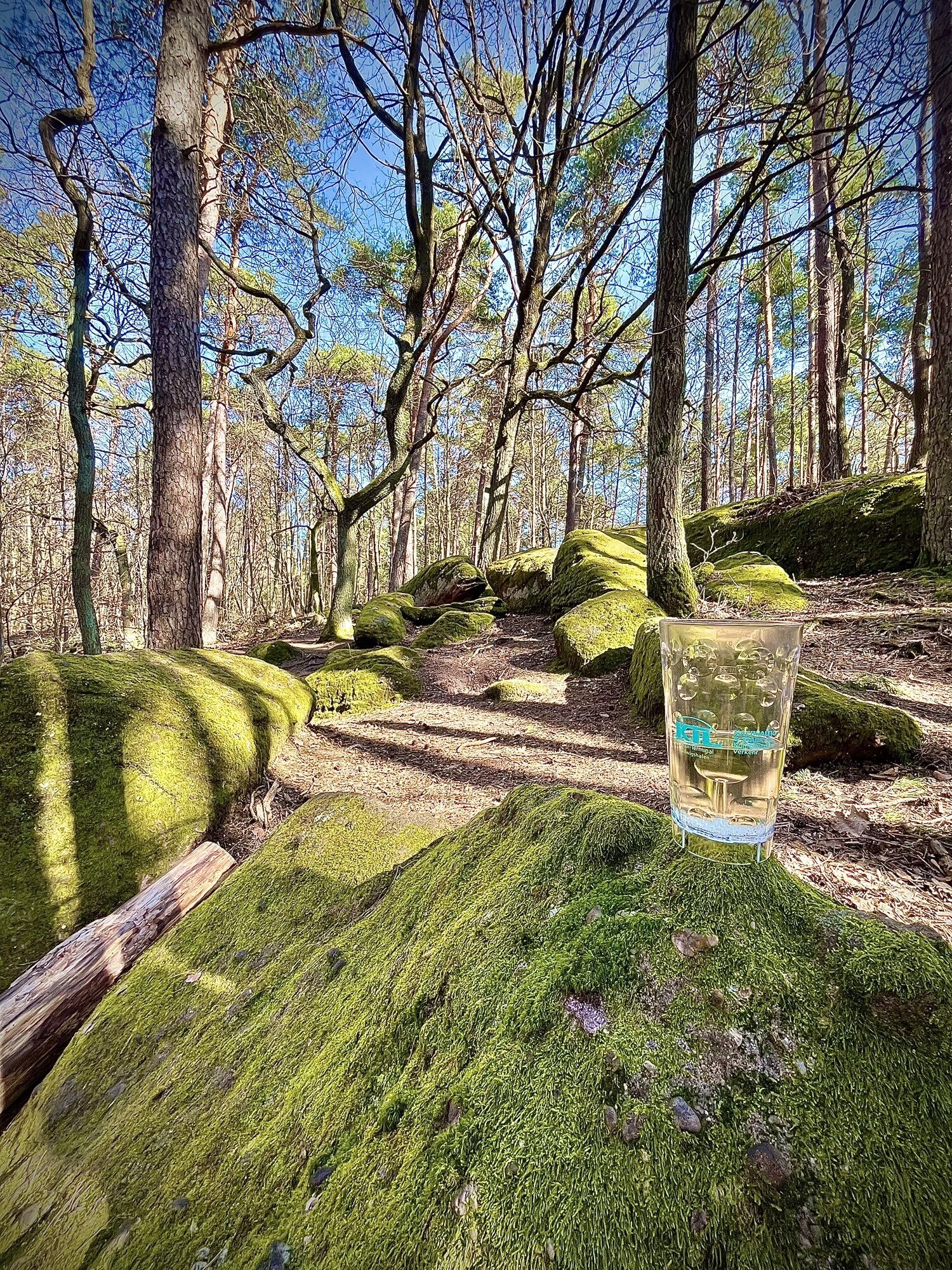
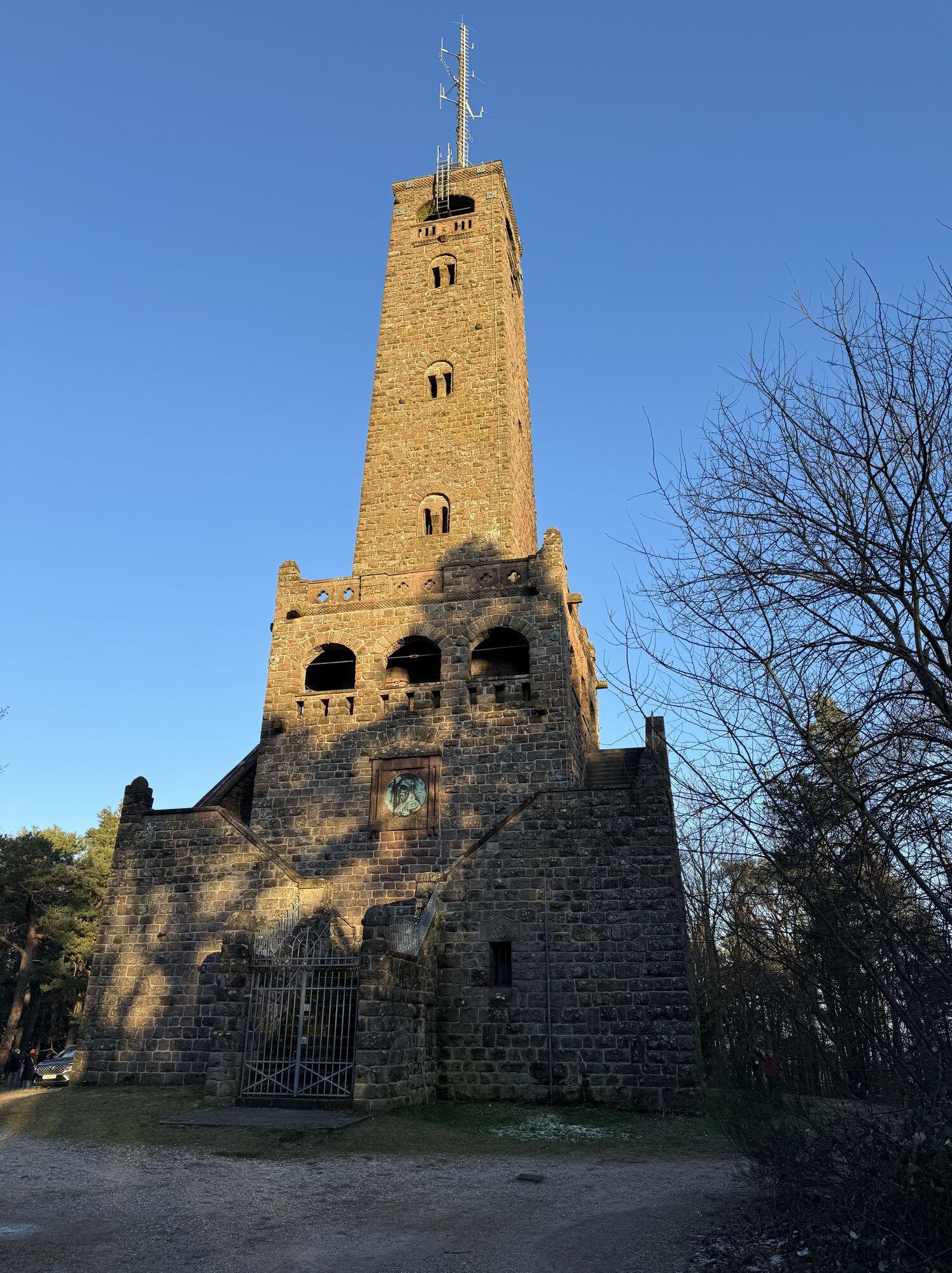
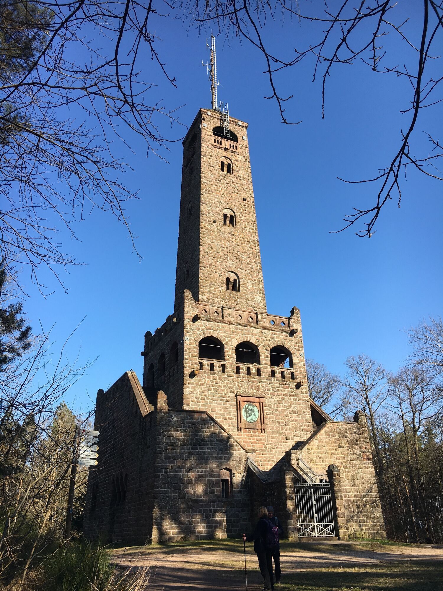
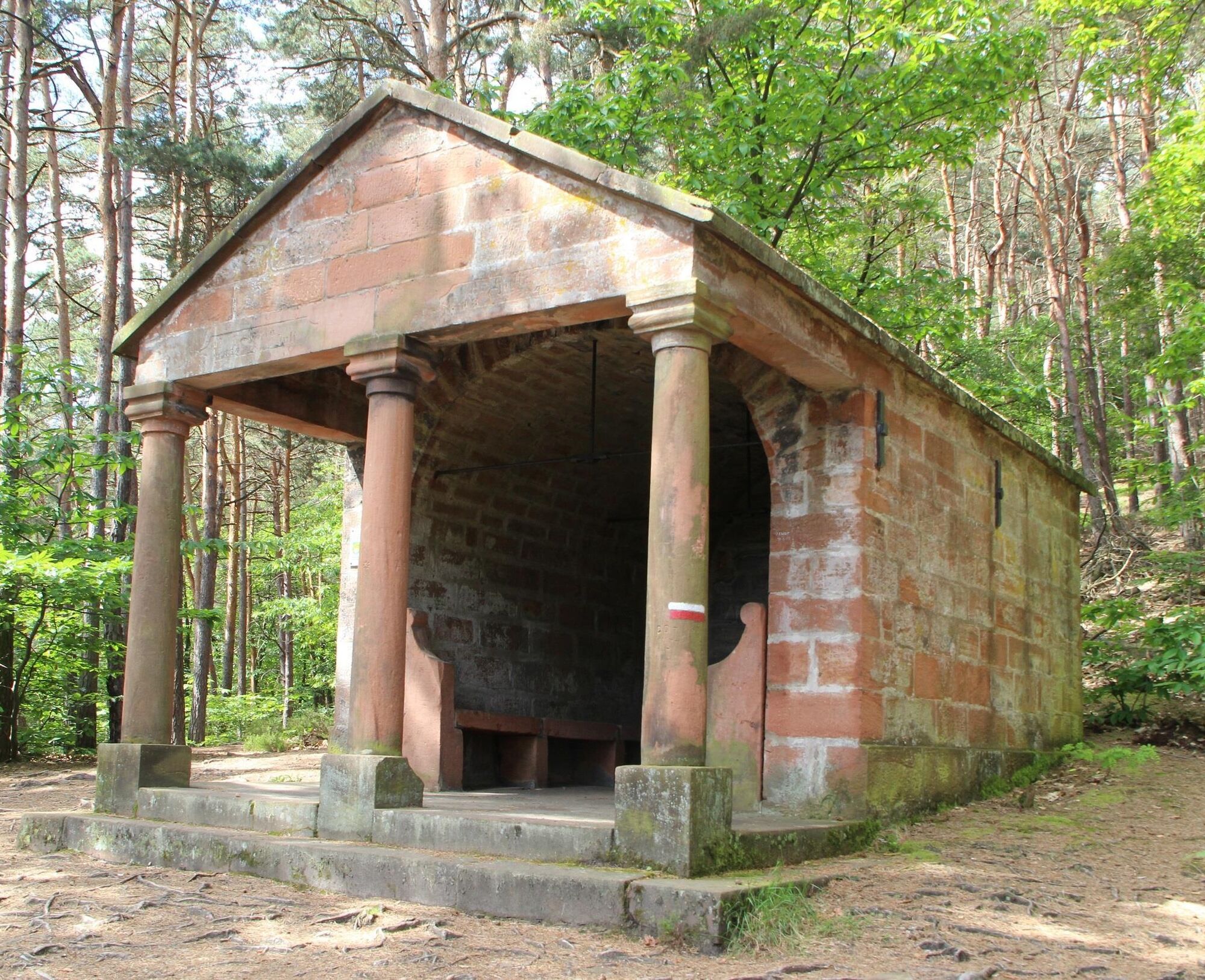
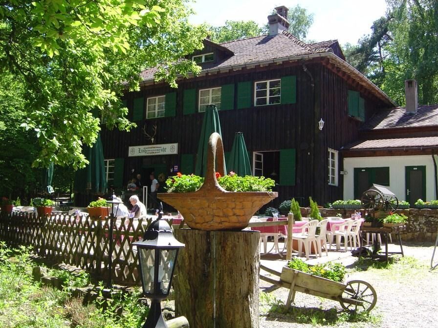
From here, continue left and then take the unpaved path to the right, always straight ahead through the Berntal nature reserve to the Weidenhof car park at the northern edge of Leistadt. Cross the road and follow the signage for the hiking trail "Seven Forest Wonders". Ascending gently, you pass the Laura hut. A few hundred meters after the Laura hut, turn left into the hollow path, after the stair steps again left, to the Krummholzer chair and to the Soup Bowl. You are now on the Ganerbenweg (marking: black axe on yellow background). After about 200 m, the path sharply branches left. You come to the Leininger boundary stone and the 'Devil's Wall'. On this section, you can also take a detour to the Kanapee and the Devil’s Bench. Continue on the Ganerbenweg to the Lindemannsruhe forester’s house with the possibility to stop for refreshment and to the Bismarck Tower.
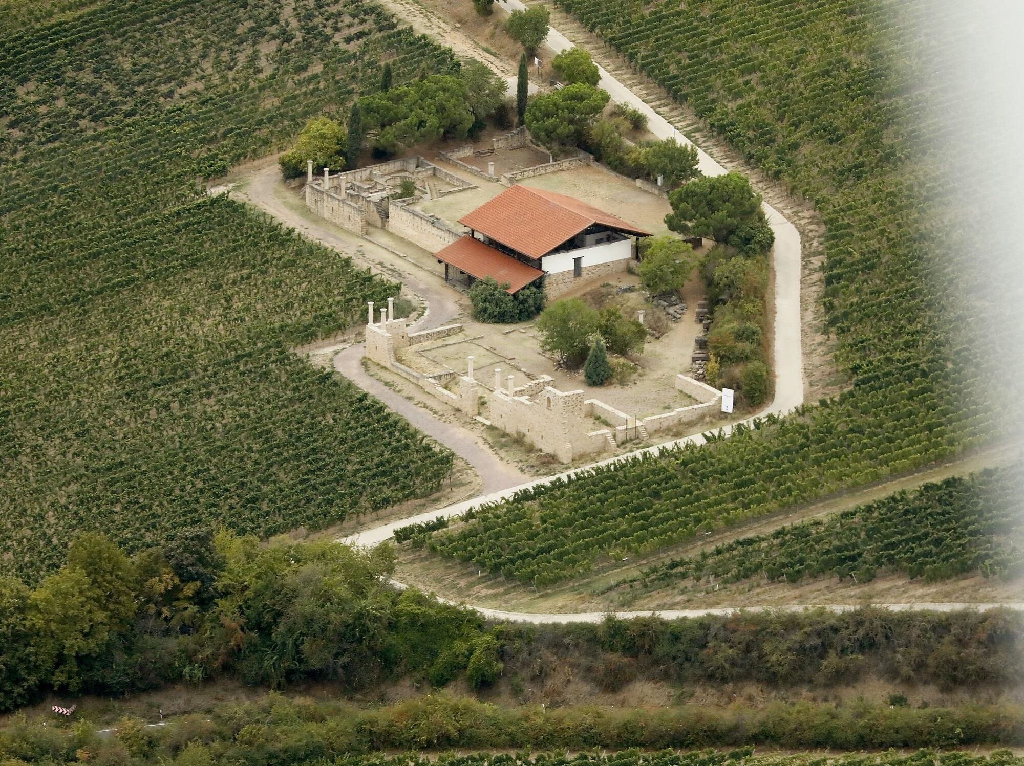
100 meters after the Bismarck Tower, leave the Ganerbenweg to the left and follow the signs "Pfalz Pfade Weilach" (marking: Bismarck Tower) to the PWV hut "In der Weilach" and to the parking lot at the forester's house. At the Weilach forester's house, cross the K3 eastward. After a few meters, turn left into the forest path. Follow marking 1 on the trees, then continue following the white arrow markings on the trees. At the grounds of the dog sports club, turn right over the unpaved path to the German Wine Road hiking trail. Follow this to the right heading south to the hotel/restaurant Annaberg. Here turn left, cross the street, and take the first field path on the right and then the second to the left. You pass the Roman press and after 100 meters go left up to the Roman Weilberg winery. At the junction before the winery, turn right towards Kallstadt, following the almond path markings. The Riesling path (blue post with yellow wine glass) leads you past Kallstadt Lake, along Backhausgasse to Leistadter Straße. At Weingut Heinz, turn right. Walk over the Place of 100 Wines and arrive at the Tourist Information i-Point Kallstadt. Here cross the wine road and turn left into Neugasse, after 30 meters immediately left again into Schlittweg (no street sign). At the end, turn left and immediately right onto the unpaved field path. After about 700 meters, there is a quick sequence of left and right turns. You now walk directly to the Hahnenplatz (natural monument with old chestnut trees) and towards Freinsheim. Over the station, Bahnhofstraße, Denkmalstraße, and Haintorstraße, you enter the old town of Freinsheim and reach the starting point via Breite Straße.
Áno
Please pay attention to weather-appropriate clothing and good footwear. Hiking poles are recommended.
The path largely leads on unpaved forest ground. Watch out for roots, rocks, and stones so you don’t lose your footing.
In the vineyards, the route runs on farm roads. Please give way to agricultural traffic. Due to agricultural use, the paths may be dirty. After rainy days and especially in spring, autumn, and winter, the paths can be wet and slippery.
From the North:
Motorway A6 (Mannheim/Kaiserslautern, exit Grünstadt) towards Bad Dürkheim, on B271 (German Wine Road) via Herxheim am Berg to Freinsheim
From the South:
Motorway A61 at the Ludwigshafen junction onto the A650 towards Bad Dürkheim. At the end of the expanded route straight ahead towards the Trift/Grünstadt industrial area. At the 2nd traffic light right towards Ungstein. At the roundabout, take the 1st exit towards Freinsheim.
Freinsheim station, regular connections from the Rhine-Neckar triangle, from Neustadt/Weinstraße and Bad Dürkheim as well as from Grünstadt.
Timetable information: www.vrn.de
Parking lot at the station (Am Güterbahnhof) or parking lot in Großkarlbacher Straße.
Walking distance to the Tourist Information i-Point Freinsheim at the historic town hall at the marketplace, approx. 10 or 5 minutes on foot
During and after the hike, the diverse gastronomy in Kallstadt and Freinsheim is open for refreshment.
Places to eat:
Forester’s house Lindemannsruhe, Tel. 06322-6208292 or 0174-9175633. Indoor and outdoor seating.
Opening hours: see homepage www.lindemannsruhe.de
Palatinate Forest Association hut "In der Weilach" Tel. 06322-65278, located 400 m from the forester’s house at the Weilach. Indoor and outdoor seating.
Opening hours: see homepage
Bismarck Tower: April - October on weekends and public holidays and Wednesdays from 10 a.m. to 6 p.m. (served). November - March on Sundays from 10 a.m. to 6 p.m. The tower opening hours coincide with the opening hours
Obľúbené výlety v okolí
-
3,6
Ganerbenweg - Premium circular hiking route in the Freinsheim holiday region
strednáTuristika 10,5 km -
Wachenheim - Eckkopf - Heidenlöcher - Wachenheim
strednáTuristika 12,8 km -
5,0
Leininger Castle Trail - Premium hiking trail with audio and video stations
ťažkéTuristika 22,3 km -
5,0
Circular route through forest and vineyard: Weisenheim am Berg - "Wine, Forest, Ungeheuer"
strednáTuristika 12,5 km -
3,5
Leininger Monastery Trail - Premium hiking trail with audio and video stations
strednáTuristika 15,3 km -
4,7
Ganerbenweg interactive - Premium hiking with audio and video stations
strednáTuristika 10,5 km -
5,0
Wachenheimer Valleys Route to Oppauer Haus
strednáTuristika 11,7 km -
Palatinate Wine Steig Stage 03 Bad Dürkheim - Deidesheim
strednádiaľková pešia trasa 15,2 km -
Pfälzer Weinsteig Stage 4: Deidesheim - Neustadt an der Weinstraße
ťažkédiaľková pešia trasa 19,9 km -
4,7
From Deidesheim over the Heidenlöcher to Eckkopf
strednáTuristika 14,6 km
Turistika a stopovanie


Nenechajte si ujsť ponuky a inšpiráciu na ďalšiu dovolenku
Vaša e-mailová adresa bol pridaný do poštového zoznamu.