


The heart trail by the pond Vrbje at Žalec
The Coronary Club Savinjska dolina Žalec was one of the first in Slovenia to set up the Heart Path in September 2011, which runs along the Vrbje pond, 1.5 km from Žalec. The trail begins at the information...
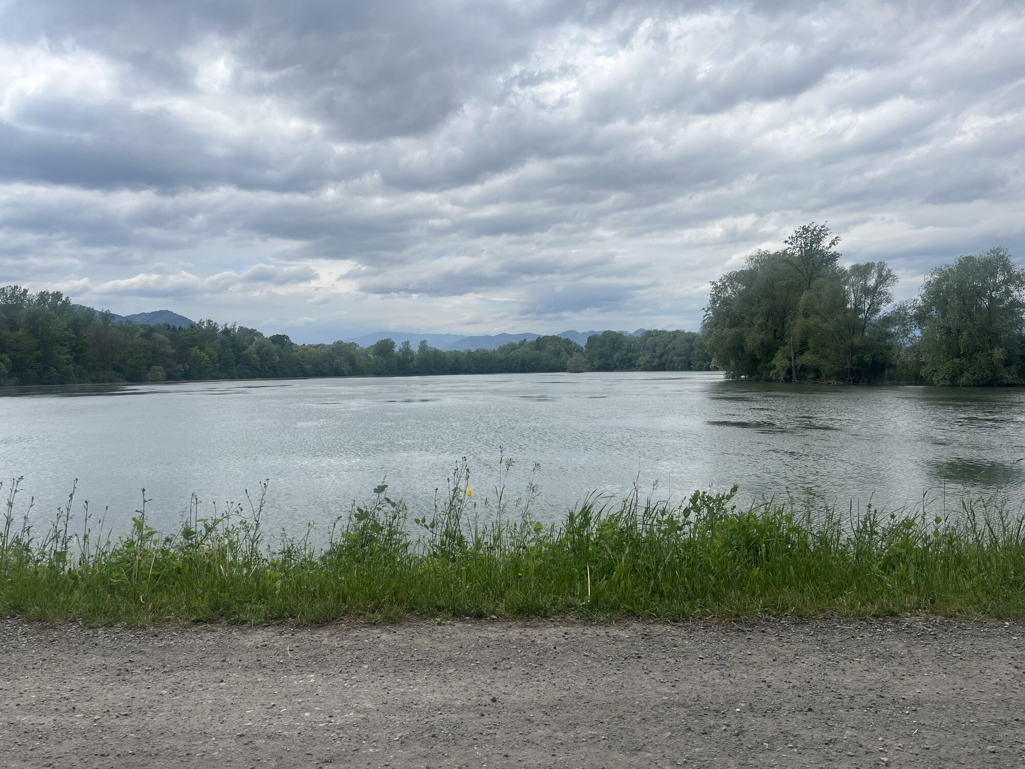
The Coronary Club Savinjska dolina Žalec was one of the first in Slovenia to set up the Heart Path in September 2011, which runs along the Vrbje pond, 1.5 km from Žalec. The trail begins at the information point of the Vrbje pond and continues through part of the protected landscape park, along the outskirts of the Vrbje pond, part of the Natura 2000 area. The Hmeljarska pot also runs along the same route. At the end of the trail, you can have refreshments in a pleasant restaurant by the pond.
The Heart Path is marked with 16 signs that are distributed along the entire path. Exercises with instructions for implementation are drawn on each board. Exercises should be performed slowly, calmly, movements should be easy, without tension. As with all our activities, personal capacity should be taken into account, not competition. There are also rest benches along the way. The route is about 1.7 km long, and the section to the Šeško bridge is about 3.5 km long.


The start and finish is at the information board next to the log cabin. Walk clockwise. 16 marking tables are supplemented with instructions for exercising at individual points. Along the path, there are benches by the pond for resting and admiring the varied flora and fauna in and by the pond.
Áno
Áno
Light sports equipment and hiking poles are recommended.
Path is safe and easy.
BrezplaÄno parkiranje ob ribiški brunarici
ok
The path is suitable for all types of walkers and is partly led through the shade of the forest, and partly through hop fields and ponds.
Obľúbené výlety v okolí
-
4,0
Zasavje long distance trail
strednádiaľková pešia trasa 159,8 km -
5,0
Loke - Krvavica (skozi okno) Slovenia
Turistika 5,79 km -
Heart trail Celje
strednáTematická trasa 3,14 km -
Mrzlica
strednáMountainbike 37,2 km -
Hmeljko hops
svetloTuristika 15,5 km -
Big hop circle
strednáCyklistika 29,3 km -
Šmohor
strednáMountainbike 32,7 km -
5,0
Smartinsko jezero Runtole, Slowenien
svetloTuristika 4,80 km -
5,0
Rečica hiking trail
strednáTuristika 34,6 km -
Kal
strednáMountainbike 29,6 km

Turistika a stopovanie


Nenechajte si ujsť ponuky a inšpiráciu na ďalšiu dovolenku
Vaša e-mailová adresa bol pridaný do poštového zoznamu.