


Via GeoAlpina - Stage 3: Prato Sornico-Cavergno
Úroveň náročnosti: T3
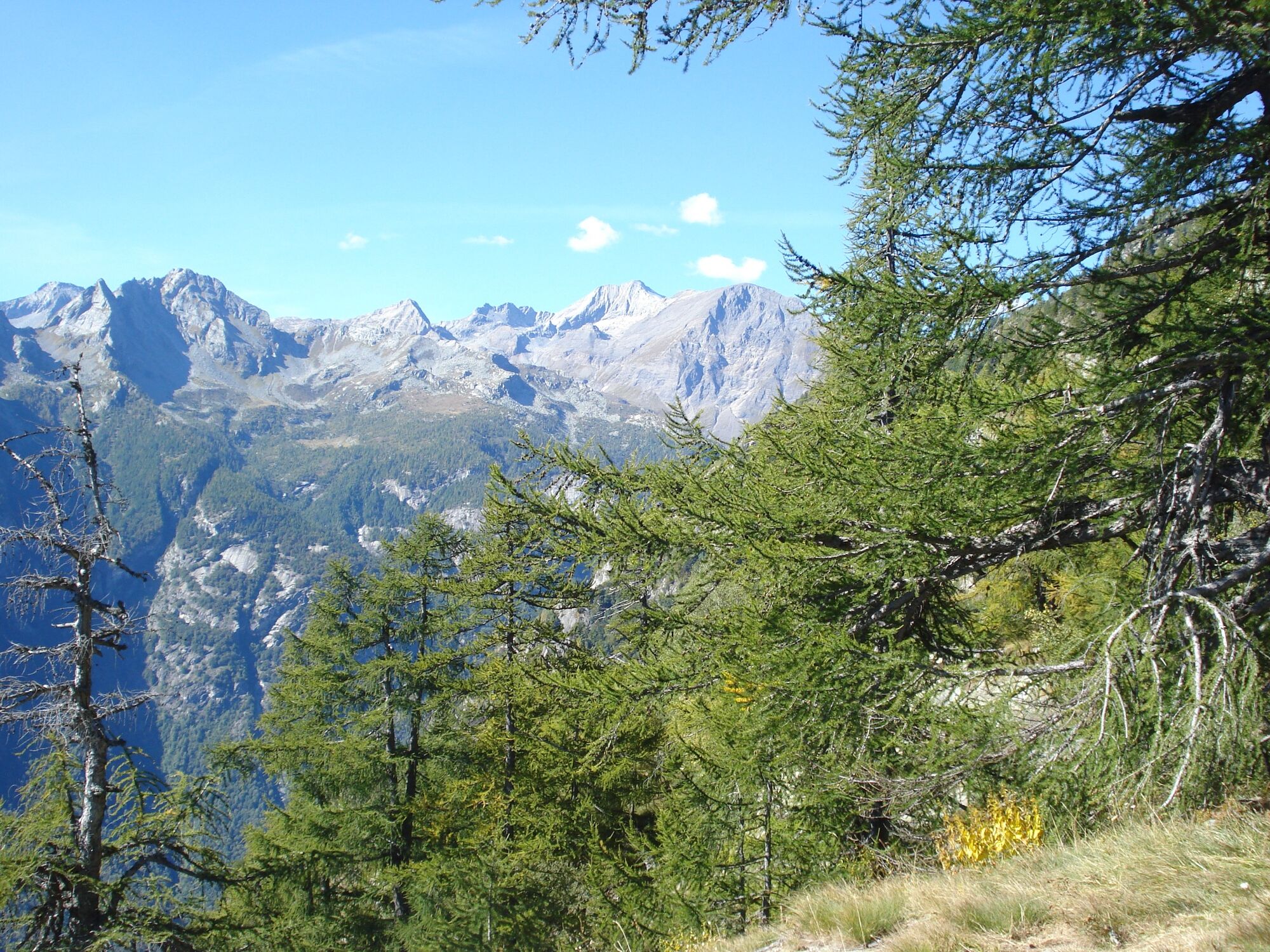
Starting in Prato-Sornico, not far from Peccia, home to the only marble to be quarried in Switzerland, this stage (the last section of the Via GeoAlpina in the Ticino Alps) leads up to Monti di Rima, a...
Starting in Prato-Sornico, not far from Peccia, home to the only marble to be quarried in Switzerland, this stage (the last section of the Via GeoAlpina in the Ticino Alps) leads up to Monti di Rima, a beautiful hamlet with typical stone houses. The route takes you through the Bosco di Müresc to Corte Grande on the Brünesc mountain, with stupendous views of the Lepontine Alps. Look out for the interesting geological features between Pizzo Massari to the north and Corona di Redorta to the south. The most important structure here is definitely the thrust fault between the Maggia and Simano folds, although this is not easily discerned as it forms a boundary between two rocks of a similar, relatively compact nature: Ruscada gneiss (light pink) below and Ganna gneiss (brown) above. Cattle are free to range here in the summer months. The landscape around Bocchetta di Fiorasca becomes typically alpine as the path heads towards to Val Bavona. It then drops down to the unmanned Rifugio Fiorasca hut. There follows a long, steep descent to Fontana. If you wish, you can spend the night in the hut and recharge your batteries before tackling the last section in the morning. The Antigorio Fold makes up most of the Bavona Valley, composed mainly of granite gneiss containing amphibolite fractions. The Val Bavona has several special features, including the Splüi: fallen rocks and boulders used as cellars, homes and shelters for humans and livestock. On reaching Fontana you can catch the PostBus to Cavergno.


Prato Sornico-Monti di Rima-Bocchetta di Fiorasca-Fontana-Cavergno
Áno
Áno
Trekking backpack (approx. 50 liters) with rain cover
Comfortable and sturdy footwear, second pair of shoes / sandals if necessary
Adequate and durable outdoor clothing in multiple layers
Change of clothes,
Telescope sticks
Sun and rain protection
Snacks and drinking water
First aid kit
Penknife
Mobile phone
Headlight
Maps
Travel documents
Toilet bag and travel towel, travel detergent and clothesline, camping equipment if necessary (tent, sleeping mat, sleeping bag, cooking equipment), hut equipment if necessary
T3
Obľúbené výlety v okolí
-
4,7
Fusio-Lake Mognola-Fusio
strednáTuristika 8,94 km -
Maggia-Someo-Maggia
svetloTuristika 15,5 km -
4,0
Foroglio-Calnègia-Foroglio
strednáTuristika 8,37 km -
Via Alta Vallemaggia
ťažkéTuristika 169,7 km -
Glaciological Path
strednáTuristika 8,18 km -
5,0
Bignasco-San Carlo
strednáTuristika 12,8 km -
Lago del Naret-Sasso Nero-Lago del Naret
strednáTuristika 8,55 km -
5,0
Bosco Gurin-Lago Melo-Lago Pero-Bosco Gurin
strednáTuristika 10,6 km -
Ossasca - Cristallinahütte
Turistika 6,80 km -
5,0
Sonogno-Corte-Sonogno
strednáTuristika 5,64 km
Turistika a stopovanie


Nenechajte si ujsť ponuky a inšpiráciu na ďalšiu dovolenku
Vaša e-mailová adresa bol pridaný do poštového zoznamu.