
Ski tour Schönberglspitze 2.640m
stredná
Získajte túto prehliadku v mobilnom telefóne
Ski tour Schönberglspitze 2.640m
stredná
Skitour
6,62
km
Naskenujte kód QR a spustite navigáciu v aplikácii bergfex


Turistika a stopovanie



Ski tour Schönberglspitze 2.640m
stredná
Vzdialenosť
6,62
km
Trvanie
05:00
h
Ascent
1 744
hm
Hladina mora
850 -
2 594
m

Naviguj sa počas prehliadky v aplikácii
Nainštalujte si aplikáciu zadarmo a sledujte trasu vďaka GPS navigácii a sledovaniu polohy.
Využite službu „ bergfex “ už teraz v aplikácii
Naskenuj QR kód pomocou fotoaparátu
Ak máte aplikáciu nainštalovanú, obsah sa otvorí priamo. Ak aplikáciu ešte nemáte, budete presmerovaní na stránku, kde si ju môžete bezplatne stiahnuť.
Stiahnutie skladby
Ski tour Schönberglspitze 2.640m
stredná
Skitour
6,62
km
The Schönberglspitze is in the eastern foothills of the Deferegger mountains, in the ridge which proceeds to the north west of Lienz’s local mountain, the Hochstein. It is accessible from the lovely town...
Opis
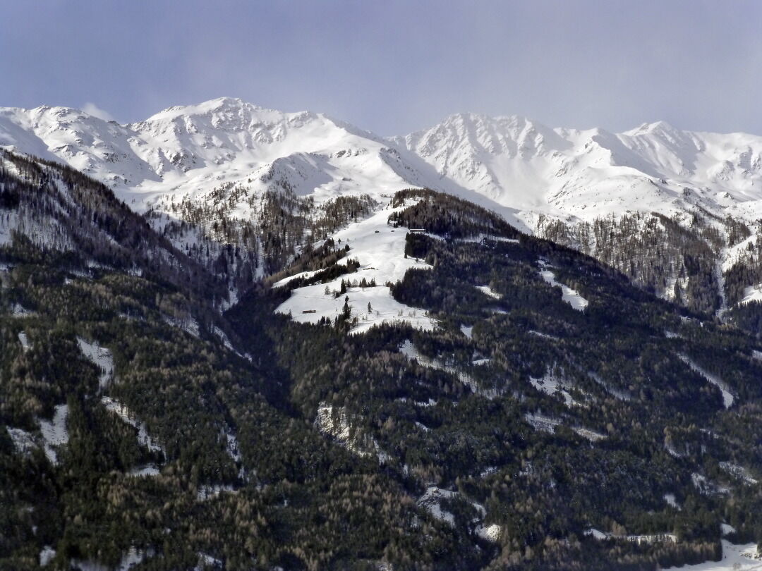
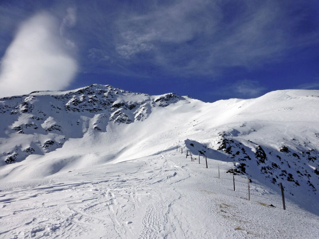
The Schönberglspitze is in the eastern foothills of the Deferegger mountains, in the ridge which proceeds to the north west of Lienz’s local mountain, the Hochstein. It is accessible from the lovely town of Schlaiten, which is set on a sloped terrace, via the traditional alpine pastures and provides a wonderful view to Iseltal and the greater Lienz area. Connoisseurs will enjoy the ascent to the sun-drenched Krass- and Petoggalm inns which are a worthwhile tour destination alone. Starting point is Mesnerdörfl Schlaiten, around 10 km to the north west of Lienz. We use the road which proceeds uphill through the town, before signposts before the bridge at Schlaitnerbach twice proceed left, heading steep up to Glanz. Via the narrow mountain road we head out of the valley and after around 1 km at the start of the tour we come a junction (995m, not much parking available). The road here descends slightly to Glanz – Oberlienz, whereas we keep to the yellow signposts heading for Krass Alm. Initially we have to carry our skis briefly along the road before we head, in the first right bend, below a building, into the impenetrable protected woodland and thereby shorten the first loop. From the building we can also climb via the additional forest trail which is used as a toboggan run in the winter, heading for Krass Alm (route signposts); this route is recommended when there is not much snow. After the first short cut we take the goods road, continuing to a nice forest cross in a right-hand bend. We can again shorten the route several times by heading through the protected forest or head in more leisurely fashion via the forest trail (route signposts), which is recommended for those who do not know the area. Anyone who has endeavoured to ultimately tackle the 500 metre altitude forest belt, will enter lovely glades at a wooden shelter (1450 m) and will keep heading uphill via open terrain. Those who head through the forest will come across a pass to somewhat higher in the Alpine terrain. The destination is the striking large agricultural building of the Petoggalm (1815m). The route now continues through charming troughs, heading south west and heads above the forest limits into a small kettle. We leave this in an impressive left-hand crossing area (east) beneath steep slopes (north-east, 30°) and enter the accompanying ridge at the flattest section available. Please note that there is a risk of avalanche! When conditions are not safe the forest limits area may also be traversed from the rear. Always keeping to this route after a few hairpin bends we get to the summit ridge between the Schönberglspitze and Lavant-eck at around 2540 m, where we, via the boulder-strewn north-west ridge we climb to the highest point mostly not on skis. Descent along the ascent track.
Additional ski tour tips can be obtained in the ski tour guides by Thomas Mariacher. These are available here: http://www.grafikzloebl.at/verlag/buecher/
Additional ski tour tips can be obtained in the ski tour guides by Thomas Mariacher. These are available here: http://www.grafikzloebl.at/verlag/buecher/
Trasa
Trasa
Ski tour Schönberglspitze 2.640m
stredná
Skitour
6,62
km


Zariadenie
Basic equipment for ski tours includes touring skis with skins, touring poles, suitable touring ski boots and functional clothing based on the layering principle including sufficient spare clothes. Keep your backpack weight as low as possible. Essential in open terrain is complete avalanche emergency equipment (transceiver, shovel, probe) as well as a first aid kit, a bivy sack and a charged mobile phone. Sufficient fluids and food should also be carried. An avalanche airbag backpack can further increase the chances of survival in an emergency.
This information serves as a guide and does not claim to be exhaustive. Equipment must always be adapted to the tour destination, weather conditions, season, natural hazards, environmental influences and personal needs.
This information serves as a guide and does not claim to be exhaustive. Equipment must always be adapted to the tour destination, weather conditions, season, natural hazards, environmental influences and personal needs.
Informácie o príchode
Príchod
Coming from Lienz, drive towards Felbertauern, turn left towards Schlaiten/Glanz
Parkovanie
Coming from Lienz, drive towards Felbertauern, turn left towards Schlaiten/Glanz
Oceňovanie

Obľúbené výlety v okolí
-
4,9
Wangennitzsee Hütte
strednáTuristika 3,80 km -
4,7
Karlsbader Hütte über Rudl-Eller-Weg
ťažkéTuristika 5,10 km -
4,8
Summit hike Rotenkogel 2,762m
ťažkéTuristika 4,22 km -
4,7
Glödis 3206m: PP Seichenbrunn, Lienzer Hütte, Glödis KS A/B
ťažkéVysoké turné 16,1 km -
4,8
Lienzer Hütte
svetloTuristika 7,39 km -
4,8
Klammbrückl - Kerschbaumeralm - Spitzkofel
ťažkéTuristika 8,71 km -
4,5
Circular Europe Panorama Trail
strednáTuristika 7,01 km -
4,2
Gradental to Adolf Nossberger Hut - circular route
strednáTuristika 11,1 km -
4,0
Karlsbader Hütte - Lienzer Dolomiten
Turistika 8 km -
4,2
Straßkopf
strednáTuristika 4,06 km
Turistika a stopovanie

Viac ako 550.000 návrhov výletov, podrobné mapy a intuitívny plánovač trás robia z aplikácie povinnú výbavu pre všetkých nadšencov prírody.

Nenechajte si ujsť ponuky a inšpiráciu na ďalšiu dovolenku
Prihlásiť sa k odberu noviniek
Chyba
Vyskytla sa chyba. Prosím, skúste to znova.
Ďakujeme za vašu registráciu
Vaša e-mailová adresa bol pridaný do poštového zoznamu.
Zájazdy po celej Európe
Rakúsko
Švajčiarsko
Nemecko
Taliansko
Slovinsko
Francúzsko
Holandsko
Belgicko
Poľsko
Lichtenštajnsko
Česko
Slovensko
španielsko
Hrvaška
Bosna a Hercegovina
Luxembursko
Andorra
Portugalsko
Island
Spojené kráľovstvo
Írsko
Grécko
Albánsko
Severné Macedónsko
Malta
Nórsko
Čierna Hora
Moldavsko
Kosovo
Maďarsko
San Maríno
Rumunsko
Estónsko
Lotyšsko
Bielorusko
Cyprus
Litva
Srbsko
Bulharsko
Monako
Dánsko
Švédsko
Fínsko


