


Hike Stuibenfall - Umhausen
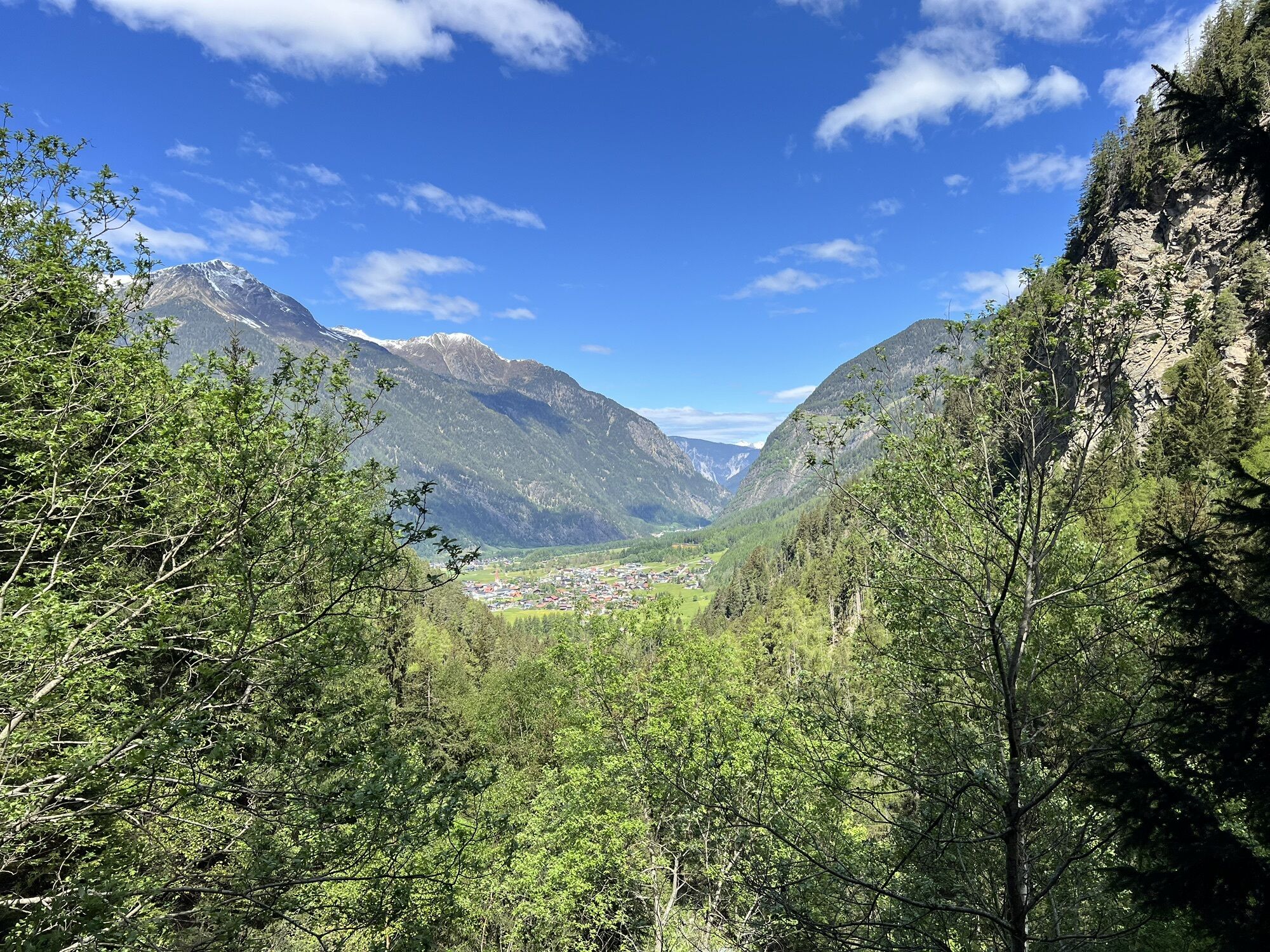
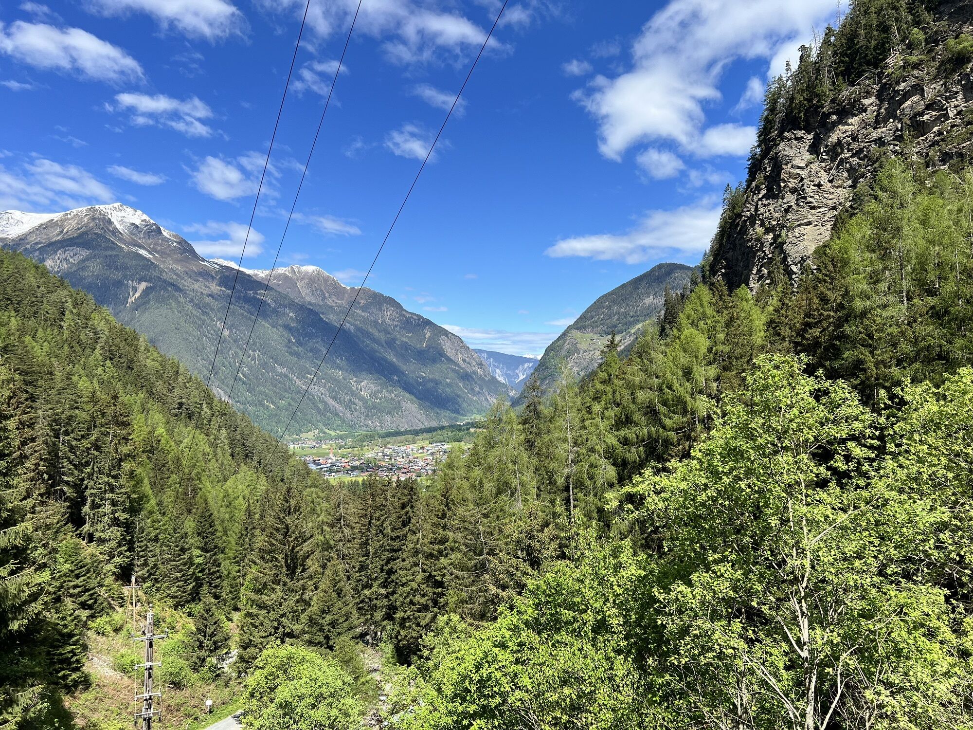
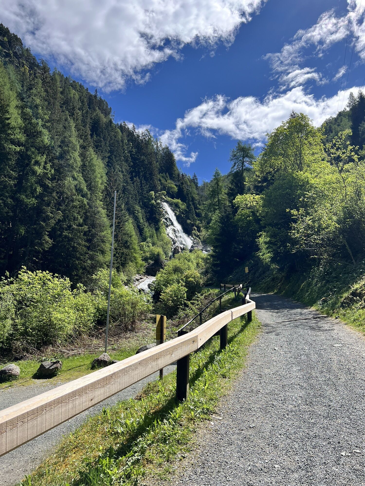
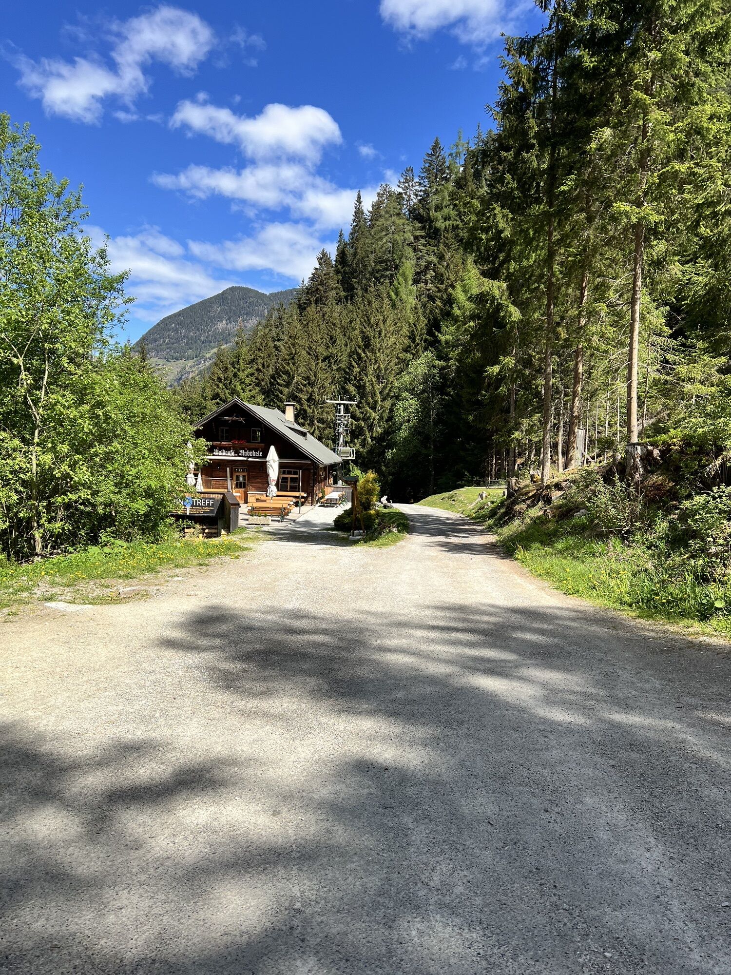
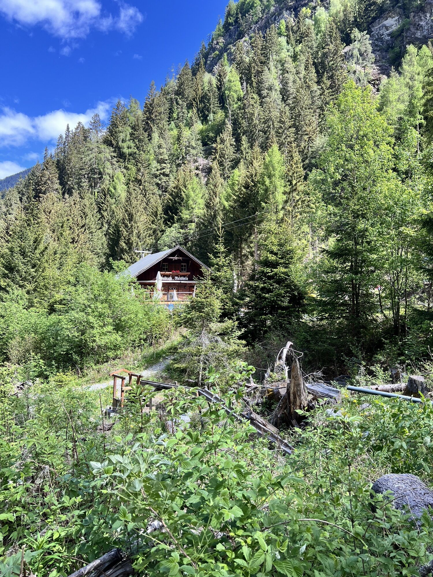
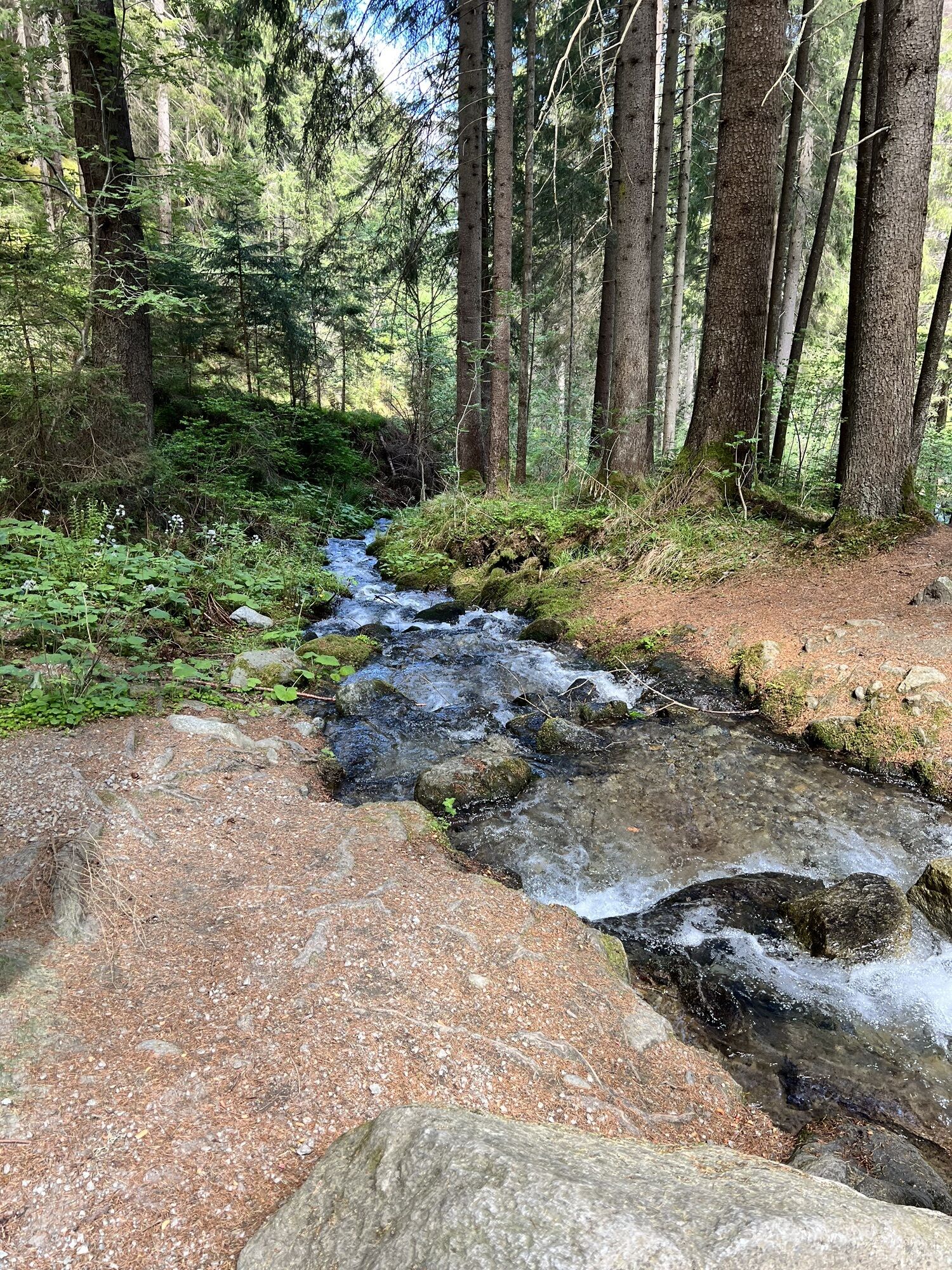
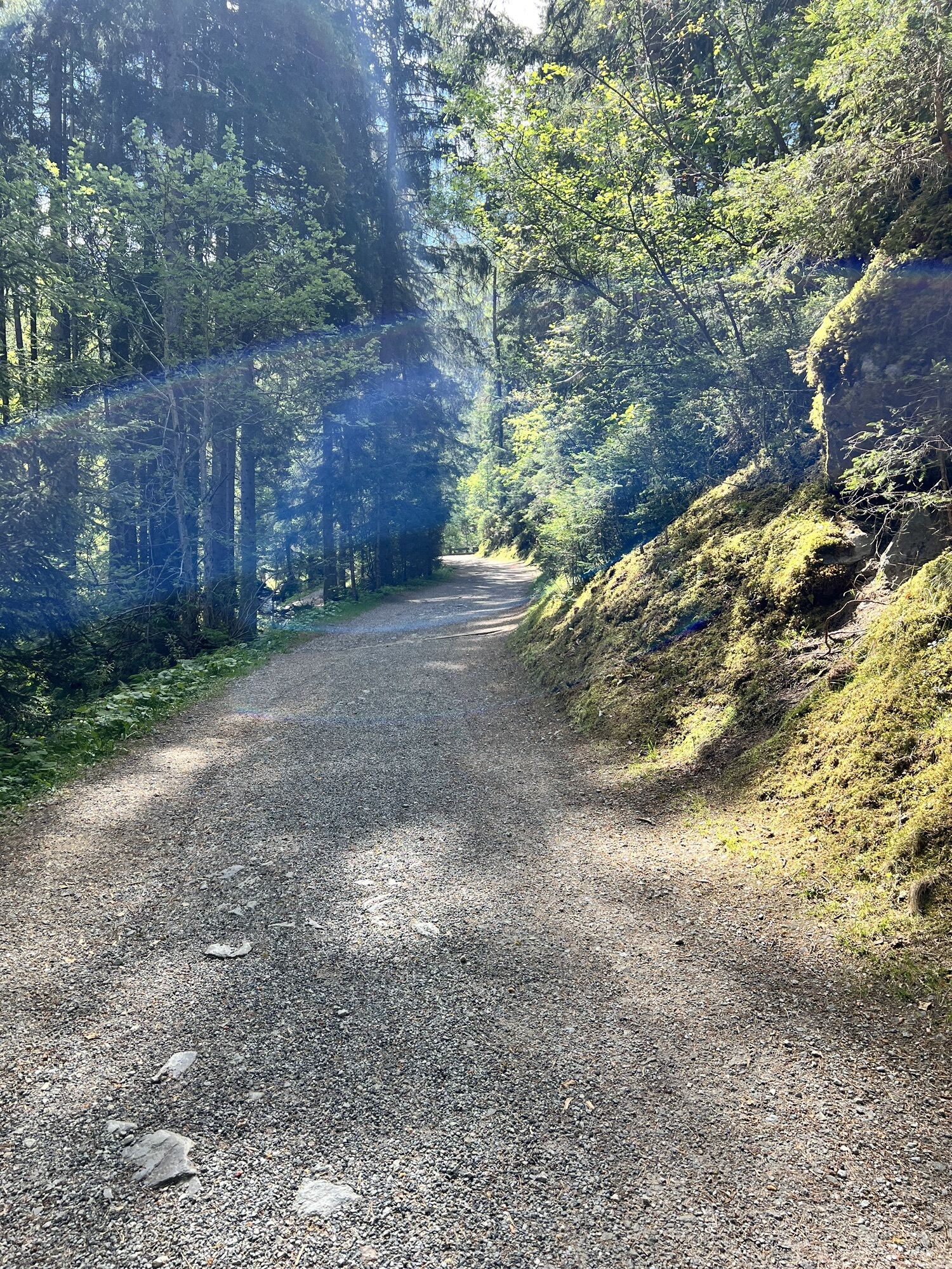
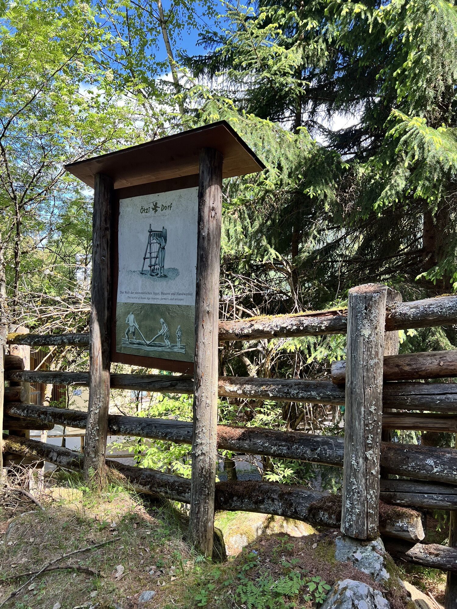
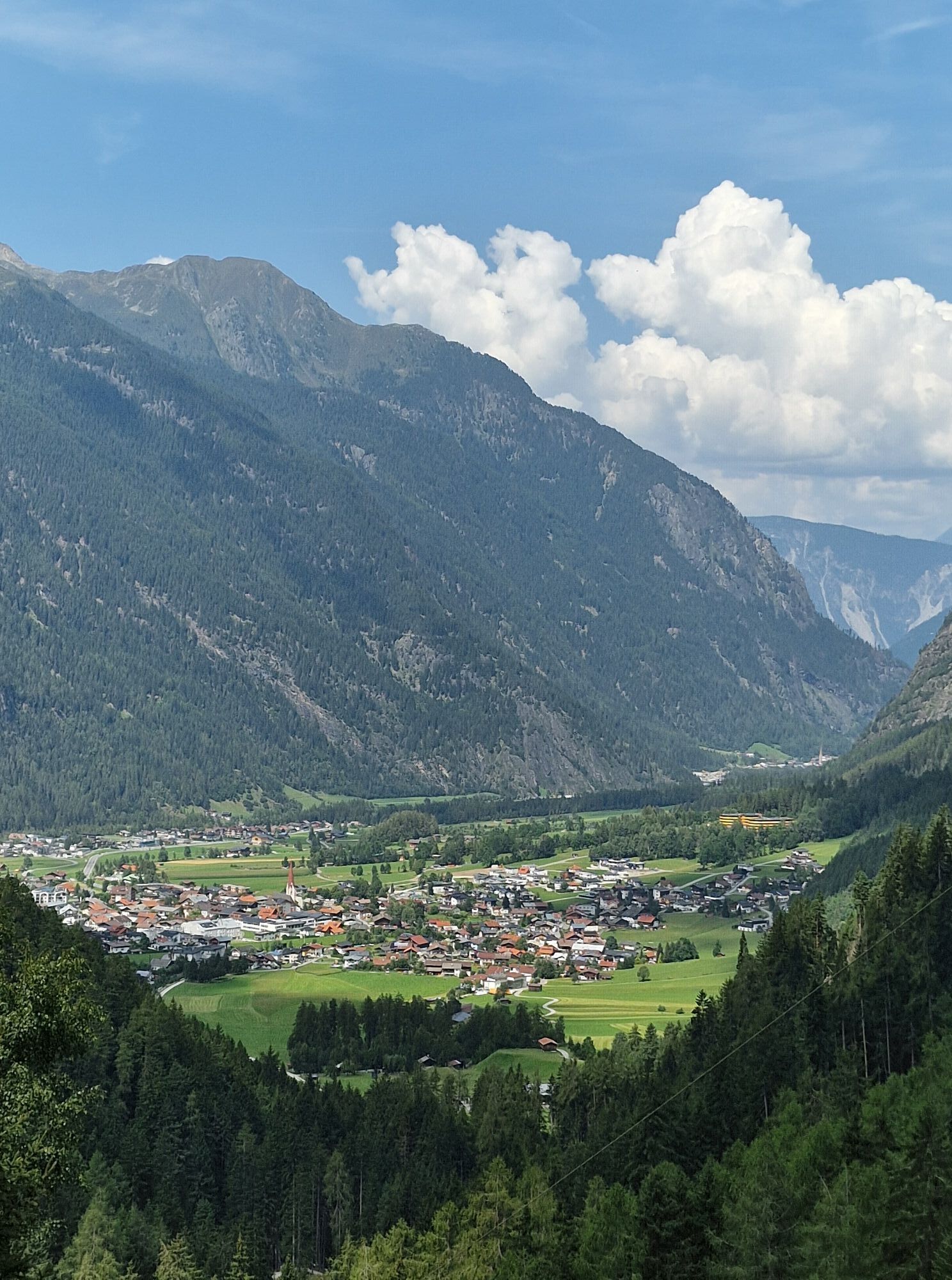
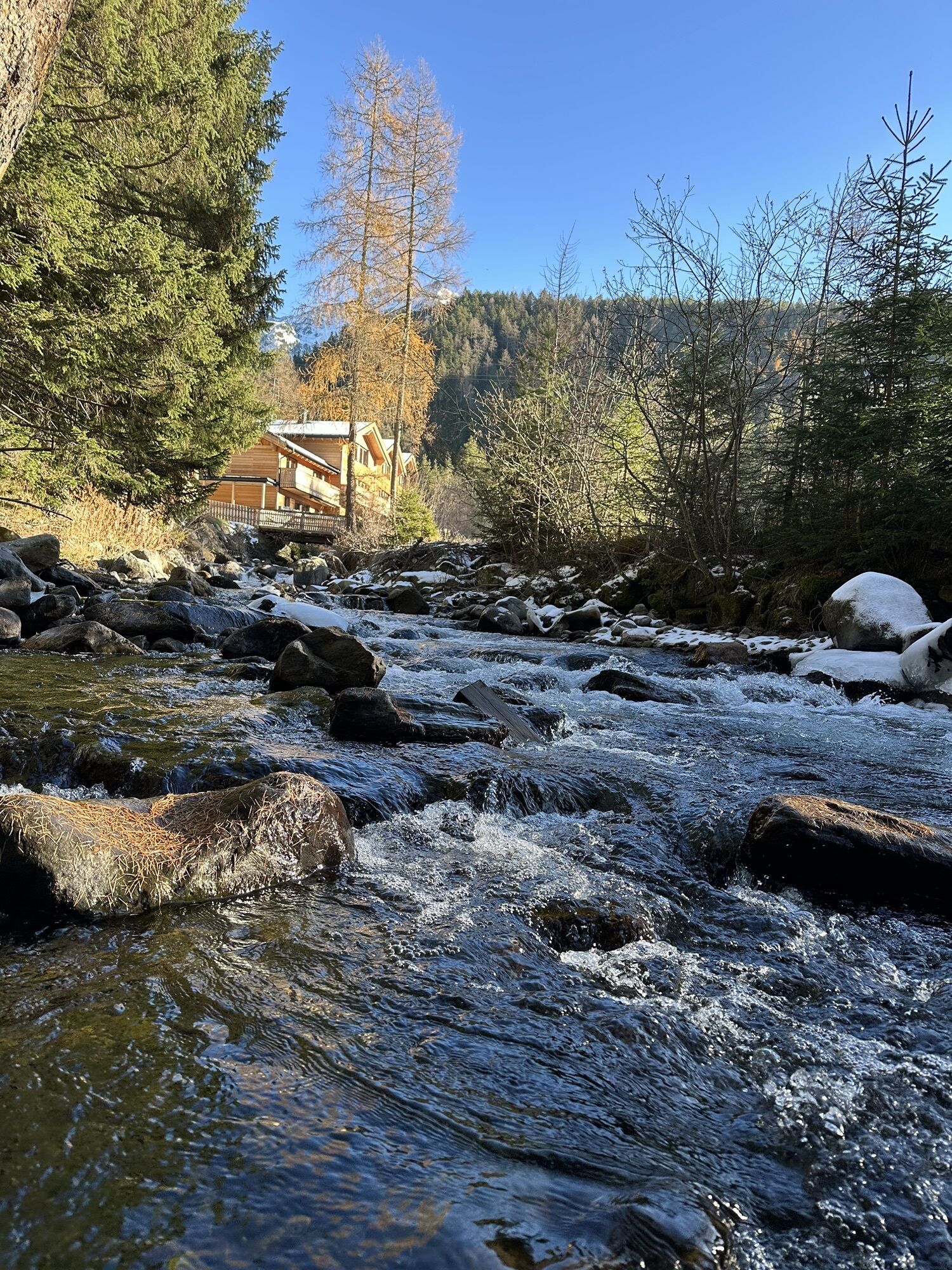
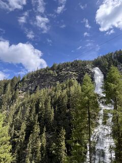
From the Bischoffsplatz parking lot in Umhausen, the wide hiking path leads past the Ötzi Village, raptor park and Stuböbele forest café to the foot of the Stuibenfall. The hike from the parking lot to...
Have you already tried our new discovery trail?
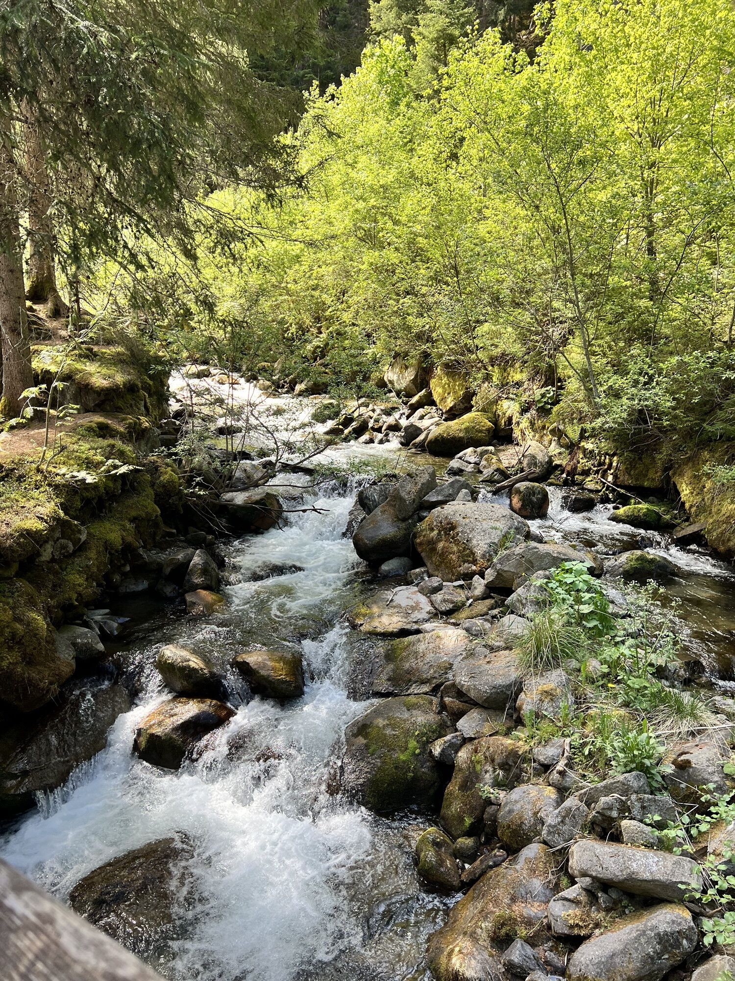
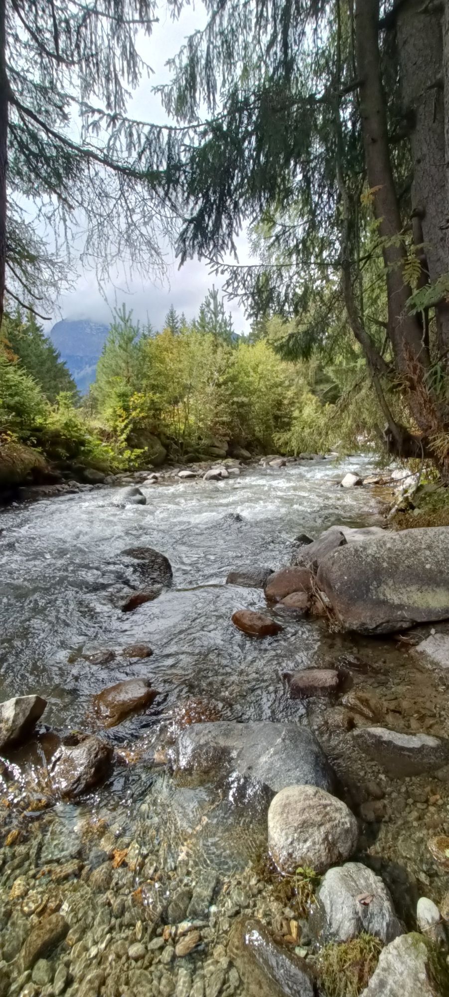
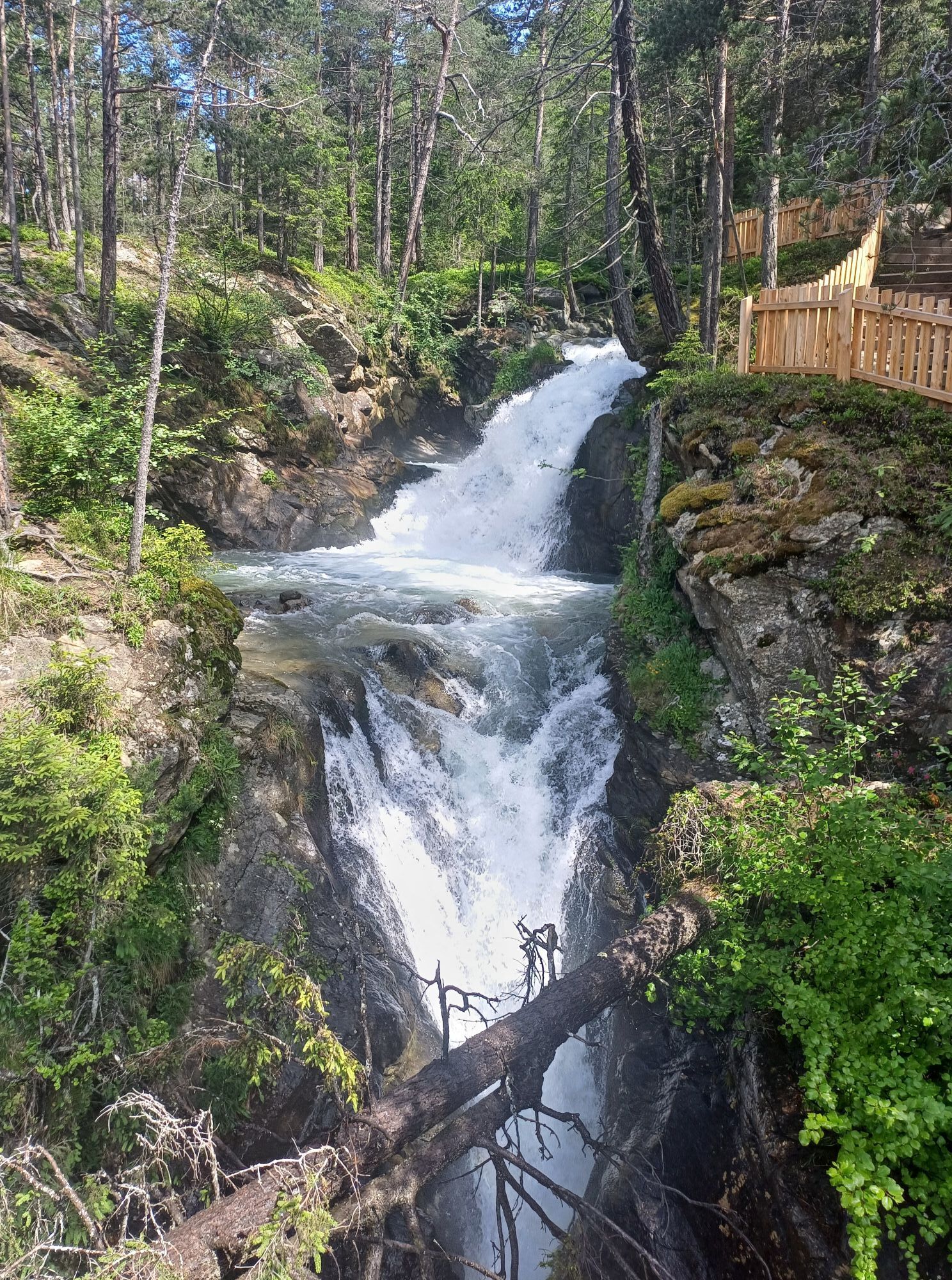
Debris flows, flood disasters, and water for agriculture. The Horlachbach moves not only water masses but also the history of the valley.
More information can be found here.

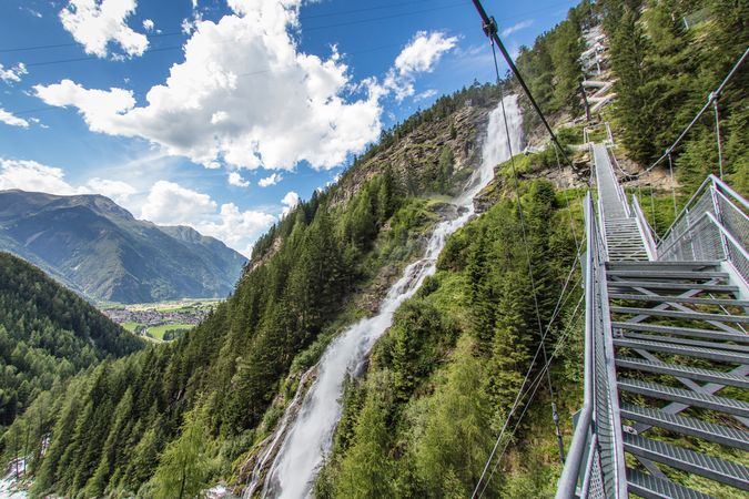
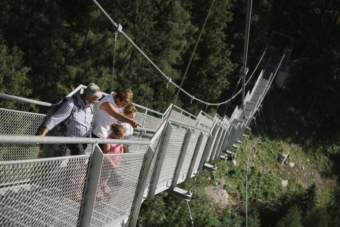
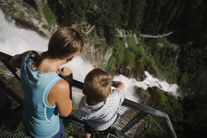
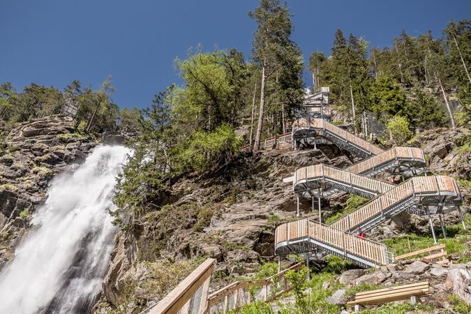
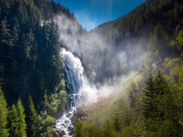
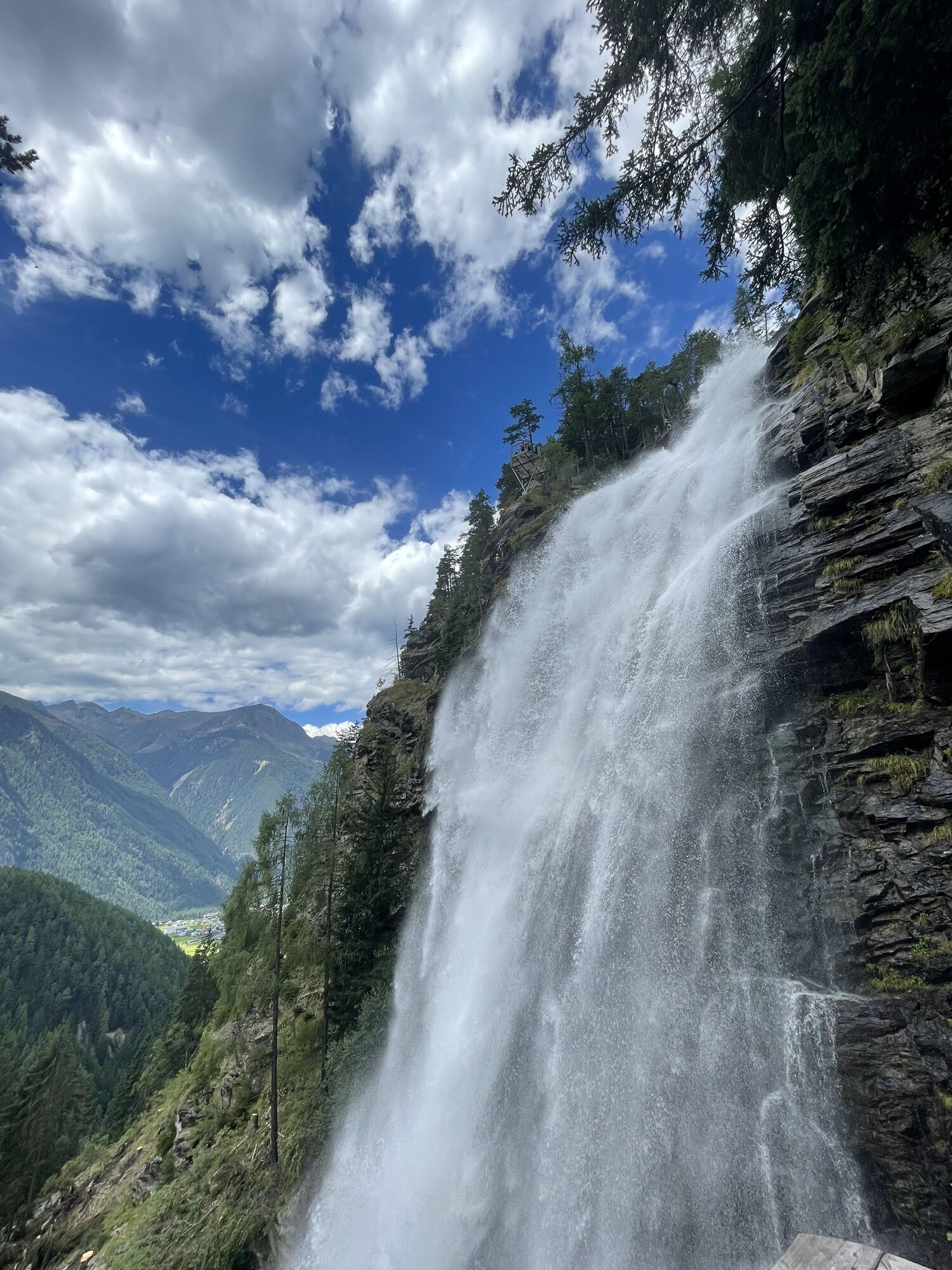
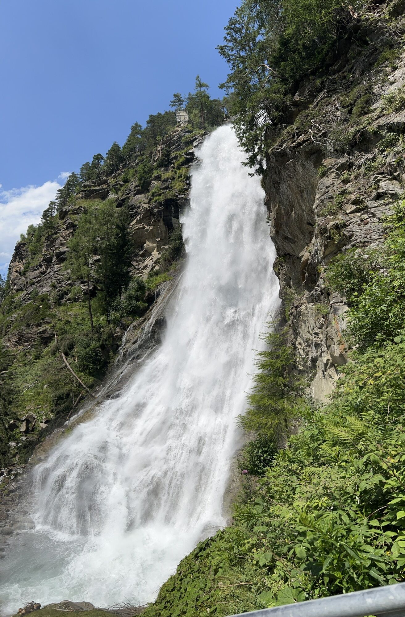
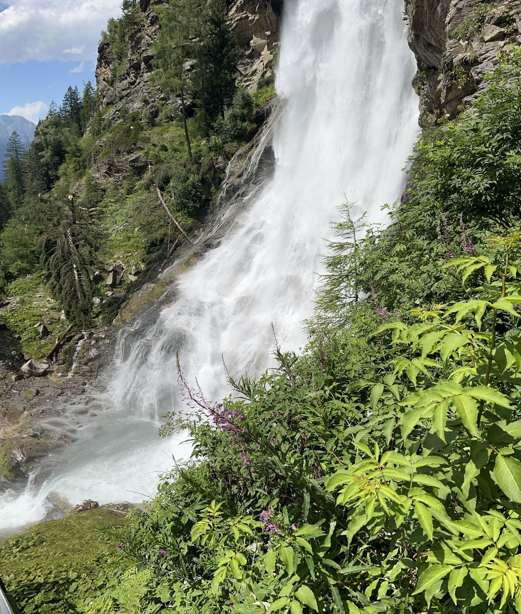
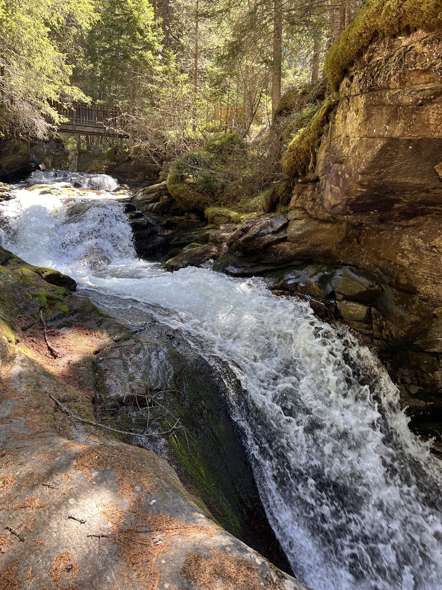
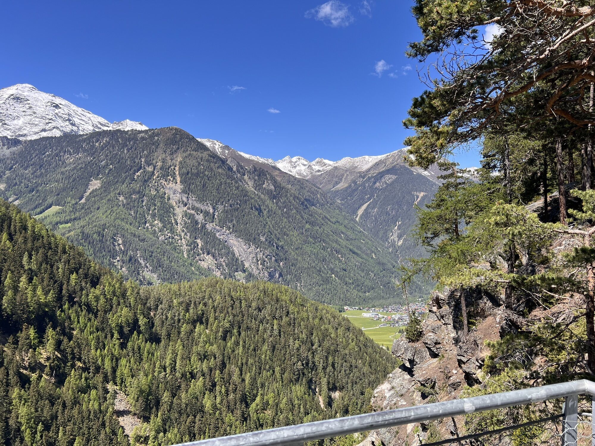
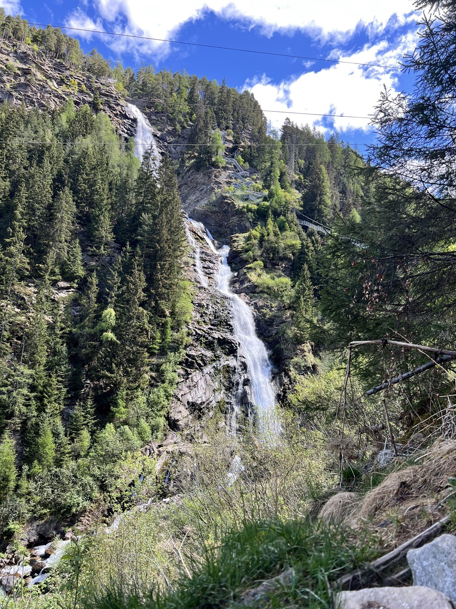
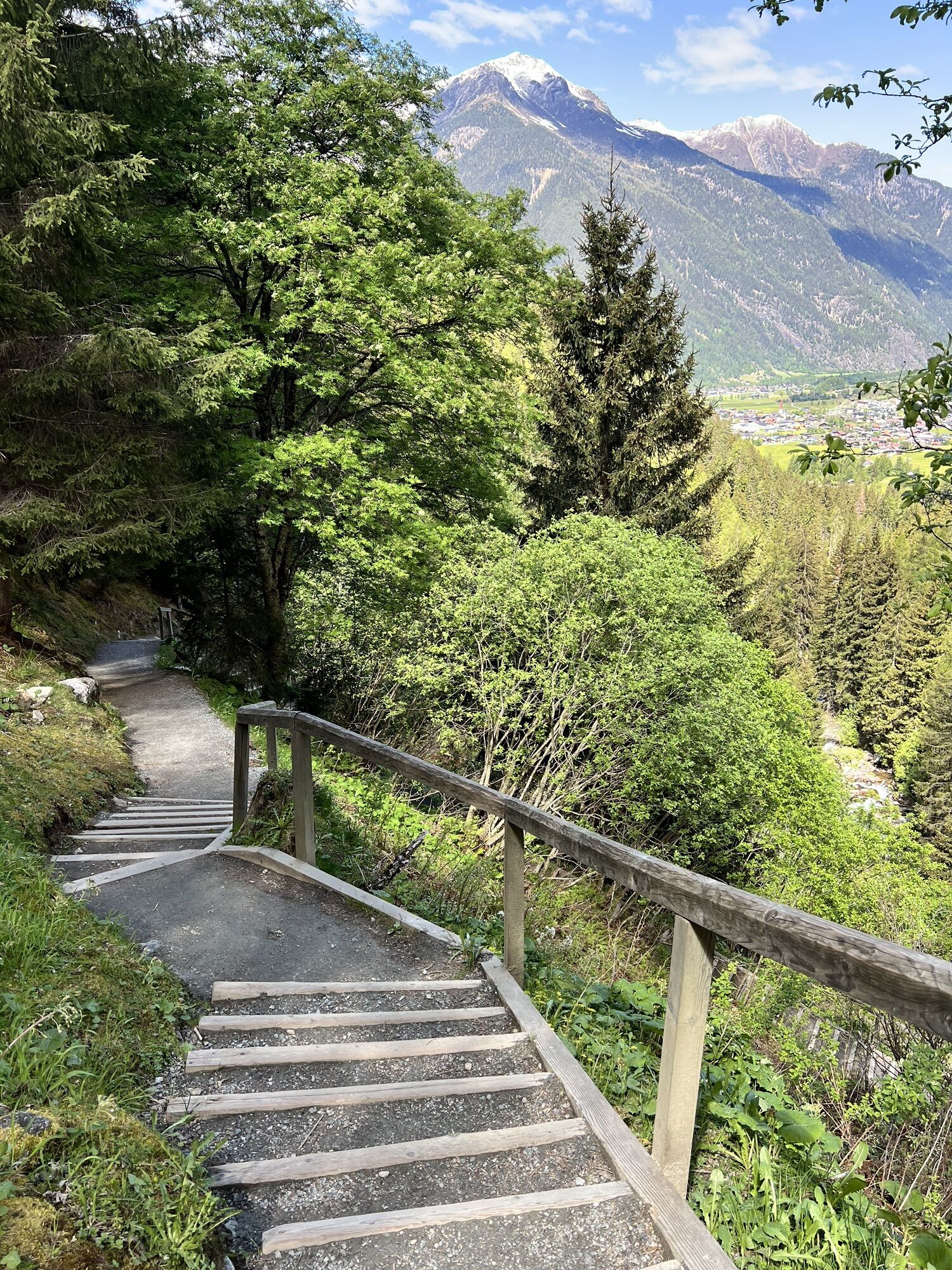
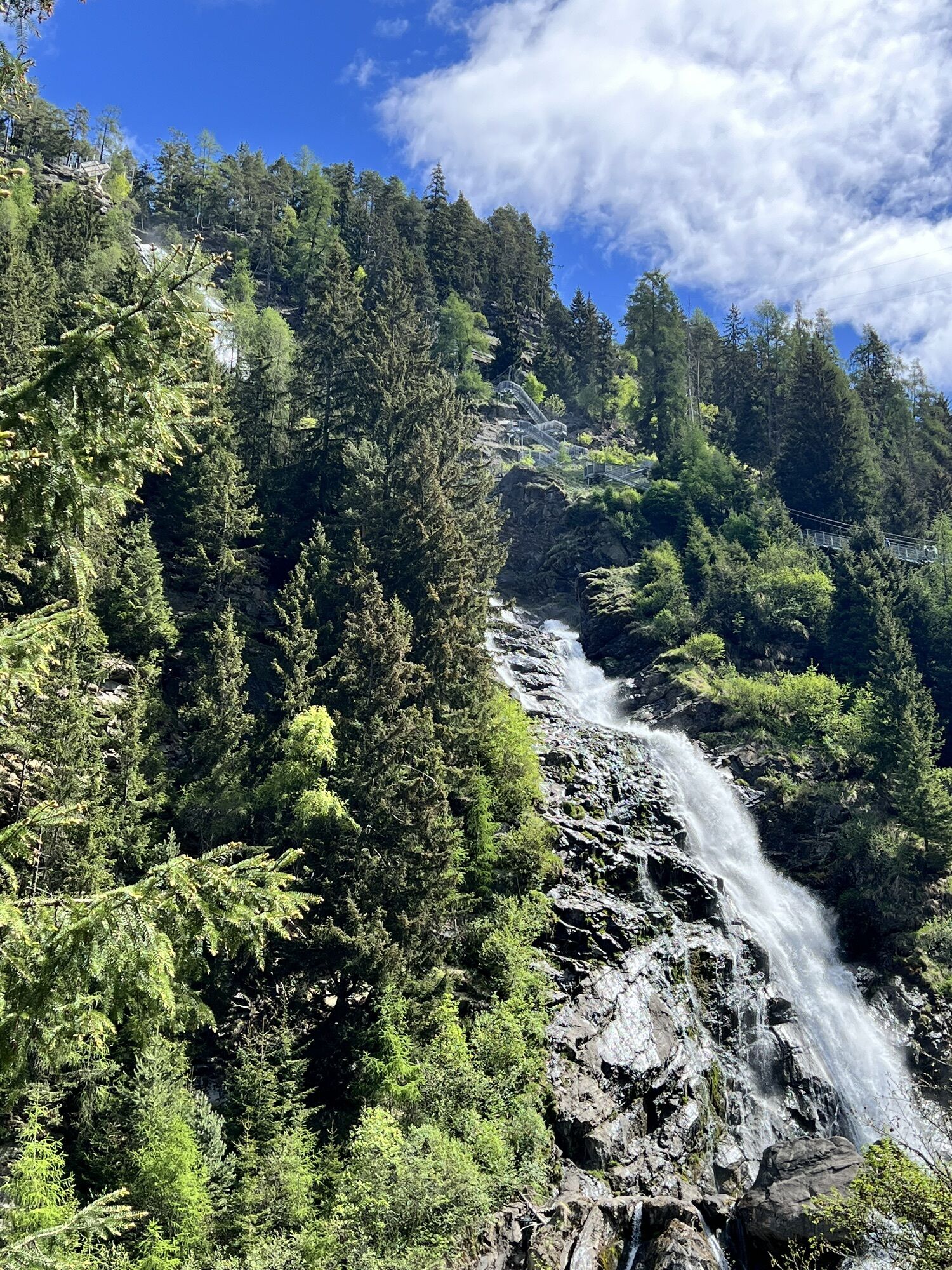
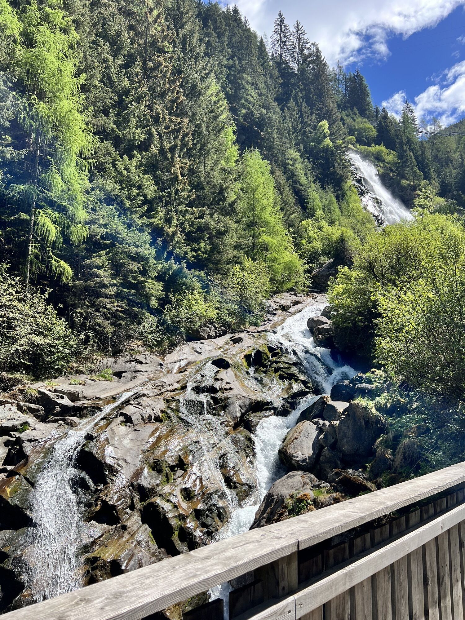
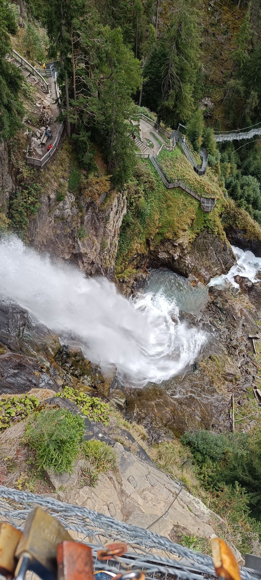
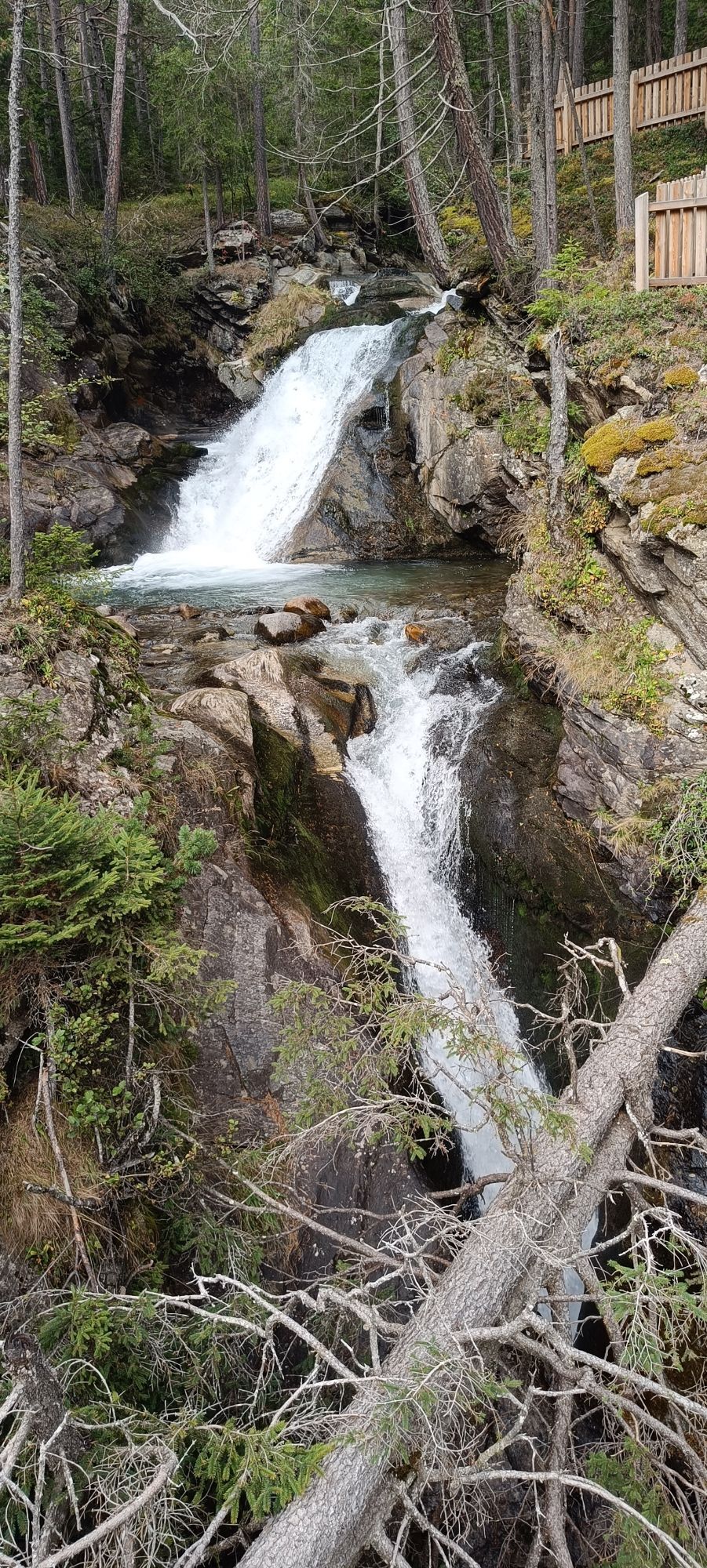
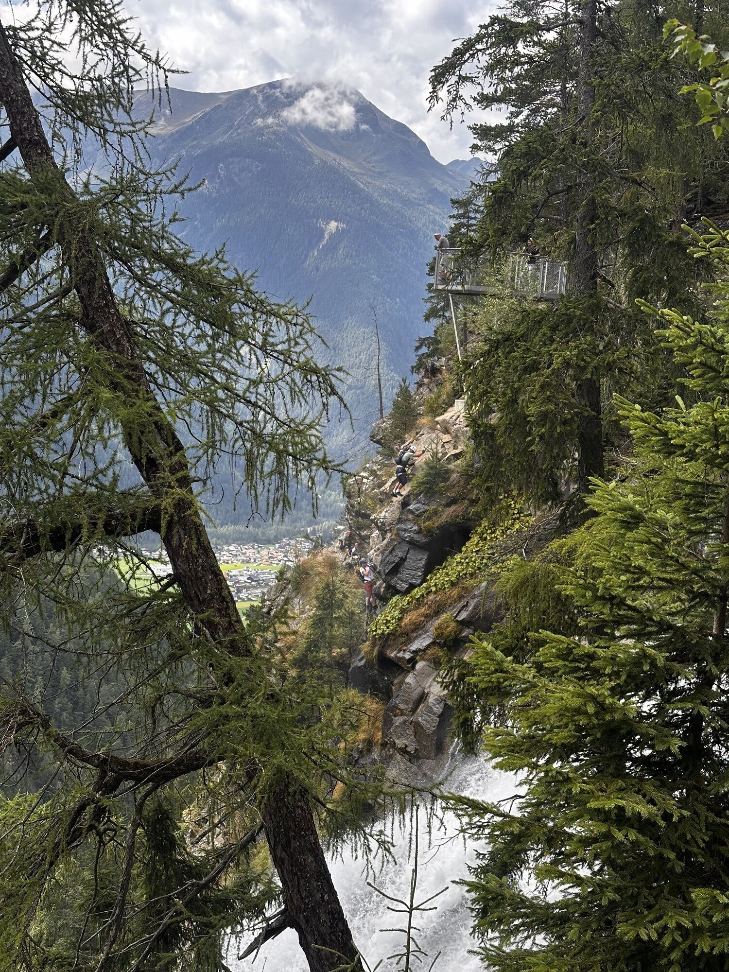
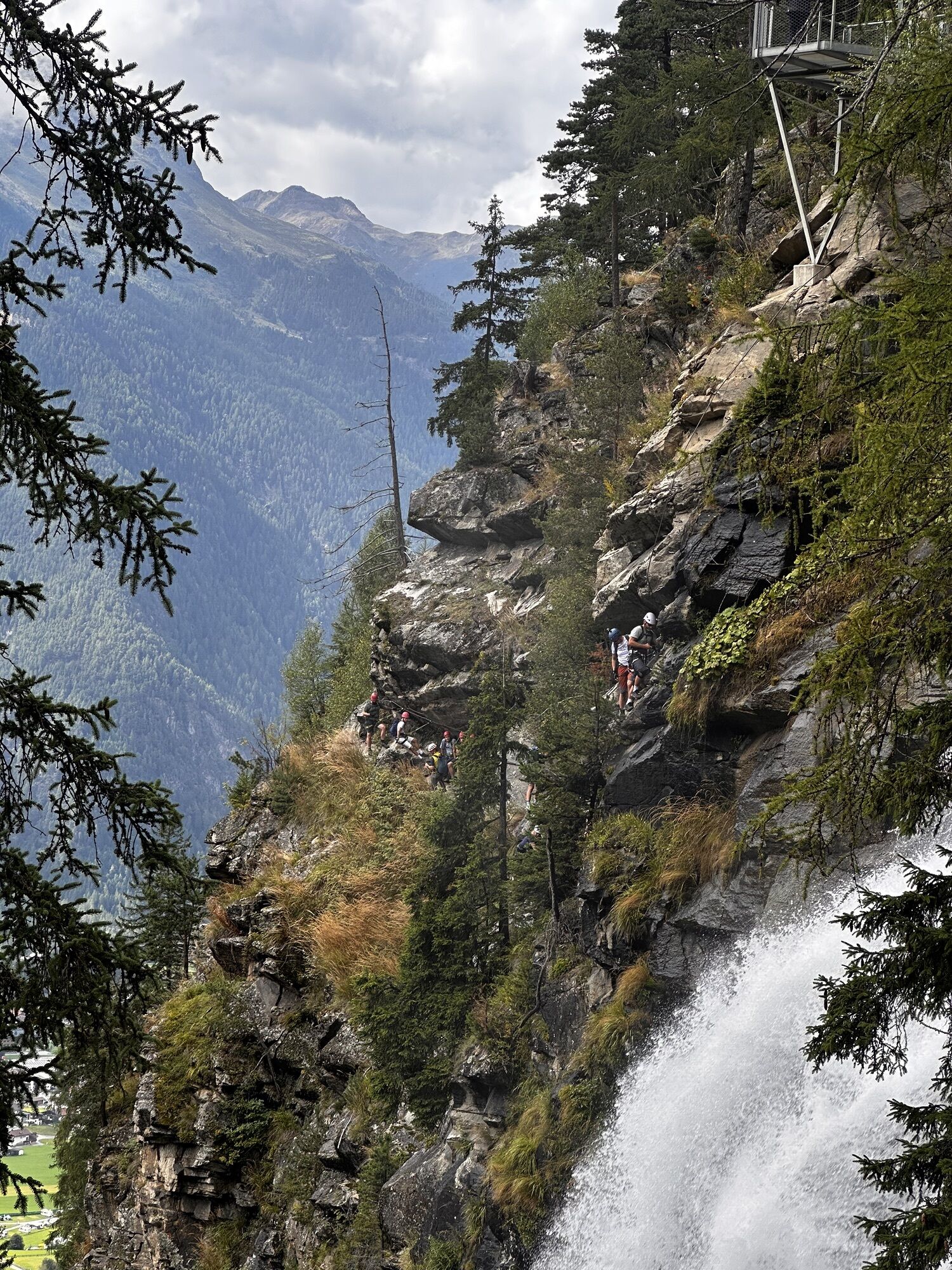
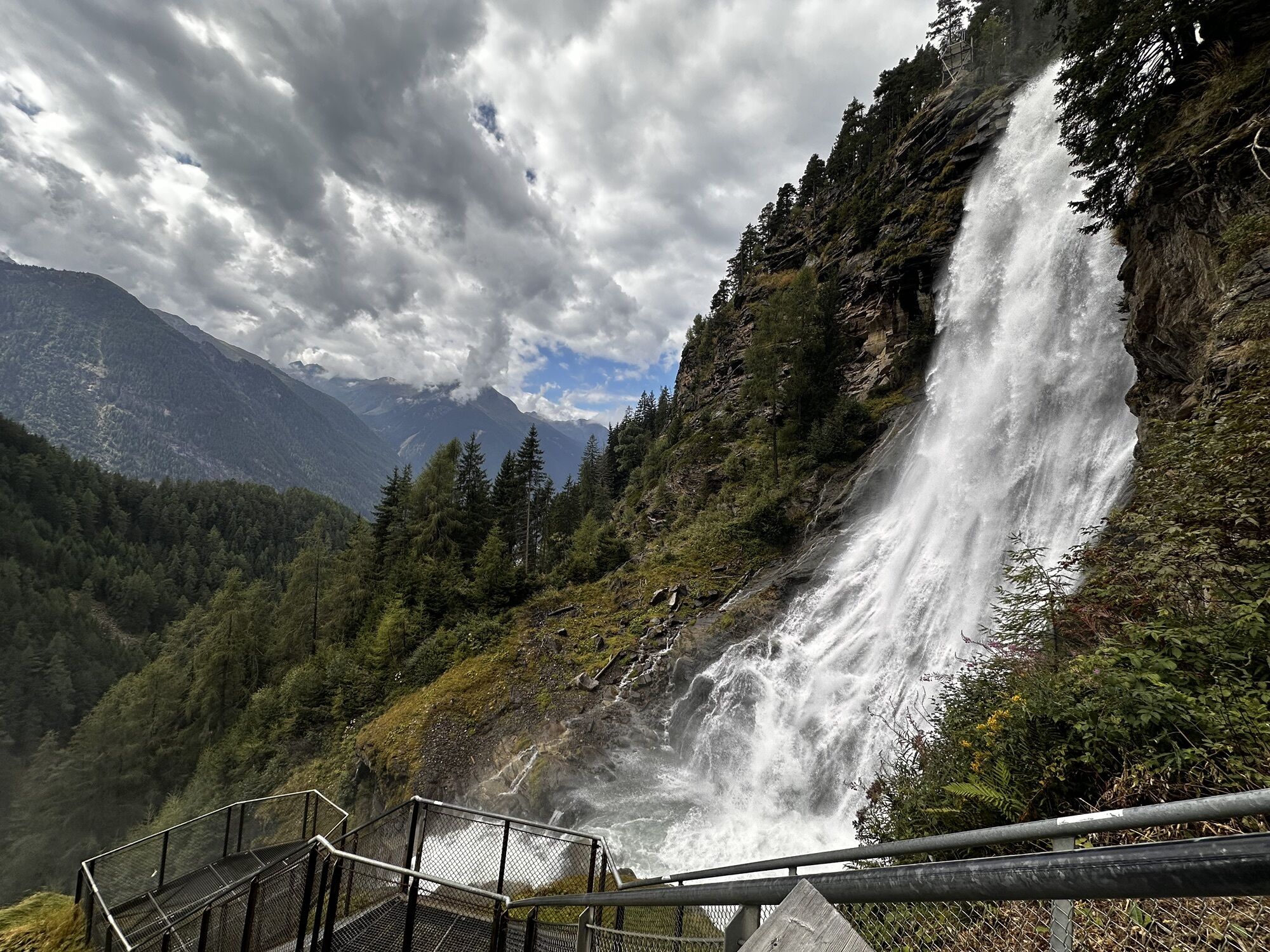
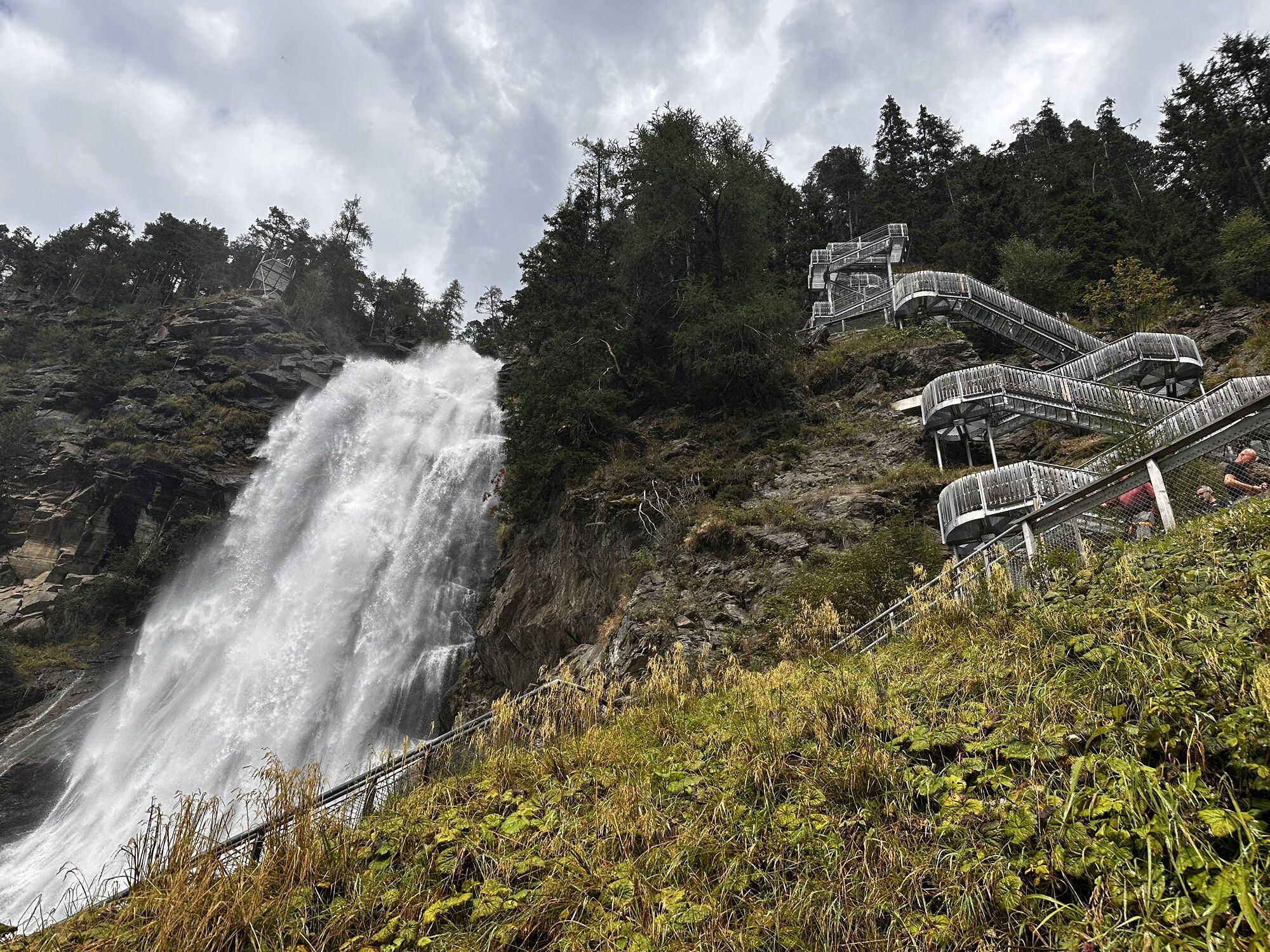
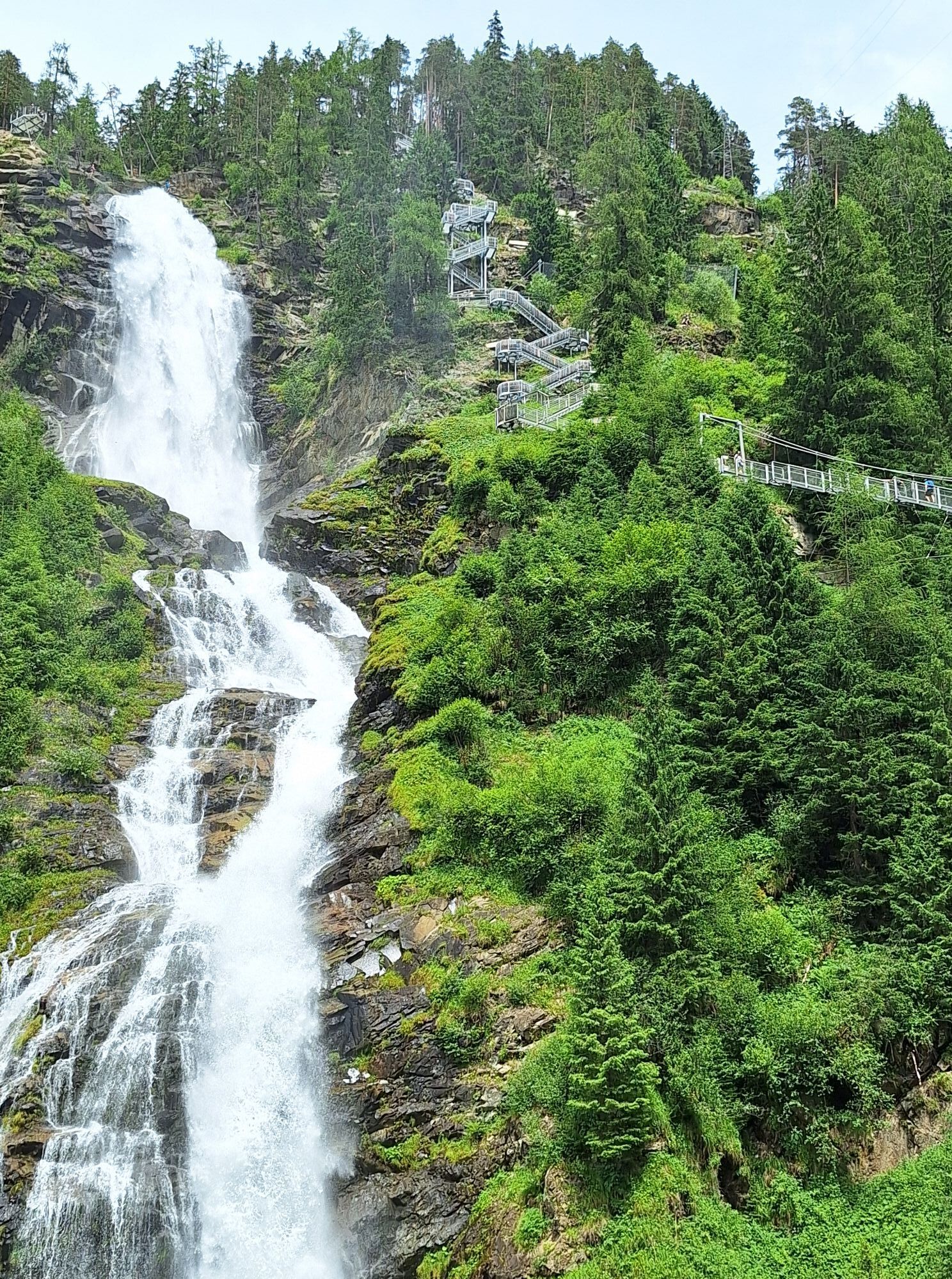
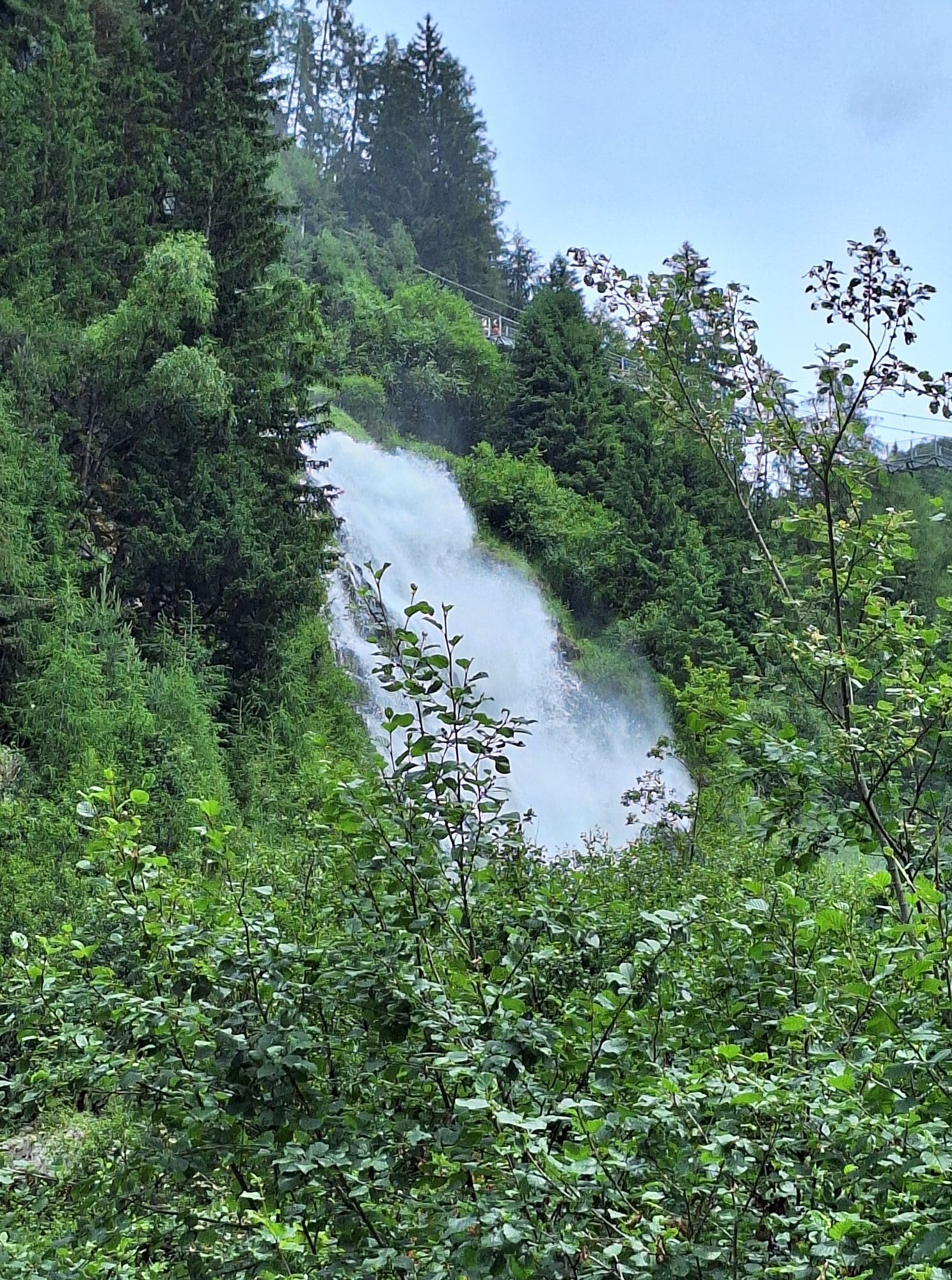
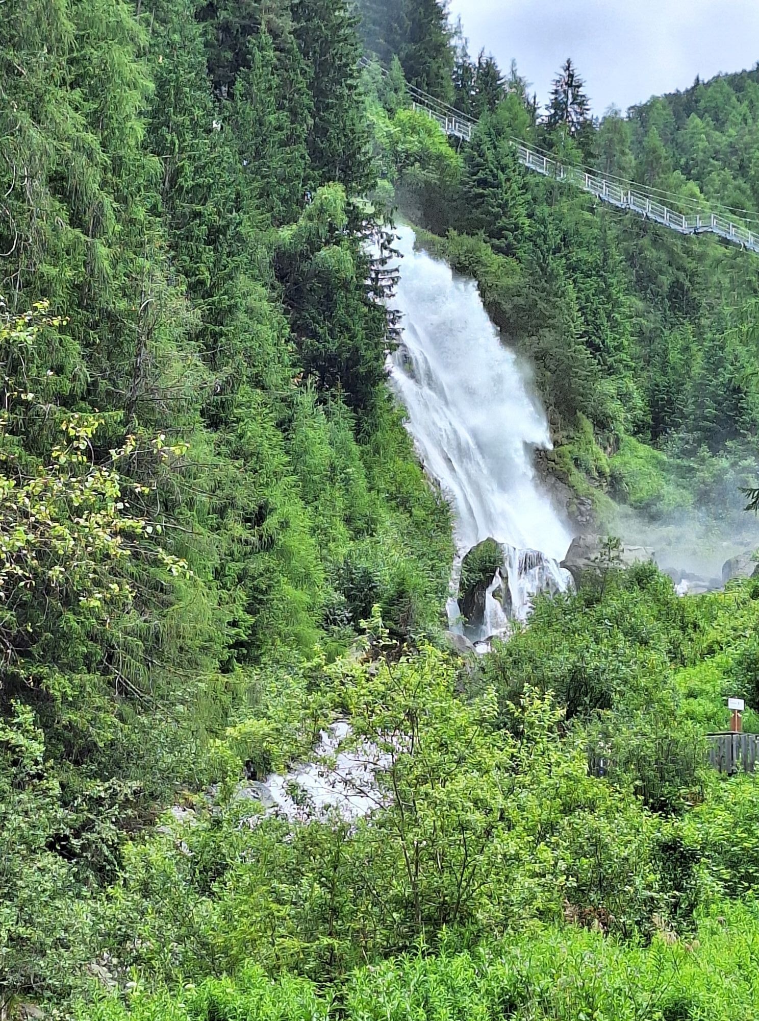
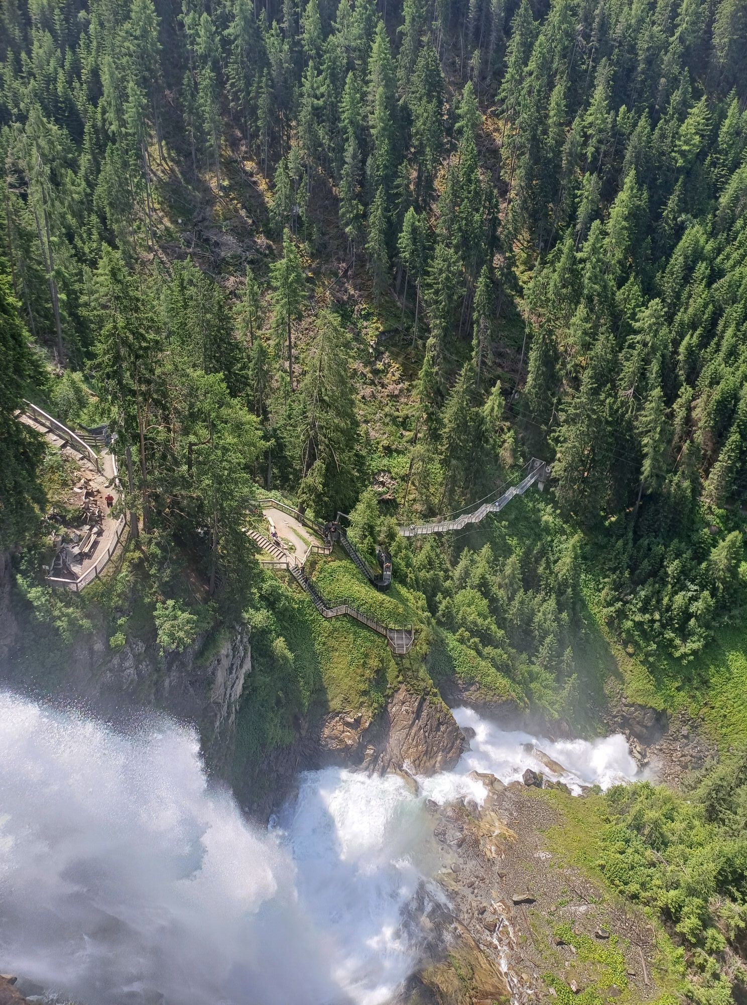
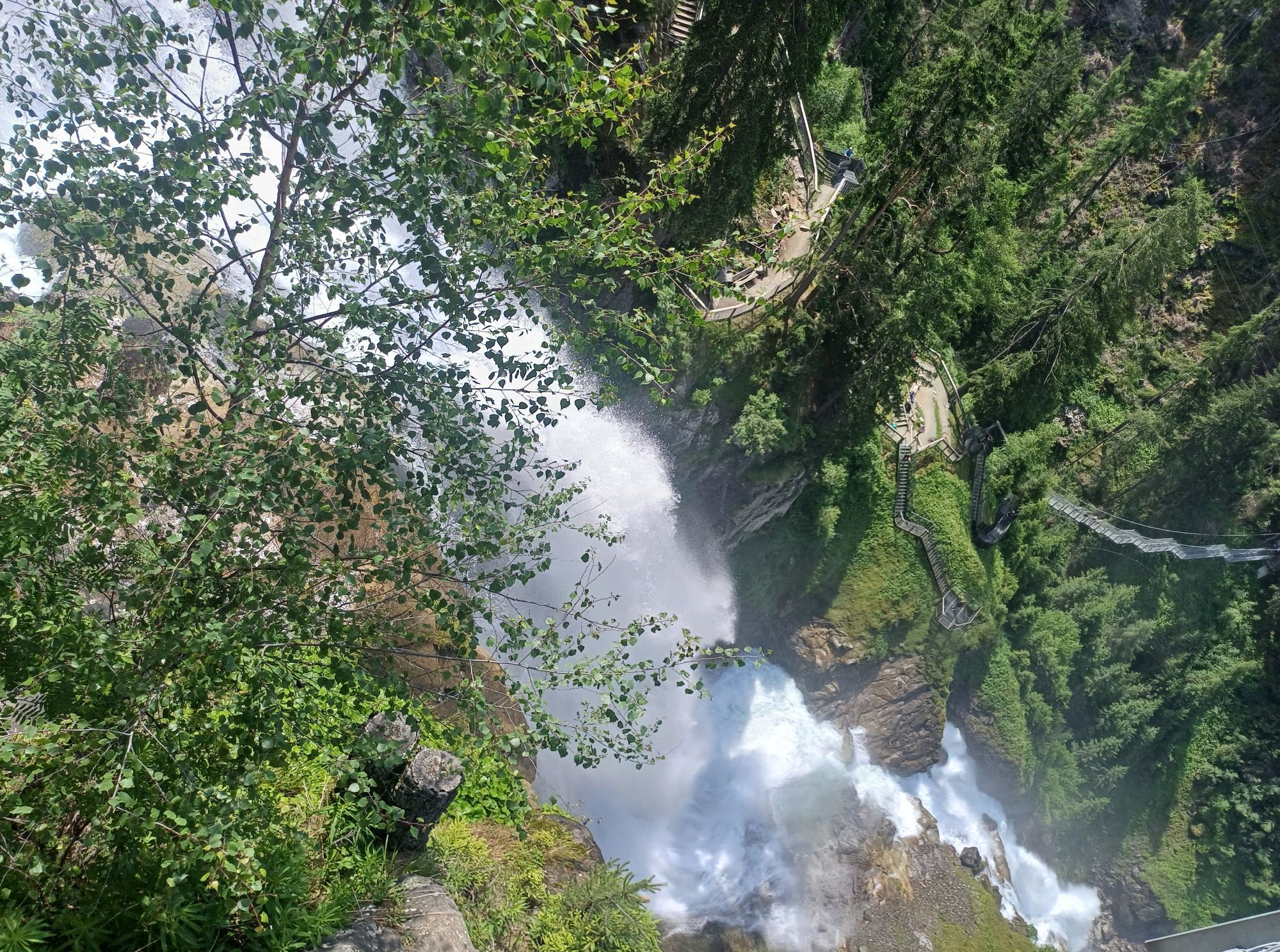
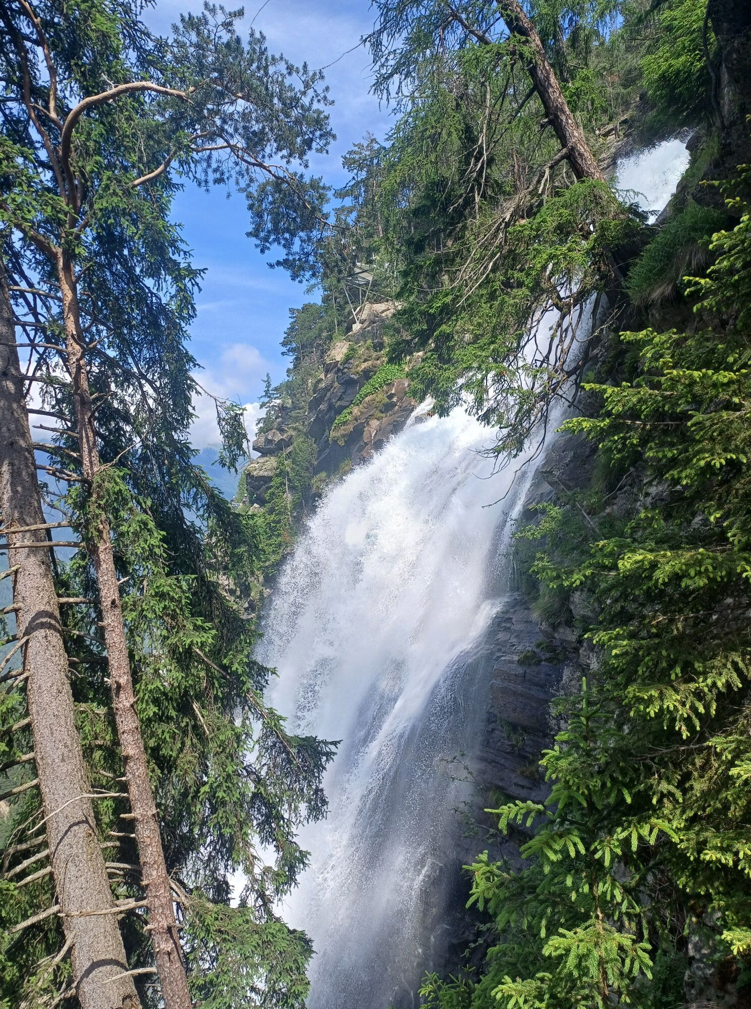
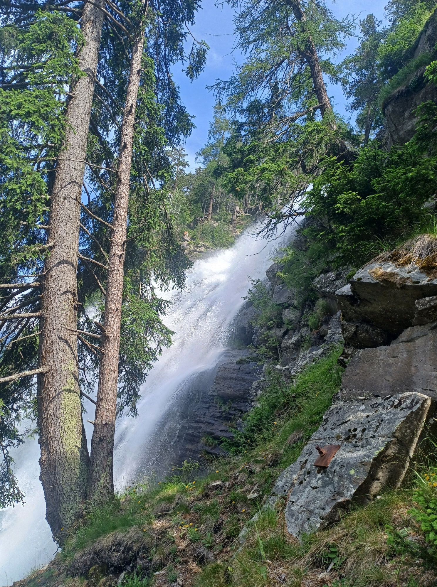
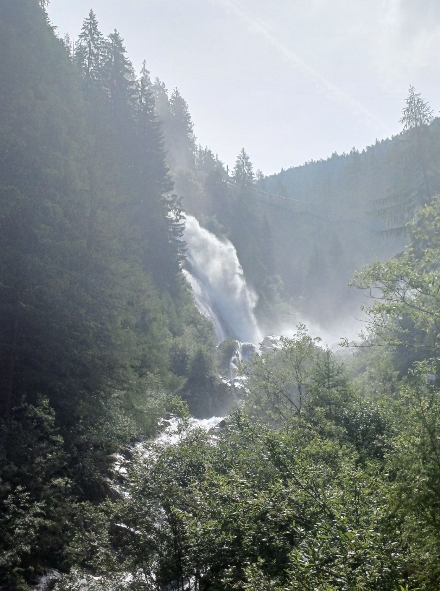
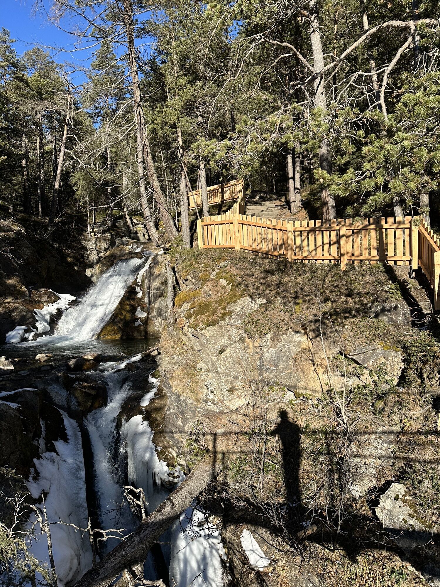
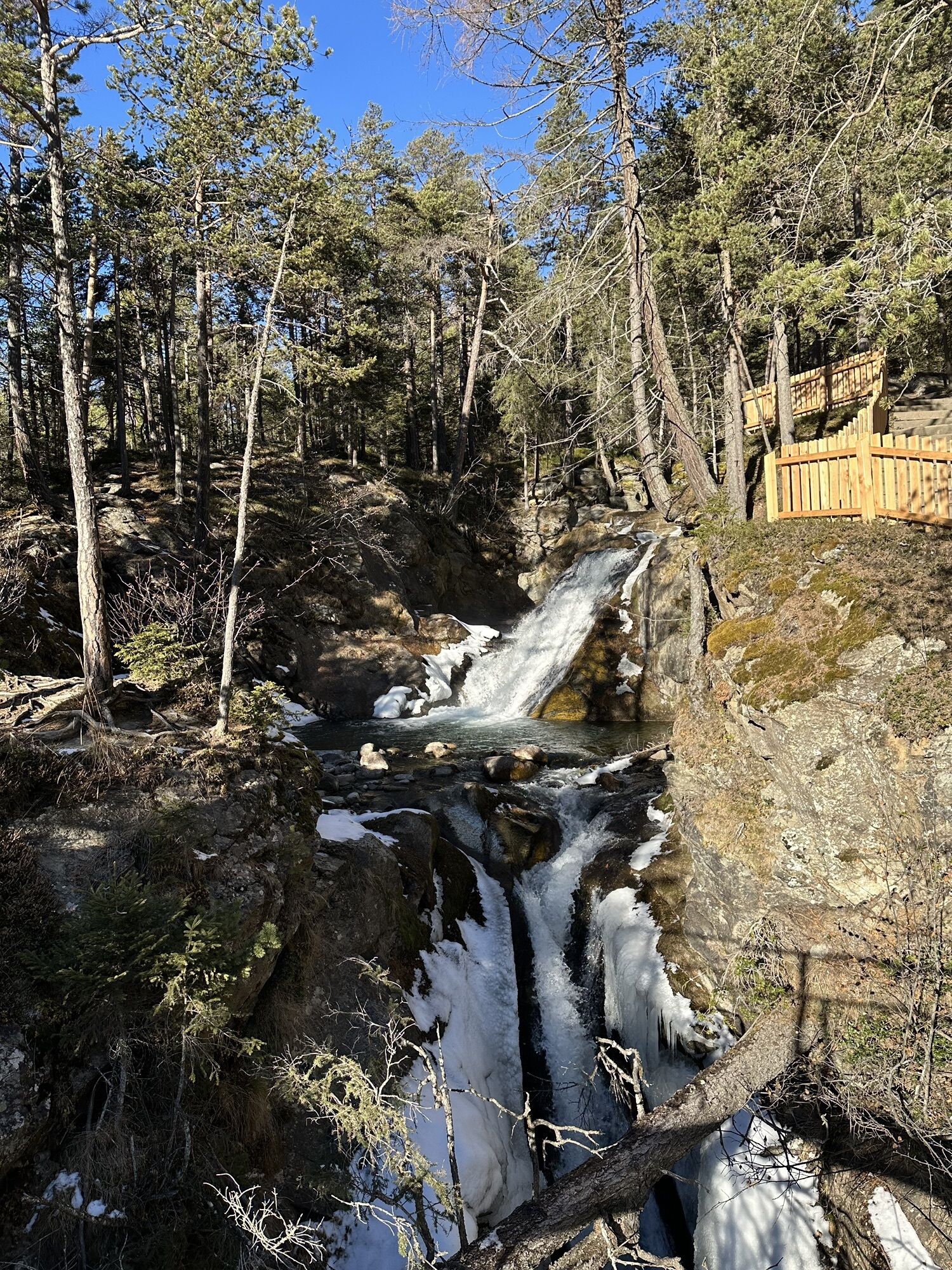
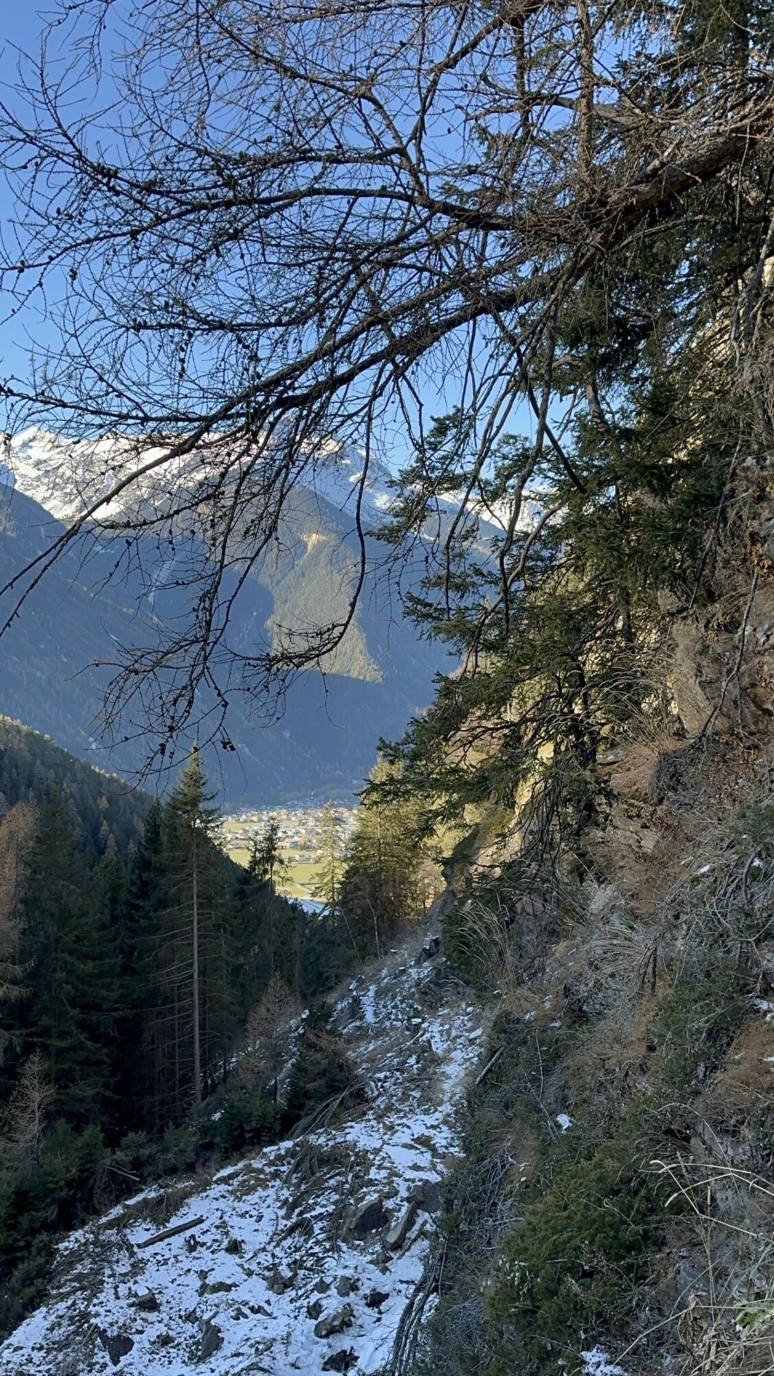
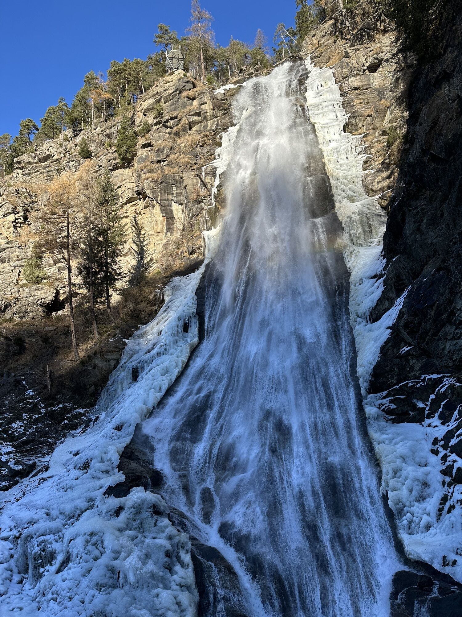
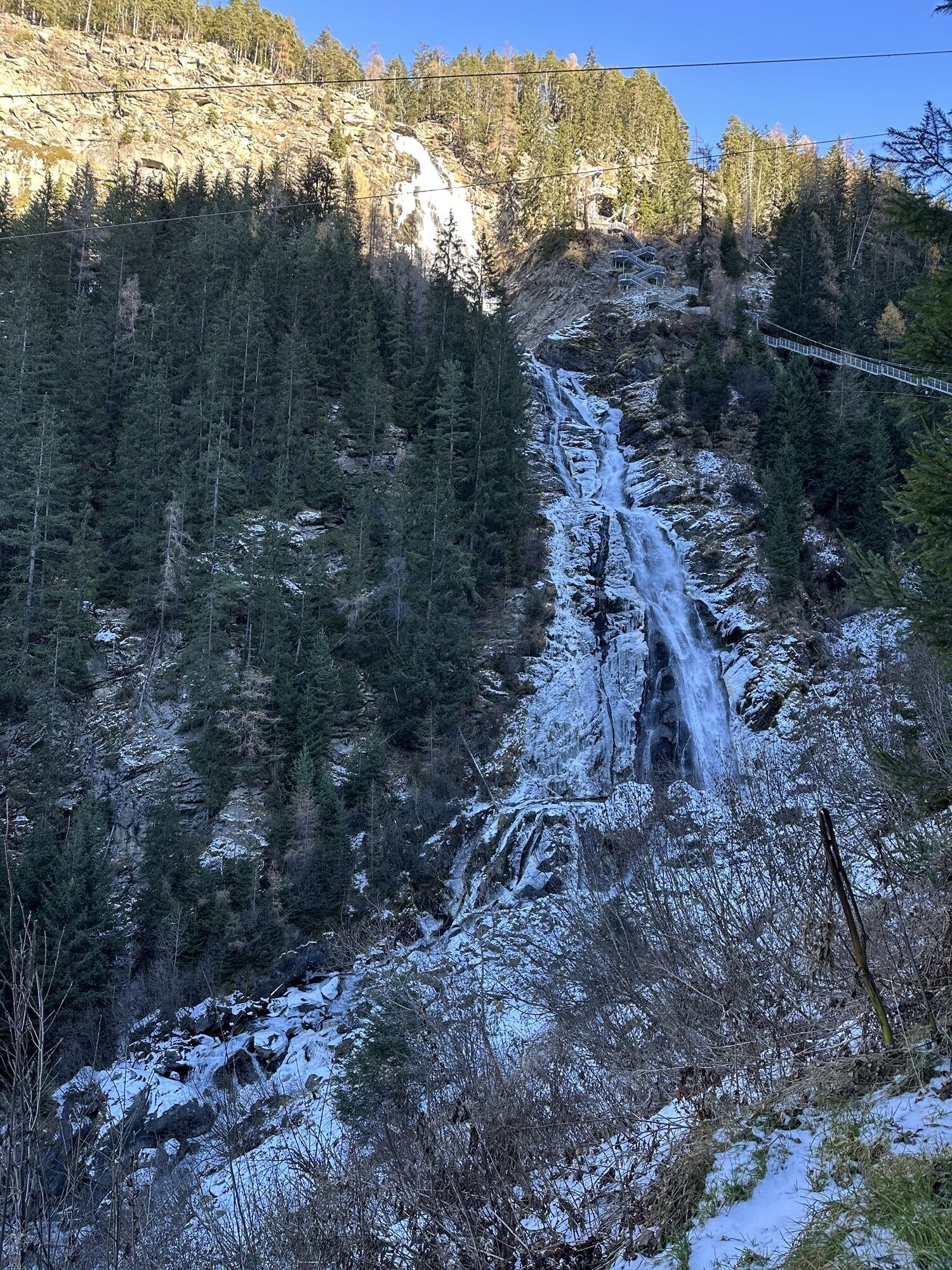
From the Bischoffsplatz parking lot in Umhausen, the wide hiking path leads past the Ötzi Village, raptor park, and Stuböbele forest café to the foot of the Stuibenfall waterfall. The hike from the parking lot to the foot of the Stuibenfall (gravel area with benches) takes about 30-40 minutes and is also well suited for families as well as with strollers/buggies. From the gravel area, you then continue hiking along a narrow trail up to a path and step construction (about 700 steps & an 80-meter-long, exposed suspension bridge), passing viewing platforms and roaring masses of water to the highest point of the waterfall, a fixed suspension bridge. There you cross this natural spectacle, experience fantastic views into the depths, and reach the last platform, which rounds off the Stuibenfall experience in its full uniqueness at dizzying heights. From there, it is about a 20-minute walk to the Stuibenfall guesthouse.
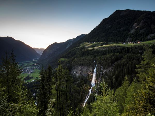
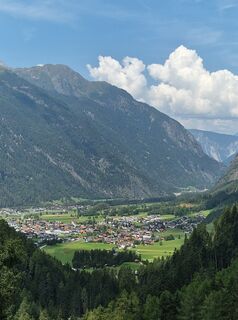
From the Stuibenfall guesthouse, there is the option to continue hiking on to Niederthai, which takes about 20 - 30 minutes.
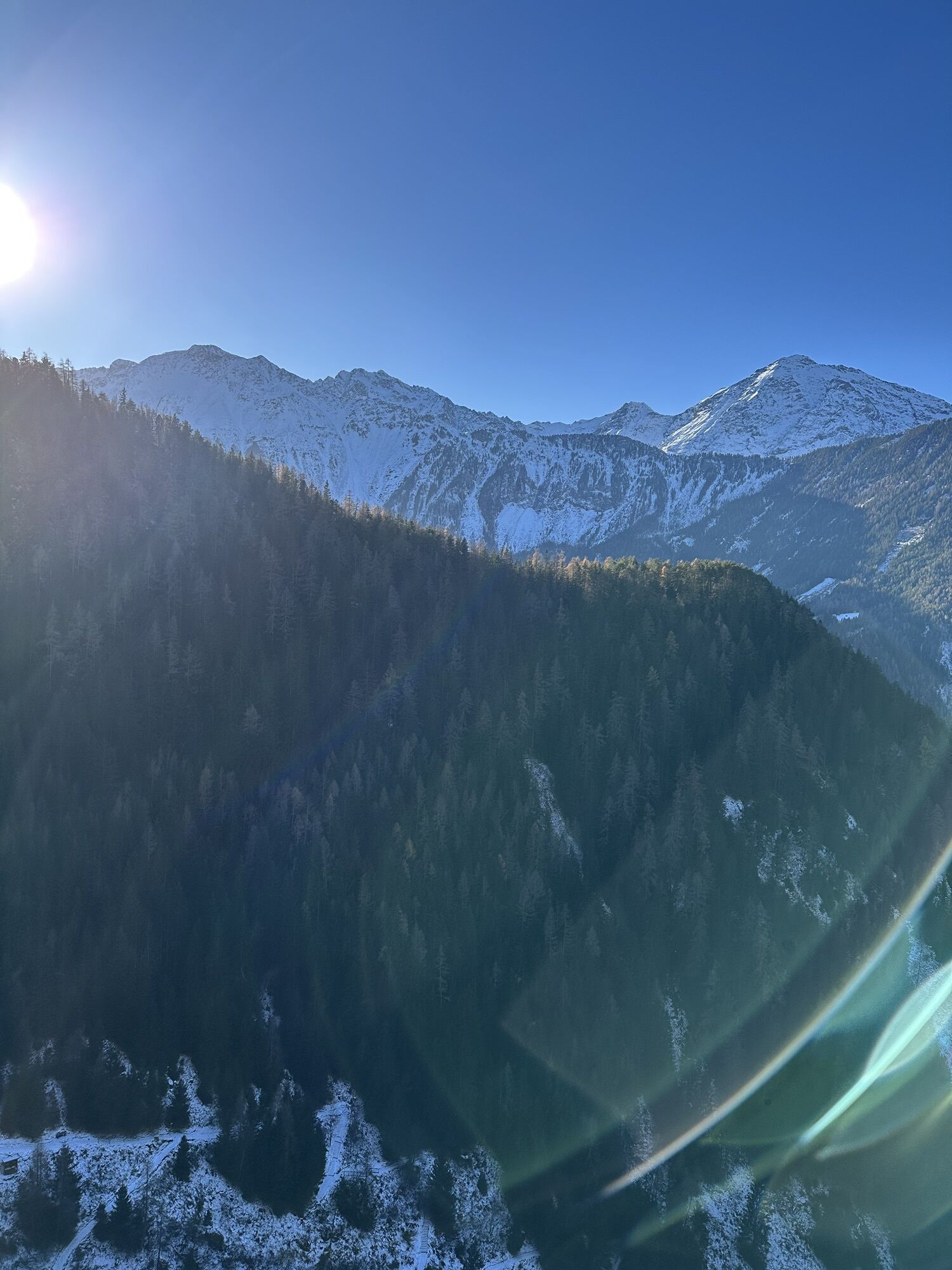
As alternative return routes to Umhausen, the "Old Niederthai Road" with a walking time of about 1.5 - 2 hours or the "Umhauser High Trail" with a walking time of about 2 - 2.5 hours are recommended.
Áno
Appropriate equipment such as breathable and weather-appropriate outdoor clothing, ankle-high hiking boots, wind, rain, and sun protection, hat, possibly gloves, is required for all hikes and routes. Carrying a first aid kit, a mobile phone, and possibly a hiking map, as well as sufficient provisions for hikes without the option to stop for food, is necessary.
Easy hiking trail; suitable for beginners and walking
Please note the current weather report
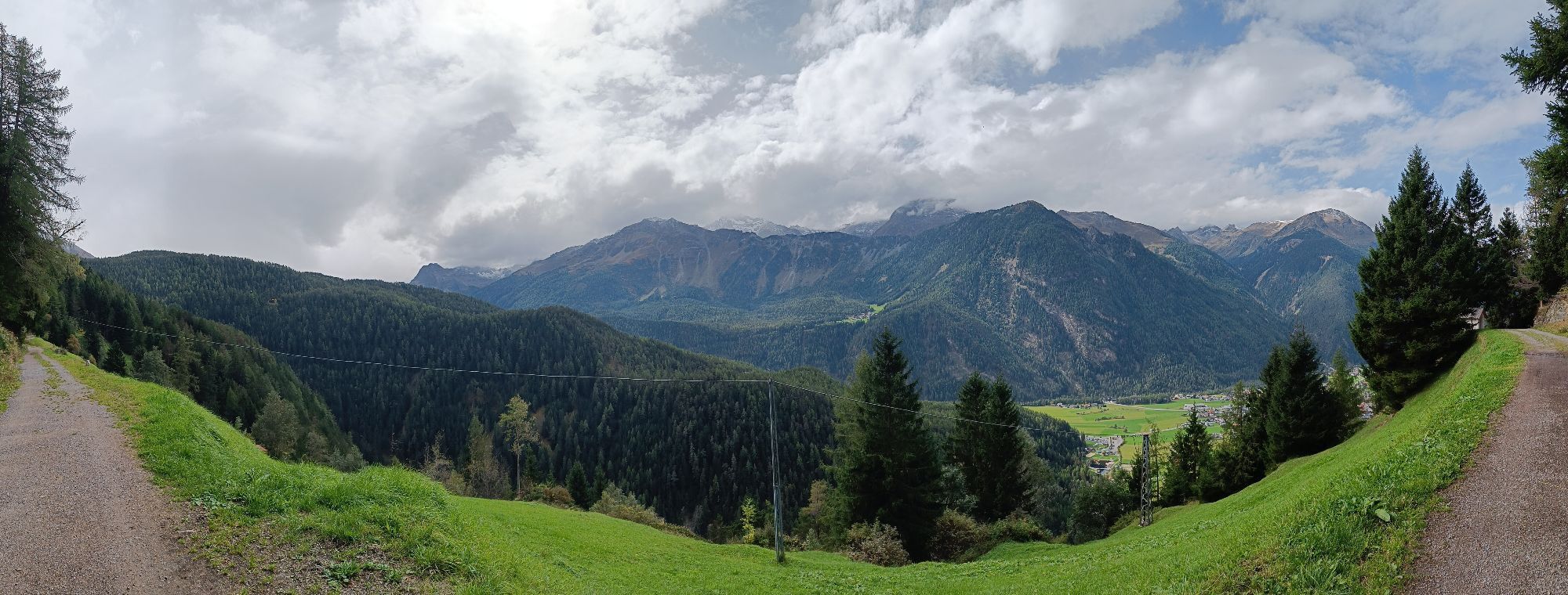
The car trip to the ÖTZTAL. Located in Tyrol, the Ötztal branches southwards as the longest side valley of the Eastern Alps. Traveling by car takes visitors through the Inn Valley to the valley entrance and along the Ötztal. Apart from the toll motorway, country roads may also be used. With the route planner, your trip can be quickly and conveniently planned.
To the route planner: https://www.google.at/maps
Travel comfortably and safely by train to the Ötztal train station. The final stop or exit point is the ÖTZTAL station. Afterwards, you travel conveniently and quickly with public transport or local taxi companies through the entire valley to your desired destination! The current bus schedule can be found at: http://fahrplan.vvt.at
In Umhausen, the following parking options are available:
Bischoffsplatz parking lot | Cost: €6.00 per car day ticket, mandatory from 7:00 am - 6:30 pm Multi-day tickets available Guests with disabilities – display card to park for free Buses park for freeMore info about hiking in the Ötztal can be found here
Webové kamery z prehliadky
-
Niederthai im Ötztal
-
Niederthai - Alpin Appart
-
Umhausen - der Veitenhof
-
Stuibenfall
-
Stuibenfall
-
Stuibenfall
-
Stuibenfall
-
Stuibenfall
-
Umhausen / Hotel Tauferberg
-
Umhausen / Hotel Tauferberg
-
Umhausen / Hotel Tauferberg
-
Umhausen / Hotel Tauferberg
-
Umhausen / Hotel Tauferberg
-
Niederthai - Delano
-
Niederthai - Delano
-
Umhausen / Hotel Tauferberg
Aktivity počas prehliadky
-

Umhausen, Tirol/Österreich
07.06.2026 – Via ferrata -

Umhausen, Tyrol/Austria
04.06.2026 – Turistika -

Umhausen, Tirol/Österreich
26.05.2026 – Turistika -

Umhausen, Tirol/Österreich
24.05.2026 – Turistika -


Umhausen, Tyrol/Austria
13.05.2026 – Horská turistika -
Umhausen, Tirol/Österreich
10.05.2026 – Turistika -
Umhausen, Tirol/Österreich
11.04.2026 – Turistika -
Umhausen, Tirol/Österreich
07.03.2026 – Turistika -

Umhausen, Tirol/Österreich
24.09.2025 – Turistika -

Umhausen Pohodništvo
11.09.2025 – Horská turistika -

Umhausen, Tirol/Österreich
02.09.2025 – Turistika -
Umhausen, Tirol/Österreich
30.08.2025 – Turistika -

Umhausen, Tirol/Österreich
15.08.2025 – Turistika
Obľúbené výlety v okolí
-
4,5
Winnebachsee Hut – Längenfeld/Gries
strednáTuristika 4,74 km -
4,4
Stuibenfall Umhausen circular hike
svetloTuristika 9,32 km -
4,5
Oetz - Piburger See - Oetz
strednáTuristika 7,16 km -
4,4
Rundwanderung Hängebrück3
svetloTuristika 6,32 km -
4,7
Winter circular route Brandalm/Burgstein - Längenfeld 204
strednáZimná turistika 5,44 km -
4,3
Lampsenspitze, Sellrain, Tirol
strednáSkitour 4,97 km -
4,3
Amberger Hut - Längenfeld/Gries
strednáTuristika 5,60 km -
4,6
Umhausen - Stuibenfall - Umhausen
strednáTuristika 7,94 km -
4,5
Summit route Weather Cross from Hochoetz
strednáTuristika 3,06 km -
4,6
Summit route Faltegartenköpfl
strednáTuristika 4,04 km

Turistika a stopovanie


Nenechajte si ujsť ponuky a inšpiráciu na ďalšiu dovolenku
Vaša e-mailová adresa bol pridaný do poštového zoznamu.