






Mountain bike trail 12 - Les balcons des Plans - Espace FFC Ain Forestière
Úroveň náročnosti: S1
Follow the blue signs number 12
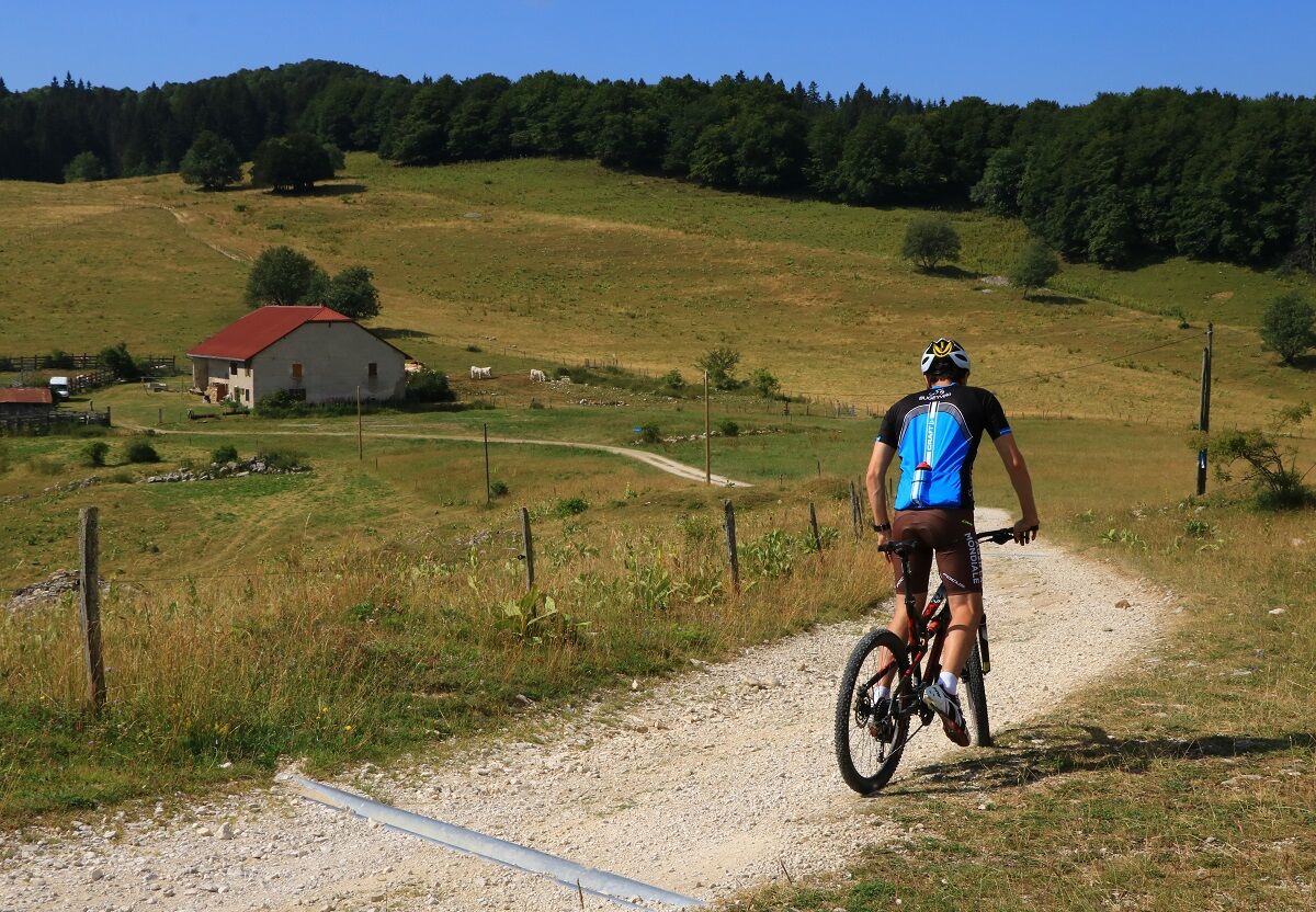
9 km long with an elevation gain of 259 m, this loop is not very technical. The first 5 km are mostly climbing until you reach the cross at les Terments, then it is mostly...
9 km long with an elevation gain of 259 m, this loop is not very technical. The first 5 km are mostly climbing until you reach the cross at les Terments, then it is mostly downhill all the way to the starting point on large forest trails.
Do not forget to download the map before you go.
Ski resort in winter, les Plans d'Hotonnes is also famous for its slopes, cross country and snowshoe tracks and the international biathlon centre where you can try your luck on the shooting range at any time of the year.
You do not own a bike? Rent your mountain bike, e-bike, at the local rental shop Sports 360 located at the starting point.


Follow the MTB marking: number 13 blue.
Marking in progress in spring 2024
Áno
Áno
Mountain Biking as you like! but…
Use the marked trails for your safety and respect the direction of the routes
Do not overestimate your abilities and stay in control of your speed
Be careful and courteous when overtaking or crossing hikers as pedestrians have priority
Check the condition of your MTB and plan for refreshments and repair accessories
If you go alone, leave your route with your contacts
Wearing a helmet is strongly recommended
Respect private property and cultivated areas
Be cautious of agricultural and forestry machinery
Close gates behind you
Avoid picking wild flowers, fruits and mushrooms
Do not disturb the peace of wild animals
Take your trash with you, be discreet and respectful of the environment
This route does not include very technical parts.
However, the route crosses the alpine pastures of the Plateau de Retord, utmost vigilance is recommended when you encounter a herd; many herds are accompanied by protection dogs, in this case, it is strongly recommended not to cross them but to go around. Please keep your dogs on a leash and systematically close enclosures behind you.
Consult the interactive map Ma Patou and learn the behavior to adopt: https://www.pasto-kezako.fr/ou-sont-les-chiens-de-protection-2/
Defective marking, incidents / safety, usage conflicts, illegal dumping? : locate and share the problem encountered on the national alert system via the SURICATE app or through the website https://sentinelles.sportsdenature.fr/
Emergency number: 112
From Lyon, follow the A42 then the A40 towards Geneva until the exit Saint Martin du Fresne where the Plans d'Hotonnes resort is indicated.
From Mâcon, follow the A40 towards Geneva until the exit Saint Martin du Fresne where the Plans d'Hotonnes resort is indicated.
The Plans d'Hotonnes resort is not accessible by public transportation.
Many parking spaces are available in the main parking lot of the Plans d'Hotonnes resort opposite the Maison des Plans.
S1
APIDAE Tourism data updated on 06/15/2022 by "Aintourisme".
An error on this sheet? Write to the owner mentioning these references:
Sheet name: Circuit 13 Les Plans d'Hotonnes - VTT-FFC Area of Bugey | Sheet ID: 98186 | URL (link) of this Outdooractive page.
Good deals from the Tourist Office.
E-MTB and MTB rental available from the start of the loops at the store Sports 360, reservation recommended. (Rentals, sales and repairs).
After the effort, enjoy the shop Ain's temps loisirs in the heart of the resort offering refreshments and light meals, an eco-responsible souvenir shop, and a wellness area composed of Norwegian baths and sauna.
This route around the Basins of Plans d'Hotonnes passing by the balconies of the resort is the easiest of the different existing circuits.
Route particularly recommended for families on e-MTBs.
The route is not accessible during the winter period.
This route is part of the "Ain Outdoor" selection.
Webové kamery z prehliadky
Získajte prehľad
Vždy naživo na mieste s viac ako 9 500 webovými kamerami. bergfex Ako používateľ Pro si teraz môžete pozrieť príslušné webové kamery pre mnohé zájazdy v aplikácii zájazdy z. Môžete si tak priamo prezerať aktuálne podmienky.
Obľúbené výlety v okolí
-
3 day-hike in Jura: hiking trails through Plateau de Retord and Grand Colombier
ťažkéTuristika 50,9 km -
MTB track 14 red - Retord - les balcons du Mont Blanc - Espace FFC Ain Forestière
ťažkéMountainbike 29,5 km -
Hike: Tour de Retord
ťažkéTuristika 18,6 km -
Hike: on the steps of the WW2 French resistance.
ťažkéTuristika 17,8 km -
Hiking in Bugey: La Ronde des Plans
svetloTuristika 13,1 km -
Running trail: Retord tour
ťažkéTrailrunning 18,6 km -
Cycling route: Du col du Ballon à la Combe de Léchaud
ťažkéCestný bicykel 122,6 km -
Multiday mountain biking loop : Mountainbiking on Grand Colombier and Retord Plateau - Espace FFC Ain Forestière
ťažkéMountainbike 92,8 km -
Hike in Bugey: Les crêtes d'Hergues
strednáTuristika 8,63 km -
Nature trail "Sentier de la Boucle d'Oreille"
svetloTuristika 4,64 km
Turistika a stopovanie


Nenechajte si ujsť ponuky a inšpiráciu na ďalšiu dovolenku
Vaša e-mailová adresa bol pridaný do poštového zoznamu.





