


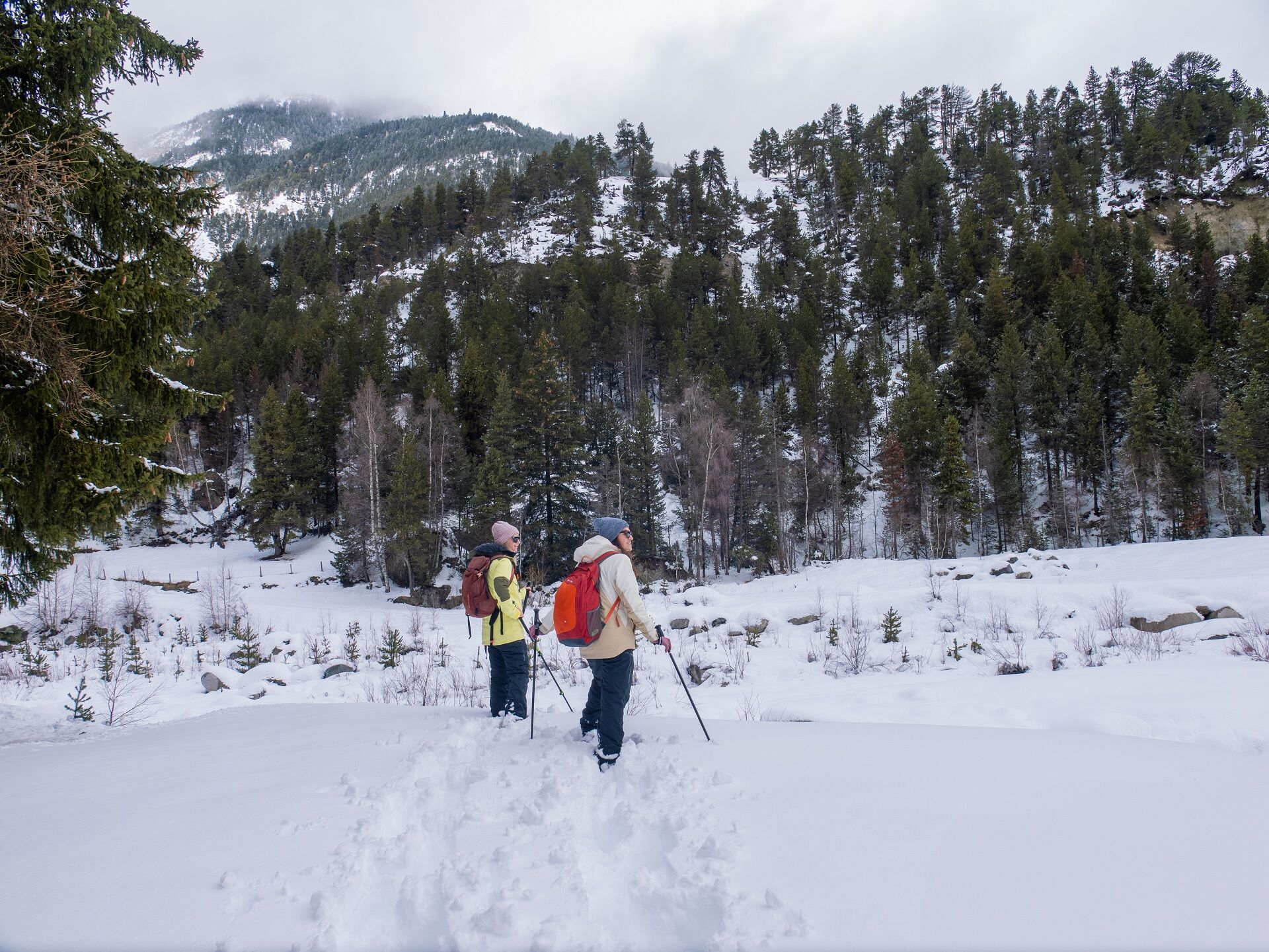
Snowshoe itinerary: Val Cenis le Haut trail
Between glades and undergrowth, every step invites discovery and contemplation, while the Val Cenis ski area reveals itself at the turn of a path, offering a perfect balance between nature and mountains.

1/ From the Val Cenis le Haut Télécabine arrival station, follow the snowshoe trail straight ahead to the first intersection in the forest.
2/ 0 h 20 - At this intersection, take the downhill path, then fork left to join the toboggan run and the Les Terres Grasses green trail.
3/ 0 h 40 - Cross the tracks carefully to pick up the snowshoe trail, then continue to Le Calvaire. Then follow the signs for Chapelle Saint Étienne to reach the La Lauzière intersection.
4/ 1 h 5 0 - From La Lauzière, head towards Lanslevillard, then turn right before the tunnel to reach the Val Cenis le Haut gondola departure station.
5/ 1 h 15 - Val Cenis le Haut Gondola departure station.
Find out about weather conditions and avalanche risk before you set off (weather services, mountain rescue services, professionals, tourist office...).
Equipment and clothing must be adapted to the forecast.
Postpone your activity if the weather forecast is poor. Follow safety instructions and do not venture off the marked routes in winter.
Obľúbené výlety v okolí
-
little 'Haute-Maurienne Vanoise' circuit
ťažkéCestný bicykel 32,0 km -
The White Lake
svetloTuristika 4,42 km -
Hike from the Avérole refuge through the hamlet
strednáTuristika 9,36 km -
Col de l'Iseran from Modane
ťažkéCestný bicykel 59,5 km -
Col du Mont Cenis from Lanslebourg
ťažkéCestný bicykel 9,84 km -
Col du Mont Cenis from Modane
ťažkéCestný bicykel 34,8 km -
5,0
Goldtoni - Alpenbogen A068 Refuge de la Leisse-Termignon Val Cenis
strednádiaľková pešia trasa 28,7 km -
5,0
Walking tour of the Plan du Lac refuge
svetloTuristika 4,58 km -
5,0
Girarde footpath
svetloTuristika 8,10 km -
Petit Mont-Cenis pass
ťažkéCestný bicykel 18,0 km
Turistika a stopovanie


Nenechajte si ujsť ponuky a inšpiráciu na ďalšiu dovolenku
Vaša e-mailová adresa bol pridaný do poštového zoznamu.