
Walking tour of the Plan d'Amont dam
svetlo
Získajte túto prehliadku v mobilnom telefóne
Walking tour of the Plan d'Amont dam
svetlo
Turistika
5,64
km
Naskenujte kód QR a spustite navigáciu v aplikácii bergfex


Turistika a stopovanie




Walking tour of the Plan d'Amont dam
svetlo
Vzdialenosť
5,64
km
Trvanie
02:45
h
Ascent
266
hm
Hladina mora
2 026 -
2 332
m

Naviguj sa počas prehliadky v aplikácii
Nainštalujte si aplikáciu zadarmo a sledujte trasu vďaka GPS navigácii a sledovaniu polohy.
Využite službu „ bergfex “ už teraz v aplikácii
Naskenuj QR kód pomocou fotoaparátu
Ak máte aplikáciu nainštalovanú, obsah sa otvorí priamo. Ak aplikáciu ešte nemáte, budete presmerovaní na stránku, kde si ju môžete bezplatne stiahnuť.
Stiahnutie skladby
Walking tour of the Plan d'Amont dam
svetlo
Turistika
5,64
km
If you love views of landscapes dramatically falling away from you, then every
step of this hike will be a delight. The artificial lake, twinkling like a diamond
in its case, attracts your eyes every time...
Opis
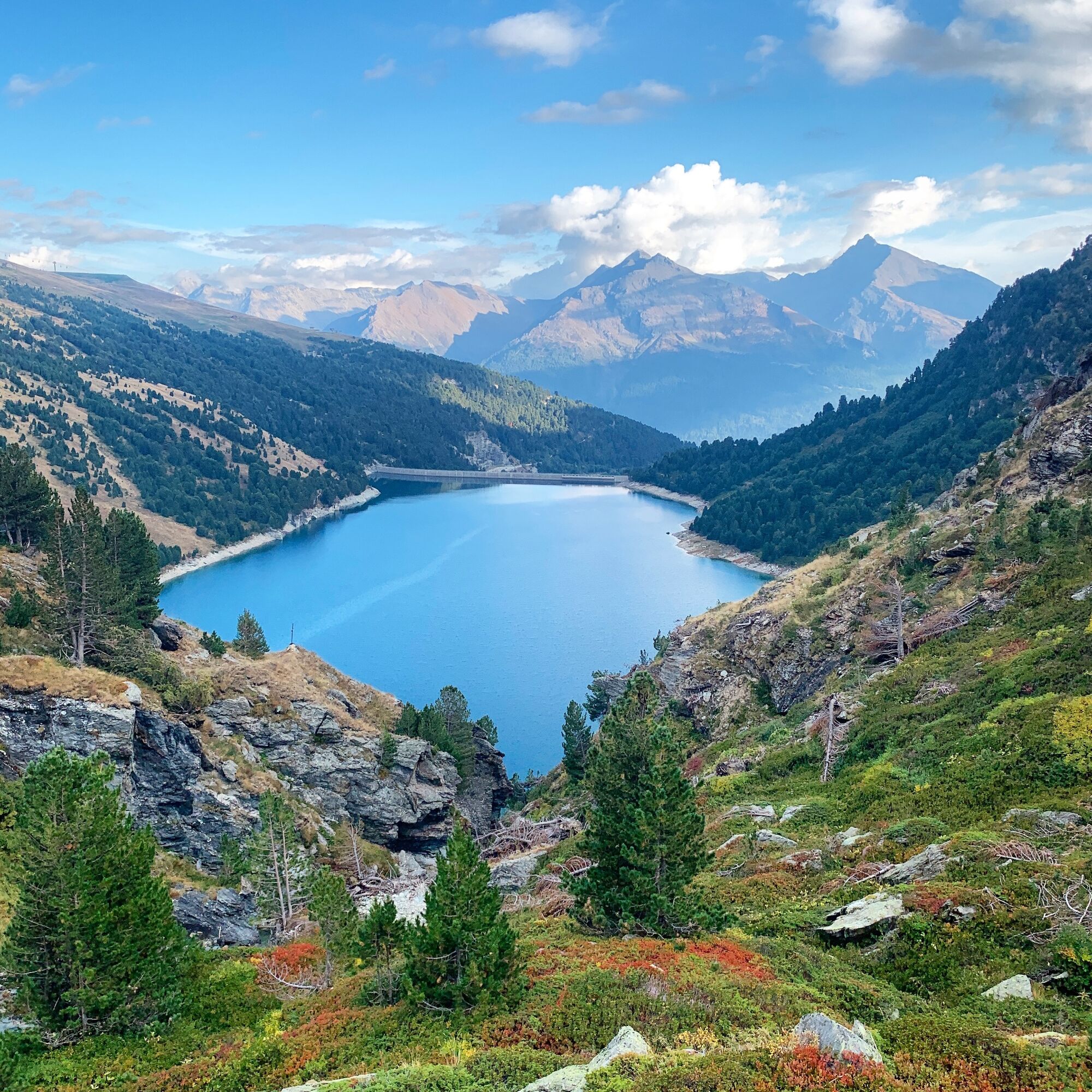
If you love views of landscapes dramatically falling away from you, then every
step of this hike will be a delight. The artificial lake, twinkling like a diamond
in its case, attracts your eyes every time you look up towards the horizon.
Whatever the season, the colours cast a magic spell. Even the marmots'
little cries of alarm won't take your attention from the satin-smooth surface.
This water basin in the high-altitude grasslands plays a crucial role in storing
water for the neighbouring valley. Like its downstream counterpart, Plan
d'Amont's hydroelectric dam is used, among other things, to power ONERA's
international wind tunnel, a flagship aerospace research project that tests
model aircraft and rockets.
At La Fournache refuge, take a rest as you imagine all those seasoned
mountaineers heading towards Pointe de Labby or Dent Parraché, majestically
rising up above you to a height of over 3,500 metres above sea level.
step of this hike will be a delight. The artificial lake, twinkling like a diamond
in its case, attracts your eyes every time you look up towards the horizon.
Whatever the season, the colours cast a magic spell. Even the marmots'
little cries of alarm won't take your attention from the satin-smooth surface.
This water basin in the high-altitude grasslands plays a crucial role in storing
water for the neighbouring valley. Like its downstream counterpart, Plan
d'Amont's hydroelectric dam is used, among other things, to power ONERA's
international wind tunnel, a flagship aerospace research project that tests
model aircraft and rockets.
At La Fournache refuge, take a rest as you imagine all those seasoned
mountaineers heading towards Pointe de Labby or Dent Parraché, majestically
rising up above you to a height of over 3,500 metres above sea level.
Autor
Poskytuje Haute Maurienne Vanoise
Prehliadku Walking tour of the Plan d'Amont dam zabezpečuje outdooractive.com.


Informácie o trase
Trasa
To guide you in the field, consult the "step-by-step" directional diagram provided in pdf.
Jednosmerná prehliadka
Áno
Ďalšie informácie a tipy
Ďalšie informácie
The duration of hiking trails is calculated using reference paces: 300 m/h ascent, 500 m/h descent and 4 km/h on the flat.
As hazards may occur at any time on the routes, the GPX tracks provided are not contractual. They are given for information only. Riders use them at their own risk, depending on their level of technological proficiency and their understanding of the terrain.
As hazards may occur at any time on the routes, the GPX tracks provided are not contractual. They are given for information only. Riders use them at their own risk, depending on their level of technological proficiency and their understanding of the terrain.
Zatiaľ žiadne recenzie

Všetky webové kamery na mape
Nainštaluj si aplikáciu zadarmo a porovnaj živé zábery z viacerých miest, než vyrazíš.
Využite službu „ bergfex “ už teraz v aplikácii
Naskenuj QR kód pomocou fotoaparátu
Ak máte aplikáciu nainštalovanú, obsah sa otvorí priamo. Ak aplikáciu ešte nemáte, budete presmerovaní na stránku, kde si ju môžete bezplatne stiahnuť.

Obľúbené výlety v okolí
-
BARDONECCHIA Rochemolles Dam - Scarfiotti Mountain Hut
strednáTuristika 7,24 km -
Refuge du Fond d'Aussois - a wild valley in the Vanoise - 2-day hike
svetloTuristika 9,22 km -
The White Lake
svetloTuristika 4,42 km -
BARDONECCHIA Decauville Loop - Scarfiotti Refuge
svetloMountainbike 34,0 km -
Col de l'Iseran from Modane
ťažkéCestný bicykel 59,5 km -
Col du Mont Cenis from Modane
ťažkéCestný bicykel 34,8 km -
Tour of the Bellecombe lakes
ťažkéTuristika 10,2 km -
5,0
The Builder's Trail on foot
svetloTematická trasa 7,23 km -
5,0
Walking tour of the Plan du Lac refuge
svetloTuristika 4,58 km -
5,0
Girarde footpath
svetloTuristika 8,10 km
Turistika a stopovanie

Viac ako 550.000 návrhov výletov, podrobné mapy a intuitívny plánovač trás robia z aplikácie povinnú výbavu pre všetkých nadšencov prírody.

Nenechajte si ujsť ponuky a inšpiráciu na ďalšiu dovolenku
Prihlásiť sa k odberu noviniek
Chyba
Vyskytla sa chyba. Prosím, skúste to znova.
Ďakujeme za vašu registráciu
Vaša e-mailová adresa bol pridaný do poštového zoznamu.
Zájazdy po celej Európe
Rakúsko
Švajčiarsko
Nemecko
Taliansko
Slovinsko
Francúzsko
Holandsko
Belgicko
Poľsko
Lichtenštajnsko
Česko
Slovensko
španielsko
Hrvaška
Bosna a Hercegovina
Luxembursko
Andorra
Portugalsko
Island
Spojené kráľovstvo
Írsko
Grécko
Albánsko
Severné Macedónsko
Malta
Nórsko
Čierna Hora
Moldavsko
Kosovo
Maďarsko
San Maríno
Rumunsko
Estónsko
Lotyšsko
Bielorusko
Cyprus
Litva
Srbsko
Bulharsko
Monako
Dánsko
Švédsko
Fínsko





