Fond d'Etache walking trail
ťažké
Získajte túto prehliadku v mobilnom telefóne
Fond d'Etache walking trail
ťažké
Turistika
17,02
km
Naskenujte kód QR a spustite navigáciu v aplikácii bergfex

Turistika a stopovanie


Fond d'Etache walking trail
ťažké
Vzdialenosť
17,02
km
Trvanie
06:00
h
Ascent
1 140
hm
Hladina mora
1 660 -
2 754
m
Stiahnutie skladby
Fond d'Etache walking trail
ťažké
Turistika
17,02
km
Setting off at a time when the dew is still dripping onto the forest floor, you are soon caressed by the first rays of sunshine. On a path that gradually winds its way through the woods, your steps are...
Opis
Setting off at a time when the dew is still dripping onto the forest floor, you are soon caressed by the first rays of sunshine. On a path that gradually winds its way through the woods, your steps are punctuated
by the quiet, flowing sound of the Etache stream.
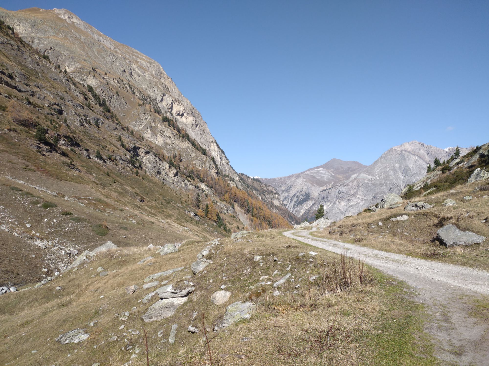
After carefully closing the gates as you pass, you suddenly feel the magic of the great high-altitude cembra groves. In the distance, the Grand Bec d'Étache can already be seen.
As you pass by the farm, enhance your picnic with cheeses sold directly all summer long. Barely refueled, the waterfall beckons. But don't stop there. The valley's secrets remain to be discovered. It's time to climb the demanding Plan des Eaux.
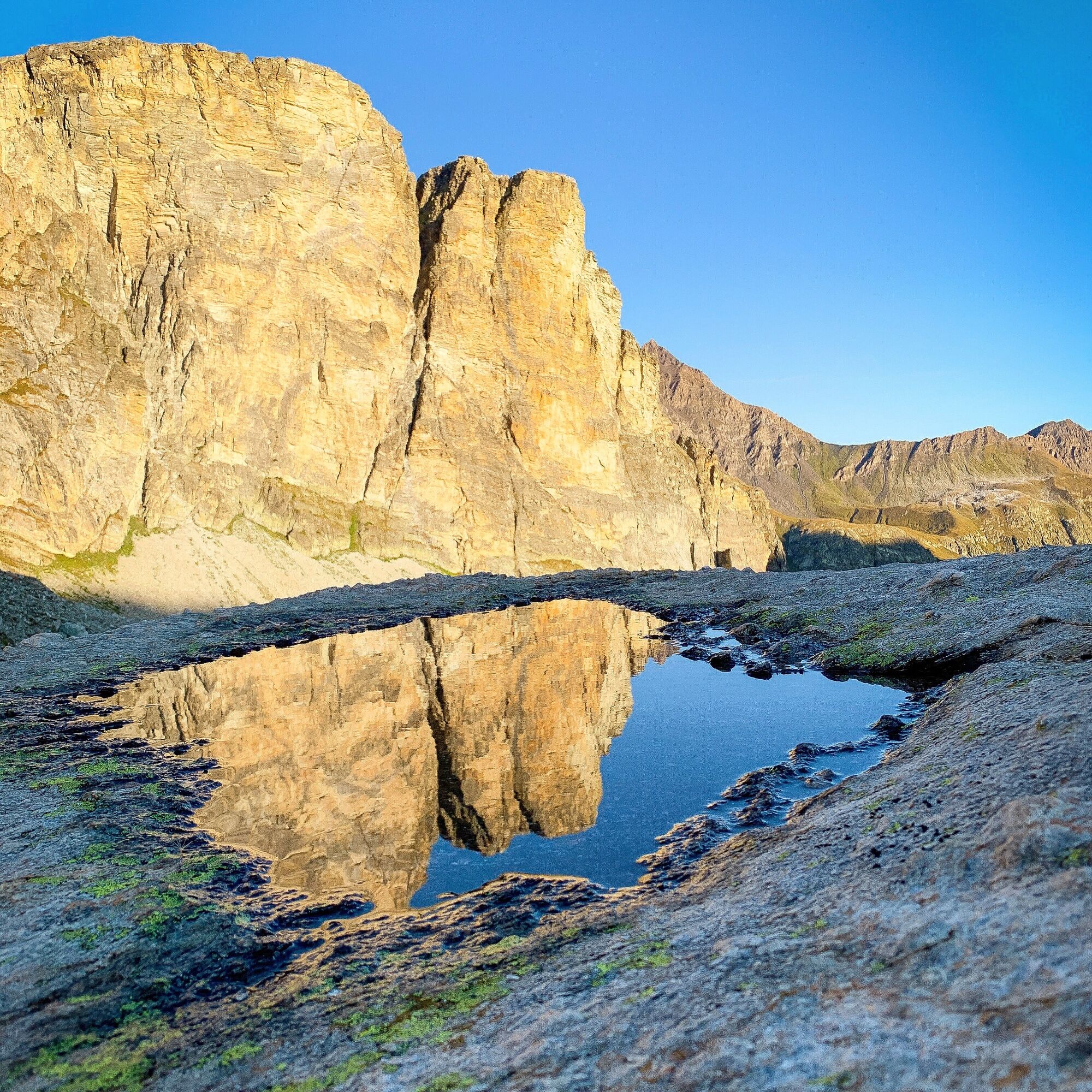
Enjoy a refreshing break on the rocks carved out by the torrent before finding your second wind all the way to the highest point of Côte Charbonnière. Enjoy a soothing stopover at Lac du Liael. The whistle of frightened marmots guides you to the Montbas mountain pasture.
Let yourself be carried away by the final descent into the forest. The subtle mix of birdsong will delight walkers and seasoned trail runners alike.
by the quiet, flowing sound of the Etache stream.
After carefully closing the gates as you pass, you suddenly feel the magic of the great high-altitude cembra groves. In the distance, the Grand Bec d'Étache can already be seen.
As you pass by the farm, enhance your picnic with cheeses sold directly all summer long. Barely refueled, the waterfall beckons. But don't stop there. The valley's secrets remain to be discovered. It's time to climb the demanding Plan des Eaux.
Enjoy a refreshing break on the rocks carved out by the torrent before finding your second wind all the way to the highest point of Côte Charbonnière. Enjoy a soothing stopover at Lac du Liael. The whistle of frightened marmots guides you to the Montbas mountain pasture.
Let yourself be carried away by the final descent into the forest. The subtle mix of birdsong will delight walkers and seasoned trail runners alike.
Trasa
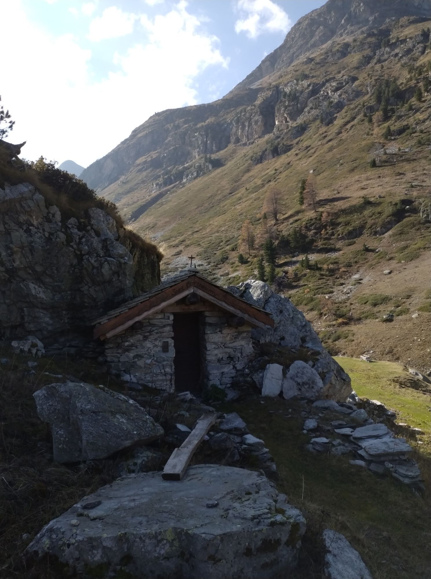
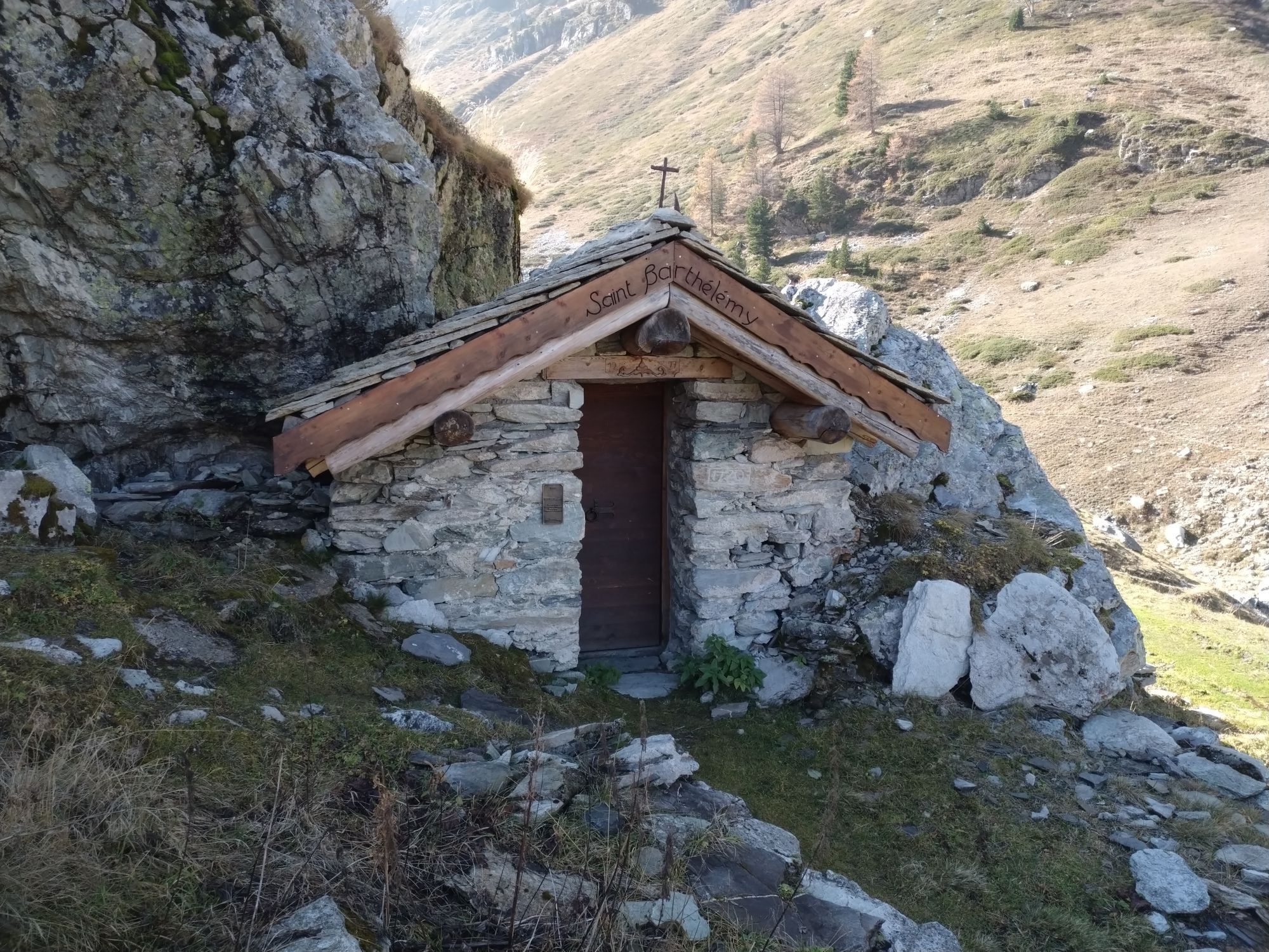
Chapelle Saint-Paul
(1 665 m)
Miesto uctievania
0,0 km
Le Planay
(1 658 m)
Zúčtovanie
0,0 km
Chalets de la Combe d'Étache
(2 076 m)
Koridor/terén
4,5 km
Montbas
(2 062 m)
Zúčtovanie
14,0 km
La Tuile
(1 688 m)
Zúčtovanie
16,7 km
Chapelle Saint-Paul
(1 665 m)
Miesto uctievania
16,9 km
Le Planay
(1 658 m)
Zúčtovanie
17,0 km
Trasa
Fond d'Etache walking trail
ťažké
Turistika
17,02
km
Chapelle Saint-Paul
(1 665 m)
Miesto uctievania
0,0 km
Le Planay
(1 658 m)
Zúčtovanie
0,0 km
Chalets de la Combe d'Étache
(2 076 m)
Koridor/terén
4,5 km
Montbas
(2 062 m)
Zúčtovanie
14,0 km
La Tuile
(1 688 m)
Zúčtovanie
16,7 km
Chapelle Saint-Paul
(1 665 m)
Miesto uctievania
16,9 km
Le Planay
(1 658 m)
Zúčtovanie
17,0 km
Autor
Poskytuje Haute Maurienne Vanoise
Prehliadku Fond d'Etache walking trail zabezpečuje outdooractive.com.

Informácie o trase
Trasa
To guide you in the field, consult the "step-by-step" directional diagram provided in pdf.
Jednosmerná prehliadka
Áno
Ďalšie informácie a tipy
Ďalšie informácie
The duration of hiking trails is calculated using reference paces: 300 m/h ascent, 500 m/h descent and 4 km/h on the flat.
As hazards may occur at any time on the routes, the GPX tracks provided are not contractual. They are given for information only. Riders use them at their own risk, depending on their level of technological proficiency and their understanding of the terrain.
As hazards may occur at any time on the routes, the GPX tracks provided are not contractual. They are given for information only. Riders use them at their own risk, depending on their level of technological proficiency and their understanding of the terrain.
Zatiaľ žiadne recenzie
Obľúbené výlety v okolí
-
5,0
BARDONECCHIA Colle Sommeiller
strednáMountainbike 25,4 km -
5,0
BARDONECCHIA Forte Jafferau Loop
ťažkéMountainbike 36,8 km -
5,0
BARDONECCHIA Decauville
strednáTuristika 7,29 km -
BARDONECCHIA Monte Jafferau
ťažkéTuristika 11,6 km -
little 'Haute-Maurienne Vanoise' circuit
ťažkéCestný bicykel 32,0 km -
BARDONECCHIA Rochemolles Dam - Scarfiotti Refuge
strednáTuristika 7,77 km -
4,0
BARDONECCHIA Sentiero dei Cosetti by Luciano Ferraris
svetloTuristika 3,24 km -
BARDONECCHIA Frejusia Basins - Decauville - Rochemolles Dam
svetloMountainbike 7,54 km -
5,0
BARDONECCHIA Decauville
svetloSnežnice 4,11 km -
Refuge du Fond d'Aussois - a wild valley in the Vanoise - 2-day hike
svetloTuristika 9,22 km
Turistika a stopovanie

Viac ako 550.000 návrhov výletov, podrobné mapy a intuitívny plánovač trás robia z aplikácie povinnú výbavu pre všetkých nadšencov prírody.

Nenechajte si ujsť ponuky a inšpiráciu na ďalšiu dovolenku
Prihlásiť sa k odberu noviniek
Chyba
Vyskytla sa chyba. Prosím, skúste to znova.
Ďakujeme za vašu registráciu
Vaša e-mailová adresa bol pridaný do poštového zoznamu.
Zájazdy po celej Európe
Rakúsko
Švajčiarsko
Nemecko
Taliansko
Slovinsko
Francúzsko
Holandsko
Belgicko
Poľsko
Lichtenštajnsko
Česko
Slovensko
španielsko
Hrvaška
Bosna a Hercegovina
Luxembursko
Andorra
Portugalsko
Island
Spojené kráľovstvo
Írsko
Grécko
Albánsko
Severné Macedónsko
Malta
Nórsko
Čierna Hora
Moldavsko
Kosovo
Maďarsko
San Maríno
Rumunsko
Estónsko
Lotyšsko
Bielorusko
Cyprus
Litva
Srbsko
Bulharsko
Monako
Dánsko
Švédsko
Fínsko