


Hike - "Green Belt Thuringia" - Stage 2
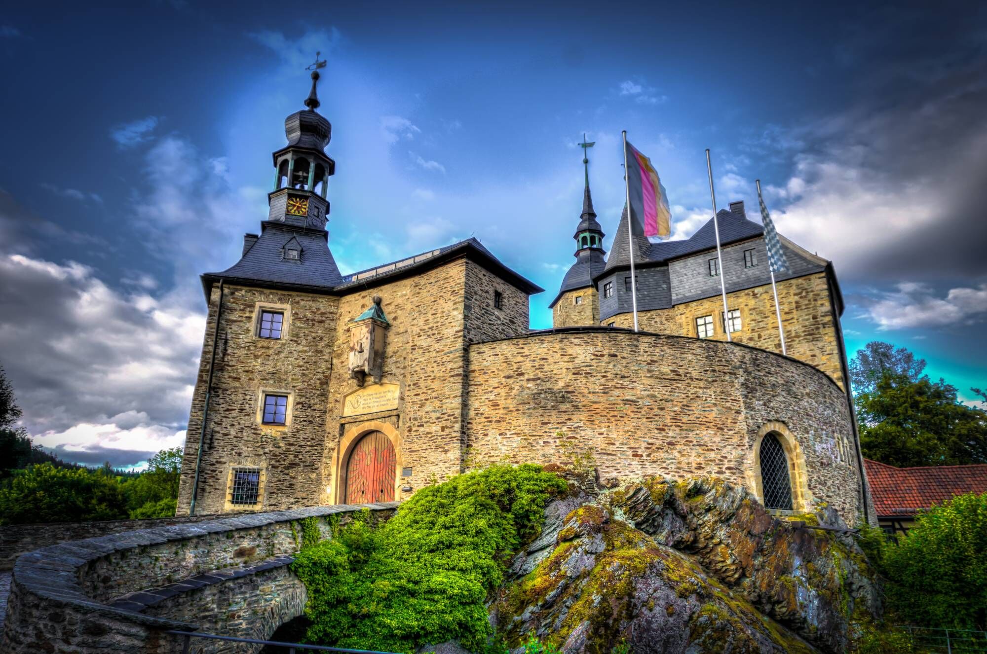
You start this route section on the Green Belt below the venerable Burg Lauenstein at the inn "zum Goldenen Löwen" and walk on the Luther Way up to Ringstraße and to the Bavarian-Thuringian state border....
You start this route section on the Green Belt below the venerable Burg Lauenstein at the inn "zum Goldenen Löwen" and walk on the Luther Way up to Ringstraße and to the Bavarian-Thuringian state border. Soon you will reach the Pulswinkel hut, which belongs to the Lauenstein youth forest home.
Not far away is the village of Lichtenhain. The small St. Sebastian church invites you for a short pause. After that, you pass the Höhkuppe on the hike and continue towards Kelintettau. Anyone who wants to briefly deviate from the original route should not miss the tropical house located there. Otherwise, follow the path along the nature park border of the Franconian Forest.
Further south on the Thuringian side you pass Neuenbau in the direction of Schauberg. Shortly before the village, the path turns through the forest, but you should not miss the short detour to Schauberg viewpoint. From here you have a wonderful view over the Franconian Forest Nature Park.
On the following section, you enjoy pure nature. Along the Tettau stream, you continue south toward Heinersdorf. Anyone who wants can make a detour to the neighboring village Welitsch from here. The Müller inn is a staple for regionally high-quality home cooking.
On the following straight section through the forest, you follow an old military road to the entrance to Gessendorf near Neuhaus-Schierschnitz. But the hiking trail on the Green Belt continues to follow the old border route. Today the B89 connects where walls and fences once separated, after which you soon reach the small village of Rotheul. Behind it lies a large deserted area landscape-wise. Once densely populated, only individual farms remind of the small villages that fell victim to the border regime between the GDR and the Federal Republic.
The path section ahead leads west again and in the distance, the local mountain of Neustadt bei Coburg will soon be visible. Along the upper Franconian river meadows, you then reach the state border between Sonneberg and Neustadt b.C. Here you face the toughest decision of the hiking section: whether Sonneberg or Neustadt -overnighting is wonderful in both places.

Burg Lauenstein - Springelhof - Lichtenhain - Tettau - Neuenbau - Schauberg - Heinersdorf - Gessendorf - B89 near Burggrub - Rotheul - Reuterwüsting - Mogger - Mupperg - Ebersdorf - Sonneberger Str. | Neustadt b.C.
Sturdy footwear
Drinks supply
First aid kit
GPS navigation device or smartphone
The hiking route runs through the former militarized border area. Always stay on the designated paths and pay attention to signs (mine clearance areas).
Coming from the A9, exit 26 (Triptis) and continue on the B281 towards Saalfeld. Continue on the B85 towards Ludwigsstadt / Kronach.
The nearest train station is Ludwigstadt. From here you have connections to the Frankenbus (lines 8347 and 8328) towards Lauenstein.
Please use the travel information of the Free State of Bavaria at the following link:
https://www.bayern-fahrplan.de/de/auskunft
NOTE: A direct return trip by public transport from Neustadt bei Coburg to Lauenstein is not possible.
Parking is available directly at Burg Lauenstein. (Google NAV point)
Those who have a bit more time on their hike should visit the small deserted villages at Rotheul. The idyllic micro-settlements are true gems where borders once divided. The observatory in Rotheul is also worth a visit.
Obľúbené výlety v okolí
-
Nature Park Trail - Griffel Path in the Thuringian Forest
ťažkéTematická trasa 6,45 km -
Rundweg Muppberg Ne2
strednáTuristika 3,46 km -
Circular hike - Glass and porcelain tradition on the Rennsteig - Spechtsbrunn
strednáTuristika 13,4 km -
Circular hike - "6-Kuppen-Steig" - Steinach - Thuringian Forest
strednáTuristika 37,1 km -
Circular hike - "Panorama Trail Schaumberger Land" - Eisfeld - Thuringian Forest
ťažkéTuristika 74,2 km -
Hike - Rennsteig - Stage 6 - From Friedrichshöhe to Spechtsbrunn
strednáTuristika 23,0 km -
Hike "Rennsteig-Leader Lauscha" Thuringian Forest
strednáTuristika 2,44 km -
GeoTrail - SlateKINGDOM - Sonneberg district
strednáTematická trasa 22,7 km -
Prinzregentenweg
strednáTuristika 4,19 km -
NE1 Auf dem breiten Weg
strednáTuristika 4,77 km
Turistika a stopovanie


Nenechajte si ujsť ponuky a inšpiráciu na ďalšiu dovolenku
Vaša e-mailová adresa bol pridaný do poštového zoznamu.