


Calanda Challenge
Úroveň náročnosti: S2
Fotografie našich používateľov
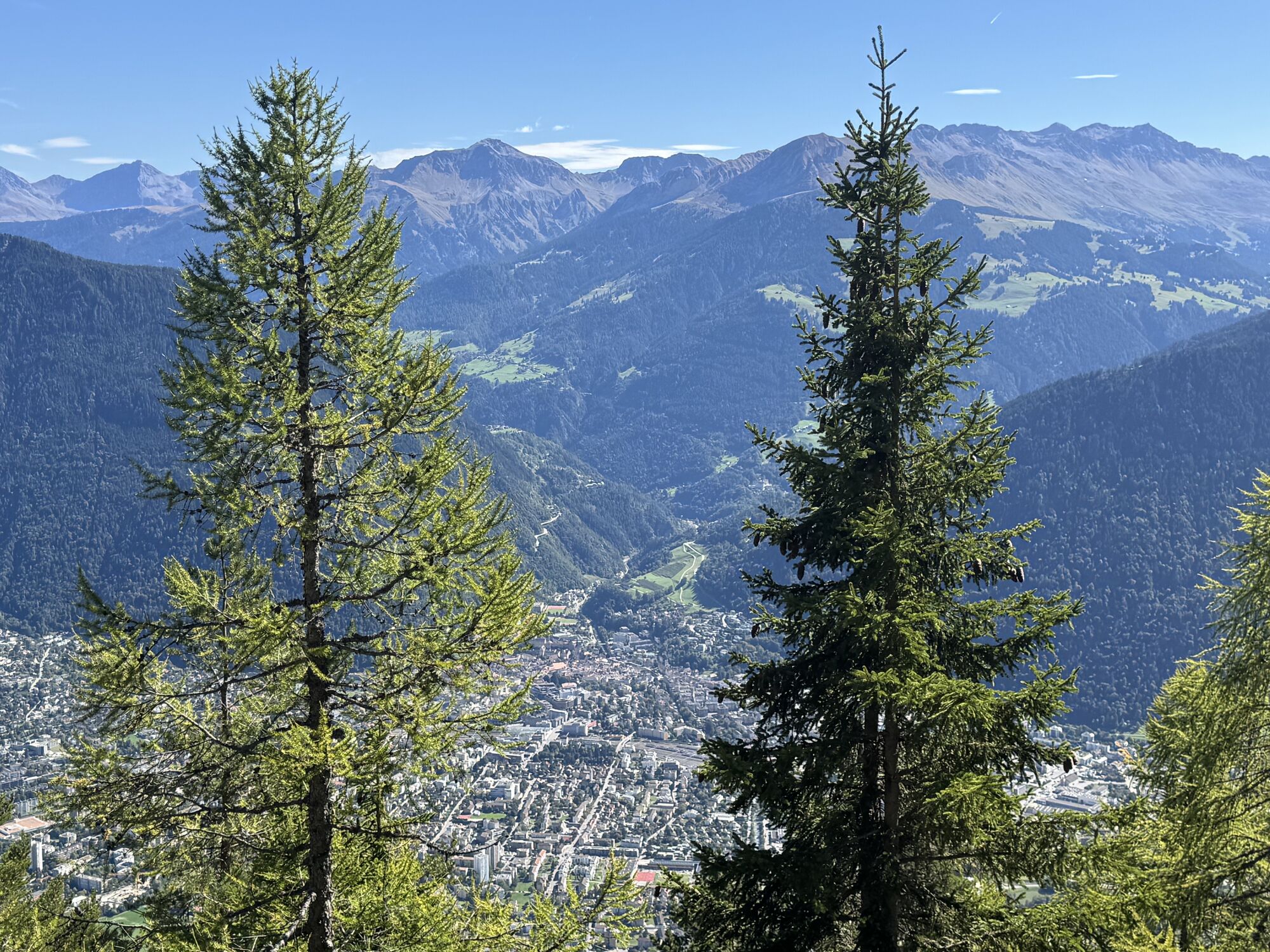

This physically demanding tour starts in the center of Chur. The Calanda massif is exposed to the sun, so the tour can be ridden far up in spring (an early start is recommended in summer). At the start,...
The Calandahütte SAC is open during the summer months. You can recharge your batteries with food and drink. Of course, you can also spend the night at the top and optionally climb the proud Calanda summit on foot (730 vertical meters from the hut).
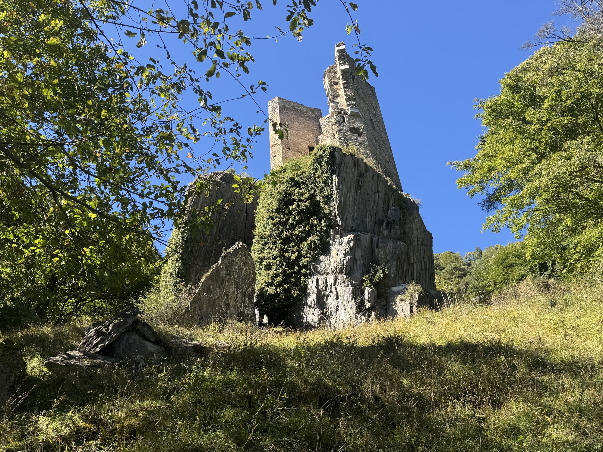
The return journey from the hut is on a single trail before following the ascent route again for a short stretch. Turn left at Alp Neusäss and follow the narrow and technical hiking trail to the Vazer Alp. After a descent on the alpine road, another trail branches off to the right at point 1515 to the beautiful settlement of Batänja. From there, follow the alpine road downhill until you pass Lichtenstein Castle ("Katzenburg") on the left. A little further down, a hiking trail branches off to the left again for the last part of the descent on a trail before you return to the village of Haldenstein.

Stay on the trail! Shortcuts harm nature and lead to illegal sections of trail.
Wear your armor! Helmet, protectors and bike gloves are standard equipment. You will also be glad to have sun and rain protection and something to drink.
Important emergency numbers are:
144 Emergency call, first aid 1414 Mountain rescue REGA 112 International emergency callThe Bike Kingdom has a place for everyone. Be a bike knight and respect trail tolerance. Hikers and bikers share the trails and show consideration for each other.
Via the A13 to Chur
Travel from Zurich by train to Chur
Various parking options in Chur
S2
Obľúbené výlety v okolí
-
4,8
Pizalun circular route
svetloTuristika 7,18 km -
3,7
5-Seen-Wanderung - DER KLASSIKER
ťažkéTuristika 9,70 km -
5,0
Circular hike Bettlerweg & 2-Lakes Hike Pizol
strednáTuristika 11,4 km -
4,5
St. Martin - Alp Sardona - St. Martin
strednáTuristika 14,2 km -
4,5
Pizol summit tour
strednáTuristika 9,28 km -
4,5
Drachenloch
ťažkéTuristika 9,72 km -
5,0
Malans-Jenins Wine Route
svetloTuristika 10,3 km -
3,0
Route of amazement Calfeisental
strednáTuristika 9,09 km -
3,0
From Vättis to the Walser settlement St. Martin
strednáTuristika 8,03 km -
3,0
2-Lake Hike Pizol
strednáTuristika 6,19 km
Turistika a stopovanie


Nenechajte si ujsť ponuky a inšpiráciu na ďalšiu dovolenku
Vaša e-mailová adresa bol pridaný do poštového zoznamu.