






325 Furna - Trimmiser Alp
After setting off in Grüsch at the valley station of the Grüsch-Danusa mountain railways we follow the route along riverside paths and pleasantly undulating single trails we track the course of the Landquart...
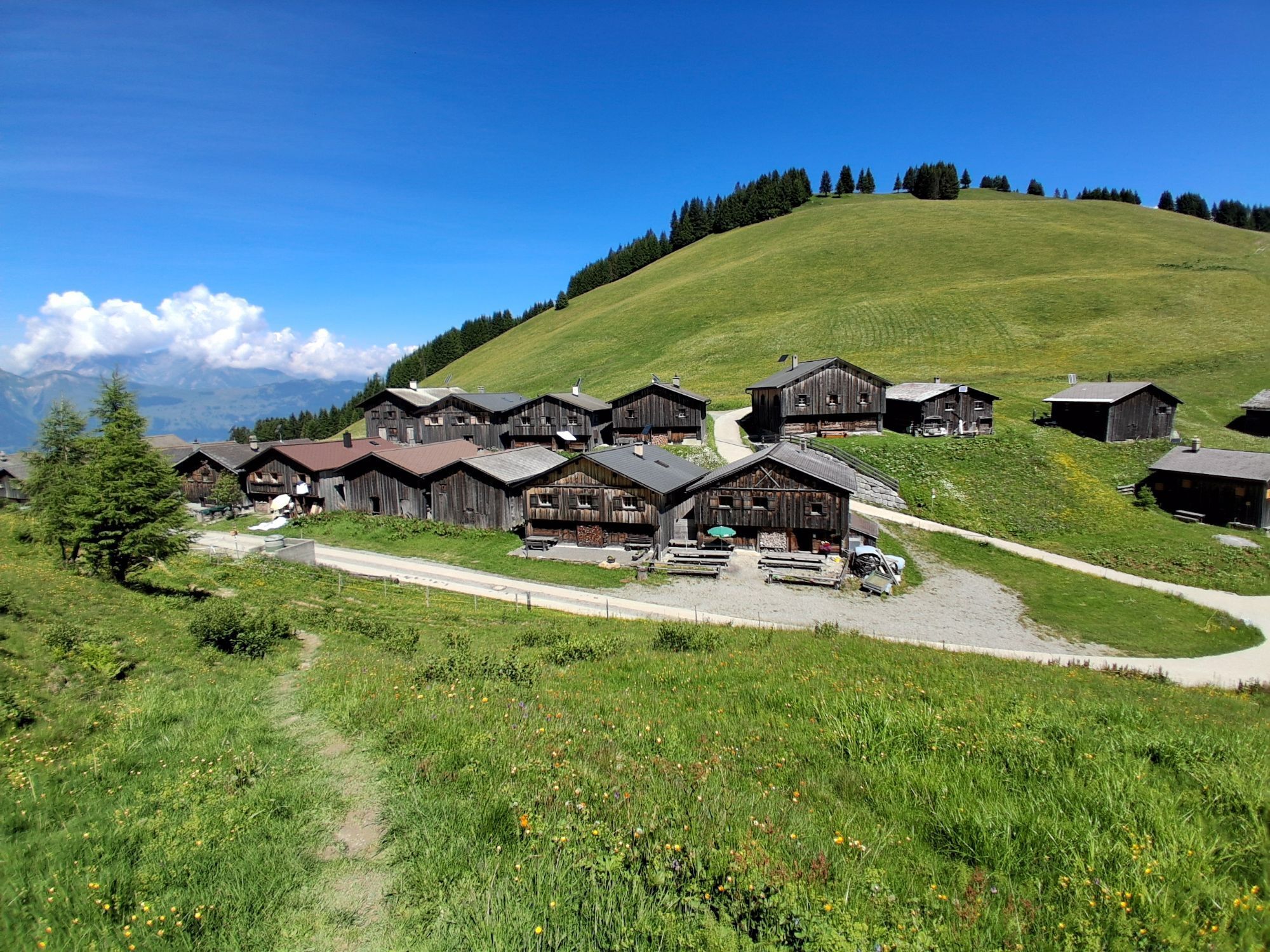
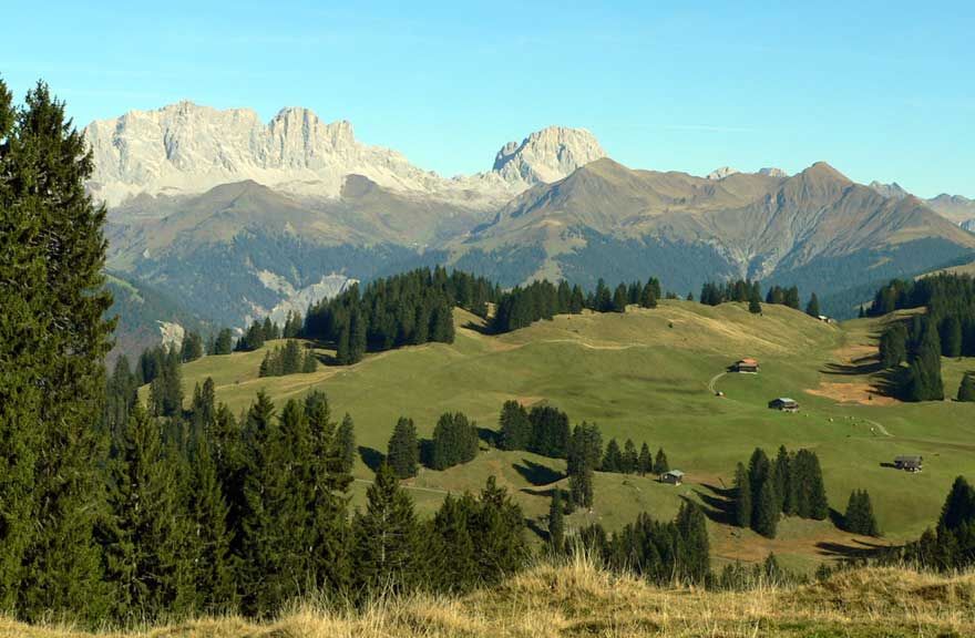
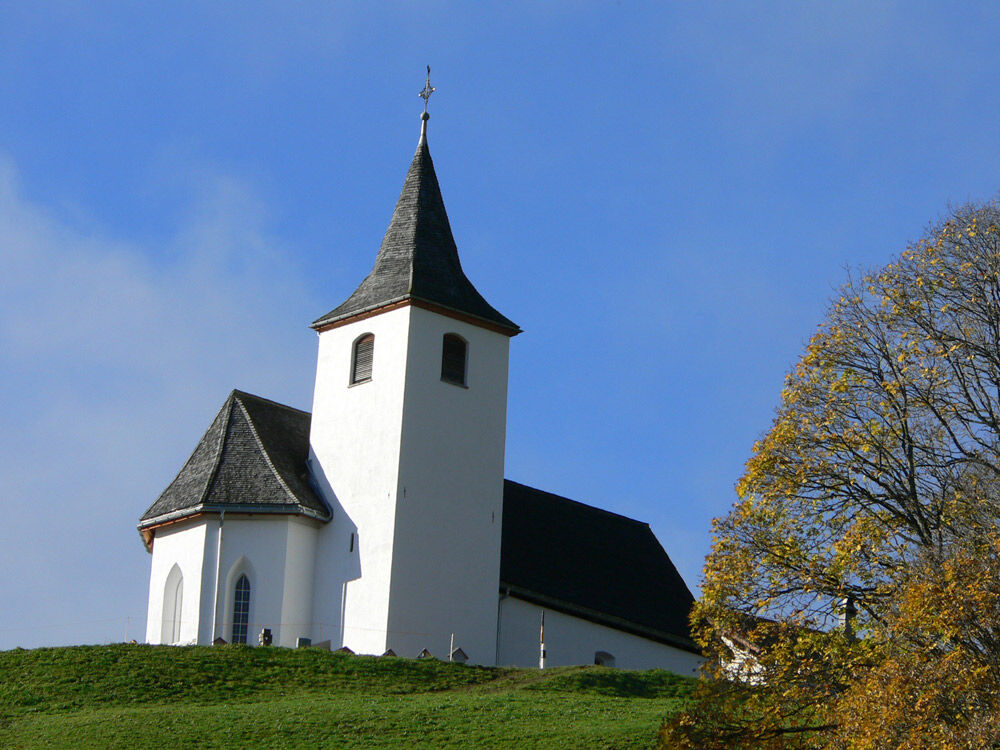
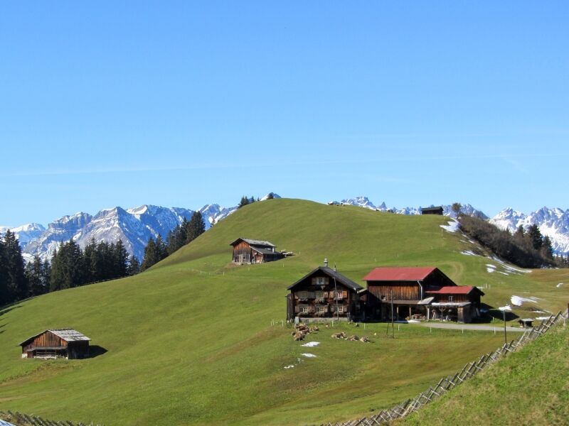
After setting off in Grüsch at the valley station of the Grüsch-Danusa mountain railways we follow the route along riverside paths and pleasantly undulating single trails we track the course of the Landquart river. From Schiers we continue along flat and pleasant sections to Pragg Jenaz. This is where the steep, asphalted ascent to the picturesque mountain village of Furna begins. It is well worth stopping at the pretty little church to take in the stunning panorama of the Rätikon range. From Furna we continue upwards along the mountain road, through the skiing area of Grüsch-Danusa, to the Alp Rona. This is the start of the wonderful single trail that takes us through the hilly terrain on a fast-flowing route. At the pretty hamlet of Scära the trail leads on to the mountain pasture and from here it plunges very steeply downhill to the alpine track in the direction of Stams. We then continue on a pleasant track through Stams, the picturesque cluster of pasture huts, then down a steeper asphalted road through the villages of Says and Trimmis to the beautiful Rhine river. The route briefly takes us along the banks of the Rhine to Zizers and then on to Igis and the fine sight of Schloss Marschlins. At Ganda the valley steadily closes in as it takes us through the narrow Chlus along flat and pleasant tracks back to Grüsch in the Prättigau valley



Grüsch - Pragg-Jenaz - Furna - Furner Berg - Scära - Stams - Says - Trimmis - Igis - Ganda - Chlus - Grüsch
Áno
Über die A13 und die B28 nach Grüsch.
Kostenlose Parkplätze stehen zwischen dem Restaurant Sportis und der Eishalle zur Verfügung.
Prättigau Marketing
Feldweg 19
7233 Jenaz
Tel. +41 (0)81 325 11 11
info@praettigau.info
www.praettigau.info
 Získajte prehľad
Vždy naživo na mieste s viac ako 9 500 webovými kamerami. bergfex Ako používateľ Pro si teraz môžete pozrieť príslušné webové kamery pre mnohé zájazdy v aplikácii zájazdy z. Môžete si tak priamo prezerať aktuálne podmienky.
Získajte prehľad
Vždy naživo na mieste s viac ako 9 500 webovými kamerami. bergfex Ako používateľ Pro si teraz môžete pozrieť príslušné webové kamery pre mnohé zájazdy v aplikácii zájazdy z. Môžete si tak priamo prezerať aktuálne podmienky.
Obľúbené výlety v okolí
-
4,7
Tamina Gorge Circular Route
strednáTuristika 14,0 km -
4,6
Pizalun circular route
svetloTuristika 7,18 km -
4,7
Off to the Falknis
ťažkéTuristika 18,2 km -
5,0
Circular hike Bettlerweg & 2-Lakes Hike Pizol
strednáTuristika 11,4 km -
5,0
Malans-Jenins Wine Route
svetloTuristika 10,3 km -
5,0
Leiterliweg, Fläsch, Schweiz
svetloTuristika 12,5 km -
Vilan round tour
ťažkéTuristika 12,2 km -
5,0
Maienfeld-Fläsch Wine Route
svetloTuristika 12,3 km -
5,0
Schesaplana round route
strednáVysoké turné 11,3 km -
4,2
Pizol Pardiel Bike No. 474
ťažkéMountainbike 21,1 km
Turistika a stopovanie


Nenechajte si ujsť ponuky a inšpiráciu na ďalšiu dovolenku
Vaša e-mailová adresa bol pridaný do poštového zoznamu.





