


Route 11: From the Hutewald to the Solling Tower
Please note that dogs are NOT allowed in the Hutewald for safety reasons.
Use of paths
“Dear MTB riders – please note that the route shown here is currently being revised. The markings are no longer continuous....
Please note that dogs are NOT allowed in the Hutewald for safety reasons.
Use of paths
“Dear MTB riders – please note that the route shown here is currently being revised. The markings are no longer continuous. You are partly riding on private land. Please respect the instructions of the landowners. Please behave according to the DIMB Trail Rules – Have fun in the Wild Heimat.”

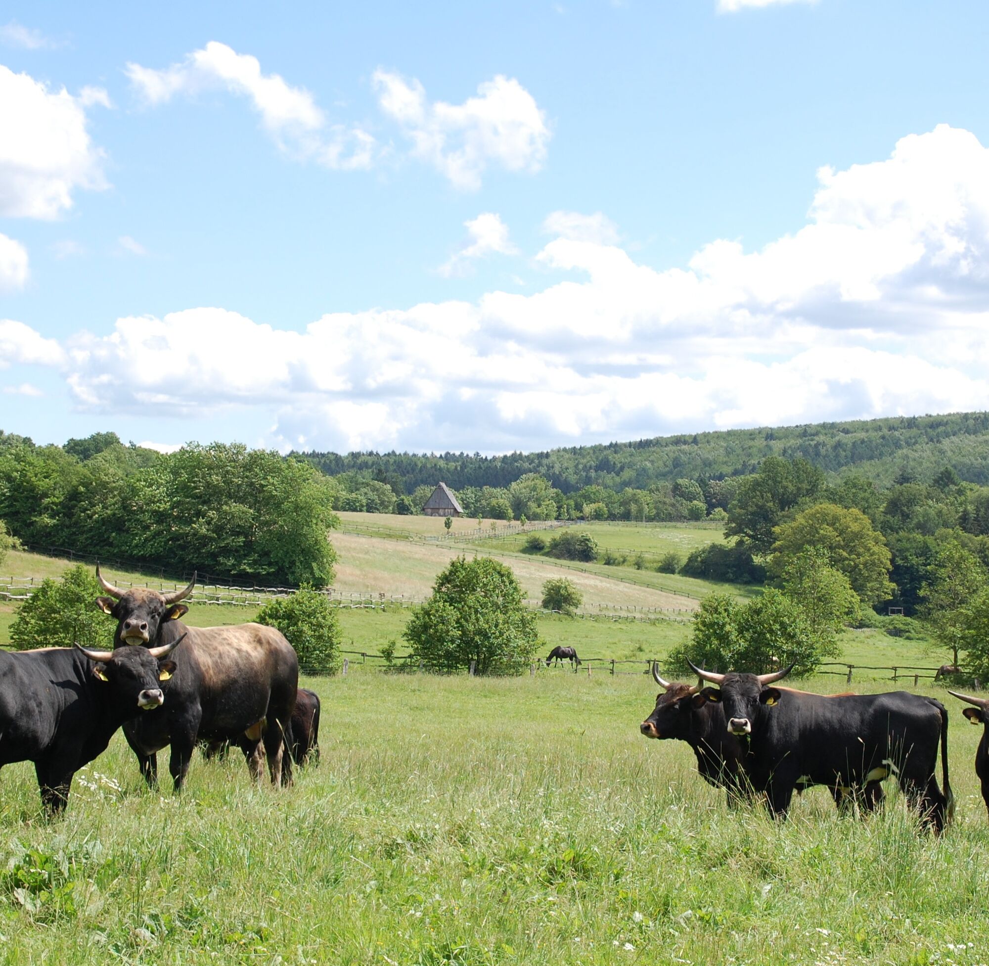
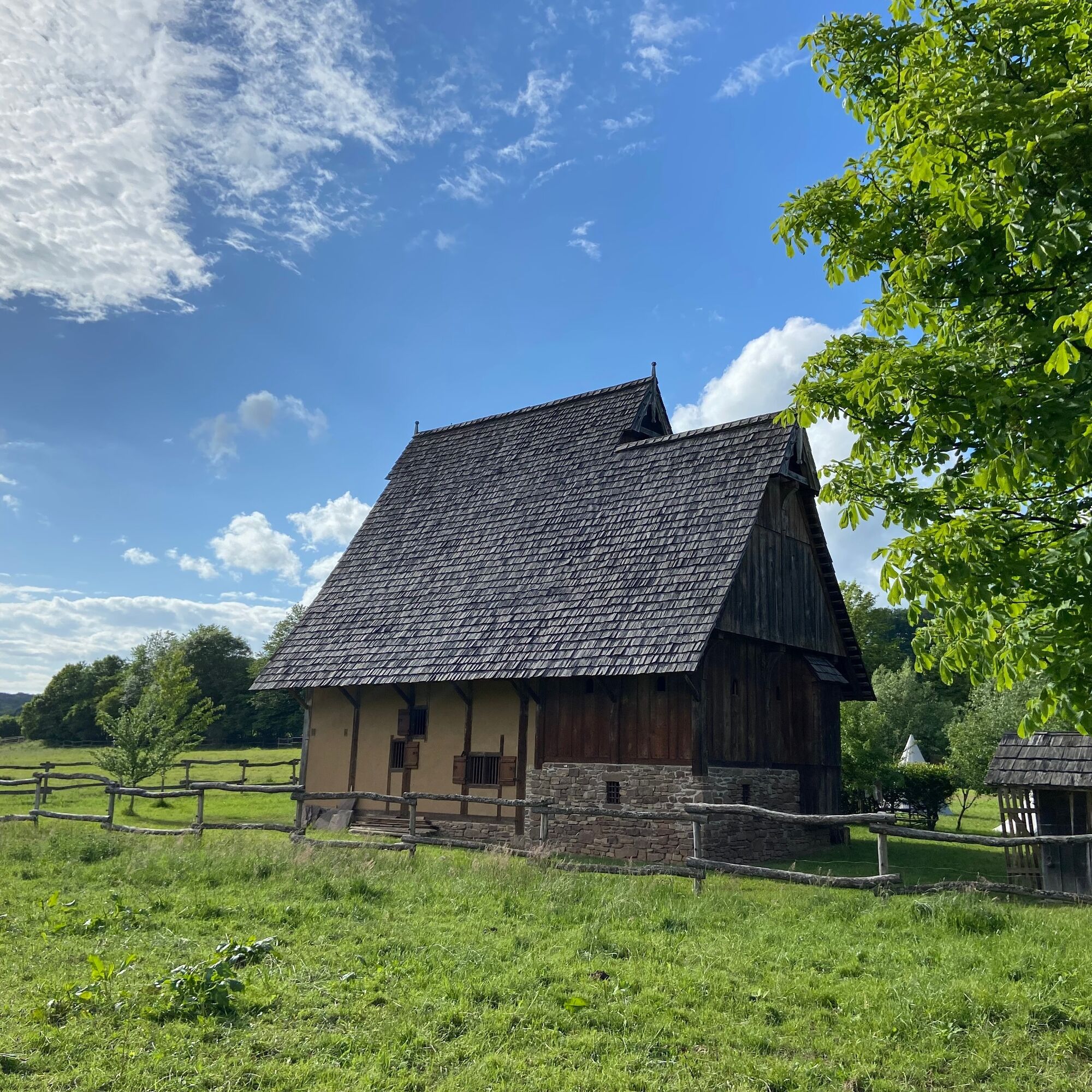
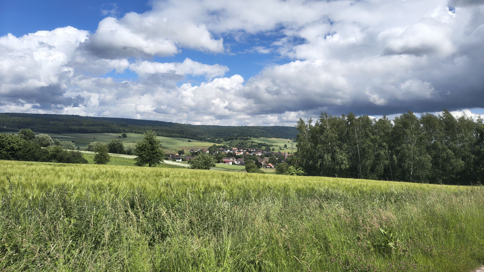
Starting from Bodenfelde, you first circle the Kahlberg, but soon return to the Weser cycle path and follow it to Wahmbeck. Now it gets tougher, as a long climb awaits. Shortly before reaching the highest point of this climb, you reach a rest area with a table and benches. To the south, you have a great view of the Weser valley at this point. After a few more meters of elevation gain, it goes flat for the first time until you reach a descent on a short section of single trail and a forest path running parallel to the enclosures of the Hutewald project, leading you to Nienover. There you can swim in a small lake or make a detour into the beautiful Reiherbach Valley.
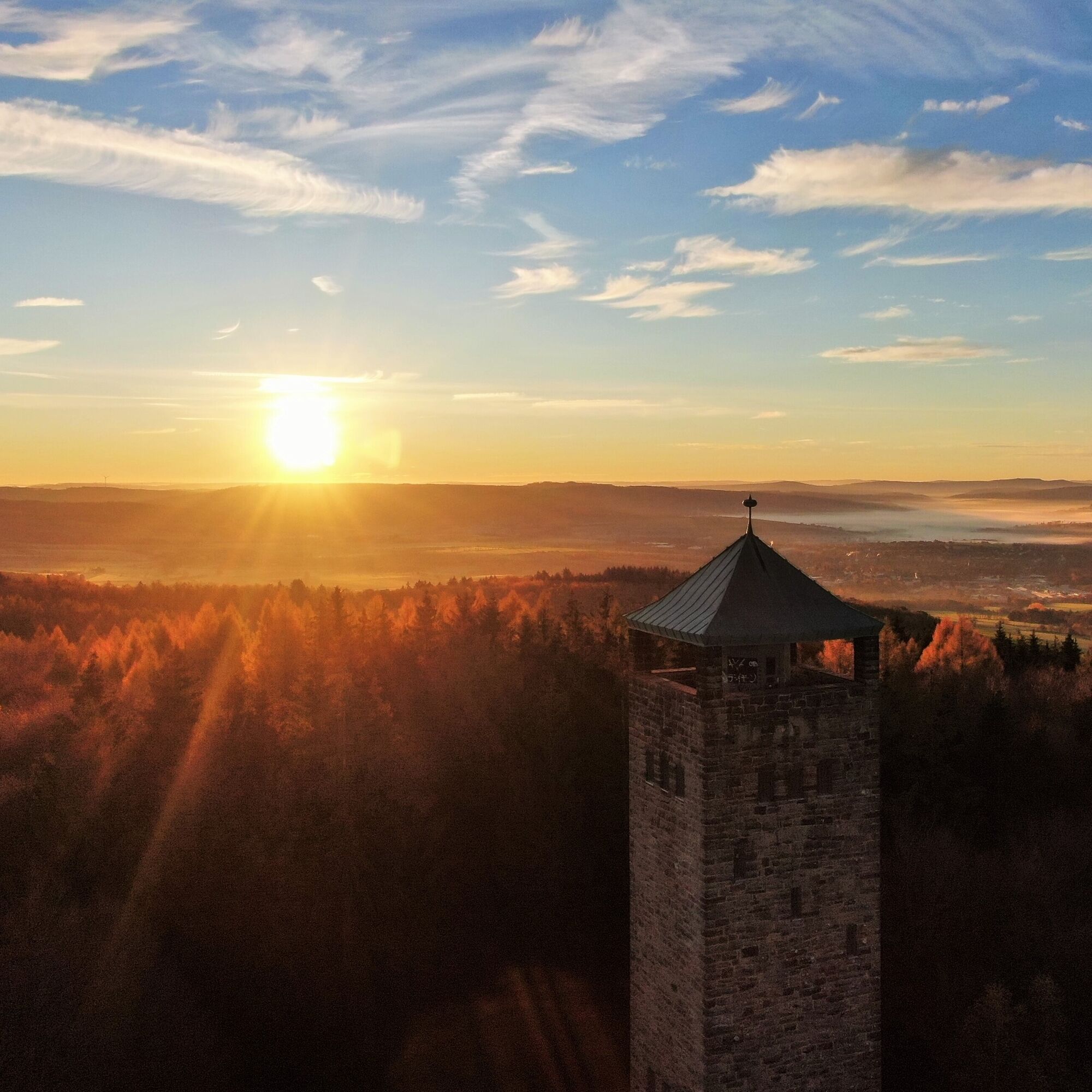
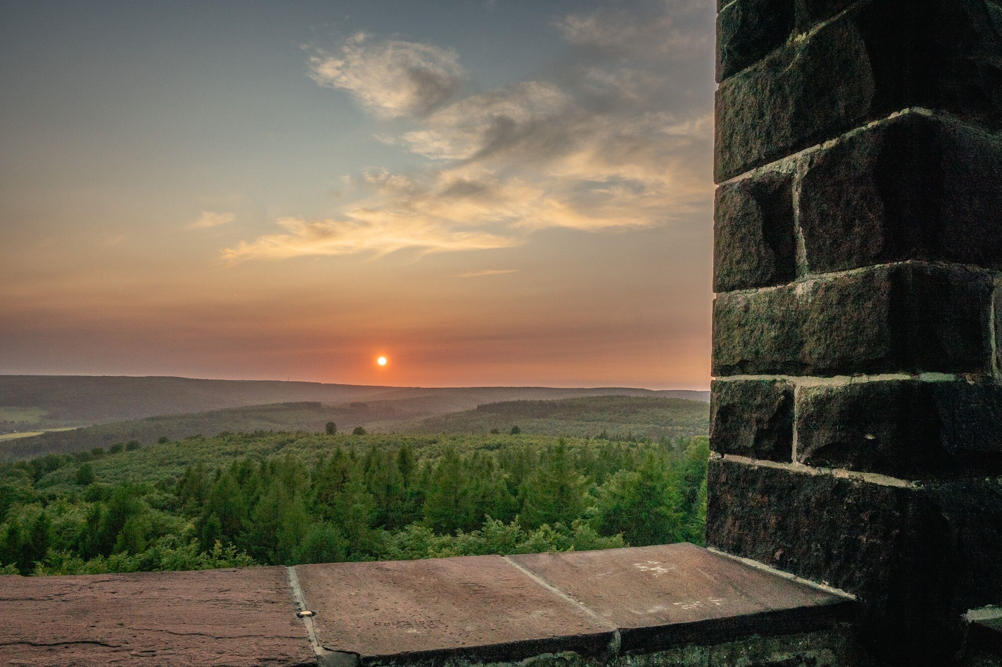
Another climb and a corresponding descent bring you to Schönhagen, where there are places to eat. You should definitely refresh yourself somehow, as the long and sometimes hot climb in summer to the Solling Tower is no joke. Fortunately, there is another great view over the Weserbergland at the top.
And then it goes downhill again, first a bit rough, then very relaxed mostly on gravel and asphalt roads to Sohlingen.
You can imagine that another climb is unavoidable. The last one is sometimes quite steep, but the descent to the finish in Bodenfelde is really fun again.
From Göttingen, follow the K 37 to Barterode, where you turn right onto the K 342 (Adelebser Weg). After about 2 km, turn right onto the L 559 and then immediately left onto the L 554. Follow this to Verliehausen and turn left onto the L 534 (Weserstraße). Follow this at first. After about 3 km, it turns into the L 3392 (Verliehäuser Str.). Follow the L 3392 until before Wahlsburg, where you turn right onto the L 561 (Montanstr.) and then slightly left onto Uslarer Str., which you follow to Bodenfelde.
By train to Bodenfelde
Parking lot at the Bodenfelde sports field
Solling-Vogler-Region in the Weserbergland e. V.
Tourism Center
Lindenstr. 8
37603 Holzminden/Neuhaus
Phone 05536/960970
info@solling-vogler-region.de
www.solling-vogler-region.de
Alternative starting points: Sohlingen, Nienover, Schönhagen, Wahmbeck
Extension of the route: possible by combining with Route 5, Route 8, Route 9, or Route 12
Obľúbené výlety v okolí
-
5,0
Lunauborn (Schö 1)
strednáTuristika 9,27 km -
Panorama trail with view into the Weser valley (Bo 3)
svetloTuristika 8,75 km -
Rund um den Wildberg
strednáTuristika 12,1 km -
Lebensraumroute - Neuer Teich und Lakenteich (LRR 9)
Tematická trasa 6,28 km -
Habitat Route - The Mecklenbruch large loop (LRR 5)
svetloTematická trasa 6,20 km -
5,0
Urwald Sababurg - Rundweg (orange/Eichenblatt)
svetloTuristika 2,61 km -
Hochmoorgeist (S 1)
svetloTuristika 8,50 km -
Weserbergland Trail, 3rd Stage: Alternative Route
diaľková pešia trasa 18,7 km -
Keilerweg (De 7)
strednáTuristika 11,7 km -
Habitat route - The Hutewald in Solling demonstration enclosure and observation tower
Tematická trasa 5,91 km
Turistika a stopovanie


Nenechajte si ujsť ponuky a inšpiráciu na ďalšiu dovolenku
Vaša e-mailová adresa bol pridaný do poštového zoznamu.