


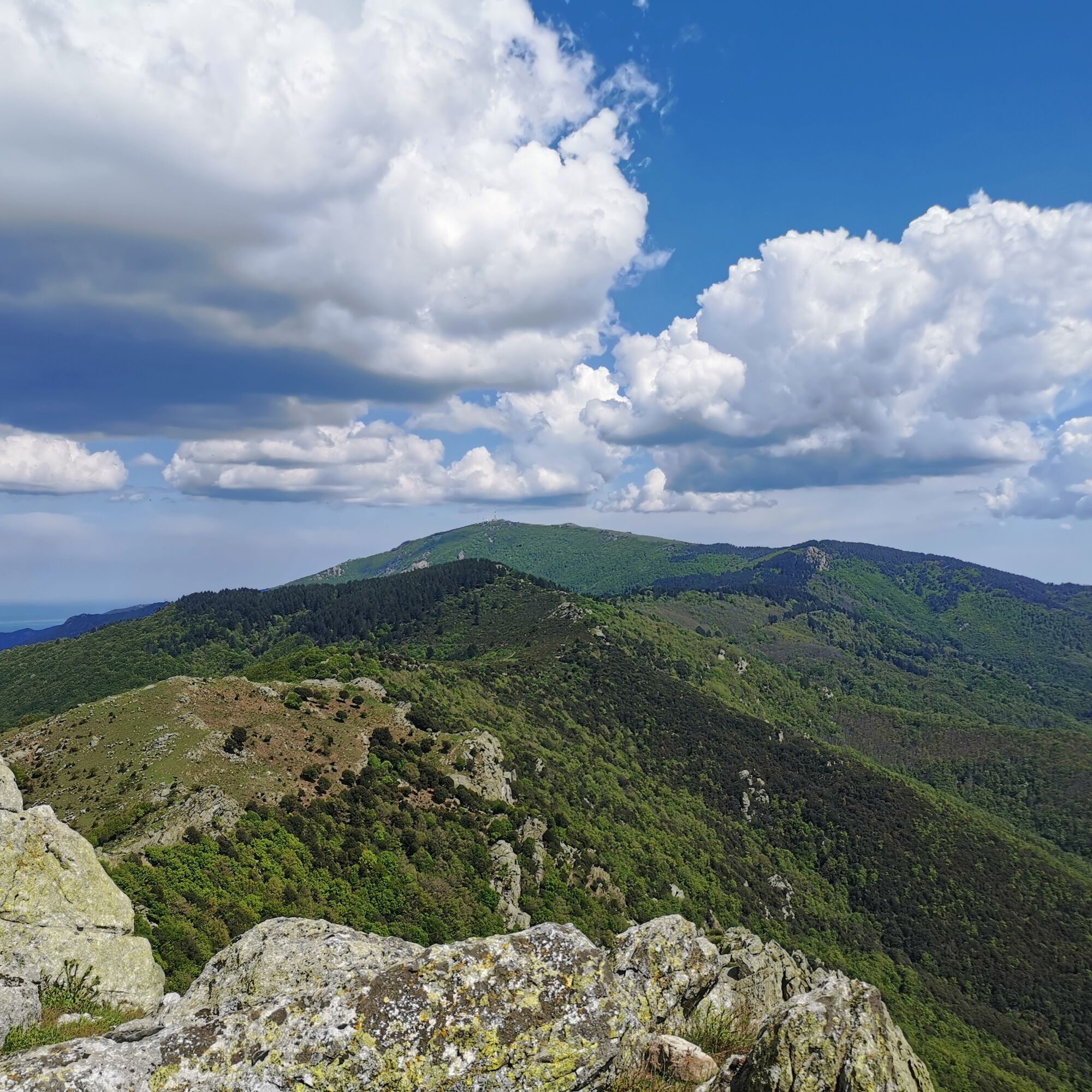
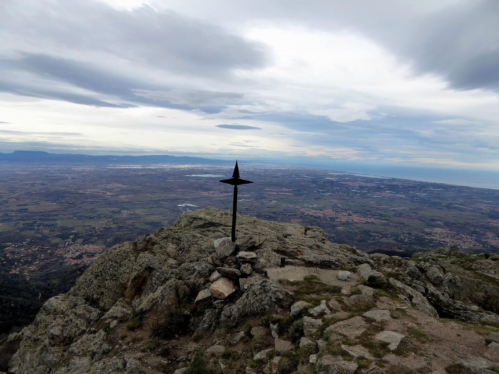
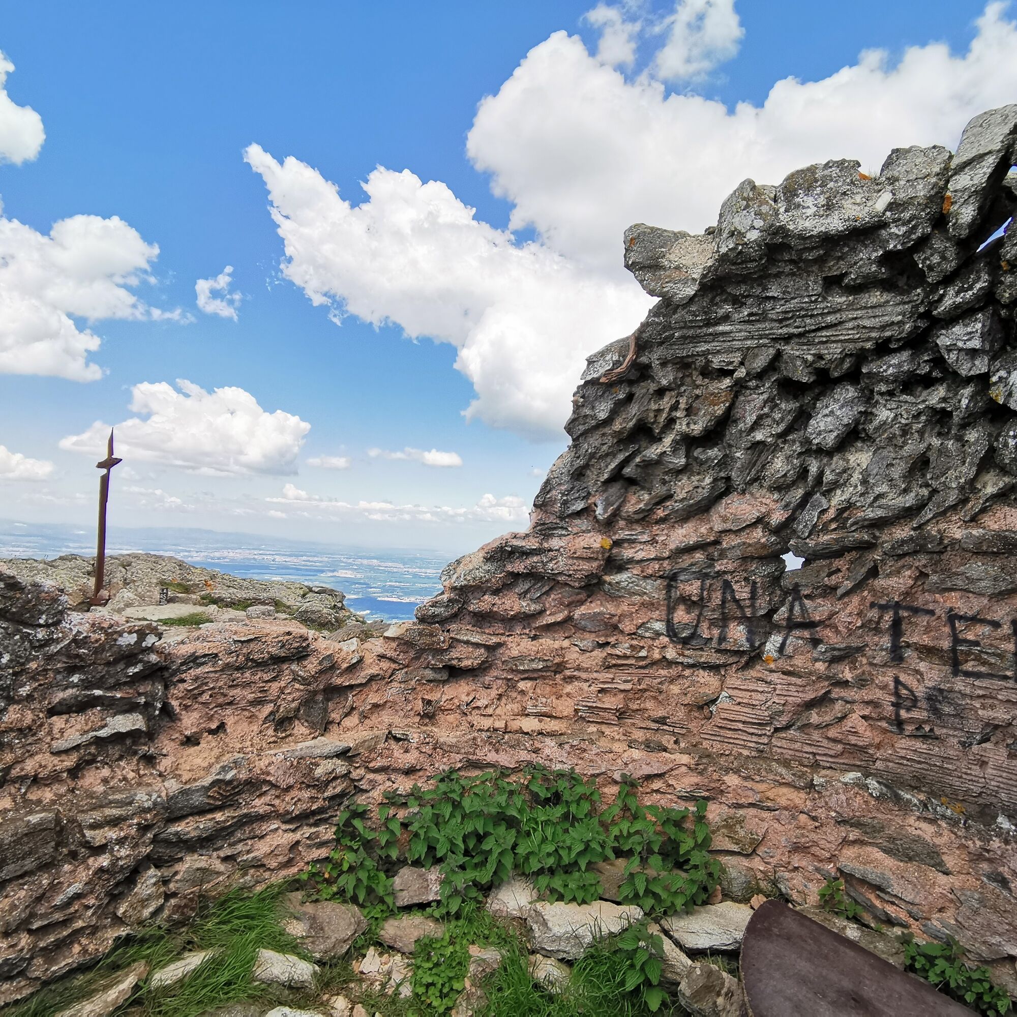
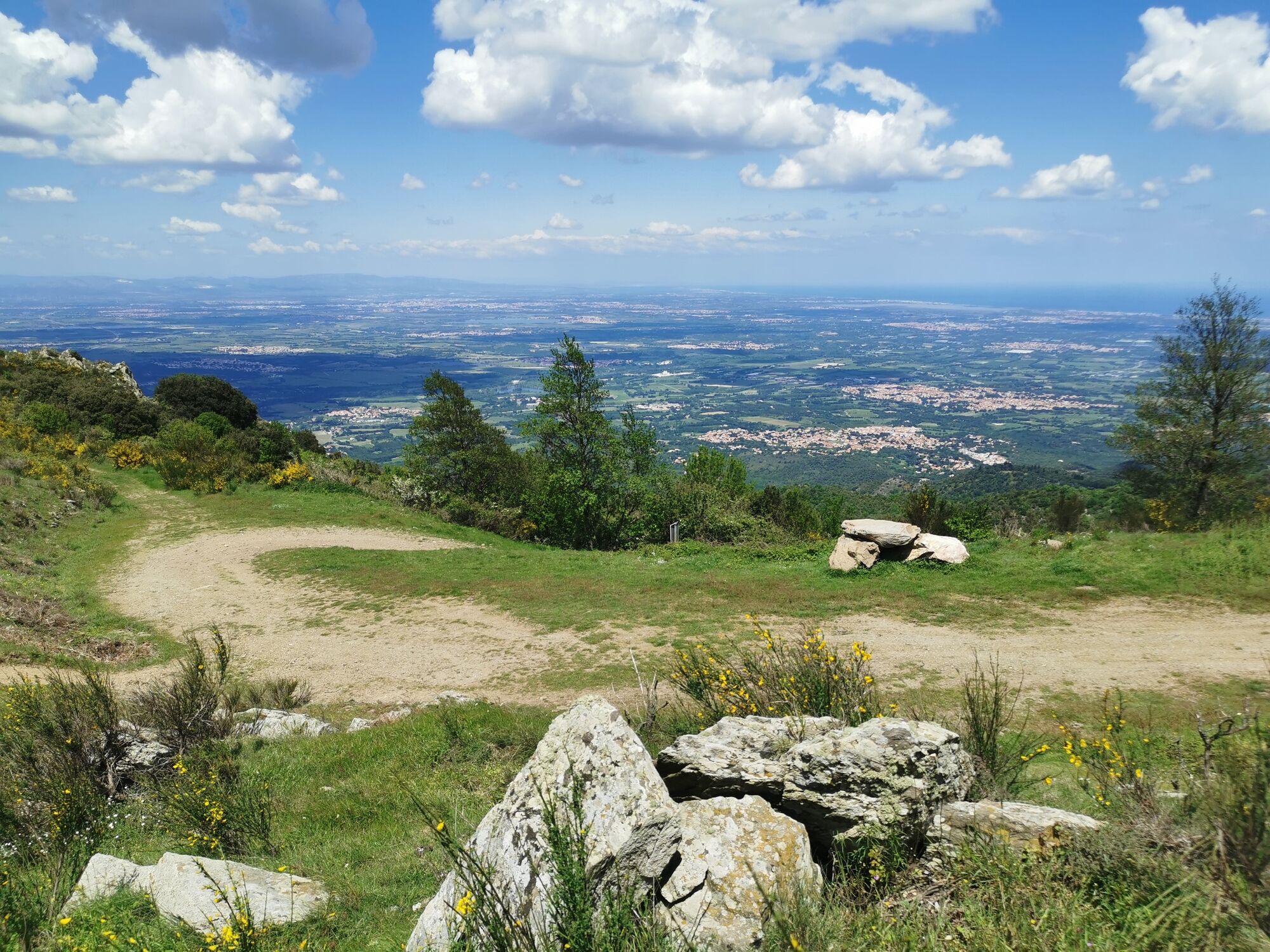
Peak of San Cristau
Discover the ruins of San Cristau and the old chapel with beautiful view of the Roussillon plain and the Spanish side of the Albères
From the city hall carpark go up the main street to the fountain St Cristau.
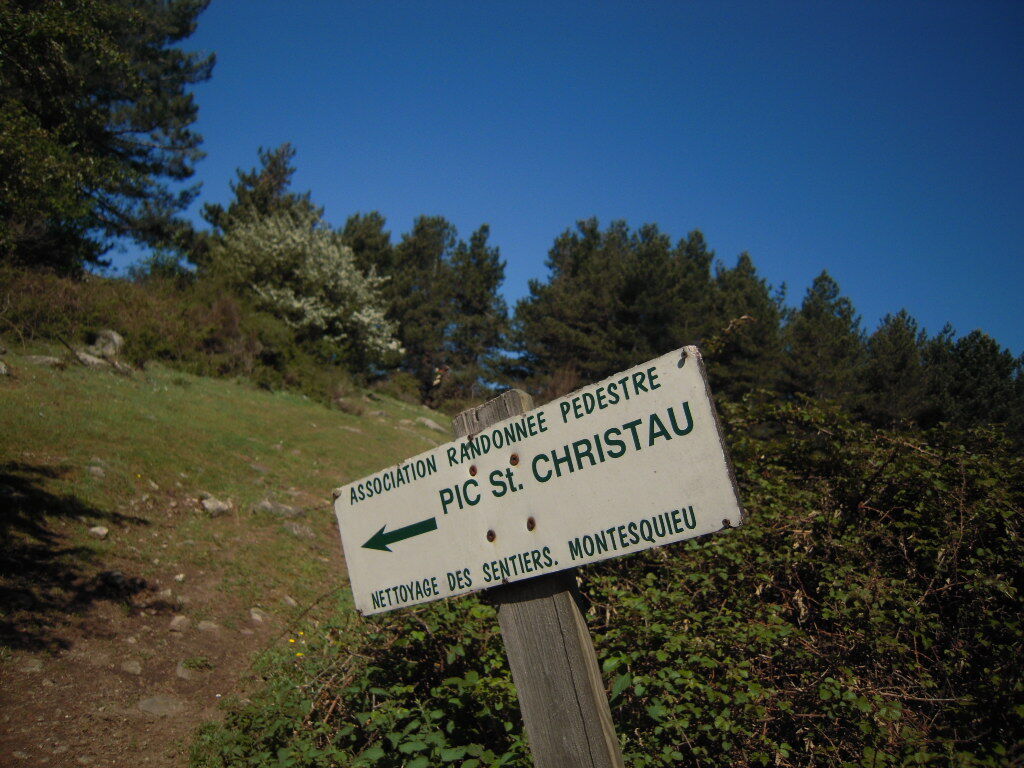
Go around the fountain on your right, then ascend the little street and turn left immediately. At the end of Saint Christophe street, take the marked path brings you opposite to the botanical trail. After about 100 meters, at a crossroad, turn right on wooden steps, and continue to walk on the botanical path. Join the track upstream and turn left to reach the basin. Leave to the left of the massif along the stream toward the Coll de Llinas. Leave the track and continue on the path that goes up sharply in front of you. At the Col de Branca, leave the track to take a right on the path that goes to the Pic San Cristau and the Chapel. Start back down to the northwest by a path to the track then take right and continue in this direction to the captured water source. In a bend, leave the trail to take a path through the beech forest. Cross a track towards a cistern, then in a bend, re-cross that track a second time to descend on a steep path to the Collada d'en Godo. Climb up a few meters, bypass the masonry pillar and reach the trail. Take the botanical trail to come back to Montesquieu-des-Albères, the final point of your hike.Áno
On the RD 618 take the direction of the village of Montesquieu.
City hall carpark or some parking places in the village
You enjoy nature, You like it, take care of it...
Along the hiking trail, rubbish bins are at your disposal.
Every month over tens of thousands of hikers and walkers visit this exceptional site. Please do not litter and use the rubbish bins (glass, plastic, rubbish etc...). Also, please dispose of any litter you might find along the trail.
Help keep this site clean with simple yet essential gestures. Lets give back to nature what nature gave us
Obľúbené výlety v okolí
-
4,3
The "Casot d'en Lic"
strednáTuristika 5,40 km -
5,0
Néoulous summit - Col de l'Ouillat
strednáTuristika 16,9 km -
The Massane tower
strednáTuristika 12,4 km -
4,0
Les Balcons d'Argelès (mountain bike)
strednáMountainbike 19,4 km -
From Lavail to Valmy via the Tour de la Massane
strednáTuristika 10,3 km -
The balconies of Sorède from Lavail
ťažkéTuristika 22,6 km -
From Château de Valmy to Château Royal via the Madeloc Tower
ťažkéTuristika 22,6 km -
Montesquieu Botanical Trail No. 2
strednáTuristika 4,08 km -
The soldier's "Casot"
strednáTuristika 8,45 km -
[Connection] Elne-Argelès-sur-Mer
strednáCestný bicykel 12,3 km

Turistika a stopovanie


Nenechajte si ujsť ponuky a inšpiráciu na ďalšiu dovolenku
Vaša e-mailová adresa bol pridaný do poštového zoznamu.