


Roero Bike Tour
The Roero Bike Tour, RBT, includes an entire territory. We are in the Roero, a portion of hills that flanks the left bank of the Tanaro river, which separates the territory from the Langhe, up to the...
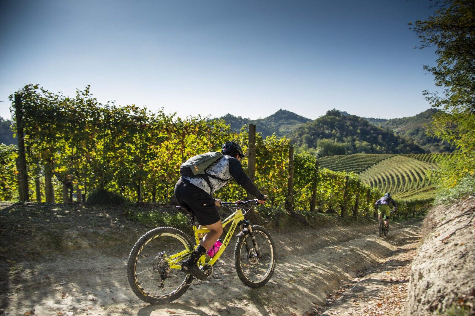
The Roero Bike Tour, RBT, includes an entire territory. We are in the Roero, a portion of hills that flanks the left bank of the Tanaro river, which separates the territory from the Langhe, up to the provinces of Turin and Asti. Here human activities, crops and historic villages are part of a still wild nature, made up of thick vegetation and rugged hills. It was the noble Roero family from Asti, who already owned the majority of the castles and lands in the Middle Ages, who gave the territory its name. It is a land of passage, still characterized today by an ancient and strong mercantile and welcoming vocation. By pedaling along the Roero Bike Tour you can move from town to town on nature trails or low-traffic roads, discovering peculiar environments and landscapes: the Rocche (an unusual geological phenomenon that preserves a rich biodiversity), the vineyards, the orchards, the truffle areas , the hilltop villages and castles. The itinerary is an exciting route designed for mountain bikes or e-bikes. Overall approximately 140 km long, and with a unique direction of travel, it is divided into 7 stages and enriched with some variants, alternative or connecting sections. It incorporates the three large existing paths: the S1 (Grande Sentiero del Roero), the S4 (Sentiero del Roero Centrale), and the S3 (Sentiero dell'Acino, Mulini e Castelli - Eastern Roero).

Connection path between the two souls of Roero, the one that looks at the Langhe and the one that runs along the Rocche ridge, the route takes us from Vezza to Montà, passing through Canale, crossing various thematic paths.
VARIANT 1A – Canale – Loc. Rocca Tagliata (Canale)
A variant of the previous stage, the route leads to the isolated town of Rocca Tagliata, first covering a long stretch of the S1 path, then the Castagno path, extending into the territory of Cisterna d'Asti, with the possibility of then arriving at Montà.
STAGE 2 - Montà - Monteu Roero Path along the Rocche ridge, admiring in ecstasy the miracle of the "capture" of the Tanaro, which has given us what you see before your eyes.
VARIANT 2A - Monteu Roero – Loc. Battagli (Vezza d'Alba)
A variant of the RBT route, this stretch allows you to connect the two ridges of the Roero, pedaling alongside the Rocche ridge, to descend to the valley floor and up towards Vezza d'Alba.
STAGE 3 – Monteu Roero – Pocapaglia
This part of the route leads us to pedal on the historic "Grande Sentiero del Roero", which winds along the ridge of the Rocche, immersed in the "Silva Popularis", the last large forest of the Po Valley.
VARIANT 3A Loc. Saliceto (Pocapaglia) – Loc. San Sebastiano (Pocapaglia)
A variant of the main RBT route, the route makes a loop through a wooded and flat area that extends as far as the town of Sanfrè, dominated by its mighty castle.
STAGE 4 – Pocapaglia – Monticello d'Alba
Stage 4 of the Roero Bike Tour connects the Rocche ridge to the strip of central Roero villages and winds its way, for the first half, on paved country roads with low vehicular traffic.
STAGE 5 – Monticello d'Alba – Hamlet Borbore (Vezza d'Alba)
Path along the passes of the S4 "Sentiero del Roero Centrale", which crosses the top villages of this part of the territory, and allows you to admire towers, castles and cultivations of precious fruits.
STAGE 6 – Borbore hamlet (Vezza d'Alba) – Govone
An ideal continuation of the previous route, this stretch allows you to pedal up to Govone, at the foothills of the province of Asti, crossing hills with vineyards, the heart of the production of the youngest DOCG of Langhe Roero. VARIANT 6A – Castagnito - Guarene Variation to the official RBT route, this stretch connects the crest side of the Castagnito town to that of Guarene, offering unique views of Roero and the neighboring Langhe.
STAGE 7 – Govone – Castagnito
A stage that allows us, joining it to stage 6, to form a ring that connects all the top villages of this part of the Roero, however leading us to discover the secrets of the mills and the crossings along the Tanaro. VARIANT 7A – Località Sotteri (Guarene) - Guarene Variation to the official route of the RBT, this short section allows you to directly reach the village of Guarene, instead of completing the longer section passing by making a loop around the village of Guarene.
Note
The RBT can also be covered forming some loops, thus adapting the route to one's needs.
Ring 1 : Formed by stages 1, 2, 2A and 5 (in the final part). Length: 34 km
Ring 2 : Made up of stages 3, 4 and 5 (up to the junction with 2A), 2A. Length: 48 km
Ring 3 : Formed by the 3A. Length: 15.5 km
Ring 4 : Made up of stages 6 and 7. Length: 43 km
STAGE 1 – Borbore (Vezza d’Alba) – Montà
A route that connects the two hearts of Roero, one that looks at Langhe and the other that travels the ridge of the Rocche. The track takes us from Vezza to Montà, passing through Canale, encountering several theme-based trails.
VARIANT 1A – Canale – Rocca Tagliata (Canale)
This route is a variant of the previous stage and takes to the isolated hamlet of Rocca Tagliata, cycling a long section of the S1 trail and then “Sentiero del Castagno”, extending into the territory of Cisterna d’Asti, with the possibility of reaching Montà.
STAGE 2 – Montà – Monteu Roero
A route along the ridge of the Rocche, admiring the miraculous "capture" of the River Tanaro, which has given us what you see before you.
VARIANT 2A - Monteu Roero – Battagli (Vezza d’Alba) >br /< This section is a variant of the RBT route and connects the two ridges of Roero, pedalling next to the ridge of the Rocche, before descending into the valley floor, and climbing back towards Vezza d’Alba.
STAGE 3 – Monteu Roero – Pocapaglia
This part of the route takes you along the historic “Grande Sentiero del Roero”, which winds along the ridge of the Rocche, immersed in “Silva Popularis”, the last big forest of the Po Plain.
VARIANT 3A – Saliceto (Pocapaglia) - San Sebastiano (Pocapaglia)
This is a variant of the main RBT route and makes a loop through a woody and flat area which extends to the village of Sanfrè, dominated by its impressive castle.
STAGE 4 –Pocapaglia –Monticello d’Alba >br /< Stage 4 of the Roero Bike Tour connects the ridge of the Rocche to the central towns of Roero. For the first half, it winds along paved country roads with little traffic.
STAGE 5 – Monticello d’Alba – Borbore (Vezza d’Alba) >br /< A route that follows the S4 “Sentiero del Roero Centrale”, which crosses the hilltop villages of this area, and allows to admire towers, castles and fine fruit cultivations.
STAGE 6 – Borbore (Vezza d’Alba) – Govone >br /< Ideal continuation of the previous route, this section allows you cycle to Govone, to the foothills of the Asti province, crossing vine covered hills, centre of production of the youngest DOCG wines of Langhe Roero.
VARIANT 6A –Castagnito -Guarene
This is a variant of the official RBT route and connects the ridge slope of Castagnito to that of Guarene, offering unique glimpses of Roero and of the opposite Langhe.
STAGE 7 – Govone – Castagnito
Together with stage 6, this stage allows us to form a loop connecting all of the hilltop villages of this part of Roero to discover the secrets of the mills and the crossings along the River Tanaro.
VARIANT 7A – Sotteri (Guarene) - Guarene >br /< This is a variant of the official RBT route and takes you directly to the hamlet of Guarene, instead of cycling the longer route which makes you do a loop around the village of Guarene.
Obľúbené výlety v okolí
-
5,0
Castagnito - Oratory of the Holy Spirit
strednáTuristika 14,7 km -
Barolo Classic
ťažkéCestný bicykel 50,0 km -
PRALORMO - Ring around the Lake of the Thorn
Cyklistika 11,3 km -
Via dei Briganti | Stage 1 Cisterna d'Asti - Ferrere
svetloTuristika 10,2 km -
Via dei Santi: Stage 1 San Martino Alfieri - Celle Enomondo Fraz. San Pancrazio
svetloTuristika 6,93 km -
BTB - Bar To Bar - Stage 1: Alba - Treiso
strednáTuristika 16,1 km -
Via dei Santi | Variant 1A San Martino Alfieri - Bridge over the Tanaro
svetloTuristika 2,82 km -
The Big Chestnut Path
svetloTuristika 4,34 km -
Cycling through the Rocche of Roero
strednáCestný bicykel 83,4 km -
On the tracks of the Masche (folklore witches)
svetloCestný bicykel 39,7 km

Turistika a stopovanie


Nenechajte si ujsť ponuky a inšpiráciu na ďalšiu dovolenku
Vaša e-mailová adresa bol pridaný do poštového zoznamu.