







FFC bike circuit no. 16: the Col de Vence loop
Úroveň náročnosti: 3
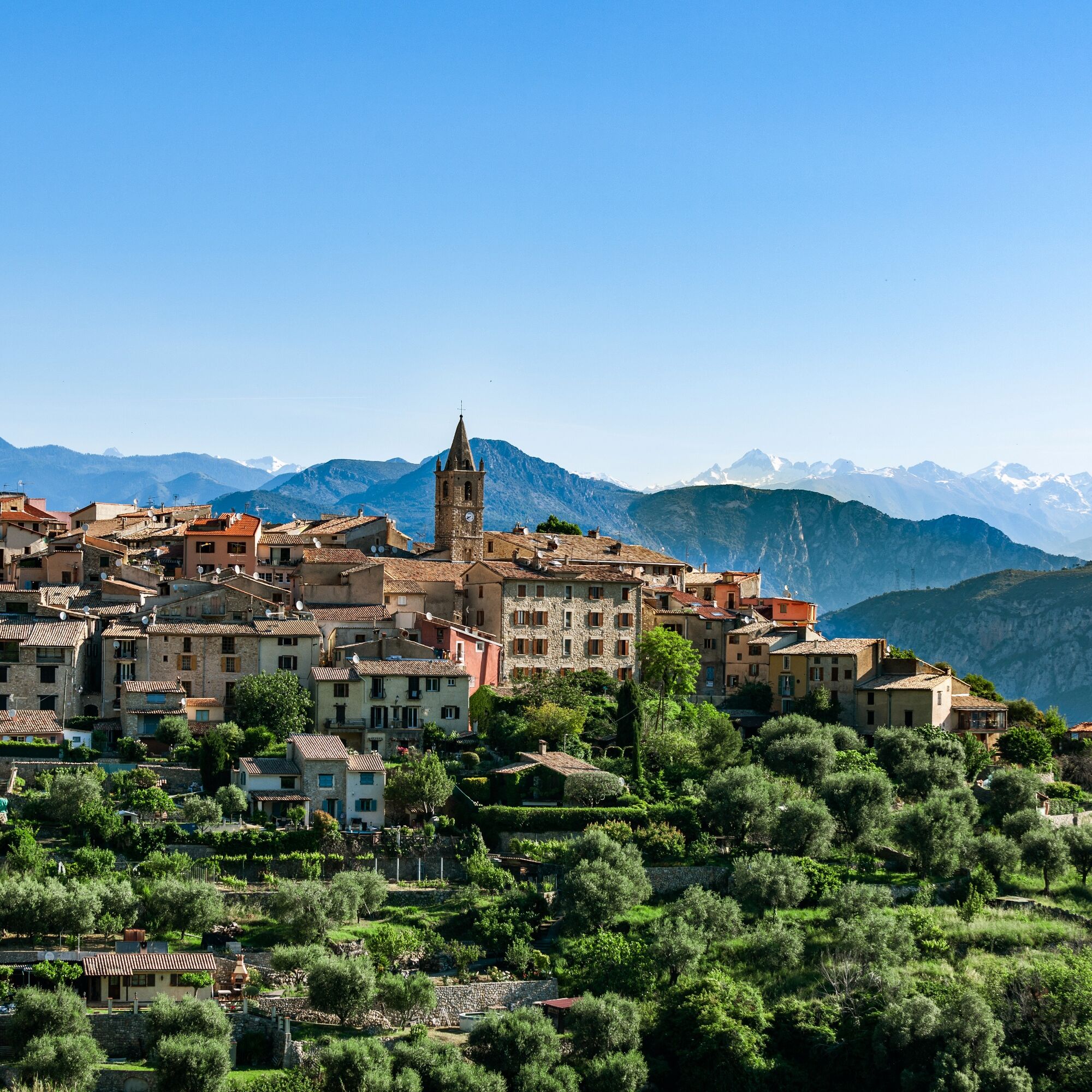
This loop opens on Coursegoules, a village located north of Vence after the pass. It is the first village of the Préalpes d’Azur Regional Natural Park.
The Jardin du vallon du Brec, located on the route,...
This loop opens on Coursegoules, a village located north of Vence after the pass. It is the first village of the Préalpes d’Azur Regional Natural Park.
The Jardin du vallon du Brec, located on the route, is open from April 1 to June 30 and from September 1 to 30, by appointment. It will surprise nature lovers and those who know how to take their time.
All outdoor activities of the Nice Côte d'Azur Metropole are on https://outdoor.nicecotedazur.org

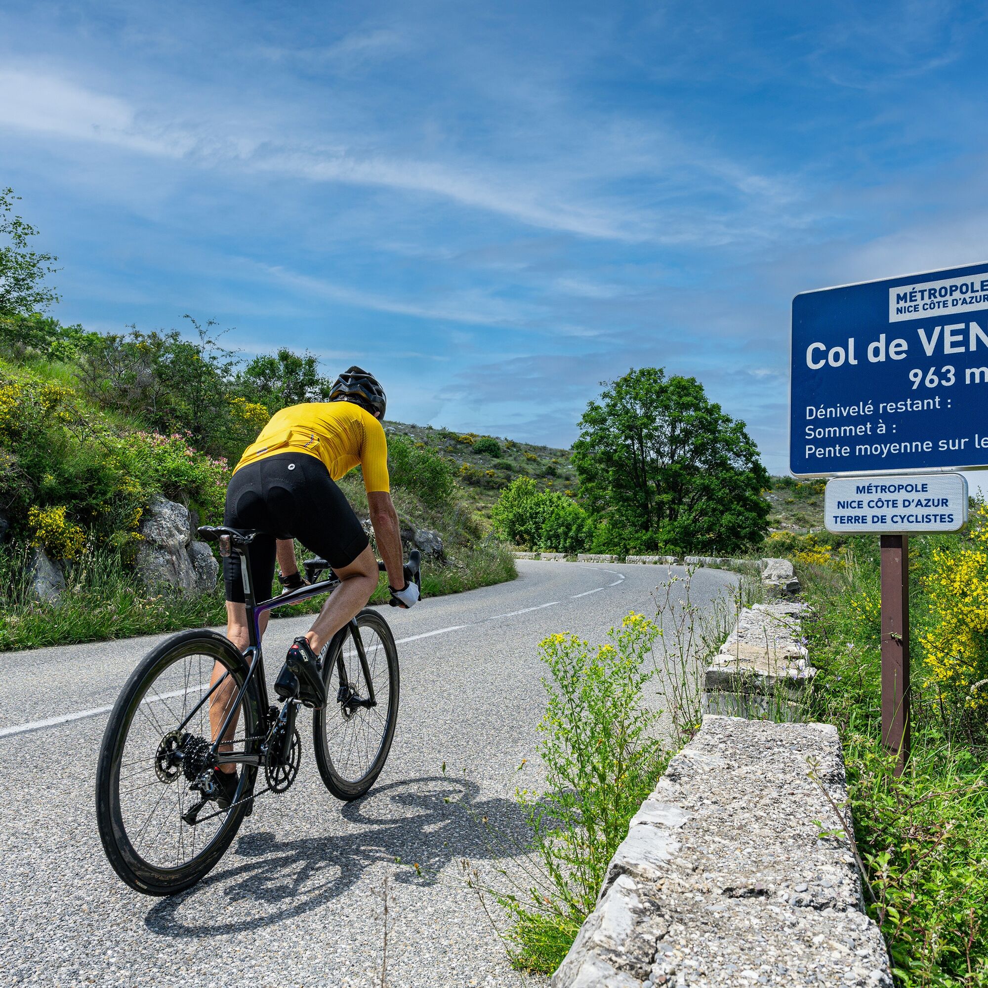


Áno
Áno
Before leaving:
Make sure the bike is in perfect mechanical condition, including tires and brakes Ensure the bike is properly adjusted to your body shape Wearing a helmet is strongly recommended Bring a repair kit Remember that the traffic code applies to cyclists at all times Never ride more than two abreast and move into single file when traffic conditions require it Respect other road users as you would want them to respect you Choose a route suited to your physical abilities Inform those around you of your itinerary Check the weather conditions A first aid kit is not essential but can be very useful Inform yourself and keep emergency phone numbers Respect the environment by not throwing your food packaging on the roadside If you must return at nightfall, make sure to see and be seenEmergency number: 112
BASIC RULES
Choose a route suited to your physical condition, do not overestimate your abilities Remember to carry an ID and a number to call in case of danger Respect traffic lights Prefer using bike lanes when they exist In other words: a sign can compel you. If the "bike lane" sign is square: you decide. If it is round, you must use this lane. Respect the environment and other road usersGOOD PRACTICES FOR GROUP RIDING
Riding two abreast is allowed, but single file is required: at nightfall or when visibility is poor when a vehicle wishing to overtake signals its approach. In case of breakdown, move to the bottom side of the road and not on the road At a “Stop”, yellow light, fixed or flashing red light, make a full stop for the entire group. Communicate within the group and use verbal and gestural signals to indicate obstacles or vehicles. A single gesture or word can prevent a fall or accident.Via the A8 motorway "La Provençale" :
From Paris, Lyon, Marseille, Aix-en-Provence take exit Villeneuve-Loubet / Cagnes-sur-Mer No. 47
From Nice take exit Cagnes-sur-Mer No. 48
Then take the RM 336, the M 36 expressway and the M 2210 to reach Vence directly
The Lignes d’azur network offers a single fare across the entire Nice Côte d’Azur Metropole. Validation is mandatory each time you board the bus regardless of the ticket used.
To consult all fares and routes, click here: www.lignesdazur.com
Marie Antoinette Parking near the panoramic starting point – Paid surface parking – 153 spaces
3
To learn more about our destination, visit our site
Sporty circuit (FFC color: red)
Obľúbené výlety v okolí
-
Nice - Aspremont / Pagarine Route (stage 1)
strednáTuristika 15,8 km -
4,0
Little hike in Aspremont: Mont Chauve circuit
svetloTuristika 6,49 km -
Grande Randonnée® de Pays: Lou Camin Nissart
ťažkédiaľková pešia trasa 44,7 km -
FFC bike circuit no. 5: on the Tour De France routes (big loop)
strednáCestný bicykel 74,2 km -
FFC bike circuit no. 8: the 70.3 circuit (Half IRONMAN)
strednáCestný bicykel 92,8 km -
FFC bike route no. 7: Tour of Vence
svetloCestný bicykel 57,7 km -
A short walk in Saint-Jeannet : Les Baous de la Gaude and St-Jeannet
strednáTuristika 12,2 km -
FFC MTB route no. 25: The summit of Broc
strednáMountainbike 18,9 km -
The "Route des Paysages" between the coast and the middle country of Nice
svetloMotorrad 147,7 km -
VTT FFC circuit no. 7 - The Olive Trees Loop
svetloMountainbike 8,09 km
Turistika a stopovanie


Nenechajte si ujsť ponuky a inšpiráciu na ďalšiu dovolenku
Vaša e-mailová adresa bol pridaný do poštového zoznamu.





